
We drove back to I-84 and then on towards Baker City. We stopped for lunch at a rest stop that had a nice display on the Oregon Trail—Burnt River Canyon took the folks 6 days to navigate because it was steep and rocky—we motor through in ½ hour now.
From Baker City we took Hwy 7 through the Blue Mountains to Hwy 26. The larches had turned yellow and some of the mountain sides were simply gorgeous—but no turn out for good photos. We stopped at a turn out for a potty break and I got a few shots but nothing like the areas that were really bright yellow.
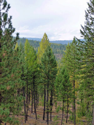
We came out of the mountains into the rolling hills and ranch land around John Day. We found a campsite at Clyde Holliday Recreation Area which is really just a wayside park where you can hear the highway part of the time.
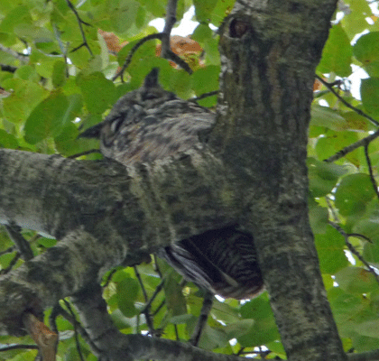
They do have a nice little nature trail along the John Day River that we took. We stopped to look at some droppings on some rocks next to a big tree and looked up to see a great horned owl looking back at us. I took a photo of him as best I could and while it’s not stellar it’s pretty decent and you can recognize him.
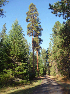
The trail goes through a nice stand of Ponderosa Pines.
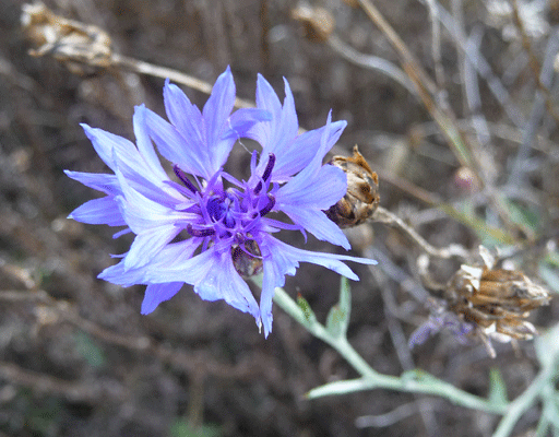
There were batchelor buttons still in bloom along the trail.
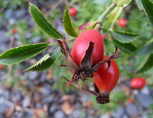
And nice rose hips too.
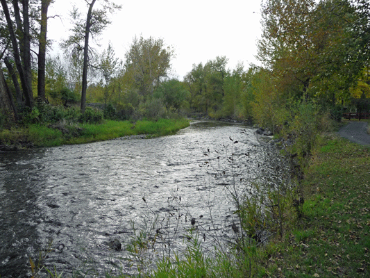
And you can get nice views of the John Day River.
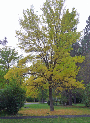
I had to take a photo of the nice fall color while I was at it.
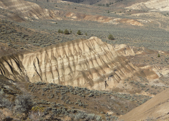
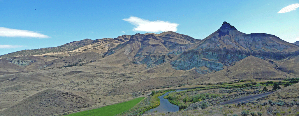
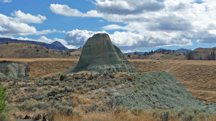
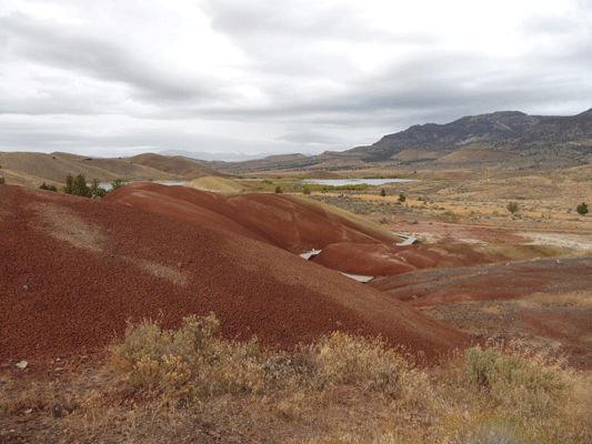
We rolled out at about 9:30 and were at the Mascall Formation Overlook of the Sheep Rock Unit of the John Day Fossil Beds before 10.
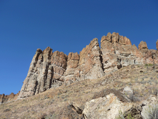
Here's a close up shot of the formation.
It was sunny and nearly clear by this point. We then went on to the Visitor’s Center and the wonderful museum that is there. There’s both a great display on paleontology and a wonderful display of all the various periods and fossils they’ve found in the various units of the park. They have fabulous leaf fossil including a bunch of Metasequoia gliptostriboides (Dawn Redwood) fossils!
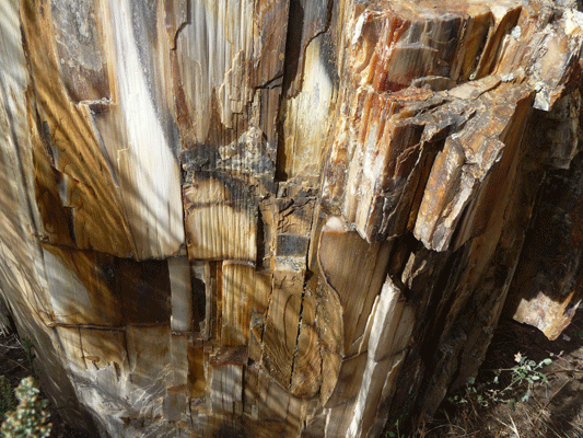
Here's a shot of a great hunk of petrified wood that was on the porch of the visitor's center.
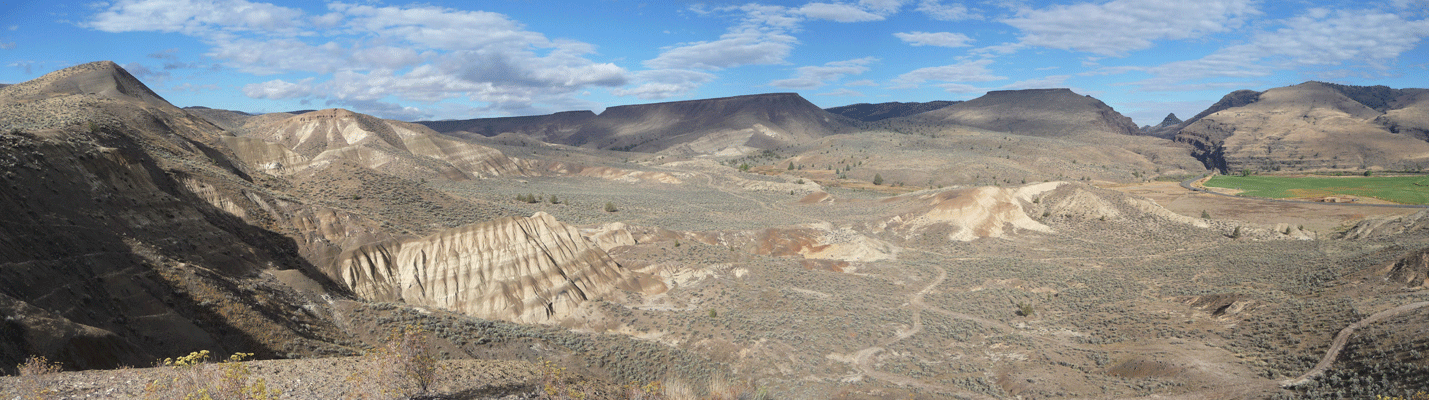
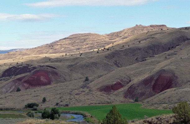
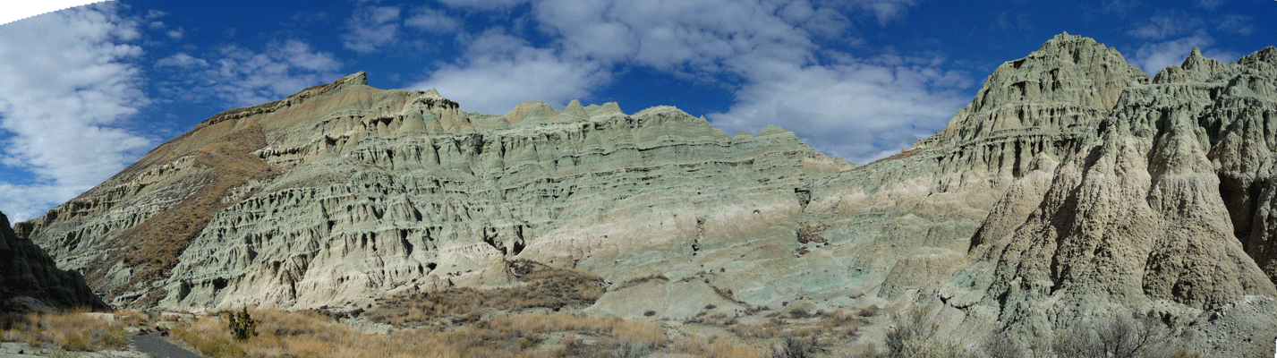
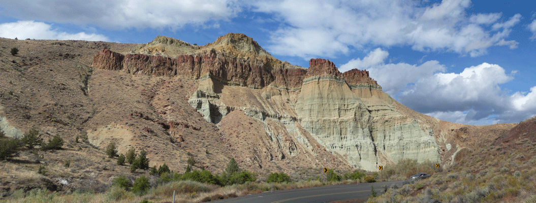
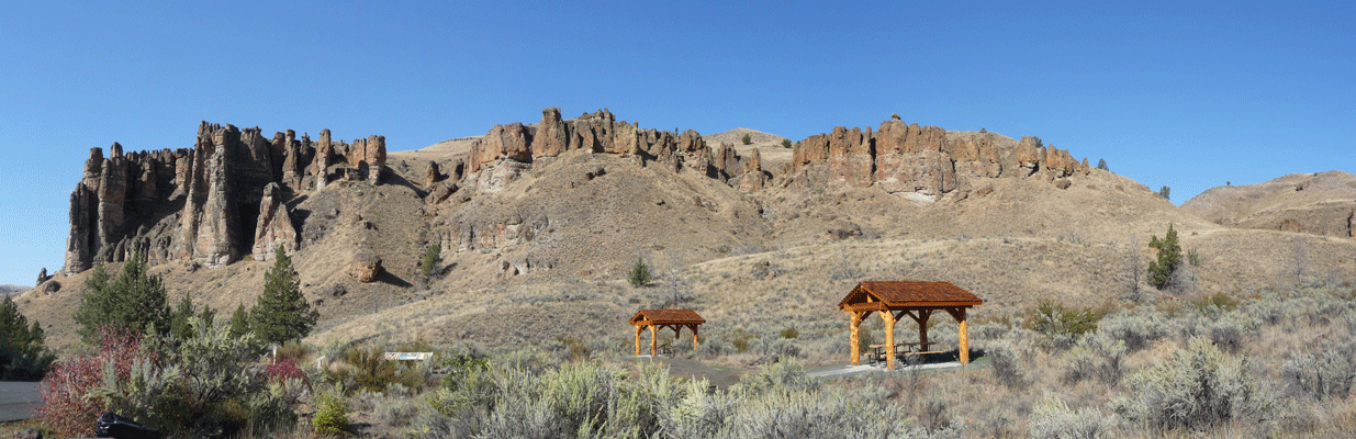
After our time in the museum we hiked up the rise behind the visitor center. Here's a panorama shot of the view from up on the rise.
And this is Sheep Rock on the right.
Looking north you can see the edges of the red clay and the green valley along the river.
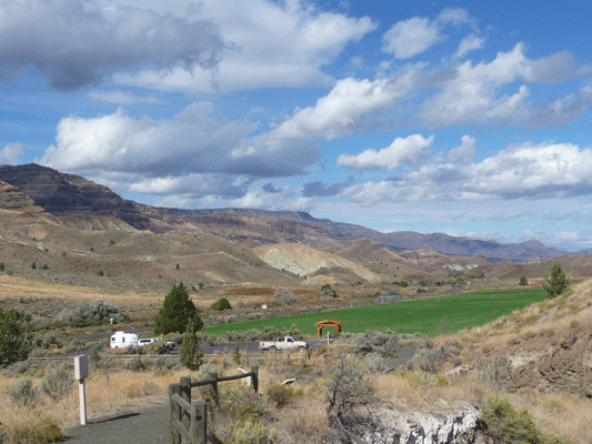
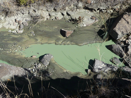
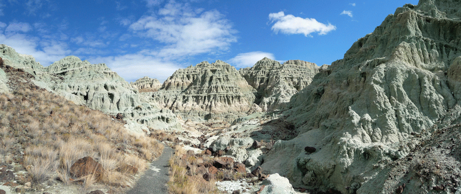
From here we drove north through the ranchland that is in the park to the Blue Basin. We took the .6 mile hike (one way—1.2 miles round trip) that gains about 200 feet (or so it felt). Here's the view of the trailhead parking area and beyond from just a ways up the trail.
I think it should be called the green basin but hey, they didn’t ask me. Certainly the water in the creek was really really green.
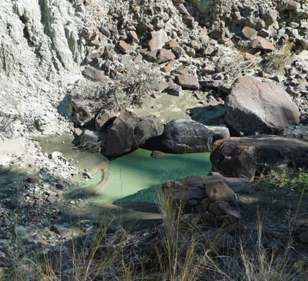
This is from the clay of the surrounding hillsides being dissolved in rainwater I suppose.
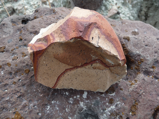
The rocks that we found along the trail were really spiffy.
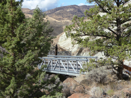
There were 11 metal bridges that crossed the little creek flowing through the basin—all different lengths and it must have been quite the process to put them all in.
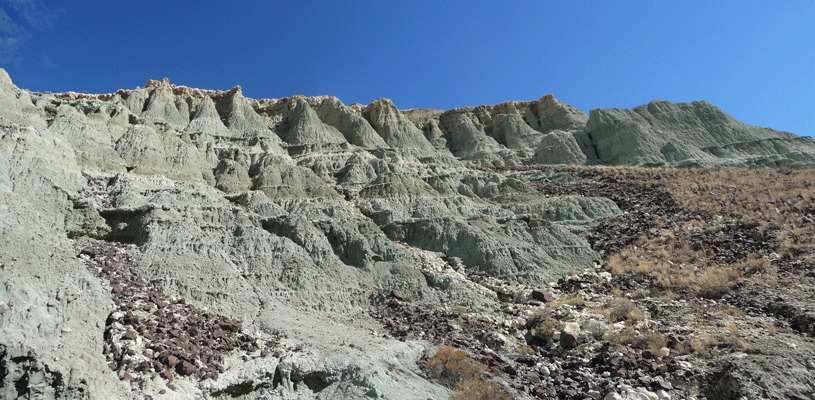
The erosion patterns of these hills are pretty amazing.
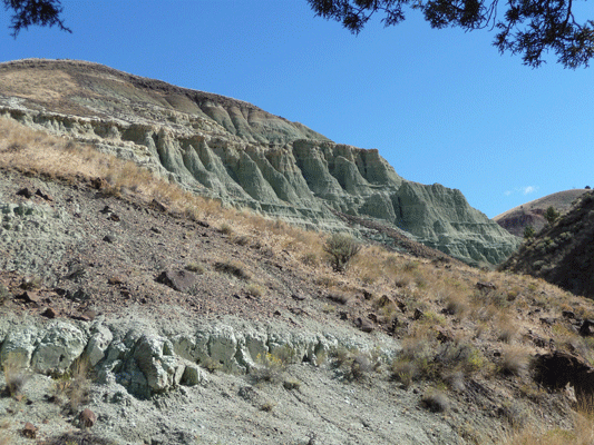
The trail leads through these wonderful formations.
The red rocks only add to the contrast really.
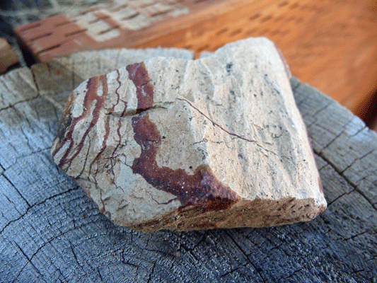
Here's another cool rock sample we found along the way.
At the end of the trail there's a round basin where I tried to take a panorama shot. You can hike on up and around for a longer loop but were were happy with what we did.
By the time we got back to the rig I was HOT. It was 82 degrees outside! We drove north to the picnic area where the hikes called Story in Stone and Flood of Fire start. It was 86 in the rig and I put on my shorts, we opened the windows and had lunch.
Here's a shot of a formation on the beginning of the Story in Stone trail.
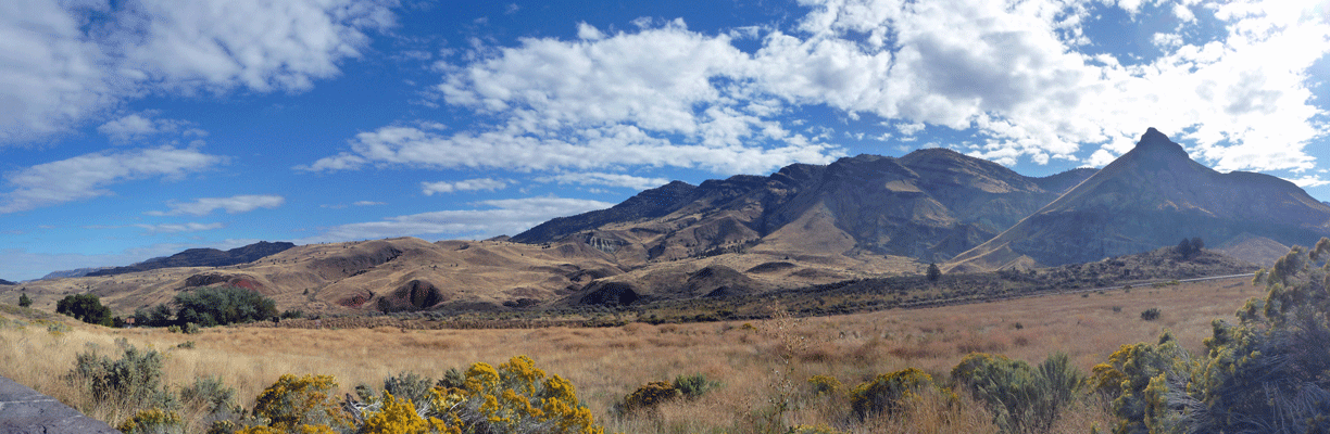
After lunch, we followed the road on up past the Cathedral Rocks.
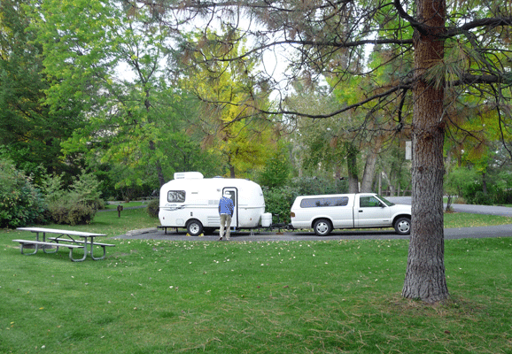
From here we drove north on Rt 19 UP into the mountains to Shelton Wayside Park next to Service Creek. It’s a county park that was first developed in 1927. Very few of the sites are level and the road is pretty steep in places. Once again the transmission overheated a little and I couldn’t go up a steep grade from a full stop without putting it in 1st. We found a spot and set up camp by about 3 PM. By now the clouds were coming in serious like and it had cooled down so I changed back into my jeans. We were at about 3800 ft elevation and there were Ponderosa’s in the campground.
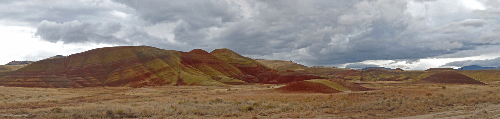
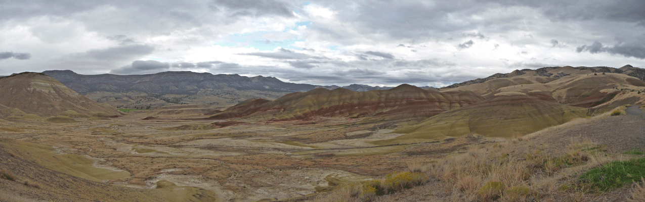
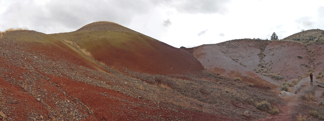
After setting up camp, we drove back down Rt 19 to Hwy 207 and went up and down a bunch of winding road to reach Hwy 26 to go a few miles to the turn off for the Painted Hills Unit of John Day Fossil Beds. It’s about 6 miles off the highway and you get samples of the cool colors as you drive along. It was just starting to spit rain when we got there at about 4 PM.
We stopped at the first turn out to take photos. Pretty amazing colors, no?
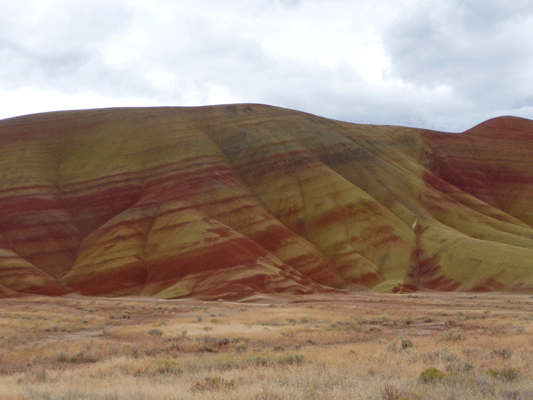
Here's a close up of the above hills.
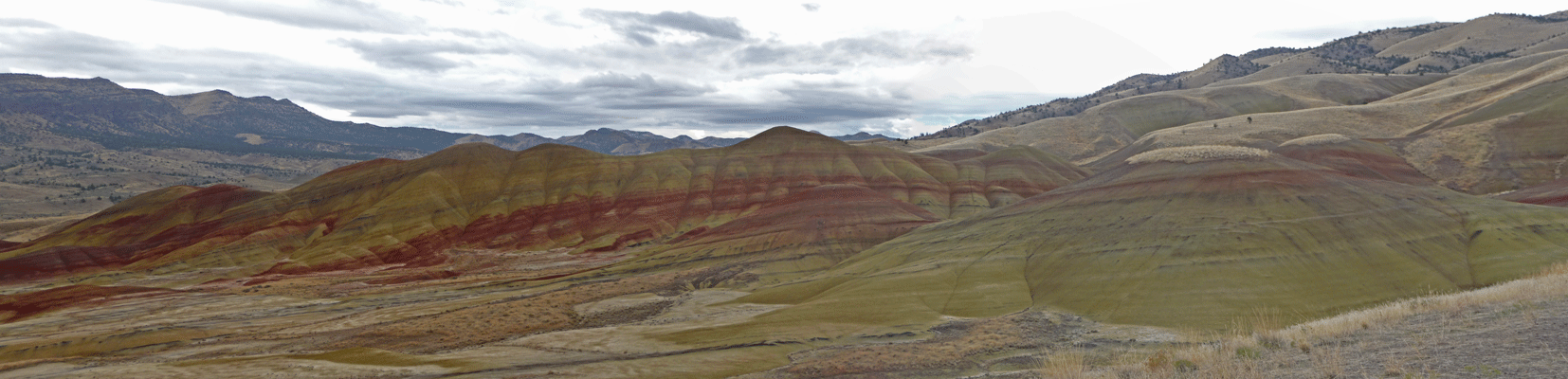
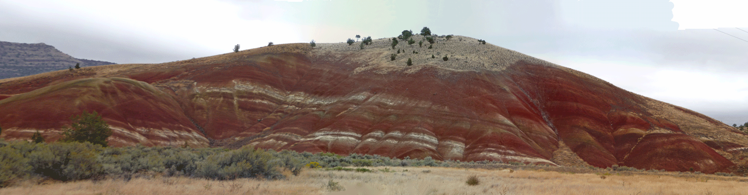
And here's a panorama shot of the view from one of the view points.
And a closer up panorama of the color.
then we drove to Painted Cove and did the little ¼ mile nature trail through a small group of painted hills. Great fun and I was so glad that Walter had suggested that we take our jackets. It was putting out BIG drops by the time we got done.
They've put a trail in here because there is such a wide range of color in such a short span. Pink/purple
Orange/red/yellow
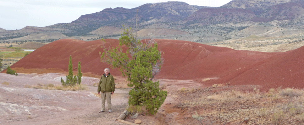
Here's Walter on the trail with mustard yellow in front and brick red in back.
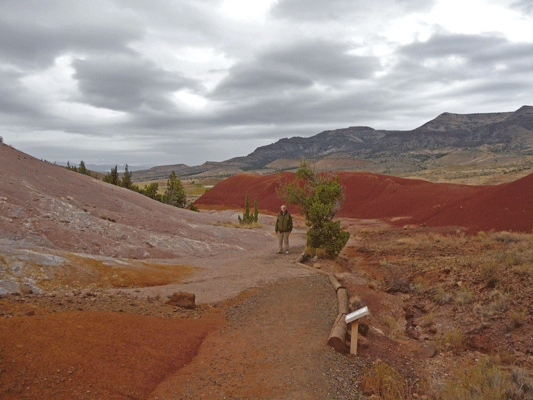
And a close up just in case you're forgotten what Walter looks like.
It turns out that the colors are supposed to be better when the painted hills are wet so we were lucky to be there in the rain!
It was 31 degrees when we work up the next morning at 7:30. It was 42 in the rig and needless to say we turned the heat on. There was frost on the picnic table in our campsite but the sun was out!
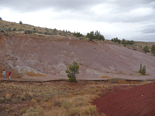
We pulled out at about 9:30 and headed out Rt 19 to the town of Fossil. We looked for gas but didn’t find any and then drove on to Rt 218 to the Clarno Unit of the John Day Fossil Beds. The road had lots of UP and down and switchbacks. We met a nice couple there who were admiring our Casita so we gave them a tour and visited with them. They both work for the Forest Service and were on a trip that included all 3 units of the John Day Fossil Beds plus a work day in La Grande and time at Wallowa Lake.
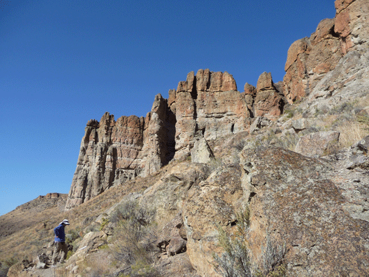
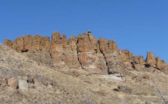
After they left we hiked the Geologic Time Trail (1/2 mile round trip) out to the Trail of the Fossils at the foot of The Palisades. Those are The Palisades behind Walter.
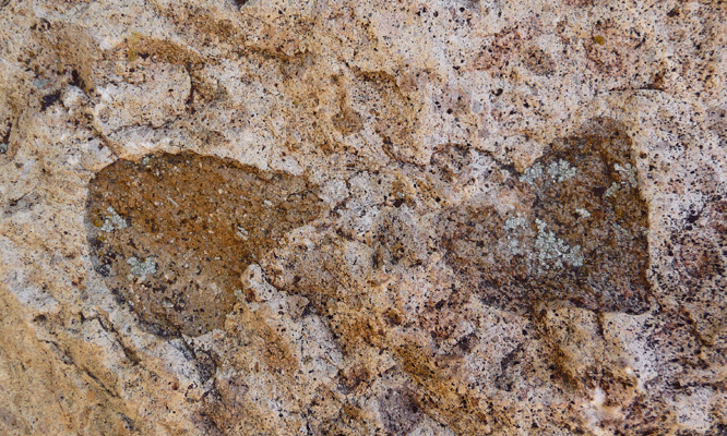
There were of lots of really cool leaf fossils that are in the rocks right there along the trail. FUN! There were also petrified branches and tree trunks to see.
Here's a view of The Palisades from along the trail.
When you're at the foot of them, they're really petty tall.
Here's a panorama view of the surrounding hills and valley.
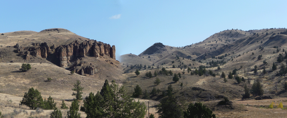
I took one last shot of the Palisades before we headed out.
From here we drove on through the UP and DOWN of the hill roads to Antelope. Again no gas station to be had and on to Shaniko at 218 and Hwy 97 where we finally got gas We stopped for lunch in Moro parked along the hwy across the street from the very unimposing City Hall.
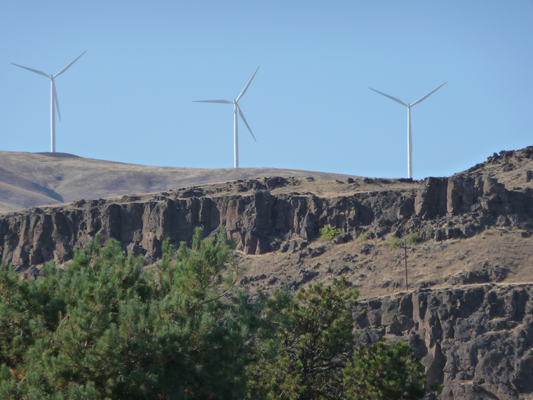
We were at Maryhill State Park along the Columbia by 2:30. We got a nice pull through site and then did a little walk along the river.
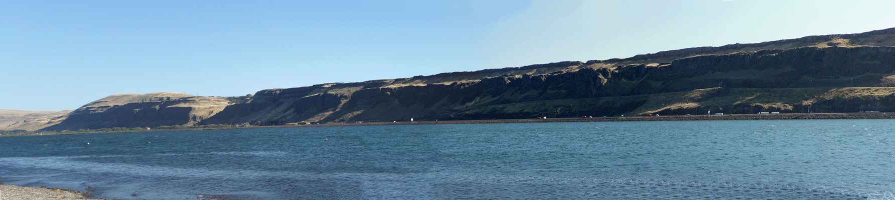
A huge number of wind turbines have been erected in Oregon before you get to the river and on the top of the hills on the WA side too since last we were here—in 2007 I think.
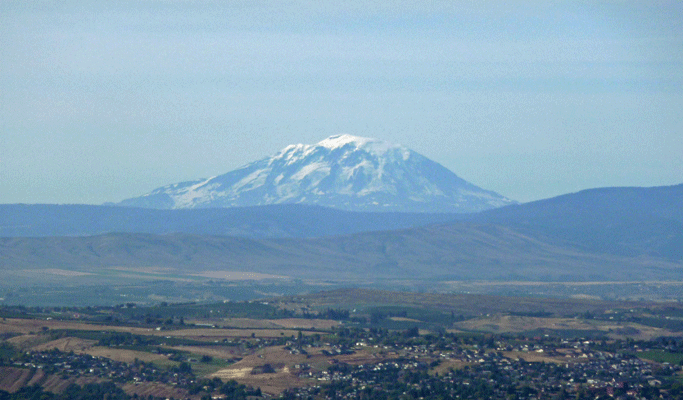
We stopped at the rest area in the hills above Yakima and you could see Mt. Adams to the south.
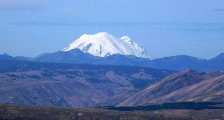
And Mt. Rainier.
It was a great trip and we were both glad to be home again.