The temperature got down to about to about 50 on Monday morning and it was pretty cool in the trailer too. We bundled up with our long johns on and ran the generator as we ate breakfast. Just a few days before on Friday I’d had shorts on because it was in the high 80’s in the trailer and now I had long johns and 2 fleece on. Talk about a roller coaster.
The sun broke through the clouds at about 10 and we both breathed a sigh of relief that it might be a decent day for a hike. We packed a lunch and headed west out of the park, through the town of Cherokee and then down Highway 19 to Byrson City. We wandered around town a bit until we saw signs pointing the way to the Deep Creek Campground back inside Great Smokey Mt National Park. The road was a very narrow two lane job and we were both thankful we’d decided we didn’t want to camp out there because it was harrowing enough with just the truck since folks coming the other way were having trouble staying on their side of the yellow line and there was very little verge.
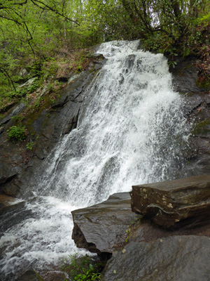
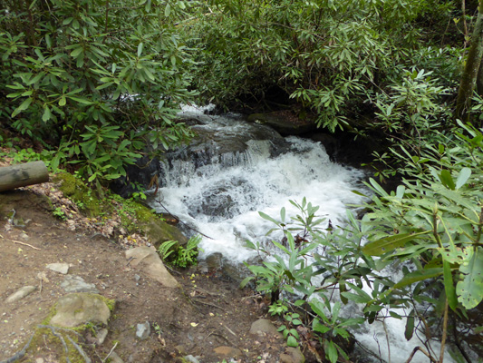
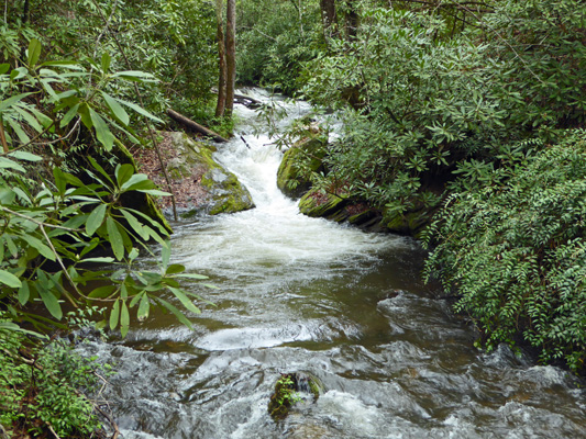
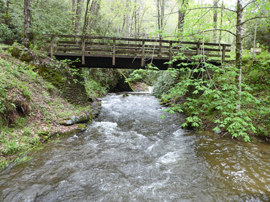
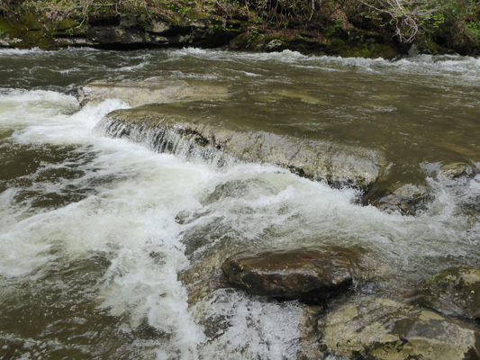
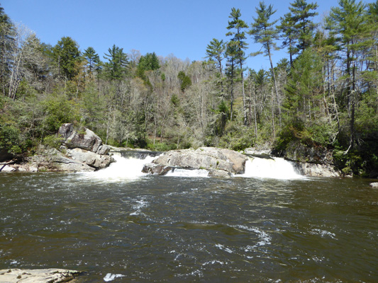
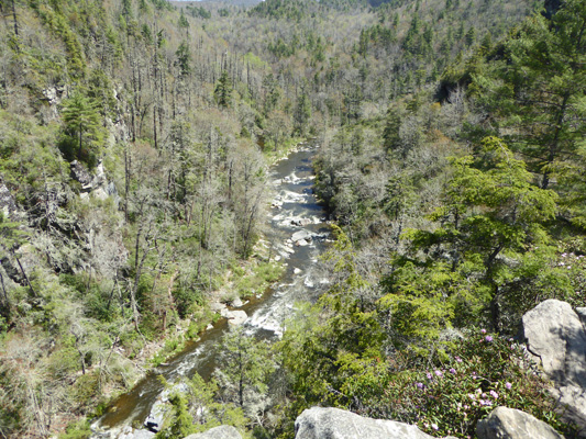
We were headed for the 3 Falls Loop Trail that starts just past the Deep Creek Campground. We stopped to use the restrooms in the Picnic Area and I went down and shot of photo of Deep Creek roaring along. This is usually a calm little creek that people take inner tubes down.
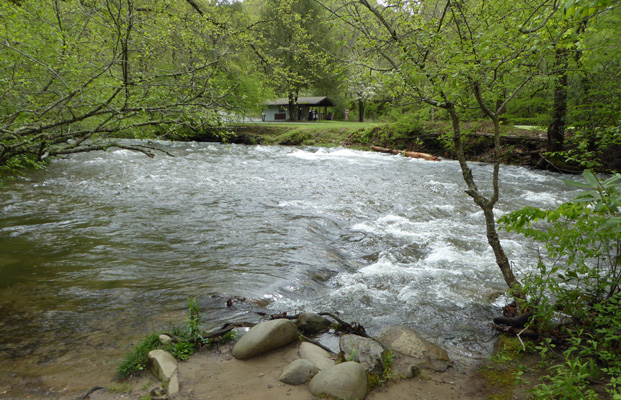
I’m sure this sandy little beach is a place little kids play in the summer. But not today.
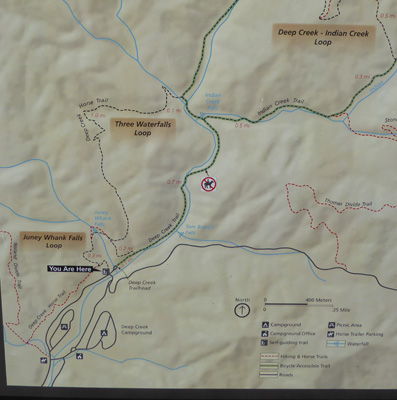
We found a place to park in the trailhead parking lot and I took a photo of the trail map—which turned out to be a good thing because the signage later on was confusing.
I will note now that we completed the Three Waterfalls Loop. The part of the loop that takes you from Juney Whank Falls up over the ridge and around to Indian Creek Falls (on the Deep Creek Horse Trail) is a steady uphill grade that includes a couple of switchbacks to get you up over the ridge. Once you hit the top of the ridge it’s downhill all the way. The entire loop is about 2.4 miles. I had thought this was the best way to see all three waterfalls. However having done the loop I’d advise anyone who simply wants to see the three falls to not do the loop but instead take the Juney Whank Falls Loop and then hike along the Deep Creek Trail to see the other two falls. It’s nowhere near as much elevation gain. We enjoyed the loop and it was a good hike but we didn’t NEED to do it to see the falls.
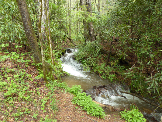
We took the loop in the clockwise directions heading up the Juney Whank Falls Trail to start. There’s a nice little cascade in the creek just as you start out.
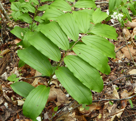
This is a fairly steep trail but it’s wide and the surface is good. It feels like it might have been a road once upon a time. In fact all the trails we took in this area were like that. Just as we approached the falls I spied some False Solomon’s Seal (Smilacina racemosa) in bloom.
And then we took the stairs down to the falls themselves. There’s a nice little bridge across the creek with a bench where you can sit and enjoy the falls. I took this from across the bridge because it was the best view.
We stopped and talked to a pair of ladies who had taken the loop counterclockwise and they said there wasn’t much more up hill. I’m thinking they really hadn’t done the whole loop since it was down hill on the Juney Whank Loop and pretty flat on the Deep Creek Trail but the Three Falls Loop was up hill for a good long while.
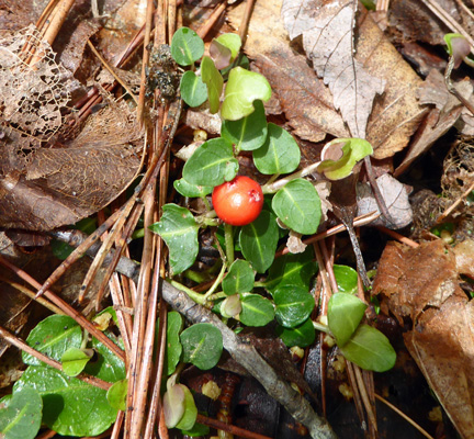
Ah well, we enjoyed ourselves and only saw one other couple of the loop so we had the forest to ourselves. We stopped to rest at one point and found one lone red berry growing on the forest floor. I think it’s a partridgeberry (Mitchella repens). Remember that cute little fuzzy flower I saw down at Congeree? Well this is the berry it produces.
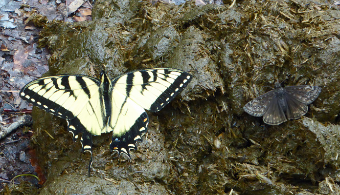
We made it to the ridge and were happy to head back downhill since it wasn’t all that steep. This portion of the trail is a horse trail and we’d seen many fresh horseshoe prints along the way. But what fun to discover 2 butterflies resting on a fresh pile of horse pucky.
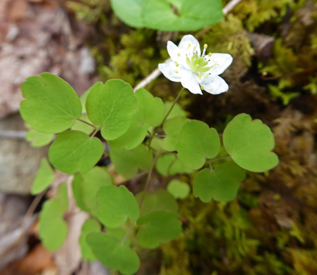
Just before the horse trail rejoined the Deep Creek Trail I spied a number of these little white flowers. They have delicate foliage and of course aren’t in my flower book.
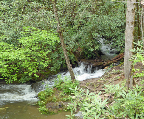
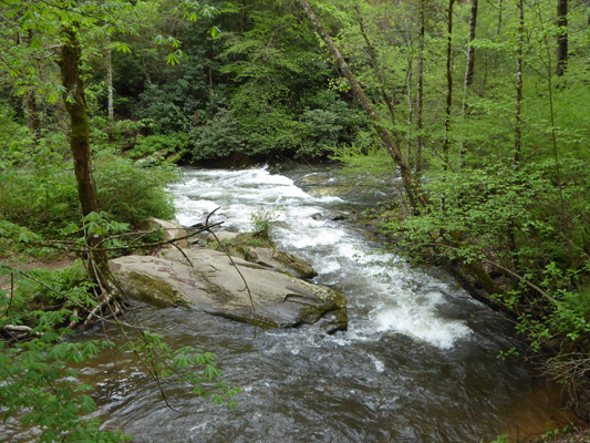
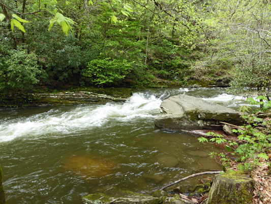
We really didn’t know where we were on the loop at this point except that we were headed the right way and had rejoined the Deep Creek Trail. I took a photo of the cascade on Deep Creek because I didn’t know if it might be one of the waterfalls we were supposed to visiting—you never know what folks in the east consider a waterfall...
We crossed the creek on a nice little bridge.
And continued on down hill past yet another nice cascade.
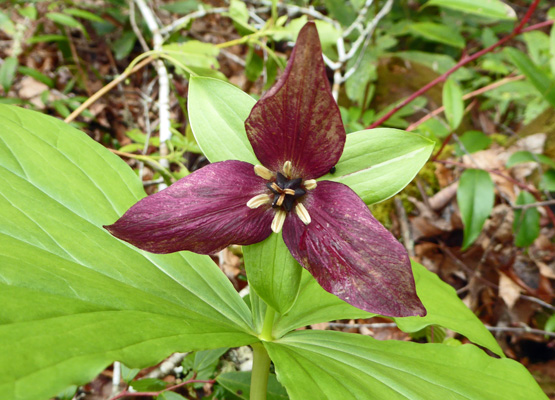
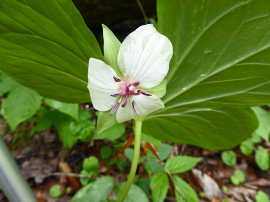
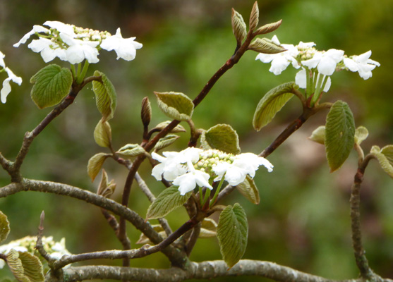
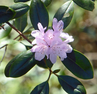
At this point we began to see some really nice flowers. First off was a Purple Trillium (Trillium erectum).
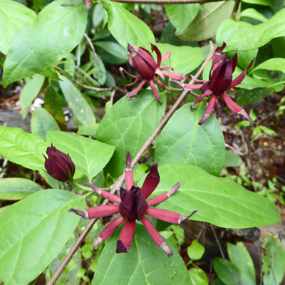
And then there was this strange shrub with odd maroon flowers. It turns out to be Sweetshrub (Calycanthus floridus).
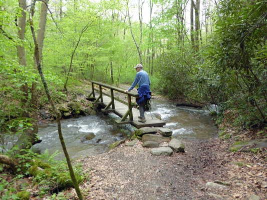
We came across a bridge spanning Indian Creek just before it joins Deep Creek.
Here’s the view up creek.
And down creek where it joins Deep Creek.
Walter found a nice place to rest while I climbed on the big rock above to take photos.
Here’s the view of the bridge looking up creek.
I climbed around and shot photos of Deep Creek too but they just weren’t all that interesting when I got done.
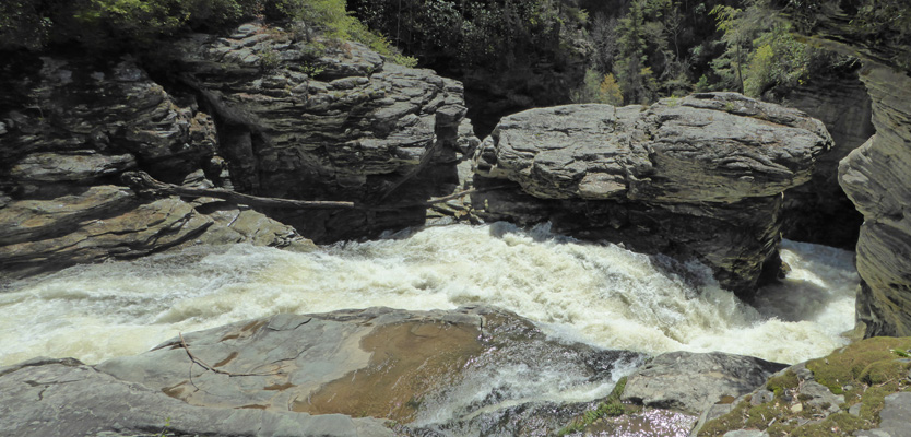
We started to head down the trail when we notice that there was a sign pointing UP the hill along another wide trail. It said Indian Creek Falls 200 feet. We almost missed it! It’s not 200 feet to the falls. It’s more like 200 yards but hey that’s okay. And you can climb down some stairs to get a good view.
As we headed back down to the main trail there was a big group of people coming up the trail. Clearly folks come up this way JUST to see these falls. And the only uphill part is the last 1/4 mile or so.
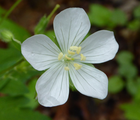
We headed on down hill and I noticed a white Wild Geranium (Geranium maculatum)! They usually come in pink and I’d never seen one in white.
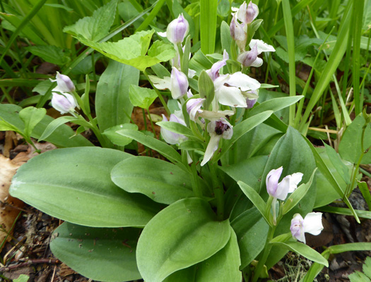
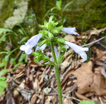
As we walked down hill I noticed a big clump of Showy Orchis (Galearis spectabilis). These had their faces up a bit more so you could see even more of the purple inside them. Later in the day I found another one in our campsite!
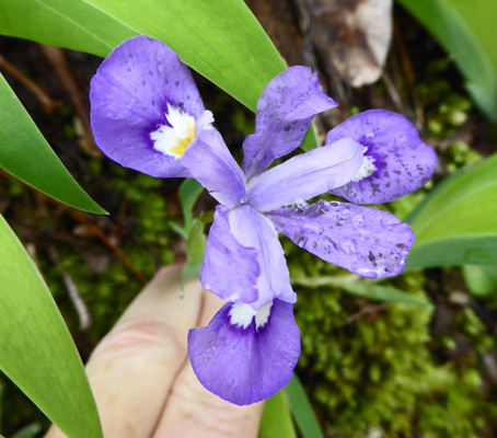
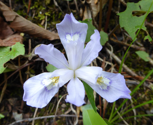
There was water seeping out of the hillside along the trail and there were Dwarf Crested Iris (Iris cristata) growing near the seeps.
Not far from these I noticed an odd trillium with it’s face pointed downward. This is a Nodding Trillium (Trillium cernuum).
As you head down hill benches appear along the trail in places where it’s nice to sit and view the water. One was sitting right in front of this interesting feature.
And another was sitting so you could see the water come shooting out here. Just above this area there were signs that you couldn’t go tubing above this point. It might be a thrill to come through this chute sitting on an inner tube.
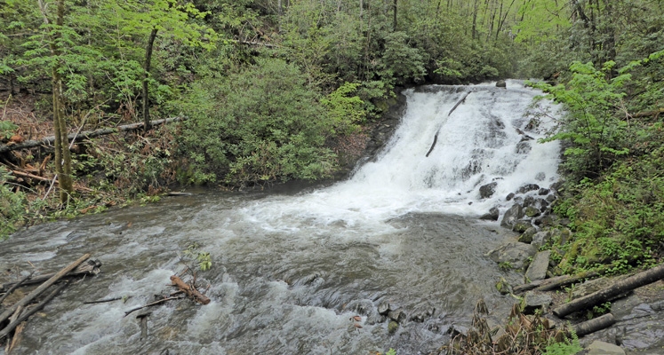
There were 4 benches clustered along the creek so you can sit and enjoy Tom Branch Falls.
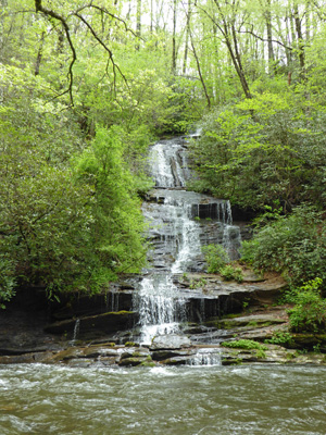
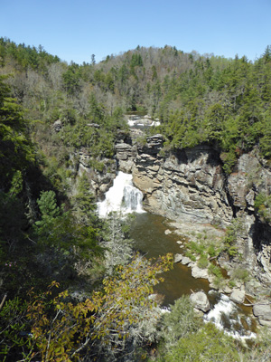
Many people just visit Tom Branch and Juney Whank Falls but I think all three are worth the trip.
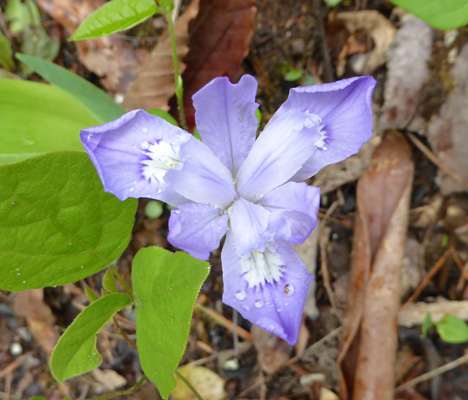
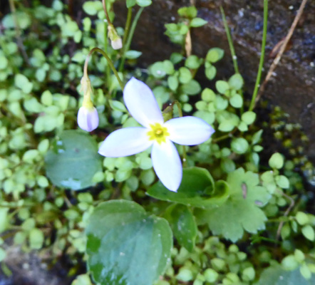
There was a little patch of this interesting blue flower along the trail.
And another large patch of Dwarf Crested Irises (Iris cristata) just coming into bloom.
 |
 |
The sun went away in the afternoon but we didn’t have any more rain. Yippee!
Tuesday April 25th we packed up and headed east from Smokemont Campground to the beginning of the Blue Ridge Parkway. The Parkway is 465 miles long and stretches from Great Smokey Mountains National Park (right at the entrance near Cherokee) all the way northeast to Shenandoah National Park in Virginia. It’s a winding mountain road which follows the crest of one ridge of the Appalachian range. The speed limit is 45 mph but because it is very hilly and winding we averaged about 30 mph which is what all the literature said to expect.
Our first stop along the Parkway was one dedicated to the Cherokee Homeland. I took a photo of the information sign not only for the info but because it was in Cherokee too. And they have a really cool alphabet.
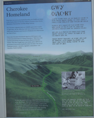
The Eastern Band of the Cherokee was formed by 150 families who were not relocated in 1830 when the rest of the tribe was marched to Arkansas and Oklahoma on the Trail of Tears. They hold 56,000 acres here.
The view here looks out across to the Qualla Boundary—the Cherokee Homeland.
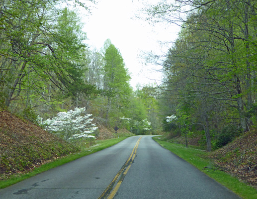
This part of the parkway was full of Dogwood in bloom.
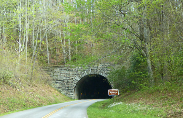
As we gained altitude there were Silverbells in full bloom with their delicate little white flowers which are not easy to photograph while you motor along! This part of the Parkway has LOTS of tunnels which were mostly built by the CCC during the late 1930s. All the tunnels we saw in the first 150 miles of our journey had this same stone facing style. And as it turned out that's all the tunnels there are.
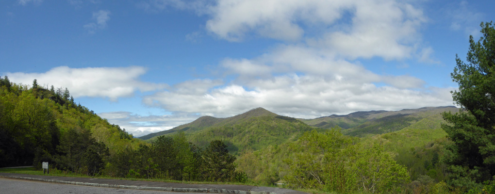
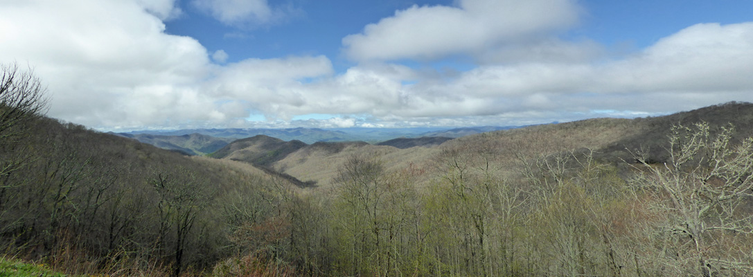
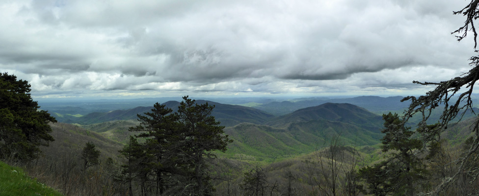
While most of the trees were leafed out down below 2500 feet above that there were fewer and fewer leaves. The view out across the mountains to the east was pretty stark once you were up at 5,000 feet. This is the view from Bunches Bald at 4925 feet.
We continued going up and down for some time until we reached the highest point on the Parkway at 6,053 feet.
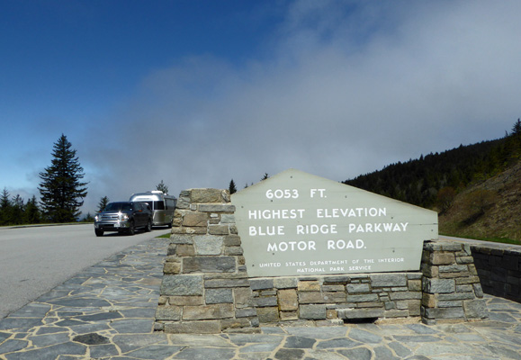
It was 48 degrees but the sun was out.
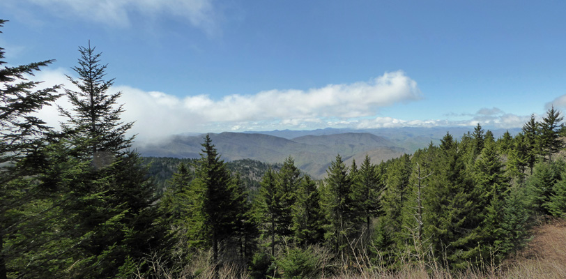
Here’s the view from the overlook. There are balsam and hemlock above about 5,000 feet. Otherwise it’s all deciduous forest.
We stopped to switch drivers at the East Fork Overlook. This is just south of Asheville, NC at 4944 feet. Way down below is the East Fork of the Pigeon River.
We drove through Asheville on the Parkway and the only reason you had any idea you were in the city was that there were more cars on the Parkway and the speed limit was only 35 mph.
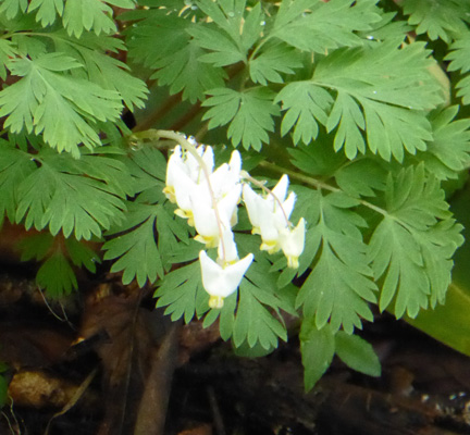
We stopped for lunch at the picnic area at Craggy Gardens. The elevation was about 5,000 feet and it was cloudy and cold (50 degrees). We huddled in the trailer and had our lunch. On the way back down the hill to the Parkway I stopped and took a photo of the Hobblebush(Viburnum lantanoides)--which I initially thought was a wild hydrangea-- that were blooming along the road.
And I spied some Dutchman’s Breeches (Dicentra cucullaria) too. It’s not the best photo I’ve ever taken but considering I did it hanging out of the window of the car it’s not bad.
Right after we rejoined the parkway we drove into thick fog. That continued for maybe 20 minutes off and on until we drove out of the clouds. Whew.
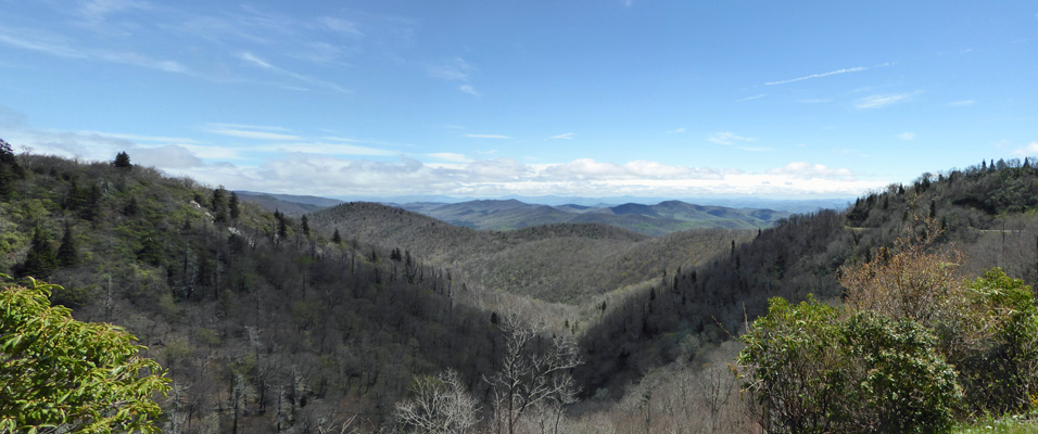
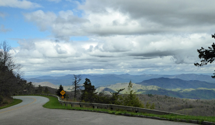
A half an hour later I pulled over at the Laurel Knob Overlook to take a photo of the view. The elevation here was 4602 feet. And we were beginning to see an occasional pink azalea along the verge with no place to stop to take a photo.
Here’s a shot of the parkway as we came out of the pull out.
We arrived at Linville Falls Campground at Milepost 315 at about 4:45. So it took us 6 hours to drive 150 miles including stops for photos and lunch. This was not fast going but it was pretty.
We got a nice side pull through spot (they have three and they were all open) that was really long and set up camp. Once again, this was a National Park campground so there were no hook ups. There was a water faucet nearby and a nice camp host to check us in and our spot was in the sun so we prayed for sun the next day so we could set up the solar panel. Since the sun was just getting ready to go behind the clouds (and then the trees) we set up the generator. No tent needed this time which was nice.
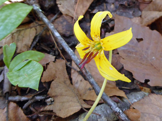
Wednesday April 26th we awoke to sunny skies! We set up the solar panel and I took a little walk down to the Linville River which runs next to the campground. There were a few Trout Lilies (Erythronium americanum) in bloom in the shade along the trail.
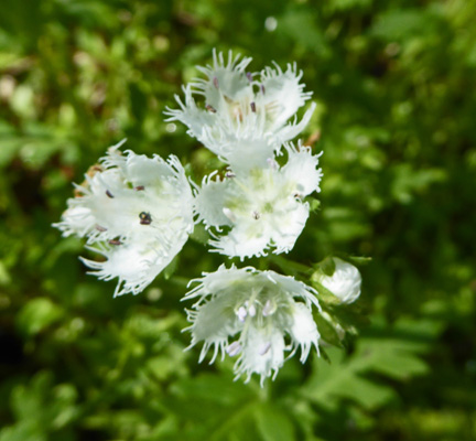
And there were masses of Blue Ridge Phacelia (Phacelia fimbriata) along the river.
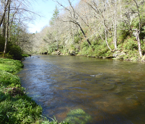
The river had been up over its banks when we first arrived but had receded a bit and cleared some by morning.
There were also still lots of Robin’s Plantain (Erigeron pulchellus) in bloom in the campground and along the Parkway.
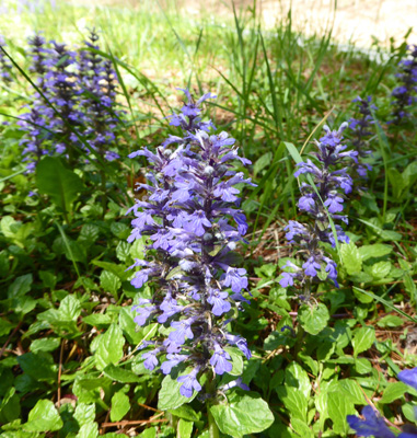
Having had my flower fix drove a few miles off the Parkway to get gas for the generator and the truck. On the way back we noticed this patch of bright blue flowers. I’m not sure about it but I think that it’s Meehan's Mint (Meehania cordata).
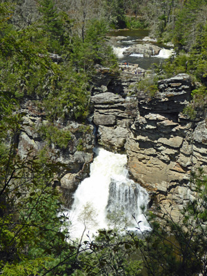
The activity for the morning was a hike to Linville Falls. The trailhead is just a mile or so along the road from the campground. During the summer there’s a Visitors Center here but it wasn’t open yet for the season.
It’s a moderate 1/2 mile hike from the parking area to the viewpoint for the Upper Linville Falls. A short spur takes you down to a broad stone viewing area. That spur was a little muddy but not bad. And you get a great view of the Upper Falls.
The river rushes on by to the right of this photo and then curves around and goes down a chute.
The Lower Falls start at the bottom of the chute but you can’t see them from here.
We sat and watched the falls for a while and I noticed some Bluets (Houstonia caerulea) in bloom under the bench we were sitting on.
To get a view of the Lower Falls you have to hike up the hill another .2 mile and then down a steep set of stairs (many of which were washed out leaving boards hanging free). But that was worth it too. The view of the Lower Falls is marvelous from the lowest viewing platform. If you look carefully above the Lower Falls you can see the Upper Falls too. At the bottom of this photo you can see the water start to cascade its way down into Linville Gorge.
The Linville Gorge runs eastward quite a ways.
I took a bunch of photos of the falls and this is the one I like best because you can see both sets of falls clearly.
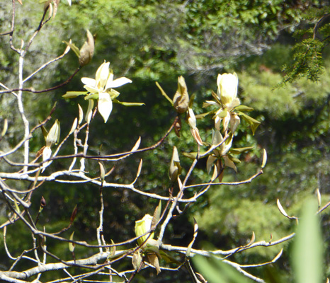
On the way down the steep stairs I noticed a tree in bloom that I’d spied as we drove on the Parkway the day before. After studying things I think it’s an umbrella magnolia. In any case as we went further north and they were fully leafed out that’s what they were.
There were pink azaleas in bloom along the edge of the viewing platform for the Lower Falls. These are Carolina Azalea or Rhododendron (Rhododendron carolinianum) the first of the rhody family to bloom in the area.
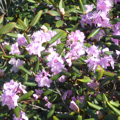
They have big leaves like a rhododendron but the flowers are small and in small clusters like an azalea.
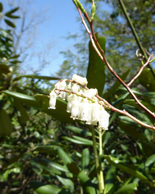
There was a nice bench to sit on at the top of the stairs and we rested for a few minutes in the shade. It was in the low 70’s and humid so we’d gotten warm. I spied these little white bells on a bare branch. They turn out to be Redtwig Doghobble (Eubotrys recurva).
From here you can hike another .2 mile with LOTS of stairs to have another view of the gorge. We decided we were happy with what we had seen and turned around and hiked back.
We had a quiet afternoon with the solar panel charging away. By the end of the day there were 3 more Airstreams in the campground. All were 25 footers like ours just different models. We had only seen one other Airstream for weeks so it was a bit of the treat. The others were all from Georgia. I guess Atlanta is the kind of place where folks buy Airstreams.
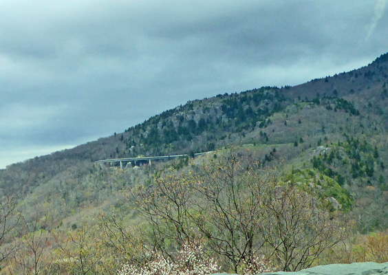
Thursday April 27th, we packed up and turned north on the Blue Ridge Parkway. Not far from Linville Falls you come to the Linn Cove Viaduct, the last stretch of the Blue Ridge Parkway to be completed. It took 20 years to work through all the environmental and engineering issues to get this 7 mile stretch of the Parkway completed.
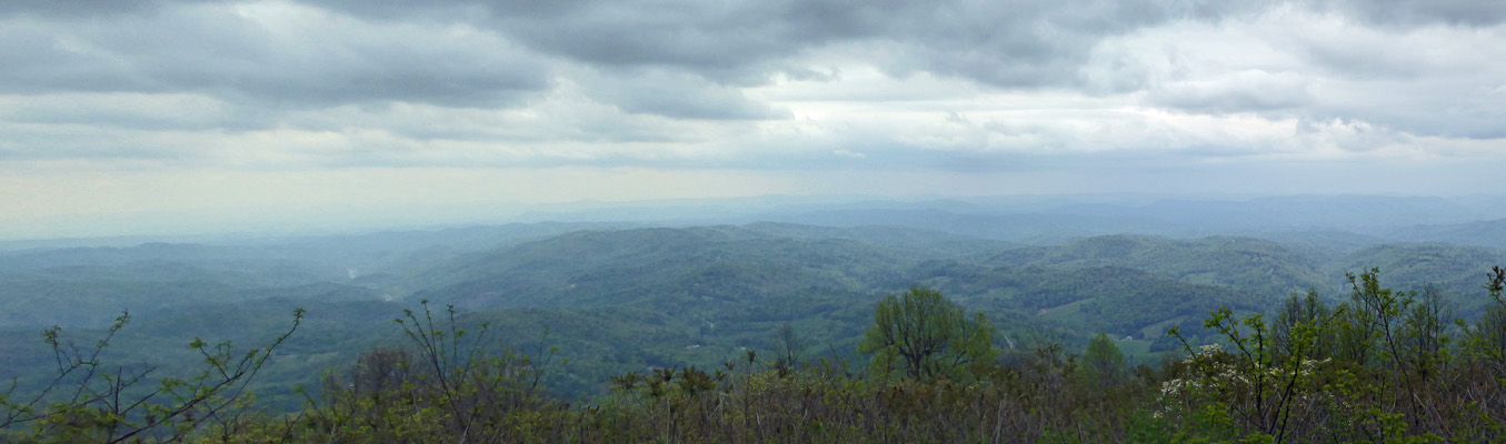
It was a cloudy day mostly so the views from the overlooks weren’t stellar but they do give you an idea of why this area is called the Blue Ridge. Just as the Great Smoky Mountains get their name from the low lying clouds and fog that make them look smoky, the Blue Ridge looks blue in cloudy or humid weather.
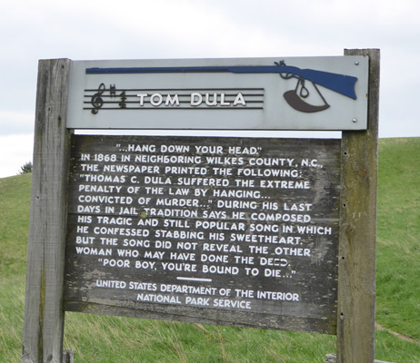
At The Lump Overlook (the names of these overlooks sure are interesting) there was a sign about Tom Dula, who wrote the song Tom Doley in 1868 when he confessed to killing his sweetheart and was hanged for it.
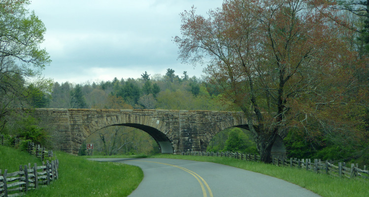
We continued on our way and passed into Virginia and just as we were supposed to get off of the Parkway at MP 215 we came to this lovely overpass—the Hwy 89 Bridge.
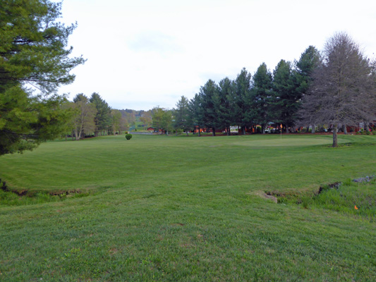
We turned west off the Parkway to Cool Breeze Campground. It was basically empty (there was one other RV in the park) and we had our pick of spaces. We took a back-in spot that had a nice view of the 9 hole golf course that’s next door.
They had nice inexpensive laundry (regular washers and dryers with an honor pay system) and good showers. Their WiFi was good most of the time and Walter found enough TV over the air to make him happy. His phone worked but of course my Virgin Mobile (Sprint) phone didn’t.
It had been 5 days since we’d had an internet connection so it took us a while to wade through the email and the news waiting for us. And then we began to plan the next week or so of our trip.
Friday April 28th it was sunny and in the high 70’s. We spent the day doing laundry and grocery shopping since the Blue Ridge Music Center which was just up the road wasn’t open yet for the season.
On Saturday April 29th we packed up and set out to buy propane for the trailer. Walter remembered seeing a place from our drive the day before and we ended up driving all over the countryside before ending up at the propane place just before it opened for the day. So if we had gotten their earlier instead of driving all over the place we would have just had to wait. We got our propane tank filled and then set out for the Parkway and missed the sign and drove about 6 miles too far before turning around and making our way back to the entrance. It was one of the THOSE days.
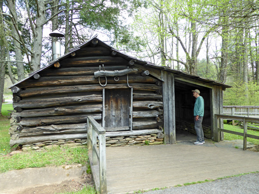
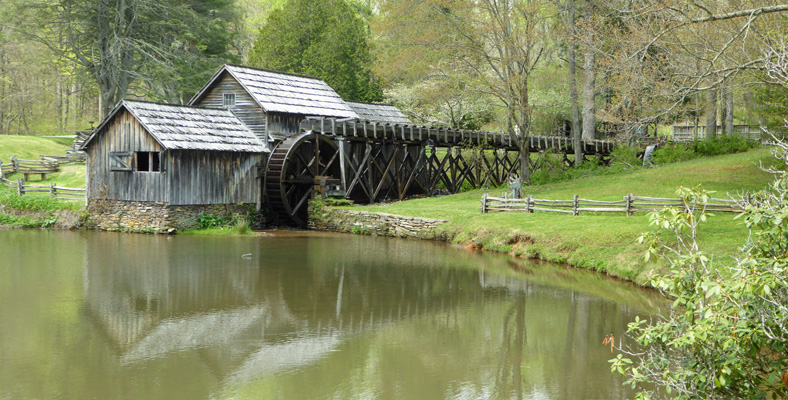
We drove north on the parkway to Mabry Mill—the most photographed spot on the Blue Ridge Parkway. We parked in the overflow lot which is marked especially for RV’s but wasn’t very well suited to them. We wandered through the grounds of the mill and stopped and looked at the old Blacksmith’s shop.
And then went into the mill. This mill was built in 1910 by Edwin Mabry. One end of the mill was a saw mill and the other end was a mill for cracking buckwheat for feed and grinding cornmeal for flour. He also had his blacksmith shop and a wood working shop. Inside the mill you get a great view of the water wheel that originally powered the mill.
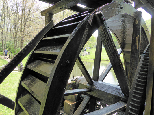
At some point in the 1920’s the converted this to be powered by a gas driven motor so Mrs. Mabry could run the mill. They ran the mill until 1936. The Park Service restored the mill in 1945.
If you hike around to the pond side of the mill you get a very picturesque view of the mill.
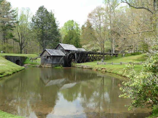
I loved how the mill was reflected in the pond but I also wanted to get a good view of the flume. So I tried a panorama shot too.
We had lunch and then drove north to Buchanan where we took a very winding road (posted ‘RVs and Trailers not advised’) down into town and then north looking for the Middle Creek RV Campground. We were following Carmine the Garmin’s instructions and began to think that we were on a wild goose chase when she took us way up into the National Forest. So we turned back when we came to a wide place in the road. Walter called the place and sure enough it was way out there but by then I was NOT interested in heading back out to the middle of nowhere. So we got out our campground books and decided to drive 10 miles north to the Natural Bridge/Lexington KOA Holiday Park just north of Natural Bridge. We arrived there without a problem and they had openings so all was good.
KOA’s aren’t cheap and this one was true to form. Our water and electric pull-through site was nearly $52 a night with the taxes. The site wasn’t very level side to side but with a little jockeying we found a place where we could get level enough. It was hot and humid. It had warmed steadily during the day and had been 88 in the Roanoke area but was only about 85 when we arrived at the park. But at 11 pm it was still 75 degrees outside with 79% humidity and it was 80 inside in the trailer. Ugh. But there were tornedos in Texas and torrential rain in Arkansas and Missouri so we we grateful to just be hot.
Sunday we gave up on the last few miles of the Blue Ridge Parkway and took I-81 north to Verona (just west of Waynesborro) to the Shenandoah Valley Campground. It’s a nice campground along a little river. We got a water and electric site down by the river with a bit of shade for $41.70 a night tax included. We have some chores to do before we go north into Shenandoah National Park later in the week. While it was still hot and humid there was a breeze and it supposed to cool down on Monday which would be a blessing for sure.