We set out that morning to complete the most iconic of Prince Edward Island tourist excursions: a visit to Green Gables Heritage Place. For those of you who didn’t read them when you were growing up (or see the movie) the Anne of Green Gables books take place on Prince Edward Island and the Green Gables Heritage Place preserves the house that was the setting for the books. Every tourist to PEI seems to have a visit to this place (and the beach) on their list. And even though it’s not quite high season yet the place was pretty busy.
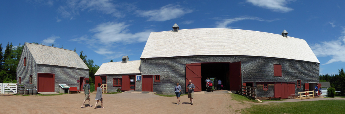
The Visitor Center is housed in this lovely old barn at the front of the property.
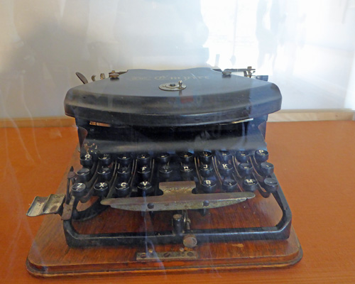
There’s a small museum dedicated to Lucy Maud Montgomery, the author of Anne of Green Gables, on the lower level on the right including a nice little movie about her and the writing of the books. Anne of Green Gables was published for the first time in 1908. And became an incredibly popular book with adults and children for a good 50 years or more. It’s obviously still popular because the place attracts so many people. Along with lots of family photos, they even have the typewriter she used to write her books.
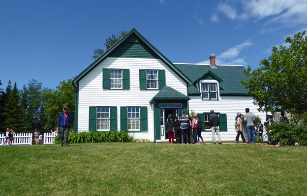
Lucy Maud Montgomery grew up on the farm next door to this one and roamed the property as she grew up. While she never lived at Green Gables, she always said that it was the model for the house in the book.
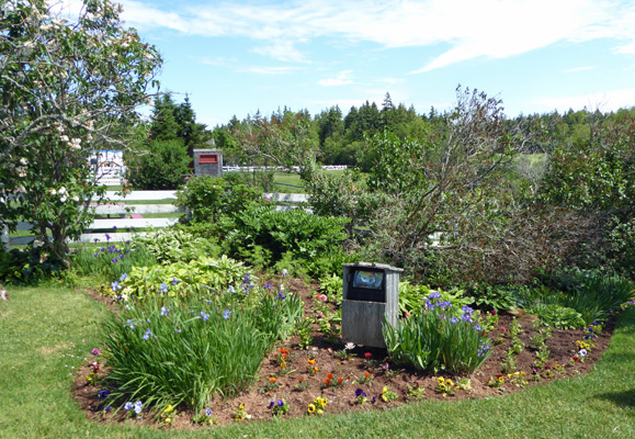
They have a nice garden around the house which was still being planted with annuals on this lovely day. The high season starts on July 1 so there were still lots of pre-season preparations going on.
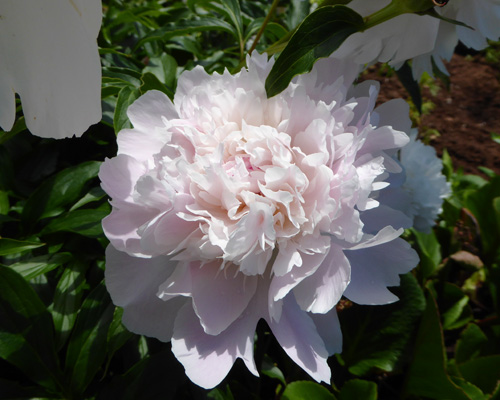
There were peonies in bloom and I had to go and smell them...
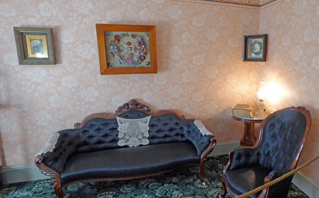
We made our way through the restored house which is supposedly set up as the house was in the books. I think it was over-decorated just as the Hughes House in Oregon had been. Clearly someone who was as impressed with Victorian wallpaper selected the stuff for this restoration too.
Here’s part of the living room
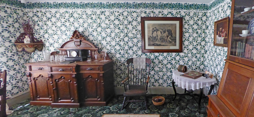
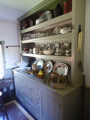
And the dining room
The kitchen area actually looked closer to reality to me—this was a farm house after all.
There was a Dairy Porch
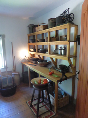
And a Pantry
The kitchen was so dark and so full of people I didn’t get a decent photo of it.
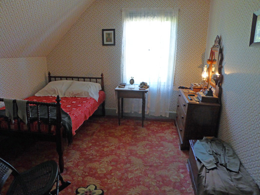
The traffic pattern then takes you upstairs to Anne’s bedroom
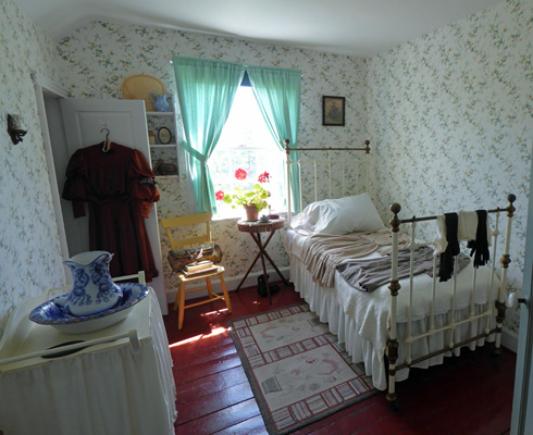
A guest room (complete with chamber pot)
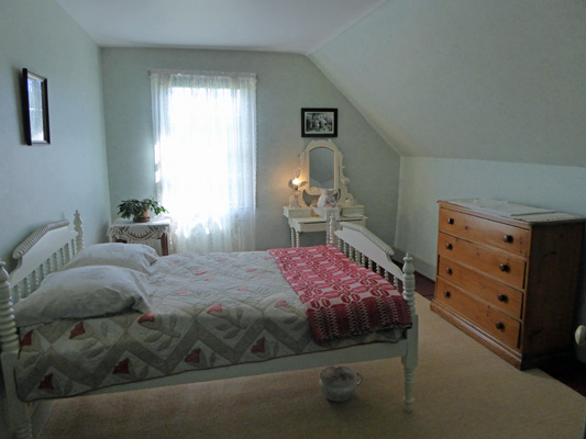
Marilla’s (the adoptive ‘aunt’ in the books) room
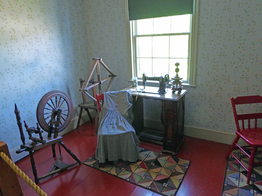
And a lovely sewing room complete with treadle sewing machine and spinning wheel
We then made our way back downstairs and outside again. The fact that I got photos of any of the rooms without people in them is a miracle. We had a busload of tourists taking photos of each other in front of every room!
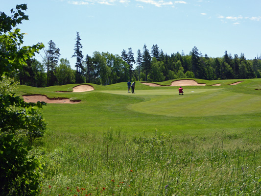
There are two trails that start at the house. One is the Haunted Wood Trail that takes you through the woods over to the house that Lucy Maud Montgomery grew up in (privately owned by her descendent with admission fee). The other is Lover’s Lane. We took Lover’s Land out through the woods and when we came to a sign that said Balsam Hollow Trail, Walter wanted to continue on the trail we were on. So we did. It turned out to be a path to the golf course and in the end we came out not far from one of the greens of the Green Gables Golf Course (owned by the National Park Service).
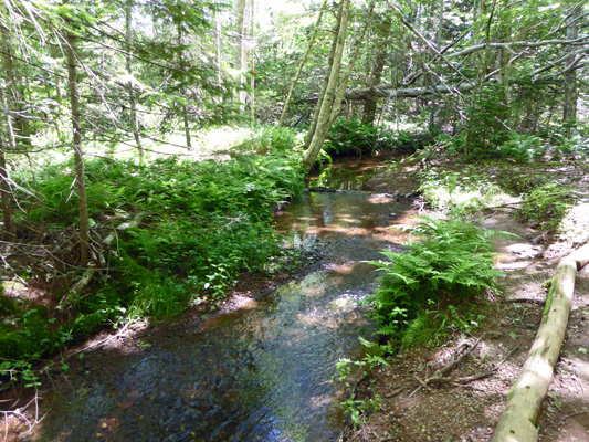
I muttered a thing or two about this and we turned back since even though we could see the trail, there was no way to get to it from where we were. We walked back a ways and found our way through the underbrush over to the main trail. It’s a lovely wooded area with a creek running through it and lots of tourists.
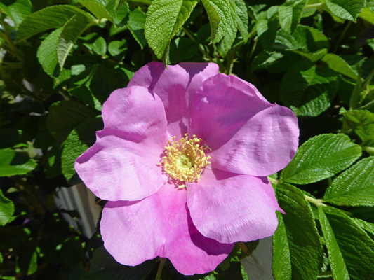
Having completed the trail we wandered on back through the grounds. The rugosa roses were just coming into bloom. There was a hedge of them on one side of the house.
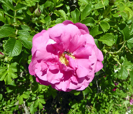
And out in the parking lot I found some doubles that smelled heavenly.
From here we went over to the Cavendish Visitors Center to use the free WiFi. There were actually about 6 people using it when we arrived but they weren’t putting much of a dent in the bandwidth. We got caught up on our internet tasks and then drove east to finish the drive along the coast that we hadn’t finished the day before.
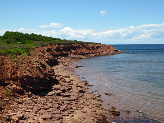
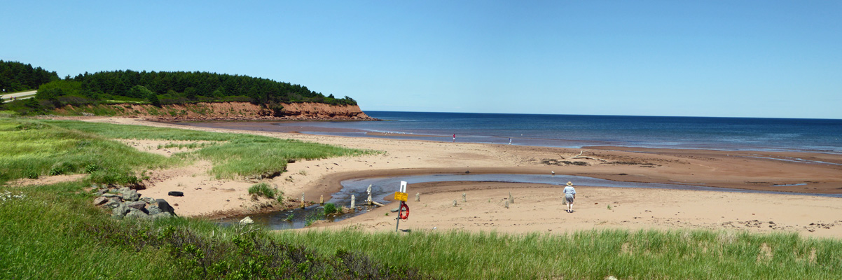
This took us out to Cape Turner where the cliffs aren’t as high as Orby Head but there is a bit of sand to the west
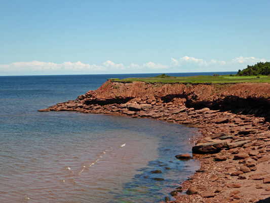
But not much to the east.
We completed the drive here at North Rustico Beach where there’s a nice sandy beach at the parking lot and an even bigger expanse of it to the east along a 1 km dirt road.
As I was getting ready to take a photo to the east a pair of fishing boats came into view headed for a breakwater.
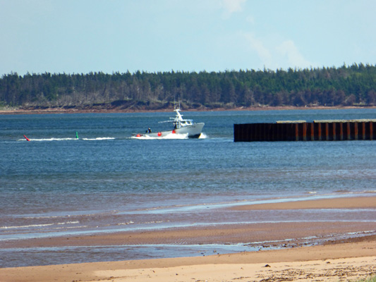
They look to be the same sort of boats we saw up at Kouchibougauc.
It was in the mid 70’s so we sat on a bench overlooking the water and had our lunch. It was breezy and lovely.
Then we drove inland (because that’s where the road goes) and followed many twists and turns of Hwy 6 to get to the Brackley-Dalvay section of Prince Edward Island National Park. The park itself is the smallest in Canada and preserves 3 sections of coastline along the north shore of PEI. Brakeley-Dalvay has a small sand spit, two beach complexes (snack bars, life guards and the like), LOTS of sandy beach and the Stanhope Campground (which is about 1/2 the size of the one at Cavendish).
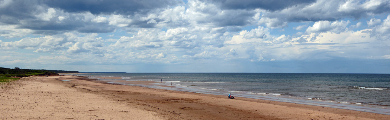
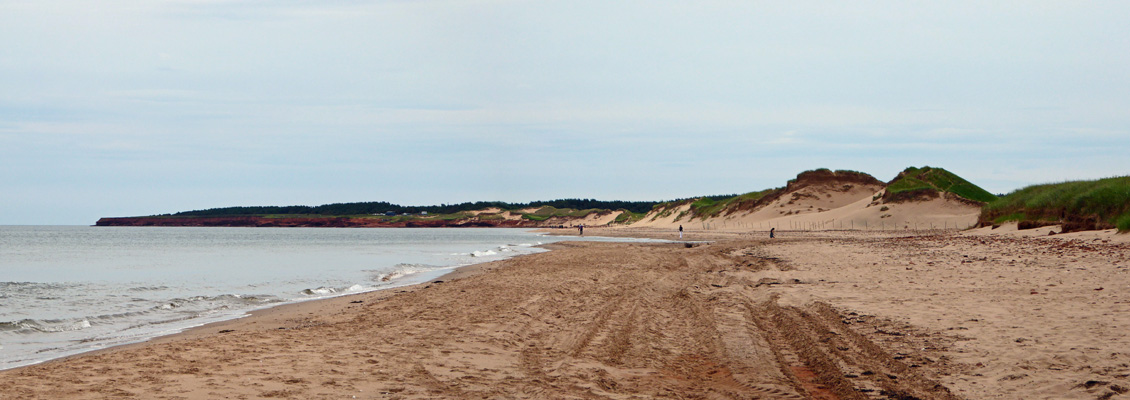
We stopped at the Stanhope Beach Complex and I got out and hiked out to the beach. Here’s the view to the west. As you can see, the beach seems to go on and on. And there were lots of dark clouds that direction.
But hardly a wisp of a cloud to the east.
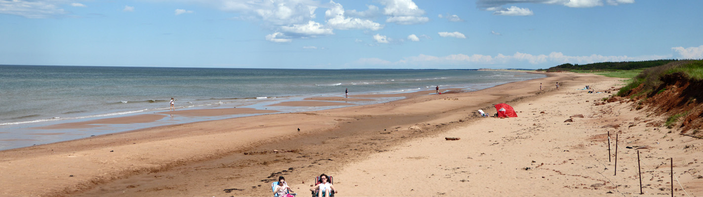
At the Dalvay Beach there were actually people in the water—shrieking about the cold. These two ladies were waving their arms about and then the one on the left gave a loud shriek and went under coming up with a great yell.
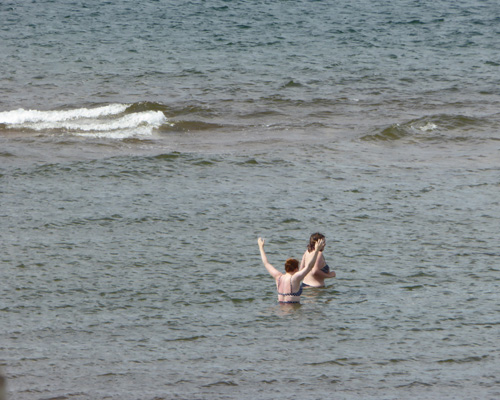
All of her gasping did not convince me that the water wasn’t freezing! Across the road is Dalvay-by-the-Sea, a summer house built in 1896-1899 by Alexander McDonald, a one-time CEO of Standard Oil. It’s a National Historic Site. And is now a hotel with restaurant. It’s a lovely Queen Anne Revival style mansion.
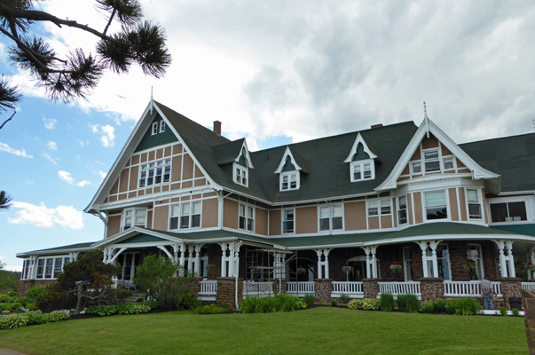
It sits overlooking a pond. And it’s lawn was covered with Canada geese.
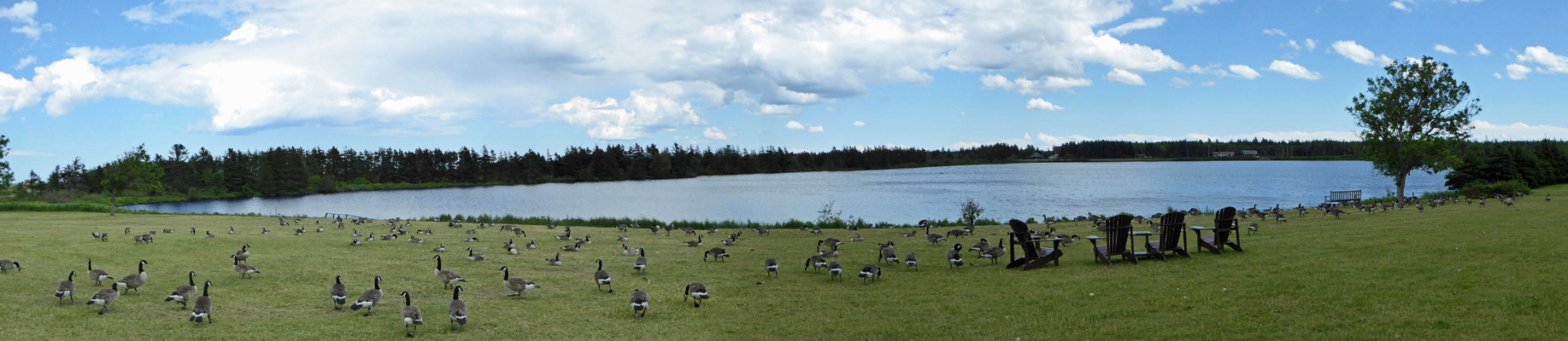
As I was shooting this panorama I realized that at last I was taking photos of Canada Geese in CANADA where they belong! My Seattle area friends will understand my sentiments about Canada geese.
We started our journey back to the campground at this point and it began to rain. And then it poured. And then the sun came out and the sky cleared. The clouds were black in the rear view mirror and the road was full of water but the sun was out. The weather here passes so quickly it gives a whole new meaning to scattered showers. When we got back to the trailer we discovered it hadn’t rained there at all.
Tuesday June 27th, we awoke to clear skies once again. We decided that it would be a nice day to stay close to home (after a couple of driving days) and hemmed and hawed for a time over where to go for a hike. We set out in the late morning to hike the Cavendish Dunes trail but on the way we came across the trailhead for the Homestead Trail right in the campground and upon examination of the trail map decided we’d hike out as far as New London Bay and then come back.
The first part of the trail (and most of what we hiked) heads through the trees which once again were very thickly spaced. This is not the kind of territory where you’d ever want to try to take off across country. No bushwhacking—you’d get whacked first for sure.
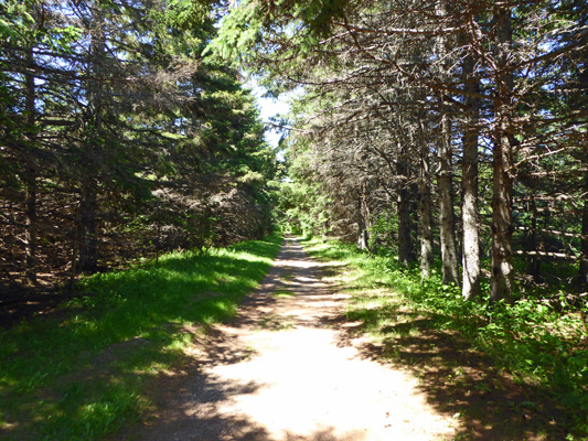
This is a pretty wide trail since it’s open to bikes and they give you room for two abreast.
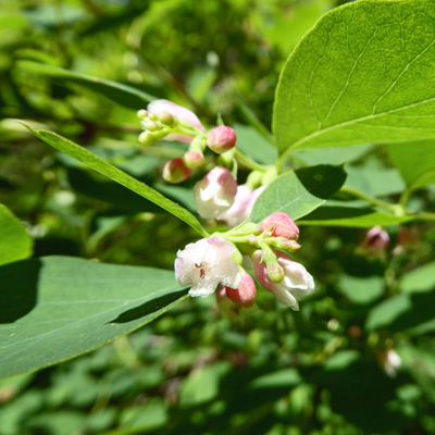
There were snowberries (Symphoricarpos albus) in bloom in the underbrush.
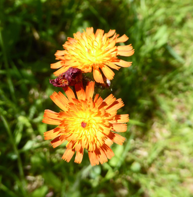
And as usual there were tons of bunchberries. There were also some Orange Hawkweed (Hieracium aurantiacum) mixed in with the dandelions.
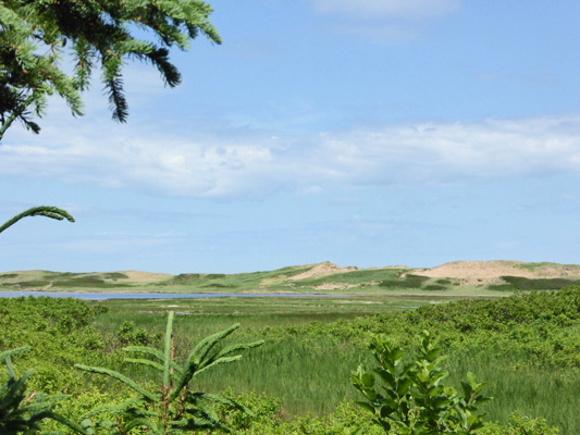
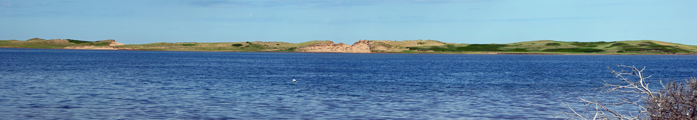
About halfway out to the bay, we got a brief view of the sand dunes out along the coast.
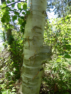
Here and there we saw some very mature Paperbark Birches with wonderful peeling back.
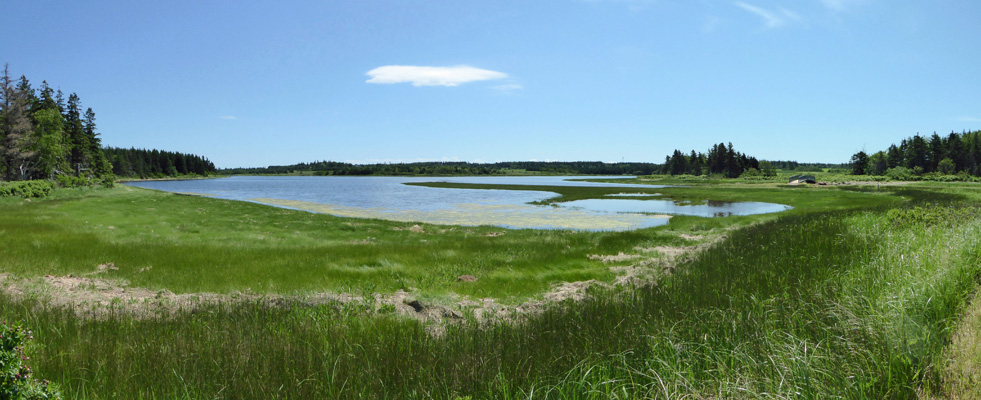
After about 1/2 hour of brisk walking (don’t stand still for more than a moment because of the mosquitoes!) we came out to a sandy spit and a wide view of New London Bay.
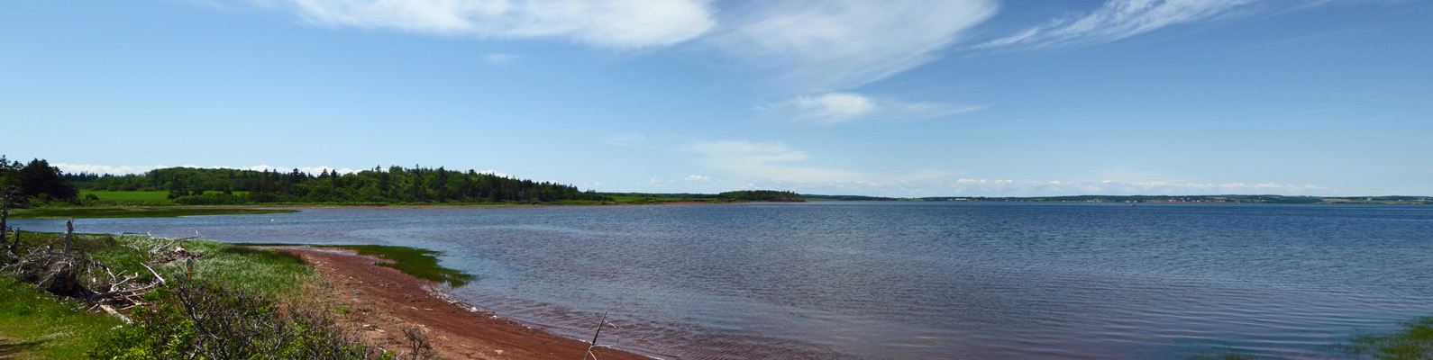
You can see the sand dunes over on the coast
And straight across the bay you can just make out a little lighthouse and some of the many acres of freshly plowed agricultural land. All the soil here is red.
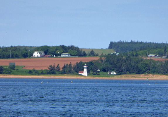
I admit I still haven’t gotten used to the little short lighthouses they have here.
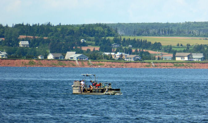
There was a fishing boat out on the bay that was different than any we’d seen thus far. He was just puttering about and may have been visiting crab or lobster pots but we couldn’t tell for sure. They farm oysters and mussels here but the bay wasn’t set up with the tons of buoys associated with that.
Around the point there was a little inlet.
With a nice bridge to get over the outflow.
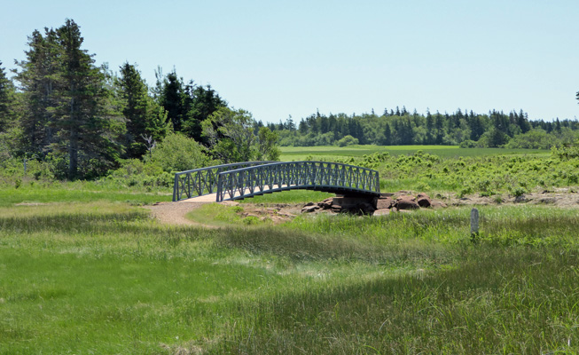
The tide must have been going out because the water was flowing really fast under the bridge out into the bay.
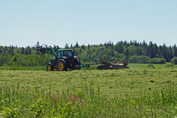
We’d been hearing some equipment off in the distance for a while and at last spied a farmer in the adjacent field cutting hay at great speed.
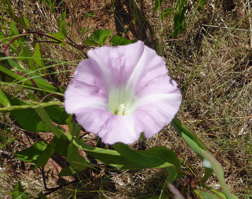
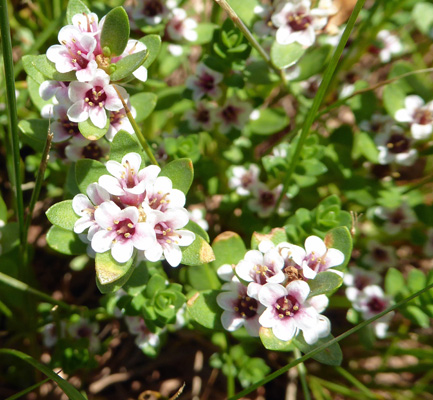
We turned back here and worked our way along the shoreline where I noticed some Morning Glories, aka Bindweed (Calystegia sepium)
And interesting little weed that from a distance looked like clover but was much prettier than that up close. It turns out to be Sea Milkwort (Glaux maritima), a plant common to salt marshes.
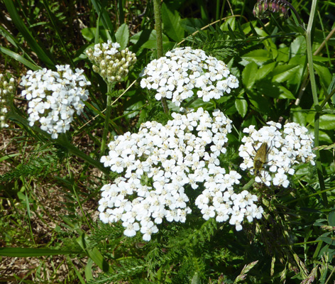
And there was some ubiquitous yarrow (Achillea millefolium).
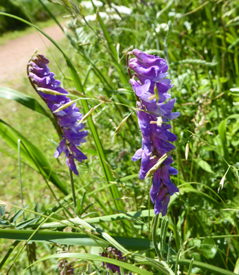
I also finally gave in and took a picture of the local vetch (Vicia sp.). We’d been seeing it since we were up at Kouchibougauc and it was everywhere here on PEI.
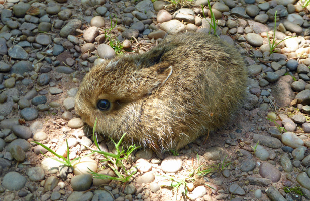
On the way back up the trail (it’s a very gentle up hill on the way back) Walter noticed this little bunny frozen in the middle of the trail. He wasn’t even quivering (as they sometimes do). He wasn’t even as big as my fist.
Also along the way I managed to pick a wild strawberry to eat. It wasn’t very sweet but it was warm and had lots of flavor.
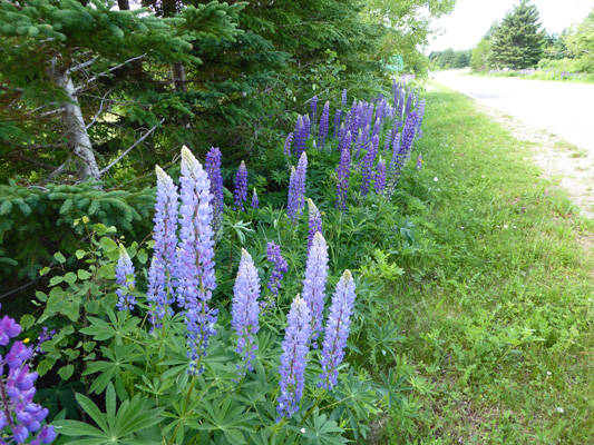
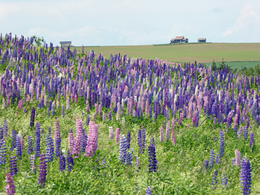
This was a very satisfactory hike. We were out for a little over an hour, saw a bit of wildlife, a few flowers and got some nice views. After lunch we drove over to the Cavendish Information Center and used their WiFi. The roads on PEI have been lined with lupine with nowhere to stop to take a picture. At last I found some just down the road from the Information Center so I took a walk and then found this lovely farmhouse with lupine in front of it.
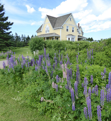
There’s a band of lupine about this wide along the side of nearly every road. They come in everything from white, to light blue, to pink, to dark blue to purple. They aren’t native and are thought to have escaped from people’s gardens but boy are they happy here.
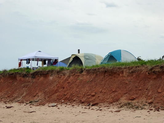
Wednesday June 28th, it was cloudy when we finally got up. We decided to take a walk along the campground beach because while it was cloudy it was still warm and the sun was trying to come out. From on the beach you could see a few of the tents in the beachfront section of the campground. The sites are really close together but some of them have quite the view.
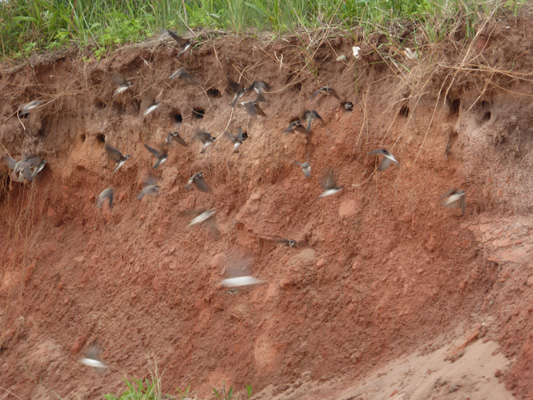
There were swarms of swallows flying back and forth from the cliff faces out to the waterline and back in a marvelous dance. While I couldn’t catch them swirling over the beach I did manage to get a bit of the activity at their nest holes.
We went on and got a nice view of the dunes that are down to the east—at Cavendish Beach itself I would guess.
Since our last visit down here, they’d put out the lifeguard tower and hut. They sure are eye catching with their red and white stripes.
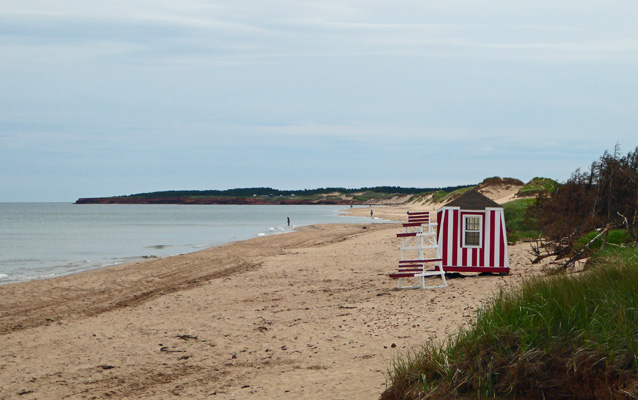
You’ll find them out on any beach that is ‘supervised’, in other words has a lifeguard. They take them in each winter and then put them out during the last week of June since the lifeguards start work on July 1.
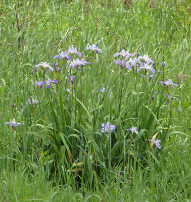
We wandered on back through the campground and passed a patch of Blue Flags growing in a little wetland.
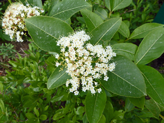
And there was some Wild Raisin (Viburnum nudum var. cassinoides) in bloom near our camp site.
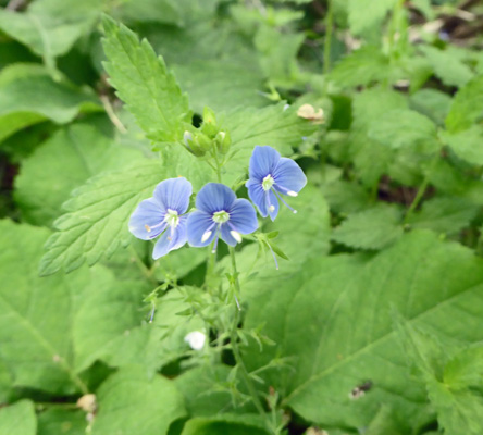
And there were a few Persian speedwell (Verionica persica) in bloom in among the trees.
By this point the sun was coming out so we made a picnic lunch and then set out for an afternoon drive. There was a nifty rock formation on the front of the PEI map that we had and I thought it might be down at Orby Head so I stopped at the registration station to ask. They had no idea where it was so we drove on to the Cavendish Information Center and they knew right away and gave me directions on how to get there too. We decided we’d do our internet surfing first so we settled in to use their WiFi. And Walter’s Chromebook wouldn’t sign on. We ran all the usual tests and procedures and nothing fixed it. Uh oh. The good news is that when we arrived in Nova Scotia the next day his computer signed onto the WiFi at the campground just fine. Whew.
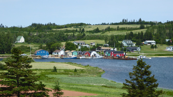
Having struck out with the internet fix, we set out on our drive at last. PEI is a really challenging place to navigate. The ocean is NORTH for goodness sakes and both of us have been turned around most of time. I’ve been off 90 degrees one way and Walter’s been off 90 degrees the other. So it’s not surprising we’ve taken a few wrong turns here and there but we’ve never actually gotten lost. That was true this time too. We went west on Hwy 6 and missed a turn and went a mile or so before we found a place to turn around but then we managed to find the turn onto Hwy 20 without a hitch. That takes you along the shores of New London Bay and then to French River where we found a marvelous overlook (they’re called look-outs here) of this very picturesque fishing village.
And across the road I got my shot of roadside lupine (Lupinus polyphyllus) in spades. The entire hillside (acres and acres of it) was FULL of lupine.
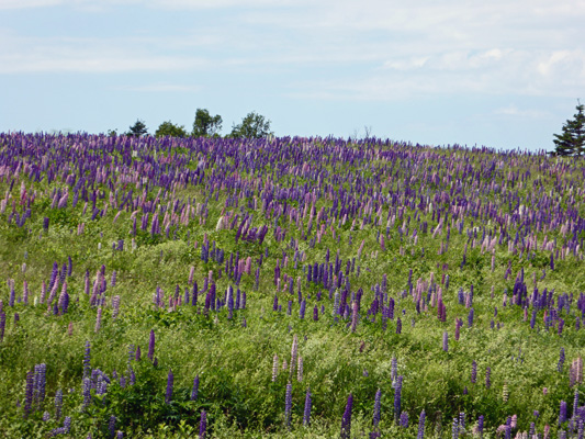
It just went on and on and on.
I just love it when serendipity serves up a big WOW.
We continued on through Parker Corner and Sea View until we found the turn onto Lower Darnley Rd. And we were having so much fun looking at the sights of Darnley Basin and the summer cottages and the big RV Resort that we missed our turn. We got to the end of the road and turned back and found Thunder Cove Rd without a problem and drove along until it ended at the beach. We had a little water view so we ate our lunch and then headed down the rocky path to the beach. I took off my sandals (Walter left his tennies on) and we headed left (west) up the beach until we came to a big rock formation. My directions said you might have to walk around this and sure enough you did. However the tide wasn’t entirely out so you had to get your feet wet. Walter decided to stay put and I rolled up my pants and waded on around.
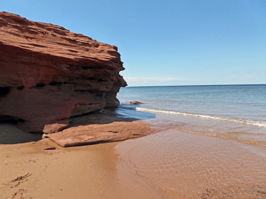
The water wasn’t particularly cold which was nice. When you get around this head you come to a a free standing rock leaning over and if you get lined up just right you can see another one through the window.
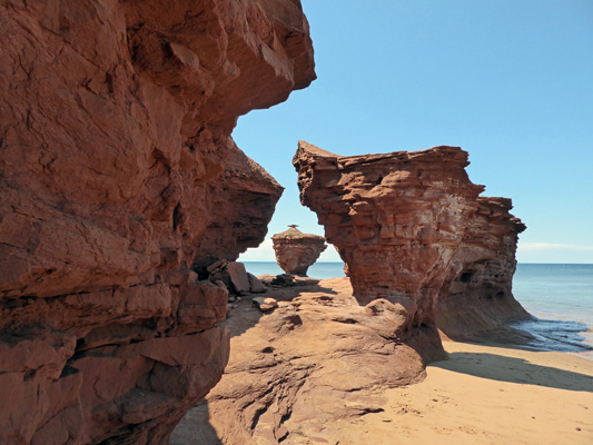
The photo on the map must have been taken at high tide and from up a ways on the cliff face because the rocks formed a solid arch with water in front of the rock behind. Ah well, I’m pretty happy with this.
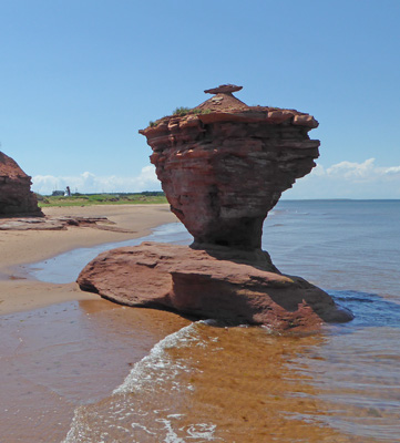
I clamored over the rocks and came up with a shot of the free standing rock with a little light house in the background (over on the left).
We had a nice walk back to the truck. The temperature was in the low 70’s and there was a nice breeze. There were lots of clam and oyster shells on the beach and lots of flat pebbles perfect for skipping rocks. This was an all around fun expedition.
On the way back I stopped for just a moment (there was no one behind me) to take a photo of the lobster and crab pots on the wharf at Southwest River. They’re still using wood pots here while in Maine they’ve switched over entirely to metal ones . They come in flat-topped and domed-topped crates. So much more photogenic than the metal ones.
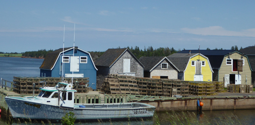
The folks on PEI take really good care of their buildings. Everything looks freshly painted and there are very few run-down buildings. We’ve seen an old barn or two and one older single wide trailer but otherwise everything is very spiffy and prosperous looking. The farms are tidy and painted and the boats and wharf building bright and shiny.
We liked this section west of Cavendish much better than Cavendish itself or the section east of it. It’s less crowded and more bucolic. There are cottages to rent but they aren’t all clustered together as they are the other way. It’s much less touristy and we both like that better.
PEI is a really interesting place. There are only two towns over 10,000 people. All the rest of the dots on the map except Cavendish, are just wide spots in the road with a community hall. Most of the land is devoted to agriculture—potatoes, peas, hay and dairy cows and beef cattle (though we didn’t see many beef cattle). The fishing industry is strong and they farm oysters and mussels. What little industry we saw was on the south side of the island near the bridge to New Brunswick. If you want to live a quiet life in the country, PEI is a great place—an there’s nowhere on the island that is farther than 20 miles from the ocean. Too bad they have WINTER.
Thursday June 29th, we packed up and motored out headed for Antigonish, Nova Scotia. I put the coordinates of our destination into the GPS but didn’t check the route. Only when we seemed to be headed the wrong way did I take a look. Sure enough, she had us headed to the ferry dock on the southeast side of the island. The only problem with that is that the ferry would cost us $117 and only runs once every hour and 45 minutes. I reprogramed her to convince her we wanted to go over the bridge and it turned out that our little detour only added about 10 minutes to our drive. They only collect the toll on the bridge on your way off the island (and they only collect the fare for the ferry on the way off too). The bridge costs $46.50 for a 2 axel vehicle (car, truck, whatever) and $8 for each additional axel. So it cost us $62.50 to take the bridge. Thank goodness they take plastic! Can you imagine not knowing how much the toll was and coming up to the toll booth to see they wanted $46.50? We both wonder what they do when people don’t have the money to get off the island.
The fun thing is that we saw a couple of Tall Ships sailing in the Northumberland Strait as we went over the bridge. They’re in the Maritimes off and on all summer so we may see them again.
Once over the bridge we drove a while in New Brunswick before turning south onto Hwy 104 into Nova Scotia. We’d taken the ‘avoid toll’s choice off of the GPS so that she’d give us directions over the bridge but now we began to see signs about the last exit before tolls! So we got off and turned the avoid tolls option back on and she had us take a 35 mile loop that only added a few miles but avoided the toll. Who would have a 28 mile section of highway in the middle of nowhere have a toll? Nova Scotia, that’s who. Turns out they realigned this section of the highway in the 1990’s using a public/private partnership. The $5.25 toll we avoided ($4 for a regular car) is being used to pay off the private loans.
We arrived at long last at the Oasis Motel and Campground in mid afternoon. We had a reservation (because I was concerned about finding a place for us to stay on Friday the 30th with the Canada Day Celebration on Saturday July 1st) and got the pick of the few spots that weren’t reserved already for the weekend. This is a no-frills motel and campground. Our spot was on grass and far from level front to back but okay side to side. The electrical and water hookup were on the wrong side. But it wasn’t real hard to get into the spot at least. We paid $42 a night ($48.30 with the 15% tax) for a full hook up (what they call a 3-way). Private campgrounds are expensive here as far as I can tell. We set up camp, had a late lunch and then I did our laundry in their laundry room where they had 2 washers and only one dryer. The dryer was fast so I still managed to get it all done in under 2 hours.
Walter managed to find 2 over-the-air TV stations and they had good free WiFi (and Walter’s computer had no trouble connecting to it thank goodness). And our Virgin Mobile Canada phone worked fine.
It had been warm and sunny when we left PEI but we drove through a heavy thundershower on our way to Antigonish. The sun was back out when we arrived but things clouded up as the afternoon went on. We awoke on Friday June 30th, to clouds and a light mist which eventually turned to a good steady rain. We hung out most of the morning enjoying having WiFi at our kitchen table once again and then went and did grocery shopping. There was a nice Atlantic Super Store which made things easier—nothing like at least having the same brand of store to shop in two weeks in a row! Then we got to figure out where to buy some beer and wine. In Nova Scotia they sell beer, wine and hard liquor in Nova Scotia Liquor Board Stores. And nothing is cheap. A 750 ml bottle of California Beringer White Zinfandel is $13. That’s a far cry from Three Buck Chuck at Trader Joe’s. And a 6 pack of Stella Artois beer was $16.26.
Having had our shopping adventures we came home to our nice warm trailer for the afternoon.