
Here's a map of our journey over the next 3 days. We're starting at Slana, AK (Point A) and going to Beaver Creek, Yukon (Point B) on the first day. The next day we'll go to Pine Lake Campground just outside of Haines Junction, Yukon (Point C). And on the third day we'll drive through Whitehorse and down to Carcross, Yukon (Point D).
View Larger Map
We hit the road the next morning with mostly sunny skies and temperatures in the 50's. You could see the Wrangell Mountains again even though there were more clouds than the day before.
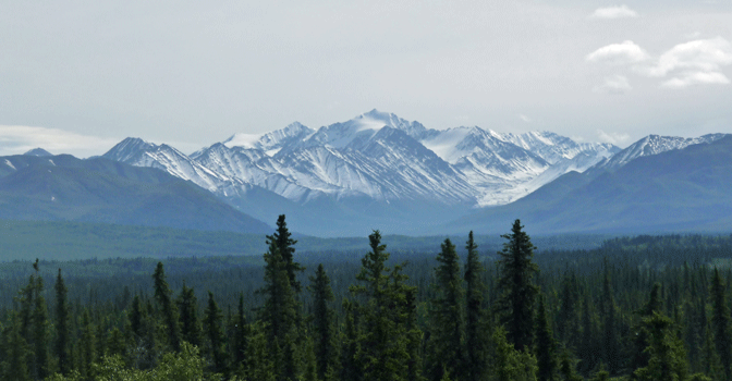
Mount Sanford was out draped with a few clouds.
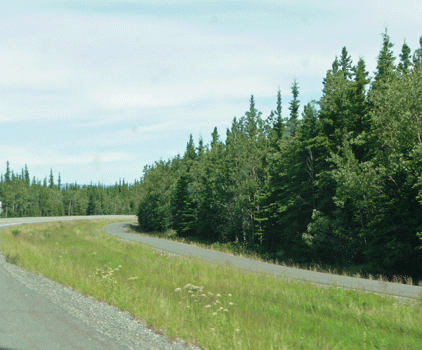
Coming into Tok, I took a photo of the bicycle path. It seemed to me that starting a few miles out of town in just about every town in Alaska there's a paved bicycle path that appears. I don't know if they legislated it, gave grants for them or it was just an idea that caught on. I don't think we ever saw anyone on a bike using one though. The 4-wheelers use them when there isn't a dirt track near the highway.
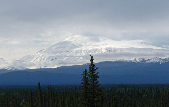
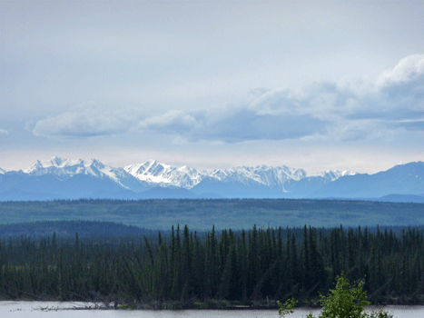
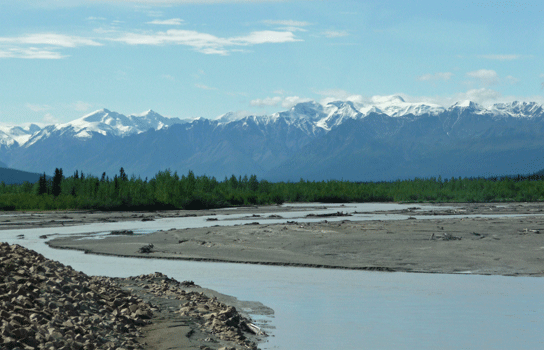
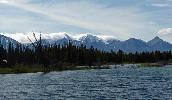
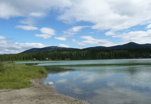
We stopped for lunch at a viewpoint that we'd stopped at coming into Alaska back on June 23rd (it was now July 12th). Here's the view from the viewpoint overlooking Midway Lake on the Alaskan Highway.
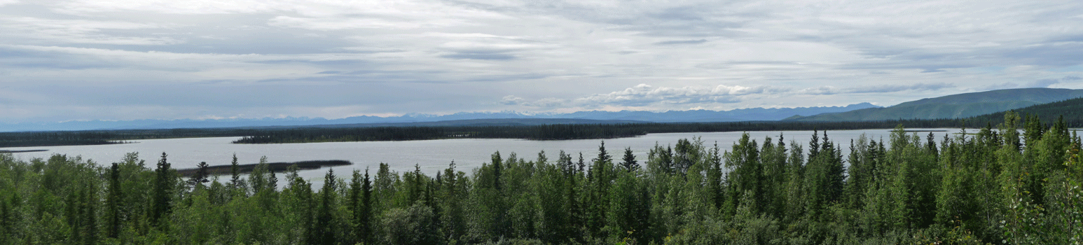
You could see a bit of the Wrangell Mountains from here too.
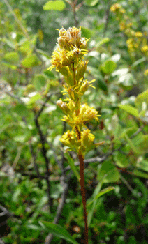
There was Dune Goldenrod (Solidago simplex var. gillmanii) growing on the edge of the parking area.
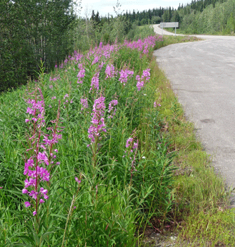
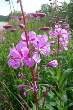
Later on we stopped to stretch and the fireweed (Chamerion angustifolium) was at last in full bloom along the highway. I'd been told it was going to be gorgeous and now I knew it was worth the wait.
 |
 |
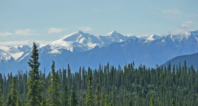
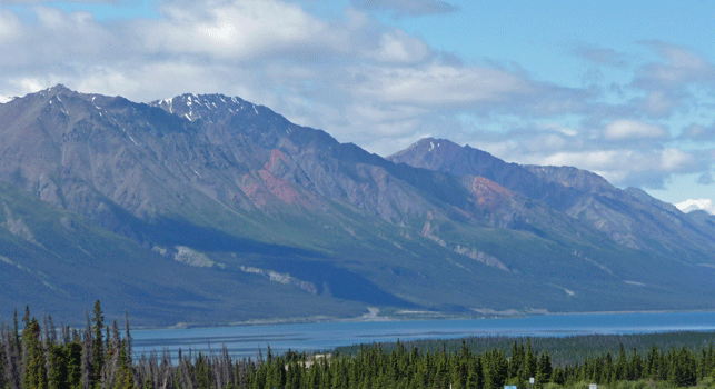
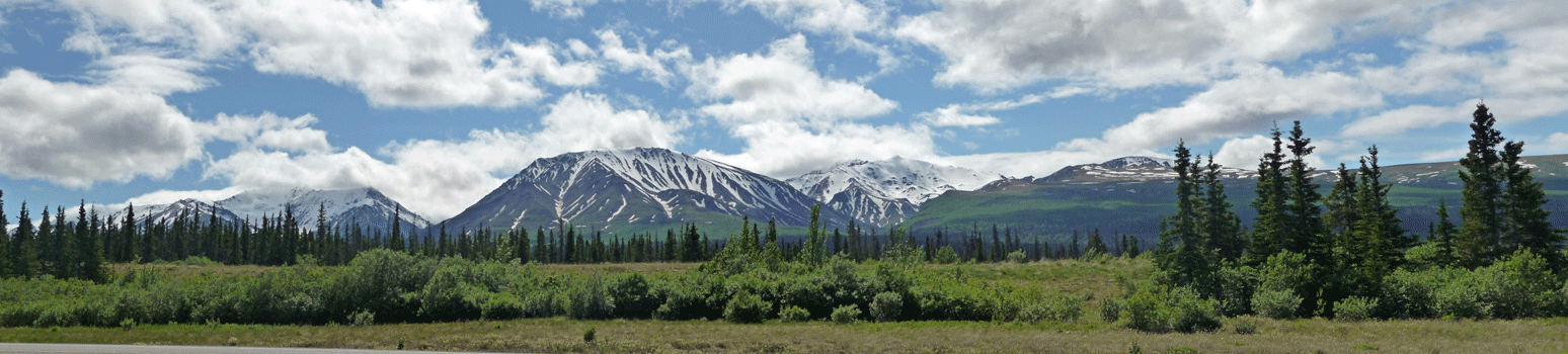
The next morning there were clouds but they burned off fairly quickly. I tried taking photos of what I think were the Kluane Range but the roller coaster effects of frost heaves make taking photos from a moving vehicle pretty interesting. Finally Walter found a turn out so I could take a few shots.
 |
 |
 |
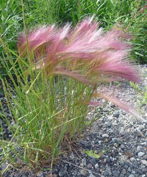
We'd been seeing Foxtail Barley (Hordeum jubatum) in bloom along the road side and I managed to get a nice photo of it here. It lines the road in patches and is really pretty.
The drive had two big sections of gravel both over 3 miles long. It was dry and dusty but there was very little traffic which at least held down the dust a bit.
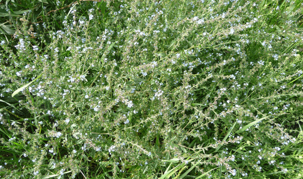
At one of our many stops I spied some Western Tickseed (Lappula occidentalis). The little blue flowers had been taunting me for days and every time I took a photo of them they'd be out of focus. So I finally gave up and took a photo of the whole bush.
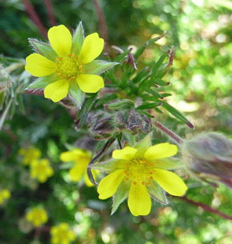
There was also some Many-cleft Potentilla (Potentilla multifida) in bloom.
 |
 |
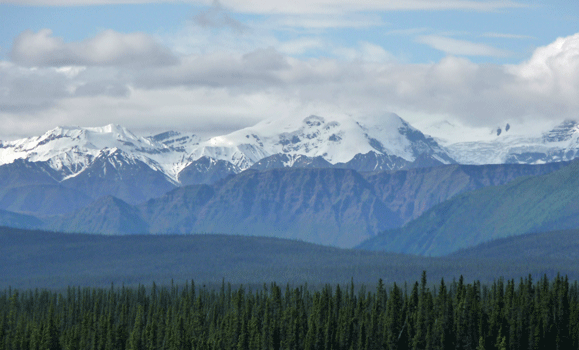
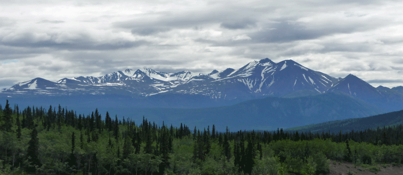
The mountains still hadn't melted all the way out.
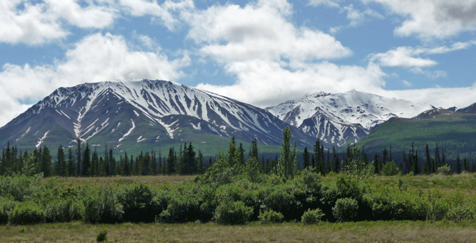
Here's a panorama shot.
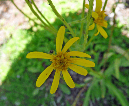
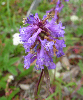
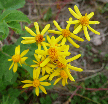
There was Black-tipped Groundsel (Senecio lugens) in bloom along with Showy Jacob's Ladder (Polemonium pulcherrimum).
 |
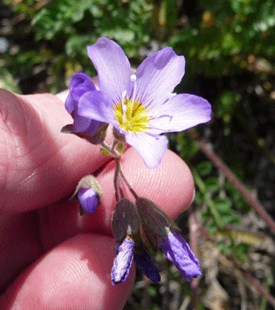 |
| Black-tipped Groundsel (Senecio lugens) | Showy Jacob's Ladder (Polemonium pulcherrimum) |
We camped for the night at Pine Lake Campground just east of Haines Junction, YK. After we set up camp we went for a walk down to the lake. Here's Walter walking on the beach in the bright sunshine.
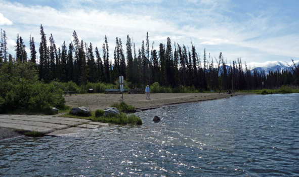
Here's the view looking from the dock northeast across the lake. It's a pretty good sized lake and the campground filled up with what appeared to be locals for the weekend.
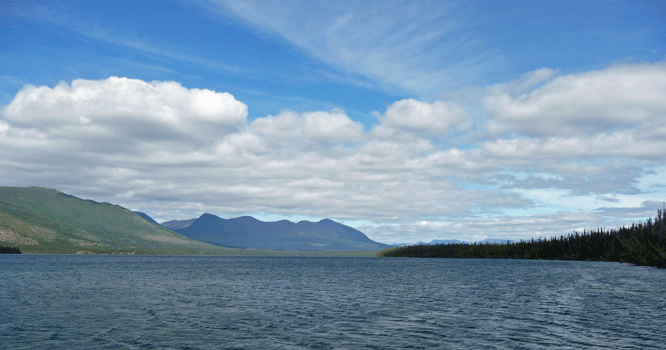
And here's the view of the mountains to the west.
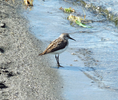
There was a Least Sandpiper on the beach who stayed still long enough for me to take a photo.
We took the nature trail along the lake only to find that it was flooded. We took a bit of a detour and came back to it only to have it go under again.
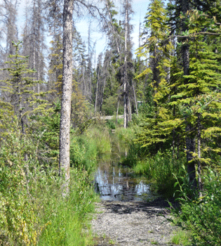
There were wild strawberries and twin-flowers in bloom and lots of mosquitos. After detouring again and hitting water for the third time, we could see our trailer up a ways so we bagged wading on the trail and went back for a nap.
The next morning it was cloudy but not cold as we set out for Whitehorse to get groceries. We stopped at a rest stop where I saw few new flowers.
 |
 |
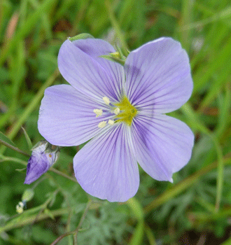
| Wild Flax (Linum lewisii) | Small Flowered Penstemon (Penstemon procerus) |
 |
|
| Few-Leaved Groundsel (Senecio streptathifolius) |
After doing our grocery shopping in Whitehorse (the metropolis of the Yukon with a population of 23,276--the population of the entire Yukon territory being 33,897) we motored on to Kookatsoon Lake for lunch. There's a nice territorial day-use park here, where we could have our lunch. There were locals with their kids out playing in the sand at least for a little while. The lake is lined in marl, a calcium carbonate rich limestone that gives the lake bottom a white surface to reflect light off of. It makes for lovely colors.
We motored south from here until we reached Emerald Lake--a truly fabulous marl-lined lake. The colors in the photo are the real deal. It's gorgeous.
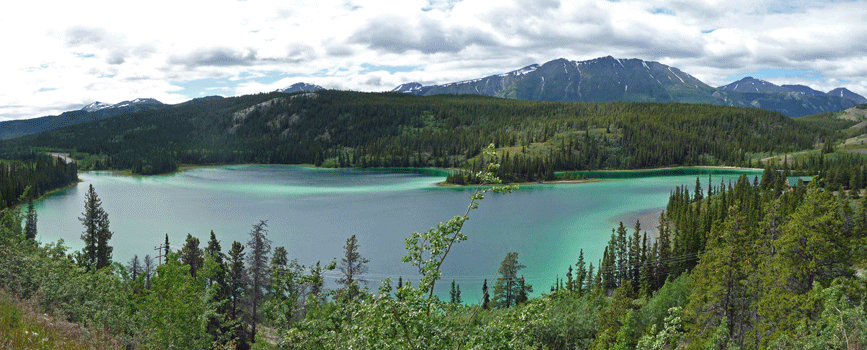
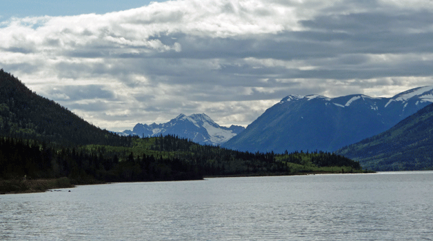
In addition to the gorgeous lake there was a nice view of the Grey Ridge Range to the south.
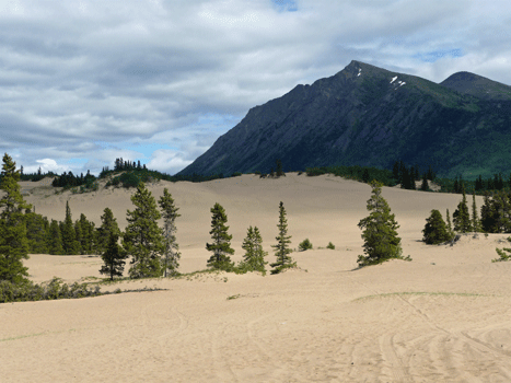
Just a little ways further down the road we came to the Carcross Desert. It’s not really a desert, just a set of nifty sand dunes with a few pine trees growing in them. Here's Walter with the Carcross Desert sign.
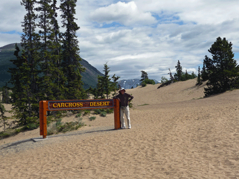
It's really not a very big place but it's still a lot of sand.
Our campground book said that there were two places to camp in Carcross, one with hookups and one without. We headed to the place with the hookups only to find that it was closed--apparently out of business. The good news is that the other place was just a couple of blocks away and had lots of empty spots but no water! There was a water spigot but it was dry. We were in need of drinking water so we begged some from the Visitor's Center in Carcross when we went into town later in the afternoon. The nice ladies there filled up a couple of jugs for us to keep us going.
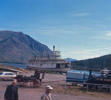
When I visited Carcross in 1967 the Tutshi Sternwheeler was parked on the banks of Lake Bennet along with a little mining engine called The Duchess.
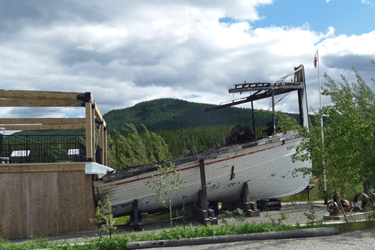
The Tutshi was restored in the 1990's and just before it was finished in caught on fire. This is what is left of her.
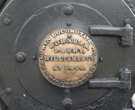
The Duchess has gotten a couple of coats of paint since 1967 and has her own little display area that she sits in now.
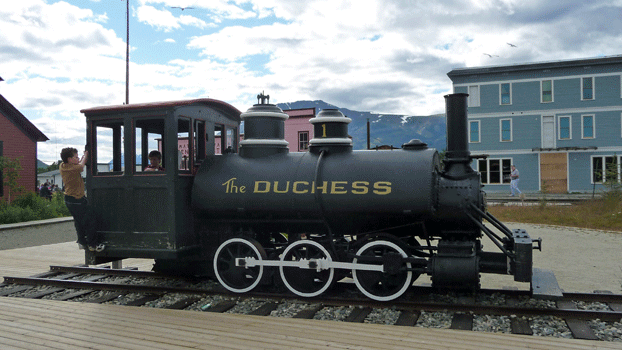
Here original manufacturing label is still in place and they keep it shined up too.
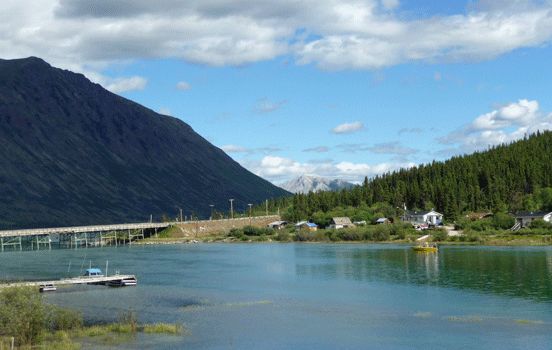
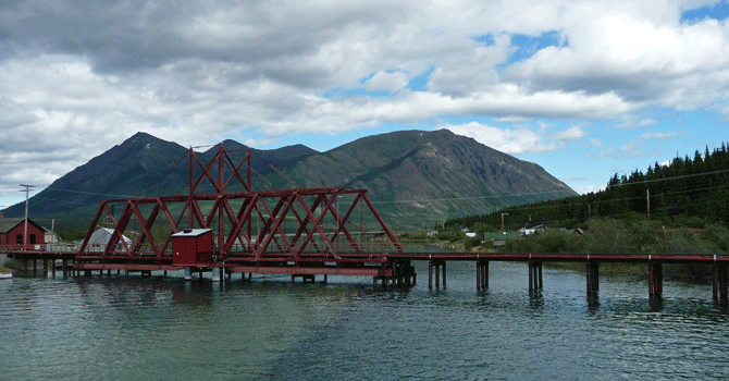
Here's the view across Lake Bennet from the Tutshi. The mountains haven't changed since 1967 but the bridge is new. Back in 1967 the only way you could get to Carcross was to take the Whitehorse to Skagway narrow gauge railway or hike. Now there's a nice highway complete with the bridge across Lake Bennet.
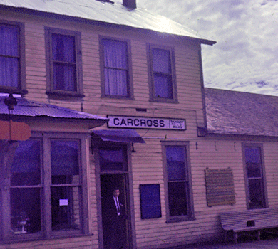
The train station has been spiffed up since 1967 too. Here's the before and after photos.
 |
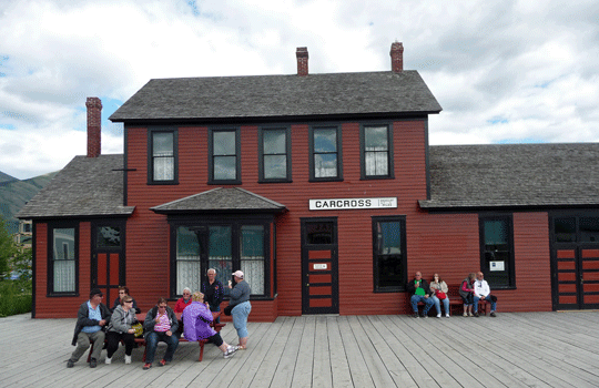 |
| 1967 | 2012 |
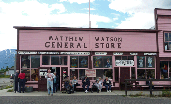
Across the street from the station is the old general store where they clearly sell ice cream cones.
We hiked out onto the fishing bridge where you could get a nice view of the old railroad trestle.
Here's the view looking the other way.
In Part XXV we'll drive to Skagway and back and then begin the next stage of our journey homeward.