
Here's a map of our journey for the next 3 days. We'll spend the first day driving from Carcross, Yukon (Point A) down to Skagway, Alaska (Point B) and back again. The next day we'll drive from Carcross (Point A) to Teslin, Yukon (Point C). And on the third day we'll drive along the Alaska Highway to Watson Lake, Yukon (Point D).
View Larger Map
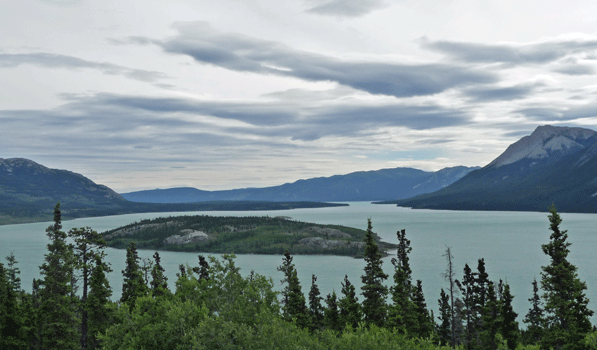
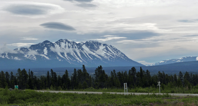
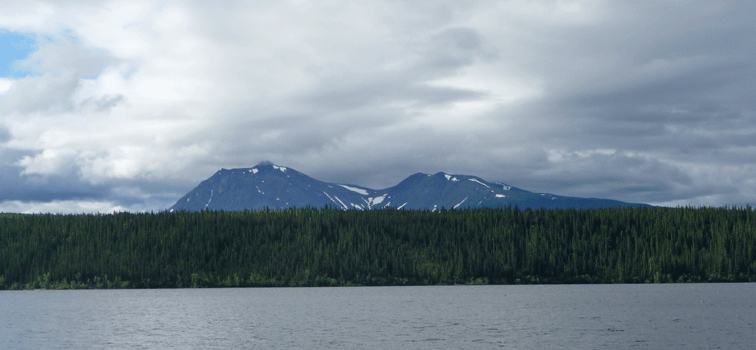
It was a partly sunny day when we set out to drive from Carcross to Skagway. The road follows Windy Arm, a branch of Tagish Lake with a great view of Bove Island.
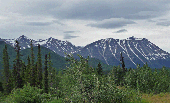
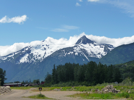
The mountains were peeking out over the tops of the nearby hills.
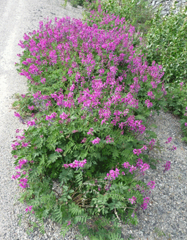
There was a huge pack of really dark pink Eskimo Potato (Hedysarum alpinum) that I had to stop and take a photo of.
I think that this was taken at the bottom of Windy Arm but I could be wrong. If it is Windy Arm then at this point we've crossed the border from the Yukon into British Columbia.
I do remember it being REALLY windy so let's just agree that it was Windy Arm and call it good, okay?
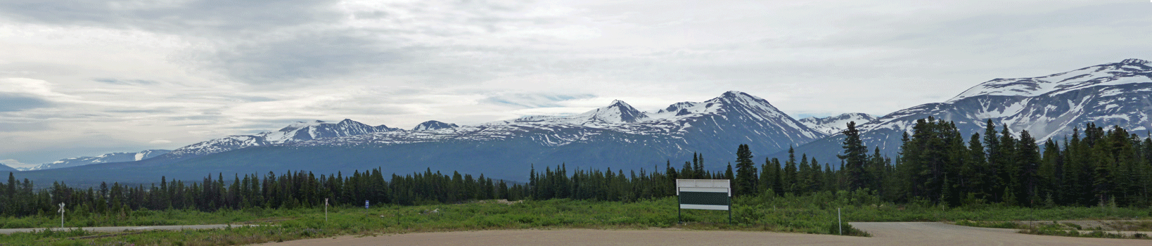
The road continues south and eventually runs along the shore of Tutshi Lake and then on to a historical marker/turnout called Log Cabin. This was the site of the Border Crossing into Canada along the old White Pass & Yukon Railroad from 1900 until the highway went through in the late 1970's early 1980's. The railroad still goes through here. You can see the railroad crossing sign along the highway at the bottom of this photo. This is looking east.
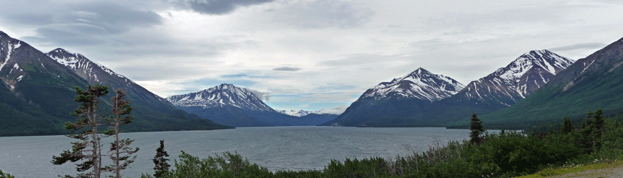
And this is a panorama shot looking mostly southwest.
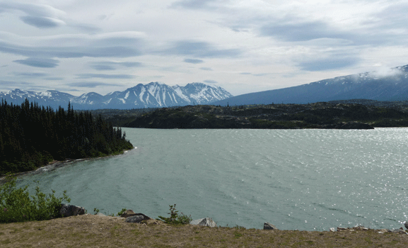
The border crossing is now at Fraser, BC which really is another one of those out in the middle of nowhere places whose entire function appears to be the border crossing. There are views of Summit Lake just before the border crossing and we stopped and I took photos.
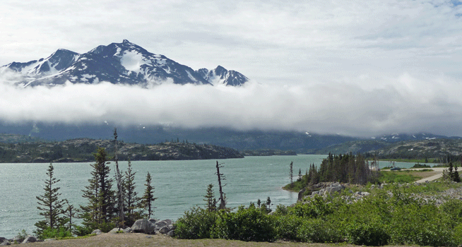
I liked the way the clouds were hanging low enough so I could catch the top of the mountain sticking out of them.
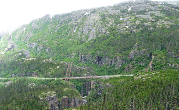
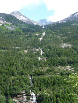
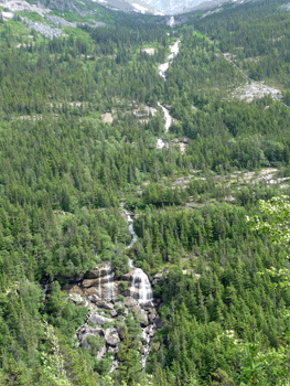
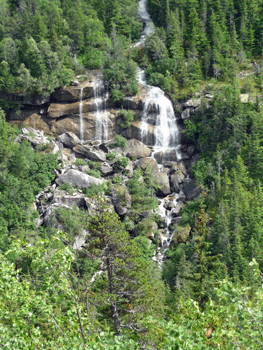
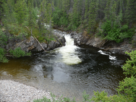
Three or four miles further south there's a pullout with a great view of the William Moore Bridge and the waterfall that is right past it.
 |
 |
We went over White Pass but it was totally socked in with low clouds and we didn't see much of anything. Besides, there aren't any turnouts where you can take photos even when you can see something.
Skagway itself is only 15 miles from the border crossing so in no time at all we were there. We drove through town and parked in the lot near the National Park Service Visitor's Center for the Klondike Gold Rush National Historical Park. We, of course, went to the Visitor's Center and watched the movie on the Gold Rush. As always, it was good but not as good as some of the other National Park movies we saw on the trip. During the gold rush in 1896-1899 the Canadian government required miners to carry a year's worth of supplies with them to the gold fields. That meant that literally a ton of supplies had to be hauled over the passes from Skagway. The miners used mules (many of whom died in the process) and the rest they carried on their backs (in multiple treks over the mountains). Here's a mock-up of the ton of supplies they needed to carry.
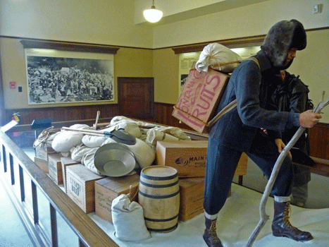
Needless to say only 30,000 to 40,000 of the 100,000 miners who set out actually made it to the Yukon.
After watching the movie we wandered around downtown Skagway. There weren't any cruise ships in town at the moment, so it was very quiet which was wonderful. Skagway is a little town and ALL the cruise ships stop here so it can get REALLY crowded when there are ships in town.
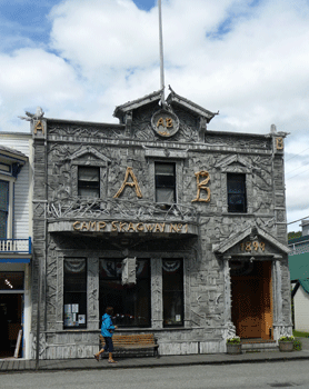
Here's one of the highlights of a stroll through Skagway: The Arctic Brotherhood Hall. The entire face is decorated with pieces of driftwood. It dates back to the late 1890's when the first buildings in Skagway were erected.
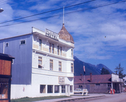
The Golden North Hotel is part of the historic district too. It hasn't changed much since I took a photo of it in 1967 but the rest of the block is much spiffier than it was then.
 |
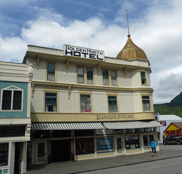 |
| Golden North Hotel 1967 | Golden North Hotel 2012 |
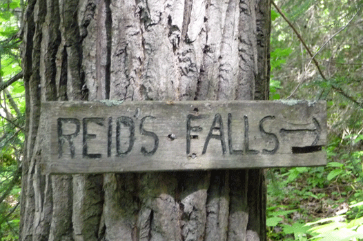
We'd come to Skagway to hike as much as to see the town so we went out to the old cemetery to take the hike to Reid Falls.
Here's the view from the parking lot at the cemetery.
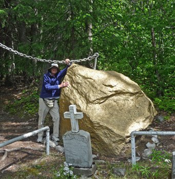
We had our lunch sitting on a bench looking at the view and then started our hike by taking the trail that goes through the cemetery. This silly gold-painted boulder required a photo op. The heavy chain holding it in place is a nice touch, don't you think? You wouldn't want anyone to try to run off with it.
The trail winds through the cemetery which has wooden headstones that look pretty fake but hey, maybe that's really the way they did it back then. Certainly the old trail signs were wood. The tourist literature all call this waterfall Reid Falls but once upon a time it was clearly Reid's Falls.
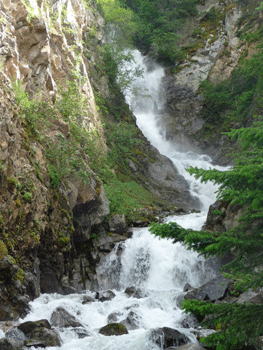
After a little bit of a steep section you arrive at Reid Falls.
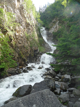
I wanted to get the whole falls so I climbed around on the boulders (which were wet and slimy) and finally got a good shot. It made Walter nervous to have me up on the wet rocks but I got down safely and thought it was worth it.
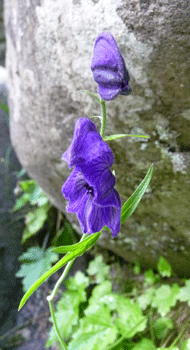
There were flowers in bloom along the trail including this Northern Monkshood (Aconitum noveboracense).
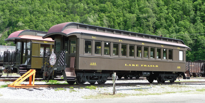
The trail winds back down the hill and there's a branch you can take back to the parking lot without going through the cemetery. From here we drove back towards town past the train yards. I had to take a photo of one of the old narrow gauge cars. We took one like this back in 1967 from Whitehorse to Skagway. I remember standing out on the platform between the cars taking pictures.
We took the Dyea Road out to where the Chilkoot Trail begins. Dyea was an native village before the gold rush and it died out once the railroad made Skagway the place to be.
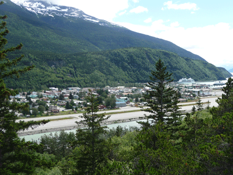
We stopped at an overlook on the Dyea Road. Here's basically all of Skagway. Big, it's not, but that's the runway of the airport in the foreground below.
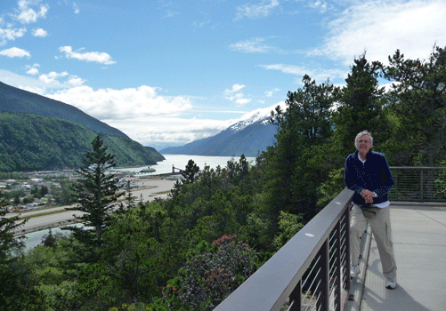
And here's Walter with the view out the Lynn Canal from the same viewpoint. By this point in the day there were a couple of cruise ships in town.
There are houses along the Dyea Road for a ways and then the road becomes gravel and the houses pretty much disappear. But the views are lovely. There was a house at the base of this inlet with their own little private beach to enjoy the view from.
We were still looking for water so once we got to the old Dyea town site we drove through the Forest Service campground that was there. No water. We talked to the campground host and he said people used river water which you were supposed to boil but he didn't. Oh well, we had enough to keep us hydrated for the moment.
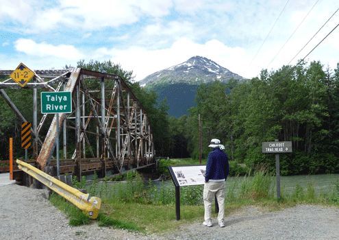
Then we drove out to the trailhead for the Chilkoot Trail. This trail is the one that most of the miners used during the stampede. White Pass (out of Skagway) became the route for the railroad after it fell apart as a trail for the stampeders (which happened quickly because of the kind of rock it is). The Taiya River flows through this area. Here's Walter reading the sign about the Chilkoot Trail with the Taiya River sign and bridge. The little brown sign on the right says Chilkoot Trailhead that-away.
The river itself was very pretty.

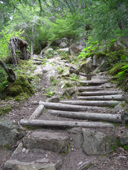
Walter decided he'd had enough hiking and sat on a bench while I hiked up the first section of the trail. It's steep and rough but I made it to the point where you're supposed to sign in which was far enough for me.
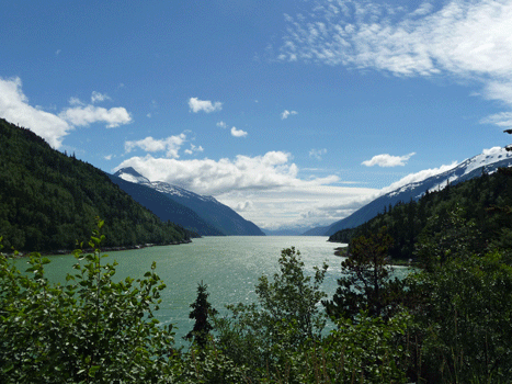
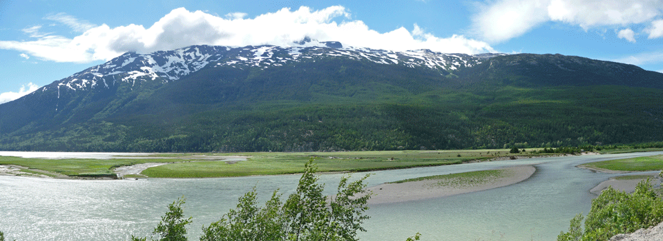
On our way back towards Skagway, we stopped at a pullout and took this panorama shot of the estuary and the old town site .
The sun was out on our way back up the Klondike Highway. I was looking for old railroad bridges like the one I took this photo of back in 1967.
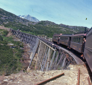
I didn't find it, probably because it's on the section that you can't see from the highway.
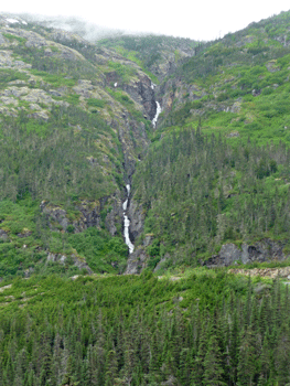
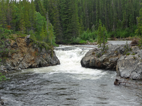
But I did spy Pitchfork Falls.
 |
 |
 |
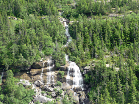 |
There's a hydroelectric project from the lake that feeds the falls, down to the river below that provides power for both Skagway and Haines. If you look carefully on the top left photo you can see part of the pipe that brings the water down to the hydro plant down below.
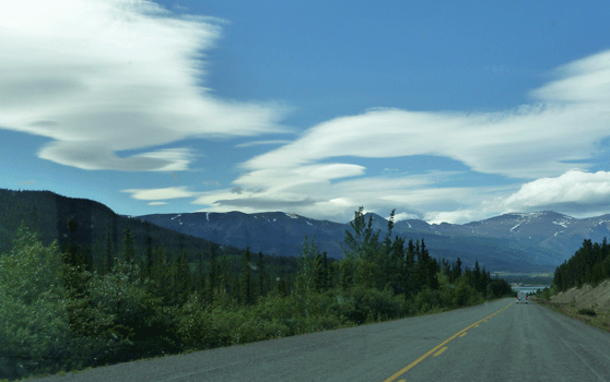
As we drove back into Carcross at the end of the day, we spied these lenticular clouds forming over the mountains. A nice crowning event to a lovely day.
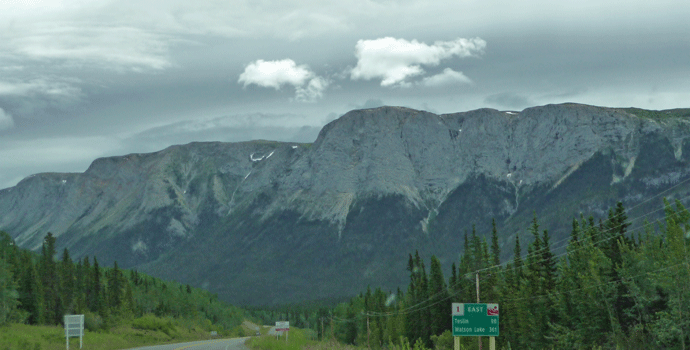
The next day we had planned to find a place to drop the trailer and drive out the dirt road along Atlin Lake which is supposed to be gorgeous. But we were both pretty tired and ready for a down day and since it was gray and cloudy and we couldn't find a good safe place to leave the trailer, we bagged the 40 miles of bad road (each way) and instead drove out the Tagish Road until we hit the Alaska Highway and headed east to Teslin. This was the only photo I took all day on the drive. It's an interesting land formation at Jakes Corner on the Alaska Highway. As you can see it was pretty dark and gloomy that day.
We were checked in at Dawson Peaks RV Park in Teslin by 1:00 PM and had showers and an afternoon off. What a concept! There were lots of mosquitos that got into the trailer somehow so we spent a lot of time swatting and squishing but by evening things were pretty much back to normal.
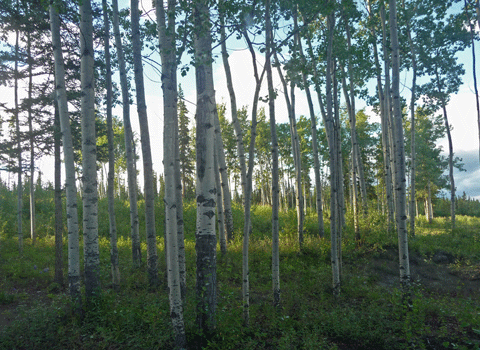
We had a lovely stand of young aspens out of trailer window that I caught lit by a late afternoon sunbreak.
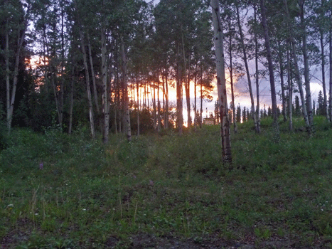
At about 11 PM we got a nice sunset too.
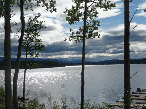
The sun was out first thing the next morning and there was enough of a breeze to chase the mosquitos way. I took a walk down to the lake and got a shot of Dawson Peaks across Lake Teslin.
The sun was pretty on the lake looking east.
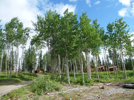
I shot this photo from the edge of the lake looking up through the aspens. You can see the cabins that are available for rent. There's a small restaurant here too.
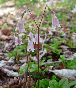
On my way back up the hill I came across more Twinflowers (Linnaea borealis).
The Alaska Highway goes nearly due east and west at this point. This is a pretty section of the highway. The soil is sandier so the trees do better and almost look normal for a change.
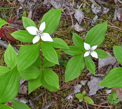
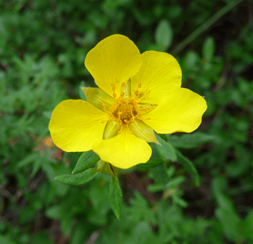
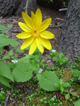
We stopped at Rancheria Falls Recreation Site for a break and took the 10-minute walk out to the falls. There were lots of flowers in bloom along the trail so of course it took longer than it should have to do the hike because I had to stop and take pictures of all the flowers.
 |
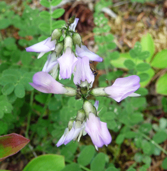 |
| Bunchberry (Cornus canadensis) | Alpine Milkvetch (Astragalus alpinus) |
 |
 |
| Shrubby Potentilla (Potentilla fruticosa) |
Heart-leaved Arnica (Arnica cordifolia) |
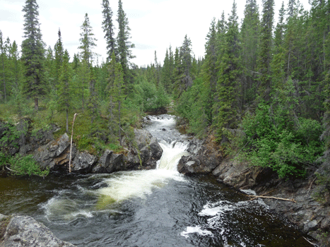
Rancheria Falls are formed when the Rancheria River splits and then cascades over a rock shelf. You can see the first falls from the trail and a bridge. This is the view from the trail.
Then you walk along a little further (to the left in this photo) and you get a view of the other falls which is much closer.
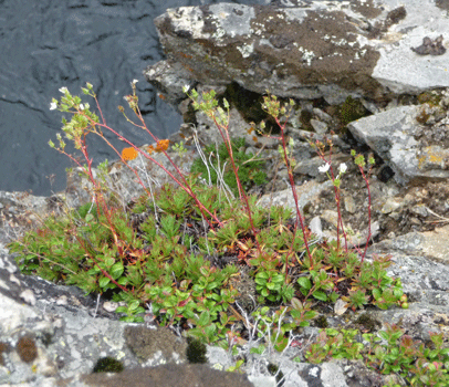
There were flowers growing on the rocks at the overlook for these falls. They look like Prickly Saxifrage (Saxifraga tricuspidata).
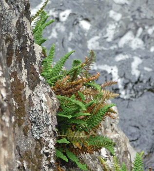
There were nice ferns on the rocks too.
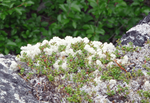
And amazing lichen growing up through the bearberry (Arctostaphylos uva-ursi). There was lots of lichen all through here which means it's prime real estate for caribou, especially in the winter.
I hiked across the little bridge on our way back and got one more shot of the falls. The nice camera angle makes the little walk over the bridge worthwhile.
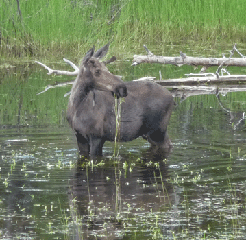
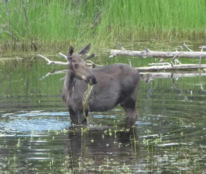
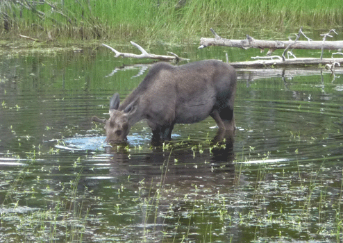
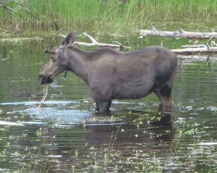
We drove on through a major construction zone where the road had washed out and closed the highway for a week back in June. Now it was just a temporary bridge and lots of gravel. Not long after that we saw folks pulled over taking photos. I pulled over too and found yet another juvenile male moose munching away in a roadside pond.
 |
 |
 |
 |
We stopped for lunch at a rest stop about 10 miles from Watson Lake. They had this great map of where we were and where we were going.
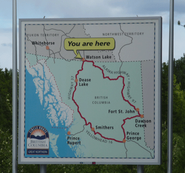
We'll spend the night in the Watson Lake area and then go down Highway 37 (the Cassair Highway) and eventually to Smithers and Prince George.
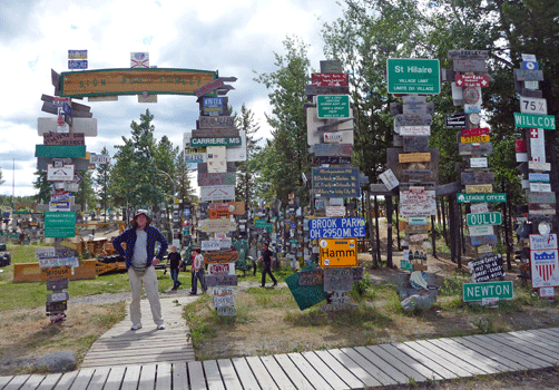
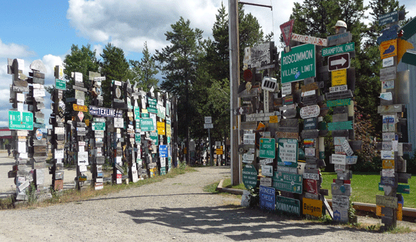
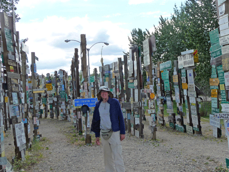
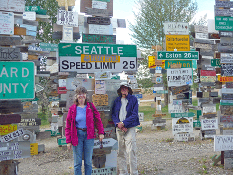
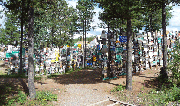
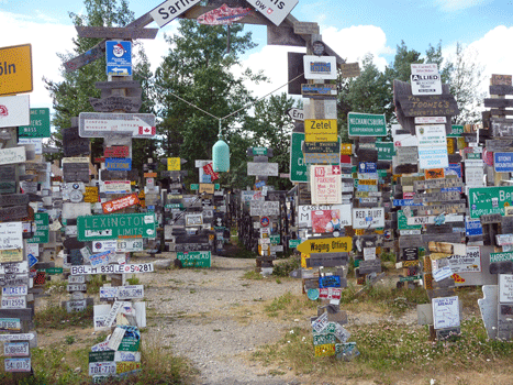
Aside from being a place to stop and camp along the Alaska Highway, Watson Lake's claim to fame is the Sign Post Forest.
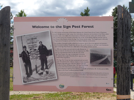
It started as a simple sign with distances to the cities and hometowns of the men working on the Alaska Highway in 1943. Over time, people who were driving the highway added signs of their own and by 2005 there were over 55,000 signs in the forest. By August 2010 it was estimated there were over 76,000 signs. Obviously you can't capture the whole thing. So here are just a few shots to give you a flavor of the place.
 |
 |
| Here's Walter at one of the entrances to the Signpost Forest | There are signs of every size and variety. |
 |
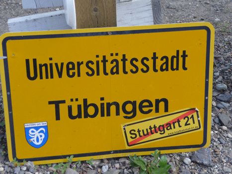 |
| There's an adopt a post program to provide more posts for more signs. | I want to know how these Germans got this BIG sign all the way to the Yukon. Did they check it as luggage on a plane? Or did they ship it and pick it up somewhere? |
 |
 |
| Here we are with a Seattle sign complete with Husky Fever bumper sticker | The place just goes on and on and on. |
 |
The town of Watson Lake is nothing to write home about. The RV campgrounds were all big parking lots with lovely views of gas stations and the highway. We opted instead to drive west a few miles and then 3 miles on a gravel road to the government campground called Watson Lake Campground where we found a great pull through campsite in a loop all to ourselves. We didn't go exploring in the park but there were very few rigs that drove through our loop that afternoon or evening and no one else camped in our loop that night so it's safe to say it the campground was pretty empty.
In Part XXVI we'll drive down the Cassair Highway to Hyder to see if we can watch bears fishing!