
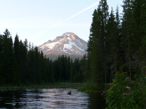
We spent the first night at Trillium Lake just south of Mt. Hood and just east of Santiam Pass. We had a great campsite with a view of the lake. Just before dinner we went out to see the mountain and I snapped this photo.
The next morning we went to visit Timberline Lodge. It was built in the 1930's by the WPA and is full of wonderful original carvings and artwork done by the folks who built it. It still operates as a year-round hotel and ski resort.
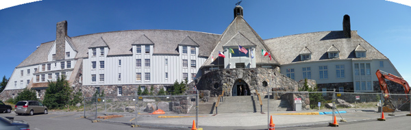
They were getting ready to do some repair work on the masonry so there was fence around the front entry area. But we managed to get in before they closed everything up and had you go in the side door.
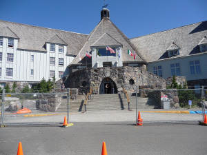
Timberline sits right on the hip of Mt. Hood and there are ski lifts that take folks up onto the snow fields well into July and August most years. It's a popular summer training site. The lifts were shut down since it was after Labor Day but you could still see the snow fields.

From here we drove down to the little town of Zigzag and out to the trailhead for Ramona Falls.
Earlier this year I saw a photo of Ramona Falls and fell in love. Walter did some research and got the trail info and now we had the opportunity to go see it! The trail is 7 miles round trip and has a 1,000 ft elevation gain--right at the edge of our comfort zone for hiking. As it turned out it was worth every step of the hike.
We started out following the Sandy River. You can see why it's called the Sandy--the river bed is like a huge sand and gravel pit, full of boulders and tree trunks with the river running through it.
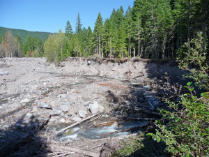
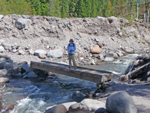
The river clearly rages in the spring. This photo was taken at a point in the trail where it had fallen away entirely. It takes up again directly across the way. Clearly the river had done a number on it. We took the detour through the woods and wound our way to the river crossing that they have to re-create each year. In the fall, they remove this bridge and then in the spring they have to find a good place to re-install it. There are signs pointing across the sand banks to the bridge and then after you cross you have to follow the arrows back to the regular trail.
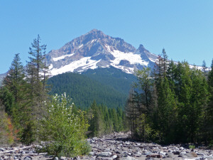
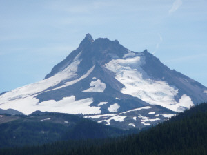
We came across the river and up that sandy bank in the background and low and behold there was Mt. Hood!
In this view you're looking east so this is the west flank--the one that most folks in Portland see.
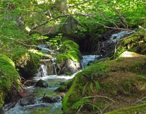
The trail winds around into the woods and enters the Mt Hood Wilderness.
It follows Ramona Creek through what looks like a moss-covered fairy land.
As we hiked through the woods we saw some bushes rustling and spotted a funny little round critter scurrying around gathering leafy branches. It wasn't a squirrel. It wasn't a raccoon. Finally we realized it was a Mountain Beaver! They're no relation to a beaver, they're just round-shaped like a beaver but without the tail. He was too quick to catch with the camera but since we'd never seen one before it certainly counted as a wildlife sighting.
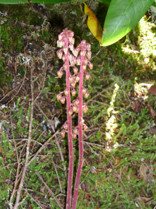
I hadn't expected to find any flowers this time of year and had been surprised to find things in bloom up at Timberline. And then in the process of climbing around in the bushes to take photos and watch critters I stumbled across some pine drops that I had to photograph.
The trail steadily climbs uphill towards a huge wall of basalt (no doubt an old lava flow from Mt Hood) that defines one side of the narrow valley. Eventually we began to see more and more little seeps leaking down it's face. Just when I had the thought that I'd be really pissed if that was all there was to the waterfall this time of year, we came around the corner and there were the falls!
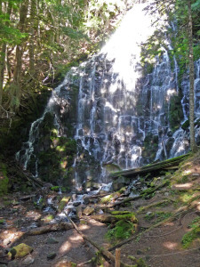
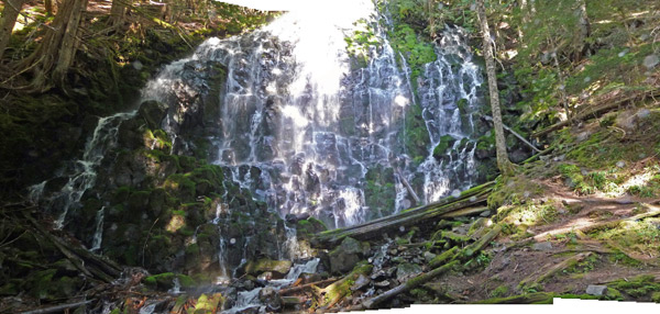
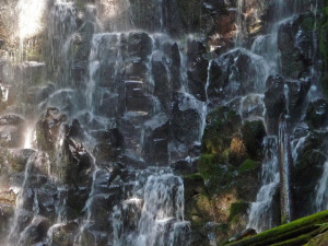
You can stand on a bridge over the creek and look straight at the falls. The sun was hitting the top of the center of the falls and then dappling the light through the rest. It was JUST like the photo I had seen and I set out to try to capture Mother Nature in action--no an easy task but I sure had fun. Here's a close-up of the way the water cascades down the chunks of basalt in on the face of the wall.
We had lunch sitting watching the falls and even though it was a warm day we got pretty chilled in the shade because of the natural air conditioning that came from the mist from the falls.
After lunch we took the trail back and ran into a young man who said he was "way lost". He'd been hiking the Pacific Crest Trail which joins the Ramona Falls trail and had taken a WRONG turn. He was 3 hours overdue and when we looked at the map later to figure out where he was supposed to be we figured he probably had another 3 hours to get back to where he was supposed to be. Note to self, pay attention to the trail signs and take a good map!
The next morning we went out to take one more look at Trillium Lake and it was full of boats. We counted over 20 of them when the night before we'd seen about 3! It turns out they had just stocked the lake with 4,000 10-inch trout and 800 trophy-sized trout. It looked like a fishing derby was in progress.
We headed south to Detroit Lake State Park. We'd hoped to camp there for three days but because of the good weather forecast they were booked for the weekend. We stayed there on Thursday night and had a nice view of the lake. We took showers and used the electrical hook up to charge up our batteries and then moved the next day to a Forest Service Campground on the south shore of the lake where we found yet another lake view campsite. We set up camp and set out for Olallie Lake which is further east out on a rough dirt road.
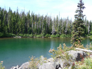
Walter had seen a photo of Top Lake on-line (he's using it as wallpaper on his computer) and found a great hike that would take us there. We started at Olallie Lake with this great view of Mt. Jefferson to the south.

We set off on a portion of the Pacific Crest Trail that first winds past Head Lake.
Almost immediately we ran into hikers even though there weren't any cars parked at the trail head. They were hiking the Pacific Coast Trail for real! One guy had just hiked from south of Mt. Jefferson and was on his way to Mt. Hood. Another had started at the Mexican Border and expected to get to the Canadian border by the first week in October. He may have gotten there before it snowed and then again...
The trail winds up through rocky areas dotted with little lakes and occasional views of Mt. Jefferson.
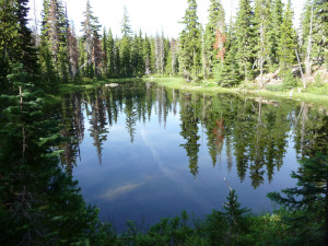
This little lake even had it's own sign.
It's called Shraft Lake.
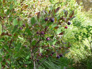
The trail was steep in sections but relieved not only by little lakes and mountain views but by BLUEBERRIES! There's nothing better to keep you going than being able to grab a blueberry on the fly any time you begin to feel a little puny.
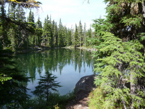
Just about lunch time we came to Top Lake.
We found a nice log to sit on and had our lunch watching the breeze make ripples on the lake surface. Walter who always looks for fish didn't see a one.
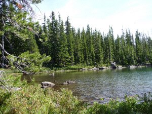
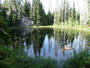
From Top Lake the trail winds down the hill again past some of the sweetest little lakes you've ever seen.
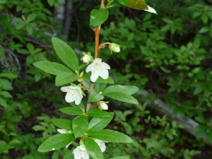
And surprise, surprise there were native rhododendrons in bloom! In September!
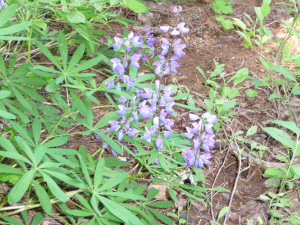
And more lupine too. We usually see them in July!
The next day we went paddling on Detroit Lake. It was a bit of a challenge because there were lots of power boats out and they make SURF. It was fun though and a good thing to do on a 80 degree Sunday afternoon.
On Monday we drove south to Diamond Lake. Along the way I snapped this photo of Mt. Washington.
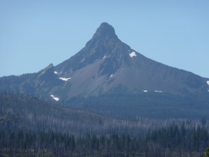
Let's see, we've got Washington, Jefferson--where's Adams? I took his picture in Washington a couple of summers ago. I haven't found a Mt. Madison or Monroe yet, but hey you do what you can with a series.
There was a fire burning about 20 miles from Diamond Lake and at first we couldn't tell from the warning signs along the highway whether we'd be able to get there or not--they tell you wonderful things like "road closed between milepost 45 and 59" but our map didn't have any milepost indicators. Turns out we started at milepost 100 and were going to milepost 80 so we were fine.
We found yet another lake-view campsite! That's 4 campgrounds in a row now! It was sunny and warm and our plan was to go to Crater Lake the next day. The last two times we'd gone to Crater Lake in September we'd gotten snowed on and here it was sunny and in the 70's. Third time is the charm! We'll take you on that part of the trip in Part II.
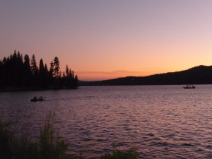
But just to finish the first week off here a sunset picture at Diamond Lake. The smoke from the fires really made for great color.
To continue with our journey go to Part II.