
We hung out at home that afternoon and then headed over to Arches National Park at about 4:30. Arches is a very popular park (always has been) and it has very little parking at it’s various points of interest. During the late spring and summer (and no doubt the fall too) they suggest that you come early in the morning or late in the afternoon to avoid the worst of the crowds.
We drove down the hill from Archview to the Arches entrance (right off the main highway) and were happy to see there was hardly any line to get in. On Sunday when we’d driven past the multiple entry lines were blocks long. We only had 2 cars in front of us. Piece of cake.
We left our visit to the Visitors Center for our for Wednesday when we’d be back, since it was closing very soon and we took the road UP the side of the mesa into the main part of the park. There was very little traffic going in but boy were there a lot of cars coming down the hill on their way out. We made a beeline for the Windows area which is on a side road at the south end of the park. By the time we got there it was 5 pm and there were plenty of parking spaces. YES!
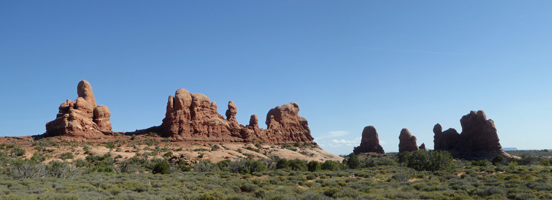
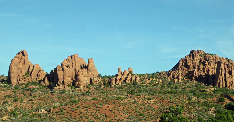
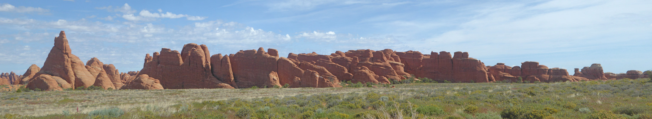
The view to the southwest looks like this—like a kid got loose with drippy sand and was making sand castles.
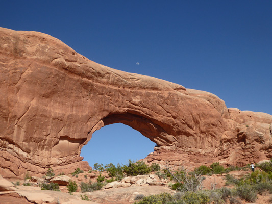
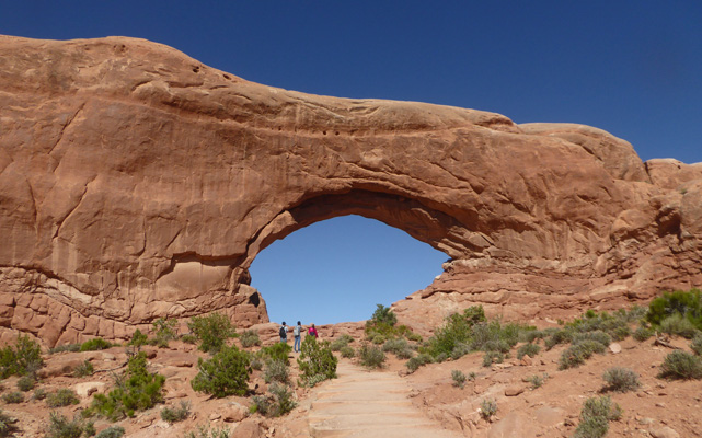
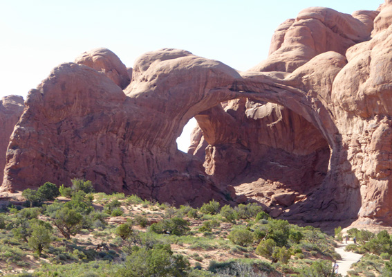
There are two window-type arches and a regular arch on the trail south of here and I started out on the trail thinking I could just go a ways and get some photos. And of course I got sucked into doing the whole loop. I took the left fork in the trail which takes you to the North Window first. That little white smudge just above the arch is the moon.
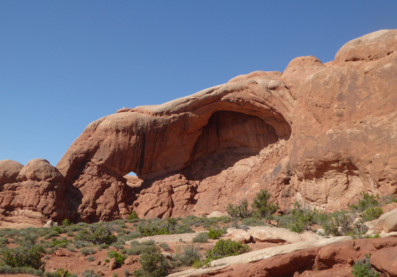
Off to the left there was a small window up on the cliff to the left along with the huge alcove that may someday become an arch.
Here’s another shot of the North Window with a few people standing near the base—they certainly give you a sense of scale.
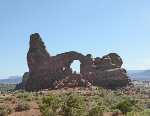
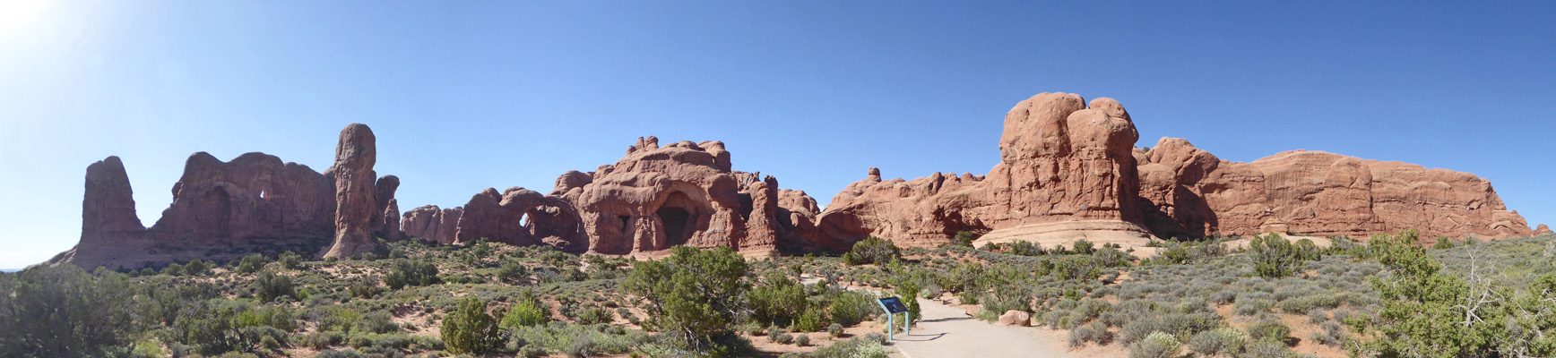
The trail turns south (right) near the base of the window and you can see Turret Arch over to the west. The trail loops south before it takes you over there. Can you see the little window on the left of the arch?
As you loop southeast you come around a corner and there’s South Window. There’s a spur tail you can take out past it and around to the east and back to the parking area. But I continued on west towards Turret Arch.
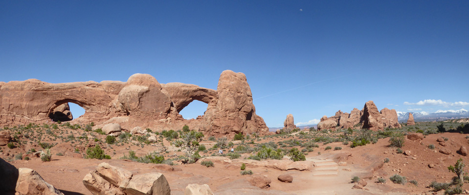
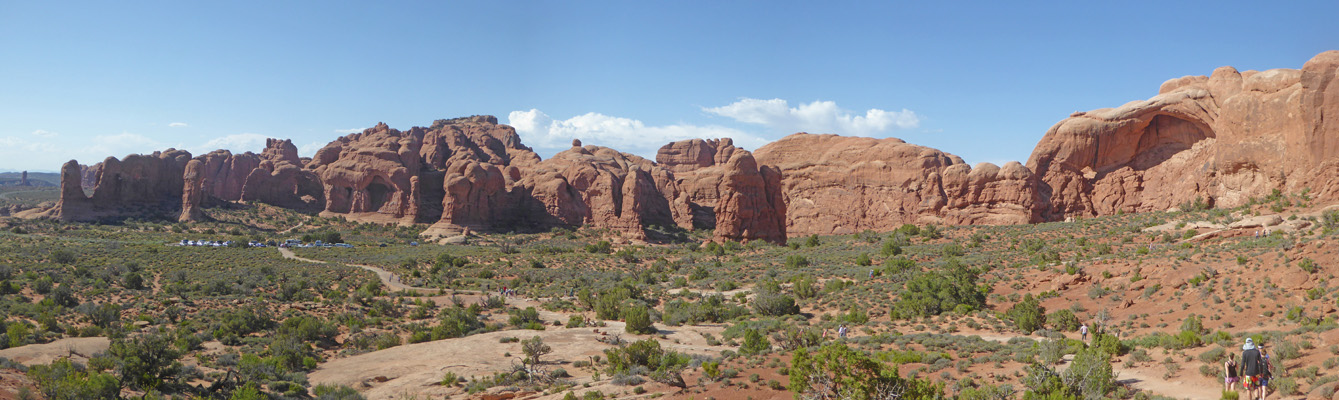
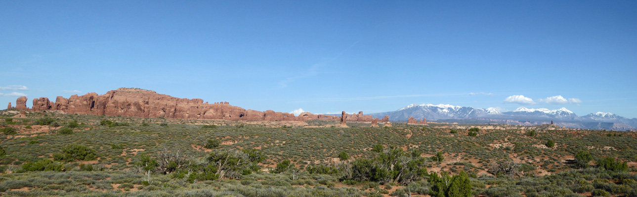
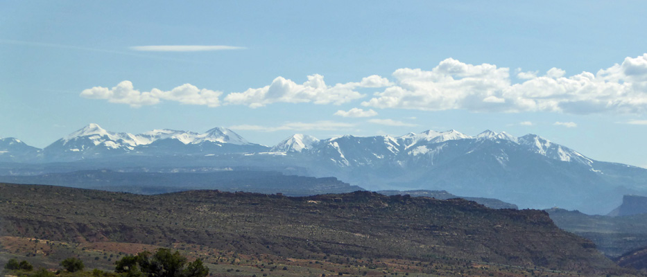
About halfway to Turret Arch you can get a shot of both the North and South Windows at once—with the La Sal Mountains over there on the right.
There were people crawling all over the area under and through Turret Arch. It required a lot of scrambling and so I left it to the younger crowd and started back towards the car. Here’s the view from the turn northward at Turret Arch. This area is called the Parade of the Elephants. If you look carefully you can imagine elephants with their trunks walking in line.
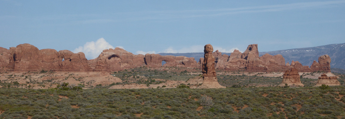
From here we drove to the lower parking area just a little bit to the north where you can get a view of Double Arch. I went down the trail a ways until I could get a decent shot.
Here’s a panorama shot of Double Arch and it’s neighbors. You can see another small window up in the rocks on the left.
Having finished with Double Arch we drove back up the spur road past some interesting formations with a nice view of the La Sal Mountains.
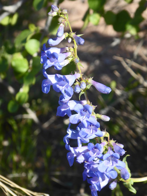
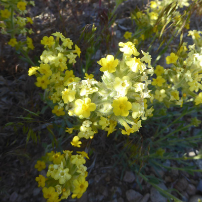
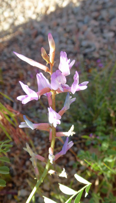
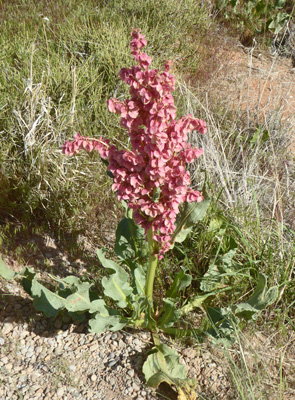
To add to the frosting on this gorgeous cake there were flowers too! There was Bluestem Penstemon (Penstemon cyanocaulis).
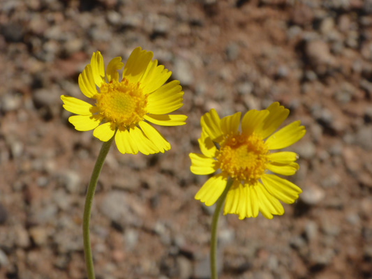
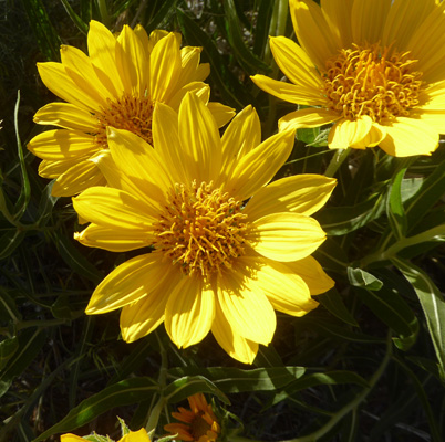
And Ives' Fournerved Daisy (Tetraneuris ivesiana).
We stopped at an area called the Garden of Eden and we were the only vehicle in the parking lot.
When we got back to the main road we turned east and then took the turn off to Wolfe Ranch and the overlooks for Delicate Arch. The parking area at Wolfe Ranch was full which was no surprise. This is where you park to hike to Delicate Arch—a difficult 3 mile hike that is a ‘must do’ for many folks especially at sunset. We had no intention of tackling that so we drove on to the nearly empty parking lot for the Delicate Arch overlooks.
We took the trail to the Lower Overlook and I got my photo of Delicate Arch.
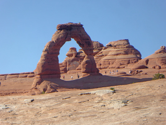
Notice all the people out there even late in the day. I think before I cropped this I counted 25 people in the photo. Delicate Arch is the arch that you see on the Utah license plates and in every piece of tourist literature for Moab and Utah too. All along the road in this section of the park there were these huge yellow daisies that turned out to be Rough Mulesears (Wyethia scabra).
There were also lots of clumps of Yellow Crytanth (Cryptantha flava).
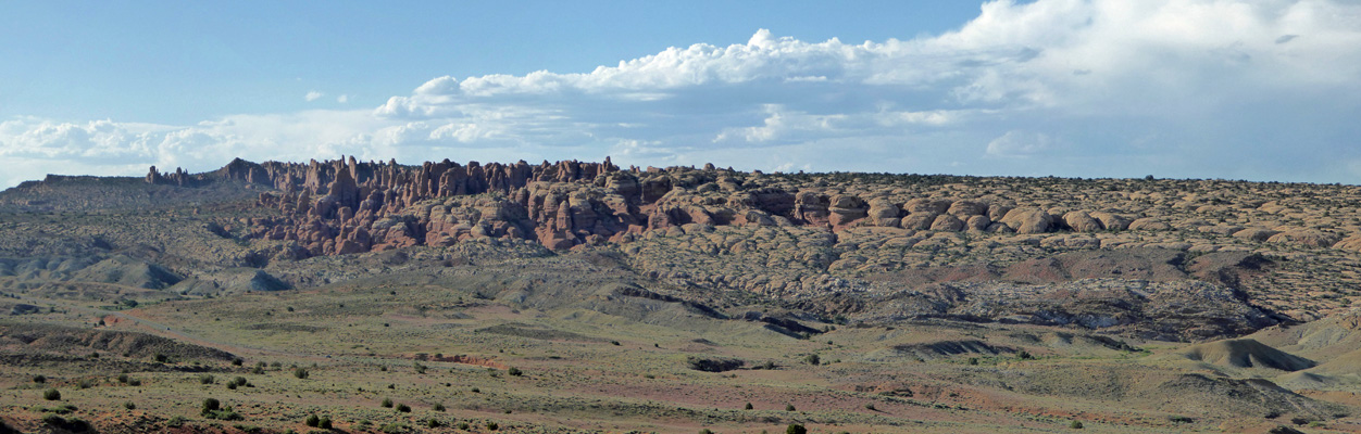
We drove back UP the rise from the Wolfe Ranch area back towards the park entrance and stopped to take a shot of the Fiery Furnace and Devils Garden areas off to the north. You can go hiking (with a permit) in the Fiery Furnace area but there are no marked trails and you can’t leave cairns to mark your way. All the formations look alike so you better be very good with a compass since phone-based GPS doesn’t work out there either. The rangers give a conducted hike once a day out through part of the area and that sounds to me like the safest bet if that’s what you want to do.
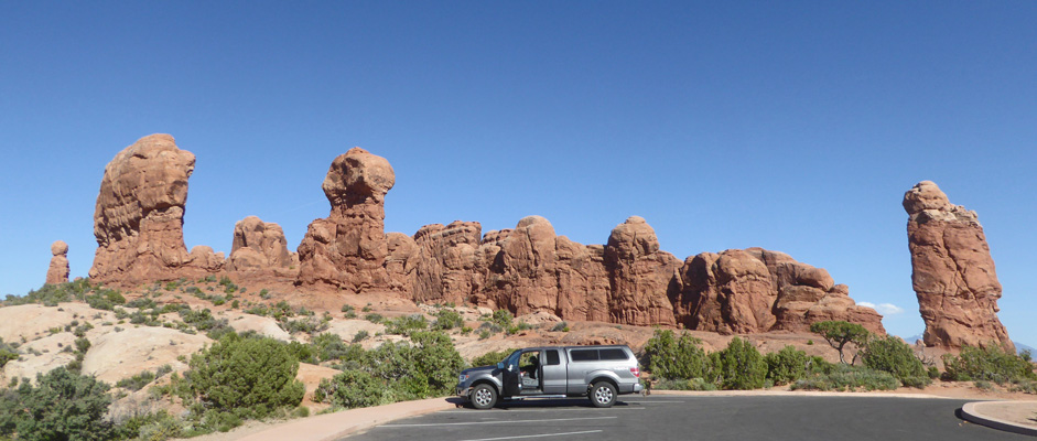
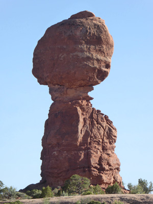
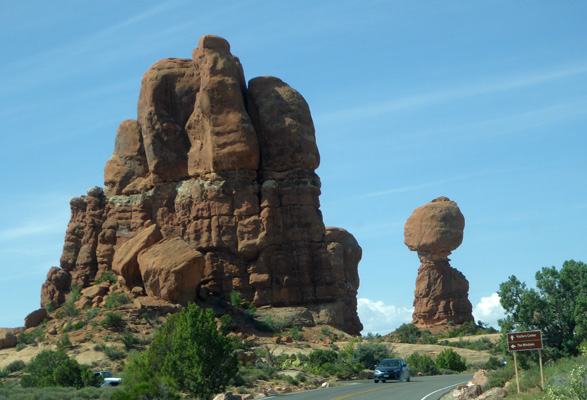
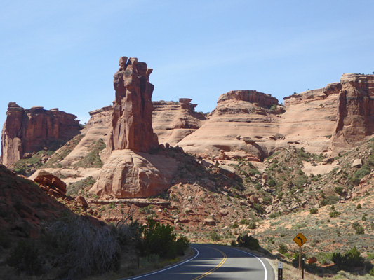
Balanced Rock sits right next to the main road not far from the turn-off to the Windows. You can get photos of it from just about any angle and the light allowed me to get it looking west which was a bit of a surprise.
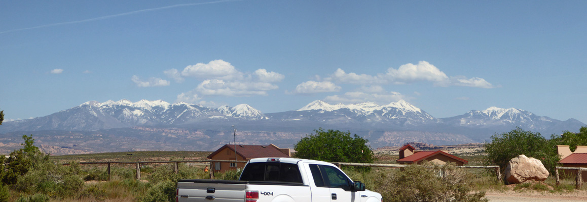
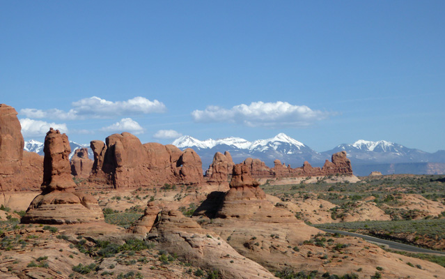
There was a nice turn-out where you can catch the La Sal Mountains and the red rocks together.
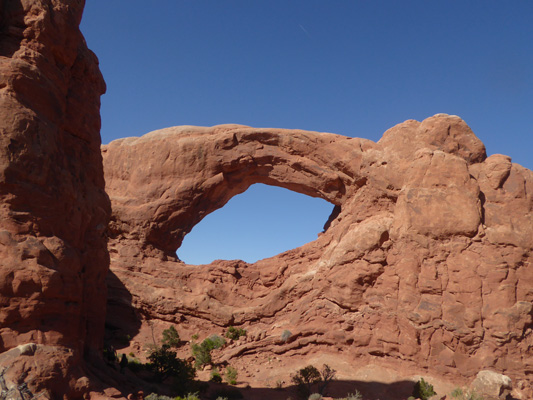
And then a bit farther on you can see the Windows again.
The angle of the sun was changing fast at this point and cast some interesting shadows as we approached the Courthouse Wash area.
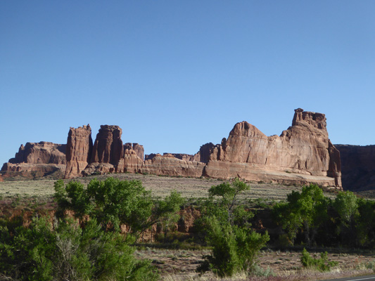
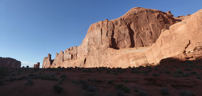
We stopped at the Courthouse Towers Viewpoint where the Park Avenue Trail ends and I took a shot back up the Park Avenue Trail.
The standard thing to do is to go to the top of the trail and take it one-way DOWN hill to here and have someone pick up you.
There was Freckled-Milkvetch (Astragalus lentiginosus var. palans) in bloom in the parking area.
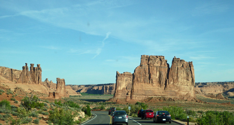
We drove on and stopped at the Park Avenue Trailhead parking lot because it wasn’t full. This gives you a sense of the area at least. The fins off in the distance remind folks of skyscrapers so the area is known as Park Avenue.
It was now past 6:30 so we headed home to have dinner.
The next day we spent at Island in the Sky in Canyonlands National Park. But on Wednesday May 15th, we got up early and were at the entrance of Arches again at 8:00 am. There was more of a line at the entrance than there’s been at 4:30 in the afternoon but it still wasn’t bad. The Visitors Center parking lot was nearly full so we decided we’d leave it until last and drove out the park road headed to the Landscape Arch parking area out in the Devil’s Garden area.
On the way I grabbed this shot of the Courthouse area. You can see that there were already LOTS of cars out. The parking lot at Park Avenue was full as was the one at Balancing Rock.
Here’s a shot of the area called the Fiery Furnace as we drove by.
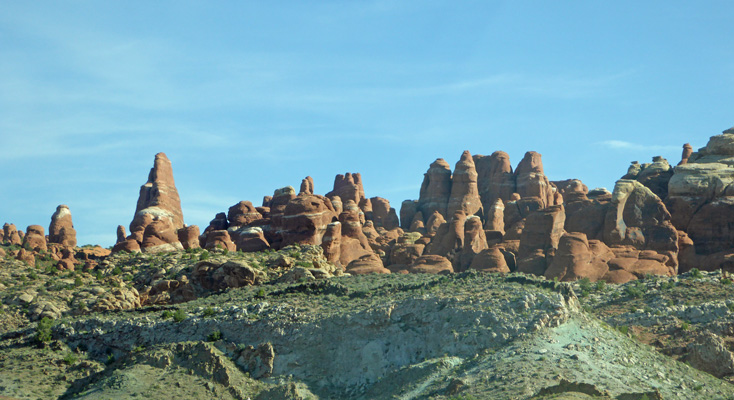
And here’s the edge of the Devils Garden.
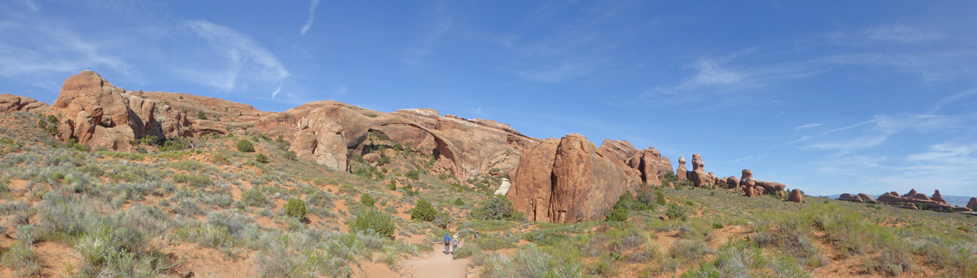
We made it to the Landscape Arch parking area in good time and found it about 3/4 of the way full—and it’s the biggest lot we found in the park. When we finished our hike at quarter to 10 the lot was nearly full.
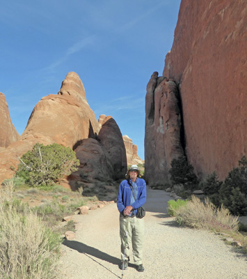
Here’s Walter at the trailhead as we were just setting out.
There were lots of large Canaigre (Rumex hymenosepalus) in bloom here and along the roads too. It’s a relative of wood sorrel which is a weed in the Northwest.
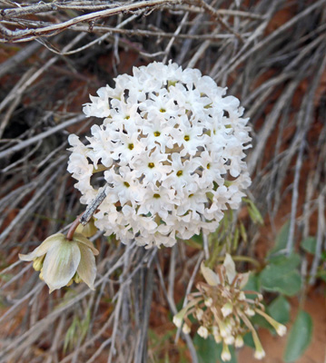
There was also this fun Snowball Sand-verbena (Abronia fragrans) which I’d been hoping to see.
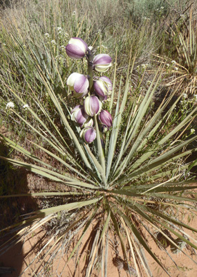
The Navajo Yuccas (Yucca baileyi) were in bloom here too.
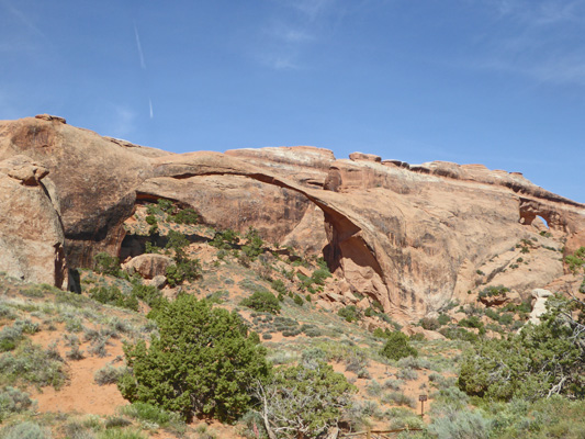
Walter got hot and needed to stop part of the way out but I continued on to see Landscape Arch. The trail comes up a bit of a rise and then there it is.
You continue on down to the foot of the big red rocks just to the right of the arch and get another view of it.
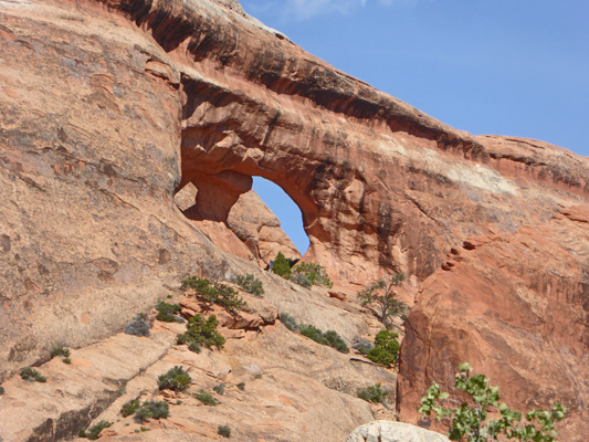
It’s getting pretty thin and they’re worried about how many more years it will last. A big chunk fell off over on the right about 10 years ago and someone caught a photo of it as it happened. Thank goodness nobody was up under it since in the old days they allowed you to hike up there.
Off to the far right you can see some blue sky in the rocks. That’s another arch. It’s either Partition or Navajo Arch. You reach them by continuing on the trail which has now turned to very dry sand. I opted instead to turn back and rejoin Walter who was sitting in the shade on a rock waiting for me.
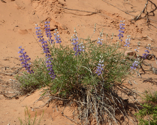
On the way back I stopped to take photos of the flowers. There was lupine.
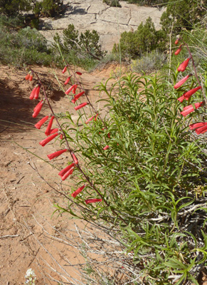
Eaton’s Penstemon (Penstemon eatonii)
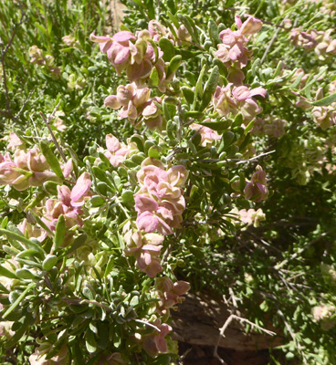
Spiny Hopsage (Grayia spinosa)
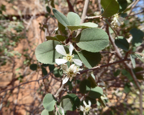
And Utah Serviceberry (Amelanchier utahensis)
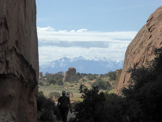
I found Walter well rested and happy (sitting on a rock of course) and we continued on our way back to the trailhead. I took a whole bunch of these photos of the La Sal Mountains peaking through the narrow canyons created by the fins but this is the only one that really came out decently. It was just before we got back to the trailhead.
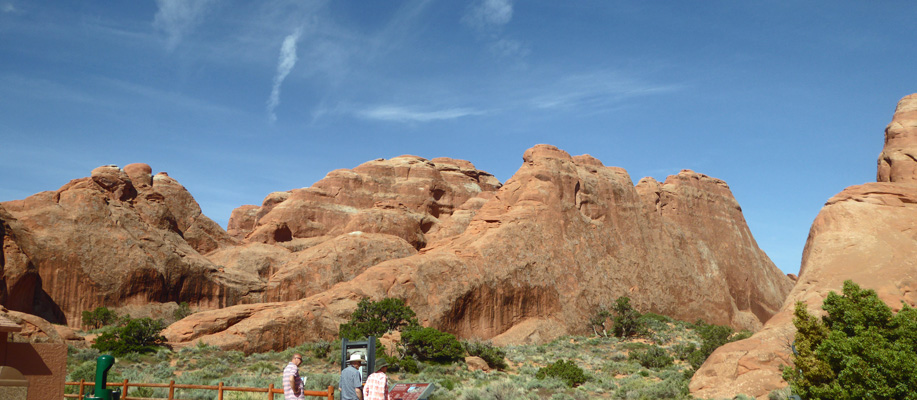
Along with the spur loop that goes out to the Navajo and Partition Arches and a side trail to the Pine Tree and the Tunnel Arches, there’s a primitive trail where you can pick up another 4 arches. So if you’re persistent and want to do a lot of hiking here you can see 9 arches from one trailhead. Not bad at all. If you decide to do it I’d advise starting early in the morning because it got hot pretty quickly.
We stopped to enjoy the view from a nice bench under a tree at the trailhead and I took this shot looking back towards the rocks at the trailhead.
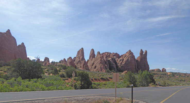
We climbed back into the truck and started the drive south again. I stopped to grab a photo of the edge of Devil’s Garden as we came out of the parking area. There’s a campground out here which is ALWAYS full. 25 years ago it was First Come First Served and people would get in line at 7 am in hopes of getting a spot when someone left. Now it’s all reservation and it books up pretty much on the day they allow you to make a reservation (6 months in advance I think).
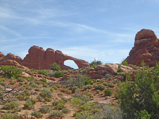
You can see Skyline Arch from the main road.
We pulled into the parking area for the Sand Dune and Broken Arches which wasn’t full—shock. The map said it wasn’t far to Sand Dune Arch so I couldn’t leave it behind. Walter was happy to sit in the truck with the windows open so off I went.
The trail goes through open country for a while and then you turn south into the cliffs and fins.
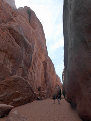
It immediately gets very sandy so it’s not easy going. But it’s lots of fun.
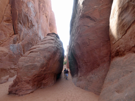
And just when I was beginning to wonder how much farther I was willing to slog in the sand there it was.
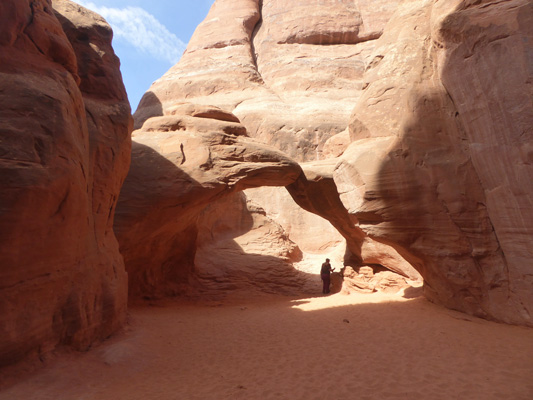
It’s not a real big arch but arch it is.
There was a baby sitting in the sand playing as happy as any toddler in a sand box. There had been another toddler who was having fun in the sand at Landscape Arch and protested very loudly when her parents picked her up to go. This was a nice shady area and these folks were content to sit with the kid in the cool canyon and let him play.
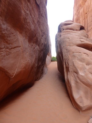
Here’s another shot of one of the slots on the way back.
When you come out of the canyon you get an panorama view out across the open country.
And off in the distance there was Broken Arch.
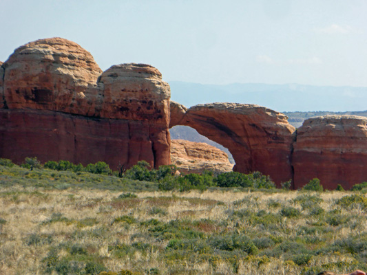
Having collected my share of arches for the day I was content to turn back to the parking area. We drove on and tried to stop at the parking area at the Fiery Furnace Overlook and trailhead. But it was full. So we drove on and I was satisfied with yet one more shot of the La Sal Mountains. We visited this area 25 years ago in April and neither one of us remember these lovely mountains. It’s nice of them to have trucked them in since then, don’t you think?
As we came to the intersection where you go south to the Windows area I managed to grab one more photo of Balanced Rock.
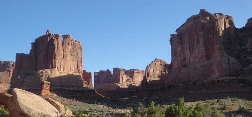
As we drove through the Courthouse area I couldn’t resist one more photo of the huge formations there, this time in the morning light.
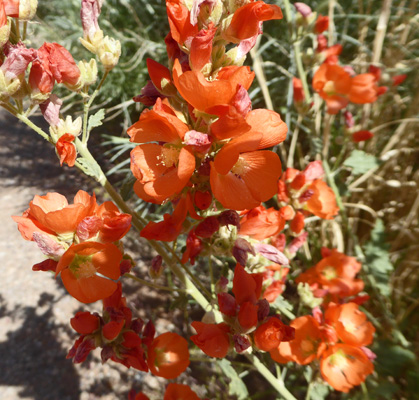
We drove on back to the Visitors Center where we found a parking spot just fine. The line of cars to get into the park now that it was almost 11 am was very long indeed, but it appeared most folks were high tailing into the park rather than stopping at the Visitor Center. I stopped to take a photo of the Small-leaf Globemallow (Sphaeralcea parvifolia) which I’d seen several places along the road.
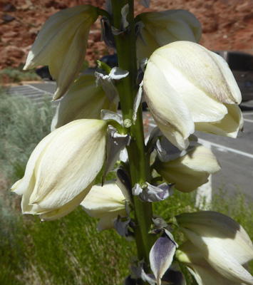
There was a Harriman’s Yucca (Yucca harrimaniae) in bloom in the parking lot too.
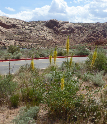
We went in and watched their movie and wandered around a bit and then came back out where I had to take a photo of this nice patch of Prince's Plume (Stanleya pinnata) in the parking area.
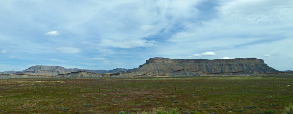
We took the afternoon off and the next morning we packed up and drove north on Hwy 191 to I-70 where we went west. Along I-70 there were some nice views.
At Hwy 24 we turned south towards Hanksville and things got interesting.
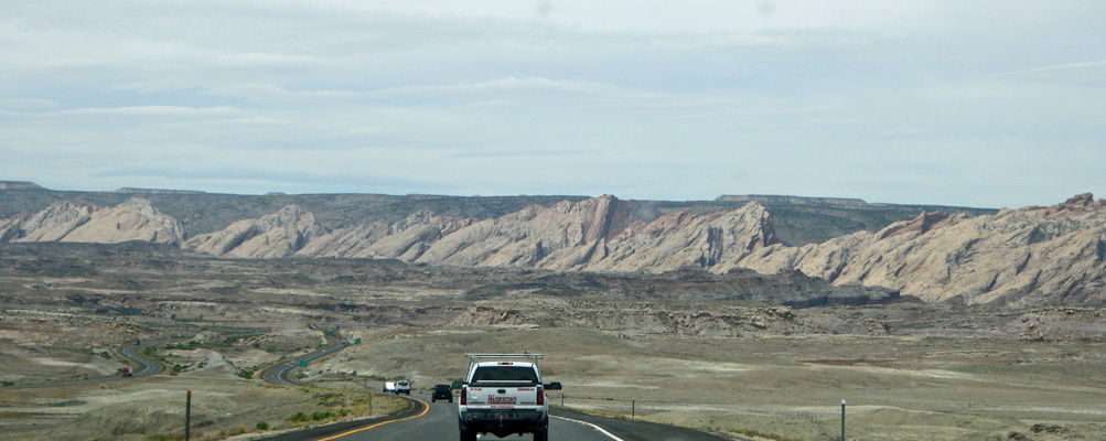
Clearly Mother Nature had done a bit upheaving along the way.
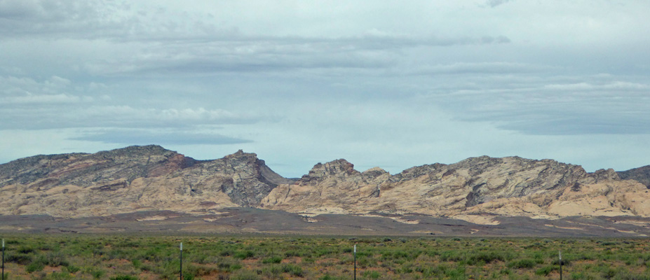
There’s a state park called Goblin Valley along through here, that’s way off the main highway. We saw people’s trailers and RV’s parked at a lot at the turn off so the road probably isn’t real friendly. But the formations off in the distance looked really fun.
At Hanksville, Hwy 24 turns west and takes you into Capitol Reef National Park. We had a reservation in the Fruita Campground there which was a good thing because it was full (of course). They only started taking reservations here a year ago so we were thankful not to have to play campsite roulette with First Come First Serve. We found our campsite and set up and notice there seemed to be an abundance of Casita Trailers nearby. It turned out there was a caravan of 12 of them plus several more fiberglass trailers. The leaders (who were in the spot behind us) were from the Seattle Area and they played the ukulele and sang for their nightly gatherings in their spot. They were our neighbors for our entire stay but we didn’t talk with them until the last morning when we were all breaking camp.
The campground is lovely and the area around it is historic and full of fruit trees that were done blooming but will produce fruit all through the summer. It looked different than it did 25 years ago when we camped there but hey, things do change.