
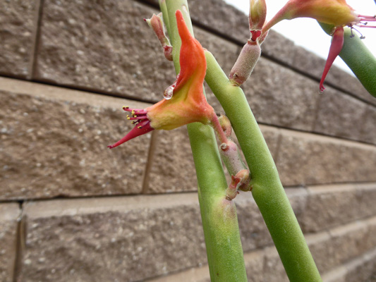
The Lady Slippers (Euphorbia tirucalli) was just starting to put out their orange/red slippers.
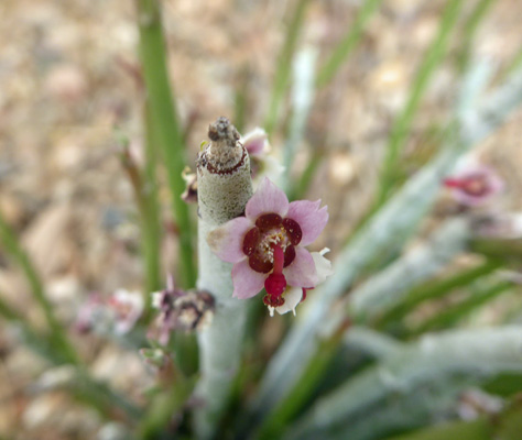
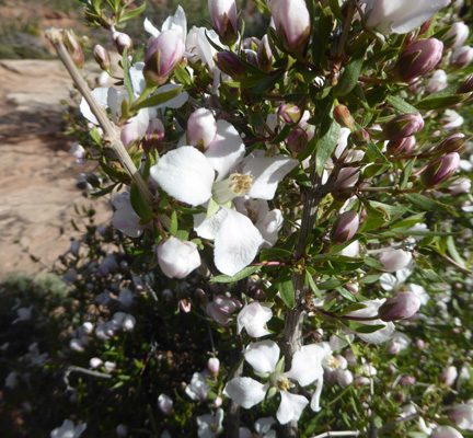
The Candelilla (Euphorbia antisyphilitica) was putting out tiny little pink flowers along its stems.
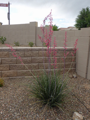
The red yucca had over 10 spears of flowers.
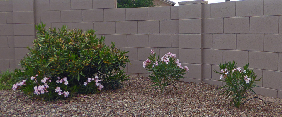
And the dwarf oleanders (both old and new) were in bloom too.
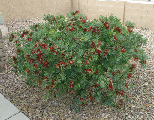
Out front the bottle brush bushes were putting on a show too.
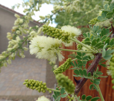
Out in the wash on the west side of our house the mesquite was blooming up a storm.
I’d thought they were all the same kind, but no! We have Texas Honey Mesquite (Prosopis glandulosa) along the bamboo fence by the waterfall.
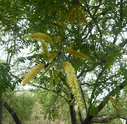
And Velvet Mesquite (Prosopis velutina) along the side of the house.
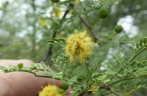
And out along the fence by the driveway we have some sort of Acacia.
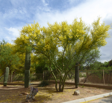
The Palo Verde tree at the end of the cul de sac was in bloom too.
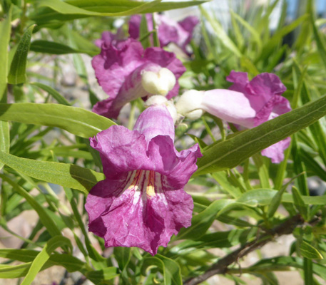
As we drove out one last time along Rancho Resort Boulevard I noticed that the Burgundy Desert Willows (Chilopsis linearis 'Burgundy') just around the corner from us were in bloom too.
We spent a night at Green Valley RV Resort after we buttoned up the house and then headed north to Show Low on May 1st. We spent 2 nights in Show Low so we could do one more round of grocery shopping and a load of laundry before heading out into the red rock country for a while.
On May 3rd we headed north on Hwy 77 to I-40 where we headed east to pick up Hwy 77 again. We drove north on 77 to County Road 15 (full of pot holes and odd rolling bumps) to Hwy 191.
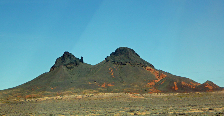
County Road 15 might not be a great road but the views were nice. There were old cinder cones.
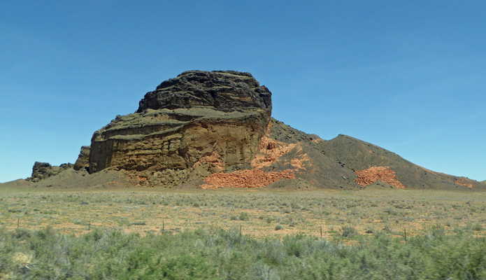
And strange little buttes along the way.
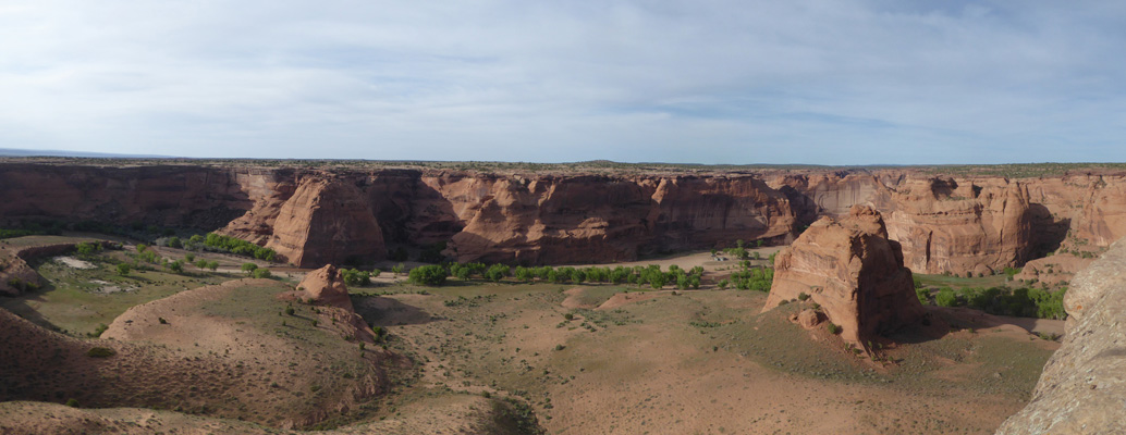
Hwy 191 took us to the town of Chinle and Canyon de Chelly National Monument.
We got a nice campsite at the Cottonwood Campground in the park and set up camp. It was a pull-through that was perfect for our solar panel set-up. And we had enough sun during our visit to keep the batteries fully charged the whole time. Score!
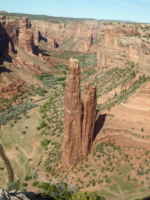
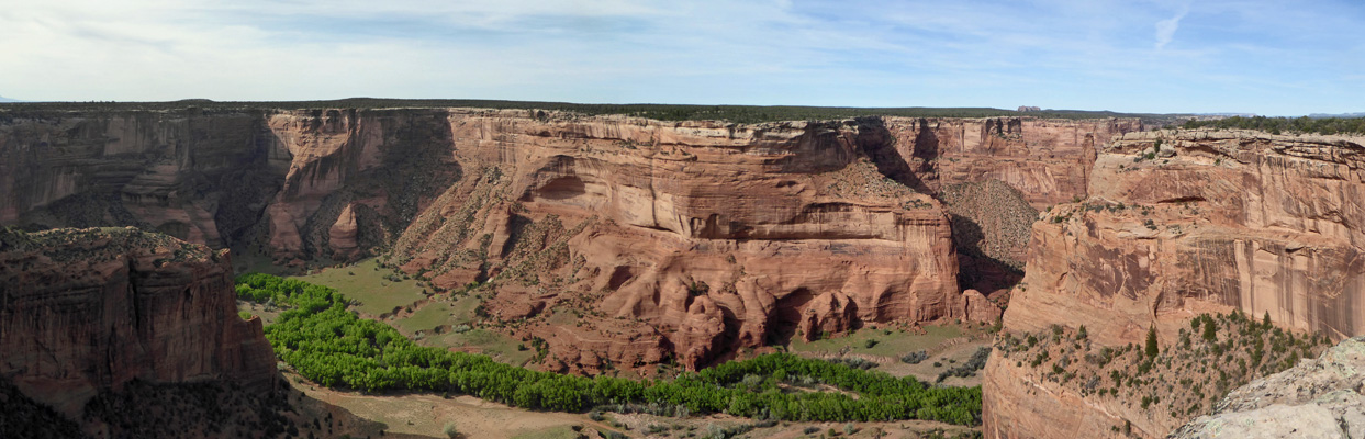
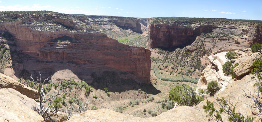
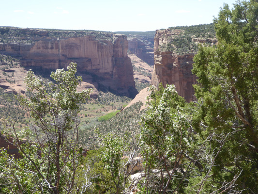
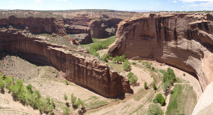
After lunch we took the scenic drive on South Rim Drive. To start we drove straight out to the end of the road to Spider Rock Overlook.
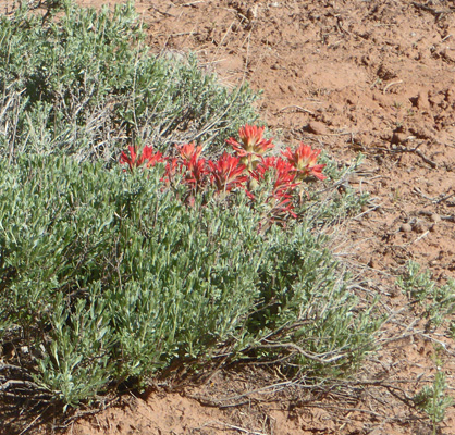
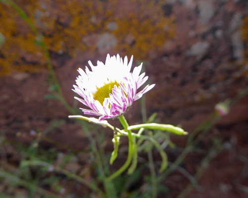
There’s a short trail that takes you out to the overlook. Along the way I spied some Desert Paintbrush (Castilleja angustifolia).
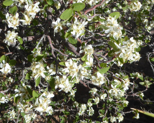
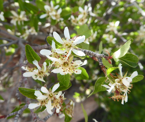
And there were lots of Utah Serviceberry (Amelanchier utahensis) in bloom too.
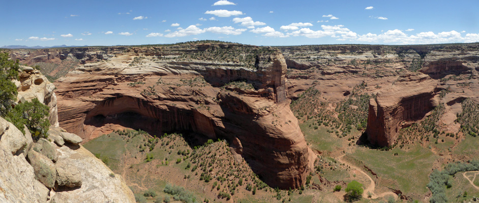
The first view of Spider Rock is pretty swell.
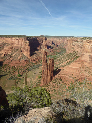
We shan’t talk about how many photos I took of this lovely formation. It’s just so photogenic!
The trail continues around the rim where there was Cliff Fendlerbush (Fendlera rupicola) just coming into bloom.
Out in the sun the Utah Serviceberries were in full bloom too.
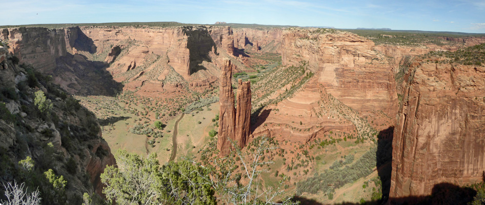
And you got a different view of Spider Rock too.
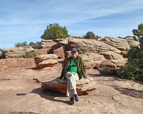
Walter found a nice rock to sit on in among the interesting cap rock formations.
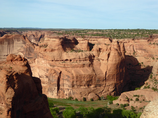
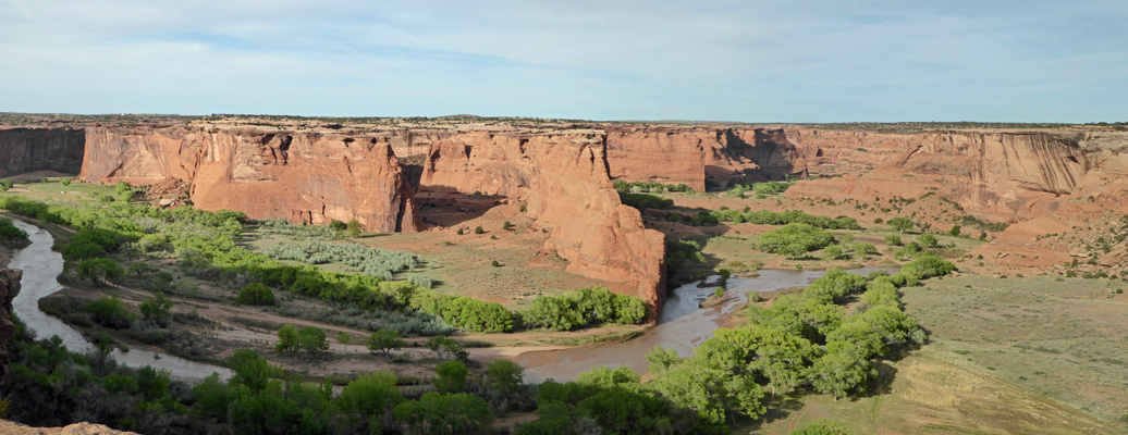
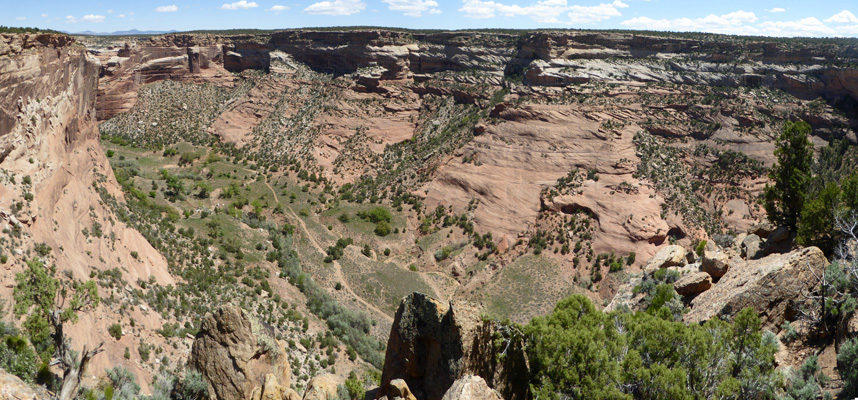
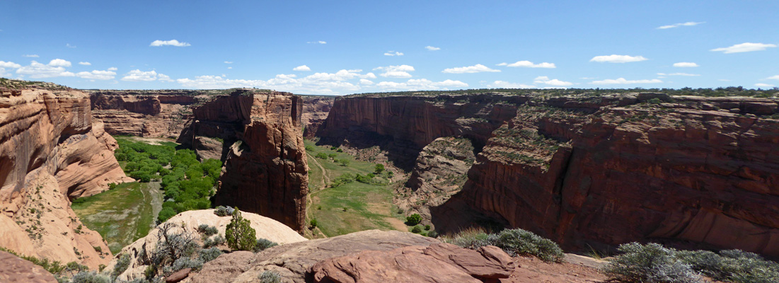
We hiked back to the truck and then started to make our way back along the South Rim Road stopping at each of the overlooks along the way. Face Rock Overlook gives you a nice view of the valley but I couldn’t decide which rock was Face Rock. Needless to say there is a river that runs down the center of the canyon, thus there are those lovely cottonwoods on its banks.
On my way out to the Sliding House Overlook I spotted one single Spreading Fleabane (Erigeron divergens) growing out of a rock.
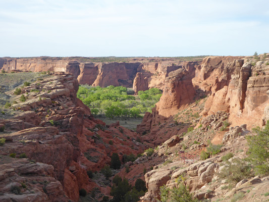
I didn’t find the sliding house out at Sliding House Overlook but I did find a nice view with a huge arena-like alcove on one end.
And a lovely view down canyon just past these interesting fins.
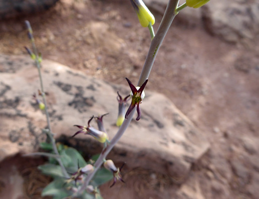
On the way back to the truck I found this odd plant called Heartleaf Twistflower (Streptanthus cordatus).
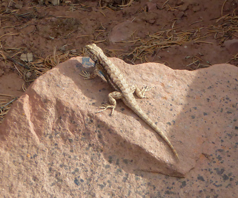
A lizard stopped long enough to do a few push ups so I got a picture of him.
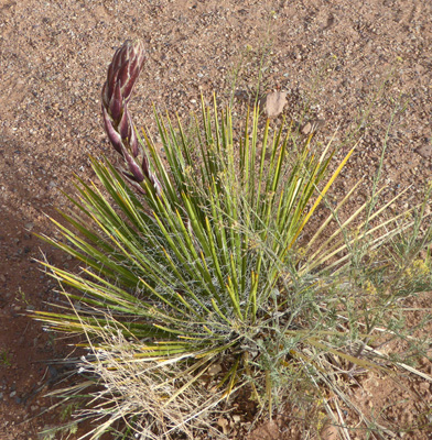
And there was also a Navajo Yucca (Yucca baileyi) just coming into bud.
The White House Ruins Overlook has the only trail down into the canyon. The trail drops 600 feet to the canyon floor and then takes you across the canyon to the White House Ruins. It’s about 2.5 miles round trip. The only other way to visit the canyon floor is on a jeep tour with a Navajo driver. It’s a very popular thing to do but we decided we were perfectly happy to stand on the rim and look out over the canyon and enjoy its beauty that way.
Even without the ruins the White House Ruins Overlook gives you a great view.
The ruins are over at the base of the sheer face.
The trail continues on along the rim a ways and gives you this great view down canyon.
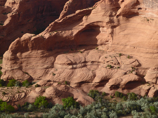
I really liked the patterns in the rocks at the base of this formation.
And when you got to the end of the trail you could see around the next bend of the river even farther down the canyon.
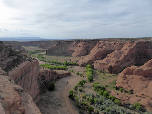
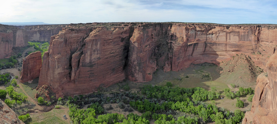
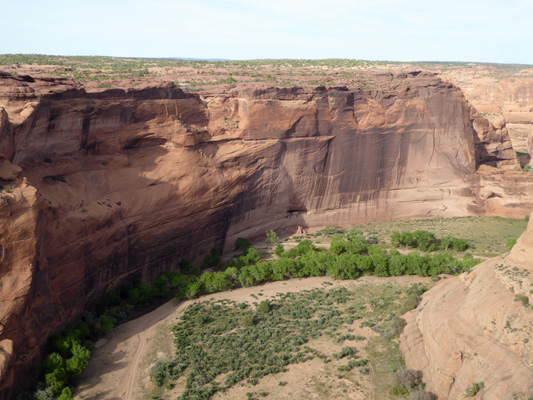
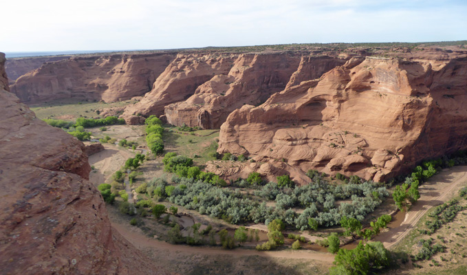
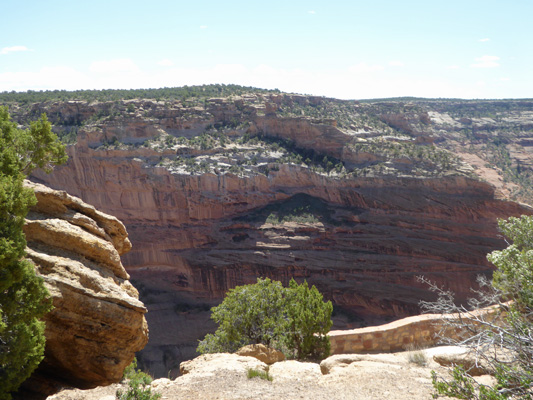
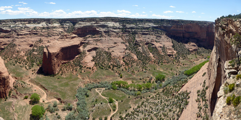
The Junction Overlook gives you a broad open view of the canyon.
I liked the row of holes 3/4 of the way up the canyon face in the formation on the right.
It was getting late by this point and the light was beginning to go. But I still got a nice shot of the Tsegi Overlook as the river winds its way down the canyon.
The last stop is the Tunnel Overlook. There’s a trail down to a viewing platform but by this point, I was pooped and was willing to forgo the hike and just take a photo from the road. It is really amazing how much energy it takes to get in and out of the truck and hike a little trail here and another one there. It adds up after you’ve done it 7 or 8 times.
Saturday May 4th, we drove into the town of Chinle (2 miles) and got gas and then stopped at the Visitors Center and watched their movie. Canyon de Chelly is the only National Monument in the country that is on reservation land. So the land is owned by the Navajos but the Park Service works to preserve the canyon. It’s an interesting joint venture. There are still about 50 Navajo families who farm in the valley each summer. Most have winter homes up on the mesa and they either drive out (down river to Chinle) or hike up out of the canyon to their houses and then drive to town. They don’t allow photos of any of their people, buildings, animals or vehicles so you have to be careful when taking photos even from the rim.
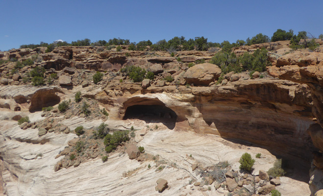
Having finished with the Visitors Center (which is actually called a Welcome Center here) we drove out to the Massacre Cave Overlook, the furthest overlook on the North Rim Road. All three of the overlooks on the North Rim Road have at least a bit of a hike and they’re all worth it.
Here’s Massacre Cave Overlook looking down canyon.
You can take the trail down to that ledge over on the right. And from there you can can see the Yucca Cave Ruin.
The ruin is nestled into the cave.
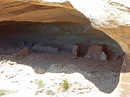
There’s even a bit of a building in a smaller cave along the wall.
The view from the ledge looking down canyon gives you a bit of a view around the corner.
And looking the other way is pretty nice too.
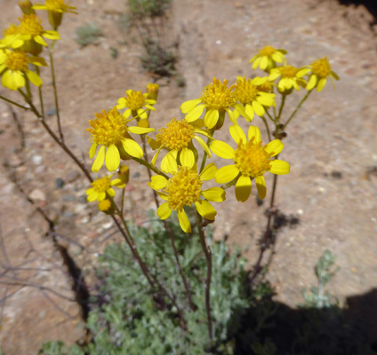
On my way back up the trail I noticed a patch of Lobeleaf Groundsel(Packera multilobata) growing in a crack in the rocks.
We stopped again at the main overlook on our way back to the truck and I took one more photo of the view. The line down therein the bottom is a jeep road running down Canyon del Muerto.
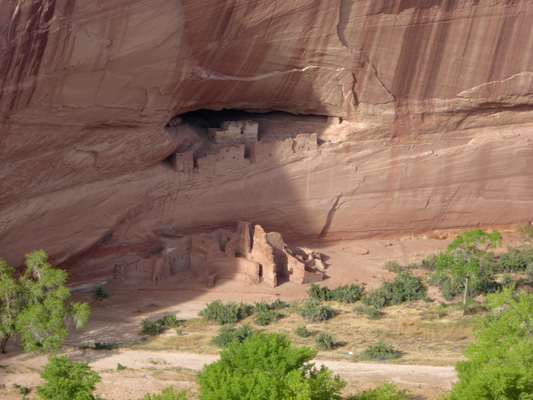
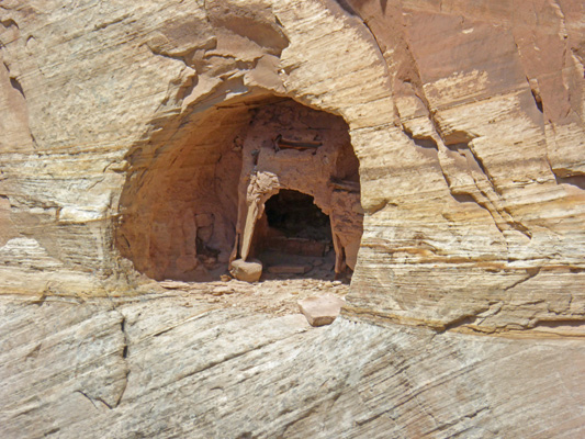
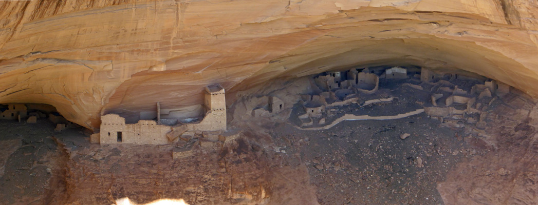
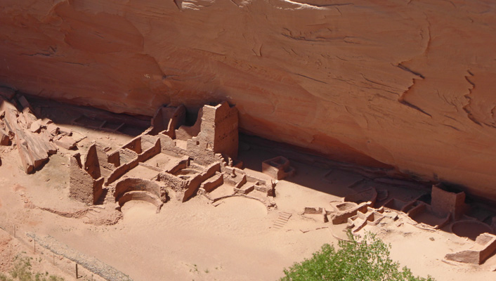
Next we drove to the Mummy Cave Overlook. Here you can figure out where the Mummy Cave is without any problem. It’s back there on the left with the ruin.
Here’s a close up of the ruin. This was clearly a pretty big village at one time. People having been living in Canyon de Chelly for over 5,000 years. It is the longest uninterrupted habitation on the Colorado Plateau.
Here’s the view looking down canyon.
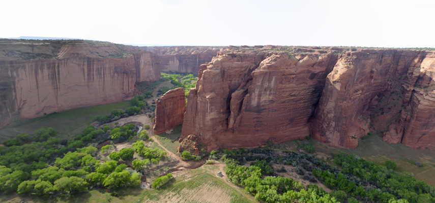
From here we drove on a ways to the Antelope House Overlook. Here you have a bit of a hike over the slick rock to get to the two overlooks.
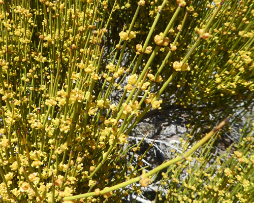
We’d seen a lot of Mormon Tea (Ephedra viridis) in bloom other places but this bush was in FULL bloom.
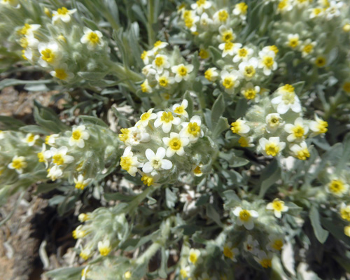
There were little clumps of Tawny Catseye (Cryptantha fulvocanescens) all along the trail.
The first overlook you come to gives you a view of the Antelope House Ruin and more of the Canyon del Muerto. While I was standing here a red jeep drove down canyon, across the river and around the bend.
Here’s a close up of the ruin.
The fence that you can see in the lower left corner separates the ruin from a small farm. The farmer was out down by the river and I had to make sure I didn’t get a picture of him or his house.
The trail heads farther along the slick rock back around the corner and from there you get a great view of where the Black Rock Canyon (on the right) joins the Canyon del Muerto (on the left).
Canyon de Chelly was a great way to start our adventures in the Four Corners Area. It was low key and quiet and peaceful. We were lucky and had lovely weather too.