
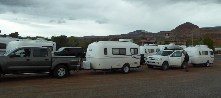
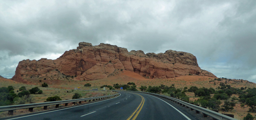
Either way you go on Hwy 24 to Torrey where the Casita Caravan was all lined up in the parking lot of a local restaurant as we drove past.
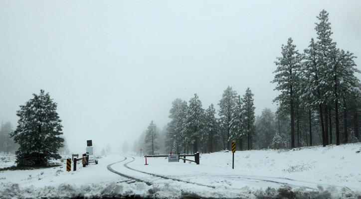
We opted to go the slightly longer way with the lower passes since the clouds were dark and it sure looked like there was moisture on the way.
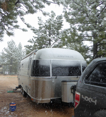
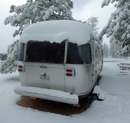
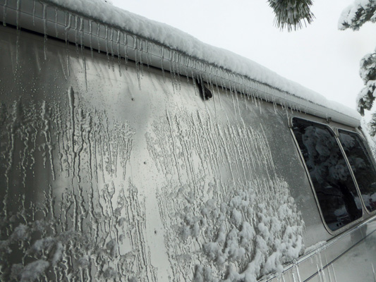
We had a few flakes as we went over the 8400 foot pass in the Fish Lake Mountains but nothing serious. However as we went east on Hwy 12 out of Panguitch, it started to rain and that quickly shifted to sleet and then snow. By the time we arrived at Ruby’s Inn and RV Park in Bryce Canyon City, it was snowing heavily. We had a reservation for a pull through spot and by the time we were parked and set up here’s what Genevieve looked like.
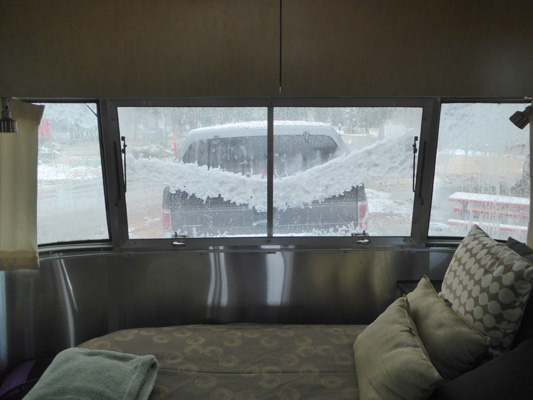
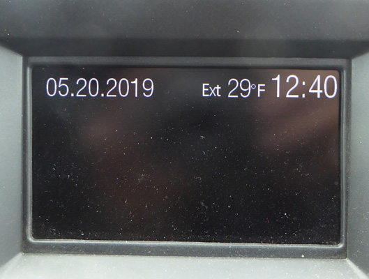
It continued to snow and we were really glad we had an electrical hook up because it was down around 34. By lunch time, the snow had pretty much stopped and here was the view out our bedroom window as the snow on the rock guard began to slump. Genevieve doesn’t get to smile very often.
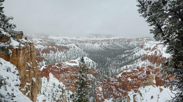
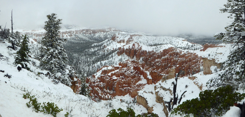
Late in the afternoon we had some sun breaks and the main road looked clear so we drove up into the park to see if we could see the canyon with fresh snow.
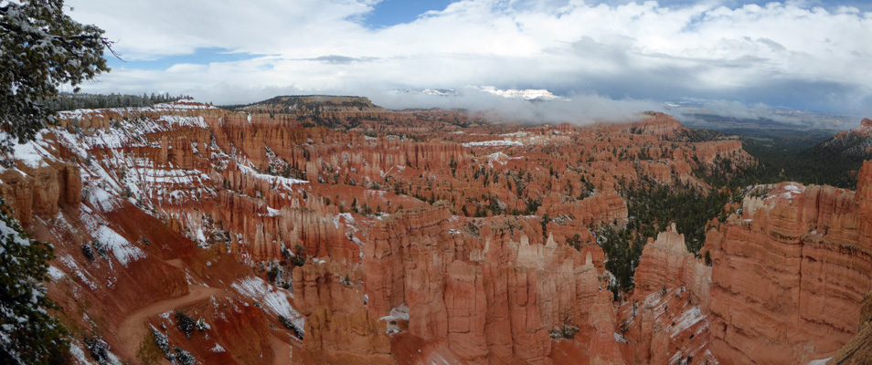
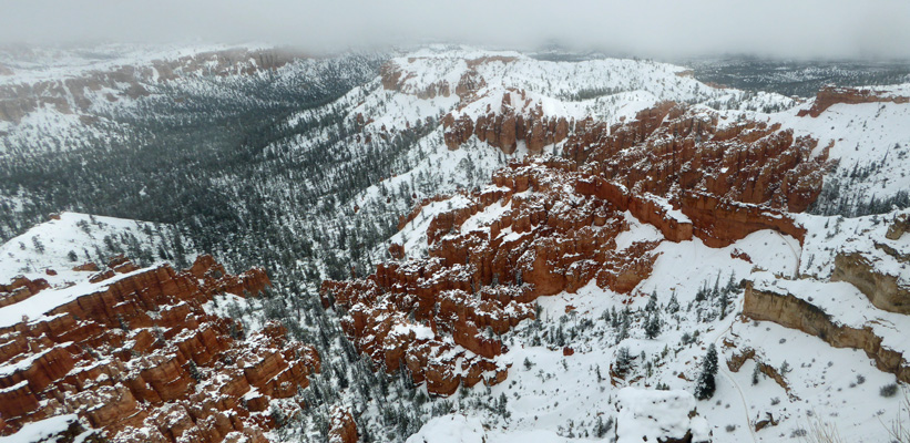
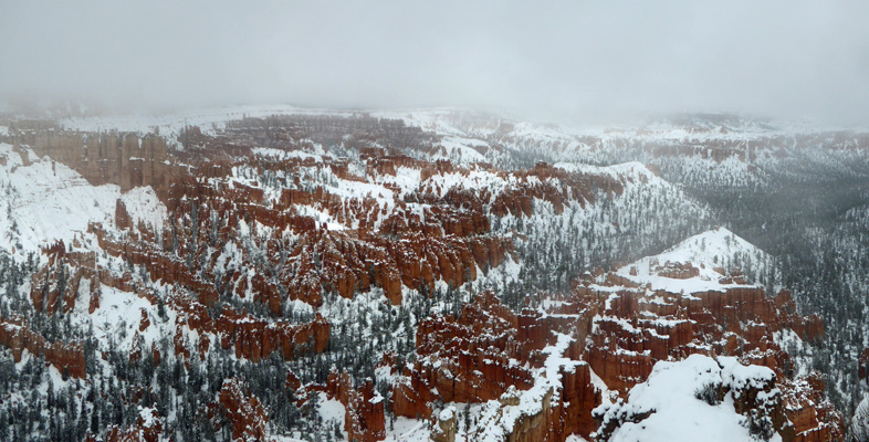
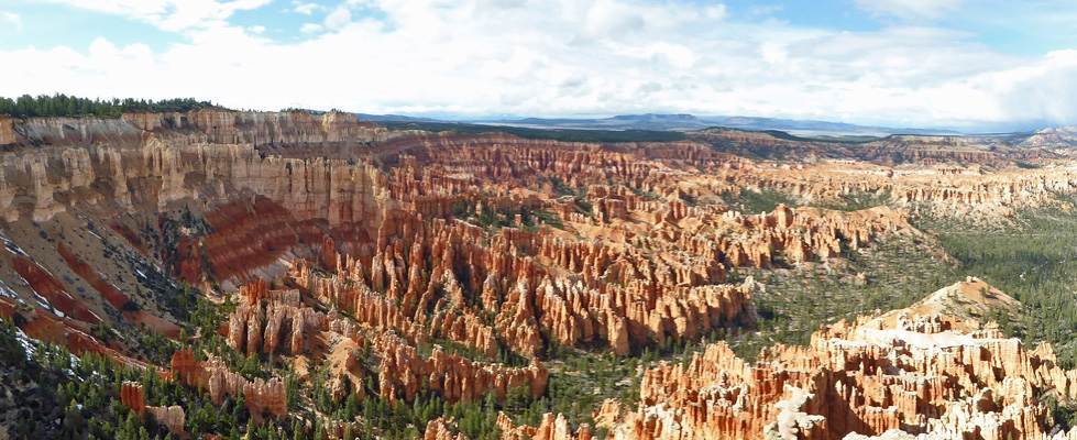
We found a spot to park at Sunset Point and took the short walk up to the rim.
There were a remarkable number of folks out taking photos but you had to grab your pictures while you could because the clouds were swirling in and out.
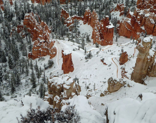
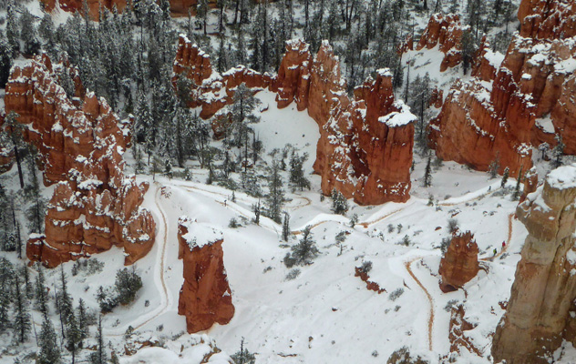
Down below on the old Wall Street portion of the Navajo Loop Trail there were these interesting contraptions parked on the trail.
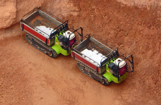
It turns out these are the work vehicles the rangers were using to remove a HUGE rock fall from the winter that had closed Wall Street once again. They have to push them up and down the trail (though clearly they are power assisted) and I was told it is hard work. This section of the Navajo Loop Trail has been unstable for years. The last few times we’ve visited Bryce it has been closed. So I had thought that they’d given up on it entirely. But no, they work on it until it’s at least semi-safe and then open it again because it is so popular.
For Walter, these things were the hit of the day. For me, it was the snow on the red/pink rocks.
We stopped at the Bryce Canyon Lodge just for fun since we hadn’t been there for years. It’s a little shabby around the edges but a pretty classic National Park Lodge. The Visitor Center was closed by this point so we left it for the next day.
Of course, the reason we were visiting Bryce once again was so I could hike the Bristlecone Pine Trail. Even before we arrived I knew that wasn’t going to happen because it was still closed with snow and winter trail damage. But I’d hoped I be able to hike someplace. But with the snow and the cold I bagged the idea entirely and just enjoyed the view.
We had snow showers off and on in the evening and then in the night we had a serious dumping of snow. When I opened the trailer door the next morning, the door skimmed snow off the top step—more snow than we’ve ever been in with the trailer. Those are my footprints on the step.
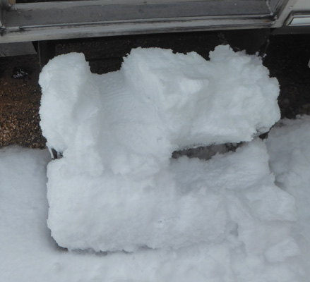
It was COLD and I stomped around taking pictures. Genevieve was buried in snow as were the trees around us.
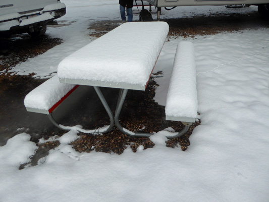
You can see how deep the snow was from the depth on the picnic table. I didn’t get a ruler out but it was over 3 inches and probably close to 4.
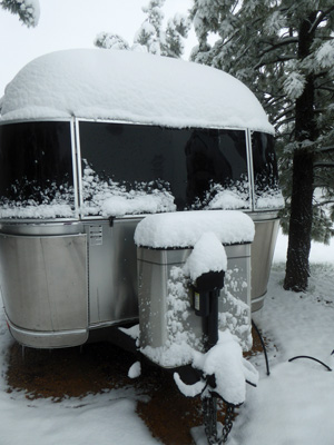
Here’s the front of the trailer. Look at that lovely pile of snow on top of the propane tank cover.
And here’s Francois.
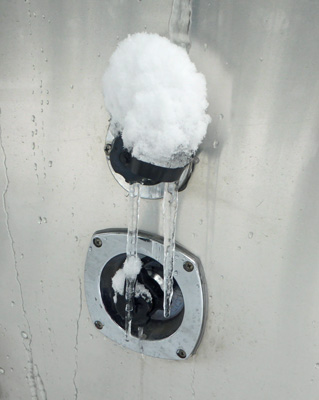
Along about this point I began to notice that on the street side of the trailer we had icicles hanging off the awning cover and all down the side.
That’s the water inlet. Needless to say we’d just filled up our tank and put the hose away the day before.
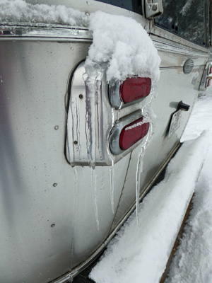
And here’s a marvelous long icicle hanging off the red tail light.
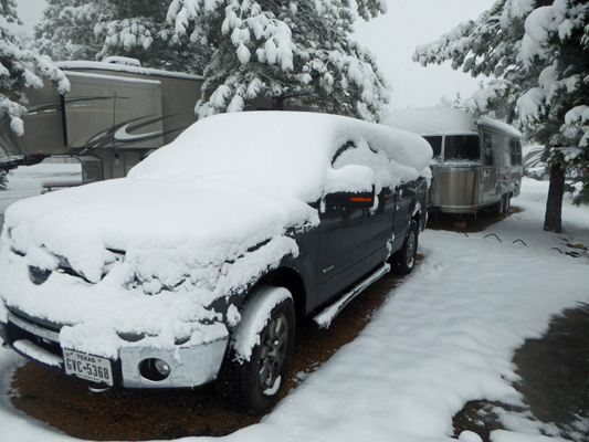
By about 12:30, things had defrosted enough that we decided we could take a drive up into the park. Getting the snow off the truck was a bit of a project but not too bad.
The roads in town were clear and I couldn’t resist taking photos of the snow as we drove up through the park.
We drove as far as we could and then hit the point 2 1/2 miles into the park where they close the road when it snows.
So we turned left and went out to Bryce Point to take a look. It was a little cold but I bundled up in hat and gloves and went out to see the view.
The sun was playing hide and seek again so all of us out along the viewpoint took photos every time the sun peeked out.
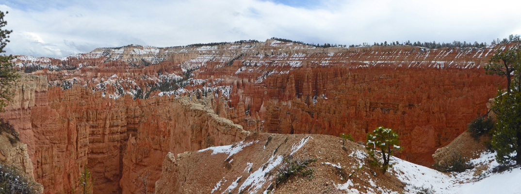
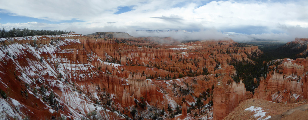
As you can see, there was way more snow than the day before.
I walked on out towards the actual point.
If you look straight down from the point you can see the trails below.
And there were people out hiking! I’d seen a couple of people slip-sliding down the trail at the trailhead. I can’t imagine how much fun it was to slide all the way down to the bottom and then hike in the snow. There are 4 people in this photo. Can you find them over on the right?
What more could you want but snow and red rocks? Well, yes blue sky would have been nice but don’t get greedy.
Now remember, this is May 20th. Here’s the same view when we visited on April 9th, 2016. There were little patches of snow but ...
On our way back out of the park we stopped at the Visitor Center and watched their movie and talked to the rangers about the trails etc. Then we had the afternoon off.
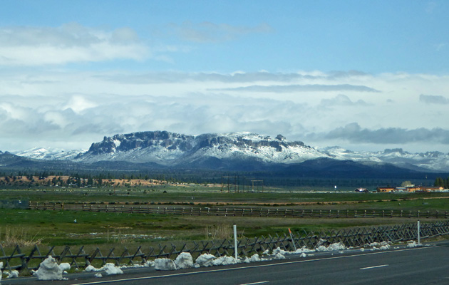
On Tuesday May 21st, we packed up (it had only snowed a tiny bit in the night and it melted by the time we packed up) and headed west on Hwy 12 back towards Panguitch.
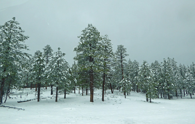
On the way I couldn’t resist taking photos of the snow in the surrounding mountains. You can also see there was still snow piled on the verge of the roadway from the snow plows.
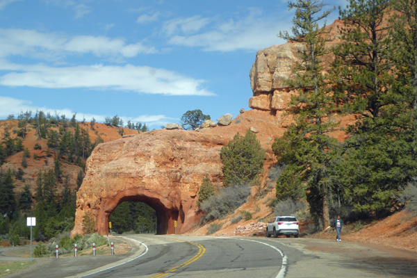
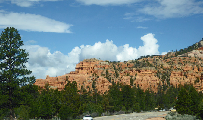
There are two tunnels on Hwy 12 as you enter the Red Rock Canyon area. We just slowed down a bit so I could grab a photo. Lots of people pull over and stop.
The Casita caravan we’d met in Capitol Reef were supposed to camp in the campground here but we saw several come in to Ruby’s Inn and RV Park the day before. Dry camping in the snow (with no power) isn’t a lot of fun.
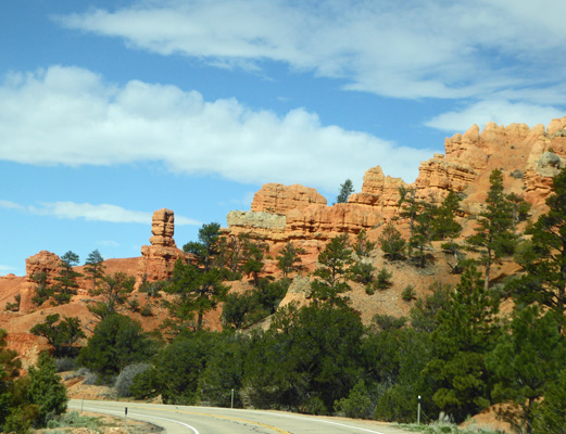
Red Rock Canyon is a lovely little mini-Bryce Canyon. Usually it’s full of cars but the weather seemed to have scared the crowds away.
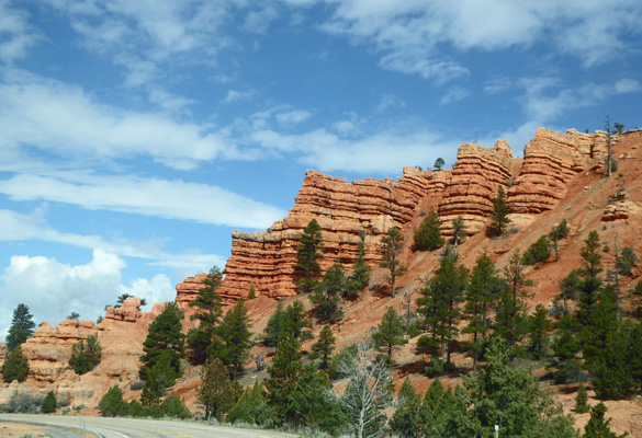
You can easily see why it’s popular. There are hiking and biking trails here too.
You can easily see why it’s popular. There are hiking and biking trails here too.
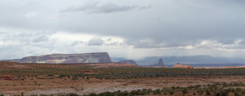
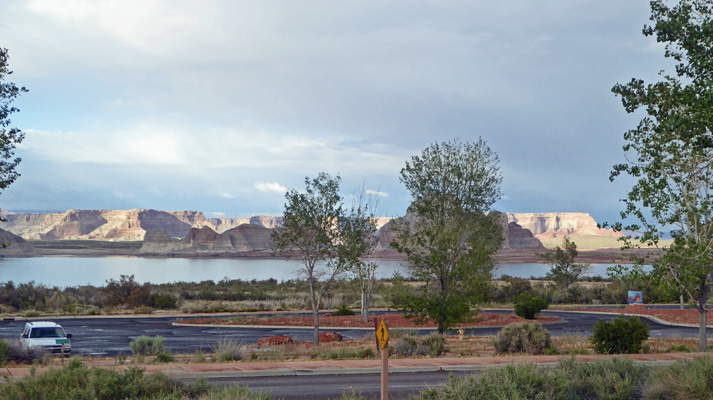
There were snowy views off and on even south of Panguitch as we drove down Highway 89 towards the town of Kanab. We took regular Hwy 89 (instead of Alt89 which swings south towards the North Rim of the Grand Canyon) on to Wahweap Campground on Lake Powell just north of the town of Page. Wahweap is a resort run by a concessionaire so it’s not cheap but it has nice big long pull through spots and a view of the lake and the cool rocks around it. It’s RIGHT on the Arizona-Utah border with an address in Arizona. Looking at the campground map I discovered that part of the facility is actually just over the border in Utah.
Here’s a bit of the view from our campsite.
We had a few showers that day and while it wasn’t cold it wasn’t the usual 80 degrees that folks expect this time of year.
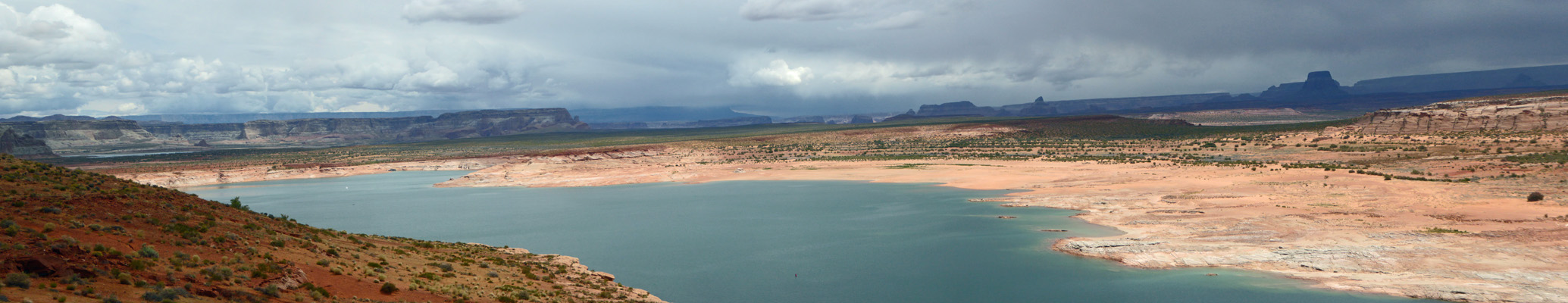
The next morning we drove south along Lake Powell (and Hwy 89) towards Page. Here’s a view from along Hwy 89.
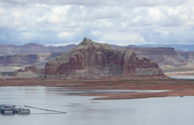
The water doesn’t really belong in this landscape but given that it’s here it makes an interesting juxtaposition. Here’s the view from Wahweap Point. That’s the Wahweap Marina down below.
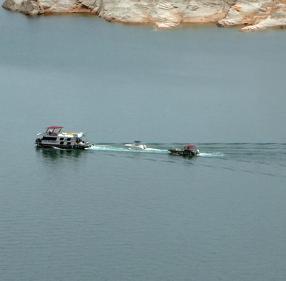
There were a few boats out, including this houseboat with two smaller boats in tow.
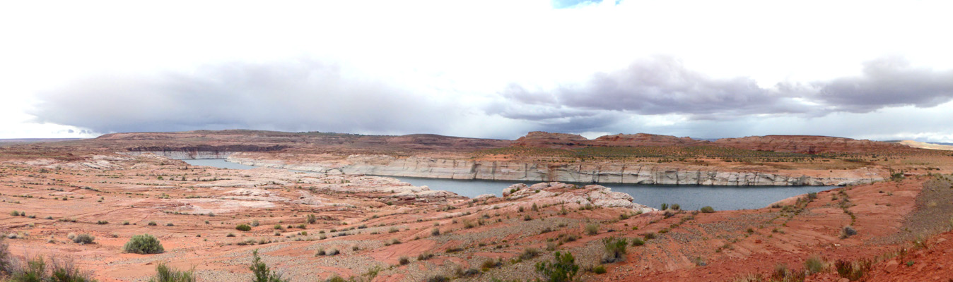
Here’s yet another view from Wahweap Point.
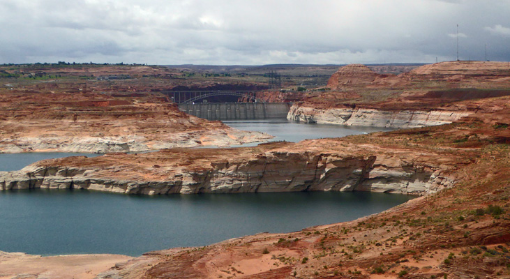
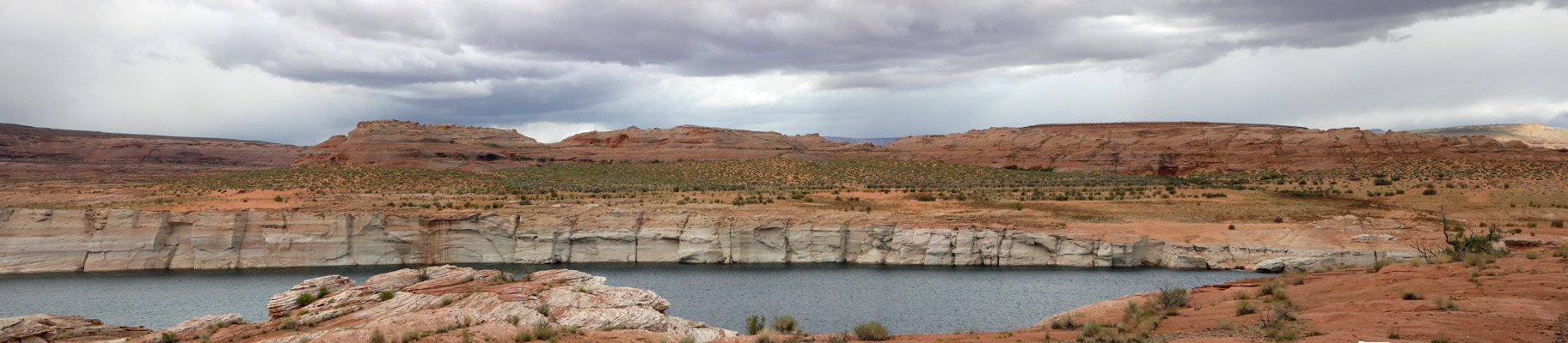
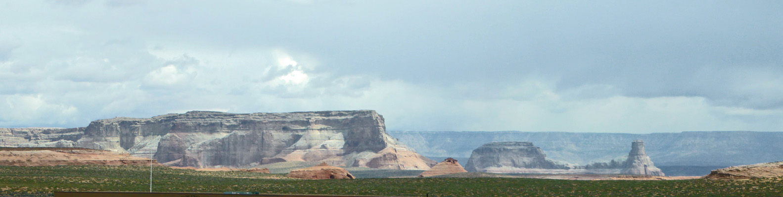
We drove on to Navajo Mountain Overlook. The mountain was hidden by the clouds but you got a great view of Glen Canyon dam.
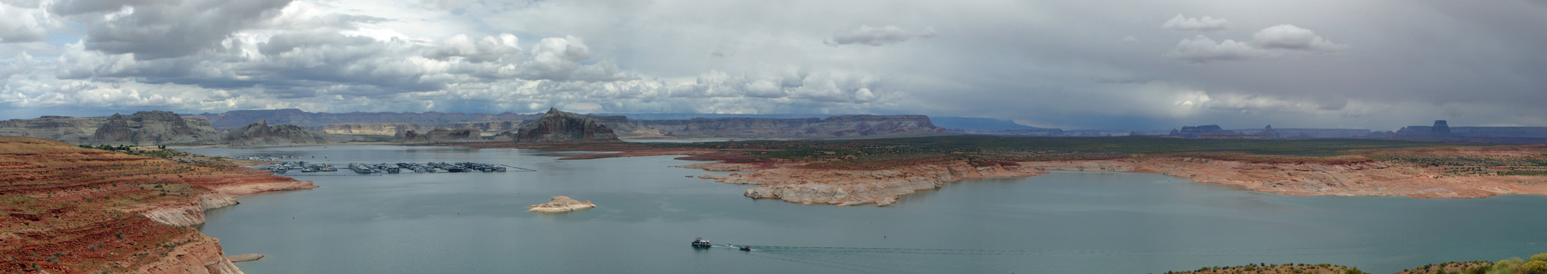
Here’s a panorama shot from the overlook reaching from the dam on the right circling left.
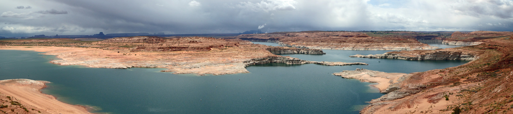
And here’s the rest of the pan.
We drove through town and out towards Antelope Canyon which has become a super big tourist attraction over the last few years. They take herds of people on buses and jitneys out to the trailheads for the upper and lower canyons. The canyon is controlled by the Navajo Nation and they are doing a bang up business giving guided tours to would-be photographers. I wasn’t interested in being in a herd so we took a pass since being on a conducted tour is the only way to enter the canyon. Instead, we drove out to Antelope Point on the lake.

That’s a houseboat motoring by the very large boat ramp.
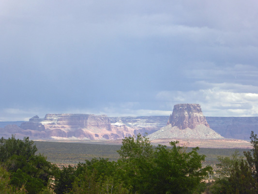
There are interesting rock formations off in the distance.
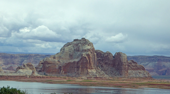
Here’s yet another example of water in a weird place. This is very near the mouth of Antelope Canyon. In fact, you can take Antelope Canyon boat tours too.
I drove around the edge of the enormous parking lot here and got yet another water view.
On our way back out we drove over to the Antelope Point Marina—where the parking lot had a lot of cars in it. I suspect their owners were off on boat tours of the canyon and farther out into the lake. You can take an all day boat trip from Wahweap out to Rainbow Bridge and back. My mom, sister, Kathy, and I did that back in the spring of 1972 when Lake Powell had just reached full pool for the first time. It was fun but it was a loooong day and best done in good weather.
The view from the marina once I’d cut the buildings and cars out was actually pretty nice.
We drove back into Page and did our grocery shopping. Just as we were checking out a large number of Asian tourists started to wander in. When we got out into the parking lot we realized that there were 4 buses that had just disgorged their passengers for lunch. There was a Chinese restaurant and a Thai restaurant across the street but many people were having a look at the grocery store too. Maybe they were looking for corn dogs in the deli?
It rained that afternoon and late in the day the sun peeked out and I got out and took a photo of the sun on the distant rocks.
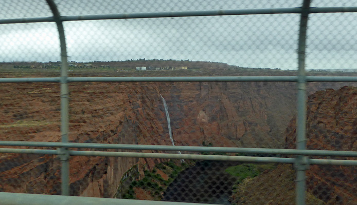
We spent the afternoon relaxing. The next morning we packed up and drove south on Hwy 89 to the Flagstaff KOA for a night. Along the way I shot a few photos. When we’d crossed Glen Canyon Dam the day before there hadn’t been a waterfall but with the rain there was now one cascading down the cliff face. I tried to get a shot through the car window between the railing post through the wire mesh.
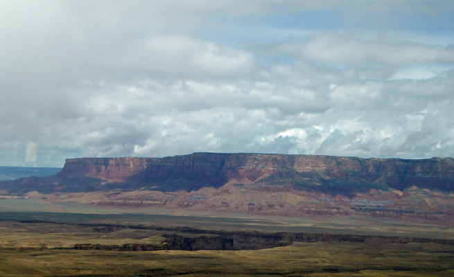
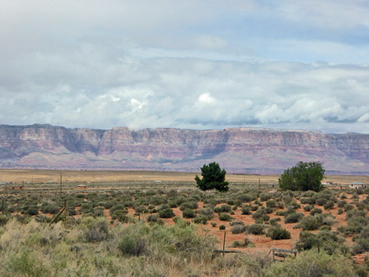
South of Page, past Horseshoe Bend (which has become overrun with people), Hwy 89 winds through red rocks.
And as you go down the hill you pass viewpoints for the Vermillion Cliffs.
Once we got down from the top of the mesa the sun came out and the colors really changed.
By the time we got to Flagstaff it was cold and raining. I did our laundry—big excitement but hey it needed to be done.
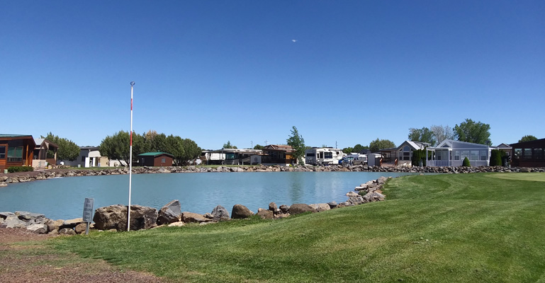
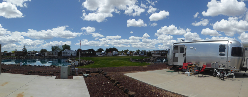
Friday May 24th, the sun was out and it warmed up nicely as we picked up I-40 east to Holbrook and then turned south on Hwy 77 towards Show Low. About 7 miles north of town we turned east to Juniper Ridge Resort where we’d rented a lot for 4 months. We checked in, and then got ourselves parked in our home for the summer. Once we were settled in I went out and took a photo of the view from our dining room windows.
This is looking off to the left from the 15th hole (the grassy area on the left). The 15th hole is right in front of our trailer.
Here’s a shot I took of the view last fall when we rented the spot.
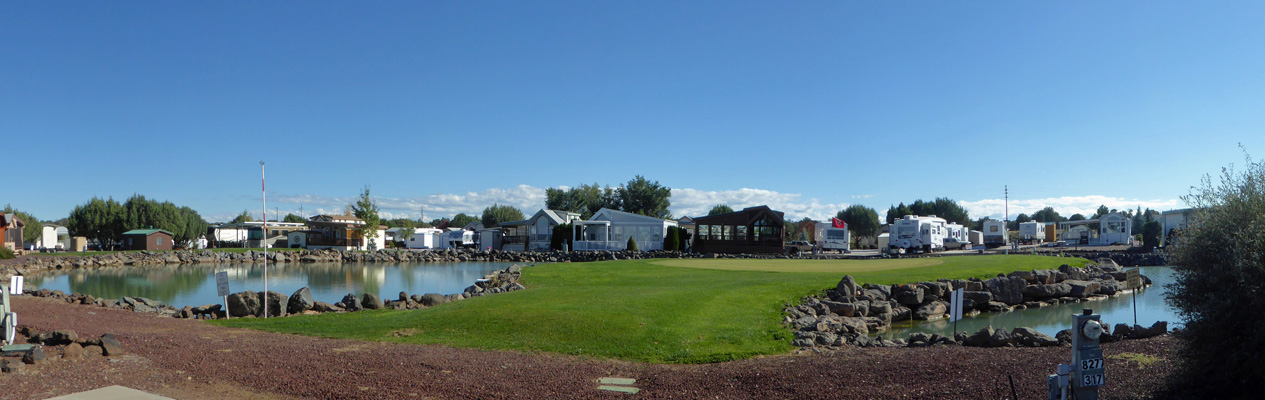
We settled in for Memorial Day weekend. The temps were in the 70’s and it was pretty windy. People were out playing golf and rarely did anyone actually make it onto the little peninsula with the green. Since the wind was blowing from the southwest (right to left) most folks ended up short in the water. But a few folks overcompensated and ended up overshooting the green and landing in the lake on the other side. There’s a fellow who lives down by the tee who spends most of his day fishing balls out of the lake. This is what is called an Executive Course so they play with a lighter than normal ball and it floats! So that red and white stripped pole on the edge of the lake has a little cup that you can use to fish your ball out with if you’re lucky enough to hit it near the shore. Otherwise, Richard collects it up when it blows his way and returns it to the Pro Shop. They write everyone’s lot number on their balls so they can be returned to them.
On Memorial Day they had a little golf cart parade that drove around the development honking their horns (all 7 of them). But mostly, we stayed home and rested and got used to our new digs.
By Wednesday the 29th, we had made numerous trips to town and finally had our new cable modem up and running so we had high speed internet once again—such a treat. There’s a Verizon tower on the property so cell service is excellent but it’s still nice to have unlimited data for the computers and Walter’s Roku.
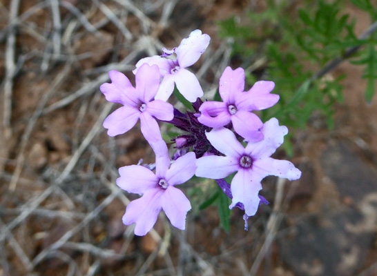
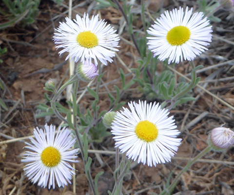
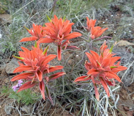
During our trips in and out of the park, I had noticed a little patch of wildflowers along the main road in the development—there’s 40 acres of open land on one side. So I stopped and took some photos.
There was lots of Dakota Mock-vervain (Glandularia bipinnatifida).
Patches of Running Fleabane (Erigeron tracyi)
And of course yet another variety of paintbrush: Wholeleaf Paintbrush (Castilleja integra).
They were running the sprinklers on the 15th green when I set out and I just couldn’t resist taking pictures. Dancing waters, puffy white clouds, green grass and a blue lake. Yum.
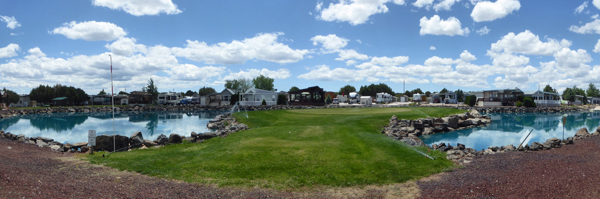
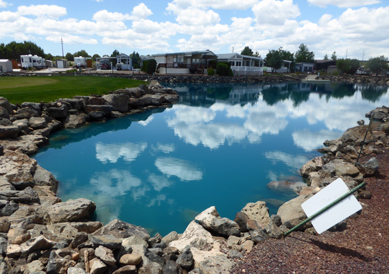
We have grown to really like this view. The lake is super blue in these photos because they added some chemical to kill algae (it didn’t hurt the giant carp or catfish who live in the lake) and it turned the lake BRIGHT blue.
The lot next to us is empty so I stood on it to get a photo of Genevieve in her spiffy digs.
And then I couldn’t resist taking a photo of the white puffy clouds reflected in the lake. Down at the far end of the lake (over on the right of the photo) there’s a little dock where you can go fishing (and a park with picnic tables). You have to use barbless hooks and it’s catch and release but folks still have fun with it. There’s also a fountain down there as part of the water recirculation system.
We’re very happy here. And we’re really excited to be buying this same lot which will close on June 24th. Monday June 17th we were down in the Phoenix area to place an order for a park model to place on the lot. It will be ready for delivery in April or early May 2020 just in time for next summer.