
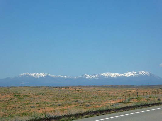
The road gains some altitude and we got a nice view of the snowy Abajo Range to the northwest.
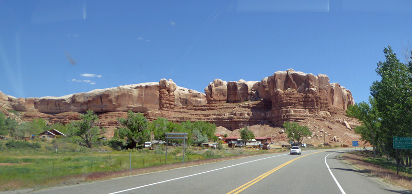
We turned east on County Road 262 and followed the signs (and the GPS) through a series of twists and turns. Part of this road was FULL of pot holes so we drove really slow. Other parts were in great shape. We asked at the Visitor Center why there was so much difference in one section versus another and they said it had to do with whose jurisdiction you were in—County, BLM, or Reservation. In any case, the roads take you to Hovenweep NM which is nearly to the Colorado border.
Hovenweep has a nice 30-site campground with no hook ups and only one water spigot up by the bathroom. Some of the campsites are designated for RVs only but they were all full. Instead, we found a nice side-pull through spot which turned out to be much easier to get into than the RV spots which were arranged perpendicular to the road rather than at an angle. We were very surprised at how full the campground was it being mid-week and all. It turned out to just be luck. The next day the place emptied out and there were LOTS of open spots at the same time as we had arrived the day before—including most of the RV only sites.
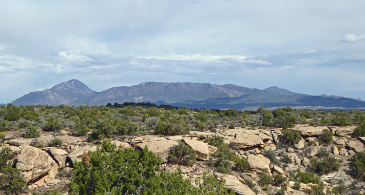
We had a nice view of the Sleeping Ute Mountain from our site. For those who have problems seeing such things, his head is on the left and his toes are on the far right.
We set up camp and had lunch and then decided we’d check out the Visitor Center. One of the nice things about the tour we were making this spring is that most of our drives were under 200 miles—often WAY under. This meant that we arrived at our destinations fairly early and we weren’t tired from the drive. So we’d often set out the first afternoon to check things out.
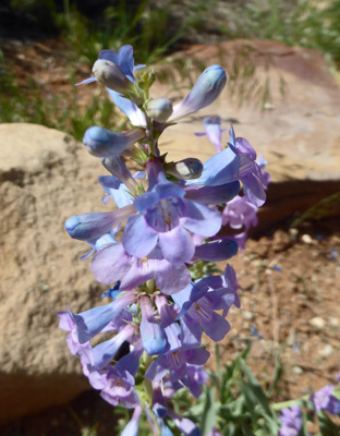
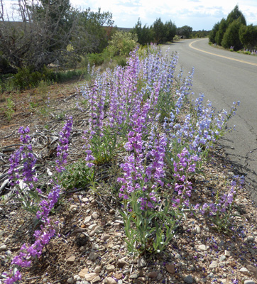
We watched the movie about the park and then took the short paved trail down to the canyon rim. Along the way I stopped to photograph some Broadbeard Beardtongue (Penstemon angustifolius).
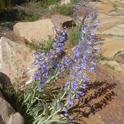
There was tons of this in bloom on the verge of the roads leading to the park and within the park. It’s very pretty stuff.
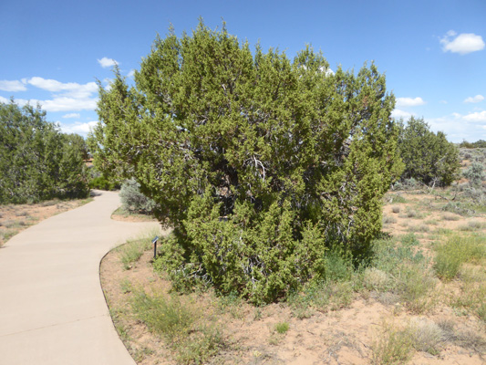
The bulk of the trees here were Utah Junipers.
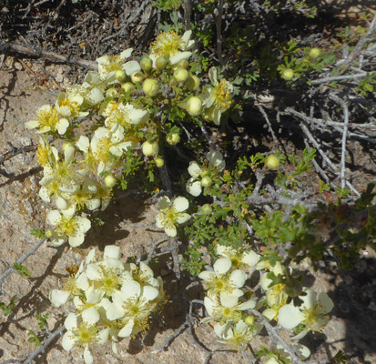
There were a few Stansbury's Cliffrose (Purshia stansburyana) along the way too.
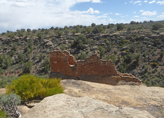
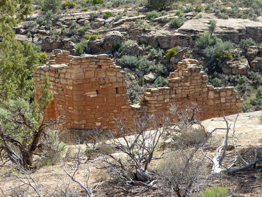
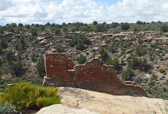
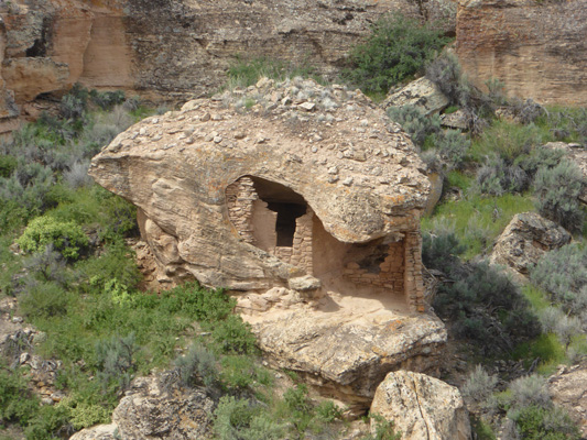
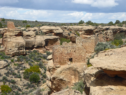
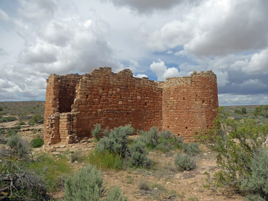
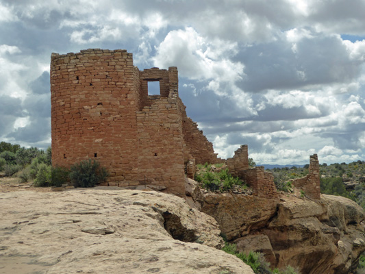
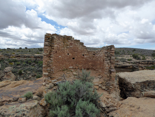
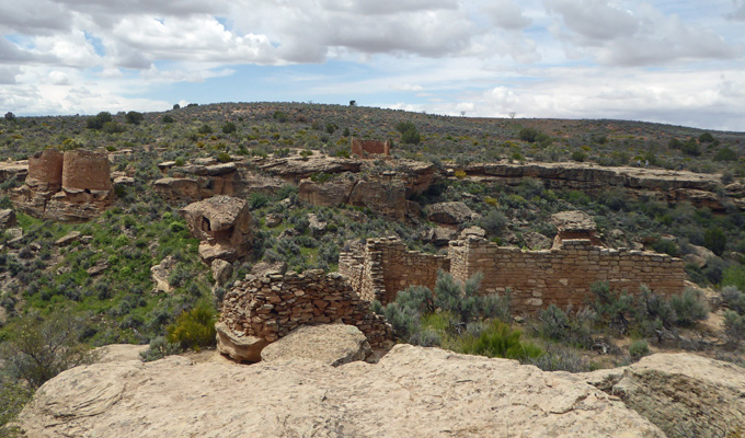
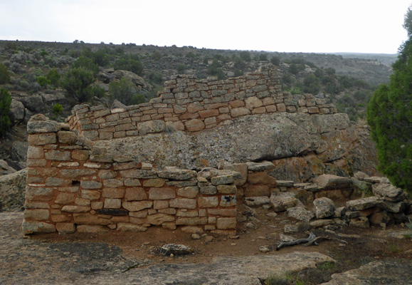
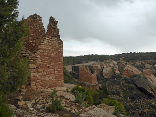
The paved trail ends at the Stronghold House. It was named for its fortress-like appearance. What you see is actually the upper story of a building that continues down the slope.
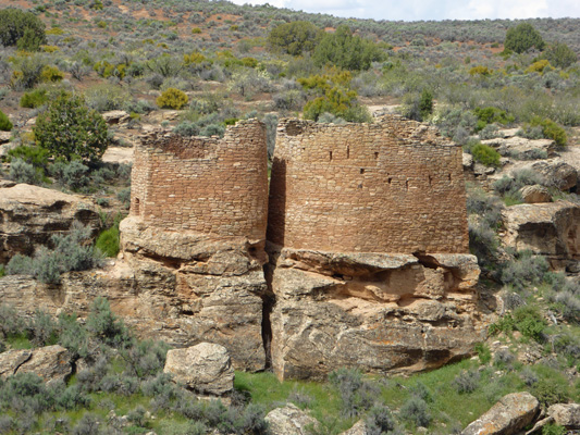
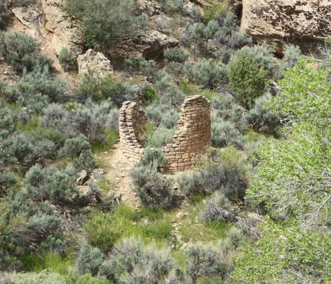
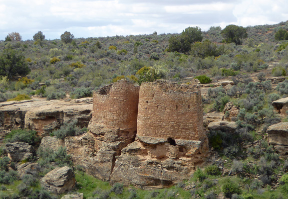
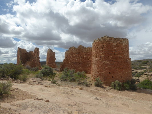
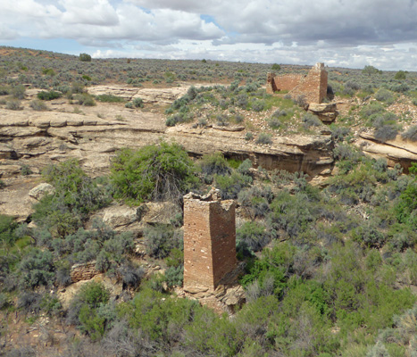
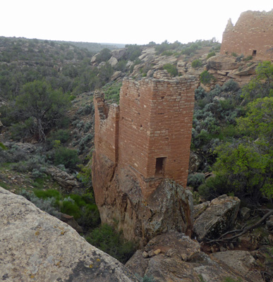
Across the canyon we could see the Twin Towers.
One tower is oval and the other is horseshoe-shaped. The two towers had 16 rooms combined and are considered some of the most carefully built structures of the era in the southwest.
Down in the canyon itself you can is Eroded Boulder House which is just plain fun.
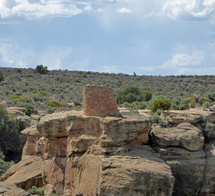
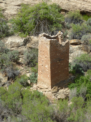
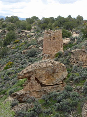
Farther down the canyon rim you can see the tower on Tower Point.
We walked a little ways to down the trail and got a different view of Stronghold House before we returned to the Visitor Center.
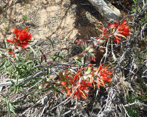
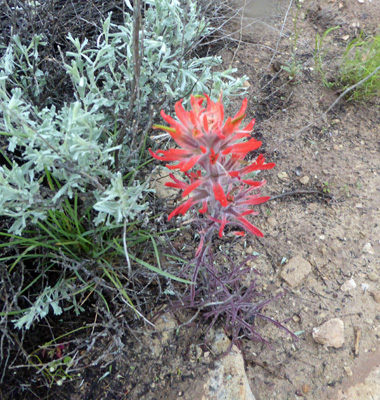
On the way back up the hill we found some Desert Paintbrush (Castilleja chromosa).
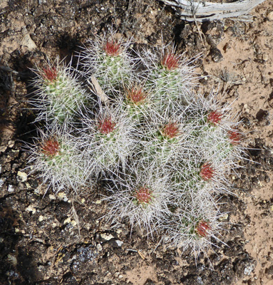
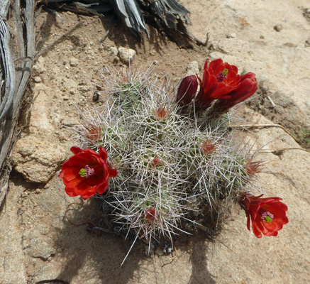
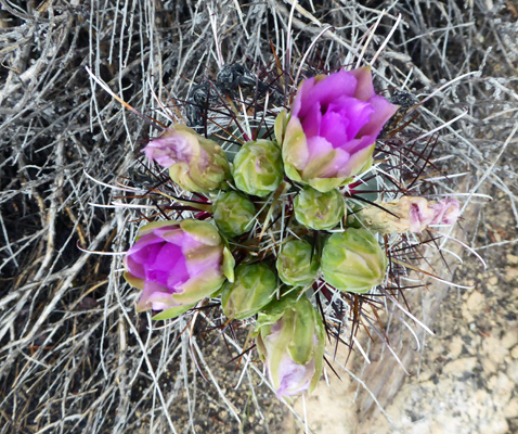
And a Scarlet Hedgehog Cactus (Echinocereus coccineus) just getting ready to bloom.
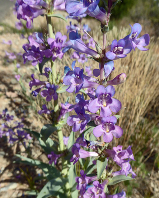
While Walter took his nap later that afternoon, I took a stroll up along the Park Road to take more photos of the Broadbeard Beardtongue (Penstemon angustifolius) growing along the edge of the road.
The sun was really bright which made it a bit of a challenge but it was worth it.
The next morning it was a bit cloudy and there was a chance of showers. So while there was a sunbreak we went back to the Visitor Center to take the Little Ruin Trail from Stronghold House out to Hovenweep House and back. The trail itself is a loop that circles the canyon but there’s a section where you have to go DOWN into the canyon and back UP again that was very steep and rocky and we decided that we’d both be happy with doing just one side of the canyon.
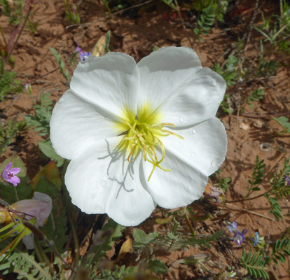
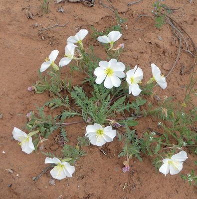
This time we saw some White-stem Evening-primrose (Oenothera albicaulis) in bloom.
Stronghold House looked different in the morning sun so I had to take another picture of it.
And Twin Towers were sharper looking too. You can easily see the slit windows in the walls of the right-hand tower. I love how carefully the towers seem to grow out of the rocks they sit on. This is really organic looking architecture.
Along the trail there were some huge Stansbury's Cliffrose.
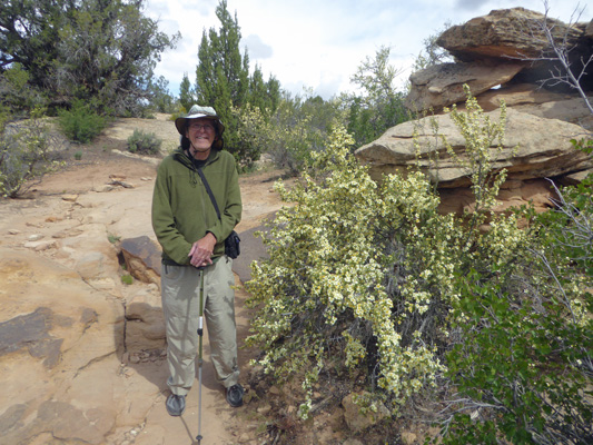
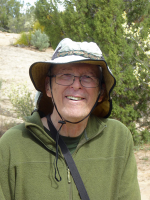
And while I had him smiling I got a photo of the birthday boy. May 8th was Walter’s 83rd birthday. He’s looking good and still going strong.
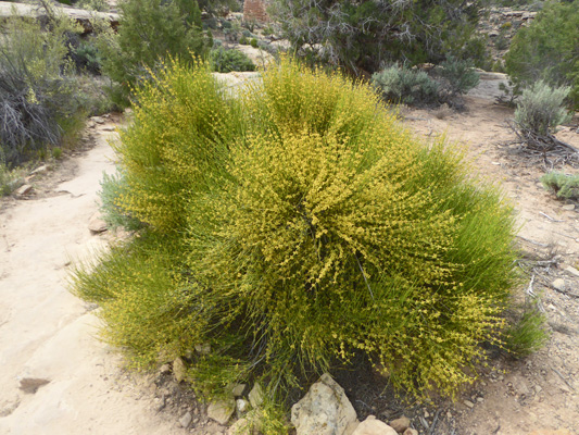
The Mormon Tea (Ephedra viridis) was in full bloom.
As we went along the trail we got a great view of Eroded Boulder House. It’s whimsical shape is a cross between a Hobbit house and a kids playhouse.
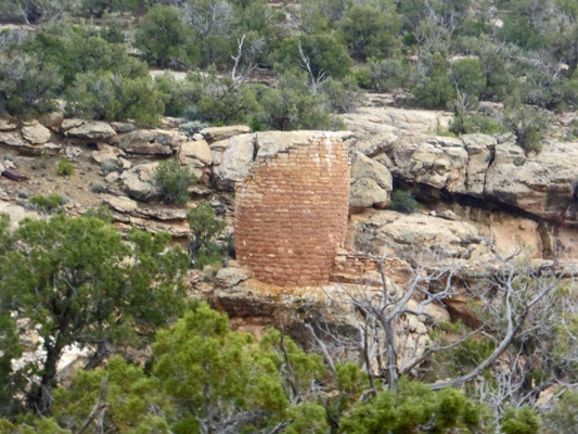
There were several partial towers you could see down in the canyon. Notice how this one is made with a double wall. It’s almost perfectly round which I guess is unusual.
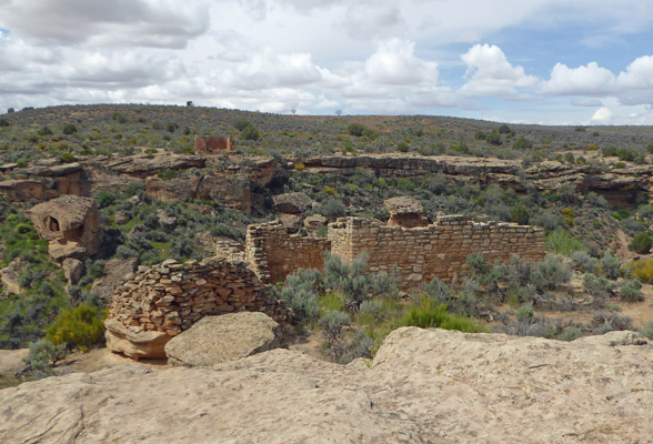
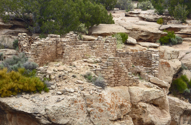
Unit Type House is the name archeologist gave to a basic building plan they identified early on in the southwest. This ruin is seen as a perfect example of this type. There were a few living and storage rooms and one kiva—just right for a family or small clan.
Here’s a view of it from the side as you approach it.
And here it is from the back.
I found a Scarlet Hedgehog Cactus (Echinocereus coccineus) in bloom along the trail.
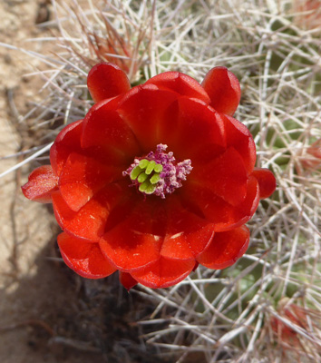
Here’s a close-up of the flowers.
Here are the Twin Towers from farther along the trail. You can really tell they’re not round from here.
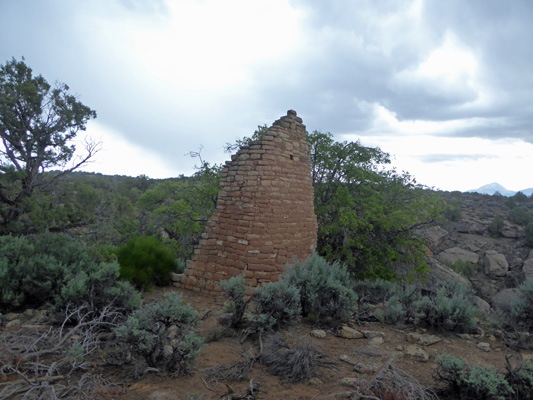
Rim Rock House is just up the canyon rim from the Twin Towers.
They don’t believe that this was actually a house at all since there are no apparent room divisions. It has a lot of oddly angled slit windows that they don’t know what they were for. So go ahead, make up a story about what it was for.
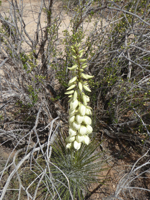
There were a few Navajo Yuccas (Yucca baileyi) in bloom.
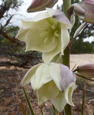
Here’s a close-up of a flower on a different plant which was fully open.
There were Sego lilies (Calochortus nuttallii) in bloom too. We saw quite a few on our way to the park too.

And more White-stem Evening-primrose (Oenothera albicaulis).
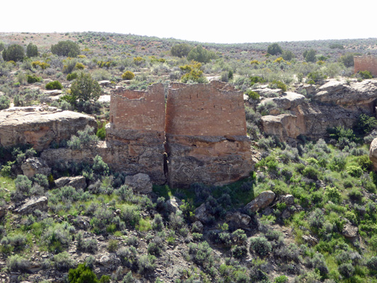
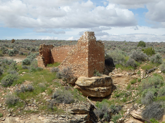
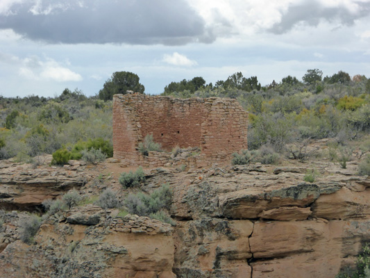
Hovenweep Castle sits on the rim of the canyon. It consists of 2 D-shaped towers with walls that are two and three courses thick.
It looks very different from different angles.
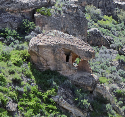
Just past Hovenweep Castle you can see Square Tower part of the way down in the canyon.
It sits on a large boulder and has a T-shaped doorway that faces west. A seep is nearby which is year-round and was no doubt was very important to the community here.
Hovenweep House sits on the rim past the Square Tower.
From here you get an interesting view of Hovenweep Castle as you look back down the canyon.
We turned back here. The trail continues on around the canyon and past the Rim Rock House and the Twin Towers to complete a 2-mile loop. It’s just as well that we turned back since it started to rain before we would have finished the loop.
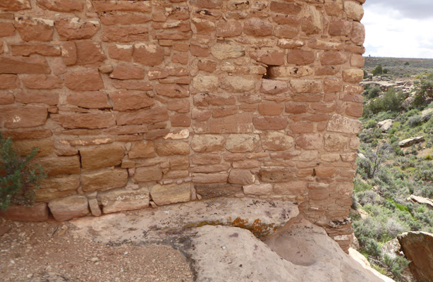
As we walked back I stopped to take a shot of the masonry-work at the base of the tower. Look how everything melds with the underlying rock.
Looking back where we had come from you could see both the Square Tower and Hovenweep House.
Walter found a rock ledge to sit on and I headed out the Tower Loop Trail while he rested. The map said that the loop would take 20 minutes. But I guess I was walking fast because I had completed the loop and walked back to where I had left Walter before his watch said that 15 minutes were up and it was time to head back up the trail to meet me.
The loop trail takes you out to see the remains of the tower sitting out on Tower Point.
You also get a different view of Eroded Boulder House where you can see the side wall that would have helped enclose it. Behind it is on of the Twin Towers.
You also get a different view of Rim Rock House.
Following the trail around you get a different view of Unit Type House too.
On our way back, we stopped to rest a while and enjoy the view near Unit Type House and I got this nice view of it and Eroded Boulder House, Twin Towers and Rim Rock House all together.
We stopped by the Visitor’s Center on our way back and the Ranger suggested that we could take the drive to Holly Unit because we had a 4-wheel drive truck. There’s an 8-mile round trip hike to the Holly Unit that started right by our trailer. Clearly we weren’t going to hike that far and so a drive seemed like a good option.
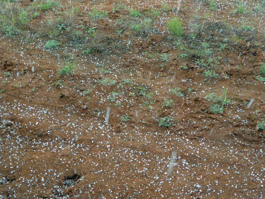
So after lunch we headed out. It had stopped raining when we left but we had a shower as we drove east into Colorado along Hwy 413. By the time we came to the turn off to the Holly, Horseshoe and Hackberry Units it was hailing.
The road was dirt but it wasn’t slippery so we drove on and got a view of the Horseshoe Unit from the road.
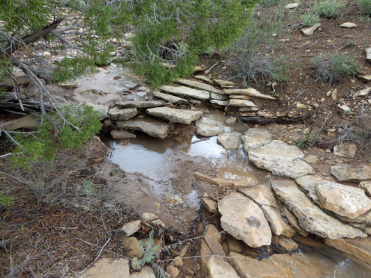
It was raining lightly when we arrived at the parking lot for the Holly Unit, so we put on our rain jackets and made our way along the short trail. There were 3 little creek crossings where springs trickled across the trail.
And I found a Smallflower Fishhook Cactus (Sclerocactus parviflorus) just coming into bloom.
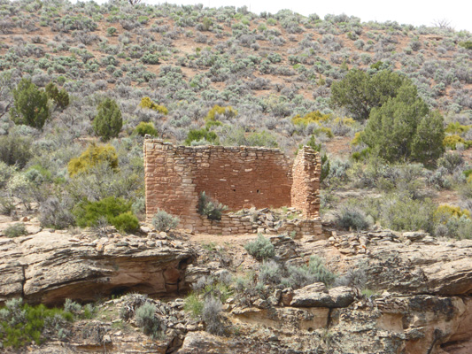
We came around the bend and got a nice view of the first section of the Holly Unit. Look at how the far wall is positioned along the rocky ledge.
There was a square tower down in the canyon a ways perched on an interesting outcropping.
Around yet another bend you got a view of another small tower.
And then we came to a bigger structure where you could see the square tower down below—and of course it turns out it’s not square at all. It’s a rectangle at least from this side. You may recall on the other side the far wall looked like two towers next to each other. But hey, it’s not a round tower at least.
By this point it was raining pretty hard so having seen all the structures here we turned back.
We saw a bit of Desert Paintbrush (Castilleja chromosa) along the way.
Once we were back at the truck the real adventure began. First we had to get out of the very rough parking area. I got us turned around okay using 4–wheel drive but things were getting slippery in the rain. We held our breath and made it through a narrow gate (whew) and then on down the road. Thank god for the 4-wheel drive. The road had turned to slippery wet clay and it was a case of slip sliding away all the way back to the highway. We didn’t get stuck. We didn’t run off the road. But boy did we pick up a lot of mud on our running boards.
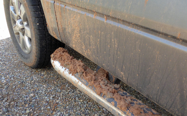
The tires got cleaned off driving on the highway on the way back but you can see that the truck was none too clean itself.
While I held it together for this drive just fine, I did notice that a few days later I wasn’t real excited about driving any more dirt roads—even when they were dry. One Mr. Toad’s Wild Ride was enough for me.
It rained hard off and on in the night but the next morning it had stopped. From here we made out way up to Moab by going east on Hwy 413 to Colorado and then up Hwy 491 back into Utah and Hwy 191 on north. The Ranger said that the road this way was way better than the one we had come on and he was right.