
It was in the high 70’s and sunny when we set up in our site in the shade of several nice Ponderosa Pines.
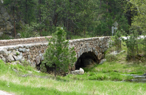
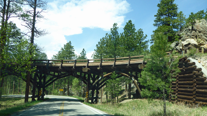
On Thursday May 17th, we set out to drive the Wildlife Loop Road which takes you through the open country in the southern portion of the park where wildlife abounds. This park has a lot of lovely stone bridges built by the CCC during the 1930’s. This one is just around the corner from Blue Bell.
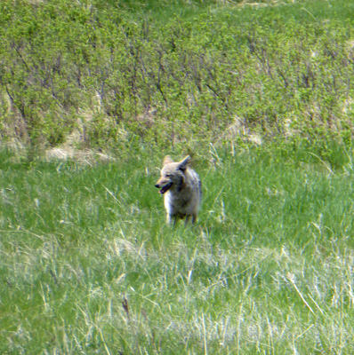
We hadn’t been on the Wildlife Loop Road long at all when we spied this coyote out in an open field. Later I saw one hunched over a prairie dog hole ready to pounce!
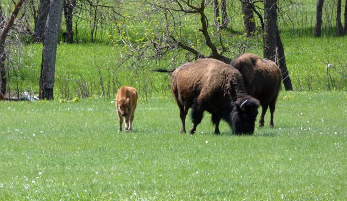
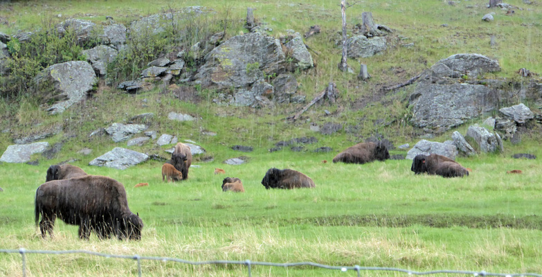
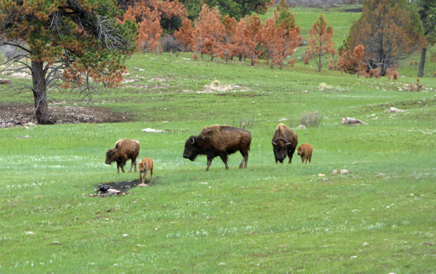
The park has about 1300 head of bison and most of them hang out in the grassland along the Wildlife Loop.
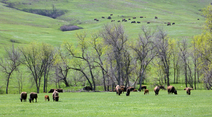
It was spring so there were lots of ‘red dogs’ as the baby bison are called.
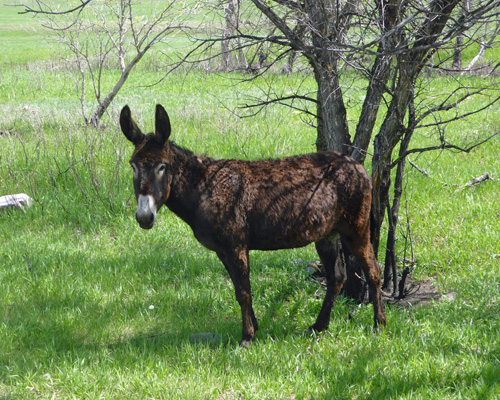
Once upon a time the park offered trail rides on donkeys up to the top of the highest peak. When they stopped offering the rides they turned the donkeys loose in the park. There were about 8 of them hanging out near a bend in the road.
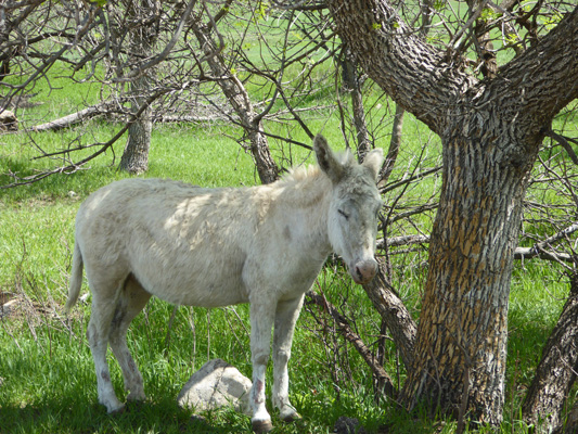
This guy sure looked lovely to me. I guess I like the white around the eyes and the white nose.
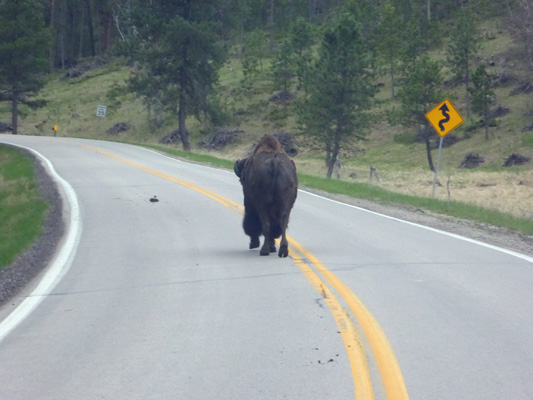
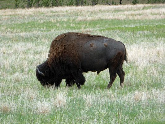
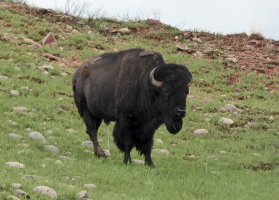
Just across the road from the Wildlife Station Visitor Center, there was a nice big bison posing for the tourists.
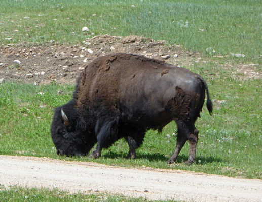
It doesn’t seem to matter have many bison I’ve seen I always get excited about seeing one of these big guys.
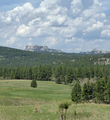
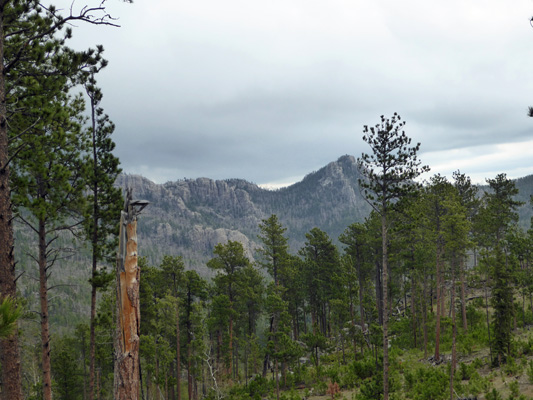
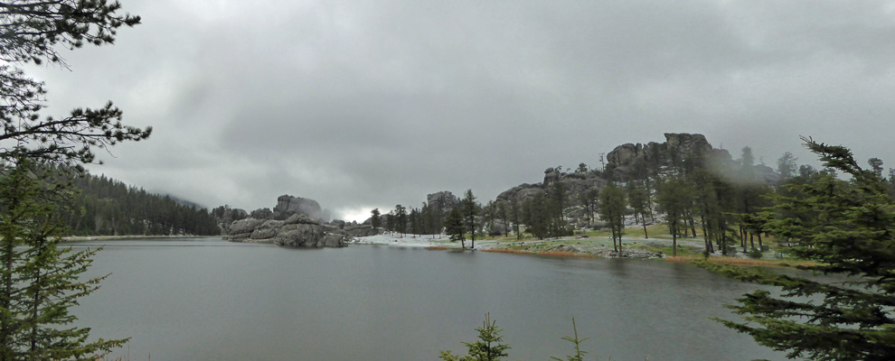
Having completed the Wildlife Loop (and thoroughly enjoyed it) we made the jog on Hwy 16A which becomes Iron Mountain Road which twists and turns its way north toward Mount Rushmore. Here the prairie gives way to the rocky outcrops of the Black Hills.
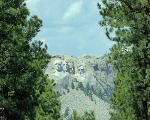
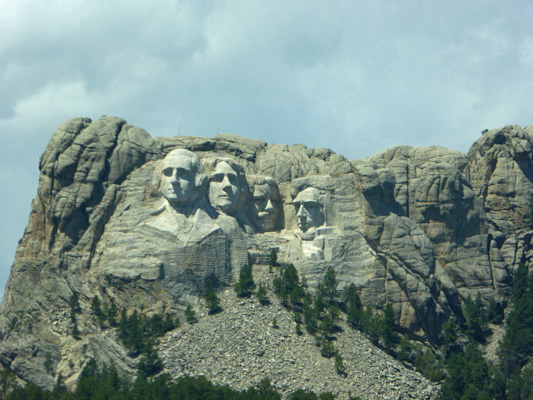
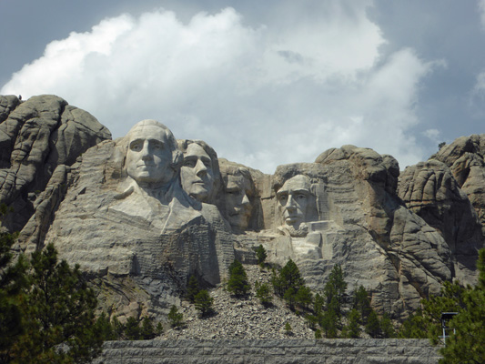
We drove on, and off in the distance we got our first glimpse of Mount Rushmore—on the big mountain on the left hand side.
Well, okay here’s a close up for you.
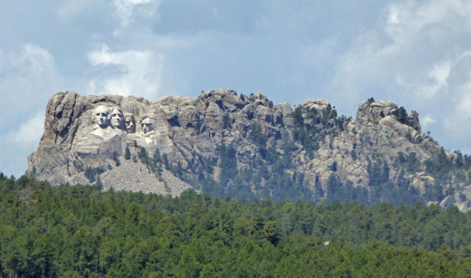
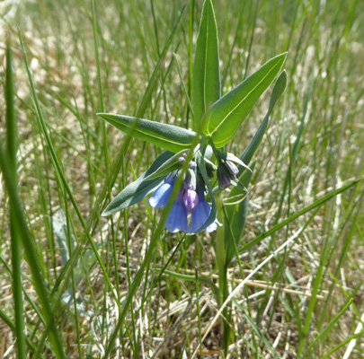
I’d never realized it was part of such a large wide mountain. There were blue bells in bloom in the grassland. There are too many different blue bells that grow here for me to figure out which one this one is. So we’ll just say it’s a Mertensia and call it good.
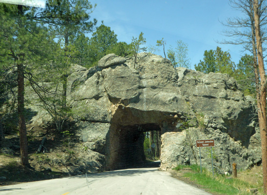
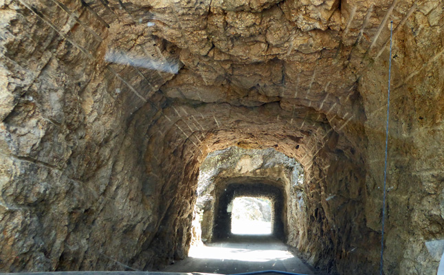
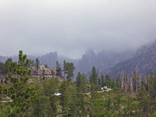
The CCC blasted 3 narrow tunnels through the mountains when they built this road. And all give you a view of Mount Rushmore (two heading north and one on the road heading south). This is the Scovel Johnson Tunnel which is only 13’ 2” wide and 12’ 4” tall. Needless to say they warn folks about taking large RV’s on this road.
When you come out of this tunnel here’s the view of Mount Rushmore you get. Actually you see this from inside the tunnel but you have to wait to take a photo until you come out.
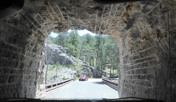
The next tunnel is the CC Gideon Tunnel at 13’ wide and 11’ high. It’s really two tunnels.
And of course these are single lane so there was someone waiting when we came out.
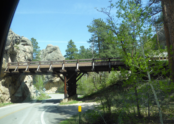
The road also has 2 pig-tails where a bridge takes you over the road before you curl back under it to loop the loop.
After the Doane Robinson Tunnel we got another view of Mount Rushmore.
And another pigtail bridge.
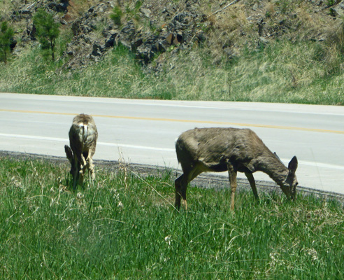
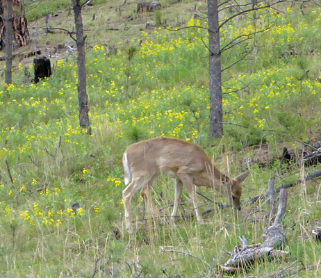
Around the next bend there were mule deer!
It’s not long until you hit the nice new wide Highway 244 which leads you to Mount Rushmore itself. The parking area for Mount Rushmore is run by a concessionaire so we actually had to pay to park. It wasn’t very full but my mind kept going to what it must be like in the middle of the summer when the place is swarming with people. Yikes!
I admit to having mixed feelings about Mount Rushmore. The idea of carving faces of Presidents into the sides of mountains seems like a really strange thing to me. It was beautifully done which is what saves it for me, but I still think it’s pretty darned weird.
The folks here in South Dakota are very proud of Mount Rushmore and have raised a lot of money to make the monument entry and viewing area very fancy.
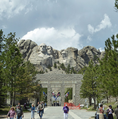
It’s all done in the same gray granite as the carvings themselves.
As you proceed up the promenade you get a different view of the mountain.
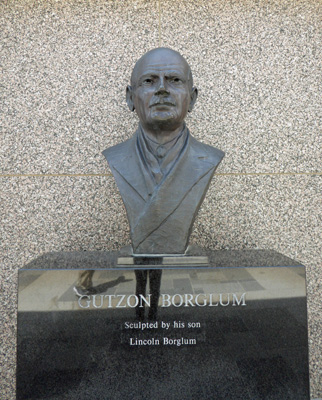
Along the way there is a memorial to Gutzon Borglum, the sculptor who did the carvings.
And then you arrive at the main viewing area.
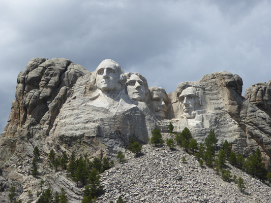
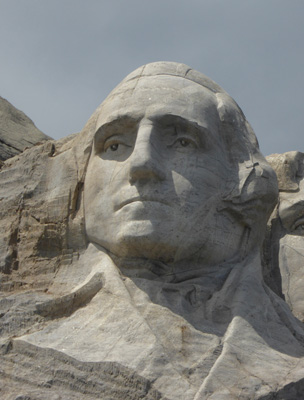
I took a series of close ups of the carvings.
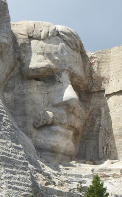
Here’s Washington
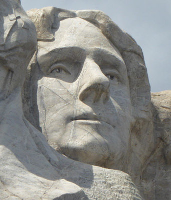
Jefferson
Roosevelt
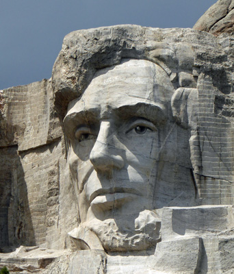
And Lincoln
The clouds were beginning to gather for afternoon thunderstorms so we hustled back to the car so we could see the Crazy Horse Memorial before it rained. This is a private project set up in 1948 as a non-profit with the intent of not receiving any money for the government. For many years all the work was done by a single fellow, Korszak Ziolkowski, who had 10 children who grew up to help him. Seven of them (I think) plus some of the grandchildren are now involved in the management and continued work on the memorial. He died in 1982 and his widow and his kids have continued on with the project.
Crazy Horse’s face was finished and unveiled in 1998.
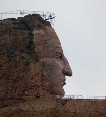
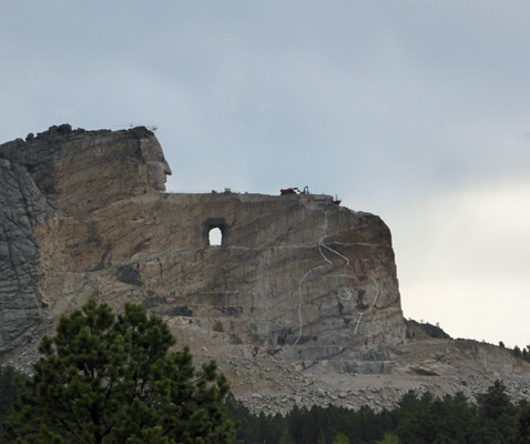
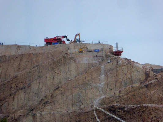
This is a HUGE project. All of Mount Rushmore (as in all 4 heads) could fit in Crazy Horse’s head. The mountain crew (as it’s called) works year round blasting away rock and then doing the feathering work to smooth the sculpture. It looks like they are currently working on his outstretched finger and the horse’s head.
They have a very nice, highly informative movie which we watched and then we wandered through their Museum of the North American Indian and their very high end gift shop. It was raining so you couldn’t take the tour bus out to the foot of the carving but I did get this shot of the work on the top of the mountain.
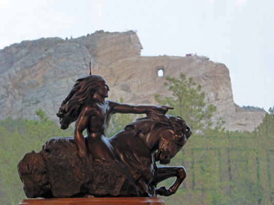
Ziolkowski was a well regarded sculpture who had worked on Mount Rushmore. He was invited by Chief Henry Standing Bear to carve Crazy Horse. They have several bronzes of his work on the grounds.
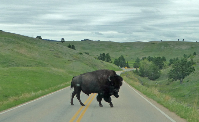
It was raining by now and we were tired so we drove through the town of Custer and got gas and then headed back to Blue Bell. And ran into a bison jam! There wasn’t much of a back up but we did have to follow this fellow for a while before he decided to actually cross the road rather than walk down the middle of it.
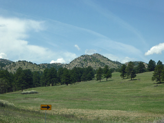
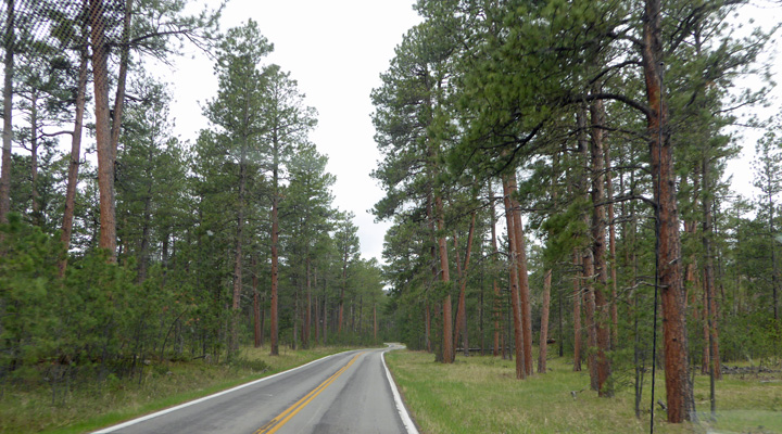
Friday May 18th, we did laundry in the morning and then set out to drive the Needles Hwy in Custer State Park before the afternoon rains came. This road starts just past Legion Lake area and goes north through Ponderosa pines.
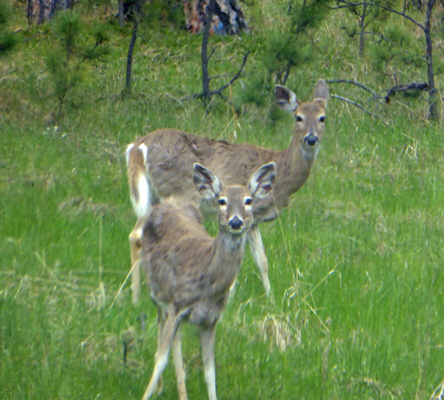
We saw white tail deer grazing in the forest floor.
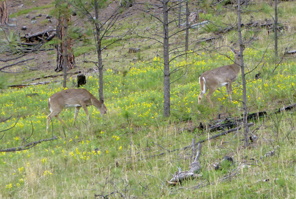
Their white tails are really long in comparison to mule deer.
These yellow flowers were in bloom in huge swathes in the upper reaches of the park along the Wildlife Loop and we saw tons of them growing in among the Ponderosa.
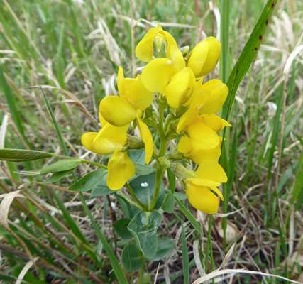
They’re Golden Bean (Thermopsis rhombifolia).
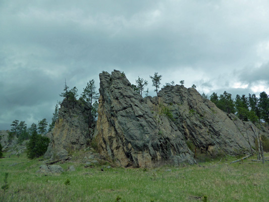
Now and then there would be large outcropping of stone.
And then the grassland and the trees would return along with the deer. They’re not curious or anything...
There were really nice stands of Ponderosa.
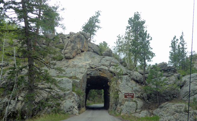
The CCC did their thing on this highway too. In fact, the tunnels here are even narrower than those on the Iron Mountain Road. The Iron Creek Tunnel is just 9’ wide and only 11’ 4” high. And it had a jog in the middle too.
The clouds were coming in but we did get a glimpse or two of the mountains to the north.
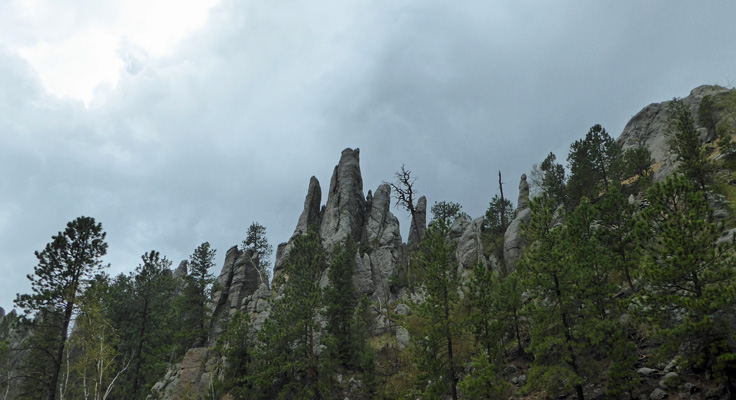
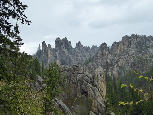
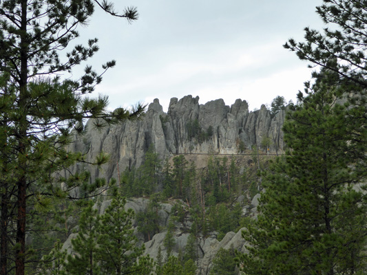
The road winds around and the clouds got thicker just as we got to the actual Needles.
And the sky opened and it hailed and poured and generally was exciting, making photo taking beyond challenging. So we pulled over in a turn out and had lunch. And the sun came out for just a moment so that I got one sunny photo.
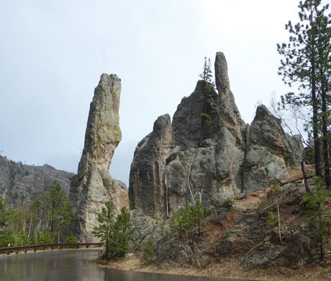
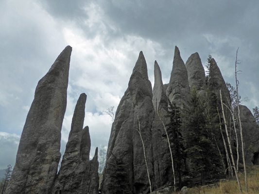
We turned back to the main Needles parking area (there’s a trailhead here) and I got out in the rain and took a few photos. This area is known as the Cathedral Spires.
And the trail takes you out among them. A fellow came running back soaked to the skin which was a good clue that this was NOT a good day for a hike.
We drove on and I grabbed photos when I could.
We stopped at a pull out and I shot this photo across the canyon. The flat line mid-picture is the road. And a full-sized tour bus had just disappeared into the tunnel on the left where the line ends.
We drove round the curve and entered the tunnel to find the bus moving very very slowly thru the other end.
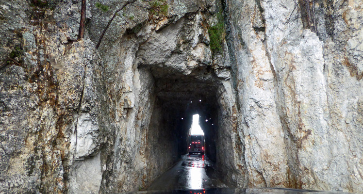
This is the Needles Eye Tunnel. It’s only 8’ 4” wide and 11’ 3” tall. To put this in perspective. We measured the distance from side-view mirror to side-view mirror on the truck and that’s 8 feet exactly. I was glad to have the excuse of a slow bus so I could go slow too. There was a traffic jam on the other end since there’s a parking area plus the bus and the folks who were waiting on the other end to come thru and people directing traffic because of the bus!
We drove on to Sylvan Lake where the hail had accumulated pretty deeply.
The bus was in the parking area at Sylvan Lake and it had its side view mirrors pulled in and their paint was scraped clean off in places. I’m sure this is due to more than one trip through the tunnels but still...
The road winds out of the park for a while and you pass a private bison ranch.
When we got back to the campground it hadn’t rained at all there. That’s the thing about weather like this, you just never know.
The campground filled up on Friday night and it got COLD (low thirties). The forecast was for a high of 45 to 48 so we decided it was a good day to visit Wind Cave National Park since the cave has a consistent temperature of 54 degrees.
This is the shoulder season in South Dakota so they only offer one of the many different tours that they offer in the summer time at Wind Cave. We arrived about 12:30 hoping to get a spot on the 1:30 tour. It was full already and they’d just sold the last 4 tickets on the 2:00 tour (which they’d added because it was so busy) so we got tickets on the 2:30 tour. Clearly we were not the only folks who thought that going to the cave was a great idea on this cold day.
Walter asked the ranger where we might see some wildlife and he sent us on a drive back up Hwy 87 to near the border with Custer State Park and then we made a right turn on the unpaved NP5. On the way we saw a lone bison.
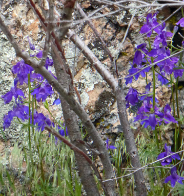
And a bunch of two-lobe larkspur (Delphinium nuttallianum) growing along the road.
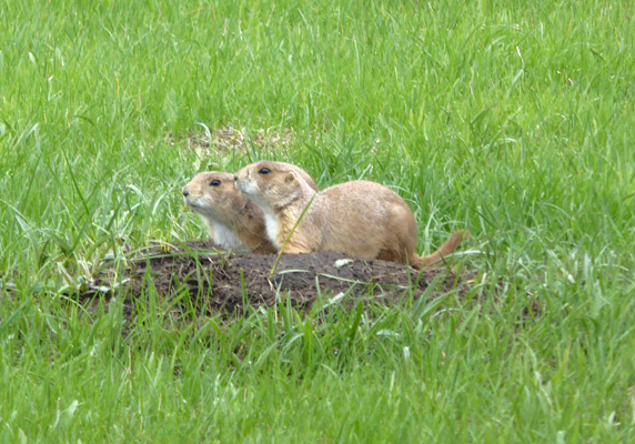
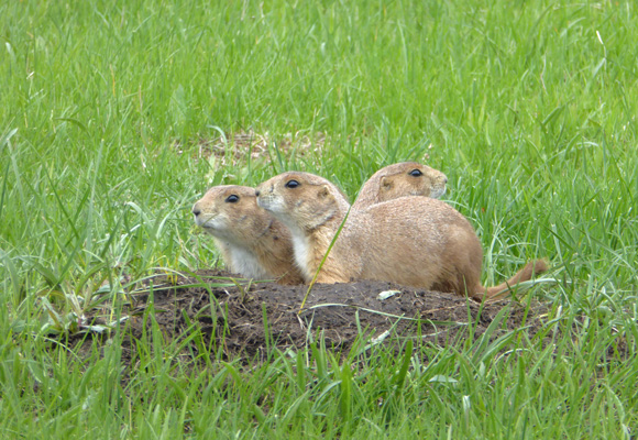
Not far out on NP5 we came to another huge Prairie Dog Town alive with the little guys.
These two were kind enough to stay still (which was remarkable) while I grabbed a photo.
And then a third one popped up and I get all three at once. Score!
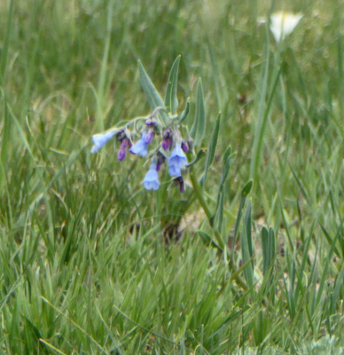
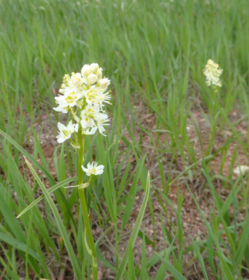
There were Oblongleaf Bluebells (Mertensia oblongifolia) in bloom in the mixed grass prairie.
This part of the grassland had burned in the big fire in December 2017. A power line had come down up at Legion Lake (north of Blue Bell) in high winds and when it was all over 50,000 acres had burned across the two parks and private land. The fire seems to have been stopped by the road here. On the left you have lush green post-burn prairie. On the right you can still see last year’s dry grass mixed in with the new grass.
Over the next hill and around a bend we came to part of Wind Cave’s herd of 350 bison—with babies.
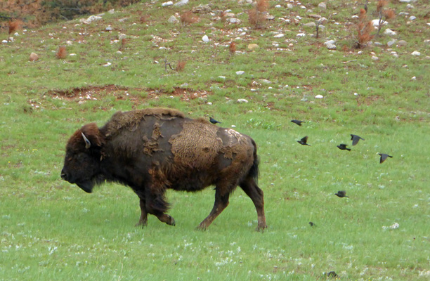
This guy had a whole flock of black birds in pursuit and when he/she slowed down then took up residence on its back.
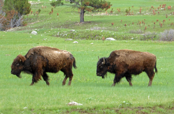
They were on the move and they’re so much easier to photograph when they’re pacing along.
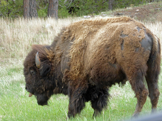
We drove on and ended up behind some folks in a rental car who spent a long long time taking pictures of this big old bull. So we got a chance to do it too. Note that he was sticking his tongue out.
And then there was his pal across the road.
The road goes out of the park and along the way I saw a field of what appears to have been Mountain Death Camas (Anticlea elegans).
We looped back towards the park on Hwy 101 (which isn’t paved either) and then took Hwy 385 back north to the Visitors Center. Just as we were approaching the Visitors Center this big old bison decided he just had to cross the road in front us of. So we let him.
We got back with time to spare and had our lunch in the car because it was still only in the mid 40’s—brrrr. We got out our winter hats and gloves and headed to the outdoor waiting area for our 2:30 Natural Entrance Tour of Wind Cave. Now that we’d seen most of the above-ground portion of the park it was time to see at least part of the underground portion of the park.
Wind Cave is a complex maze cave with hundreds of miles of passages all packed into 1 square mile. They have only mapped about 140 miles of the cave. But studies of the air flow indicate that over 95% of the cave hasn’t been explored yet!
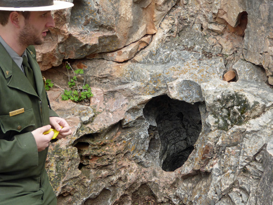
Wind Cave gets it’s name from the wind it creates breathing in and out depending upon the external barometric pressure. Settlers ‘discovered’ it when the cave blew the hat off of one of the local young men. The next day when they came back, it sucked his hat right out of his hand. As you can see, the natural entrance to the cave is pretty small.
The native Americans considered the cave sacred and the source of the bison (an involved story whereby the Great Spirit forgave some ne’re do-wells and instead of killing them turned them into the bison) so they didn’t try to enter it. But of course the settlers couldn’t resist and dynamited an entrance nearby and began to explore. They dynamited tunnels down into the bigger passages and began to give tours in the late 1800’s.
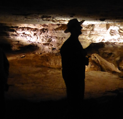
Our tour took us down those passages (widened by the CCC in the 1930’s) and down about 500 stairs.
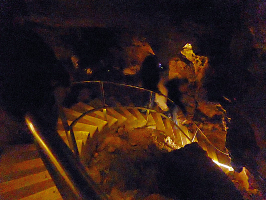
It’s narrow and the ceiling is pretty low in places so we all called to one another about places to duck and since it was pretty dark it was real nice to hear that a ramp had turned into steps before you got there.
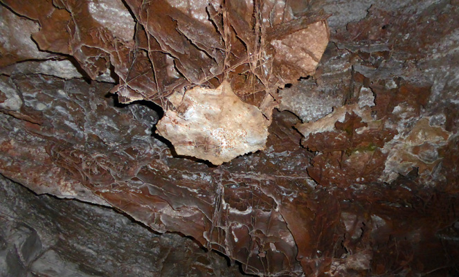
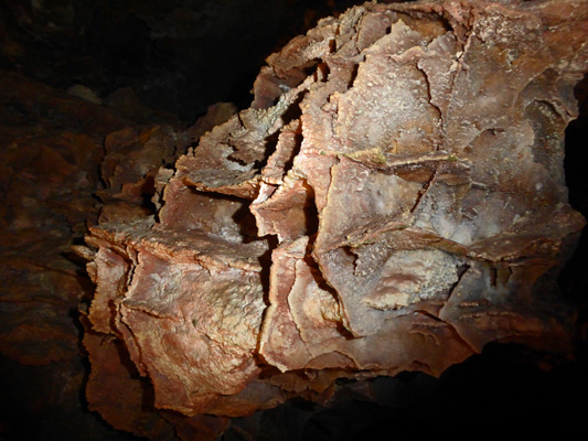
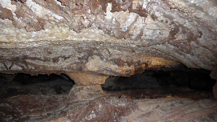
Wind Cave is not a very heavily decorated cave. It has very little flow stone because it’s a mostly dry cave. There’s a bit of frostwork here and there.
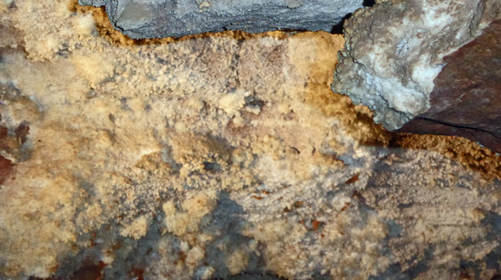
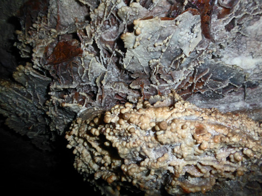
But what it is really known for is boxwork. 85% of the boxwork in the world is found in Wind Cave.
This is really interesting stuff. What it is is calcite which formed in cracks in limestone millions of years ago. When the cave was formed the limestone was washed away and the calcite remained. So these formations weren’t formed in the process of the cave being created like most cave features. These were formed before the cave was formed and then revealed as the cave formed.
The boxwork is really why Wind Cave is a National Park. Early tour guides who brought folks into the cave allowed them to take boxwork home with them. It’s brittle—about like a potato chip--and they had completely cleared off an entire wall of a large room in a few years. So folks convinced the powers that be to make this the first cave in the National Park system just to save the boxwork.
Here and there (sometimes on the boxwork itself) there’s a bit of popcorn.
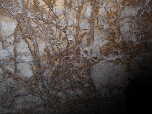
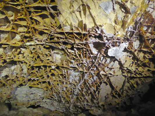
But the boxwork is definitely the star.
Some of the pieces are really pretty big.
And others are fine as spider webs.
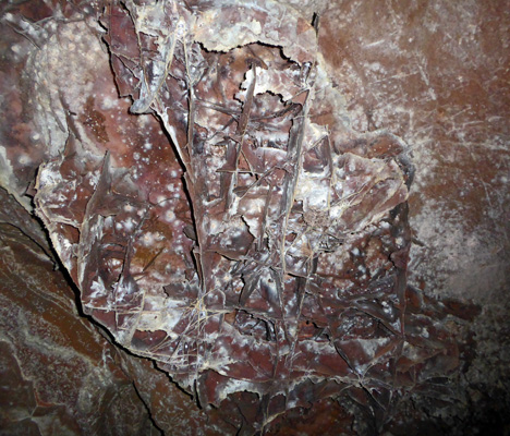
Some places it’s the whole ceiling that is covered and other it comes in streaks.
We finished up in the mid level of the cave where the ranger talked about the unexplored portions of the cave and tried to keep folks from wandering off all the enticing side tunnels there.
And then we took the elevator back up to the surface and hiked back to the truck.
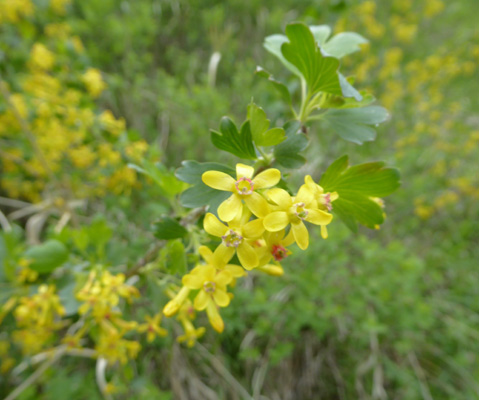
There was a lot of Globe Currant (Ribes aureum) in bloom.
But we didn’t linger long because it was so darned cold.
We drove back to Blue Bell in time to see folks loading up for the Saturday night Chuckwagon Dinner ride at the Blue Bell Lodge.
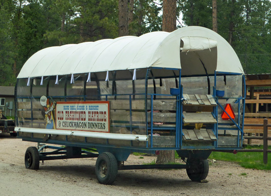
We decided that Custer State Park is the perfect place to experience what folks used to think of as an Old West Vacation. You can stay at Blue Bell Lodge (or one of the other 3 lodges in the park) in a little log cabin and go on the hayride and chuckwagon dinner and then during the day you can go on a trail ride starting at the stables at Blue Bell. It’s a dude ranch wrapped in a wonderful state park full of wildlife and cool geology—plus it’s within easy driving distance of Mount Rushmore and Wind Cave National Park. Such a deal.
We really enjoyed our time at Custer State Park and highly recommend it as a place to stay while exploring the Black Hills of South Dakota-whether you’re camping or not.