
There were dark clouds but the forecast said there was only a 10% chance of rain. Ha!
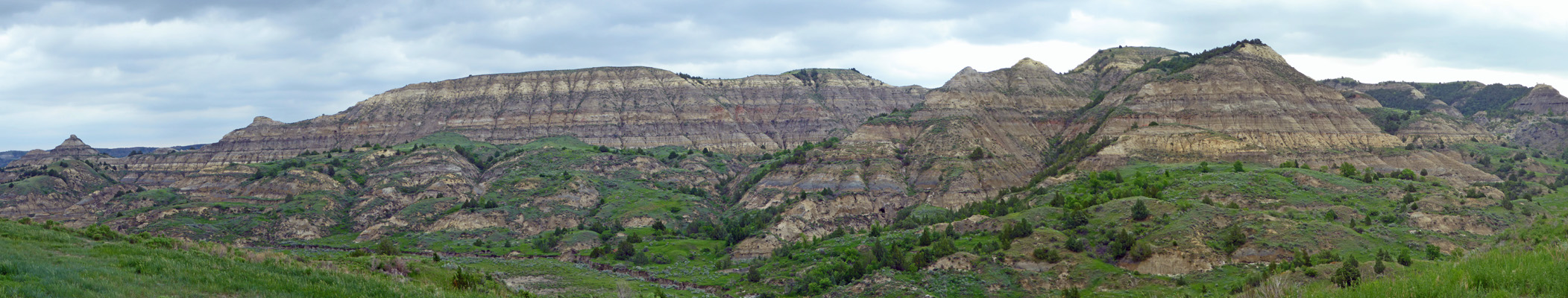
The rain held off as we drove into the park and stopped to take in the view. More badlands but at least these are a bit more colorful.
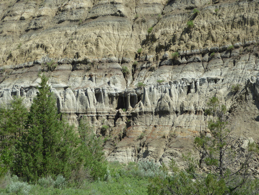
There’s a pull out with a great view of sections of the hills that have slumped. What happens is that the bentonite clay layer gets wet and very slippery and if there are enough cracks in the hillside it will get wet enough for the whole section to take off down hill. And then you get something like this.
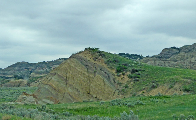
You can see up hill where this section used to be. It’s like a 3D jigsaw puzzle piece.
By the time we’d found the campground it was sprinkling and it rained while we dumped our tanks and topped off our water tanks but at least it stopped while we set up camp. We got the awning out and put out the generator and ran it in the rain which works great (better than the little tent we made) as long as the wind doesn’t blow too much.
We had one bar some of the time on my cell phone even with the booster but it never stayed long enough for us to get anywhere. So we were internet-free for a few days. It poured buckets and after two hours it got so bad we turned off the generator because it was getting wet even under the awning. Then the wind came up so we brought in the awning. But at least I had time to update my missives and Walter had a nap.
There was supposed to be a wedding over in the Group Campground that afternoon/evening. I hope it wasn’t a washout. They were putting up a tent when we drove by but it was not the kind of weather you’d want a lot of folks out in and it certainly wasn’t festive!
It rained and blew much of the night but by morning the rain was over. However it was still blowing like crazy. We put out the solar panel and weighted it down with one of the bars from our weight distribution hitch since we’d had it blow over once before when things were gusty. Then we set out to drive the Scenic Road in the park.
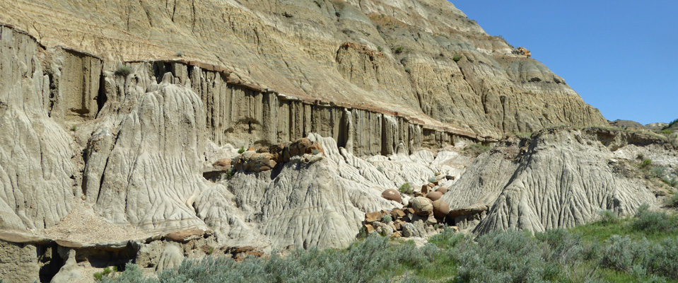
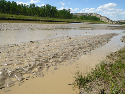
The first stop was just across the road from the campground where there are what are called Cannonball Concretions. (Notice the large puddle. That was from the heavy rain the night before.)
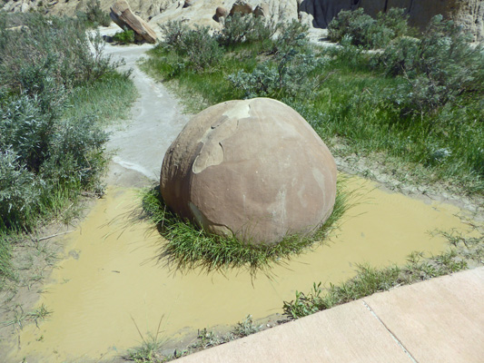
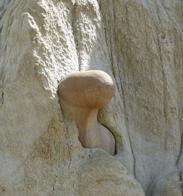
These lovely round cannon balls fall out of the hillside where they are embedded in an old creek bed where they had formed eons ago. Somehow tiny particle accumulated over time as the water dropped silt and you got these round balls. Cool.
Here’s another shot of a nice round one waiting for erosion to free it.
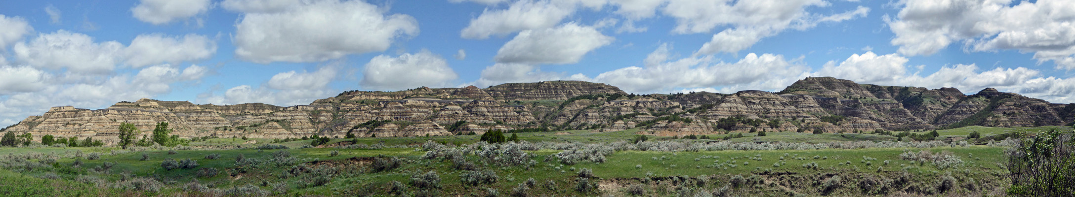
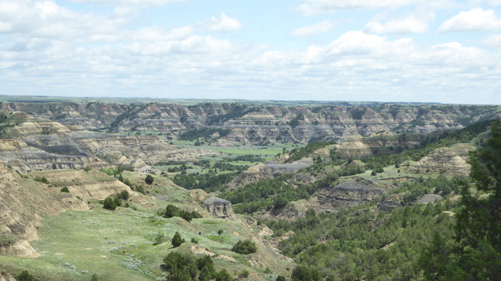
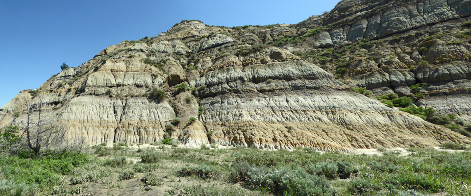
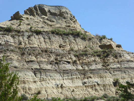
The view from the area is lovely. The badlands here have much more distinct striations than those in the southern unit.
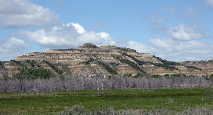
We drove on to the Layers In Time pull out where they talk about all the different layers that make up these badlands.
Most of these deposits are 25 to 30 million years old. There are fossils but of course no dinosaurs because they’re from a much earlier period.
There was a lone bison around the next bend and he was kind enough to pose so I could get him AND the badlands behind him.
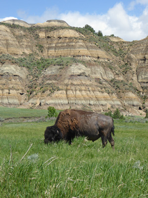
The herd here is not as large as in the southern unit but we saw about 20 or so of them along the drive.
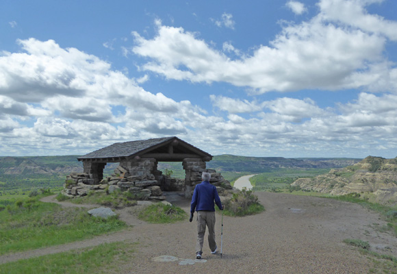
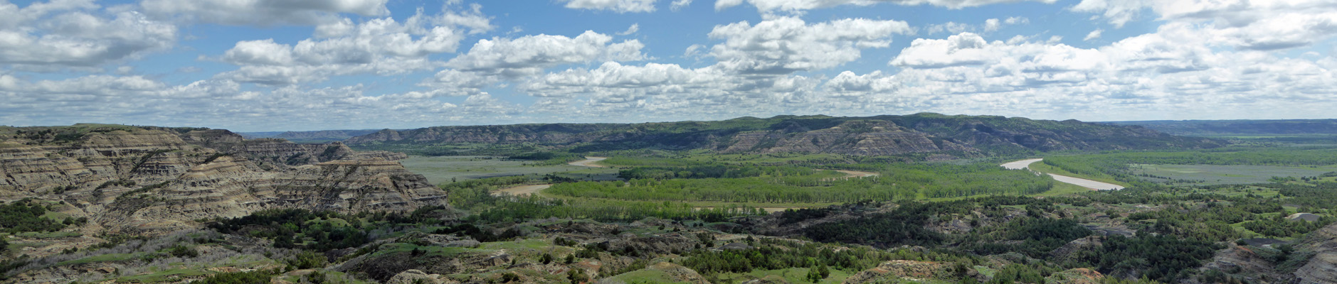
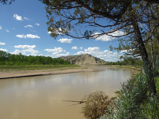
The River Bend Overlook has been popular here since the 1930s before the park existed. The CCC built this stone shelter so folks could enjoy the view after bumping out what I am sure was an interesting dirt road since part of the paved one was covered in mud from a recent landslide/slump.
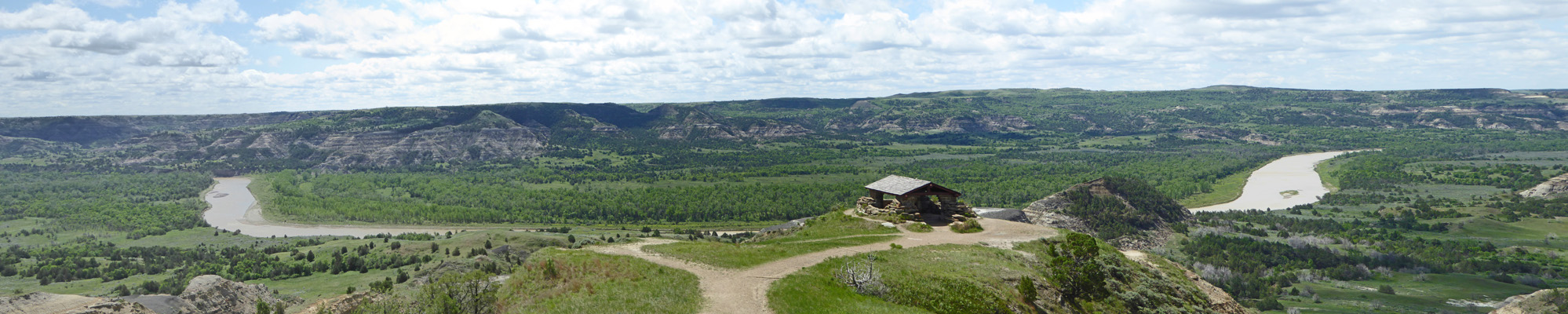
This is the muddy Little Missouri again which winds its way south like a twisting snake.
The stone shelter is still in great shape but it had a huge puddle right where you’d like to stand to appreciate the view!
The next overlook gives you a great view of what happens when the layers above the bentonite erode leaving the tops gray and bare. Bentonite is volcanic ash that forms a clay that can absorb many times its volume in water. All badlands have bentonite in them, it’s what makes a badland a badland really (or so a sign I read back on the Blue Mesa Trail at Petrified Forest National Park said). The wind was howling here. When I went to get back into the truck I had to use both hands and all my strength to get pull the door closed against the force of the wind on the door.
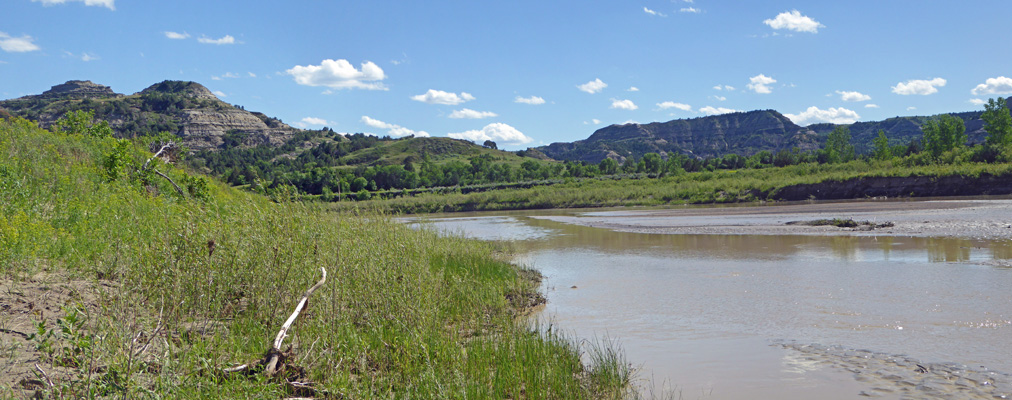
The road ends at the Oxbow Overlook. Here the Little Missouri not only curves, it does a bit of an S curve so if you look carefully you can see that it comes in on the left at the back of the photo, curves around in the middle of the photo, then swings left again and then comes across to curve around on the right. Back before the last Ice Age the Little Missouri turned north here and flowed into Hudson Bay. But the glaciers blocked it so it turned south instead and it continues on that path today.
Taking this photo was a real challenge because the wind was blowing so hard I had trouble keeping the camera steady. There’s a nice hike out to a point about a mile away where you can get a better view of the oxbow but neither of us thought that fighting the wind to do it sounded like fun at all. There were a few people out hiking but they were struggling to stay upright while holding on to their hats.
We drove back spying bison as we went and stopped at the little visitors center near the park entrance. It’s a single-wide trailer with a tiny gift shop, 2 rangers to answer questions and a seating area where you can watch their video. We watched the video which turned out to the be the one we’d seen in the south unit and then drove the 15 miles north on Hwy 85 to the oil boom town of Watford to get gas. The place is full of singlewide trailers and prefab duplexes and triplexes to provide housing for the gas and oil workers. It’s a pretty good sized town but it sure felt a lot like Texas!
The sun played peekaboo all afternoon but it was enough to charge the batteries so we didn’t need to run the generator.
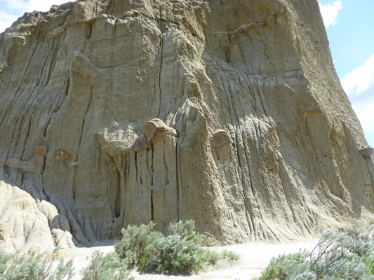
Sunday June 3rd, it was sunny and warm from the get go. It had been almost cold over night (47 degrees) but we were far enough north that the sun came up EARLY (actually we were in Central Time which we were ignoring so it was later than we thought) and warmed things up quickly. We drove back out to the Scenic Road and stopped when I realized there was a really great view of the cannonball concretions on the other side of the formation from the parking area. Walter waited for me while I hiked over and took some photos.
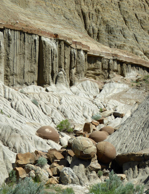
Here you can see the cool erosion patterns, the cannonballs sitting on top of the eroding clay layer AND a pile of fallen cannonballs.
Here’s a close up of the pile of cannonballs.
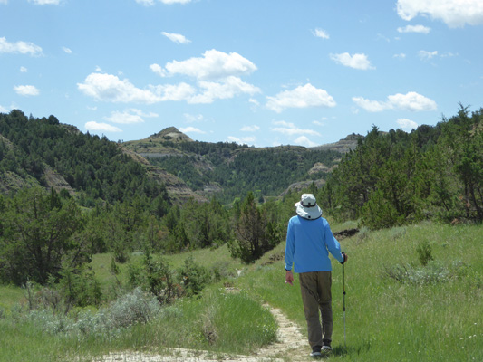
We drove out the Scenic Road a few miles to the trailhead for the Caprock Coulee Nature Trail. The Nature Trail is simply the first .8 miles of the Caprock Coulee Trail which is a 4 mile loop trail that takes you up to the River Bend Outlook and back down again.
The trail begins with a nice view of the badlands that the trail takes you out into.
It was warm and humid and the trail takes you gently uphill without you even knowing it. It was muddy in places so I imagine that it might have been pretty awful the day before right after the rain. We stopped and read the nature trail booklet at each of the numbered signs and this time the verbiage actually pointed out things on the trail for a change.
Like this ledge of sandstone that juts out of the clay hillside.
There are four kinds of cactus that grow here in the park which is remarkable given how far north it is and how cold it gets in the winter. There’s prickly pear cactus which wasn’t in bloom yet but was getting ready.
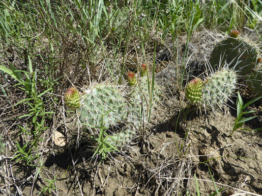
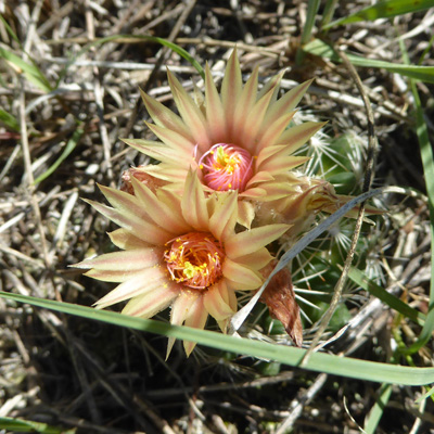
And this little tiny cactus that had lovely peach-colored blooms which covered the plant up entirely. It’s a Missouri Foxtail Cactus (Escobaria missouriensis).
Farther along you could really see the sandstone layers that make up the caprock really well.
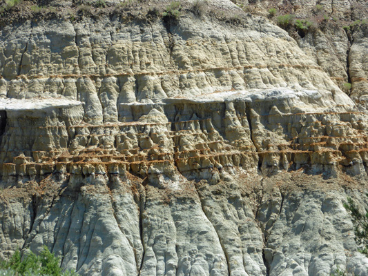
It’s called caprock because when the layers above it erode way, the sandstone acts as a cap to protect the softer clay below.
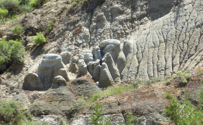
There were some fun hoodoos at the base of an area that had slumped down the hill.
And rivulet erosion had continued in one area to the point that it had created an area called piping.
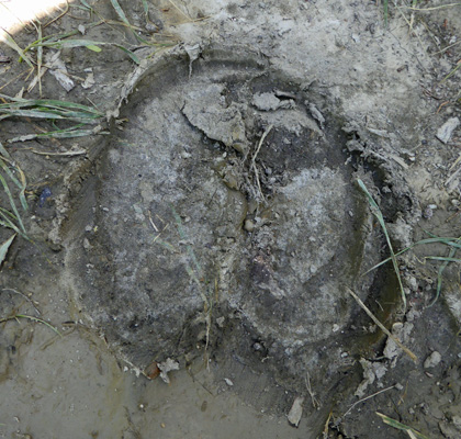
Things began to get muddier and we began to see bison prints in the goo.
Later on we met a hiker who had had to turn back and do the Caprock Coulee Trail in the reverse direction because there had been a bison standing in the middle of the trail. By the time he’d gotten back to that spot again, the bison had moved away a bit which just meant that he got more pictures while still being able to actually get by.
We didn’t see the bison. Instead we reached a point where it was just too muddy. It wasn’t far from the end of the nature trail and we were hot. So we found a little shade and rested for a while and then turned back.
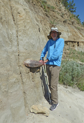
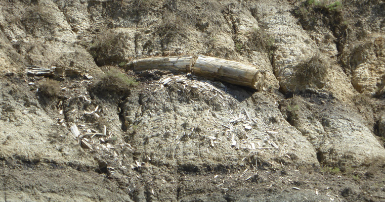
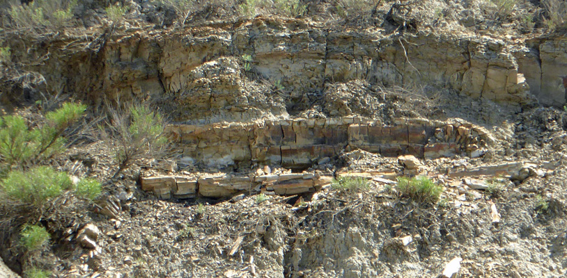
On the way back we stopped and really looked at the hillside where the booklet said there was petrified wood. And sure enough we found quite a bit all in the same layer.
Here’s a close up shot of the petrified log in the middle of the picture above.
And here’s another pair of eroded logs.
The view on the way back was nice.
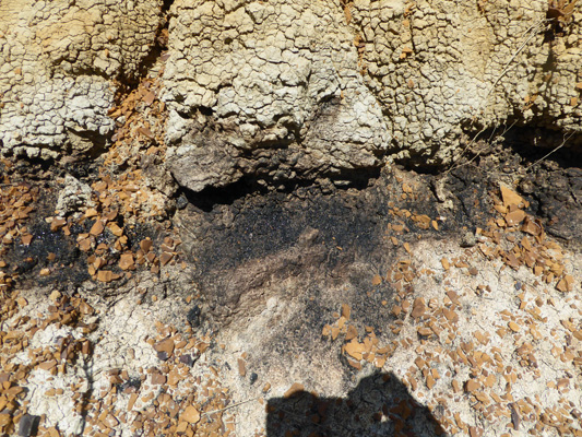
We stopped and had a look at a thin layer of lignite coal too.
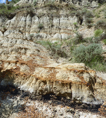
The layer directly above is bentonite and above that is a sandstone with some iron in it. Bentonite always has that checked look to it.
We were both feeling a little worse for wear from the heat and humidity and were happy to go back and cool off in the trailer.
After lunch we took a little stroll on the short trail from the campground out to the river.
From there we followed an old bit of pavement out to the road and over to the beginning of the South Achenbach Trail. This trail goes out into the Wilderness area of the park and has warning signs about people getting lost so please take another easier trail. They really shouldn’t need to put up warnings. The first thing you come to is the river and you have to wade through the mud to the other side and THEN find the trail again.
No bridge, no signs, no nothing. Just mud.
We saw one set of footprints crossing the river but we could only guess which part of the bank you should climb to find the trail. Needless to say, we took a pass and wandered home for the afternoon.
We enjoyed our stay here but it is just a bit strange and limited in scope for a National Park. We’re glad we visited and took it at a low key pace but I wouldn’t tell anyone to take as many days to see the two units as we did.
On Monday June 4th, we packed up and drove north on Hwy 85 to pick up Hwy 2 (with a few little short cuts provided by our GPS) and then headed west on Hwy 2 to Glasgow, Montana. There’s nothing special about Glasgow except that it’s 200 miles from Theodore Roosevelt National Park’s North Unit and that means it was a good place for us to stop.
We got a full hook up pull-through site at Shady Rest RV Park for $32 a night with our Good Sam Discount. We set up camp and settled in to use their pretty good WiFi (better with my Bear Booster than without it). Walter found PBS and a few other stations over the air and all was good. We had a few thunderstorms in the late afternoon but thank goodness they didn’t amount to much. At one point there were warnings of possible 50 cent sized hail and 60 mph wind. But the cell broke down and we just got some rain.
It rained off and on all night but by morning it was pretty much done. We did grocery shopping in the second smallest Albertson’s in the country. It was jam-packed with stuff which made finding things a challenge but that’s why shopping on the road is like a scavenger hunt! We found a local drug store (since the Alberston’s didn’t have any cough drops) and stopped by an enormous ACE Hardware (at least twice the size of the grocery store) and then came home and did laundry. Exciting huh?
It was in the 70’s for most of the day with a few little showers here and there.
On Wednesday June 6th, we headed west on Hwy 2 to the town of Havre to camp at the Evergreen Campground. This is an older campground with lots of trees a few miles outside of town. We arrived at the same time as 4 Airstreams on a Caravan on their way to the Airstream International Rally in Salem Oregon in late June. Because of that check-in took a while but ah well. We got a nice grassy pull-through spot (no sewer but we didn’t need it) for $35.10 a night with our Good Sam Discount. Their back-in sites have full hook ups and go for the same price. No cable TV and only 3 stations (one really with 2 substations) over the air (or using their TV antenna which they have each site wired to). Their WiFi was great, they just asked you not to stream any video or music.
It was pleasant and in the low 80’s. The caravan had a cocktail hour at 5 pm and they invited us to join. It was interesting to hear why this group of folks were traveling together and how it worked. It reminded me of being on a conducted bus tour. The Caravan Host planned the route (and had driven it and checked every place out) and made reservations for both the camping and lots of outings too. It’s a perfect way for folks who don’t like to do any planning and who want to feel ‘safe’ to travel. But don’t expect me to sign up for one soon.
Thursday June 7th, we took the morning slow and then packed a lunch and drove south of town about 15 miles to explore the Beaver Creek Park. This is a long narrow county park which turns out to be the largest county park in the country. It starts out in rolling grasslands.
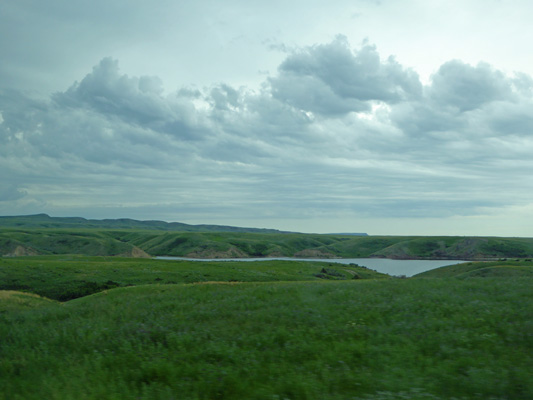
And there are several lakes and reservoirs where folks can fish. There are also lots of small dry camping campgrounds along the road. We were driving south through the park and there were really dark clouds gathering over the Bear Paw Mountains to the south. We stopped to pay our entrance fee at the office and by the time we got back in the car it had started to rain. We drove on and the rain got heavier and then we got hail. There are more campgrounds as you head up into the hills and more trees too though we didn’t see much for all the rain. We came to the boundary of the park and turned around only to have to drive back through the driving rain and hail. Needless to say our plan for a hike on their 4 mile long nature trail didn’t happen.
The rain let up some as we came back into the grasslands. I stopped once or twice in hopes of taking photos of the flowers growing the prairie grass but the pull outs were always in places with no flowers. Finally just before the northern boundary of the park we found a turn off and I went out in the light rain and took some photos.
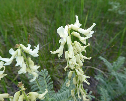
There was Narrowleaf Milkvetch (Astragalus pectinatus).
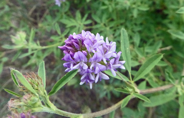
And there was Prairie Milkvetch (Astragalus laxmannii) which had pompoms of flower rather than spikes.
We drove back into town where it hadn’t rained yet and got gas and made it home just before it started to rain. It rained hard for a couple of hours and then finally stopped late in the afternoon.