
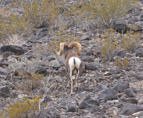
We have 3 weeks to wander around before we are due to arrive in San Diego for the holidays. So we did a bit of research and decided to go to Lake Mead National Recreation Area just east of Las Vegas. There are hikes in the area and nicely developed campgrounds with shrubs and palm trees. On Wednesday, December 3rd, we drove through the edges of Las Vegas in a light rain (and fog on the pass from Pahrump) and then on to the Northshore Road of the Lake Mead National Recreation Area. Admission to the Recreation Area is free for Golden Access Pass holders (just like National Parks are) and the campgrounds are 1/2 price too. At mile 12 we took the road south to Callville Bay. Along the road we spotted a Big Horn Sheep ram just standing there next to the road. I slowed down and he ambled off giving us a nice rear view of the big guy. You can tell he’s pretty old because his horns are long. Their horns keep on growing each year all of their lives.
The campground was nearly empty and we found a nice spot with oleanders and palm trees and a nice southern exposure for the solar panels if and when the sun came out. No hook ups here but we had topped off our water tank and emptied our waste water tanks before we left Pahrump so we were ready to go. We registered for 4 days all for the cost of $20. No, not $20 a night, $20 TOTAL. The price of spots here is $10 and we get 1/2 off with our Golden Access passes so we camped in this great place for $5 a night. To top it all off, there’s a cell tower on the hill behind the staff housing so our hot spot and our cell phones worked here. This is the life.
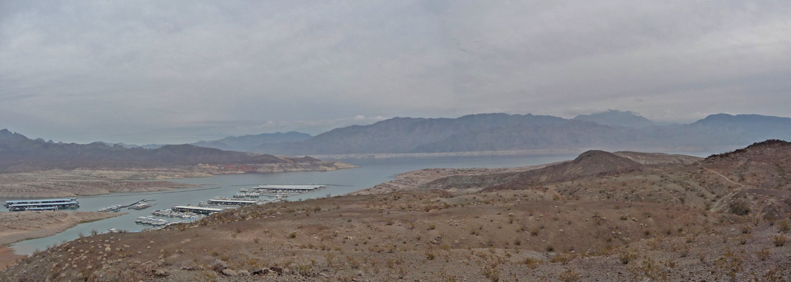
On Thursday morning December 4th, it was still misting lightly so we packed a lunch and decided we’d take the drive along Northshore Road northeastward towards the Valley of Fire State Park which is located just at the NE corner of the Lake Mead Recreation Area. The clouds made for a very low ceiling so most of the surrounding mountains were hidden. First stop on this adventure was down to the Callville Bay boat launch along Lake Mead. The lake is down about 200 feet from it’s historic highs (there’s a serious drought throughout the southwest) which produces the white bathtub ring around the lake. But there’s still plenty of water here.
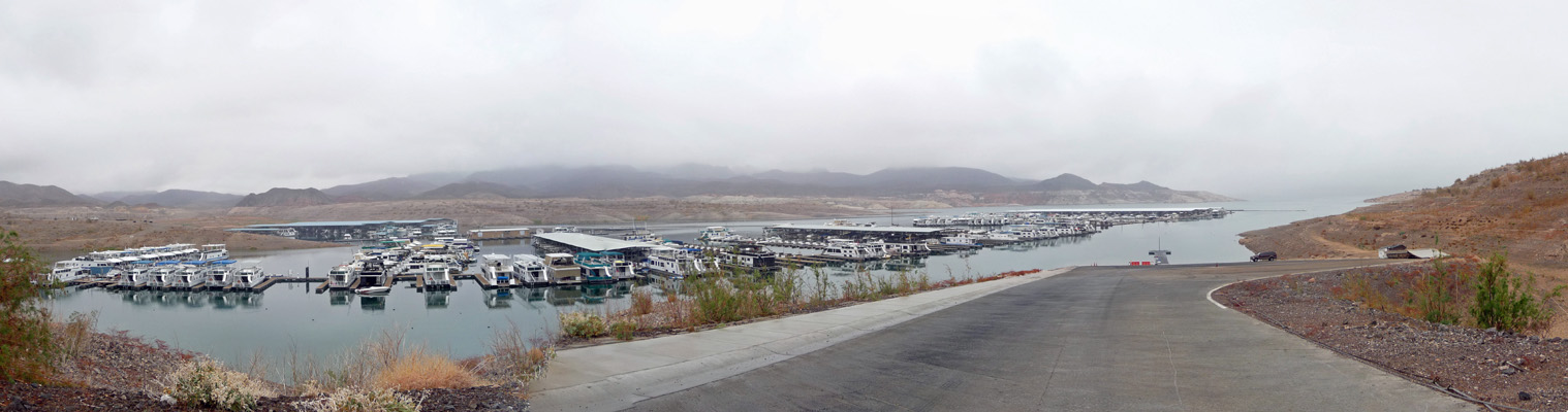
Those are houseboats that you can rent—though mostly they go out in the spring through fall. It was only in the mid 50’s this day—though by our last day here it was in the 70’s.
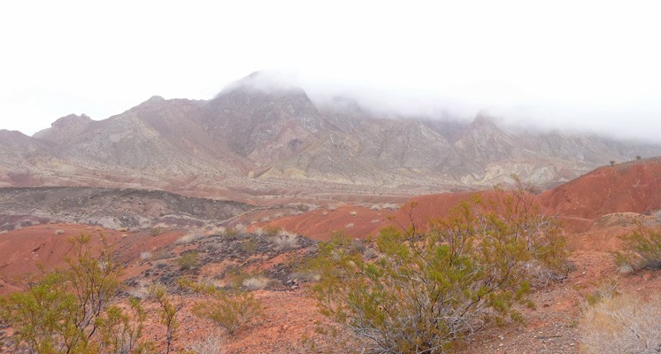
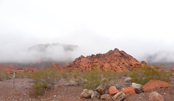
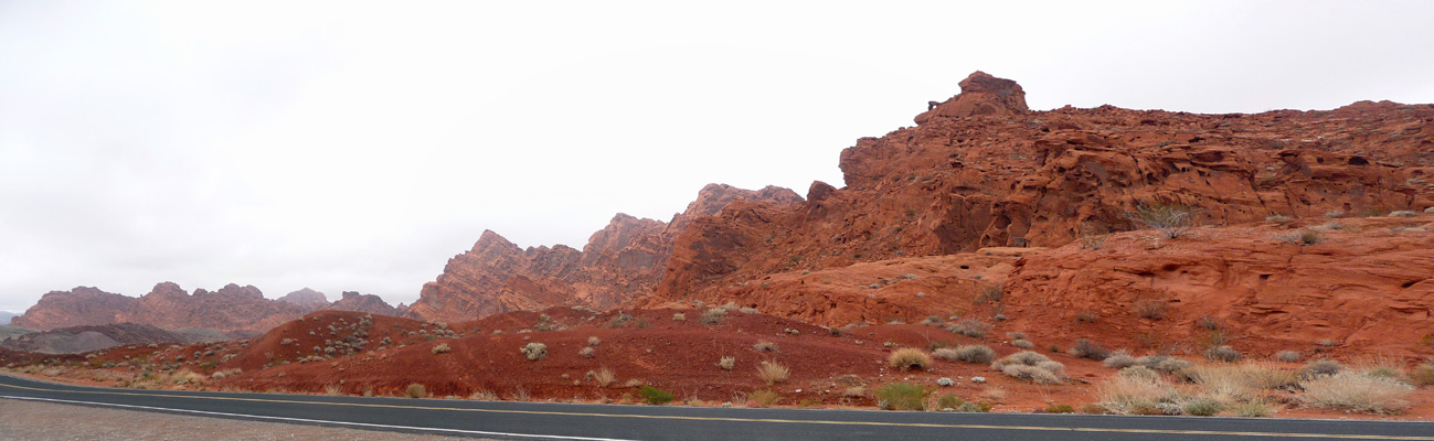
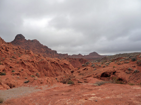
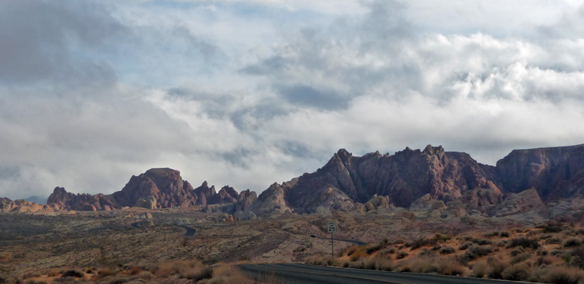
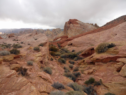
The low clouds made the views along the road kind of spooky but the bright reds and oranges still glow.
There are all sorts of great colors along this road and tons of creosote bush and mesquite. Redstone Dunes picnic area has a section of exposed red sand dunes that were formed millions of years ago (read when dinosaurs roamed the area), became sandstone under pressure and are now exposed again and eroding in cool ways. We’ll be back here again in a few days when the sun is out.
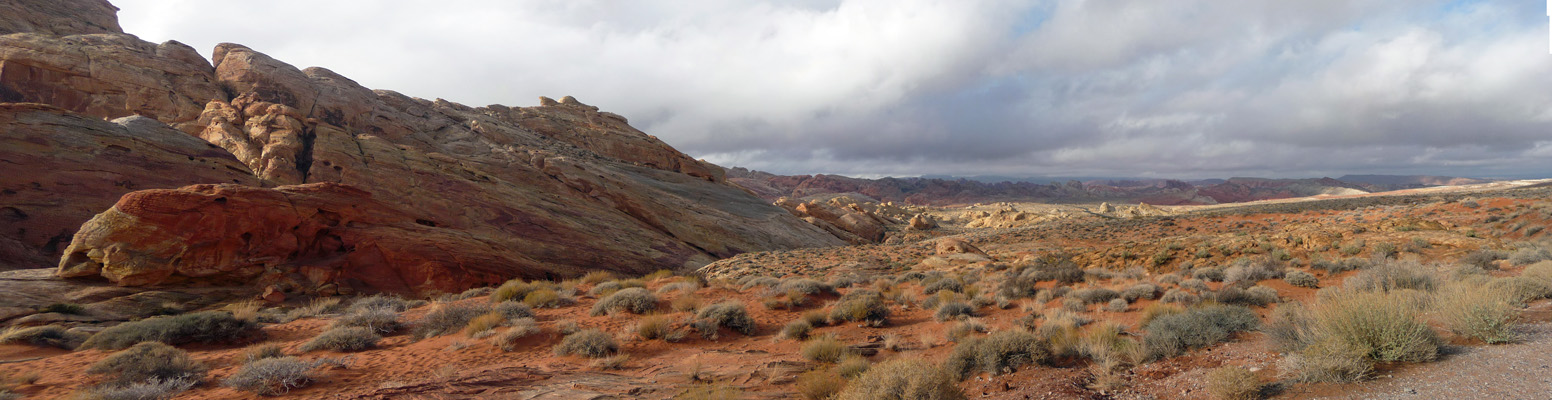
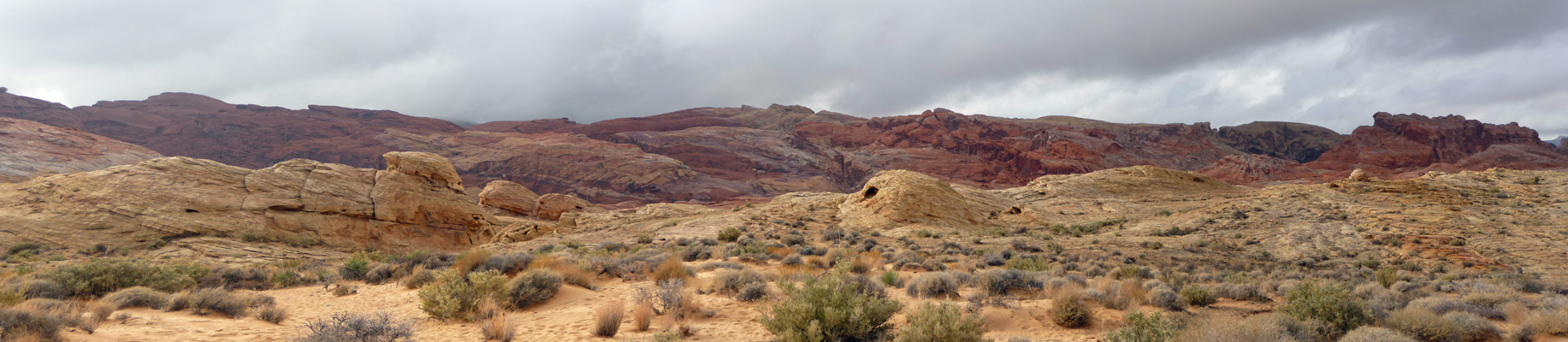
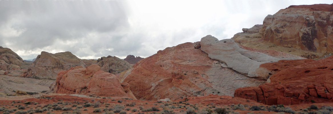
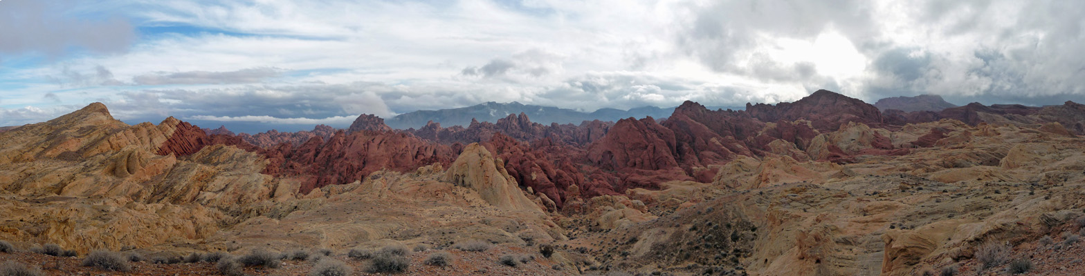
It’s about a 35 mile drive from the Callville Bay turn off to the north entrance station of Lake Mead. You can take a left there and enter the east entrance of Valley of Fire State Park. They have self registration on this end. We stopped to pay our $10 admission fee and I took this panorama shot.
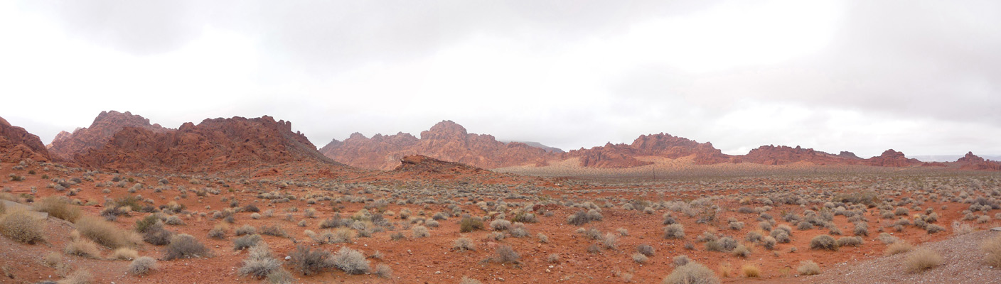
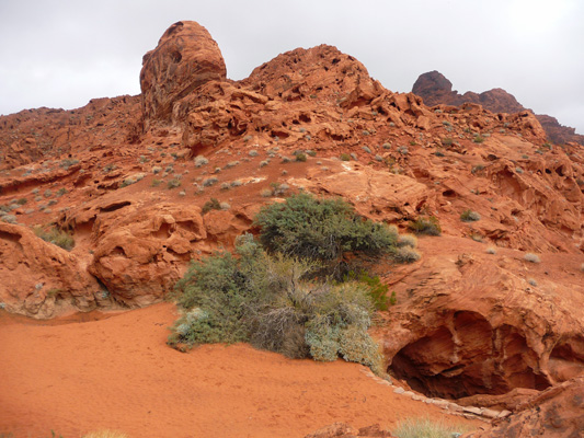
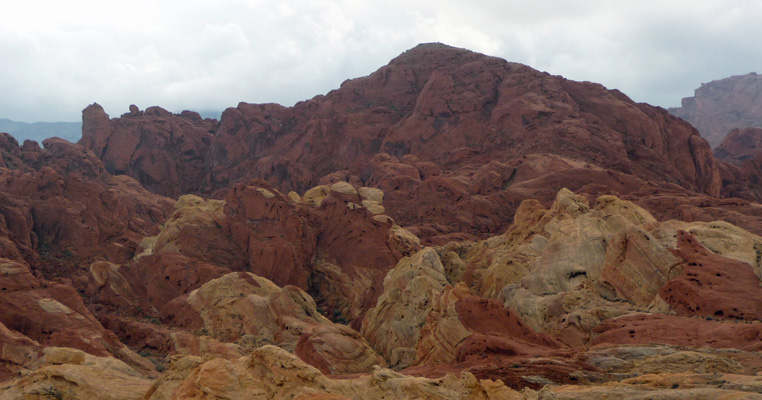
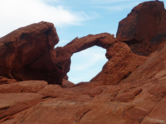
This place comes by it’s name honestly. There are miles of this lovely red rock that has eroded into all sorts of fantastic shapes. They also have named a lot of them. There’s a small arch here they has a big hump next to it and they call it “the Elephant”.
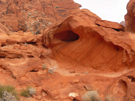
Here’s the view across the road from the entrance station. I love all the little eroded holes that make it look like red Swiss cheese.
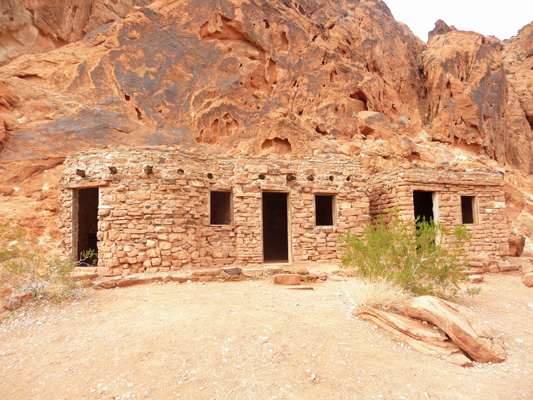
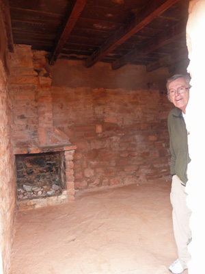
As we drove along we came to a sign that simply said “Cabins” and decided to see where the road went. Turns out there are 3 stone cabins here that were built by the CCC when the park was being developed in 1935/36. They’re set aside for historic preservation now.
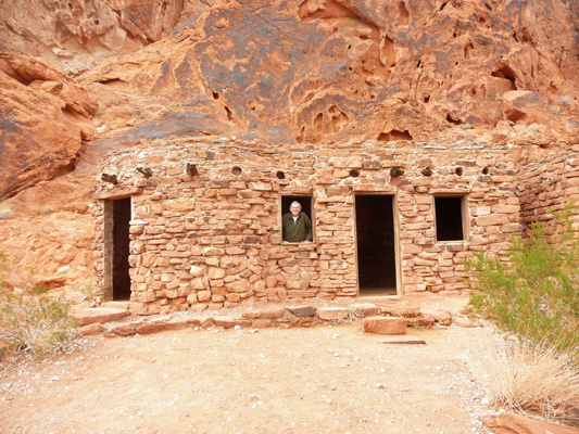
Walter had to get into the act...
They have fireplaces and just about enough room for a bunk bed.
Here’s the view from the cabins.
There’s a wash to the left here that had some mesquite trees that were an amazing green against the red rock. The camera didn’t quite catch the glow but you get the idea.
And if you scrambled up the path beyond the cabins there was this cool eroded bowl.
From here we drove on to the Visitor’s Center and read about the hikes and roads here. We decided that the road out to White Domes looked like a great adventure and that we could take the Mouse Tank hike and see the petroglyphs there. So off we went.
The hike to Mouse Tank is only about a 3/4 a mile round trip and well worth it. What made it even better is that we had sun breaks which were a very welcome sight after several rainy days. It’s called Mouse Tank because there’s a basin that water collects in at the end of the hike. Back in the late 1800’s there was a local fellow who was giving everyone in the area a hard time and he must have been called Mouse because this was one of his favorite hide outs.
The sand was fairly damp because of the rain the last few days but this trail gets a lot of traffic so it was pretty well churned up.
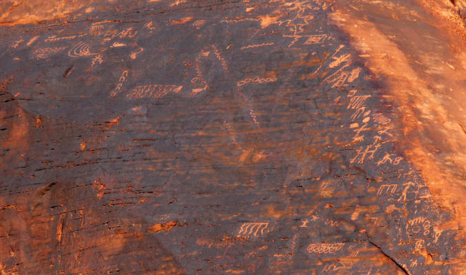
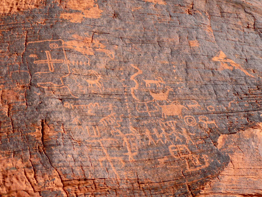
There are tons of petroglyphs here. The native people chipped off the dark tarnish on the rocks to reveal the red below.
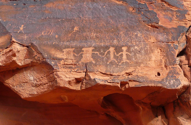
There was a huge ledge with petroglyphs all along the top edge and face.
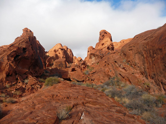
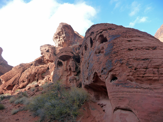
As you continue down the canyon the red spires and rocks get better and better.
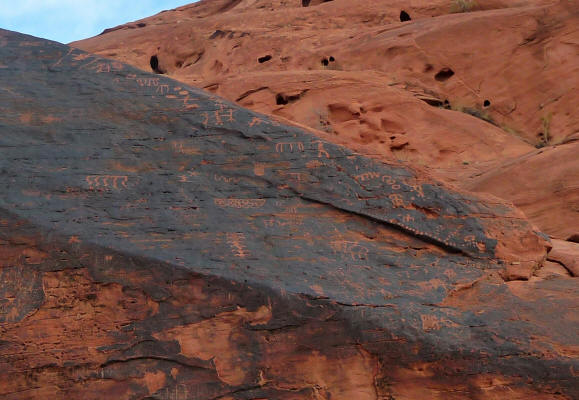
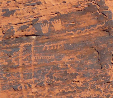
And there are more petroglyphs.
I love the hands here.
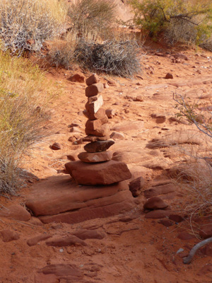
And of course someone had to build a nice 13-rock cairn along the way. I added one more rock but it and the top rock slid off. So I just added another 13th rock and let it go.
Around yet another bend there were more petroglyphs. I like the interesting ‘flower’ up in the upper left corner here.
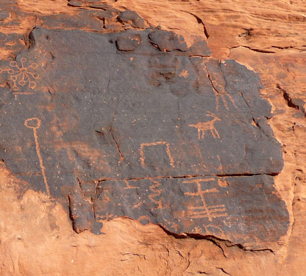
You could hardly walk 10 yards without seeing more of them. And I assure you that this is just a small sample of what we saw!
Meanwhile the rock formations started having wonderful big holes in them.
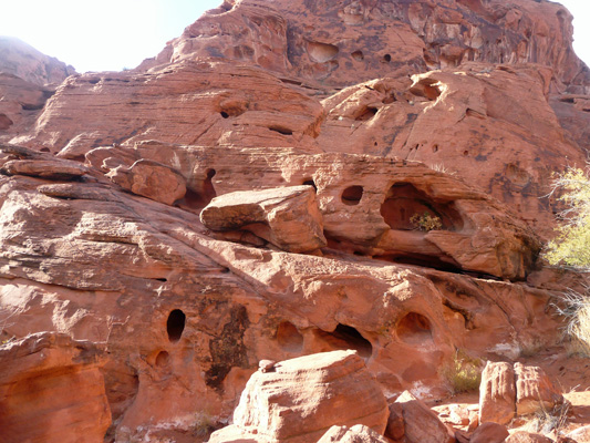
Hikers can’t seem to resist putting rocks in the smaller holes that you can reach as you hike by. But they specifically tell you to stay on the wash floor and not to climb the rocks here so there aren’t rocks in the big holes up the canyon walls.
All over the area there are formations that look like beehives (the woven kind) with striations on their sides.
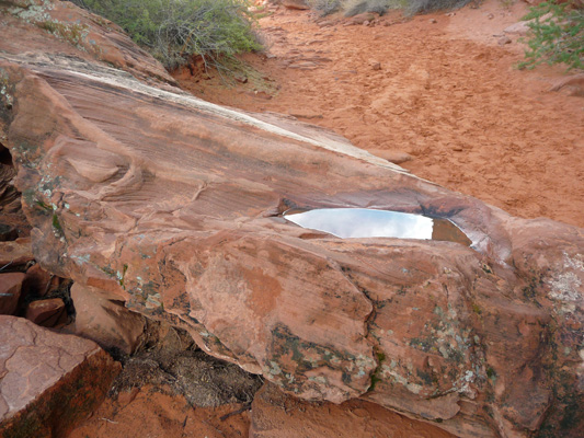
There is a sign right here that says that the hike ends to your left. When you go there, you can see the dry ‘tank’ that gives it’s name to the hike. It’s a cavity where rain collects when it’s been wet. It wasn’t terribly picturesque so I settled for this photo instead.
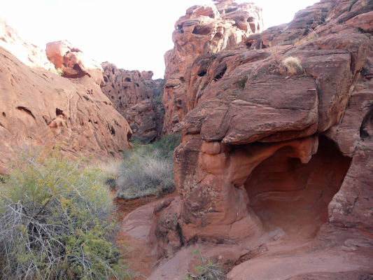
You can scramble a ways further but things get pretty rocky so I turned back.
We had quite a bit of sun on the way back.
But there had been rain here earlier and here’s my proof.
We drove on to Rainbow Vista where you can take yet another hike amongst the red rocks. We took a pass on that hike.
But I did hike across the road to take a panorama shot of the Rainbow Vista itself. The rocks here are streaked orange and yellow and red and then on across the valley in many colors too.
Past this point on the road they don’t want you to pull over onto the verge (they’ve put rocks in all the wide spots to keep you from using them) and instead have given you 3 parking lots to use for photos.
Parking Lot #1 (labeled as such with a nice big sign) provides a great view back towards the Rainbow Vista parking area.
And out into the colorful rocks.
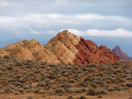
Parking Lot #3 was my favorite. It looks like somebody went wild with tempera paints.
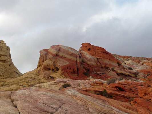
And then did some finger painting while they were at it. I love the texture here.
The Fire Wave Trail starts here and is supposed to have some great red and white striations in a wavy pattern. But it’s a 1 hour hike and we were beginning to get tired so we took a pass. But I did climb around a bit more to take a few more photos.
The road ends at the White Dome parking lot. There’s a loop trail here that goes out amongst some white formations that top the red badlands. The best part here was that there was this lovely red formation off in the distance that was lit up by the sun.
On the way back, I cheated and pulled off on a wide spot of the verge that didn’t have any rocks to block it and took this shot.
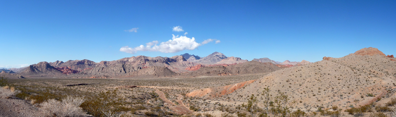
We stopped and ate our lunch in Parking Lot #1 and then took the short drive out on Fire Canyon Road. With a name like that, we were supposed to skip it? Hardly. And boy am I glad we didn’t. I took this shot from the road before Walter noticed that there was a short trail out onto the ridge.
And there I got this wonderful panorama shot.
I know it doesn’t look real, but it really truly does look like this. I can only imagine what it must be like on a day when there aren’t any clouds!
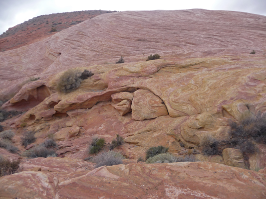
I took this close up shot of the rock formations down on the right hand side of the valley where they have white tops and red bases and all those lovely swirls.
We drove on down to the main road and then north just a ways to the last little side road called Scenic Loop Road. There are two campgrounds on this loop and there are lots of formations with names like the beehives and Arch Rock.
It was a long day but well worth it. We both took a long nap when we got back to the trailer and agreed that the next day we’d stay close to home.
It was still mostly cloudy on Friday December 5th, when we got up but the clouds were mostly high clouds and they did thin as the day went on. We took a hike through the other campground loops which are closed right now and and then came home and hung out until lunch. We put the solar panels out and actually got quite a bit of power out of them even with the thin clouds.
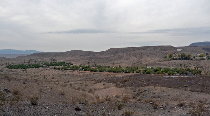
After lunch we headed for the Callville hike that glamorously starts by the dump station in the campground. It goes up the hill so you get a nice view of the campground with it’s palm trees and oleanders. The area further up the hill behind the campground is staff housing and the cell tower that allowed us to use our hot spot and even our phones here.
We continued up hill until we came to the top of one of the hills (you’ve got a choice of about 4 hills to climb here all with trails leading to them) and I took a panorama shot across the lake. You can really see the white ‘bath tub ring’ across the lake here.
If you look northeast this is the view you get.
It was good to have a nice quiet day after the long day on Thursday.
On Saturday December 6th, we awoke to SUN! We put the solar panels out and didn’t even bother to run the generator. That meant we could actually get an early start on a hike for the day rather than waiting the 1 1/2 hours that usually goes to running the generator.
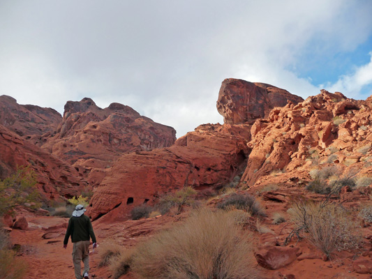
We drove the 15 miles back up Northshore Road to Redstone to do the hike there. There were people out climbing on the rocks in the picnic area next to the parking lot. At first all we heard were voices and then up popped this guy out of one of the gaps in the rocks.
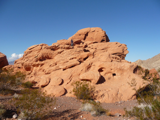
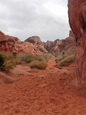
We found the trail head and started out up the wash. The trail disappears from time to time as you go—it’s a wash after all and Mother Nature uses trails as drainage ditches during the monsoon season. There were wonderful Mare’s Tail clouds along with the sunshine and the red rocks.
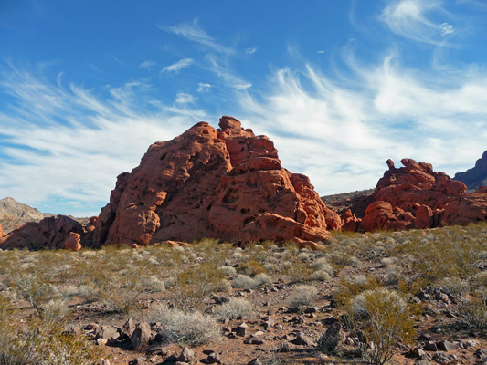
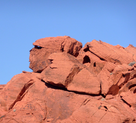
We decided that this formation looked like a bear with a snag behind him.
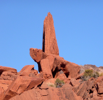
And I decided that this looked like the guardian of Redstone.
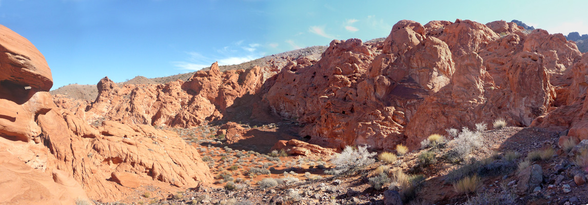
The trail petered out—even though it was supposed to be a loop trail—so we just wandered around where we wanted and ended up with this view of this little back canyon.
And this view out back towards where we’d come from.
It really was a gorgeous day.
We never really found much of a trail on the way back. We followed washes where we could find them and saw foot prints from time to time but even when we thought we’d found the trail it disappeared again. In any case, we were never lost because we could always spot the roofs of the picnic structures off in the distance and head that way.
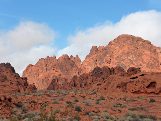
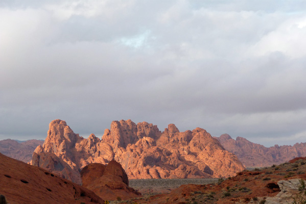
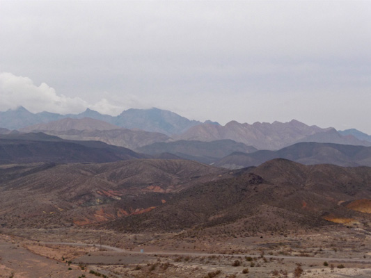
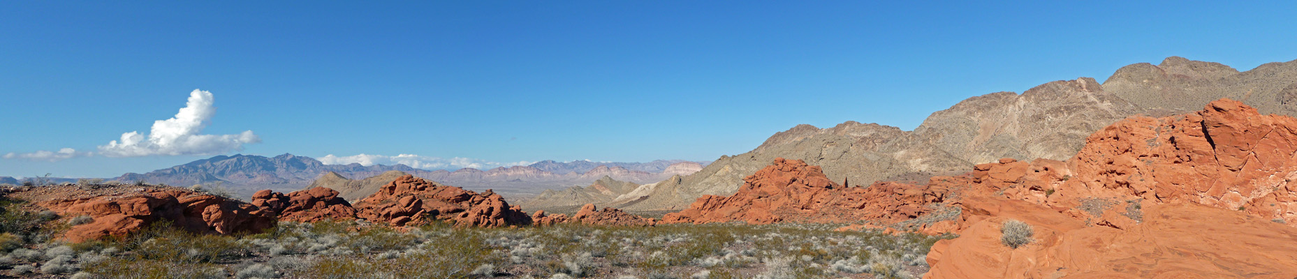
We drove on back towards Callville Bay and I stopped to take this panorama shot looking north across the valley. Those are the Muddy Mountains off in the distance and the Gale Hills nearer by.
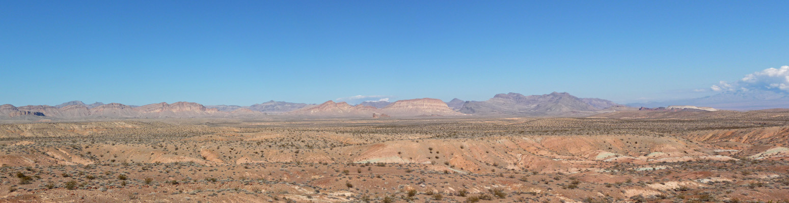
It all looked so different than it had when we drove through in the clouds and mist on Thursday. It’s gorgeous country really.
This is a shot of the edges of the Bowl of Fire. Behind those grey hills is a nice bowl of red rock. You can see glimpses of it from the road but of course there’s no turn out where you can photograph those glimpses!
We really enjoyed our time here. For those of you who visit Las Vegas, I highly recommend taking an afternoon off from the bright lights and driving out to Valley of Fire State Park. It’s well worth the drive.
From here, we’re headed to Bullhead City for a few days in an RV park so we can do laundry, catch up on ‘life’ and plan the next phase of our journey.