We filled up our water tank before leaving to drive west on the Columbia Gorge towards White Salmon. We’d read on the internet that the Peterson Prairie Campground was having water problems and so we made sure we had plenty of water before we set out.
After 12 years, Walter had finally used up his little can of hitch grease and we were looking for an auto parts store so he could buy some more. We stopped to get gas in a funny little gas station along the way and old the guy who came out to pump our gas (an oddity in Washington though it’s required in Oregon) offered to let Walter fill his can up for free. So Walter got a nice sized glop of grease and we no longer needed the auto parts store.
Outside of White Salmon we turned north on Hwy 141 towards Trout Lake. About half way there, we hit construction. They were chip sealing the road and there were pilot cars for miles keeping us all down to 30 MPH. Mostly we didn’t have to wait too long for the next pilot car but it definitely slowed us down. The highway turns west at Trout Lake and Carmine the Garmin, had us turn south on a forest road just before the pilot car section stopped. And a quarter a mile later the nicely paved road ended at a closed gate. Carmine had been trying to send us into the campground (we were using her latitude and longitude feature) through the group campground gate which was locked. Oops. So there we were without enough room to turn around (no verge on a Forest Service Road). Walter got out and scouted the situation and decided that we were going to have to back out. I got out and walked backwards directing him and slowly but surely we backed out onto the highway. During all this time there were no cars going by. But of course, now that we were out across the road, along comes a pilot car and a whole bunch of cars behind him. We pulled forward and out of the way while they all drove past and then we joined the line. Not long after the road work ended and the forest service road began, we came to a sign for the campground. Note to self: Don’t always trust the GPS.
After driving all this way, we held our breath as we looked for a campsite. There was a nice side-pull-through site with an “Open” sign on it, so we pulled in. Turns out someone had reserved it and didn’t like it. So they’d moved across the road to a better tent site and switched signs. They were thrilled that we were taking their site and would handle the paperwork since the Camp Host wasn’t around because it was his day off. I love how things always seem to work out perfectly.
We had a good hard rain late in the afternoon but no thunder and lightening. Things were really dry here so clearly they hadn’t gotten any of the storms that had come through before.
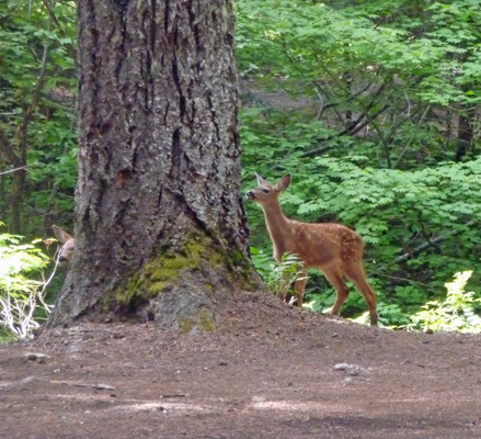
The next morning while we were running the generator, Walter spied a doe and two fawns heading through the campground. They spent a long time making their way through the site across from us, stopping and smelling everything and even licking one of their camp stools.
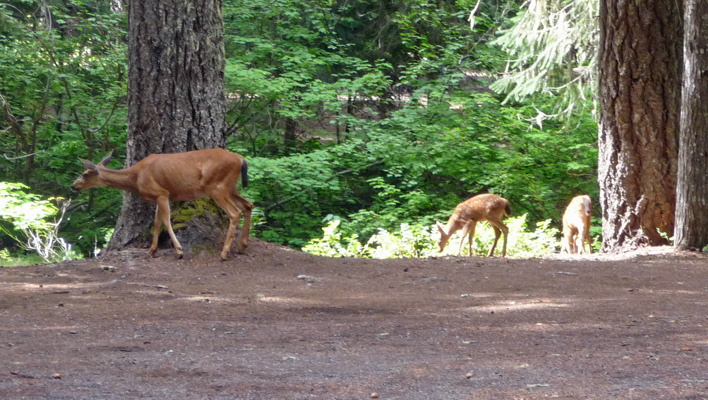
The fawns still had some of their spots and didn’t let Mom get too far away.
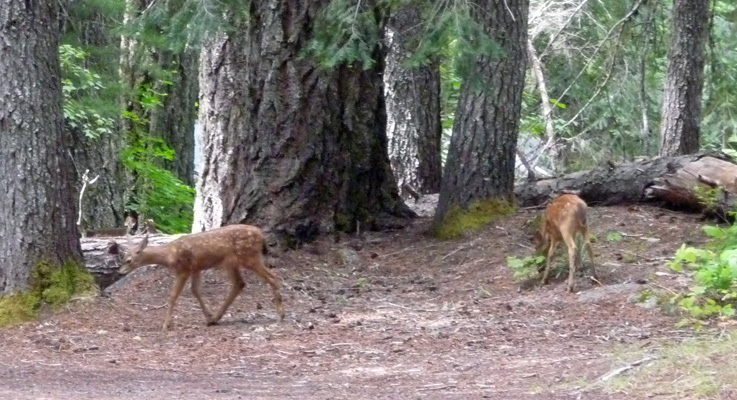
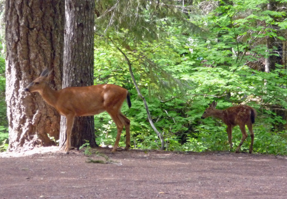
Though they did stop and explore things a bit.
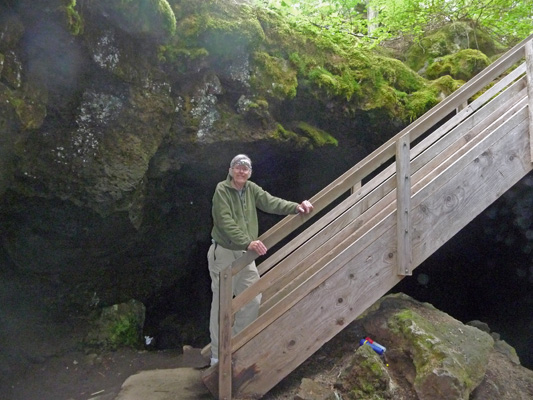
Once we were done with the generator, we tootled on down the road a mile or so to the access to the Ice Cave. This is a lava tube that is open in places so that snow accumulates in it in the winter and ice forms and stays that way all summer long. We put on our headlamps and our fleece and went down the stairs that lead into the cave. There was cold air wafting up the stairs at the top.
It was very dark but we did manage to find some ice formations.
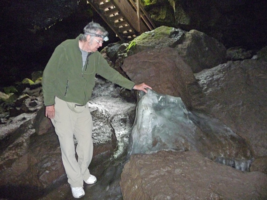
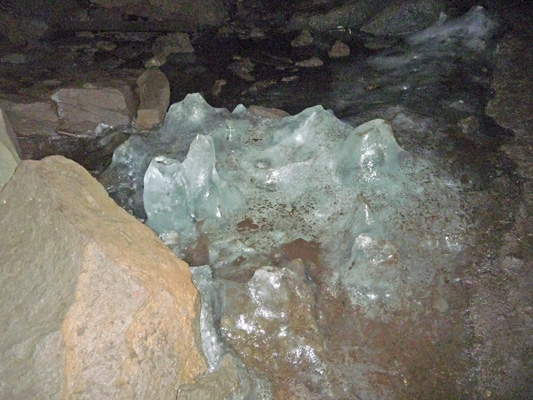
The footing was pretty slick and it was dark so we didn’t go very far in. We met some other folks who decided they needed a lantern and when we saw them later they said they had managed to explore the entire 650 ft of cave and that there had been a lot of ice at one end. I guess in the late spring there are stalactites and stalagmites of ice in this cave.
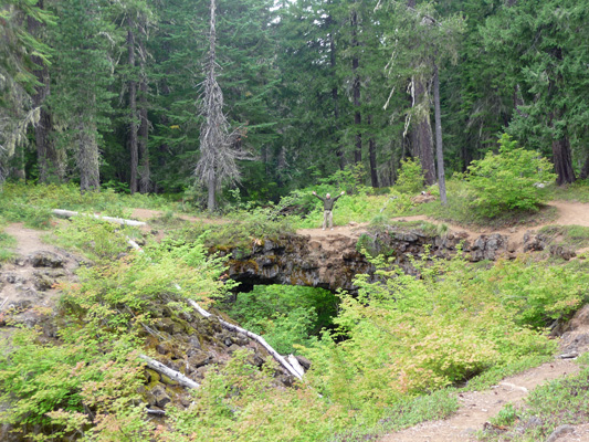
From the Ice Cave we drove back a ways to the entry to the Natural Bridges area. This is more lava tube but this time parts of it have collapsed leaving a pair of bridges over a rock lined ravine. Here’s a distant shot of the bigger of the two bridges.
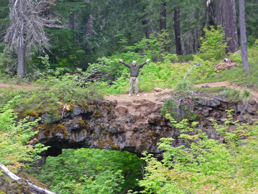
And a close up so you can see Walter goofing around better.
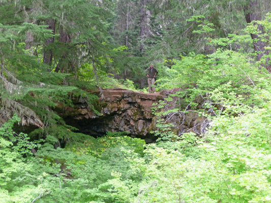
If you go along the trail a little bit you come to a second smaller bridge. Here the vine maples in the bottom almost reach the bottom of the bridge.
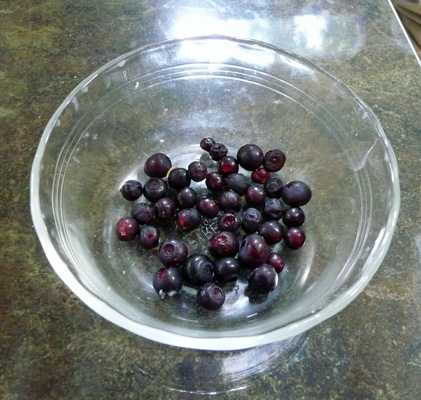
We followed the trail a ways and wandered around in the woods and found some huckleberries that no one had picked yet. The area around Peterson Prairie is known as the best huckleberry patch in the state if not in the country. There are professional pickers who then sell them to huckleberry buyers who hang out near Trout Lake. I didn’t find that many but enough to amuse me.
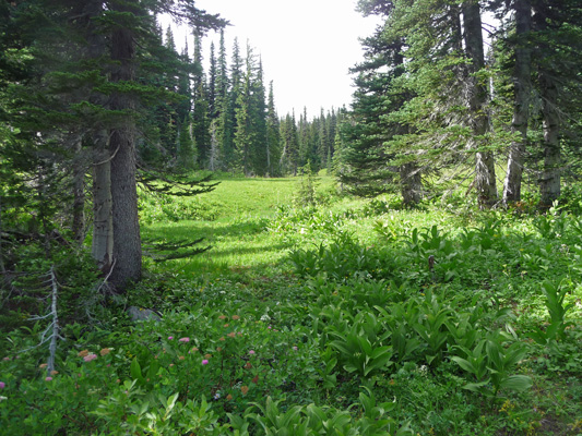
When we were done with the Natural Bridges we drove on past the campground out to an information sign that explained how Peterson’s Prairie got it’s name. The Peters family lived out here in the 1890’s and homesteaded in a meadow that they called a prairie. Somewhere along the line someone added ‘son’ to the end of Peters Prairie and it stuck. Around the corner from the sign was a nice open meadow. I’m not sure if it’s actually Peterson’s Prairie but you get the idea.
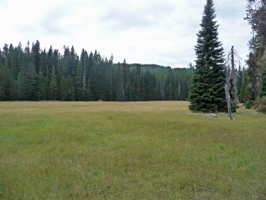
It had Leafybract Asters (Aster foliaceus) along the edge and sprinkled in amongst the grasses.
On Saturday August 16th, we awoke to mostly sunny skies. We ran the generator while we ate breakfast and made our picnic lunch. And then took off back to Trout Lake to check in at the Ranger Station to make sure the road to Bird Creek Meadows was open. Bird Creek Meadows is on the Yakima Indian Reservation and the road is only open from July 1 to Sept 30th so it’s always a good idea to check. Besides that they don’t do much maintenance on it and some years it might not really be passable.
We got a map of both the road and the trails and set out on the somewhat arduous journey to a wonderful hike. There are 11 miles of gravel and dirt road to traverse but it’s worth it. The road is rough gravel with a few dirt washouts and a bit of washboard here and there while you’re in the National and State Forests. But as soon as you hit the Yakima Nation section it becomes single track dirt. There was a lot of traffic going both ways which made it that much more challenging. We paid our $5 parking fee at the pay station and then drove on up to the upper parking area.
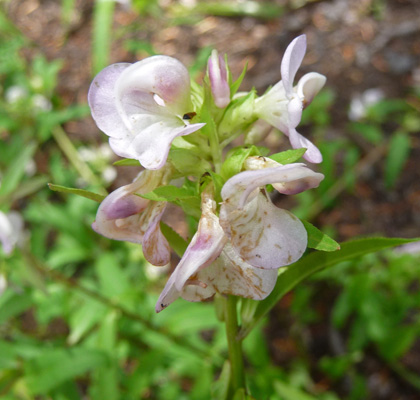
The last time we did this hike back in 2006, we started at the lower trailhead by Bird Lake. This time we parked in the big upper parking area to give ourselves a different view of the place. Personally I preferred the route we took back in 2006 because it included a couple of waterfalls. But this one was good too. The trail goes UP through the forest which opens up now and then to small meadows with flowers like Sickletop Lousewort (Pedicularis racemosa) growing around the edges.
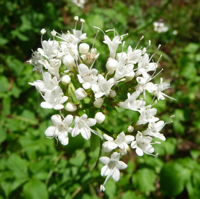
And Sitka Valerian (Valerian sitchensis).
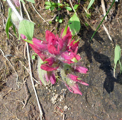
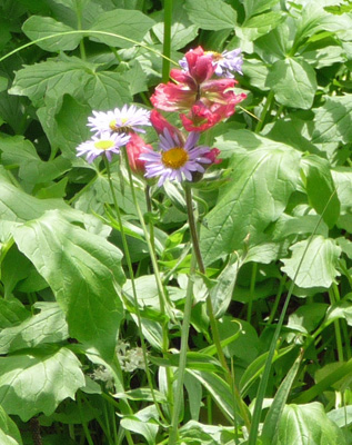
And our old friend magenta paintbrush.
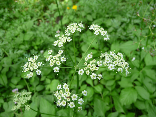
In wet sunny areas there were swaths of Angelica, though I don’t know which one it is.
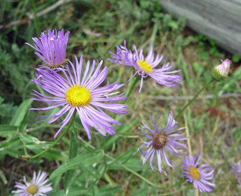
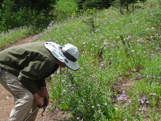
As we gained elevation we entered meadows full of asters.
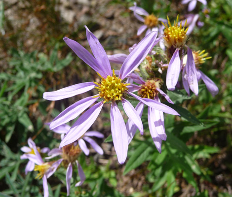
These are Douglas's Aster (Aster subspictus).
In time we finally entered larger meadows with bouquets of flowers everywhere.
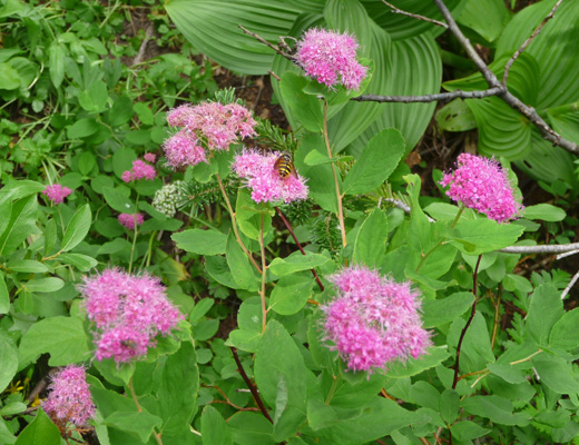
Near the streams cascading down the mountainside there were large patches of Rosy Spiraea (Spiraea splendens). There was lots of false hellebore too but none of it was in bloom.
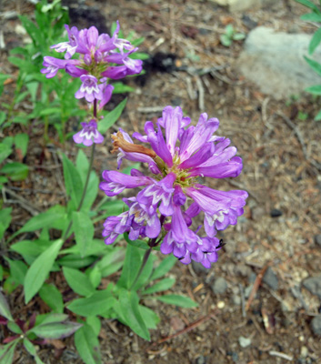
We paused to rest and have a snack in a picnic area surrounded on both sides with meadows. I found a little patch of Cascade Penstemon (Penstumon serrulatus).
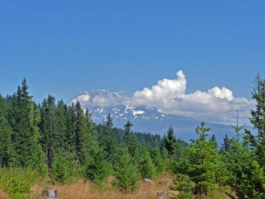
After we’d hiked up for about an hour we decided that we’d had enough. The trail goes on and on. We could have hiked for miles doing the loops that go around the edges of these wonderful meadows. But it was warm and humid and we’d had enough. So we turned around and made our way back DOWN the mountain. We got a few brief glimpses of Mt. Adams with wispy clouds hiding his top.
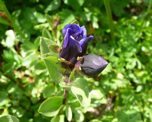
In one of the boggy areas I found a bit of Mountain Bog Gentian (Gentiana sceptrum) almost in bloom.
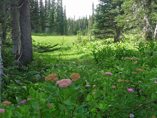
Walter wanted me to take a shot of one of the smaller meadows to give you an idea of what they look like. It’s always hard to capture places like this since the flowers seem to disappear into the grasses. Needless to say there were flowers speckling the grassy area in the background.
I got down on my knees and took this shot so at least you can see the spiraea in the foreground.
It only took us about 45 minutes to come down the trail and we were definitely ready for lunch. Then we made the return drive over the bumpy road (40 minutes of dirt and gravel) and greeted the pavement with a sigh of relief.
On Sunday morning we packed up the trailer to motor on out of the Trout Lake area. The full campground was now nearly empty. It’s amazing how quickly they fill up on Thursday afternoon and early Friday and then presto by 11 am on Sunday everybody has packed up to go home.
As we left the campground, I got Walter to pull over for just a moment so I could take a photo of Mt. Adams. Those pesky clouds were still draped over his top.
We went south again on Hwy 141 back down to the Columbia Gorge. Most of the road work was done. We only had to wait for one pilot car. When we reached the Gorge we went west to Vancouver and picked up I-5 north. We stopped in Woodland to do grocery shopping (we knew where the Safeway was there). And then we motored on up to Castle Rock which is the exit you take to visit Mt. St. Helens.
We drove on east to Silver Lake and got a spot for 2 nights at the Silver Cove RV Resort on Silver Lake. It was 86 degrees when we went to set up but it wasn’t any hotter inside than out so we just opened up all the windows and started the fans going. Late in the afternoon as it began to cool down a flock of kayaks came by on the lake.
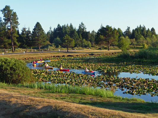
They were mostly beginners and some of them were having trouble staying in the channel and out of the water lilies. But it was still fun to have all the little ducks go by.
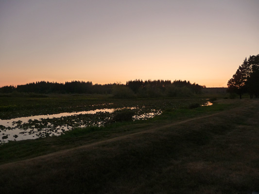
We had just a hint of a sunset which put a blush on the water and the sky.