
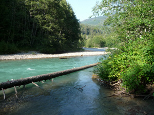
We got a great campsite at Silver Fir, a lovely small Forest Service campground along the north fork of the Nooksack River. It's rated 4 1/2 trees in our campground book and it deserves it. Here's the view from our site.

That large lump of earth on the lower right is the root ball of the tree that is lying out in the river. It fell this last winter and took a junk of the campsite with it. But there was still plenty of space for the trailer. You just had to make sure someone was watching carefully when you backed up to park so you didn't end up in the river!
Here's the view the other way. The water is that lovely emerald color because the river is fed by glacial melt.
After lunch we drove back down Mt Baker Highway a few miles to visit Nooksack Falls which is about a 1 mile drive off the highway.
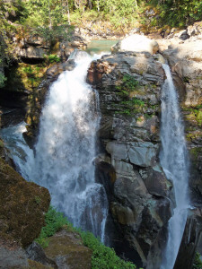
When you stand at the overlook you can see Nooksack Falls on your left and to your right you can see a cascade/fall created by Wells Creek.
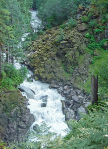
The area is lush with ferns and moss. There are lots of warning signs about how slippery everything is and how many people have died climbing in the area around the falls. And then they have to tell you to please don't climb the fence.
The next morning we drove up the mountain about 20 miles. First you come to the Mt. Baker Ski Area which is of course closed this time of year. After that you come to Picture Lake, a sweet little lake with flowers and a mirror calm surface in the morning.
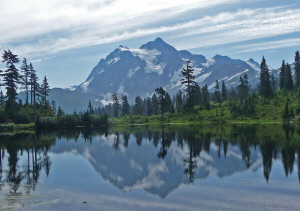
This is Mt Shuksan reflected in Picture Lake.
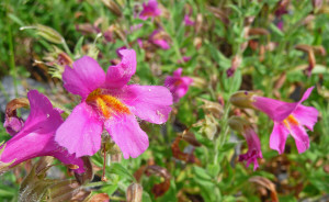
This is Mimulus lewisii (Great Purple Monkeyflower) that was blooming along the lake shore.
From there we stopped at Heather Meadows where there's a visitor's center. There are lots of hikes that leave from here but we opted instead to go to Artist's Point at the end of the road. You can't see Mt. Baker from Heather Meadows but you sure can see lots from Artist's Point.
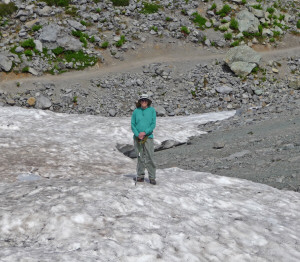
There were still a number of nice piles of snow for folks to play in.
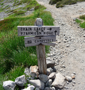
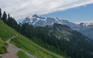
We took the trail west from the parking lot that goes to Ptarmigan Ridge and Chain Lakes.
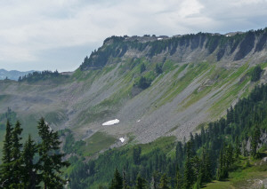
You can see the trail running along the base of Table Mountain before the scree starts to fall away down into the valley. You can hike up to Table Mountain but since the trail goes straight up we opted to go the easy way instead!
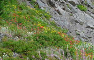
The meadows were in bloom and there were lots of flowers.
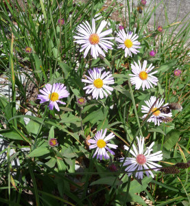
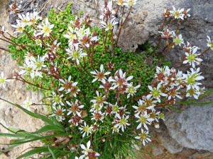
Asters
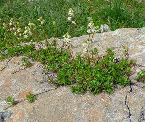
Tons of Partridgefoot (Luetkea pectinata)
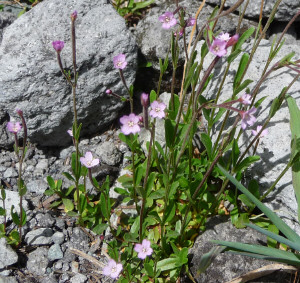
Alpine Willowherb (Epilobium anagallidifolium)
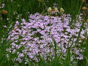
There was tons of Phlox difusa. In fact, I've never seen such a big spread of it all together as we saw here.
Saxifraga tolmiei, a saxifrage I'd never seen before.
The trail forks after about 1 mile.
If you follow the Chain Lakes trail it drops 500 feet down to some lovely alpine lakes and then goes UP 1500 feet. We stood and looked at the lakes in the distance and decided we didn't need to go that way. The Ptarmigan Ridge trail just went out a ways before it ended in a big snow field...
So we took photos and then turned around.
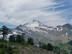
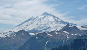
Here's Mt. Baker from a small hill just past the fork in the trail.
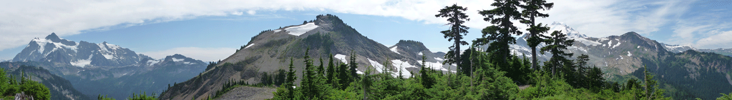
And here's a panorama shot from just north of the little hill. Mt Shuksan is here on the left. Then this is series of old cinder cones. And Mt. Baker is just peaking out from behind the trees over on the far right.
You can click on it to see a full sized version.
And here's Mt. Shuksan from just back from with the trail leading back to Artist's Point.
Since we'd only hiked a couple of miles, after lunch we took the Artist's Ridge trail east from the parking lot. It starts out level but then gains some altitude via lots of stone steps--hard on the knees coming back!
Here's Mt. Baker from along the trail.
There are small pools (called tarns) hither and yon and at the end of the trail there was a pretty good sized one. It had gotten hot and one of our fellow hikers had decided he needed to cool off.
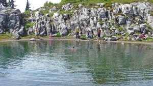
I was standing up on the rocks above him in my khaki pants, vest and hat. He started talking about how he was probably breaking a law or something and he was sorry. I just shook my head and said he had plenty of time because we'd just seen a range going back the other way. He made my day by saying he thought I was a ranger. Ha!
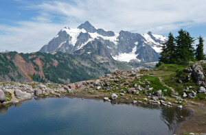
Here's Mt. Shuksan with the tarn in front.
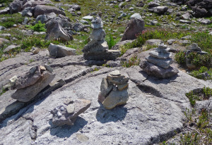
There was also a whole field of stacked rocks out at the end of trail. Given flat rocks people do have fun!
When we got up the next morning it was sunny on the mountain but we met the coastal clouds in about 5 miles as we drove homeward down the mountain. Mother Nature's air conditioning had been turned on and we got our hike in just in time!