
Thursday July 16th we set out to finally drive the loop. The road is paved for quite a ways but eventually becomes gravel. For years it was closed starting at Barlow Pass and all you could do was park and hike either south towards Monte Cristo along an old road or north along the Mountain Loop Road until it fell into the river.
Now while the road is open starting at Barlow Pass it's a 1 1/2 lane wide gravel road that follows the path of the Sauk River. It winds through lovely Northwest forest providing nice views of the river and lots of entertainment in the form of pot holes and washboard surface from time to time. Besides that you get to see all the places where the hillside has blocked the road and where the road has fallen down into the river.
There are also lots of small campsites along the road where you can pitch a tent right next to the river--no fee--and no bathrooms! We saw lots of folks camped at these and out fishing in the river.
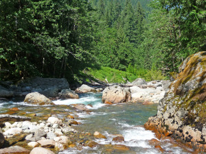
About ten miles from Darrington there was an honest to god official turn out with signs and picnic tables. Here's the view.
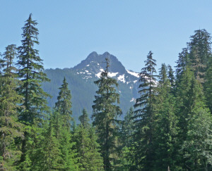
That's Mt. Whitechuck.
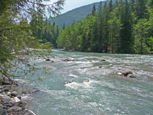
About 15 miles of dirt road after Barlow, and shortly after Mt. Whitechuck, the road becomes paved again--ahh the sweet sound of humming tires on pavement. And you go past this cool bridge that has a sign that says boat ramp. So we went across it just to have a look. We didn't find a boat ramp but we did find these great views of the Whitechuck River joining the Sauk River.
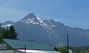
We drove into Darrington to get gas and I took this shot of the mountains looking south from town.
It's very pretty there, too bad the town itself is nothing to write home about. But then, towns aren't really why we go out camping anyway.
From here we turned around and drove the same road back. It's amazing how much shorter it seems when you know where you're going.
At lunch time we just pulled off the road in one of the 'campsite' spots; pulled out the cooler and clamored down to the river.
Here's our picnic spot along the Sauk River.
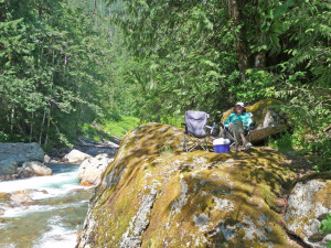
And the view of the river to the left of it.
Now don't you just want to sit down next to Walter here and listen to the rushing water?
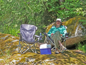
Sandwiches, fresh Washington cherries and cool drinks. Ahhhh.
After lunch we finished the drive and parked at Barlow Pass to get a taste of the hike to Monte Cristo.
Monte Cristo is an old gold and silver mining town that flourished at the turn of the century complete with a railroad that went all the way to the smelters in Everett. For years you could only get there by railroad. Finally in 1942 the county road opened. The area is known for its floods and the railroad washed out a number of times as did the county road. In 1980 another big flood came through and the county decided to stop repairing the roads and bridges out to Monte Cristo. Nobody really lived there anymore and the mines had all finally shut down. A preservation group does what it can to maintain the road and preserve the buildings that remain in the town but you can't take a car down the road anymore.
Most of the trail follows the old gravel road. It's not hard going but it's also not real exciting either. We've hiked our share of roads over the years and this one just had a funny energy to it that made it not as much fun as it might have been.
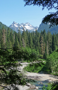
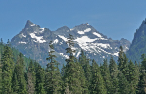
There are some nice mountain views here and there.
There are lots of mountain bikes on the trail and that seems like the best way to do this trail.
Except for a few minor details.
A mile in you come to this...
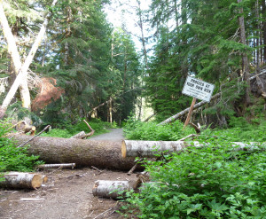
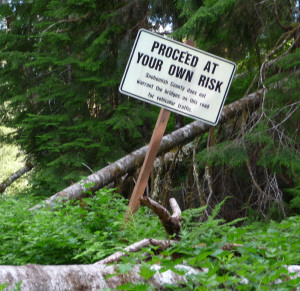
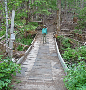
In 2006 and 2007 they had BIG floods. The hillside here began to slide and part of the road slid down into the river. The hillside is still unstable so they suggest you go around. The first thing you do on the detour, is go over this old bridge that has collapsed in the center. It's kinda spongy and springy which makes it more fun.
The trail heads up hill and actually gets interesting for hikers and a little challenging for the bikes. We saw more than one teenage boy grabbing tree trunks or walking their bikes as they were coming back down.
Okay, we've gotten around the landslide all's well right? Um, no. In that same set of floods the river changed course and wiped out the approach to the bridges that span the river. The road/trail ends abruptly at drop-off and the bridges are stranded out in the middle of the river on a sandbar. Signs tell you NOT to cross there as there are submerged cables and other dangers and instead to go up the hill and around. So things get interesting again for a while as you hike up and around to the alternative crossing--a big fallen tree.
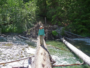
If you're biking you get to carry your bike over this since there isn't room to walk beside it. We saw folks on bikes on the other side so clearly that's what they do. It is a WIDE tree but still...
Here's the old bridge out on the sandbar. Over the years, it's collapsed in places and now it sits alone basically going nowhere except that when folks come back they get confused and hike out onto it only to find themselves in the middle of a pile of snags.
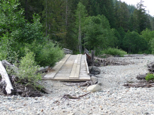
On our way back we saw someone wandering around there and had to shout across the river and wave our arms and point them back to the little unmarked trail to the log. We of course were already across the river and through the uphill detour so shouting was really the only option.
The trail then returns to the old road which is washed out down to the railroad bed in places and blocked regularly by fallen trees. You can see the gouges in the bark from people lifting their bikes over them.
It was warm and muggy and after about 3 miles we looked at each other and said, 'let's go back.' So we did.
Flowers always help to break things up and they did that here too.
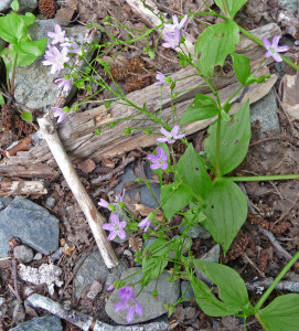
Candy flower (a member of the chickweed family)
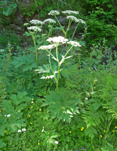
Cow parsnip. For those who aren't familiar with it, it was about 5 feet tall.
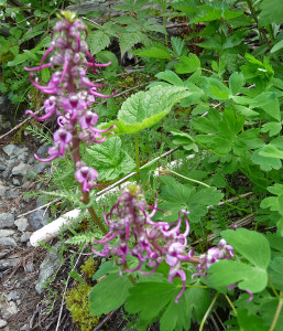
Elephant head lousewort
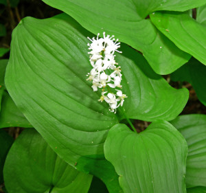
False lily of the valley
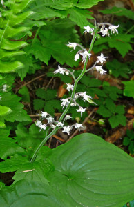
Foam flower
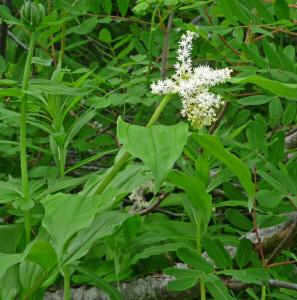
Large False Solomon's Seal
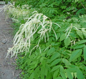
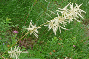
Goat's Beard
Goat's beard is really interesting because it can have long drooping flowers or short fluffy ones. There are male and female plants so I figure that must be the reason for the different looks. There was tons of this all along the first part of the trail.
We were home the next day by mid day. See how much fun you can pack into just 48 hours away from home? You can read about the first part of this trip and our hike to the Big 4 Ice Caves here.