
On Thursday we took the Tonga Ridge Trail into the Alpine Lakes Wilderness. It starts off of a Forest Service Road about 11 miles southeast of Skykomish.
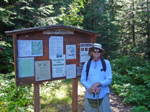
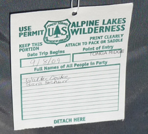
This is a great hike because you start at 4400 ft which cuts down on a lot of UP that we often encounter just getting into the Wilderness areas around here. You're so close to the edge of the Wilderness that they have you register even before you start the hike. Don't ask me why but I just love these Use Permits.
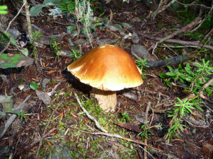
The trail starts with a mile of steady but not horrendously steep elevation gain through a lovely cool forest. It was in the high 70's so the shade was appreciated. You'd never guess that we'd just come through a long dry summer. The forest floor was spongy, the moss was bright green and there were even spots that were muddy on the trail from the rain we had over the weekend. Best of all, the mushrooms had started to appear.
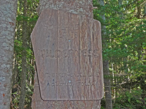
It doesn't take long before you pass the obligatory Alpine Lakes Wilderness sign. You should know by now that I'm collecting photos of these babies so here it is. This one really needs to be replaced, you can hardly read it.
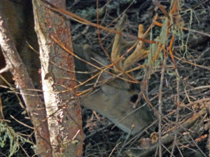
As we walked through the forest I looked over to the left and there was a buck just standing there looking at me. We watched him for a while. He still had velvet on his antlers. Then I got the camera out. He of course moved deeper into the woods. I followed him and managed to get this not real stellar photo of him.
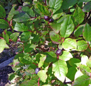
The trail starts to level out a bit, after a mile or so and you begin to see huckleberries growing in the sunny spots!
We had our lunch with us and just when I'd announced I was getting hungry, serious number of ripe huckleberries came into view. Way better than lunch--especially since there was no place to sit to eat it anyway.
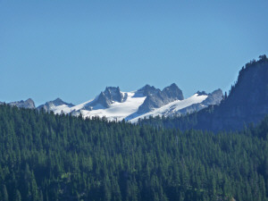
In time we actually began to catch mountain views.
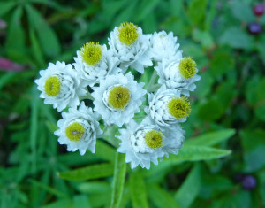
The trail follows along the side of ridge. It's pretty steep up on one side and down on the other. There were a few flowers still here and there, mostly pearly everlasting.
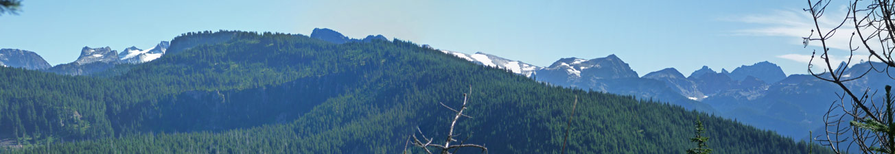
In time, the trees thin out and you just keep seeing more and more glimpses of mountains until there is finally a big enough opening to see a panorama.
Click on the photo for a full sized version.
We stopped in a wide spot along the trail in the shade to have our lunch and then hiked on for a while more.
We came to this sweet little meadow just before Mt Sawyer.
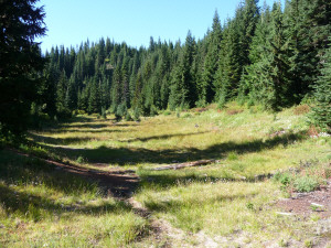
Some years this is a little tarn but clearly it's been dry enough it's a meadow this year.
The trail continues on to Sawyer Pass and a scramble up to the top of Mt. Sawyer. We could see people up on top. We'd been hiking for 2 hours (okay so we were going slow because we were stopping to eat huckleberries and to have lunch but still) and we decided we were ready to turn around here at the meadow. We'd gone about 3 miles and that was enough for us.
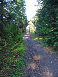
Aside for a few steep ups on the way back --the worst thing in hiking is having to go UP on the way back-- it was a quick trek back--just about an hour. You can see how steep the trail is at the beginning. I took this photo of Walter when I was about 20 paces ahead of him just before we got back to the trailhead.
The next day it was time for a little kayaking trip. We'd read about Rattlesnake Lake in one of our hiking magazines and decided that it would be fun to take the boat out to someplace new.
So we drove down to I-90 and then 1 mile east of North Bend --exit 32-- and then to the end of the road into the Cedar River Watershed.
It's a nice little lake with a couple of well tended park areas on its shores. It even has a little gravel boat launch for non-motorized boats.
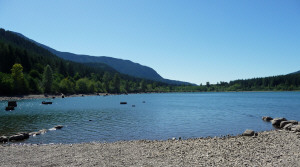
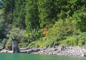
It's not a big lake and there are lots of old cedar stumps sticking out of the water this time of year. They're old stumps because you can see the notches in them that the old-time loggers made when they cut them down at the turn of the century.
The stumps made the paddle a little more interesting because you had to really pay attention to where you were going!
Here's Rattlesnake Ledge (to the west), the eastern-most peak in the Issaquah Alps.
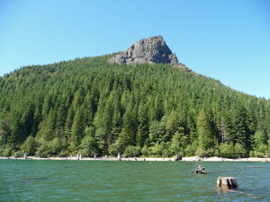
The trail to the top of it starts from the park and we saw people up at the top while we were out on the lake.
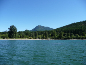
Here's the view to the east.
It was a warm and there was a brisk wind which made for a little chop in the water. The vine maples are starting to change and they added a bit of color to the shoreline.
At times on our way back we were paddling straight into the wind and it carried the water off of Walter's paddle straight back to me--a perfect way to stay cool! We got a good workout paddling into the wind but since it's such a small lake it really wasn't a big deal.
We had a nice picnic lunch in the grassy area in the shade and then toddled home for a nap. The perfect end to a stay-cation day.