
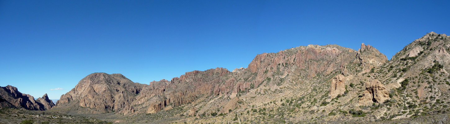
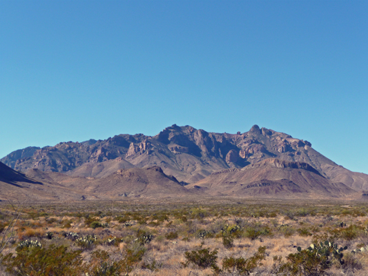
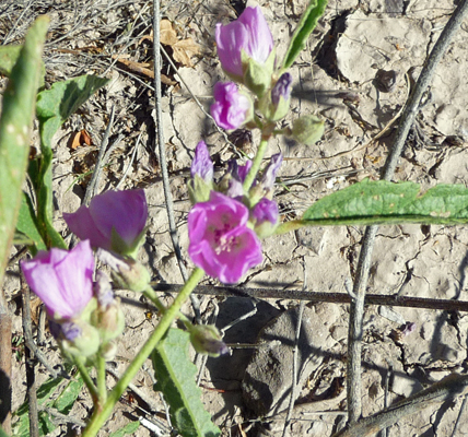
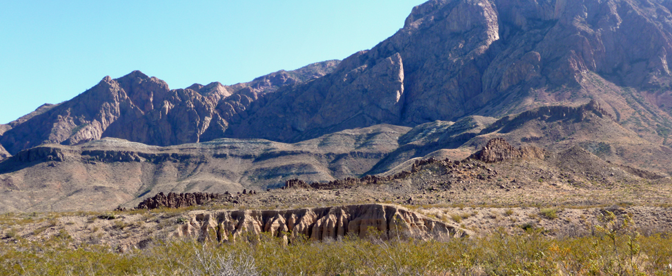
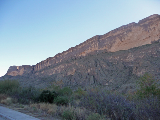
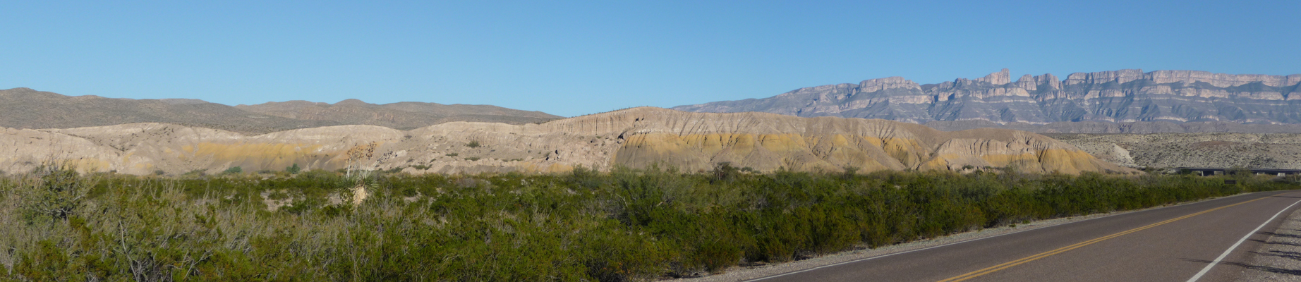
First stop, was to the Visitor’s Center at Rio Grande Village to check out their displays and the weather report. It’s a small Visitor’s Center but I did find bit of ID information about the flowers I’d seen and that was good. As we set out we had a whole other view of the Sierra del Carmen range to the east than we’d had the afternoon before.
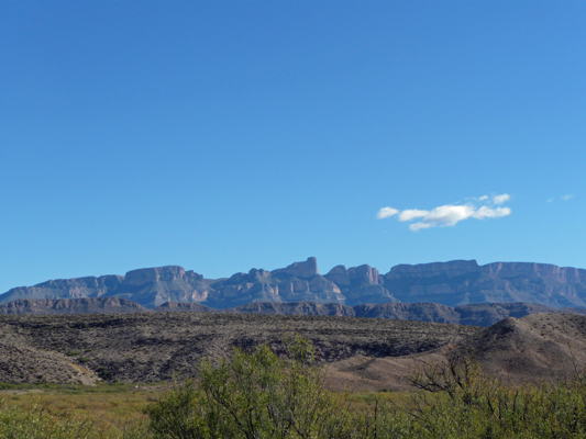
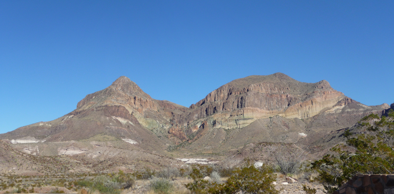
From the eastern side of the park the Chisos Mountains look very different than from the north.
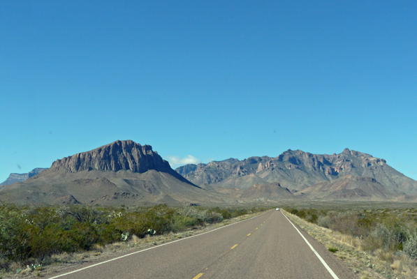
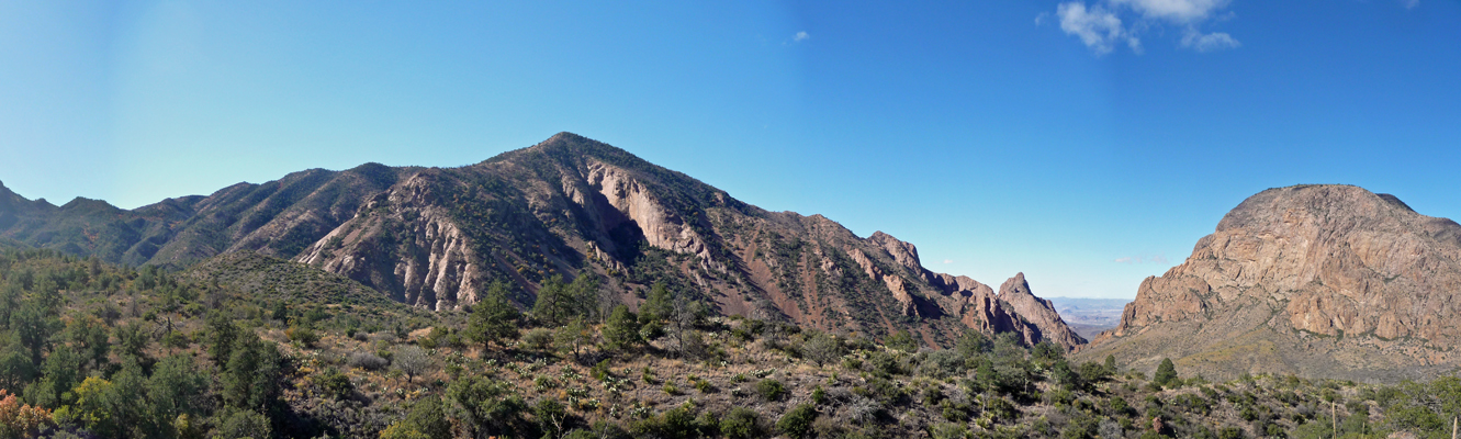
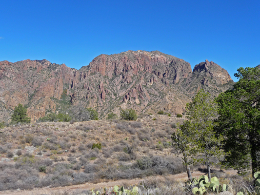
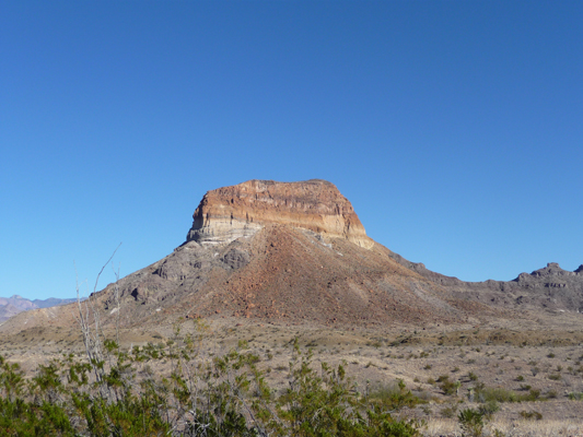
By the time you’ve driven through Panther Junction and are heading to the north of the Chisos the view has changed again.
We took the Chisos Basin Road that takes you up into the mountains themselves. As you move up in elevation trees appear and you get a sense that you’re finally in the mountains.
You drive up through a gap in the mountains and into a large bowl that is know as the Chisos Basin.
There is a lodge with hotel rooms and cabins and a restaurant plus a campground, a small store with groceries and a visitor’s center. This is the the jumping off point for a great number of hikes—most very long and strenuous—that take you out into the the basin and up along it’s rim. Since it’s way cooler here than down in the desert, folks can hike here well into the spring and maybe even early summer. It’s usually at least 20 degrees cooler here than down along the river.
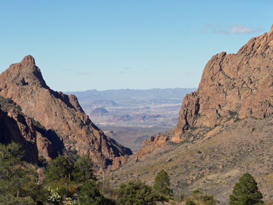
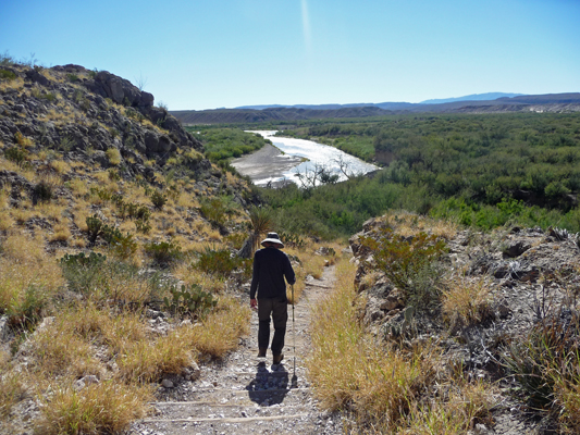
We took the easy paved Window View Trail for a direct view out the ‘window’ of the basin--just right of the center of this photo. It’s more of a half of a window frame but hey, you get the idea.
You can hike all the way to the ‘pour off’ of the window where water rushes over the edge and down into the desert when it rains but that is a much more strenuous hike than we were looking for. It was only 42 degrees and while it was warm in the sun it was cold in the shade especially when you got caught in the wind. So we kept it simple and strolled less than a quarter of a mile out to the view point where the view through the window looks a bit fake—like a diorama or a piece of old movie backdrop.
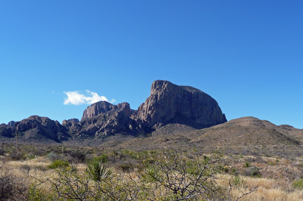
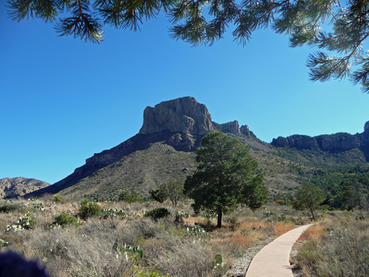
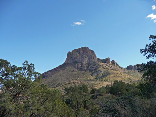
When you turn around from this spot you can look back at Casa Grande Mountain to the east.
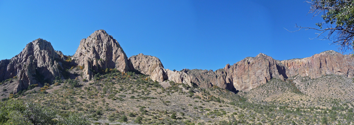
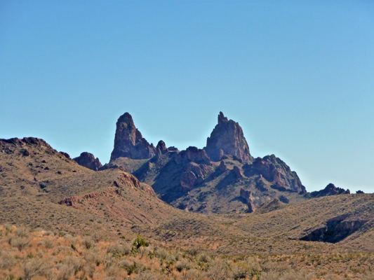
And when you turn about 90 degrees the other way you see the fun red towers on the north wall of the basin.
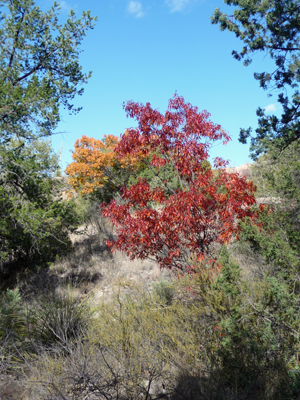
Having completed this short hike we thought we’d hike part of the Basin Loop Trail just too see what it was like. It’s a rocky uneven trail that first goes down into a small ravine with oaks showing fall color. It was pretty but COLD down in here.
Then it went back UP the hillside so we got a really nice view of Casa Grande.
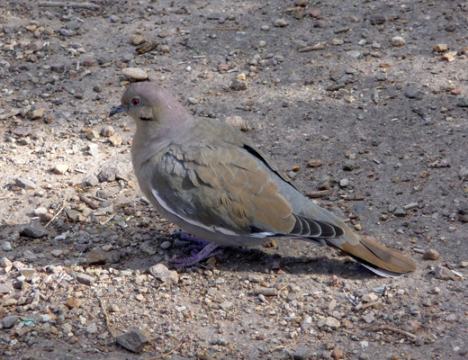
We came out at the top of the area where the cabins are and decided we’d climbed enough—we were both cold and I was getting stiff. As we wandered our way back towards the truck we spotted a sweet little white winged dove.
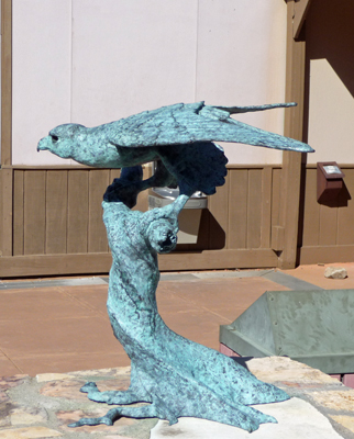
We stopped at the Visitor’s Center and I took a shot of this sculpture of a peregrine falcon called ‘Lord of the Wind’. They have several mating pairs of peregrines in the park who they work to protect.
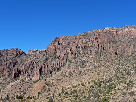
On our way out of the basin I got one more shot of the northern wall. I do so love red rock towers. There’s a trail called the Pinnacles and I suspect that this is where it goes.
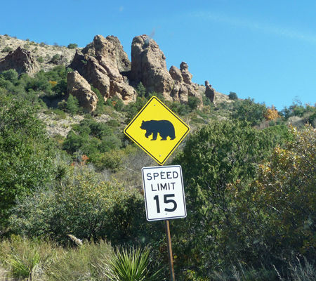
As you drive through the gap in the north end of the basin you pass a bear crossing sign—what fun! There are about 20 black bears (and 20 cougars) in the park and the lady at the Visitor’s Center said that the bears are spotted daily in through here.
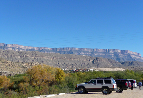
We drove on back through Panther Junction and found a turn out on the Rio Grande Village road with a view out across the Chihuahua Desert for lunch.
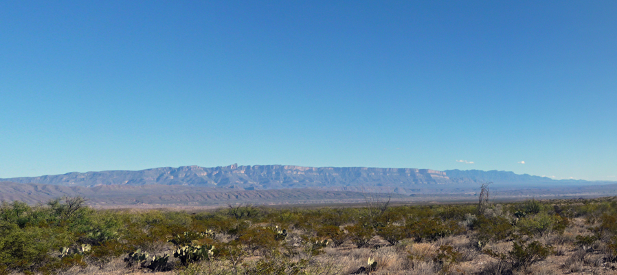
And a not to bad view of the Chisos again from the east side.
It was still fairly early in the afternoon so we drove on down to Boquillas Crossing in hopes of getting a photo of people being ferried across the Rio Grande in rowboats to visit the town of Boquillas over in Mexico. But you have to go through the border crossing (with passport in hand) to even see the river here so I settled for a photo of the view from the parking lot where you can see a bit of Boquillas in the distance.
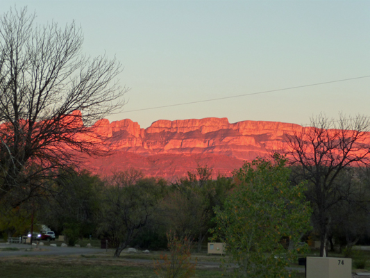
That evening the Sierra del Carmen range lit up blood red at sunset.
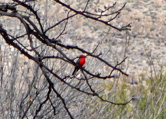
Having had 6 driving days in a row, we decided to stay closer to home on Monday December 14th. We hung around the trailer in the morning. I had a lovely time trying to take photos of the Vermillion Flycatchers that were catching bugs just outside our campsite. We saw a few of these in southern Arizona last winter but there were many more here just in the campground.
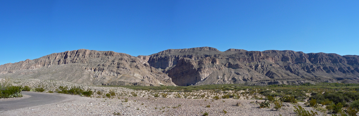
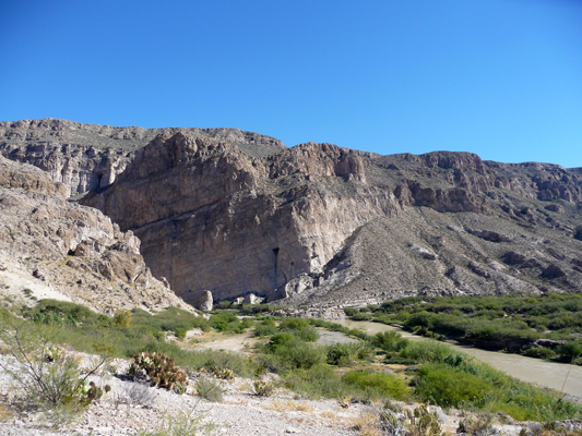
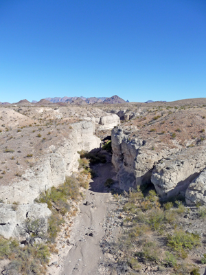
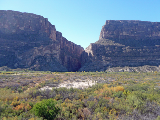
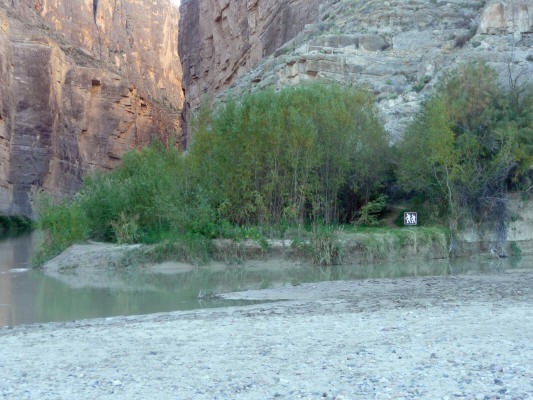
Later in the morning we drove out to the Boquillas Canyon Overlook. The mouth of the canyon is that dark shadowed area in the center of the photo. The river has ground through 1300 feet of sandstone to form the canyon.
You can also see across the Rio Grande to the town of Boquillas. The crossing is closed on Monday and Tuesday so the locals were sitting under the trees along the river with their donkey and their rowboat. Boquillas really is OLD Mexico. Back before the crossing was closed in 2002, they ferried you across the river in a rowboat and then you road to a donkey to town. Most of the donkeys wandered off in the 10 plus years the crossing was closed but clearly there are still a few around. If you’d wanted to risk it, these fellows would have happily rowed across to get you.
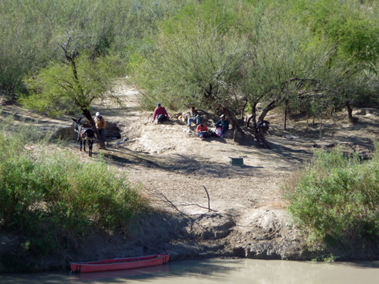
Along with having a quiet day by the river they were no doubt keeping an eye on their crafts display up at the viewpoint.

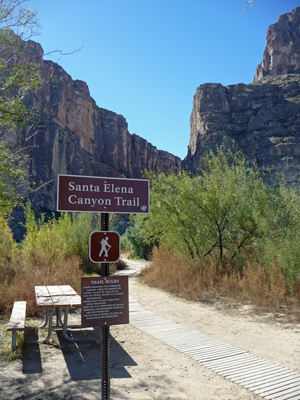
We motored on towards the trailhead for the hike into Boquillas Canyon and passed a road sign explaining that from 1915-1919, there was a mining operation on the Mexican side that used an aerial tramway to bring the ore from Mexico to the US, reaching 6 miles across the river and the desert. It delivered 7 tons of ore an hour to the Ernst Valley terminus in Big Bend. Then it made a 85-mile wagon trip up to Marathon to be loaded onto the train.
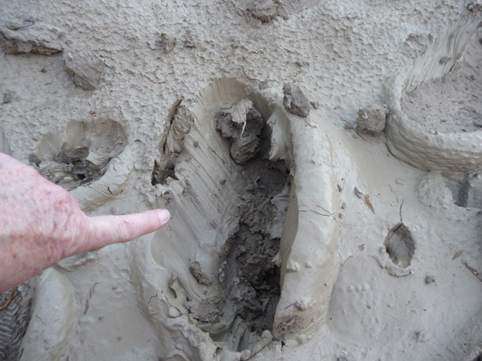
Here’s one of the ore buckets from the tramway.

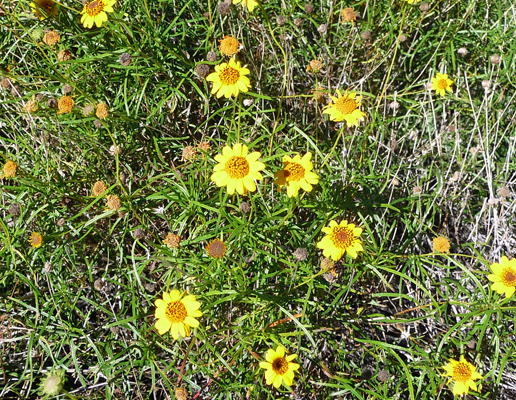
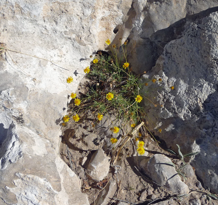
Across from the sign there were all sorts of lovely little yellow flowers in bloom. Including Skeletonleaf Goldeneye (I think) .
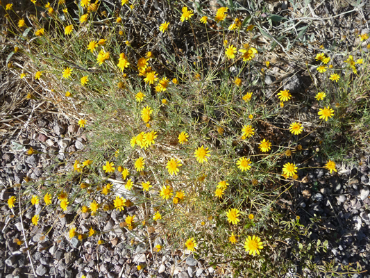
And these tiny little yellow guys.
There were more trailing four o’clocks too.
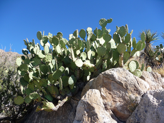
We changed into our hiking boots at the trailhead and made our way up the stairs at the beginning of the trail. There were HUGE prickly pear cactus along the way.
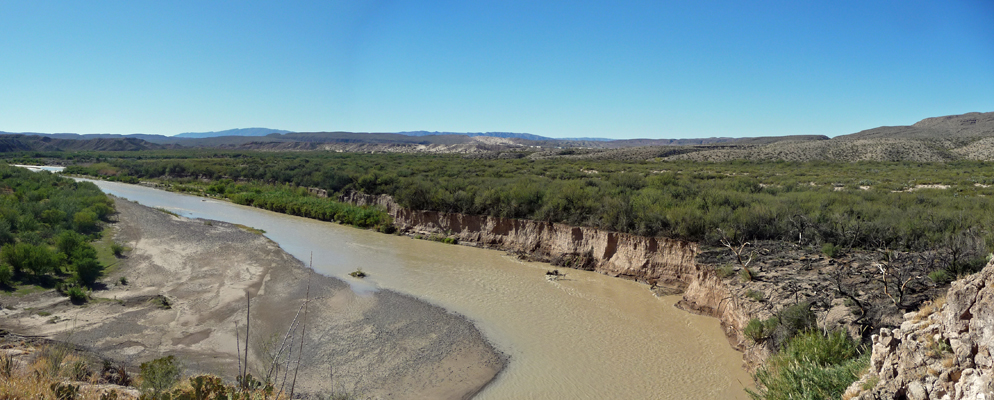
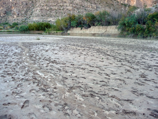
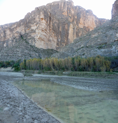
And when you got to the top you could see how the Rio Grande was making nearly a U turn before heading into the canyon. All that mud is a great abrasive to help the river wear its way through the mountains.
There were horses tied up across the river here too and another rowboat.
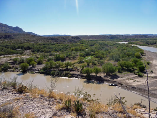
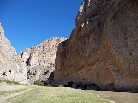
From here you can also see the river as it enters the canyon.
We hiked on down to the river and followed the trail towards the mouth of the canyon. The grass here was nicely mowed. Deer? Horses from the other side? Who knows?
Here we encountered a local on the other side of the river singing his heart out to entertain the gringos. He had donation jars distributed along the trail here and there and could see them all too. We had a little conversation with him and left him a tip—only after making change from his jar which raised his hackles a bit. When we’d assured him we were leaving him a $5 bill in exchange for the $2 he had in there, he was happy and sang some more for us. The canyon made for great acoustics.
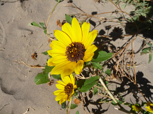
There were sunflowers in bloom along the trail.
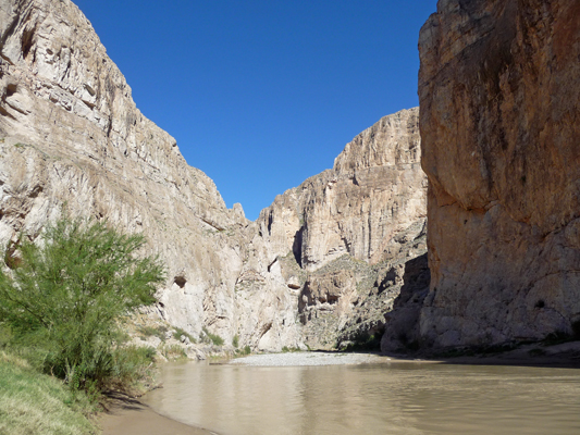
And I spent some time trying to capture the height of the canyon walls while standing in the canyon itself.
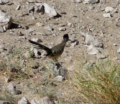
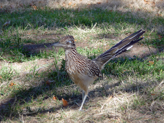
We spied a male roadrunner in amongst the rocks—he’s got a much bigger crest on his head than the females.
We ended up turning around where the trail literally fell into the river. One might have been able to scramble over the rocks but one false step and you’d drop a good long ways into the river. We decided we’d seen enough and that we didn’t need to risk it.
On our way back I spied some really tall Desert Marigolds that had fallen over. With a little help I got a nice photo of them.
We almost missed the trail back up the hill, but the crafts display saved us!
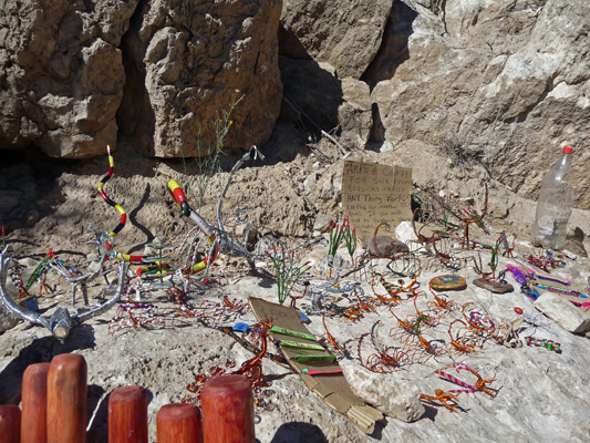
There were even deer antlers in this batch along with bracelets and painted rocks.
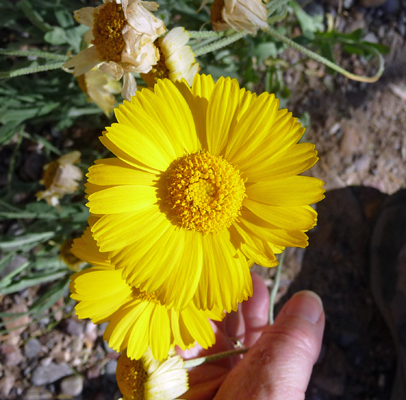
I’m not sure what these lovely yellow daisies are but I did like the way they were growing in a niche in the rocks along the trail.
This hike was just about right for us given that it was getting warm (it was in the upper 60’s) and it was rough and rocky in places. We’ve found that desert hiking is very different from hiking in the mountains in the NW.
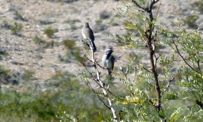
When we got back to the truck I spied some Black-Throated Sparrows in the Honey Mesquite in front of us.
Back at the campsite, the Vermilion Flycatchers were doing their thing again.
We sat outside for a while and a roadrunner came through the grassy area searching for bugs I guess.
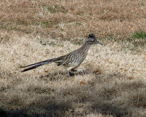
She came RIGHT up next to us so I got a great close up.
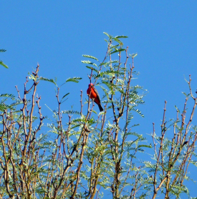
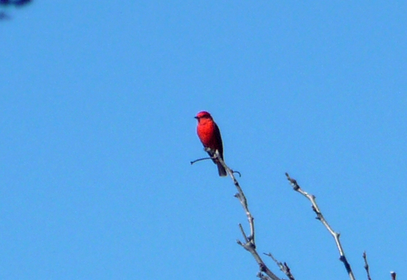
Later in the afternoon, I finally got a totally unobstructed view of a Vermilion Flycatcher sitting at the end of a bare branch.
The rest of the afternoon was a quiet one. We ended up talking with several of our neighbors about solar panels and places they’d camped and where they were going. We also got good advice for the hike we were planning for the next day: don’t get your feet wet and don’t step in the mud.
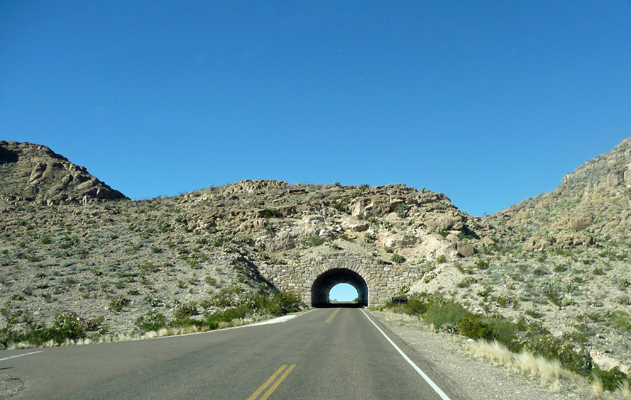
On Tuesday December 15th, we drove north, through the tunnel out of the Rio Grande Village Area.
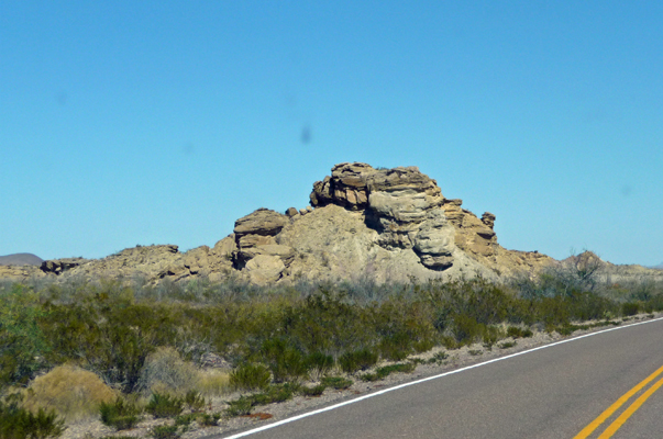
And then north through Panther Junction and past the turn off for Chisos Basin, to the Ross Maxwell Scenic Drive. Ross Maxwell was the first park superintendent at Big Bend and was very interested in the geology of the area. This drive takes you through all sorts of fun geology including odd little formations like this.
And explanations of the formations called ‘dikes’ that are actually magma that forced its way up through cracks in the rock. When the surrounding rock is eroded away it leaves these dikes which I think look more like little stone fences or spines on the backs of dragons. Once they are pointed out to you, you see them all over the park and the surrounding area.
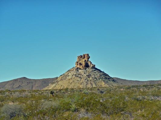
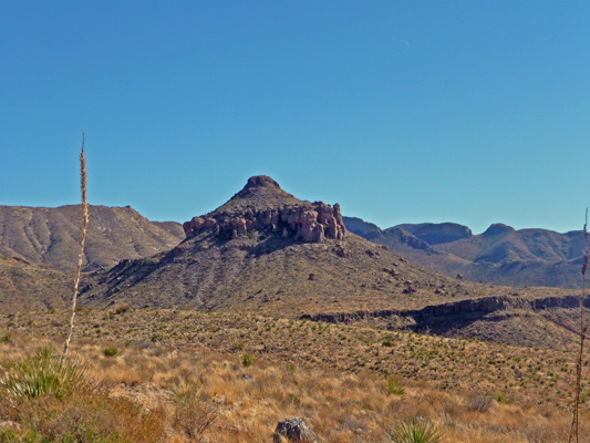
We both found these odd cones of rock highly amusing.
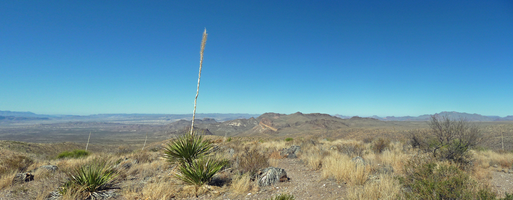
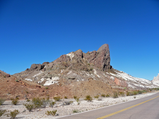
We stopped at Sotol Vista where there are lots of sotol (the same candle yuccas we saw up by Deming, NM) along with a great view across the desert towards Santa Elena.
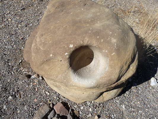
There was also a very nice mortar stone at this vista point. The early inhabitants didn’t use the mortar on sotol roots. They baked sotol hearts as a food source and used the fibers for weaving. There were supposed to be mortars in Boquillas Canyon but we didn’t see them along the river where they were supposed to be.
We stopped for a photo of the Mule Ears Peaks.
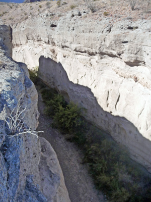
And we got out and hiked a ways for a view of the Tuff Canyon—volcanic ash that has been compressed into stone is called tuff so it’s either white or gray.
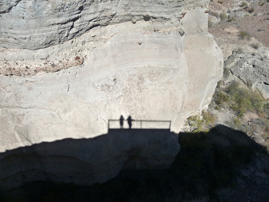
The shadows were getting long (it was December after all) and I couldn’t resist this picture of our shadows cast from the overlook down into the canyon.
This was really a fun place but it wasn’t easy to photograph.
Not much further along the road you could see a layer of red rock on top of the tuff which made for some fun formations.
The road winds through the old village of Castolon where there are ruins of adobe houses, a campground and a Visitor’s Center. We took a look at the campground. It’s got lots of cottonwoods to provide shade but that could be an issue because they don’t allow generators here—no solar because of shade or clouds would be a problem for us if we couldn’t run the generator. There were many more folks camped in Rio Grande Village than here. With lows down into the 20’s having generator so you can run your furnace in the morning is a good thing.
We continued on to the viewpoint for Santa Elena Canyon. Yes, it’s that fold in the rock up ahead. The rock on the left is Mexico. The rock on the right is US.
And then drove on down to the trailhead to take the hike across Terlingua Creek and deep into the canyon.
People in the parking lot were using sticks to scrape mud off of their shoes—not a good sign. Remember, we had about 1/4 of an inch of rain on Saturday night. That had brought the water levels in Terlingua Creek up and there was MUD where you normally would have none.
And water where you normally would cross.
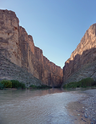
It wasn’t very deep water but it was deep enough. We crashed around in the bushes a while heading upstream in hopes of finding a way to cross. And I got a nice shot of the canyon wall from up Terlingua Creek.
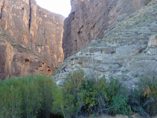
I tested the mud and found it slick and really really sticky. I wasn’t interested in walking through it underwater. In the end we did figure out how you could cross but it involved being willing to get muddy and get your feet wet and then get muddy again and THEN climb up the bank. We opted to take a pass but we did point out the route to a couple who asked us about how to get across. She was already really muddy so they went for it and while she had trouble getting up the bank they made it and we hooted and hollered for them at their success. Once you’re across the river you get to climb a series of stairs and switchbacks to get up into the canyon—see the guy in the red shirt?
Walter found us a packed dirt path back along the creek and out onto a sandbar where I could get a good photo of the canyon walls. It’s really a gorgeous place even if you can’t always get to the trail. I still haven’t managed to get all the mud off my boots (and I didn’t get that much on them in the first place) so I’d say the advice we’d gotten the day before about staying out of the mud was worth following.
Clearly not everyone followed it though. Can’t you just hear the squelching sucking noise as the boot came back out?
We had lunch at a picnic area between Santa Elena and Castolon. Walter calls the view “Trump’s Wall”. Don’t you think we need a wall on our side of the Rio Grande too?
On our way back along Ross Maxwell Scenic Drive, I got a great shot of Castolon Peak.
And further along, the green pyroclastic layer in Goat Mountain showed up in the late afternoon sun when you couldn’t see it earlier in the day.
Both of these mountains display the long history of volcanic eruptions in the area followed by erosion and sedimentary layers—all in lovely colors and interesting erosion patterns.
We drove on back to camp and just before you enter the Rio Grande Village area there’s these lovely hills with yellow deposits. There is no sign to explain them so you can make up whatever story you like about what causes the colors.
It was cold that night (we’d had to run the furnace every morning but the last night it was well into the 20’s) and we ready to move on. We’d had plenty of sunshine so the solar panels had done a great job of keeping the batteries charged. I have a new 12V charger for my computer so I could sit and process pictures with it plugged in to our one 12V outlet and not run down my computer battery either. Isn’t life good? There was no cell or internet signal here but hey, it’s a gorgeous place.
On Wednesday morning December 16th, we packed up and drove back through Panther Junction and then turned north through Persimmon Gap and on to the little town of Marathon (where they have a marathon race every year to go with their name).
On the way, we passed yet another wonderful strange eroded formation (and a nifty sign about the camel corps that worked here in the mid 1800’s).
We had a package waiting for us at the tiny post office in Marathon. When I went in to pick it up the clerk behind the counter recognized my name right away and said, “Oh good, no one knew who this was for.” Clearly they don’t get many general delivery packages in Marathon.
Then we drove west to the town of Alpine because we needed to do grocery shopping and laundry. Marathon had an RV park but neither a laundry nor a grocery store. In fact, Alpine even had a natural foods store where we could stock up on a few things—Almond Dream Bon Bons, yum! We did our grocery shopping on Wednesday afternoon and then settled in for the night. By early evening it was clear it was going to be COLD so we disconnected our water hose and just filled up our water storage tank. Good idea. It got down to 23 the next morning. Thank goodness for electricity when it’s this cold—our pipes didn’t freeze.
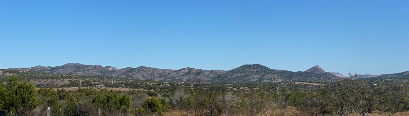
The laundry at the La Vista RV Park turned out to consist of 1 washer and 1 dryer. We could have driven into town and done it there but I decided it would be okay to hang around the trailer and do it the old fashioned way since they had a really nice free WiFi signal. Boy did it take all day! And I certainly got plenty of exercise going back and forth to check the dryer which lacked a bit in heating action. Meanwhile here’s the view from the campground. With a name like Alpine you’d expect lots of trees and snow capped peaks, yes? No, this is Texas. Instead you get lots of junipers at 5,500 feet.
On Friday December 18th we packed up and drove southeast to Amistad National Recreation Area just outside of Del Rio, Texas. This is a large reservoir fed by the Rio Grande, the Pecos River and the Devil’s River. It has a number of camping areas (complete with covered picnic tables and trash cans) but because the lake is so far down due to the drought, water isn’t visible from most of them. We drove out to Rough Canyon Campground where we’d read that we could get a water view site.
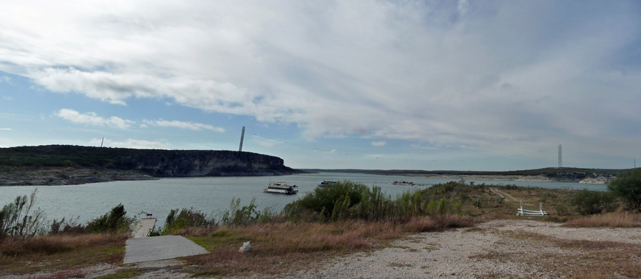
The pathway down to the lake is steep and one of the boat launches was closed to low water but it was still pretty. We hiked over to pay our camping fee ($2 with our Senior Pass since this is a National Recreation Area) and then came back and talked with our neighbor (our only one but hey this campground only has about 4 sites). We had planned to stay here 2 nights but the electronic kiosk only allowed you to pay for one night at a time. This turned out to be good since the next morning it was 50 degrees with 18 MPH wind after having gotten down to 38 the night before. We really didn’t want to sit and huddle in the trailer as we watched the clouds come in, so we broke camp and drove south instead. The clouds got thicker as we drove south and then poof we were out of them and the temperature gradually rose. By the time we reached Lake Casa Blanca State Park in Laredo, TX it was 73 degrees and the sun was out. YES!
Texas State Parks have a weird fee structure. Every individual has to pay an entrance fee (each day) and then the camping fee is on top of it. It’s a little like the vehicle fee in Idaho but in this case it’s a per person fee. You can avoid the daily per person fee by buying a state parks pass for $70 that allows you to visit all their parks for free. It also gives you 50% off of your second night of camping (for 4 visits). Given there are lots of nice parks to visit on the Texas Gulf Coast, we went ahead and sprung for the pass which took our camping fee from $52 to $27 for 2 nights. Not bad! We’ll break even quickly this way.
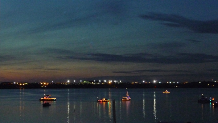
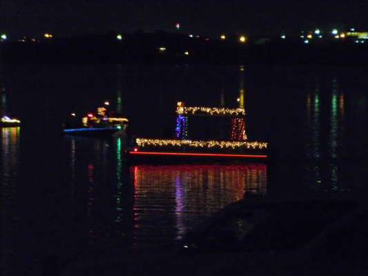
Our campsite didn’t have a water view but it did have water and electricity. And Saturday evening was their Christmas boat parade. I got dinner assembled and on the stove and then we drove back towards the Day Use area to see where we could view the parade. We found lots of cars parked at the boat ramp and sure enough there were the lighted boats getting ready to start their circuit of the lake.
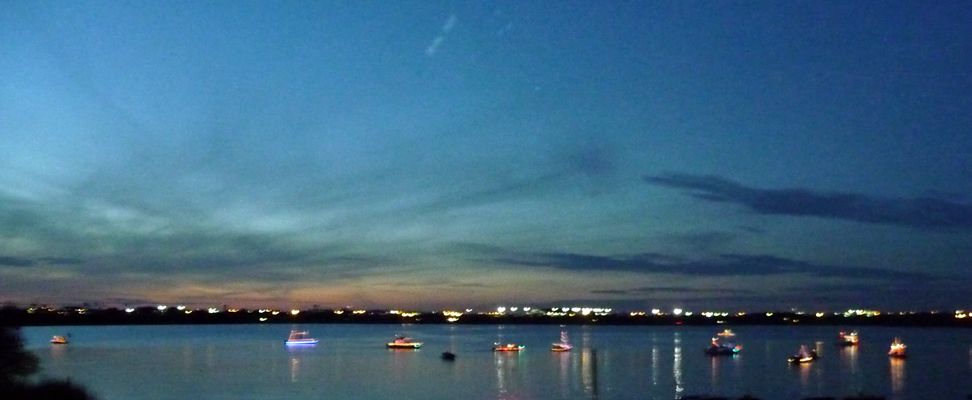
We even got a little sunset as they wandered around.
There was a sailboat with a Christmas tree set up in it’s rigging. It looked much better end on and then from the side.
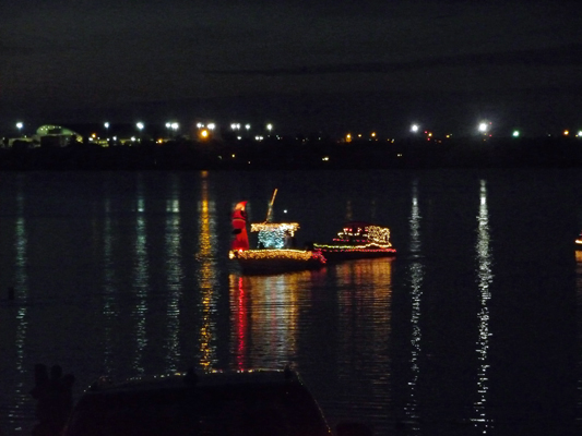
There were Santa’s aplenty.
And the lighted stripe on this boat kept changing color which was fun.
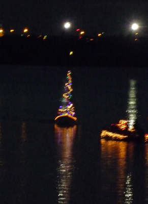
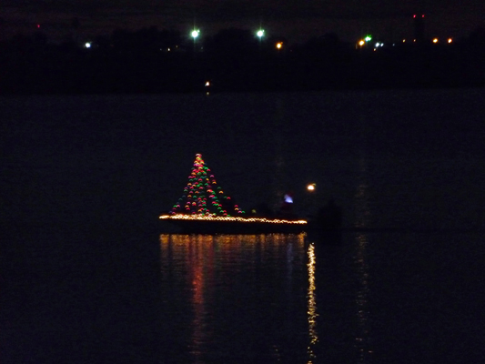
There was yet another Christmas Tree.
And lots of lights in a pattern I’m not sure was meant to be anything but pretty. I certainly like the way the reflection came out.
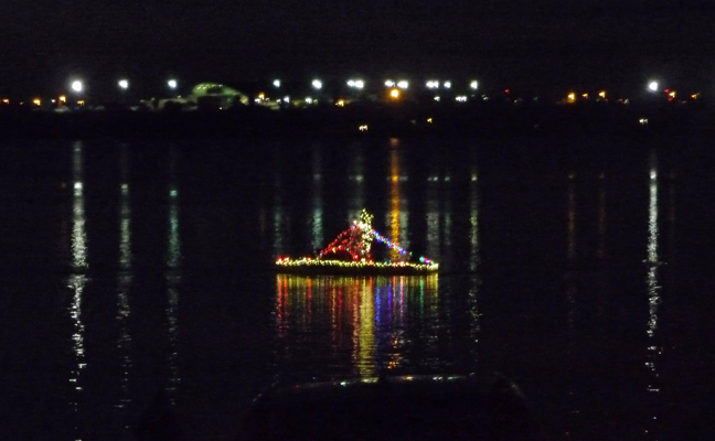
There were about a dozen boats and after they’d wandered around some, they lined up and started their tour of the lake and disappeared from sight. It was in the high 60’s and really pleasant to sit and watch the boats. After we got back to the trailer I heard the boats finish their circuit—one playing Santa Claus Is Coming To Town really loud. There was much horn tooting and clearly a good time was had by all. While the campground wasn’t full, the Day Use areas were pretty full of folks having bar b ques when we arrived. Clearly this is a fun Laredo tradition that we stumbled upon by pure luck.
We gave ourselves a down day on Sunday December 19th which included a journey through parts of Laredo in search of a hardware store. There are 250,000 people in Laredo so it’s a pretty big city. We found the Lowe’s okay but of course the item we bought wasn’t quite the right thing so we’ll have to make another trip later. The law of hardware store trips rules whether you’re at home or on the road—one trip rarely does the trick.
It was cloudy most of the day but it still got up to 72 after being down to 54 the night before. I’m not nuts about cloudy days but I’ll take 72 and cloudy over 50 and cloudy any old day.
There are a couple of mostly cloudy days in the forecast before it’s supposed to heat up in a major way down here in southwest Texas. It’s supposed to be in the high 80’s in the Brownsville area starting on Wednesday—not exactly Christmas-y weather. We’re headed in that direction but haven’t quite figured out where we’ll go next or for how long. We’re most definitely in full wander mode at this point. We may go out onto South Padre Island for a few days when it gets hot since it’s not supposed to be as hot out on the beach.