
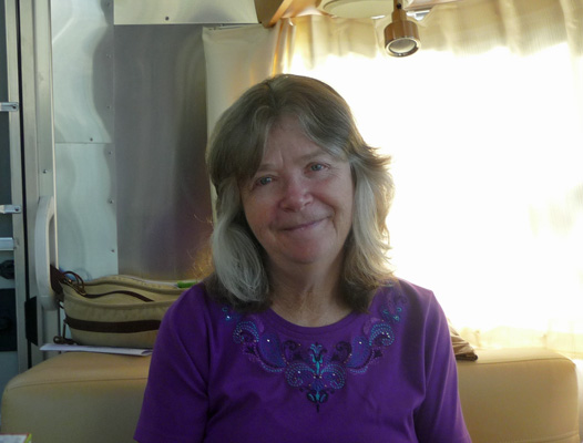
Walter insisted on taking a photo of the birthday girl over breakfast so here she is, wondering “Will you still need me, will you still feed me, when I’m sixty four.”
We packed up and headed west on Highway 58 toward Bakersfield and jogged over and picked up I-5 northward until we reached Coalinga where we took off northwest on the country roads that eventually take you to Pinnacles National Park. It’s a winding hilly drive through some gorgeous country—I just wish we’d had the road to ourselves so I could have driven the whole thing going 40 mph rather than the posted 55. There were wildflowers from time to time but nowhere to even slow down let along park for photos. It was a 230 mile drive (just over our usual limit of 200 a day) and we rolled into the campground close to 5 pm. All was well because we had actually gotten a reservation since it looked like it was going to be pretty full—spring break is underway throughout California basically for the next several weeks.
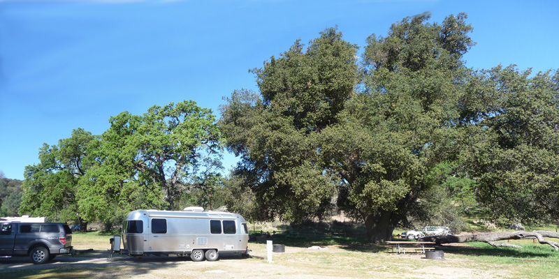
We got a nice electrical hookup spot in the shade of huge Live Oaks on the west side of the campground. This is a very pleasant campground even if the spots are a little closer together than National Park Campgrounds usually are. It used to be a private campground and given that, the spots are much more widely spaced than most private places. We were really lucky that no one ever moved in to the two spots just north of us (that empty space in front of the oaks below).
It was a pleasant 78 degrees so we hiked over to the Visitor’s Center once we were set up and discovered there was literally nothing that we needed to do to check in. But we got a map of the park which was what we were after. On the way back, we stopped by a display about California Condors at the edge of the campground, where they have a couple of viewing scopes. There was a family with a birding scope and they pointed out a condor riding the thermals to us. Pinnacles is one of the places that they have been reintroducing condors back into the wild that have been raised in captivity. There are 30 of them in the park now. They love to ride the thermals off the hills and rock formations in the park. And apparently they like to roost on one particular tree up on the ridge near the campground.
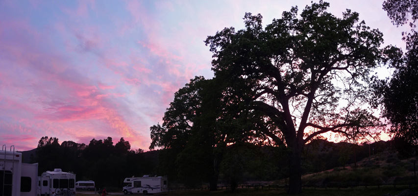
That evening there were just enough high clouds to get a bit of a sunset. This is the view from our trailer door.
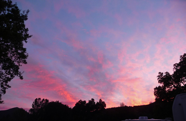
And this was the view a little further down the road a bit.
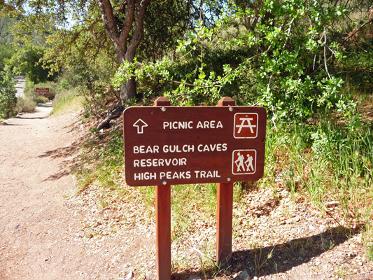
The next morning dawned sunny and clear. We got things together and headed up the road just a few miles to the parking area at the Bear Gulch Day Use Area. The parking lot wasn’t full yet (but it was when we got back 2 and 1/2 hours later) and we got a nice big spot to park the truck. We headed across the road and found the trailhead sign for the loop trail out to the Bear Gulch Reservoir and Moses Spring.
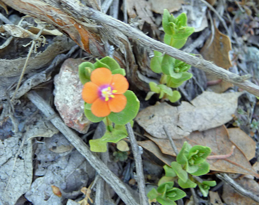
There were wildflowers scattered along the trail to the picnic area including this lovely little orange and pink wonder which turns out to be a non-native! It’s Scarlet Pimpernel (Anagallis arvensis).
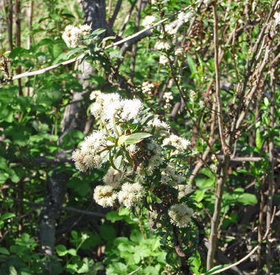
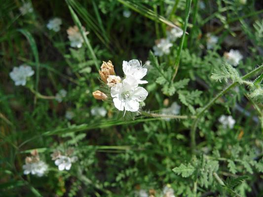
There were lots of shrubs in bloom including this lovely white one. I’ve looked through the entire plant list for the park and can’t figure out what it is.
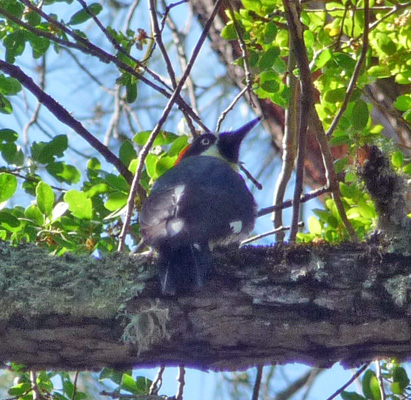
As we walked through the oak forest in the picnic area we spied this Acorn Woodpecker up on a branch.
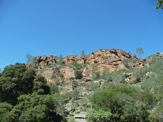
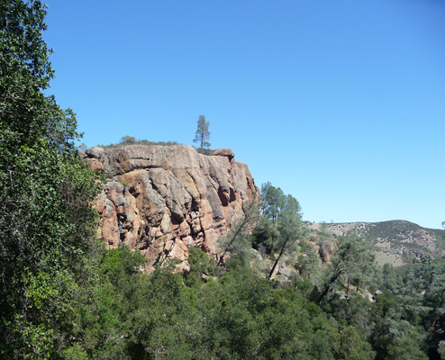
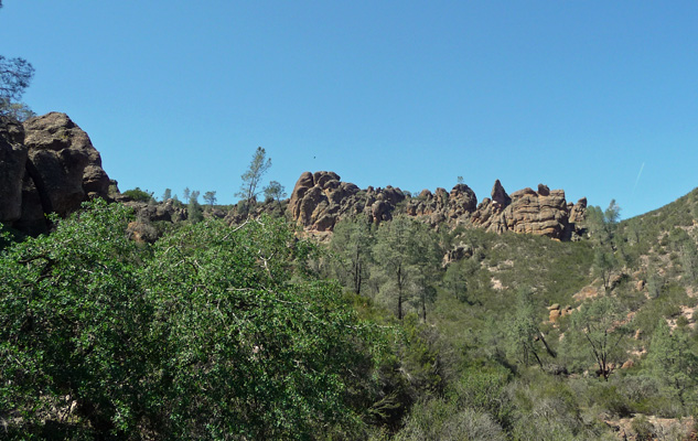
When you come out of the picnic area there’s a small trailhead parking lot (which was full) that provides an opening for a nice view of the High Peaks area. This is the end of the road on the east side of the park. You can also access the park from the west side (about a 2 hour drive from here) but it’s high chaparral and not nearly so pretty, say folks who have been to both sides.
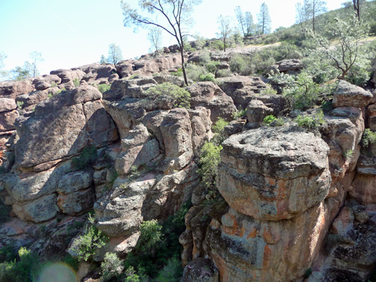
Rock climbing is VERY popular here even though the rock is very fragile and had a tendency to crumble. Just after the trail started, we saw some of the middle school kids who were camped in the tent section of the campground out climbing here.
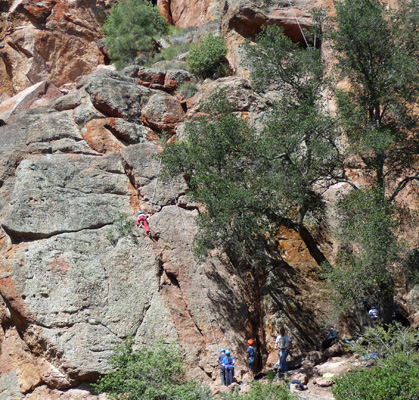
Navigating the trails here is an interesting process because there are lots of side trails that lead to climbing areas. If you don’t keep your eyes on the signs you can end up in some interesting places.
There were patches of this sweet little White Heliotrope (Phacelia distans) here and there in the shady areas along the trail.
Pinnacles became a National Monument back in 1908 so many of it’s trails were developed by the CCC during the 1930’s. It only became a National Park in 2013—there are still National Monument signs here and there. I suspect this tunnel was a CCC project.
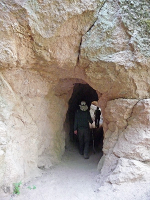
It’s pretty unusual to find tunnels and evidence of blasting along trails in National Parks but we found them here. I suspect it was the only way that they could find to make the trail accessible to just about anyone except rock climbers.
We took the turn off to Moses Spring and headed up hill a ways to a wet spot in the trail—which we figure was the spring.
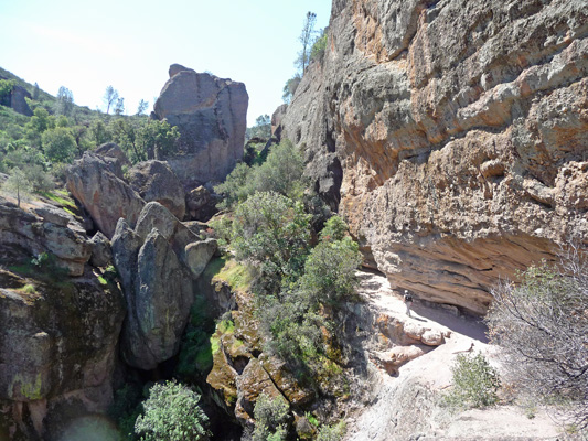
From here you could see down canyon a ways.
The trail went UP the hill and entered an area where you could see into a steep canyon—it goes WAY further down than this.
After scrambling over the top of the ridge you can look down to where the trail is heading...
Looking at all these formations one can only wonder how the heck this great jumble of rock ended up in the middle of the rolling hills that surround it. It’s a pretty cool geological story really. Once upon a time 23 million years ago these rocks were part of the Pinnacles volcano, one of the volcanoes of the Ring Of Fire created by the collision of the tectonic plates. The volcano is believed to have been 15 miles long and 8,000 feet high. But here’s the catch. The volcano wasn’t here in the central valley of California. It was 195 miles southeast of here just outside of the LA basin. The movement of the Pacific tectonic plate northward along the San Andreas Fault split the volcanic field and carried 2/3’s of it northward leaving an area called the Neenach Formation down south. During the trip northward the mass sank and wind, rain and ice eroded the rubble exposing the Pinnacles formation. Pretty cool, huh?
Now that you’ve caught your breath we can hike down the trail and along that ledge.
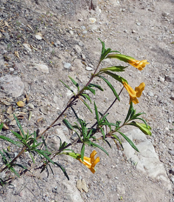
I stopped to take a photo of what is locally called Sticky Monkeyflower (Mimulus aurantiacus)—a pretty decent sized shrubby plant with really sticky leaves.
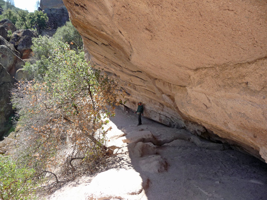
Here’s Walter waiting for me along the ledge. Notice the oak that has persisted in growing out of a crack under the ledge and out into the sunshine. You have to step over it’s trunk as you hike past.
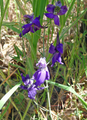
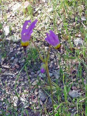
There was Parry's Larkspur (Delphiniu parryi ssp. parryi) in bloom here and there.
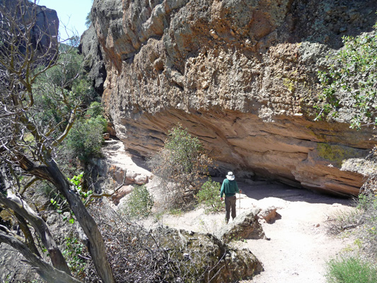
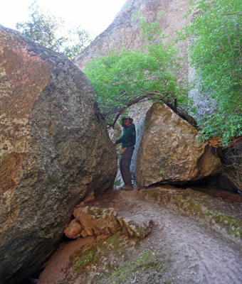
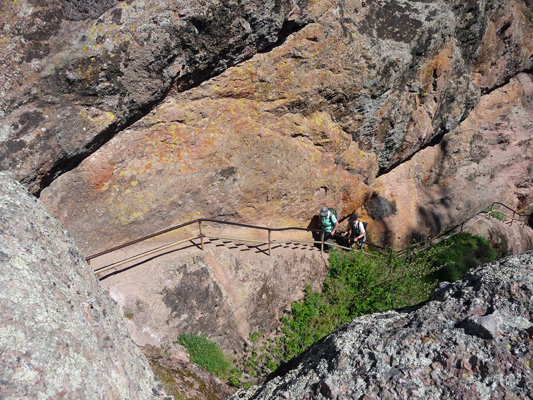
And the trail takes you through a tight spot or two.
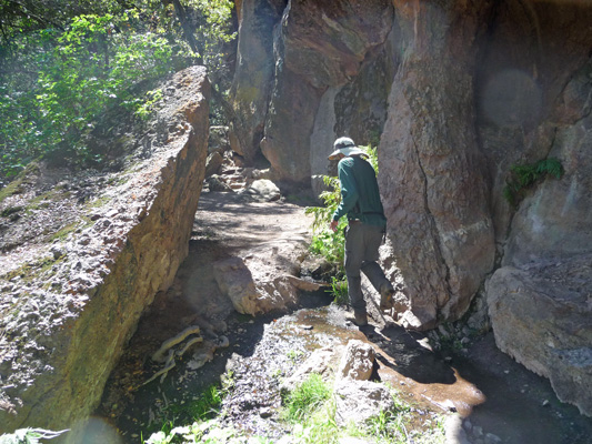
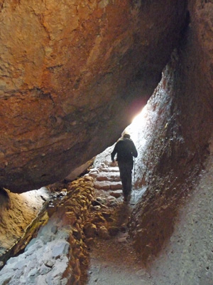
There was a trail crew out working on the steps just past here. Just past here, these stairs that lead into the Lower Bear Gulch Talus Cave. I explored the lower cave a bit and then came back up to join Walter.
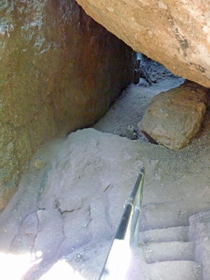
There were more trail workers and more stairs including a section that has worn away entirely. With care we made it down okay.
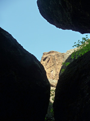
And were rewarded with a view of the rocks above through the ceiling of the cave.
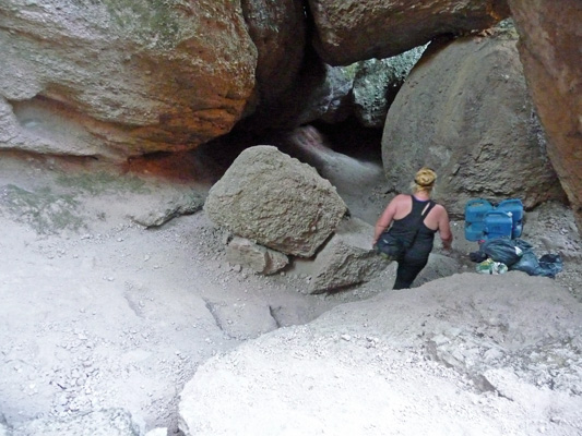
Talus caves are formed by boulders piling up in narrow canyons. There is a rather large cave complex you can hike (and scoot and crawl) through. We opted to do the springs section instead of wandering around in the dark. But you still get to hike through part of the cave anyway.
When you come out of the cave you hit a STEEP stairway that takes you up to a small reservoir.
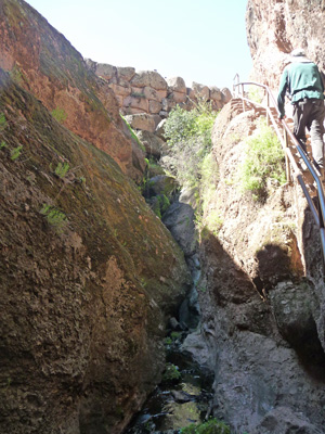
The only real hitch with these stairs is the railing is so low that it hits you at about your shins and so it’s hard to hold on to.
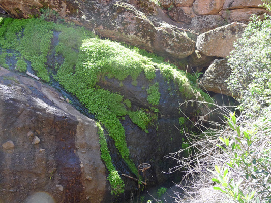
I stopped part of the way up to take a photo of the cool mosses growing along the canyon walls.
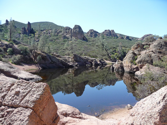
The reward for your efforts is this lovely little reservoir (also built by the CCC back in the 1930’s). It provides habitat for the California Red-legged Frog which was once endangered and is slowly recovering.
Did I mention that the stairs are steep?
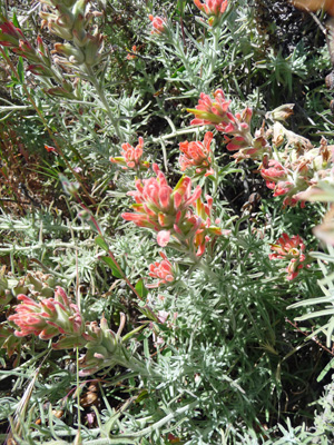
We rested here for a while and enjoyed the water view and then continued on UP the Rim Trail. Here we saw the very bushy Wooly Indian Paintbrush (Castilleja foliolosa) that we also saw along the road coming into the park.
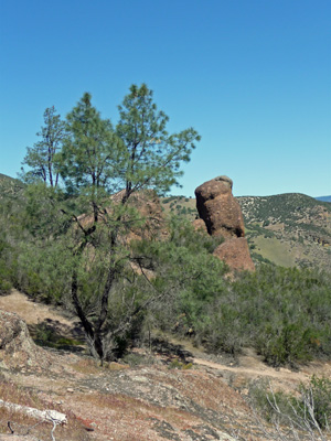
The hike up through the rocks is rewarded with a lovely view of the area complete with a nice specimen of the Grey Pines that grow here.
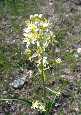
We hiked on and Walter spied a patch of white flowers up on the hillside. We got out the binoculars and decided that it looked like the closeup photo of California Buckeye that was on the map—Little did we know that Buckeye was a tree! So I hiked up the hillside to take a photo. It turned out to be Death Camus (Toxicoscordion brevibracteatum)—much more fun than a tree that's a relative of horse chestnuts.
On my way back down I saw a few Shooting Stars (Dodecatheon clevelandii ssp. patulum) in an area where clearly there had been a LOT of them in bloom a week or so ago.
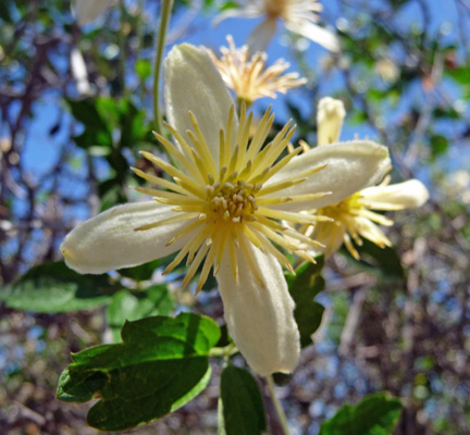
There was Clematis scrambling over the tops of small oaks and large shrubs. I think this one is called Pipestems (Clematis lasiantha). There are two clematis that grow here and they look very similar.
The trail loop passes the start of the High Peaks Trail and the ranger I’d talked to at the Visitor Center had recommended taking even just a little walk up it, so Walter found a rock to rest on and I hiked a ways up around the bend to get a view.
There was a big black bird riding the thermals over the rocks but I don’t know if it was a condor or a turkey vulture. This is an area that is supposed to be very popular with the condors.
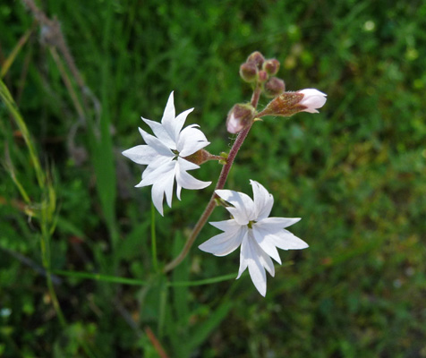
Here and there on the way back down the trail I saw Woodland Stars (Lithophragma affine).
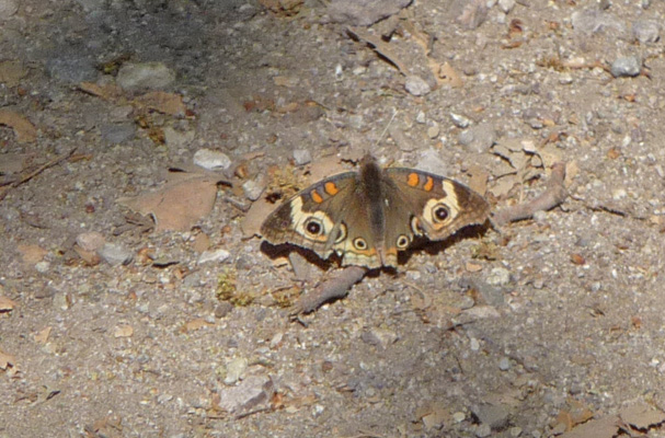
And as we made our way back through the picnic area in the oaks we saw a butterfly come to rest on the trail.
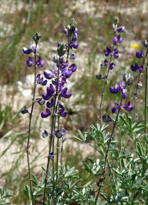
We made it back to the truck without a hitch and drove on down the road back towards the campground. Of course, I had to stop when we saw a patch of California Poppies and the big bushy Lupine that grows amongst them here, which is Silver Lupine (Lupinus albifrons var. albifrons).
We went back to the trailer and had lunch and hung out for the afternoon. It was in the 80’s and we opened all the windows and let the breeze blow through. Ahhhh, lovely. Shorts, bare feet and a gentle breeze. Feels like summer to me.
At about 6:30, just before sunset we went out again to the viewing area at the edge of the campground to look for condors. This time there appeared to be several in flight and I managed to focus the scope on one as it rode the thermals. It had white patches on it’s wings in the right place (they have black wing tips and white patches further up their wings while Turkey Vultures have white wing tips and are black on their main wing parts). Hot Dog, a Condor. We stood and watched and 3 more appeared along with a whole bunch of turkey vultures. A ranger came out and spent some time showing us how to tell them apart beyond the coloring on the wings. The turkey vultures have a narrow tail while the condors have a broad wide tail. This allows the condors to have a much more even flight while the turkey vultures rock back and forth while they soar.
We stood and watched for about 45 minutes and had a great time with all the other folks who gathered to watch. We learned that there are about 30 California Condors who use the Pinnacles as their ‘bedroom’, i.e. they roost here. There are another 30 or so who spend the night south of here all the way down as far as Big Sur. They don’t feed here. They range all over a huge area of the coastal mountains and surrounding rangeland feeding on carrion they find. All the condors in the area have been captively bred and released here (that’s true of all the California Condors in the west since they went out and collected all 22 of the known living condors back in 1982 to begin the breeding program to save them). There are now 80 or 90 of them in the Grand Canyon area in addition to the ones that are here. The first condors were released here in 2003 and each year they have released more. This year they released 3 more here. So far, none of the condors here have successfully bred and had their young survive. Right now there is one breeding pair with a confirmed egg here in the park. This is a HUGE deal. If it hatches and survives it will be the first wild-hatched Condor in the park in over 30 years! Whoo Hoo!
The forecast at the Pinnacles was for highs in the upper 80’s on Thursday March 25th, so we headed out that morning for Coarsegold, CA northeast of Fresno for a few days. The plan being to use it as a home base to go to Yosemite for day trips since it’s still too cold at night for us up there (low 30’s and no electrical hookups) AND all the campgrounds in the park are full because of Spring Break.