
We packed up and then we headed south from Lakewood, NM, through the town of Carlsbad. We had hoped to visit Carlsbad Caverns just a little further south but the elevator that takes you down into the main cavern was out of order and we decided that a 3 plus mile hike with a 750 foot loss (and gain) to just get down into the cave was a bit much for us when we really wanted to put our energy into seeing more of the caverns. So we opted to skip Carlsbad Caverns in hopes that we’ll come back this way in the spring.
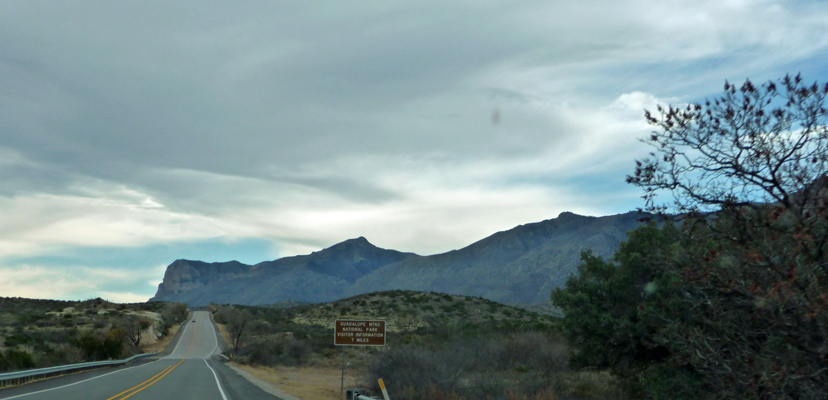
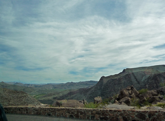
We drove on into Texas and Guadalupe Mountains National Park. It was partly cloudy so the view of the mountains were a bit shadowed as we neared the park.
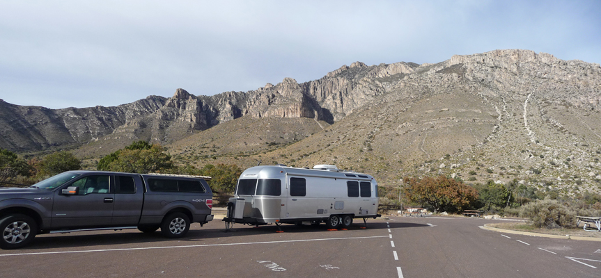
We found a decent spot in the Pine Springs Campground RV camping area. This is really just a parking lot (and not real level at that) but the view was nice.
We set up camp and I hiked back to the registration kiosk to pay our $8 for two nights stay. (It’s $8 a night but you get 50% off with your Senior Pass—AKA the Golden Geezer Pass). There weren’t many rigs in the lot so we pretty much had the place to ourselves.
The Guadalupes are the remains of an ancient reef formed 260-270 million years ago. Over millions of years, sea critters lived and grew here to form a 400-mile-long, horseshoe-shaped reef. Eventually the sea receded and the reef subsided and was buried under sediments and mineral salts to become a giant fossil reef. This portion of the reef was uplifted and it’s peaks revealed by erosion. Sitting Bull Falls is on the north side of these mountains and those hills and formations were in the lagoon formed by the reef. There are only two other sections of the reef that are visible—one just south of here near Van Horn, TX and the other in the Glass Mountains near Alpine, TX.
We had lunch and then went over to the Visitor’s Center to watch their movie (it’s a little short but the photography was nice). It was windy so we decided we’d wait until the morning (when they said the wind tended to be less of a problem) to do our hike. There are a number of hikes that leave right from the campground (in fact right across from our truck) and we planned to take one of those.
However, best laid plans and all that, life intervened. At about 6:30 pm there was a knock on the door and a ranger told us that they had spotted a fire up on Guadalupe Peak (the highest point in Texas at 8,751 feet) and we needed to be prepared to evacuate in case the wind brought it our way. We couldn’t see the fire and there was no smoke so we settled in to watch the rangers as they set up to watch the fire all night. There were trucks in our section of the campground most of the night. When I awoke at about 6:00 am I noticed they were gone and thought, “oh good, they’re gone and all’s well.” But then at 7:00 am, we got another knock on the door. We were told that we needed to hitch up and leave so they could use the RV camping are as a heliport to investigate the fire. Oh goodie. We were surrounded by fires for much of August and never had a problem. But here we were, with no smoke and no sense of fire and we had to leave, pronto.
With some difficulty we hitched up (we were clearly not all the way awake since it took a number of tries to get things lined up right). And in the process we blew a fuse in our electric hitch and had to use the emergency back-up handle to crank the trailer up and down to get it hitched. Ugh. Later that day we drove right by a NAPA Auto Parts Store with a huge place for us to park and we got a replacement fuse no problem. Hooray.
We moved down to the Visitor Center parking lot, had our breakfast and decided to go on to the town of Pecos where we had mail waiting for us rather than try to hike some place else in the park and THEN drive to Pecos. By afternoon, they were reporting that the fire was started by a small plane crash. However, over the intervening days it was found that there hadn’t been a plane crash after all. They still don’t know what started the fire but they finally reopened the campground and trails at Pine Springs after having them closed for a week.
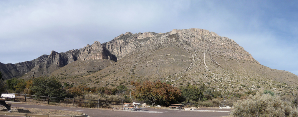
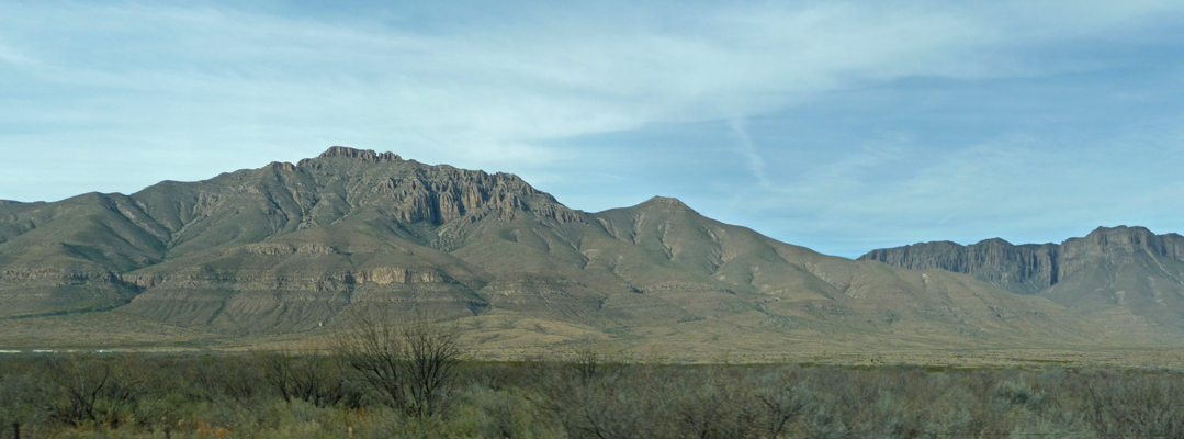
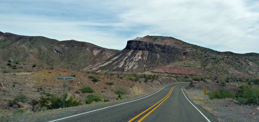
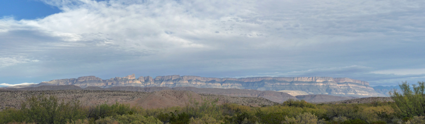
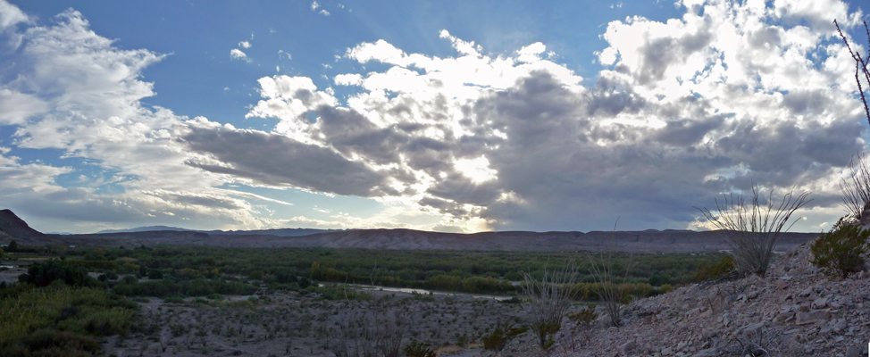
I did manage to get a nice photo of the Guadalupe Mountains in the morning light though.
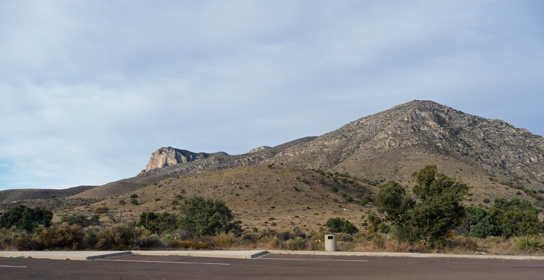
That is El Capitan peaking over the hill. I hadn’t been able to catch him the afternoon before because the sun was so bright in that direction.
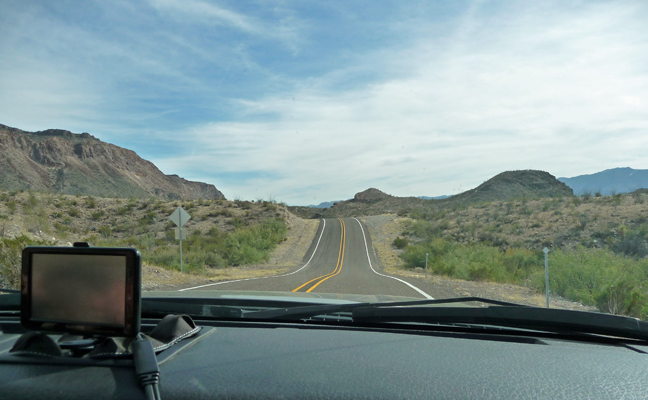
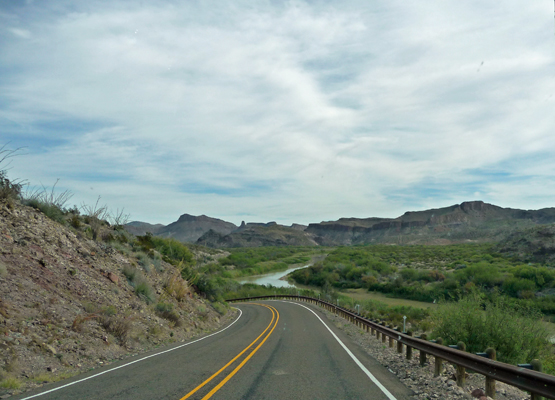
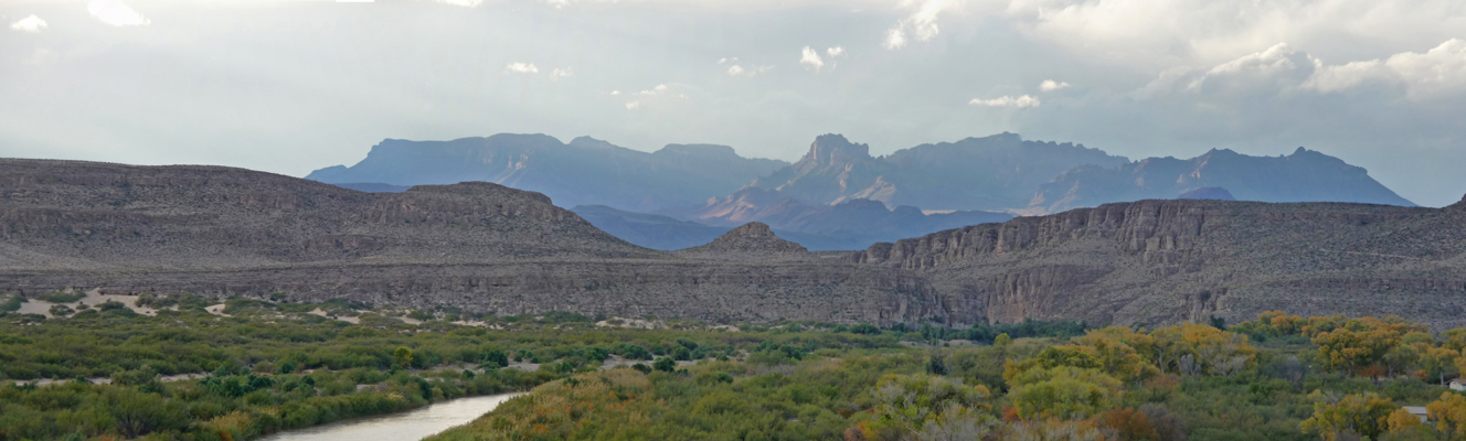
We headed south on Highway 180 and stopped at a view point where you can see El Capitan from the south.
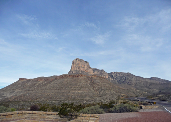
Guadalupe Peak (the highest point in Texas) is behind El Capitan but you can’t see it, even though it’s higher. I guess, it’s all downhill from here on in Texas.
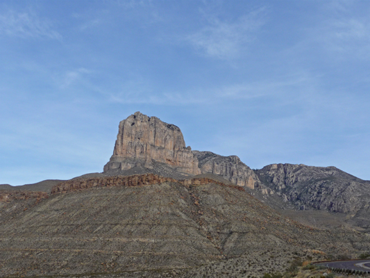
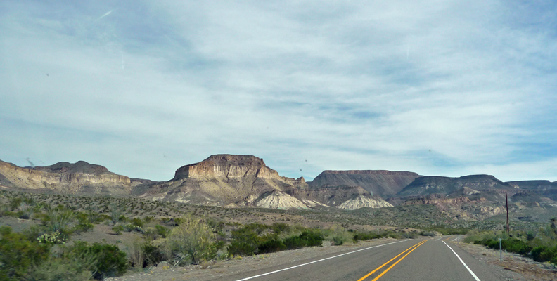
Here’s a closer shot of El Capitan.
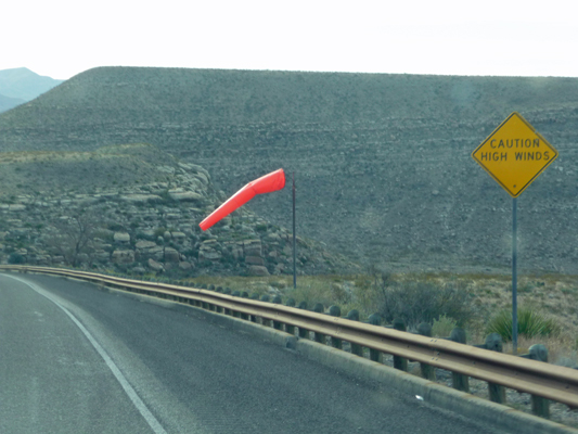
It was windy through the passes here and we saw something we’d never seen before—wind socks next to the High Wind Warning signs on the highway.
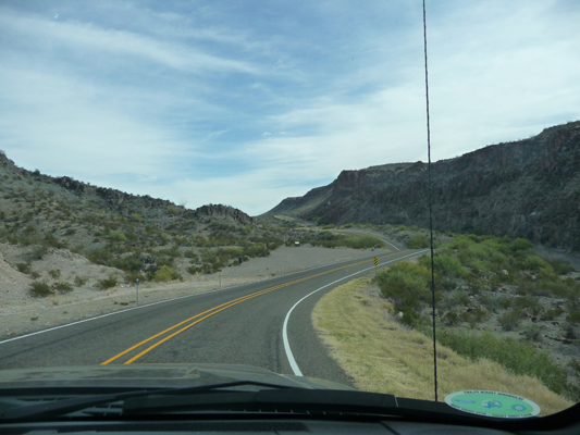
We followed Hwy 54 south along a scenic highway that takes you through some more lovely mountains—I think these may be the Apache Mountains which are part of the same fossil reef as the Guadalupe Mountains.
Highway 54 hits I-10 in Van Horn and we turned east to reach Pecos in the early afternoon. Pecos is on the far western edge of the Oil Patch and boy could you tell it was an oil town. It’s dusty with oil wells here and there and not much else. We stayed at the TRA-Park RV Park, an Escapee Rainbow Park, because it was only going to be $20 a night. It was nearly full of folks living there and the spot we ended up with was right next to the road. This is NOT a very nice park but hey it was okay for a night—and it’s unlikely we’ll ever return to Pecos anyway.
We went into downtown Pecos to the Post Office to pick up our mail and thank goodness it was waiting for us. That meant we only had to stay one night in Pecos. It might have violated one of our rules (stay every place 2 nights) but we saw no reason to stay another night.
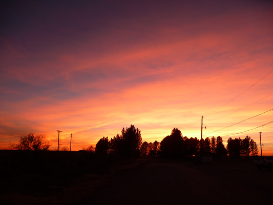
We had a great sunset that night though.
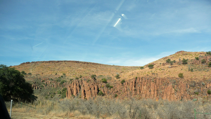
The next morning we happily headed south out of Pecos on Highway 71 through the scenic Fort Davis area. This is another ‘sky island’ area with mountains set in the middle of the desert. South of here you can go through the Glass Mountains that are part of the same reef system as the Guadalupes. These mountains were not that high, but they had fun erosion patterns.
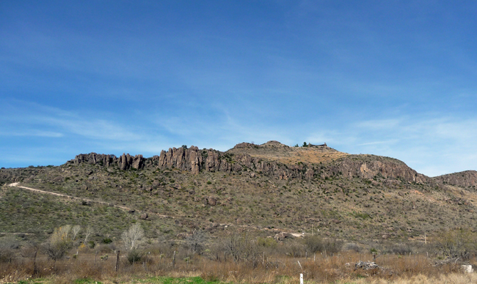
We stopped to change drivers near a historical landmark telling us that we were parked next to Barry Scobee Mountain. Turns out Barry Scobee played a big role in the preservation of the original Fort Davis and so in gratitude they named a mountain after him.
At Marfa, we took Highway 67 down to the Rio Grande and the little town of Presidio—a border crossing into Mexico and the last town of any size before you enter Big Bend Ranch State Park and then Big Bend National Park. We got a spot in the dusty little Loma Paloma RV Park which is across the highway from a golf course of all things. Once again, we decided we really didn’t need to spend more than one night here, even though it was only $15 a night with our Passport America Pass. Our hot spot worked here (amazing grace) but their cable TV (all 4 stations of it) stopped working late in the afternoon after the cable guy came to work on it and left it unplugged!
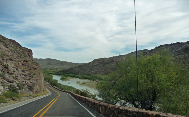
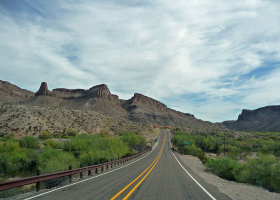
The next day, we topped off our gas tank and headed south along Hwy 170, one of the top ten most scenic drives in the country according to many folks’ lists. It’s only about 50 miles from Presidio to Lajitas but it’s a rollercoaster of a road with many more dips than straightaways. The bulk of this drive is through Big Bend Ranch State Park. There is primitive camping here and there but we opted to continue on and complete the drive rather than dry camp in the park.
The rock formations are reminiscent of Death Valley in many ways.
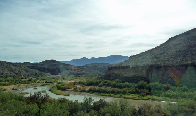
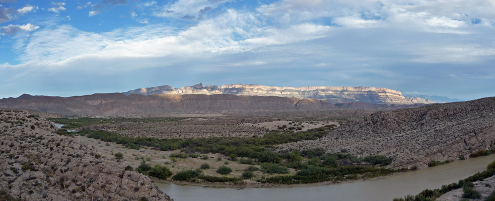
It wasn’t long before we had our first siting of the Rio Grande.
The road follows the river but they both wind a lot and not always in the same direction so the river disappears and reappears. Walter took it slow around all the curves and dips.
And then we finally hit the 15% grade UP the mountain pass that we’d read about. Thank goodness for Eco-boost on the truck. Without it, we might not have made it up the steep grade. But as it was, there was no problem and we had a moment to look out across the valley before heading straight back down another 15% grade. There are few turn outs of course and any that we saw were way to small for us with the trailer in tow.
At the bottom of the grade the Rio Grande was so shallow it looked like you could easily wade across it.
The rock formations continued to present interesting views. I thought this looked like a chocolate sundae starting to melt.
The mountains in the distance are in Mexico, on the other side of the Rio Grande.
But these are in the US on the east side of the Rio Grande.
We got a nice camping spot at the Maverick Ranch RV Resort—part of the Lajitas Golf Resort. The park is snuggled in amongst some amazing rock formations.
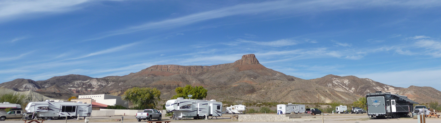
There was free Wi-Fi and good cable TV all for $21.50 with our Passport America discount. This is meant to be a destination resort complete with golf, horseback riding, jeep trips, river trips, a bar, restaurant and spa. The Passport America discount is only good for one night and then it’s $40 a night from then on. There were clearly folks there for extended stays and there were discounts for monthly rates. Late in the afternoon we had a couple of folks on horseback ride through but my pictures of them didn’t come out.
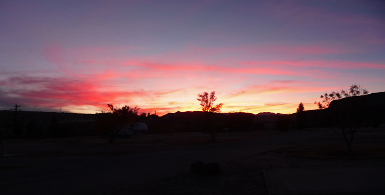
That evening we even had a nice sunset.
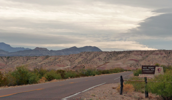
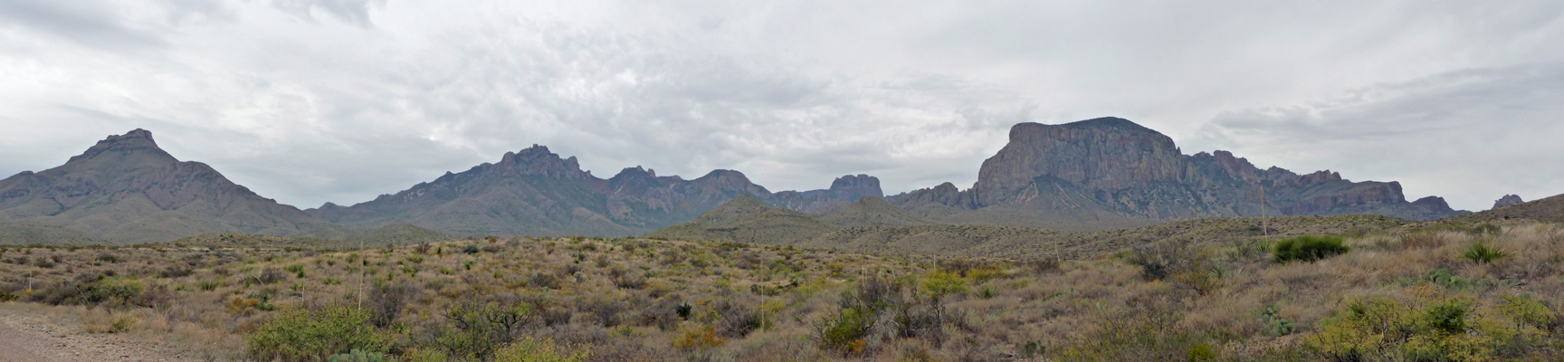
On Saturday December 12th, we headed south through the old mining town of Terlingua (which is turning into an upscale place to have a house perched on old tailings with old ruins incorporated into the new houses), through Study Butte (pronounced Stoody—rhyming with Judy) and into Big Bend National Park. It was cloudy and rain was predicted for later in the day.
This section of Big Bend is part of the Chihuahua Desert (most of which is in Mexico).
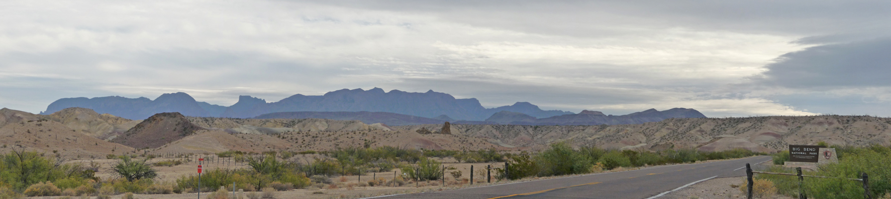
We stopped here and there along the way to read the interpretive signs and let me take photos. These are the Chisos Mountains. The entire Chisos range is contained within the borders of the park. Leave it to Texas to have a National Park so big it is the only one that holds an entire mountain range.
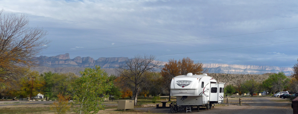
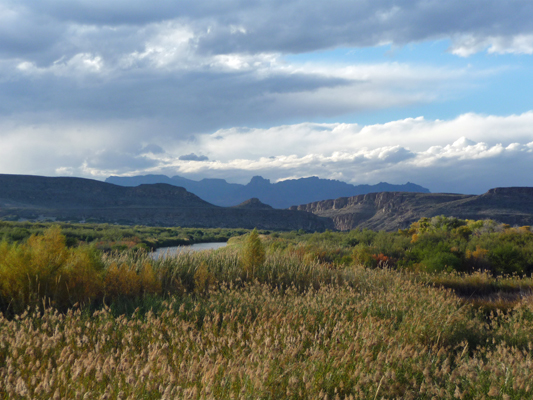
We arrived at the Rio Grande Village Campground in the southeast section of the park and found a nice pull through spot to set up camp. The sun came out for a little while and I caught a shot of the Sierra del Carmen mountains to the east—in Mexico.
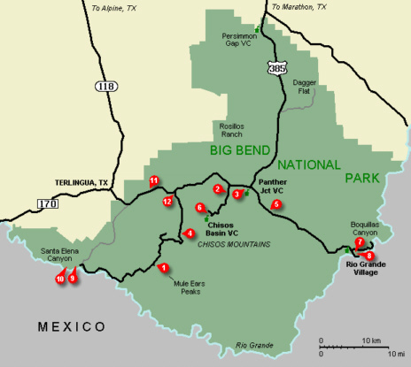
Things are directionally challenging (as in confusing) in this part of the park since at this point the Rio Grande is flowing northeast so Mexico is to the east! We’re number 8 on the map below.
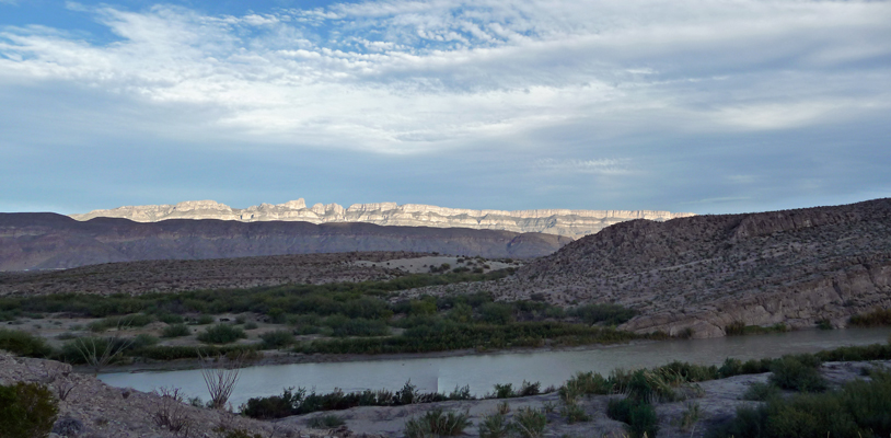
We went to check out the Visitor’s Center only to discover it had already closed for the day. Did I mention we’re in Central Time now? Clearly we were still running a little late since it was 4 in the afternoon and it felt much earlier. I got a better view of the Sierra del Carmen mountains on our way back from the Visitor Center though.
Since we had time and energy, we decided we’d take the Rio Grande Village Nature Trail that starts on the east end of the campground. It heads out through a restored wetland over a series of bridges.
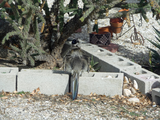
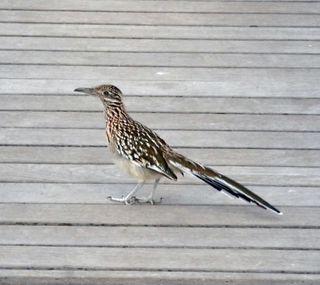
We spied a roadrunner out among the dead reeds and stopped to watch her.
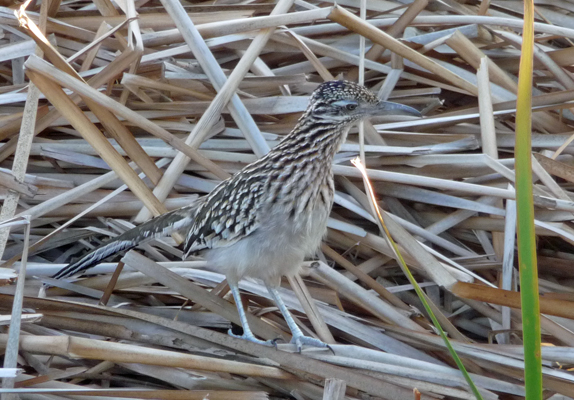
I wasn’t sure the photos would come out since she blended in so well with the dry reeds. But she stuck around long enough so that I managed to get a few shots that were decent.
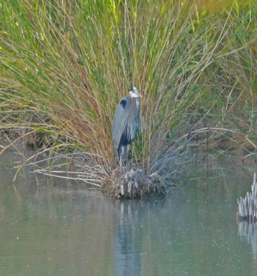
There was what looked like a Great Blue Heron sitting along the water’s edge. It was in the exact same place when we came back at the end of the hike. A sign of great patience perhaps?
There was a turtle on a rock too but he was too far way for a decent shot.
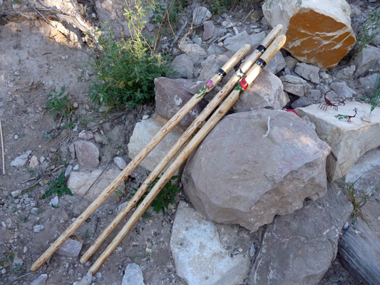
The trail heads out into a rocky area not far from the Rio Grande. Here we found a series of crafts displays left by the residents of Boquillas, the Mexican village across the river from the campground.
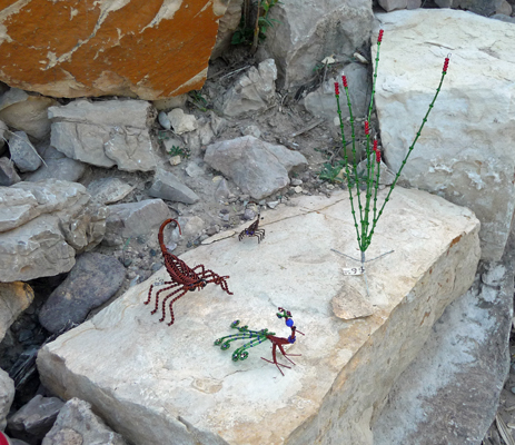
There were walking sticks for sale too.
The literature from the National Parks folks says it’s illegal to buy this stuff. But we saw it on all the trails near the river and no one seems to be doing anything about removing it. It would be a losing battle since it’s just a short row boat ride across the river for the folks to come and replace them. The town of Boquillas nearly died after they closed the border crossing here in 2002. It was finally reopened in the spring of 2013. It’s only open during the day, Wednesday through Sunday. And you get to pay $5 to be rowed across the river in the rowboat that they call a ferry. There’s not much left in the town so these craft sales (and the fees for crossing the river) are a major income source for the people in the town. Since we have no room for souvenirs, it wasn’t hard for us to leave them behind.
The trail leads you uphill so you can see across the reeds to the river itself.
As you gain height the view of the river gets better. The sun was peaking out of the clouds and lighting up the Sierra del Carmens.
I turned west and caught the sun behind the clouds.
The trail continues up to a promontory with a great view back to the Chisos Mountains.
And the other way to the Sierra del Carmen Mountains. The white specs on the lower left are the town of Boquillas.
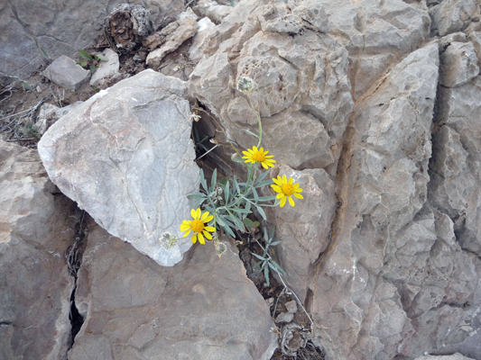
There’s been rain not too long ago (there were even a few ocotillo in bloom here and there) and I spied a few flowers in bloom. These are Threadleaf Groundsel, I think.
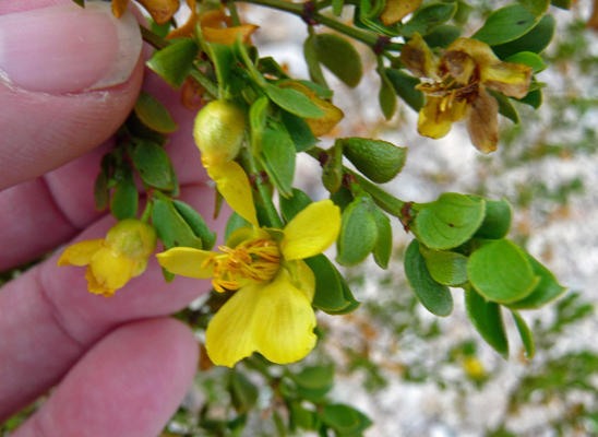
The creosote bushes were in bloom too.
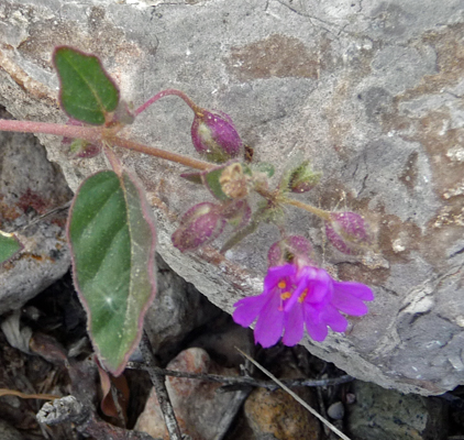
And I think that this is Trailing Four O’clock.
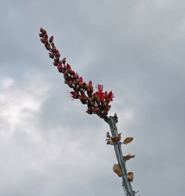
I even found an ocotillo just coming into bloom silhouetted against the sky.
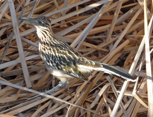
The roadrunner had moved onto the boardwalk and we watched her for a while longer and then she escorted us up the trail and nearly back to our truck.
That evening, the wind came up and we had thunder and lightening for nearly an hour before the sky opened up and it rained. The weather report the next day said we got 1/4 of an inch of rain in the night.