
When we arrived at the address we had, we discovered we were at the Kelso Depot Visitor’s Center, not the campground. Oops. Walter went in and got maps and talked to the folks behind the desk and discovered that we had basically come the wrong way. While we could get to Hole In The Wall from Keslo (and the route we had taken was prettier than the one we should have taken) it was going to require driving another 30 miles, 16 of which was on dirt road. Sigh.
We stopped and had lunch and then bumped our way out the Kelso Cima Road, which is paved but has pot holes and then got to very slowly drive east on the Mojave Road (part of the original road used back in the 1860’s) which was dirt but not too bad and then we turned south on Black Canyon Road which was lots of bad washboard.
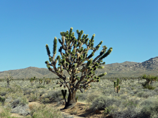
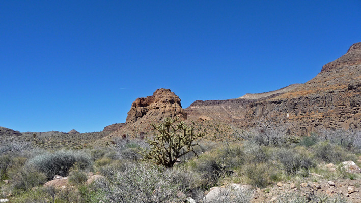
The Mojave Road portion of the drive took us through part of the world’s largest and densest stand of Joshua Trees. They spread out across the landscape as far as you could see. These trees are slightly shorter and have more branches than the trees in Joshua Tree National Park and are considered a different subspecies. They were just coming into bloom and we stopped along the roadside so I could take a photo of the HUGE one with multiple blooms all over it.
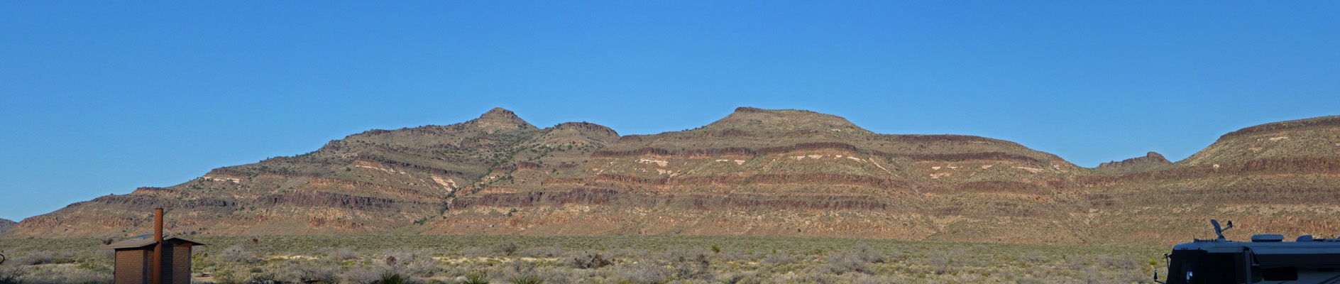
The road becomes paved just as you reach the Hole In The Wall Campground—which is why you’re supposed to come in from the other way which is paved the whole way. Duh! It being Thursday afternoon and there being no reservations available here, we had lots of choices for campsites (which were very nicely spaced). We got one with a great view of the surrounding hills and mountains. This is a National Park Service campground so our Golden Age Passes give us 50% off. So our cost was $18 for 3 days for a nice pull through site with a view (no hook ups of course). This was our view looking eastward out the dining room windows.
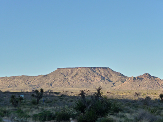
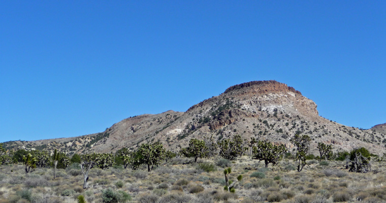
And this was our view of Table Top Mountain to the north.
Washboard seems to be especially hard on the trailer even when we drive slowly. This time a small piece in the bottom of the shower door gave way and opening the shower door is now a two-man job. Hopefully the repair will be easily done when we go in for our Warranty Repair in April. For now, we can easily make do with using showers in private RV parks but we’re going to need to use the shower regularly when doing our camp host gigs.
It was pretty late by the time we were settled in but I did manage to catch some interesting light on the formations that we could see to the south at the mouth of Banshee Canyon.
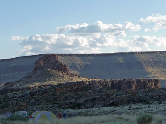
The next morning most of the clouds had blown through and the morning light lit up the hills to the west of us really nicely.
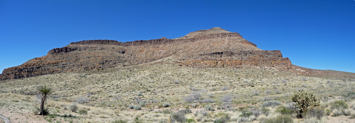
As you can tell from all of the sharp layers, this is an old volcanic area. To the east we counted six or seven distinct volcanic layers. In the northwestern part of the park there’s a lava tube you can explore (and of course a big lava flow) and a whole bunch of cinder cones to visit.
This is a HUGE park with 1.6 million acres, much of it designated wilderness. There aren’t a lot of roads but there are quite a few interesting trails. We decided we’d start our day on Friday March 20th (Happy First Day of Spring) with a visit to the Hole In The Wall Information Center just down the road from us. We took a look at the bookstore offerings, talked to the ranger about trails and decided we’d have a go at the famous Rings Loop Trail that starts at the Information Center. It’s only about a mile long and doesn’t have much of an elevation gain BUT it does require a bit of rock scrambling and there are several slots you have to go up that use rings mounted in the walls to help you up. Think Jungle Gym time!
We’d looked at a YouTube Video of the trail and weren’t sure we could do it but we decided we could at least hike the first part of the trail and have a look at the rings... So off we went.
The trail winds through the desert with buckhorn cholla and creosote bush being the main plants here. As we came around one of the hills I spied a Mojave Goldenbush (Ericameria linearifolia) with a nice little Mojave Spurge (Euphorbia schizoloba) behind it.
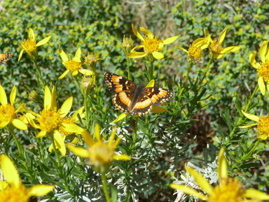
And then as a plus, there was a butterfly!
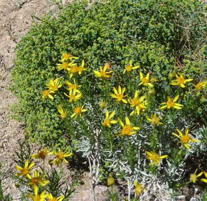
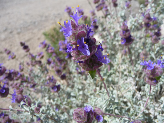
Here and there we saw Desert Sage (Salvia dorri) in bloom.
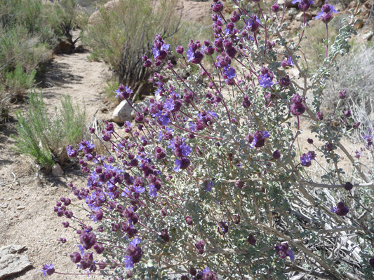
It took a number of tries, but I finally got a close up of the sage flowers.
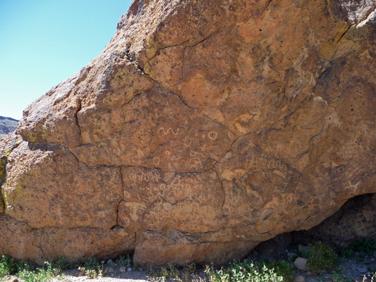
Around the next bend is a set of petroglyphs that are so old they’re hard to see.
But with a bit of effort I got a decent shot of some of them.
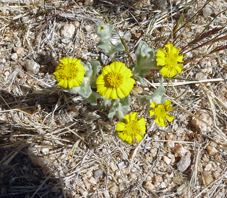
Here and there I saw a few Wallace’s Wooly Daisy (Eriophyllum wallacie). These guys are about the size of my thumb nail.
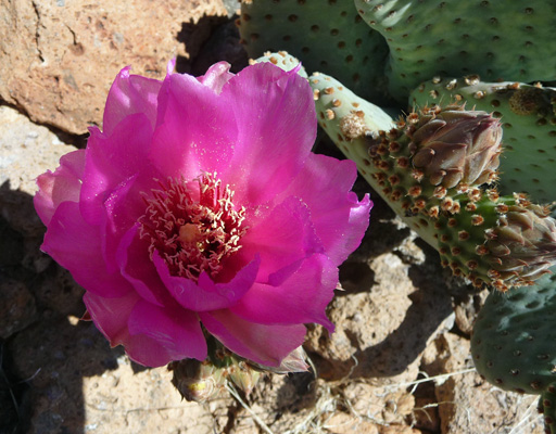
And if you were willing to crash through the bushes a bit there were beavertail cactus in bloom too.
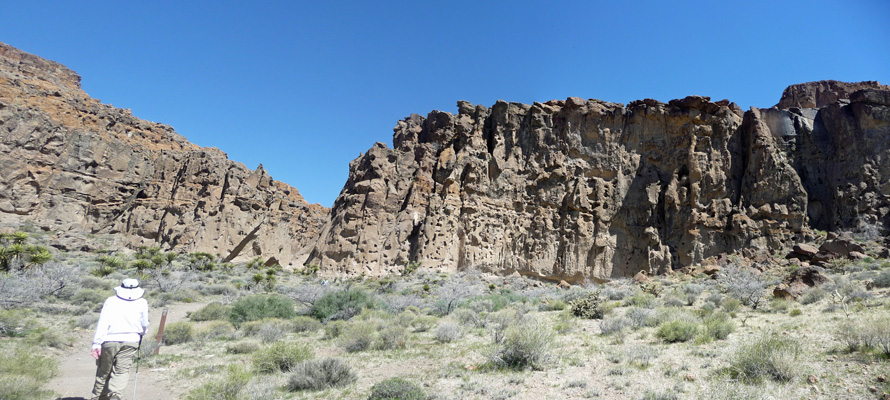
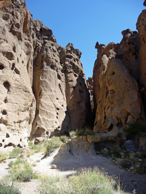
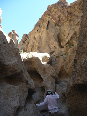
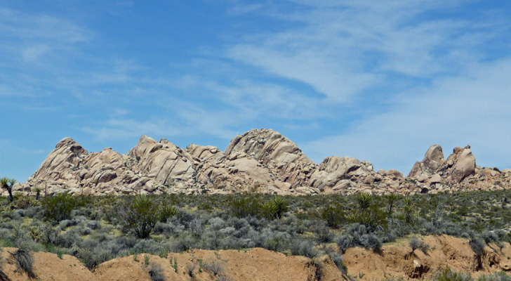
As you come around the back side of the hills where the campground and the Information Center are on the other side, you begin to see why the area is called Hole In The Wall.
Then the trail joins the longer Barber Peak Loop Trail and turns east into Banshee Canyon and the holes multiply like crazy.
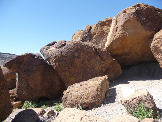
These are not little holes either. Here’s Walter standing next to the above wall. The small holes are bigger than his head.
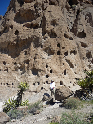
All this area is volcanic tuff—compressed ash laid down in volcanic eruptions 18.5 million years ago. The eruptions were so violent that everything within 250 miles was buried in ash. The holes here are air bubbles trapped in the ash that have since been revealed and enlarged by wind and rain.
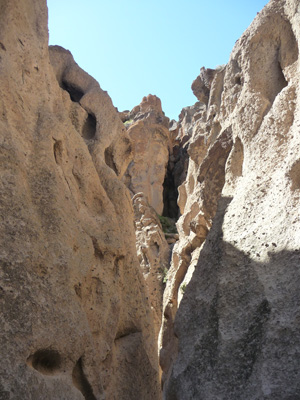
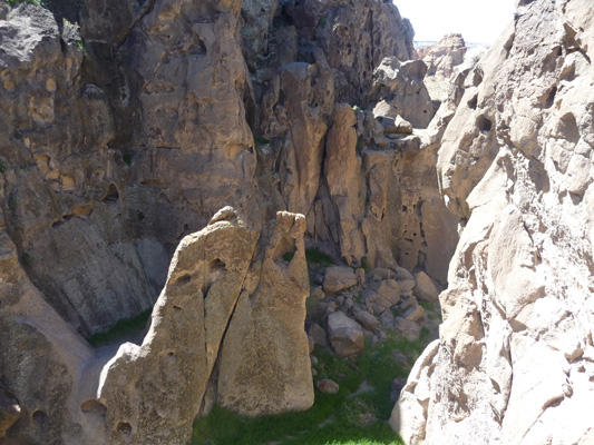
The trail takes you into Banshee Canyon itself—a pretty narrow slot canyon. There’s a side canyon that’s a dead end so we didn’t take that route.
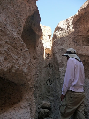
It doesn’t take long for you to come to the first of the very narrow slots where you need rings to find your way UP to the next level.
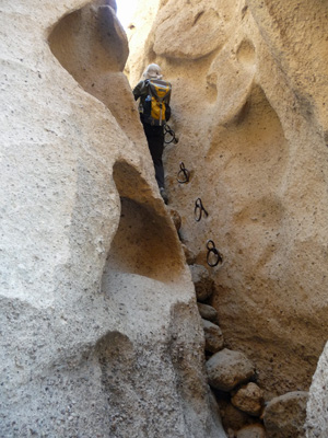
We had met some folks who had come DOWN these and then watched this lady go up and we decided we’d give it a try. I went first and made it up without too much of a struggle—I only scraped my right elbow a little as I struggled to get up past the last ring. Walter had watched me and said he was game so up he came too. This was a good thing, because I’m not sure I could have made it down.
This is the view once you get up the first set of rings.
If you have issues with tight spots—don’t do this trail!
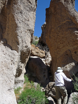
The next up didn’t have any rings, you just used the holes in the rock as foot holds.
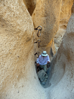
You wind around a bit and then you come to the second set of rings.
This is basically straight up and you have to get your foot into the bottom ring (or on the ring support) to climb up. We were both glad we had long legs. Having conquered the rings we both agreed that while we were glad we’d done it, we really didn’t think we’d need to do it again. But we were sure that they made up for us chickening out of doing the Ladder Trail in Mecca Canyon back in January.
The trail continues along and seems to hit a dead end.
But if you look carefully there’s a small arrow up on the rock just below the pile of sticks. And it’s pointing right. All you have to do is scramble up a ways—we used the indents in the rocks near the center of this photo.
And next thing you know you’re out in the parking lot of the picnic area just up the hill from the Information Center. Sheesh, no wonder there were people coming DOWN the rings, that’s the short way to do it.
If you scramble over some rocks here you come out on a platform overlooking the small box canyon that we didn’t visit when we first entered Banshee Canyon.
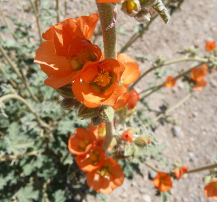
On the way back down the hill to the car from the picnic area I spied a really nice Desert Globemallow (Sphaeralcea ambigua).
We drove back to the trailer, rested a while, packed a lunch and then drove back up the dirt section of Black Canyon Road (much easier when not pulling the trailer) and then turned east on the Mojave Trail to the trailhead for the Rock Spring Loop Trail. Have I mentioned how dirty the truck is these days from all this driving on dusty dirt roads?
Along the way we stopped so I could take a shot of Pinto Mountain with Joshua Trees growing in front of it.
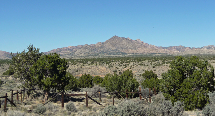
With a little difficulty we found the turn off for the Rock House. It said there was a picnic area here and in fact there’s one picnic table under a nice juniper tree where we had our lunch. I think those are the New York Mountains off to the north. The wooden fencing are the remnants of a goat pen built by the first resident of the Stone House back in 1929.
We enjoyed a leisurely lunch and then took the Ranger Walk on the Rock House Spring Loop Trail and learned all about the history of the area.
The trail gets its name from this rock house that was built by Bert Smith, a WWI Veteran who had been exposed to poison gas during the war and didn’t expect to live long. He came out to the desert for peace and quiet and dry air. He moved into the house in 1929 and lived here for 25 years—way longer than anyone had expected he would live.
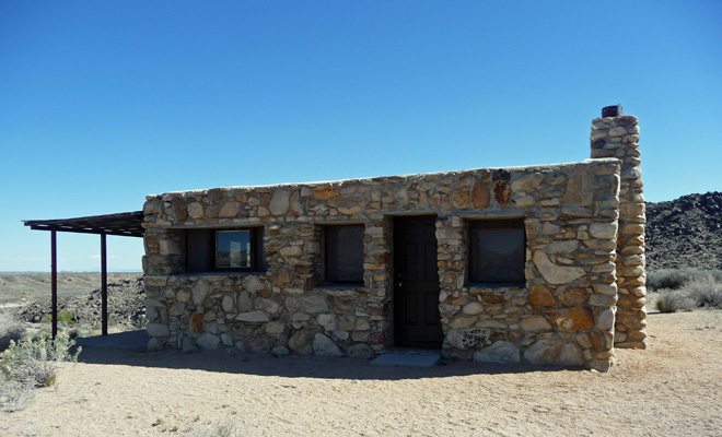
Then the artist, Carl Faber, lived in the house and then used it as his gallery from 1981 until 2003, selling his art to folks who happily explored the Mojave Trail via 4-wheel drive.
The area didn’t become a National Preserve until 1994 and because there were many homesteaders and ranchers in the area, there are still many pieces of private property in the park.
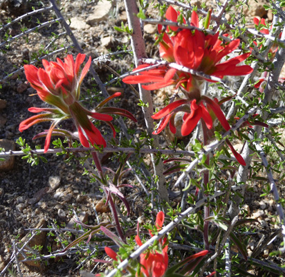
There was quite a bit of Desert Paintbrush (Castilega angustifolia) growing along the trail. Good old paintbrush—I’ve seen it all over the west from Alaska and the Yukon all the way to Arizona and back.
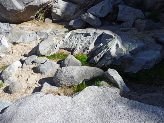
The trail winds over the hills to a spring that is hidden in amongst the rocks. It supports a few willows and a lot of moss and algae.
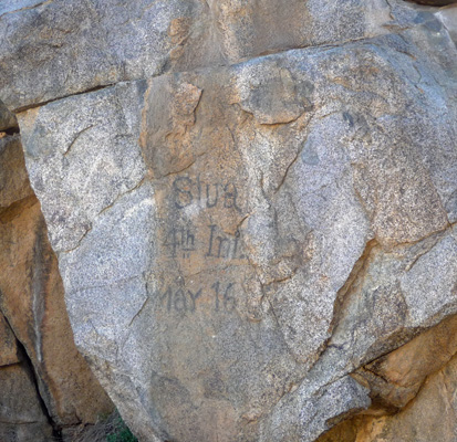
In the 1860’s there was an army post here protecting the folks who used the Mojave Trail to come west—and the mail route that went through here for about 18 months. There are only a few rock foundations left from that period but there is a bit of graffiti left by one of the soldiers.
We had a relatively large group (about 14 of us) and a talkative ranger so the walk took nearly 2 hours. It was interesting and worth the time though. It’s good to do a ranger walk every now and then to get it out of my system.
On the way back we saw some Desert Sand Verbena (Abronia villosa). It was a little taller than the verbena we saw in Anza Borrego so it may be a different variety.

We were tired by the time we’d bumped our way back to the trailer but it was a good day. The campground was filling up (though it was never entirely full) when we got back and a lot of folks had tents. That was okay on Friday night but Saturday night was pretty breezy (downright windy) and most of them got up VERY early and left on Sunday morning.
On Saturday March 21st, we decided we’d go explore the Kelso Dunes which are over off of Kelbaker Road where we’d come in on Thursday. Neither of us relished another drive on the bumpy dirt road so instead we drove south on Black Canyon Road to I-40 and then west to Kelbaker Road. There are no turn outs on Kelbaker Road so I hadn’t been able to take any photos while we were driving in on Thursday since we were pulling the trailer. The shoulders are all soft and sandy which is fine for the truck but we really don’t relish the idea of getting the trailer stuck in the sand.
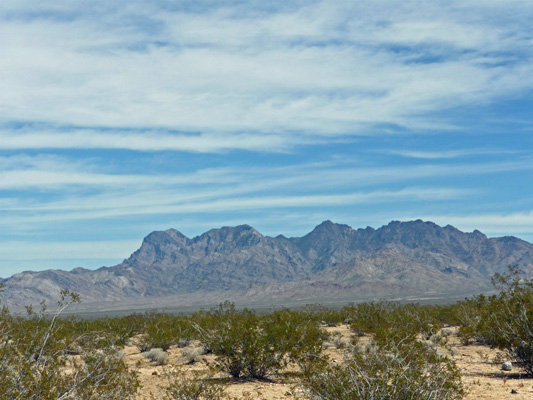
So this drive gave me an opportunity to take a photo of the Granite Mountains which are down in the southwest corner of the park.
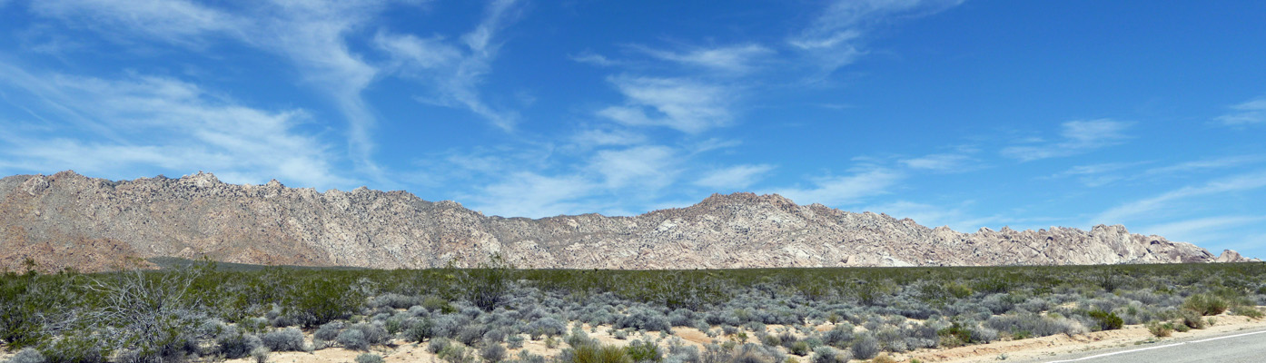
The road winds through some gorgeous country including some rocks that look very similar to those in Joshua Tree National park.
All in all it’s a 16 mile drive from I-40 to the turn off to the Kelso Dunes Trailhead. While Kelbaker Road isn’t great, the road out to the dunes is simply awful! It’s dirt with LOTS of washboard and it was a slow slog.
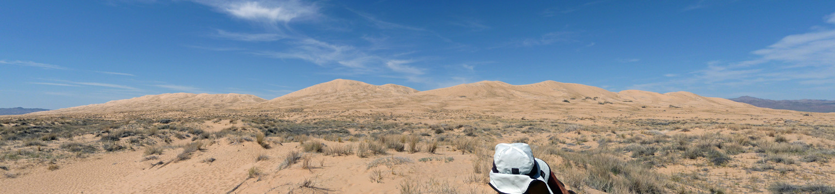
Just after we turned off Kelbaker Road we stopped and I took this panorama shot of the dunes.
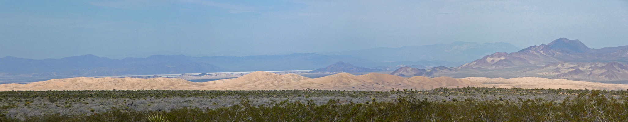
The Kelso Dune field covers 45 miles and rises 600 feet above the desert floor. It’s one of the largest and oldest dune fields in the west.
We bumped out the road and read the signs at the parking area and I took this shot of the dunes.
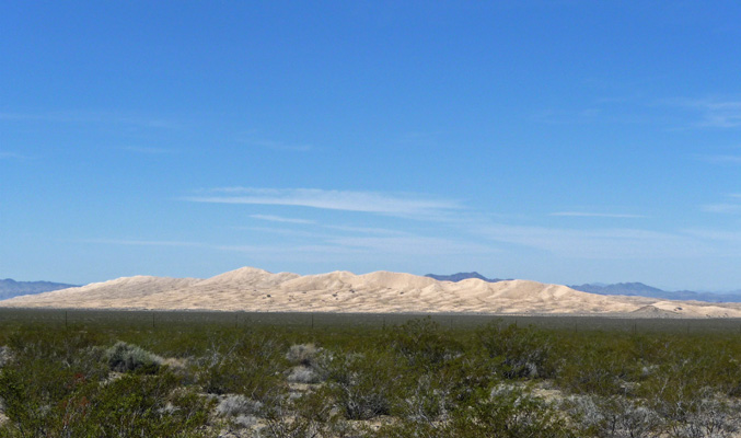
To the east you can see the Providence Mountains.
We decided that while we had no desire to slog through fine sand to scale the 600 foot high dunes we would walk out the trail until it turned to sand and the dunes started. It doesn’t take long for the coarse sand of the wash to turn to really fine sand (the dunes are made of air borne sand so it’s all really fine). We climbed to the first rise and I took this shot.
There were LOTS of folks up on the the biggest dune straight ahead and on the one to the right. If moisture conditions are just right, these dunes ‘sing’ (hum like a prop airplane) when the sand gives way under people’s feet. I didn’t hear anyone talking about it as they came back so I’d guess the conditions weren’t right for it. We didn’t see anybody trying to sand board on them either like we did at Death Valley.
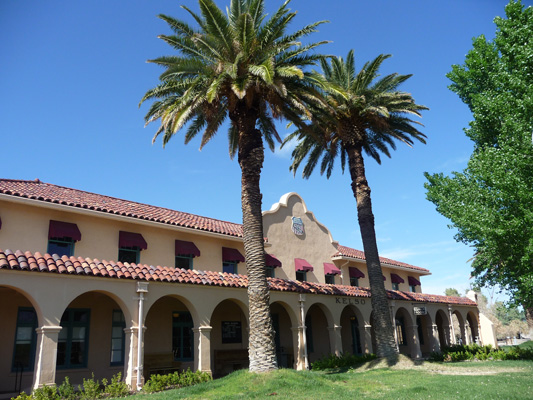
From here we drove back out the dirt road to the joys of pot hole dodging on Kelbaker Road (so much better in comparison) and drove north to the Kelso Depot Visitor Center. This was an active Union Pacific Depot until it was closed in 1985. Locals saved it from destruction and the Park Service renovated it when the park was formed in 1995.
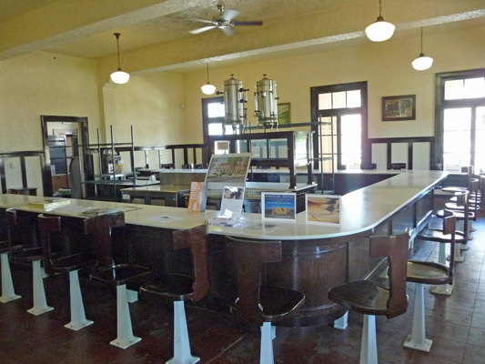
Inside they’ve kept the old lunch room. For years there was a concessionaire who ran it. But he retired a year and a half ago and they haven’t found anyone who is willing and able to take it over. So it sits empty looking historic instead.
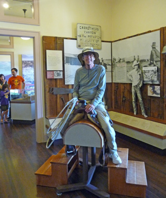
We explored the exhibits. Walter especially liked the display on ranchers and cowboys. Some kids never grow up, thank goodness.
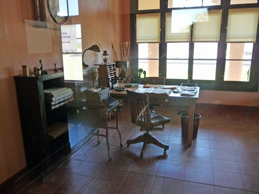
The old ticket office, luggage room and ticket window have all been restored. I took this photo through a glass viewing window so please excuse the reflections. I love old Underwood typewriters.
Once we were done inside, we had our picnic lunch sitting on the veranda of the depot waiting for the train that never came. Union Pacific still has an active yard here and there are supposed to be trains that whoosh through here regularly but there wasn’t one the whole time we were here—which was just fine with us.
After lunch, we were happy to turn around and retrace our steps down to I-40 and back over to Black Canyon Road and Hole In The Wall. There’s a lot of park here and it’s really spread out. They allow dispersed camping along the dirt roads but you have to find a previously used campsite and that requires a lot of looking. I wouldn’t mind coming back and finding a spot on the west side of the park. I really like the energy and the views on that side better than the Hole In The Wall area. But Hole In The Wall certainly is fun.
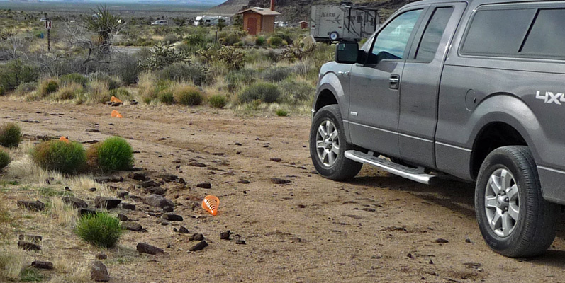
Late Saturday the wind came up and I took down our awning so it wouldn’t flap in the wind. It really howled over night and both of us woke up several times in the night worrying about whether our solar panels were okay. One night in the wind at Buenos Aires National Wildlife Refuge it blew right over on it’s face. The good news is that the solar panel stayed put in the night. But the caution cones we put out around the panel so you don’t trip (or back into) them had taken off down the pull-through drive.
Sunday March 22nd we packed up and drove west again back to Mojave and Sierra Trails RV Park (hey it’s only $13.25 with Passport America and that’s hard to beat) for a couple of days of housekeeping.