
On Thursday morning while we were having breakfast, the ranger assistants came and took the riding mower away. Things sure looked tidier out our side windows once the mower and all the miscellaneous tools had been gathered up to put into storage. The campground is supposed to be open until around Oct. 13th but clearly without a host there, they didn’t want to leave any equipment out. It made it even clearer to us that we were much more security/caretakers than camp hosts at Hilgard.
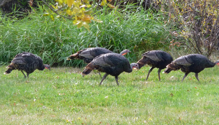
As we were hooking up the trailer to leave, the wild turkeys came through one more time. We hadn’t seen them for about a week and there were only 8 of them this time. There were 9 when we arrived. We hope the 9th one was just off exploring and didn’t end up as bobcat or coyote food. They wandered on down towards the Day Use Area and were hunkered down on the edge of the river when we left.
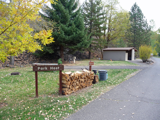
Walter pulled out and I hopped out to take a picture of our empty host site.
He went on down to the turn around at the end of the campground and picked me up on the way out. Bye Bye Hilgard Junction State Park. We won’t be back, I promise.
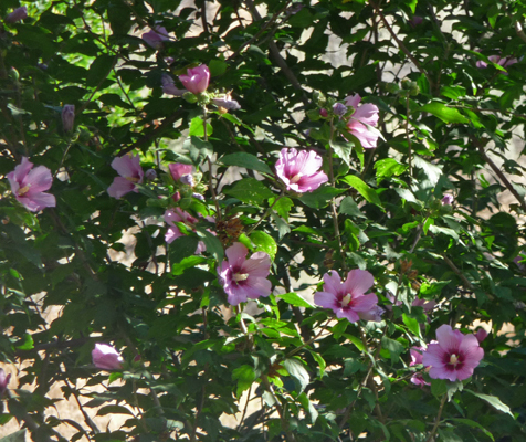
We headed north and then west on I-84 towards the Columbia River. We had planned to camp the night at Deschutes River State Recreation Area which is at the confluence of the Deschutes and the Columbia Rivers. There was a Rose of Sharon in bloom across from the registration kiosk so I took a photo of it. Can you tell that they are closely related to hibiscus?
It turned out that the campground there was FULL of fisherman—clearly the salmon must be running up the Columbia and then on up the Deschutes. So we turned around and went just a few miles back and over the Columbia River to Maryhill on the Washington side. The Washington State Parks have gotten really expensive the last few years. It now costs $40 to spend that night in Maryhill State Park. So we went next door to Peach Beach RV Campground and got a nice water and electric site for $30.
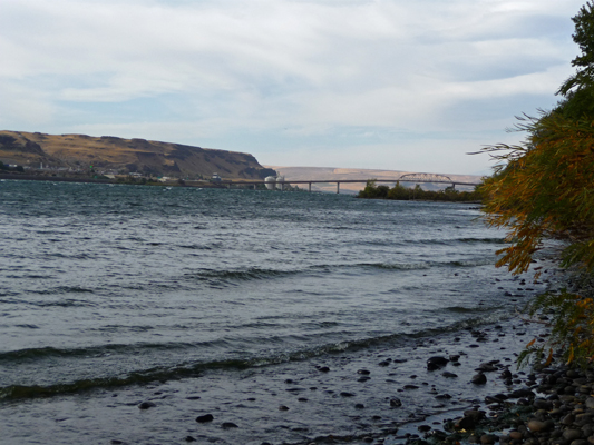
It was sunny and warm (low 80’s) and our hot spot worked marvelously. Whoo Hoo, we were back to civilization. The next morning the clouds were starting to come in when we got ready to go but the view along the Columbia was still pretty.
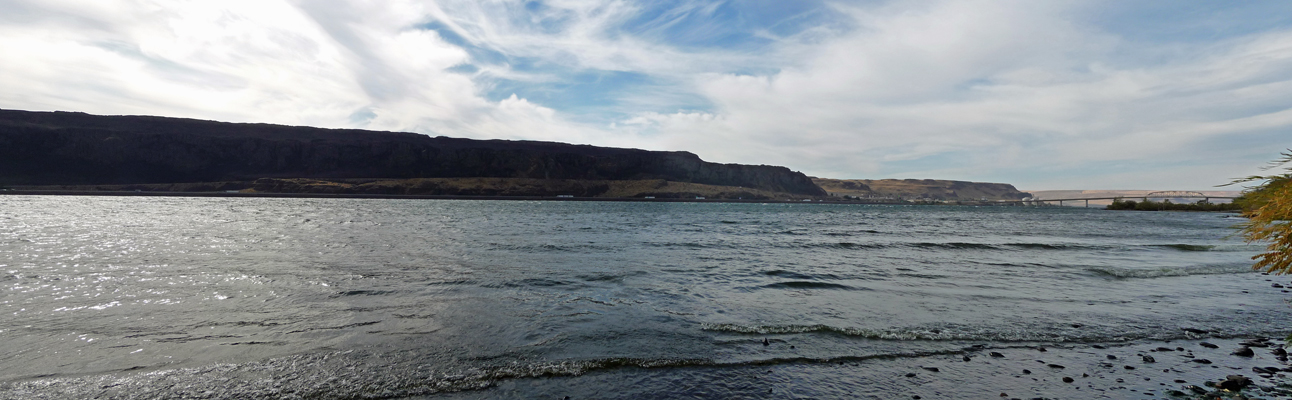
I usually take my photos here in the late afternoon and the light is too bright to capture the bridge. But since it was morning, I got a nice shot of the bridge too. It was windy and there were lots of white caps on the river. It had been calm the night before which is unusual. This is one of the places that wind surfers love.
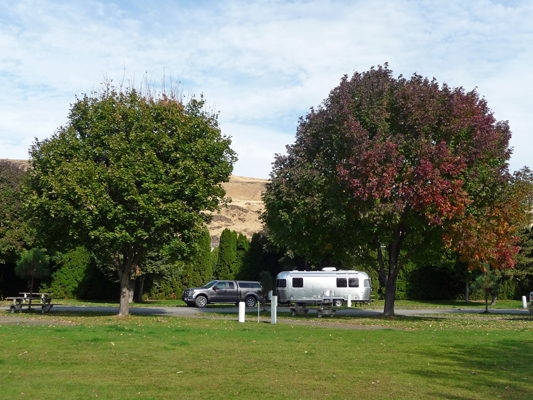
Both Maryhill State Park and Peach Beach are great places to camp. They are right next door to each other facing the Columbia River. The only problem is that there are train tracks that run on both sides of the river and they honk their horns all night long as they rumble through the area. I wore my ear plugs again which helped immensely.
Fall color was just starting here along the Columbia.
We drove back over the Columbia (and back into Oregon) and followed I-84 towards Portland.
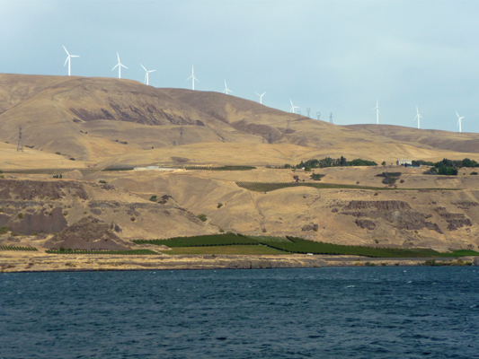
You could see the Maryhill vineyards along the river—and the wind farm up on the top of the ridge.
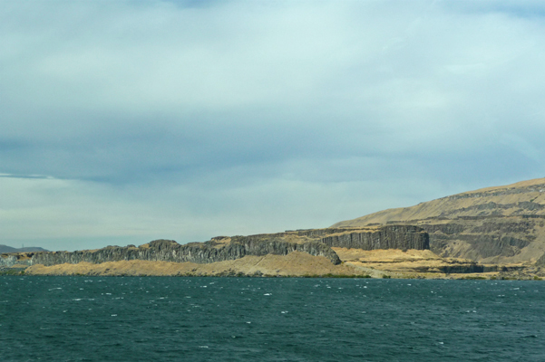
As the Columbia River Valley narrows you begin to have great views of the basalt formations that the river has cut through over the eons.
It got steadily cloudier as we headed west and the white caps got more and more numerous. We saw men out in small boats tending nets that are attached to buoys near the shore. We suspect that the Native Peoples of the area are allowed to fish with nets as part of their treaty rights.
It was misting lightly when we arrived at Fort Stevens State Park just outside of Astoria, OR. Fort Stevens is a HUGE park with an enormous campground (nearly 500 campsites) and we got a nice water and electric site with no problems. During the off season they have lots of first come first served campsites though all their full hook up sites are still available for reservation.
Fall often offers the best weather of the season on the coast. September is known to be the best month but early October can be wonderful too. The forecast was good so we settled in for the evening with the hope of sunshine the next morning.
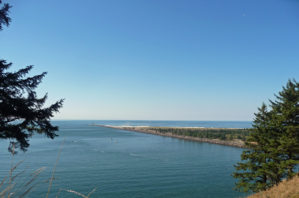
Saturday October 3rd was clear and lovely. It was our first non-camp host, non-traveling day in a long time and we gave ourselves the morning to be lazy. It was lovely. A little before noon we headed out to explore just a portion of the park. We drove north to the South Jetty (it’s the south side of the Columbia on the north side of the park). There’s a nifty observation tower where you can watch the surf (and maybe boats getting ready to cross the Columbia Bar).
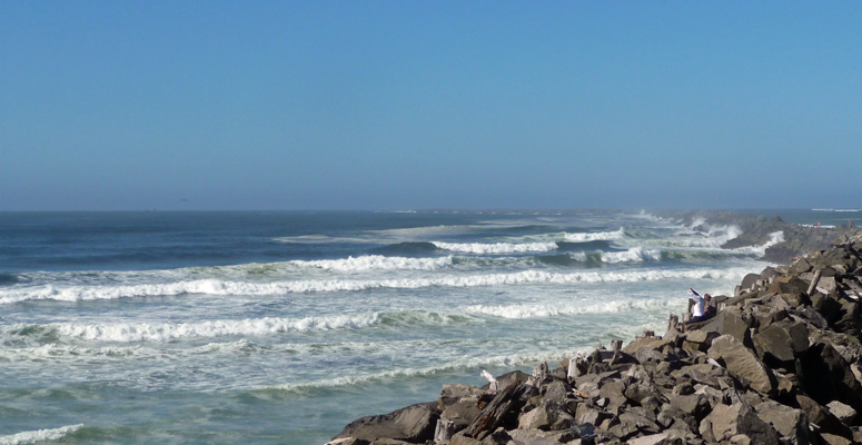
The jetties (both south and north over across the river in Washington) were built in the late 1800’s to keep the mouth of the Columbia River from moving around. The sand along the coast moves south in the summer and north in the winter so every year the mouth of the river moved. By building the jetties they made navigation into the river easier and safer. This area is known as the Graveyard of the Pacific because approximately 2,000 ships have sunk here since 1792. The Columbia River Bar is treacherous and one year we sat on the Washington side and watched a huge ship make no progress at all trying to maneuver over the 6 miles of sand bar at the mouth of the river at low tide. They use tugs and river pilots but it’s still one of the most dangerous crossings in the world.
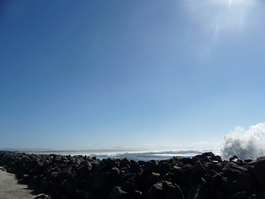
The tide was pretty far out but it was still crashing up against the jetty.
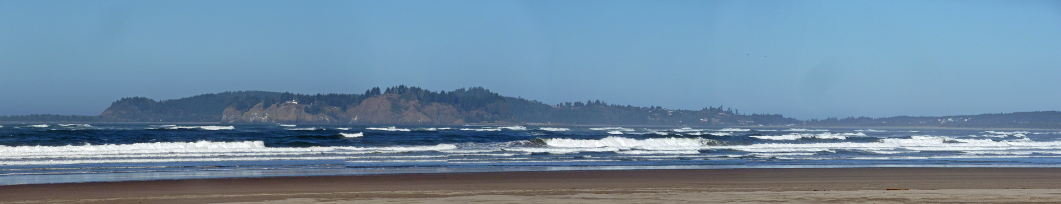
We watched the surf for a while but didn’t see any ships. Since the tide was out, the only ships that would be trying to cross the bar would be coming out of the Columbia riding the river current.
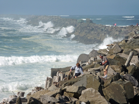
So next we hiked up the river side of the jetty to see what there was to see on that side.
The cool thing here was that the surf on the far side of the jetty would periodically come bursting into view.
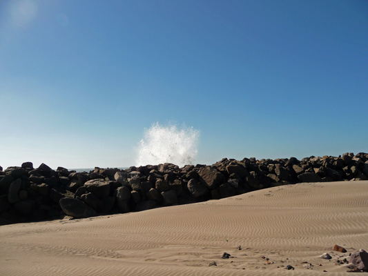
I spent a lot of time trying to get good pictures of this but what with the sun and the fact you couldn’t see the water coming I didn’t have a lot of luck.
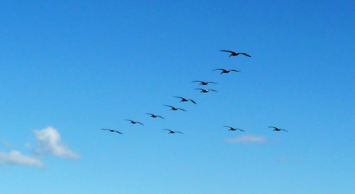
We did get to see a tug towing a boat out to sea and out past the south jetty, though. And a flock of pelicans flew overhead too.
Across the river on the Washington side you can see Cape Disappointment with its lighthouse.
As you can see, even at low tide the Columbia plus the Pacific make for a powerful force.
Just as we turned to hike back I caught one more wave as it crashed up against the jetty.
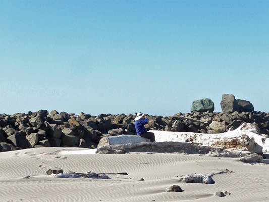
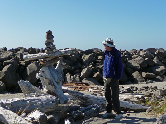
On the way back I stopped to photograph a set of cairns that folks had built near a pile of driftwood.
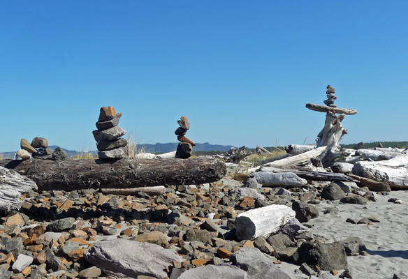
You don’t get to see mixed media cairns very often...
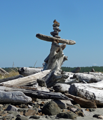
This was a BIG cairn as you can see.
From South Jetty we drove east to the end of the road where there’s a Wildlife Viewing Bunker and a view of Trestle Bay where there’s this long trestle reaching out across the water. It was built to haul all the rock in to build the South Jetty. I tried photographing it but it didn’t look like much when I was done. On our way back we stopped at a small beach access road where people had driven out onto the sand.
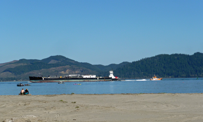
This little yellow/orange boat was hauling really fast up the river. It says Pilot on the top so maybe it's a river pilot boat.
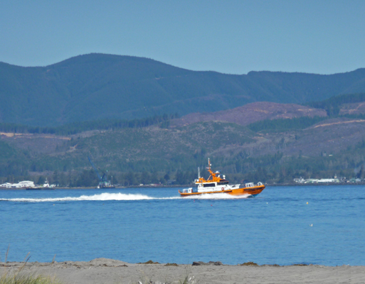
It whipped right on by this big barge being pushed out to sea by a tug boat along with the small fishing boats and kayaks out in the river with it.
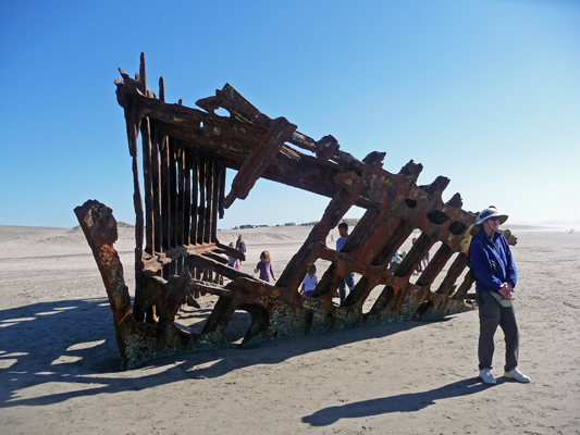
From here we drove back south towards the campgrounds and took the road out to the beach access at Peter Iredale Beach—where you can see the remains of the sailing ship, Peter Iredale, which went aground here in 1906.
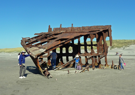
I remember seeing this 15 years ago when we visited Fort Stevens and it sure looked bigger to me back then. It was a good sized ship (285 feet) to start with but having much of her salvaged for scrap and the rest faced with 110 years of ocean waves, there’s not much left of her.
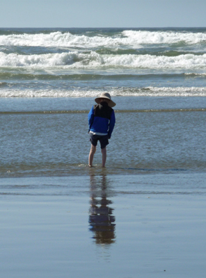
I took off my shoes and we walked along the beach for a while. There were a few kids out wading in the water but not many—the Pacific is never warm here and by fall it’s pretty cold.
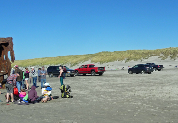
One of the oddest things about the Oregon Coast to me is that they let people drive on the beaches here (turns out they do it up on the Washington beaches too). The beach north of here is closed to driving in the summer months but after September 15th it’s open game.
On Sunday, October 4th, we drove north over the Astoria Bridge to Washington to visit Cape Disappointment State Park. Cape Disappointment was named in 1788 by John Meares, an early British explorer who was disappointed by not being able to find the mouth of the Columbia. The name stuck and joins other lovely place names in the area such as Dismal Niche where Lewis and Clark got stuck for nearly a week in the November rains.
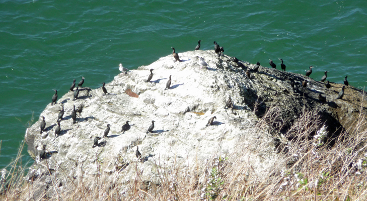
We headed up to the Lewis and Clark Interpretive Center to see the museum and in hopes of finding the Host Coordinator for the park. There’s a great view of the North Jetty from here.
And if you look straight down you get a view of a cormorant colony who live on the rocks below.
You can also see the Cape Disappointment Lighthouse from the deck in front of the museum.
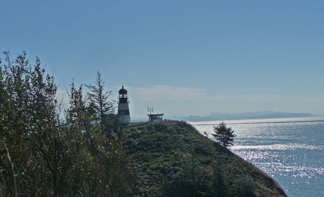
It was built back in 1856 in hopes of reducing the number of ship wrecks along the Columbia Bar. It was deactivated in 2008 and no longer even has a beacon. The Coast Guard can still use it as an observation platform though.
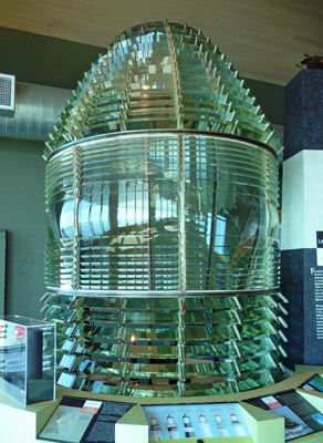
Its original first order Fresnel lens (which was moved to the North Head Light and replaced by a 4th order lens) is now in the Lewis and Clark Interpretive Center. It’s odd in comparison to the first order lens at Heceta Head because it doesn’t have bulls eye lenses in the center panels.
We enjoyed our time in the museum and talked with the host coordinator. He has no openings at all for next summer or fall! The North Head Lighthouse will be closed next year for renovation so they won’t need hosts for that and so he need for hosts is way down for next year. Ah well. We decided we didn’t much like the energy at Cape Disappointment (maybe it’s living up to its name?).
We drove north to the North Head Lighthouse and took the short trail out to see the view.
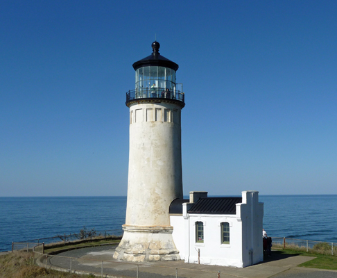
The North Head Lighthouse was built in 1897 because boat traffic coming from the north couldn’t see the Cape Disappointment Lighthouse. As boat traffic increased the demand for an additional lighthouse increased until they built a second lighthouse only 2 miles from Cape Disappointment. They moved the first order Fresnel lens from Cape Disappointment into this lighthouse when it opened in 1898 and it stayed here until 1935 when the Coast Guard replaced it with a 4th order lens. That was replaced by a beacon in the 1950’s. It has a modern beacon now which is still working. The North Head Lighthouse became property of the Washington State Parks in 2012, though the Coast Guard still maintains the beacon.
The keepers house and accompanying buildings are all still here and can be rented out as vacation rentals. My only complaint on this is they put a very un-lovely chain link fence around them. Ugh.
The view south from the lighthouse is lovely.
All that land up to the hills on the left is new since 1900 when they built the jetties. The patterns of drifting sand changed and now instead of being deposited in the middle of the Columbia Bar it’s been building up the shoreline of Washington.
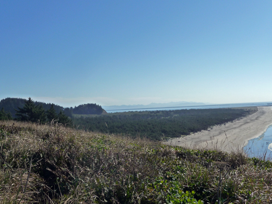
From here we drove north a ways to Beards Hollow Overlook for lunch. Here you get a nice view southward over Beard’s Hollow.
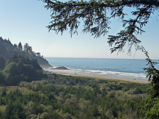
People were watching the spouts of whales out in the dark band of color way out at the horizon. I could see them with my bare eyes but it wasn’t anywhere near as much fun as seeing them close up at Heceta Head back in May. But hey, we all delight in whatever degree of whale sighting we can get.
We had our lunch and drove back to Fort Stevens for the night. We had hoped to talk to their host coordinator but she was out sick for the days that we were there. Ah well, we got to talk to a couple of hosts and they gave us a nice idea of what it’s like to host there. In the summer time they can have up to 60 hosts! There are over 24 host sites in the campground to handle all the campers, the firewood and things like renting paddle boards to use on the lake there. We really liked this place (we’d been here years ago but it was good to visit again). So we’ll do what we can to see if we can get on here for August or September.
Monday October 5th we spent the day driving north from Fort Stevens all the way to Chimacum, Washington which is up near Port Townsend (on the northern end of the Olympic Peninsula). It was a long day, but we took advantage of the day to stop and visit a couple of more Washington State Parks on the way.
The fall rain storms are on their way so after a few days in Chimacum (which I’ll tell you about in my next missive) we’ll head east of the mountains to chase the sun.
It’s great to be back on the road again. For now part of our focus is figuring out where we want to host in August and September in 2016 (since we plan to return to Lake Cascade in May through July 2016). The other is staying happy and warm and in the sun!