
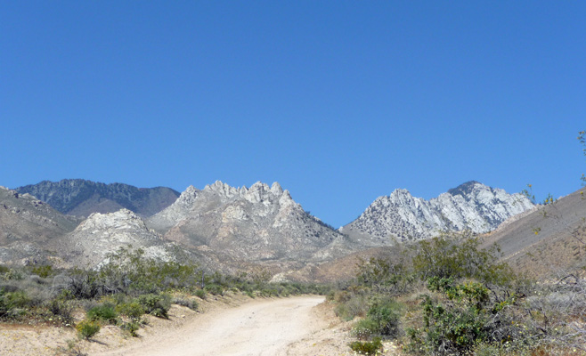
The road led up the hills and gave us a gorgeous view of the end of Short Canyon and why one would want to camp there.
The road crosses the California Aqueduct (carrying water from the Owens Valley down to Los Angeles) and goes on and on. All was well until we hit a VERY sharp hairpin turn that led UP the hills. We looked at each other and agreed that we didn’t want to go any further for fear there’d be nowhere to turn around. We were following directions from the Frugal Shunpiker (www.frugal-rv-travel.com) and sometimes the places she sends you are a little small for big rigs like ours. So Walter got out and cased the joint and figured out how to turn around—by backing UP the first part of the hairpin turn and then pulling forward—narrowly missing a large bush which of course put a few more minor scratches in Genevieve. (sigh)
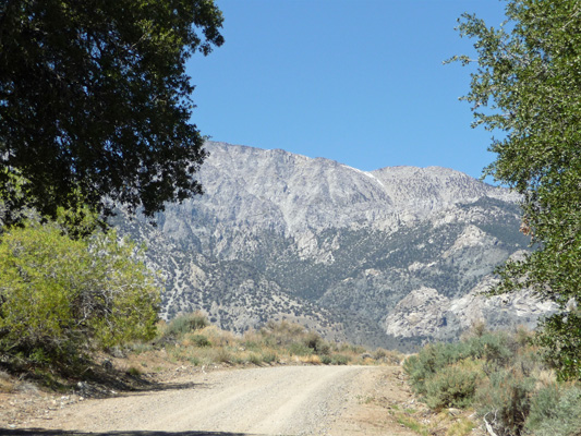
We breathed a sigh of relief as we got back to the highway and drove on up 395 until we got to the turn off for Little Lake where there was supposed to be some nice dispersed camping in the National Forest. The road was paved but when we got to the dispersed camping site it had been closed off. So we jockeyed around got turned around and drove back down the hill once again. I got out and took a shot of the view from the Little Lake area just so you could see why we’d gone on this little side trip.
We had Walter’s computer out already (to deal with the complex instructions for getting to Short Canyon) so he looked up the instructions to our next possible stop: The Alabama Hills just west of Lone Pine.
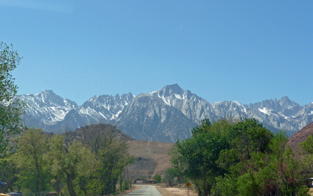
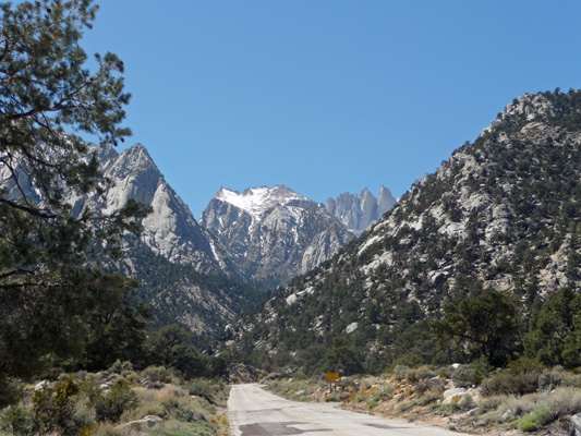
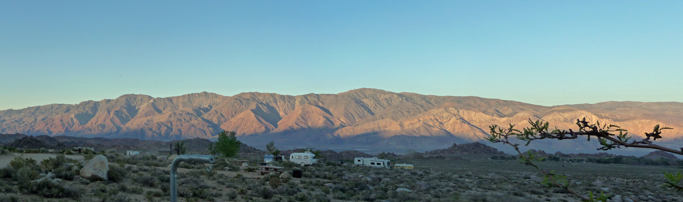
When we got to Lone Pine, we drove up Whitney Portal Road (the only signal in Lone Pine, population 2,000) and I grabbed this photo of the view from the road.
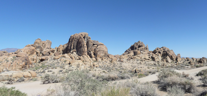
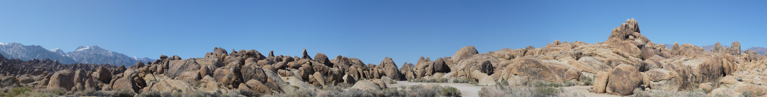
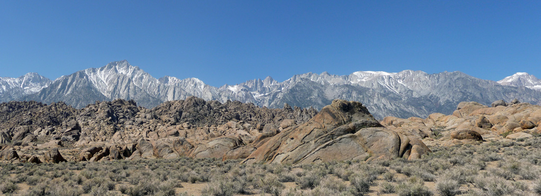
From Whitney Portal, we turned north on Movie Road and out into the area known as the Alabama Hills. Not long after the road turned to dirt, we came to a suggested turn (once again the Frugal Shunpiker) and hurray hurray found a nice spot with a 360 degree view!
We set up camp, put out the solar panels and settled in to enjoy ourselves. Here’s a shot of the view looking east out our bedroom windows.
A couple of guys rode by on dirt motorcycles a few times and we had a couple of dune buggies come by but on the whole it was pretty quiet here. The only hitch was that there was no cell or hot spot signal (and we hadn’t had one at Red Rock State Park either).
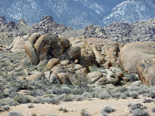
The view looking north gives you a bit of the idea of the scope of the formations here and a peek at the Sierras to the northwest.
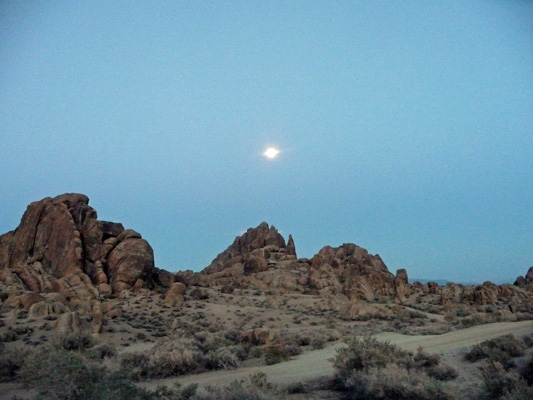
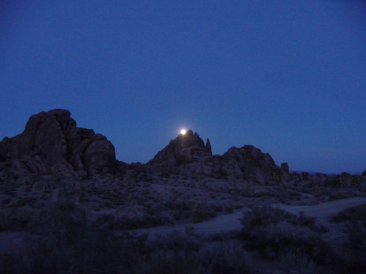
The moon was almost full and I went out and caught it as it rose over the hills.
The next morning it was once again clear and sunny. I got out and did a series of photos looking west while the light was good.
Here’s a shot of the view and our campsite. Pretty amazing place, huh?
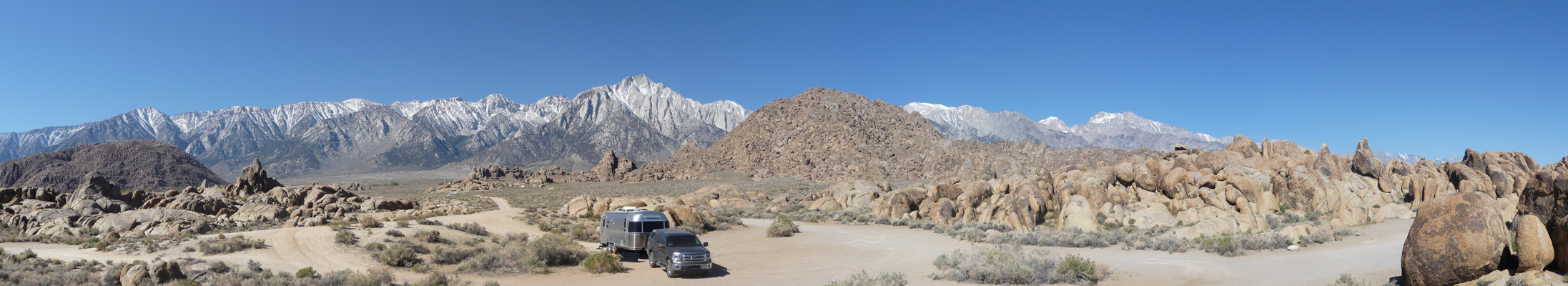
The mountain directly in front of the trailer is Mt. Whitney, the tallest mountain in the contiguous U.S. at 14,505 ft. Mt. Rainier is just 96 feet shorter at 14,409.
Now if at this point you are thinking, you know, these Alabama Hills look kind of familiar and they remind me of every Western I ever saw growing up. Well, there’s a good reason for that. Starting in the 1920’s the Alabama Hills were used as a backdrop for over 400 movies including Sierra Madre, Gunga Din, Lives of a Bengal Lancer, Along the Great Divide, Rawhide, Charge of the Light Brigade, How The West Was Won, many of the Lone Ranger movies, most of the Roy Rogers movies and all the Hopalong Cassidy movies. They’re still using the area today and sometimes areas are closed off so they can do filming. So that tells you why the road into the Alabama Hills is called Movie Road! You can even go to the Lone Pine Film History Museum in town and learn all about it if you’re into that kind of thing.
We went into Lone Pine to pick up our mail and check out Gardner’s Hardware Store. This place is wonderful. How many hardware stores have you been in that carry guitar strings, harmonics, stationary supplies, backpacking dried food and every small appliance and gardening gizmo known to man in addition to the normal True Value Hardware sorts of things? It was a great adventure just going up and down the aisles which are REALLY narrow. We picked up a really nice map of 395, some hitch grease and Walter got a new set of guitar strings.
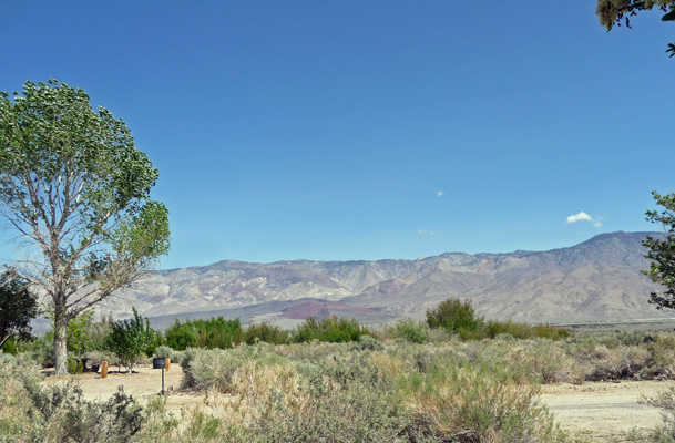
From there we drove south of town to the Interagency Visitors Center where the Forest Service, BLM and the Los Angeles Dept. of Water and Power (who owns lots of land around here because they get a LOT of their water from the Owens Valley) have all sorts of cool displays and information about the area. We picked up some maps and got instructions on a couple of hikes before we took the drive out Tuttle Creek Road to check out the BLM campground out that way. The road wound it’s way up through some cool rocks.
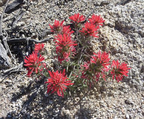
And while I was out of the truck taking this photo I spied a nice patch of Paintbrush too.
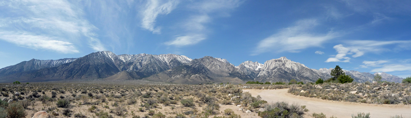
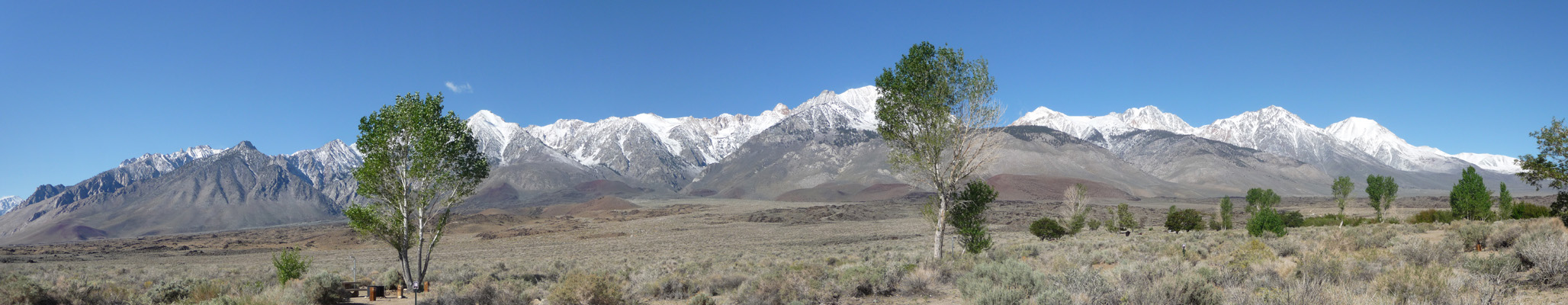
We cased out the Tuttle Creek Campground which turned out to be pretty nice with a dump station, good water spigots to fill your rig from and nice picnic tables—all for $5 night ($2.50 with a Golden Age Pass). The only hitch with the place was that it had 5 really awful speed bumps that you had to take at 2 MPH or it would shake your RV to death. We stored all this info away for later and then took the drive up Whitney Portal Road to see what we could see. This road goes WAY up the mountain to over 8,000 feet to the base camp that folks use to scale Mt. Whitney. We drove about 3/4 of the way until we hit a very tight hairpin turn that neither of us was nuts about taking in our BIG truck. So we turned around and I took this shot of the mountains.
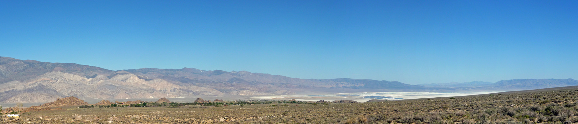
And another of the Owens Valley below.
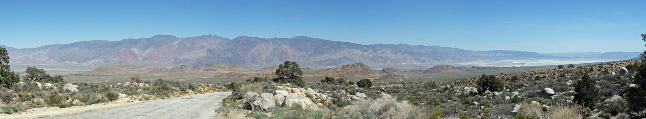
The white area over there on the far right is Owens Lake. It used to be full of water. But starting in 1913, the City of Los Angeles bought up most of the water rights in this area and started sending the Owens River water through the California Aqueduct down to LA. In the process, Owens Lake went dry and became a big dusty salt flat. In the last few years, they’ve begun to try to mitigate the effects of all this (and the dust that results) by allowing more of the water to stay in the Owens River so there is a little bit of water in the lake but no much. The big drought in the area isn’t helping at all.
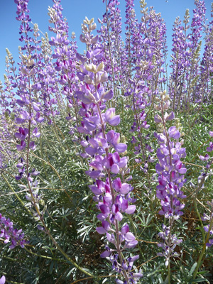
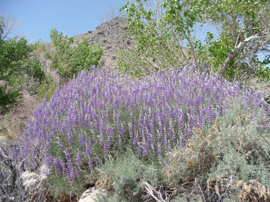
As we drove back down I spied this HUGE lupine. It’s over 6 feet tall! I think it’s Panamint Lupine (Lupinus magnificus ssp. magnificus ) but I could be wrong since I’ve had a lot of trouble finding info on it.
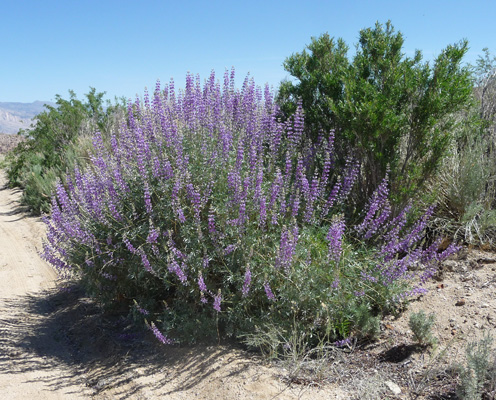
In any case it has gorgeous flowers.
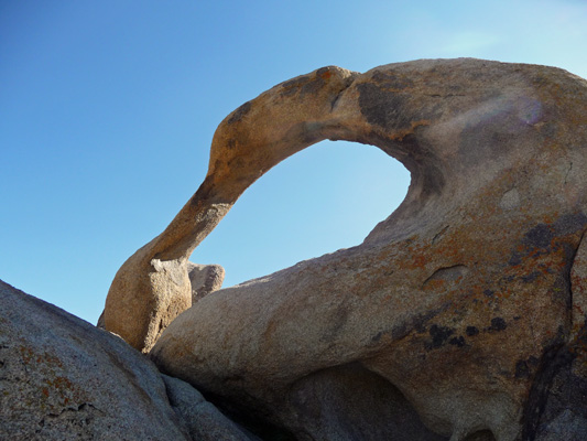
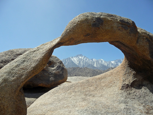
In the late afternoon we drove out Movie Road from our campsite to where it ends and took the Arch Trail. We went clockwise on the loop trail so we approached Mobius Arch from the back.
There were a bunch of folks looking for a geo cache so we didn’t stay long. But I did get down on one knee to get a shot from the other side with the sky in the arch.
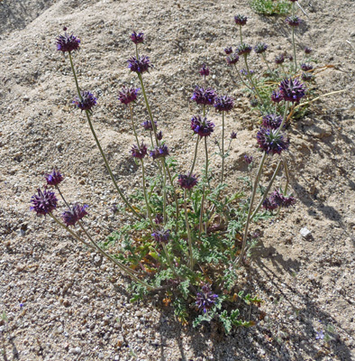
There were chia flowers (Salvia hispanica) in bloom.
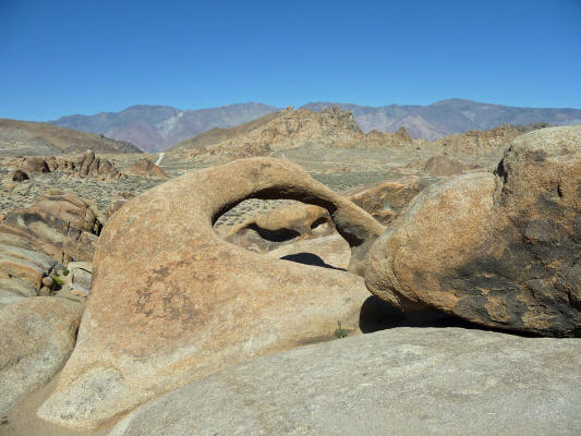
The trail wanders through the cool rock formations. And then another not quite full arch–more of an oval depression with a couple of holes in the back—appears.
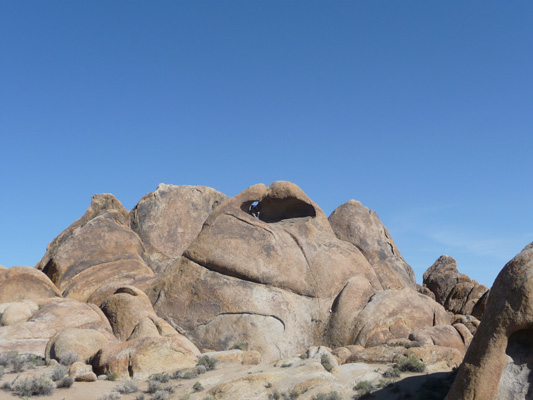
There was a guy who had climbed up the back side of this and was standing inside of it. The rock itself kind of reminded me of Jabba The Hut with a hole in his head.
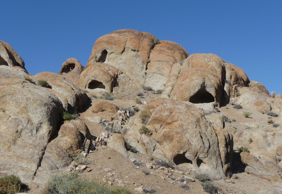
We hiked on and came to a ‘hole in the wall’ sort of place with arches in the making.
There were also several great examples of Spiny Hop-sage (Grayia spinosa).
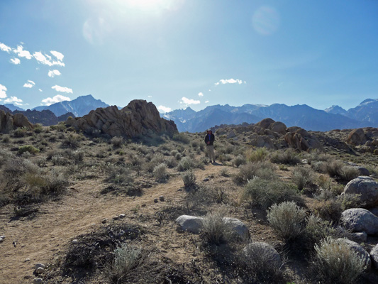
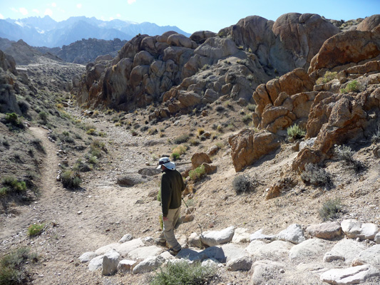
Someone had spent many happy hours lining much of the trail with stones. Here’s Walter on the trail.
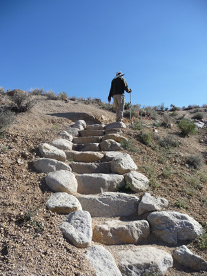
The final section of the trail consists of really cool stone stairs that go down
And after you go across the wash, they go UP.
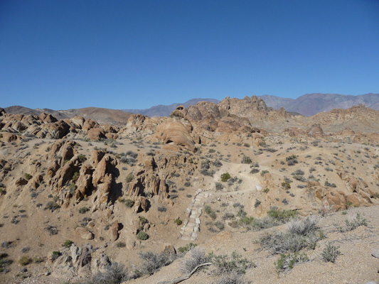
This isn’t a very long trail but it’s lots of fun. Here’s a view looking back across the wash with the stairs and out to the almost arch.
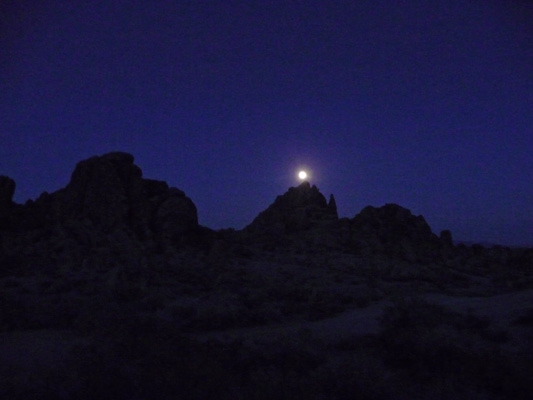
That evening the moon was full and I went out and took a few shots of it as it came up from behind the cool formations in the Alabama Hills.
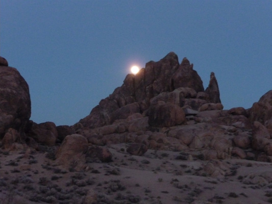
By moving around I got to catch the moon coming up over and over again.
The only problem is that it eventually gets awfully dark for the camera.
I had a lot of fun though.
After 4 days of dry camping it was time for us to fill up on water and dump our tanks but it was Easter weekend! We’d heard someone saying at the Visitor’s Center that the one nice RV park in town was full (this turned out not to be true but oh well) so we decided that since we really didn’t need electricity we’d go to Tuttle Creek Campground where there’s a nice dump station and good water. We dumped when we arrived and filled up with water. Then we set up the solar panels, turned on the hot water heater and had showers. Yum, there is nothing like getting clean after getting grubby hiking on windy days in the desert.
We got a nice campsite (after rejecting a couple because they weren’t real easy to get into) that had a nice view down into the Owens Valley.
And up into the Sierra.
All this, with water and a dump station for $5 a night ($2.50 with a Golden Age pass). Of course they charge you an additional $5 to use the dump station but that is not going to break the bank. AND we had a hot spot signal (though it was kind of slow).
That evening the setting sun (which had already gone behind the Sierra) lit up the Inyo Mountains across the valley.
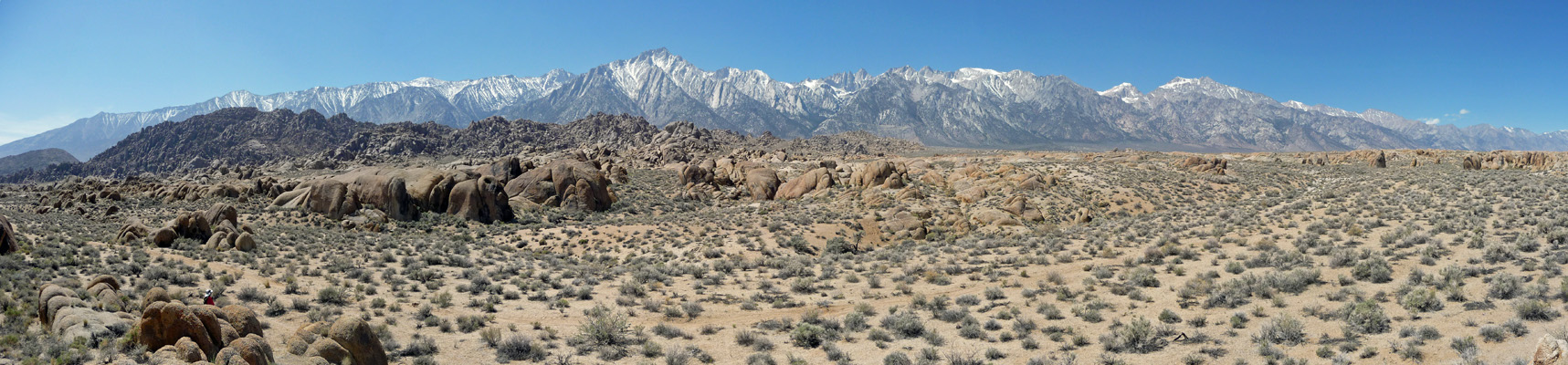
The next day was Easter Sunday, April 5th and we decided we’d go take the hike that ran out past the Arch Trail for a mile or so through the rocks. It was a gorgeous morning and as we hiked along I took this shot westward.
I’m sure those of you who enjoy geology are wondering at this point what kind of geologic forces created this incredible boulder field. I certainly wanted to know and was very happy to discover that on the back of the map that we got at the Visitors Center there was an explanation. I thought initially that perhaps this was another deposit of monzogranite like we’d seen in Joshua Tree. But no, these rock were chemically eroded or weathered—something I hadn’t ever heard of. The Alabama Hills are the same age as the rocks that form the Sierra. They were shaped by the same uplifting 100 million years ago. However, when these rocks were still covered with soil, percolating water (which became acidic during percolation) rounded the granite blocks and sculpted the formations. There is a second theory that says there was an acidic inland sea that provided the source for the water that did the weathering but it all comes down to the same thing.
The rocks are really rough (like old worn out concrete or asphalt) and the surface crumbles into little rectangular pieces if you touch it.
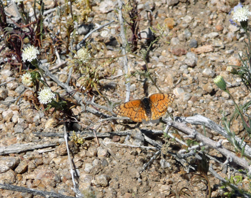
There were butterflies here too (not anywhere as many as we saw at Red Rock State Park but at least these actually stayed still for me to photograph them).
Along the way I climbed up on some rock formations (this is really easy non-skid rock to climb on) and took yet another photo looking west.
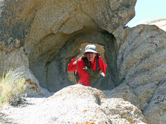
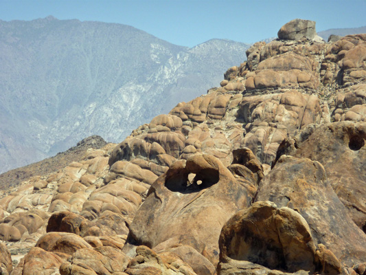
We were nearing the point when we were going to turn around (this trail just goes on and on and it gotten a little boring) when we spied a small hole in the wall across the way.
We set off across country (they just ask you not to crush the brush around here) to see how big it actually was.
It took us a while to figure out how you could get to the back side but perseverance won out.
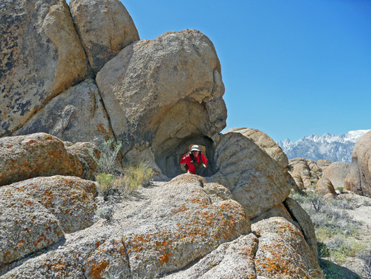
Isn’t that just FUN?
There are supposed to be lots of arches hidden out amongst the rocks and folks do go hunting for them. There’s even a website that lists them all. But we were perfectly satisfied with finding what we did.
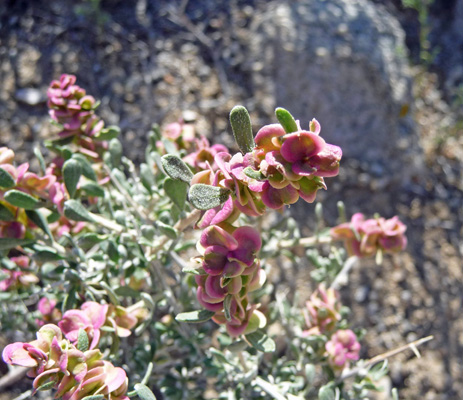
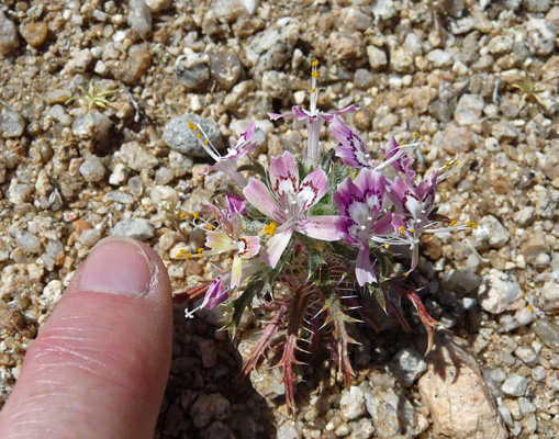
On the way back I spied this tiny little flower. It’s Desert Calico (Loeseliastrum matthewsii).
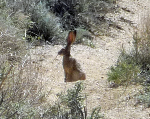
But best of all this Easter morning, we spied a Jack Rabbit sitting in the middle of the trail. We stayed very still and I used my telephoto lens to get a couple of photos of him. He sure looks like a Easter Bunny to me. If they made the chocolate ones like this just think of how much more chocolate you’d get from the ears!
While Walter returned to the car, I hiked the short distance cross country to revisit the Mobius Arch. I wanted to see if I could get what is considered the classic photo of it with Mt. Whitney behind. It required climbing further up onto the rocks than I’d gone a few days earlier but it also gives you a better view of the Mobius effect too.
While I was up taking this shot I looked down and realized that the Easter Bunny had been there.
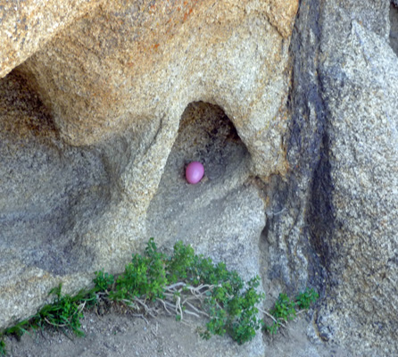
Someone had replaced the Geo Cache box with a large plastic egg. Do you suppose it just might have been the Easter Bunny we’d seen earlier?
On my way back I took another shot of the ‘almost arch’ and this time there was no one up in it so you could really see that it has two openings in its back.
From here we drove on down to town and stopped at the signage about the Alabama Hills. I spied yet another HUGE lupine which was well over 8 feet tall and smelled wonderful.
We did a bit of grocery shopping and truth to tell Joseph’s Bi-Rite, the small Lone Pine grocery store, had everything on my list. They even had fresh naan for goodness sake. No, the produce wasn’t super fresh and they didn’t have 18 brands of everything but it had plenty of what we needed to stretch our supplies out for a few more days until we hit civilization again.
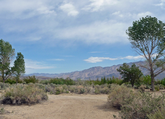
On Monday April 6th, we headed north on Hwy 395 to explore a couple of campgrounds just north of Independence, CA. We went first to the Taboose Creek County Campground which has Taboose Creek running right through it. Inyo County has constructed quite a few of these campgrounds and only charge $10 a night for them. But there is something about the way they’re laid out that makes them very uninviting. So we took a pass and continued on to the Goodale Creek BLM Campground. This is another $5 a night campground ($2.50 with a Golden Age Pass) and it’s much more nicely laid out than the county campground. There was one other rig here and so we had the pick of the place. We picked a nice pull through spot with a view both east and west. Here’s a shot looking west to the Sierras.
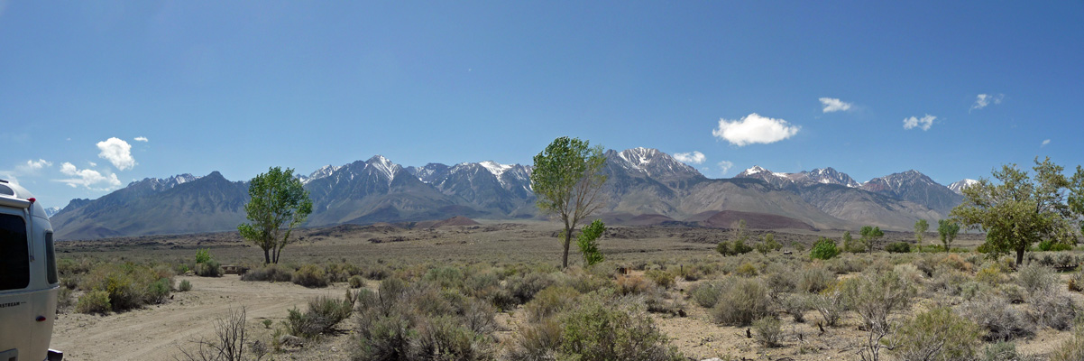
And looking east to the Inyo Mountains.
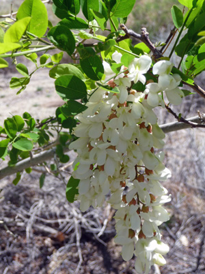
The Black Locust trees in the campground were in full bloom and smelled wonderful. There were tons of them in Lone Pine too and I couldn’t believe that they were just Black Locusts but that’s what they are. Folks plant the bright pink variety in town too. I saw some in Mojave and then again in Lone Pine.
It was really windy, so after taking a stroll through the campground to register, we hunkered down for the afternoon. We had our first really good internet hot spot signal here since we’d left Coarsegold and it was a pleasure to get caught up on our email and surfing.
The next morning, we were presented with a really strange sight. To the west the clouds that had been hanging at the top of the ridge the night before had descended down to hide the mountains
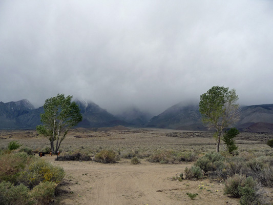
The wind was blowing like crazy but the sun had been out when we got up. By this point, we were in the clouds too but to the east it was still mostly clear and sunny.
We took a drive (it was not a good hiking day—way too cold and windy) up to the town of Big Pine to check out the two possible campgrounds there and find the visitor center we’d seen on the map. Neither of the campgrounds hit the spot and the Visitor Center turned out to be a set of signs in an oversized kiosk at the turn off to the Bristlecone Pine Forest (which is at 10,000 feet and so is closed at this time of year). After all that excitement, we drove down to drive the Fish Spring Loop where there was a chance we might see some elk. No elk (unless you count the stealth elk who look like cattle). So we drove on out Fuller Road and visited the Tinemaha Creek County Campground which is yet another oddly laid out place along a nice little creek. Walter spotted what looked like a mine up the road so we drove out to have a look.
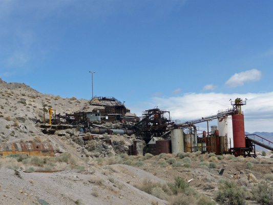
It had no signs identifying it. There were people out climbing around on the equipment exploring the place—which was odd since places like this usually get fenced to take care of liability problems. I did some research on-line and found that it is an old Perlite mine and mill that was up for sale back in 2010. I guess no one has bought it and it’s slowly moldering away.
We drove back to our campground on the back roads and then settled down to watch the weather. We got a scattering of sprinkles now and then and could watch the snow reach way down on the hills when the clouds lifted now and then. The wind howled and we had to run the generator for the first time in over a month because we weren’t getting any sun.
But the reward came the next morning when the skies had cleared and there was fresh snow on the mountains.
It had been down into the low 30’s in the night and frankly we were cold. Walter checked the highway reports and chains were required on parts of Highway 395 and on Highway 50 which we were planning on taking back over the Sierra to the Central Valley. Neither of us relished having to get chains for the trailer (or putting them on). So we decided we’d save the rest of Highway 395 for another trip (say some nice warm May or September). Instead, we turned back south on 395 and drove back to Mojave (yet again) and then west on Highway 58 to Bakersfield.
Our little trip up Highway 395 was lots of fun and we found a lot of great places to camp and even more to explore sometime when the weather up in the mountains is warmer. We dry camped (no hook ups) for 8 days in a row (a new record); had sunshine for solar all but one day (ran the generator 3 hours total); and paid only $61 for camping and dump fees which included 2 nights at a state park that cost $23 a night. The 6 days when we were actually up on 395 only cost us $15! Such a deal.
Wednesday night, we ended up camped at the Bakersfield RV Travel Park just off of Highway 58. It’s a nice park and we got a pull though site for $30 a night (full hook up with cable TV and good WiFi) with our Good Sam discount. It had great WiFi and decent cable TV. The only hitch is that there’s quite a bit of train traffic. We spent Thursday April 9th doing chores—showers, grocery shopping and defrosting the freezer. From here we’ll slowly mosey north up the Central Valley and then on through Oregon to Issaquah for a few days there before we head back to the Oregon Coast.