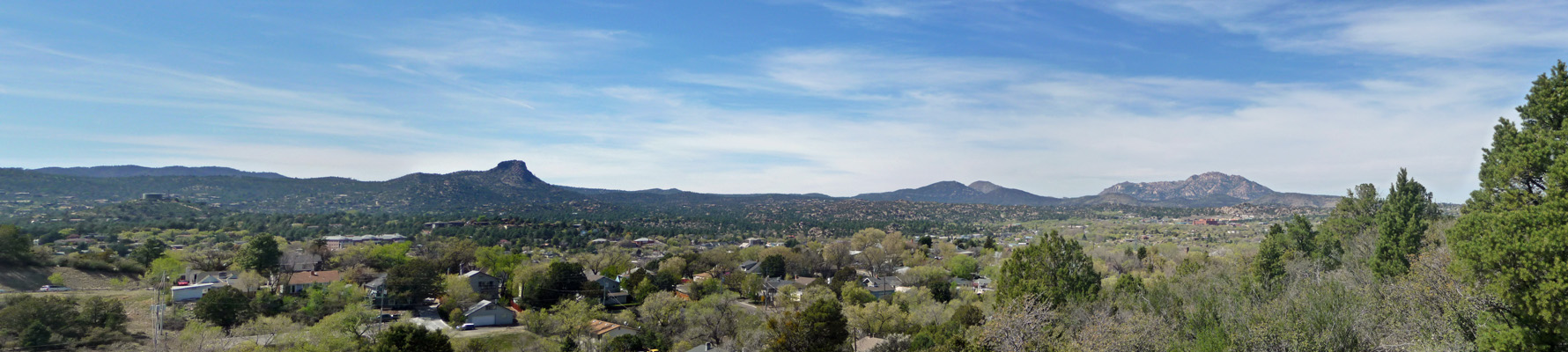
We arrived in Prescott in the early afternoon and stopped by a hotel in the center of old town to pick up a tourist info map. There was a big park on the outskirts of town that was listed has having a nice hike. It sounded like a great outing so we drove out only to discover half the town was there for an Easter service that morning and had stayed to enjoy the park. We bagged that idea and instead went back into town to Acker Park and took the loop trail that took us up the hill (though not as steeply as the counterclockwise direction on the loop) and gave us a nice view of the Prescott area. This park is completely surrounded by houses—some very large and impressive.
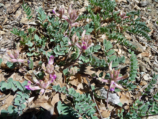
Along the way I spied some just coming into bloom.
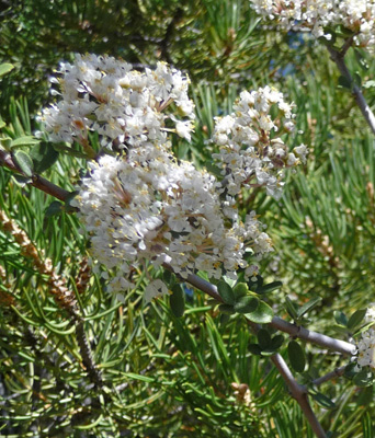
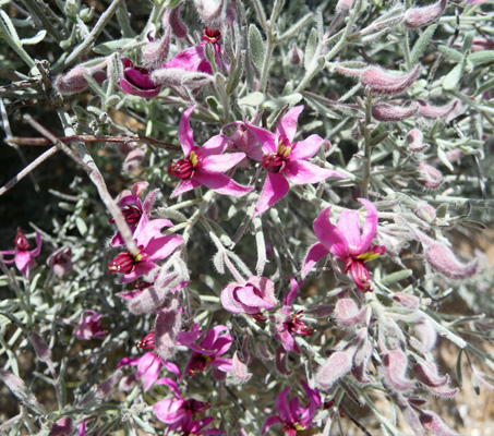
There was also a LOT of Desert Ceanothos (Ceanothus greggii) in bloom all along the trail. It’s a nice shrub and the flowers perfumed the trail most of the way.
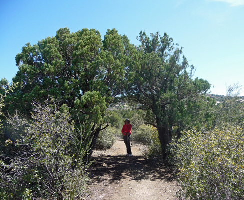
We followed the trail along the ridge and then down a pretty steep section to a pair of Alligator Junipers that made an arch over the trail.
After our hike we had a picnic lunch—it was just warm enough to enjoy ourselves sitting in the sun.
Prescott wasn’t real exciting but there is a nice old town area and there were lots of folks out walking in the central square and along the streets where the shops were open. Not being shoppers, we didn’t stop but instead headed back down the winding road towards Congress. There is a very nice stand of Ponderosa Pines just west of town with a National Forest campground (which looked full) nearby, otherwise there wasn’t much to ring our chimes in Prescott.
Monday March 28th, we picked up our long awaited mail including my birthday present, a new Panasonic Lumix DMC-ZS40 camera with a 30x zoom and lots of nifty new bells and whistles that I get to learn to use. There were some things in the mail that required action and an internet signal so I climbed back into the truck to head back to the post office (where we’d had a blazing fast signal) and discovered that our hot spot worked fine in the truck--but not outside next to our back door or inside the trailer. Talk about weird spotty coverage.
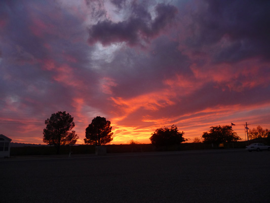
That night we had a super duper sunset. It didn’t last long but it sure was pretty.
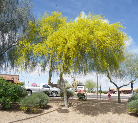
On Tuesday March 29th, we packed up and headed south to Wickenburg to do our grocery shopping. And there in the parking lot of the Safeway, we found the Palo Verde trees in full bloom.
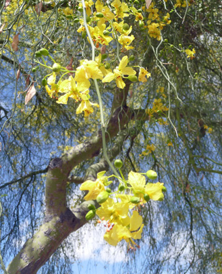
I’d never seen them in flower before so of course I had to get a shot of the flowers up close and personal.
After finishing our shopping, we programed Carmine the Garmin to take us to Lost Dutchman State Park in Apache Junction. It was hard to see what route she was taking us by and boy will we not depend on her if we make the drive again. She took us down through downtown Phoenix (bumper to bumper again of course) and then out to Apache Junction rather than taking the northern route (which no doubt is a few minutes longer) which by-passes most of town.
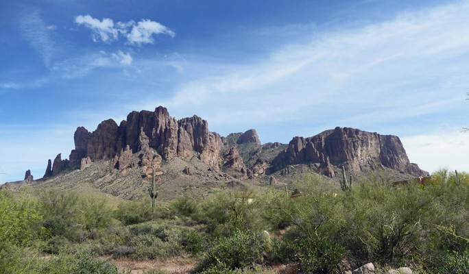
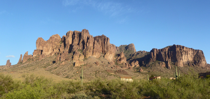
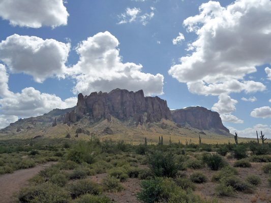
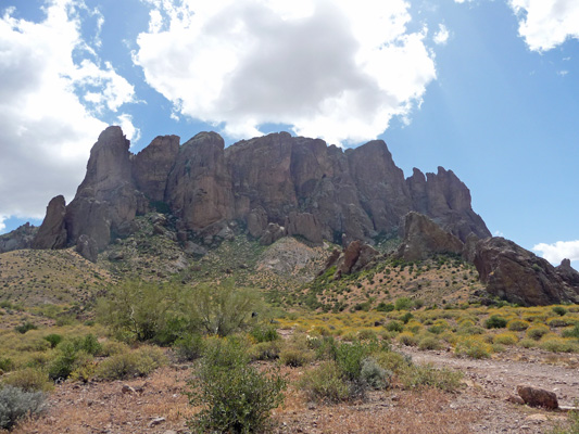
Never mind, we arrived safely and got a lovely spot with a view of the Superstition Mountains out our back windows.
We also had a nice little ‘garden’ in the front of our site too.
It was a pleasant afternoon with mostly sunny skies and we hooked up the solar panel to keep everything charged up since we had no hook ups ($20 a night for dry camping with this great view).
Late in the afternoon the setting sun lit up the Superstitions big time.
Those buildings on the lower right are private homes wedged between the state park and the National Forest (and Wilderness) that encompasses the Superstitions.
Once again we had an iffy hot spot signal. It was fine in the afternoon but once the sun went down—poof it was gone. At first we thought it was a case of the locals coming home and overloading the tower but the signal was still bad at midnight which means it wasn’t an overload problem. Who knows what causes these things?
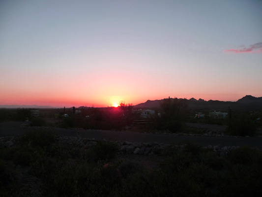
In any case, we had a little bit of a sunset that night to make up for losing our signal.
There’s one very popular hike at Lost Dutchman State Park and we attempted it back in February 2007 but gave up because it was too cold and windy as we got towards the top. This time I was determined that we would do the whole 2.4 miles of the Treasure Loop Trail. The weather was perfect—partly sunny and in the 60’s with just a gentle breeze.
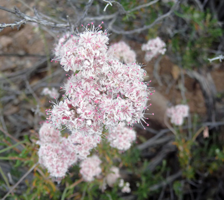
We parked at the Cholla Day Use Area and started up the trail. There were tons of folks coming down off the trail as we were setting out but then it was coming on noon and most folks are heading for their lunches at that point. There were lots of Flat-topped Buckwheat (Eriogonum fasciculatum) in bloom along the roads and the lower reaches of the trail.
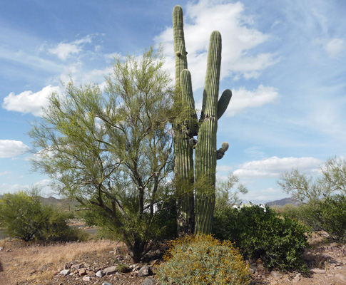
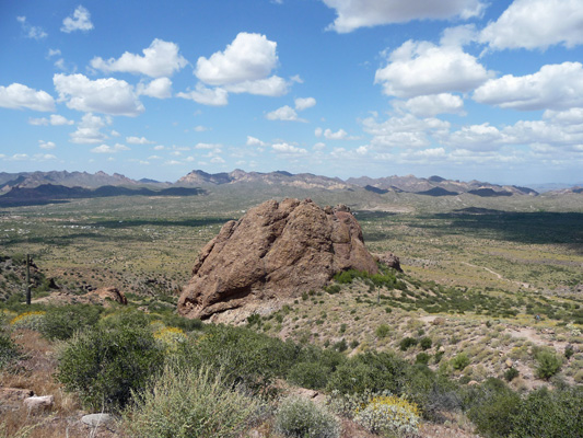
It doesn’t take long before the trail leaves the state park and heads out into the National Forest area—no there are no trees in this forest just lots of cactus and other cools stuff. I stopped to take a photo of the Superstitions as we headed up the trail.
Along the trail there were lots of Buckthorn Cholla in full bloom.
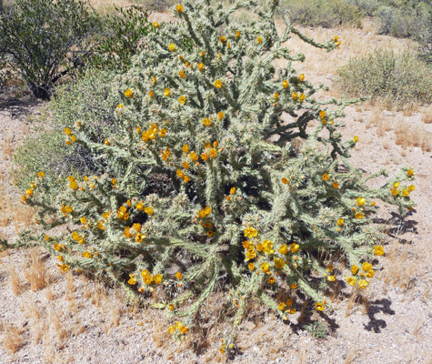
They’re really lovely up close and you can tell by the cluster of buds that they’ll be blooming for some time.
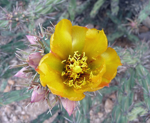
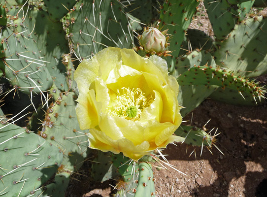
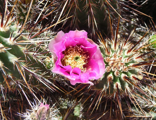
The Engelmann Prickly Pears were in bloom too.
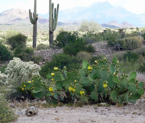
Their flowers are much bigger than the chollas.
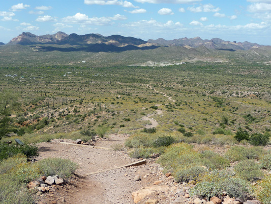
There are lots of nice benches distributed along the trail and we tested most of them and found them wonderful.
Most of them had lovely views out across the Apache Junction valley too.
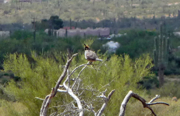
We even spied a Gamble Quail perched on a nearby snag as we sat.
As we gained altitude (the trail is a pretty steady grind with a gain of 500 feet in about 1.2 miles) the plants changed. There were American Threefold (Trixis californica) in bloom.

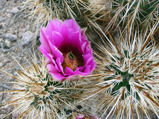
And the Hedgehog Cactus were just coming into bloom too.
And we just kept getting closer to the mountains.
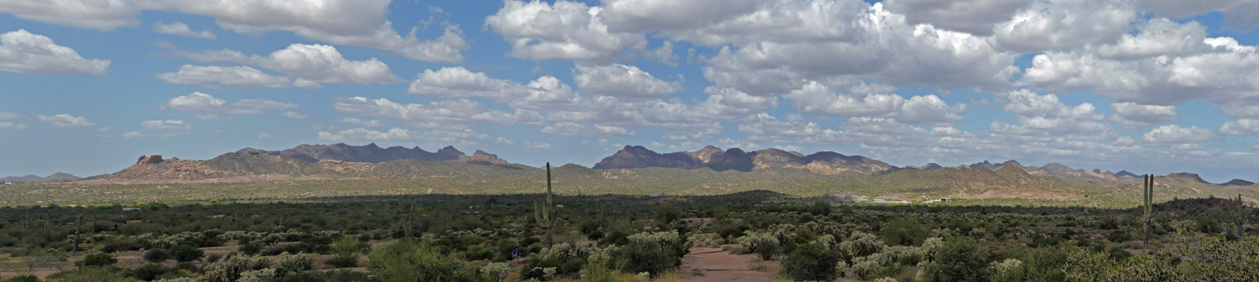
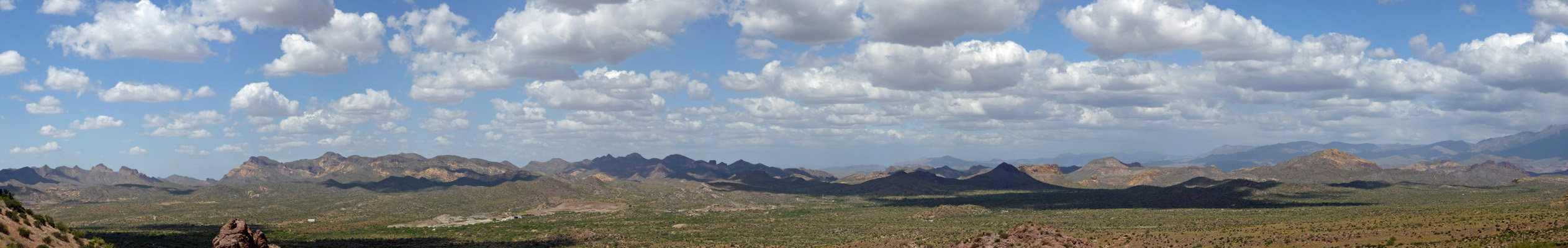
The view across the valley kept getting better too.
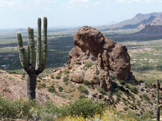
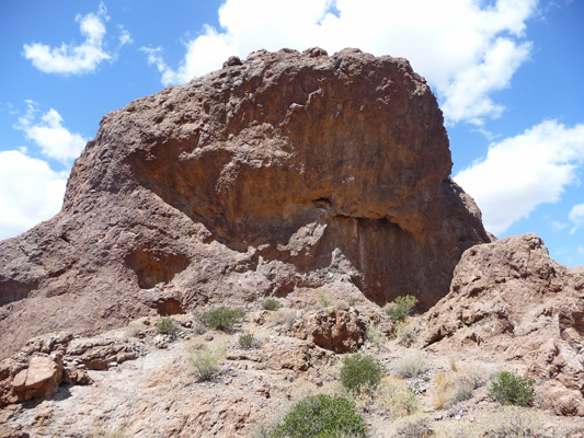
When we made it to the place where we turned around last time, a blast of wind hit us but it wasn’t enough to keep us from going on. We reached the top of the trail with no problem and then saw why it seemed that folks kept going UP. The trail has to skirt a gully before it finally peaks out just behind the Green Boulder. If you look carefully you can see there are folks clustered at its base having their pictures taken.
There was a nice bench (well it could have been better since you had to perch on the edge to get your feet to touch the ground but it was still very welcomed) at the top and we sat and talked with a mother and daughter from Florida who were resting after coming up the way we would be going down (which is a bit steeper). Mom said she was still struggling with altitude after they’d been to Bryce and Zion and the Grand Canyon which are all way higher than Apache Junction. But when you live at sea level everything else is UP.
We headed on down past the Green Boulder and I took a photo of yet another of these big boulder shaped formations—they look much bigger in person. You can see the trail we came up on as it snakes along on the right hand side of the photo.
The Green Boulder is a bit greener from the downhill side (lichens make it green).
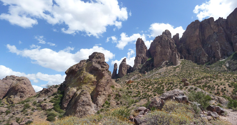
And the view of the pointy parts of the Superstitions is pretty swell too.
As you can see the trail is pretty steep on the way down—just enough to make my knee whine a little while we were doing it but not be sore the next day.
Here and there further down along the trail there were Range Ratany (Krameria erecta) in bloom. It’s a pretty scraggly looking shrub but the flowers are nice.
And there were more hedgehog cactus in bloom too.
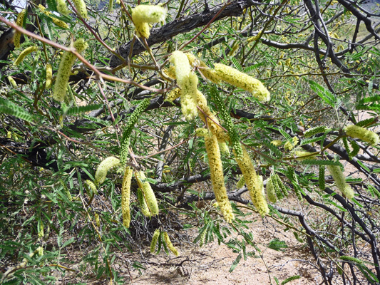
We finished the loop at the Saguaro Day Use area and made the short walk back to our car on the mountain bike trail. The Velvet Mesquite was in bloom in the parking lot.
The rest of the afternoon we hemmed and hawed about what we should do next. Our plan was to go to Sedona to hike for a few days. The temperatures were due to rise on Thursday and be downright hot down in the Phoenix area for the weekend. But we discovered that the campground we were hoping to camp in wasn’t going to open until Friday (at the earliest). In the end, we decided we’d risk it and go up on Thursday and try to beat the cheaters as Walter says, and get one of the first come first serve campsites in the other campground in Oak Creek Canyon just north of Sedona.
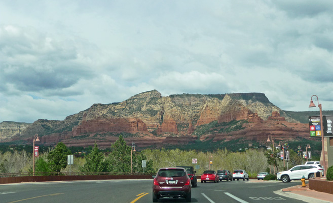
We had cloudy weather first thing in the morning on Thursday March 31st, but by the time we broke camp the sun was out. We drove northwest out of Apache Junction and caught I-15 north up to Hwy 179 into Sedona. By the time we got to the little town of Oak Creek Village (which didn’t used to exist 10 years ago) the traffic was heavy. And as we turned towards Sedona itself it bogged down to a crawl. There are at least 12 traffic circles on Hwy 179 as you approach the main drag in Sedona and it was bumper to bumper the whole way.
The good news was, that allowed me to get one photo of the red rocks even though I was driving.
The bad news is that it was incredibly crowded in Sedona. There were cars and pedestrians everywhere. By the time we made the turn onto US 89A I was in serious doubt as to whether I was willing to go back into Sedona itself to get to any hikes there. All the trailhead parking lots along 179 had been full and it just looked like a zoo. Somehow in the last ten years, Sedona had turned into a very upscale Glitter Gulch. Clearly Sedona is a big draw for Spring Break in Arizona—they tell us it’ll be over in Arizona on Sunday April 3rd but who knows about the folks in Utah.
It was no surprise then when we arrived at the campground and found that the only spot that was open was too small for us. We drove back to double check that Cave Springs Campground was still closed (and it was and we had to back up to get turned around). At that point it was clear it was time to punt. We found a place to park along Oak Creek Canyon and watched a steady stream of cars roar by while we had lunch and looked at our options.
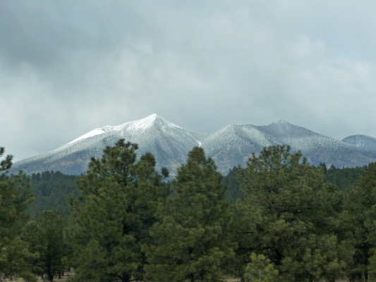
In the end we opted to continue north to Flagstaff and then drive west to Williams, the gateway to the Grand Canyon. They’d had snow in the mountains the previous day and Humphrey’s Peak, the highest point in Arizona at 12,663 feet, was covered in fresh snow as we came into Flagstaff.
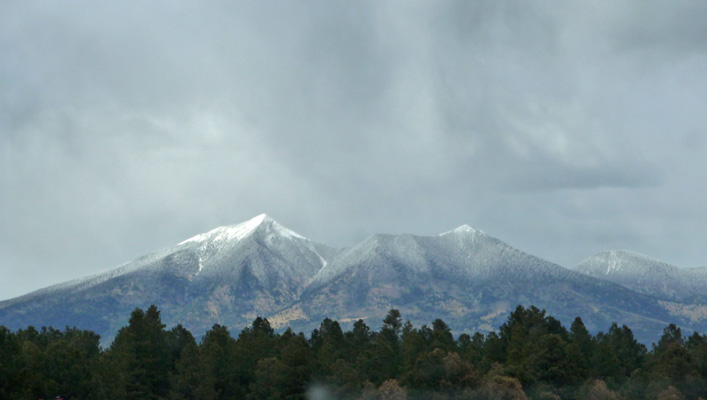
We wound our way over to I-40 and headed west out of town towards Williams and I caught yet another shot of the mountain. Flagstaff is 6,900 feet so there are lots of pines here including a few stands of Ponderosa here and there along the freeway.
We headed in to The Canyon Motel and RV Park on the edge of Williams. It’s a Passport America park so we got a back-in full hook up site (with cable TV) for just $22.25 a night. Williams is at 6,765 feet so while the forecast was for pleasant days (temps in the high 60’s and low 70’s) the nighttime temperatures were due to be in the low 20’s. That means you don’t leave your hose hooked up to your rig because it will freeze. We didn’t care about that. The most important thing was to have electricity so we could run our heaters. As it was it got down to 21 every morning. Brrrr.
They had free wifi here that worked just fine with my Bear Booster but Walter had trouble getting any speed out of it so he used our hot spot while we were here which worked great.
That evening we sat down with internet in hand and did a bit of planning for the next week. We scored a 2 night full hook up reservation at the Trailer Village in Grand Canyon Village for Sunday April 3rd and Monday April 4th (the only 2 day spot available for the next week or so) so we opted to extend our stay in Williams for another day to get us to Sunday. We also managed to get a coveted full hook up site for 2 nights at Kodachrome Basin State Park in Utah (up by Bryce) for Thursday and Friday April 7th and 8th. We don’t do reservations that often but since the nights are still so cold at these high elevations we really prefer to have electricity and reservations gave us a guarantee of not freezing our patooties off.
Friday we did laundry and got caught up on internet stuff and Saturday we did grocery shopping and some routine maintenance on the truck and trailer—gotta keep those tires inflated and the batteries full of water.
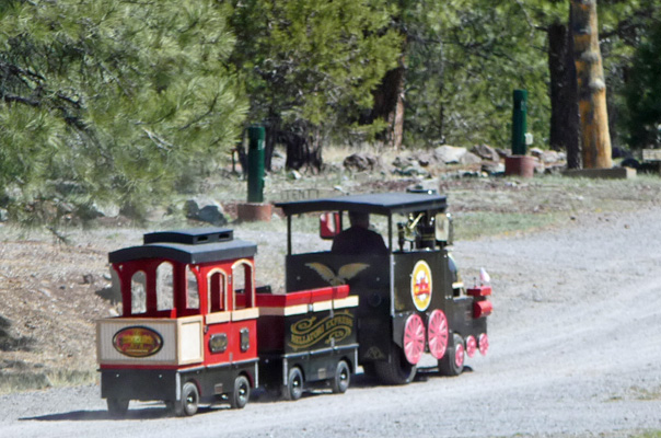
Saturday morning, the owner of the park was out in their little train.
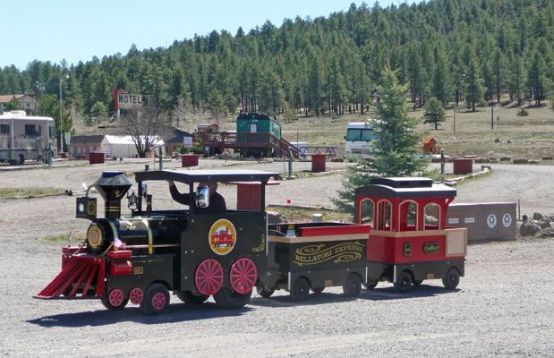
We’d seen him driving it the day before without the two little cars in tow. Now it was truly the Bellatori Express, complete with a wonderful old-fashioned train whistle.
He did one lap of the RV Park and that was that for the day.
You can take the train from Williams up to Grand Canyon and back for a day trip (it’s not cheap but it’s scenic) and we heard train whistles all day on Saturday because it turns out that the first Saturday of the month is “Steam Saturday” when they take the steam train (powered by waste vegetable oil) up to the Grand Canyon. The rest of the time they use regular diesel trains.