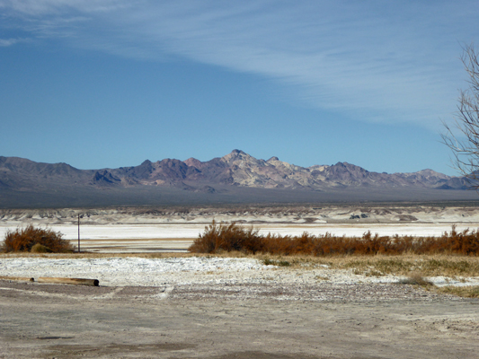
The water from the hot springs does flow out across the desert so there are places where it is wet but they aren’t big.
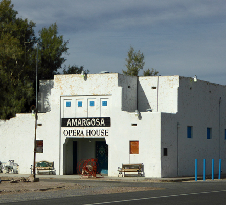
We headed north back up to the Hwy 127 and then up through Shoshone and on to Death Valley Junction. We stopped to switch drivers across from the old Amargosa Opera House. For years there were regular performances here by a woman who had been a famous dancer. There’s an old fashioned motor inn next to it so you can even stay here.
We continued on into Death Valley and checked in at the Furnace Creek Campground just before 1 pm. The ranger came out and gave us our check-in package even though she was on her lunch hour—which was awfully nice of her since the kiosk said she was closed. For our first night, we’d snagged a pull through site (number 75 for future reference) with a full hookup. It was great. All the pull thrus were nicely spaced so we had a lot of open area around us and the tent camping sites behind us were big too. All this for $25 a night with our Golden Age Pass (full price is $36 and they only give you 1/2 price on the camping fee not the $14 fee for the hook up). We were within a short walk of the Visitors Center and had a great view of the Funeral Mountains (part of the Amargosa Range) from our outdoor sitting area.
Walter turned on his phone and amazing grace he had 3 bars! They’ve put a cell tower in here at Furnace Creek and another at Stovepipe Wells! It’s an ATT tower but they support Verizon too so Walter’s phone was on roaming (and as always that didn’t seem to work). Our hot spot didn’t work which isn’t surprising since it never works when Walter’s phone is on roaming. There used to be free WiFi at the Visitors Center but now that they have a cell tower they don’t provide it anymore.
After getting set up we walked over to the Visitors Center and watched the Death Valley National Park movie—it was new one since the last time we stopped to watch. It was narrated by Donald Sutherland and it was a really good one. We did a little Christmas shopping and then headed home for lunch and a quiet afternoon.
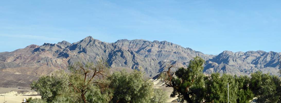
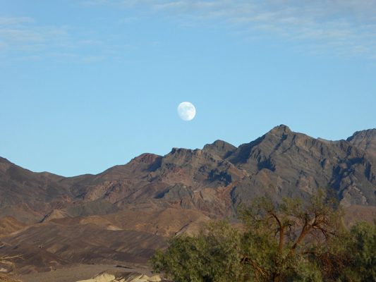
Not long before sunset the nearly full moon rose over the Funeral Mountains.
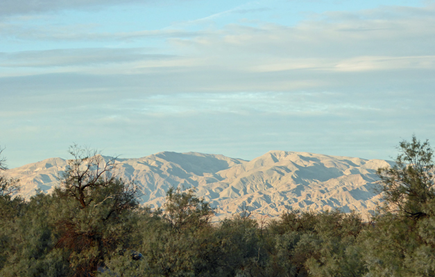
And a bit further north the Amargosa Range lit up.
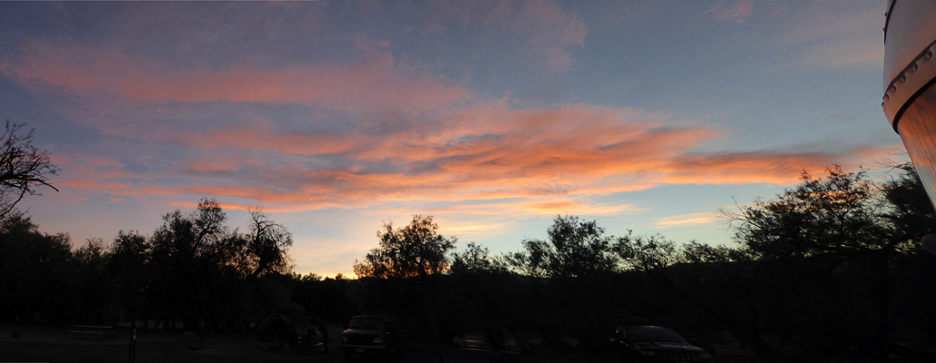
This is a great campground because it actually has trees! There are both native mesquites and lots of non-native salt pines. We had a great view of the sunset out our kitchen windows.
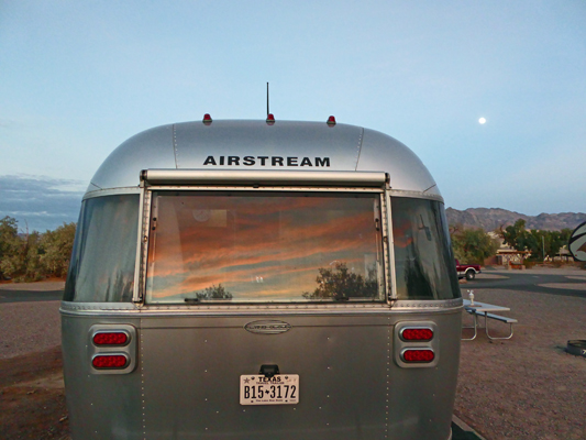
When I came back in from taking photos I noticed the sunset reflected in Genevieve’s back window with the moon over her right shoulder, and I couldn’t resist.
Monday December 12th, we had to pack up again and move since we’d only been able to get one night in this nice pull thru. So after breakfast, we hiked back to the entry kiosk to check out and on our way we walked by our new site which happily was already empty. After checking back in again we walked back to the trailer, broke camp and moseyed over to our new spot and set up camp again.
Here’s the view from our back windows from our new back-in spot (site 43 for future reference).
So the payoff for having to back in (rather than just pull through) was a much nicer view from our kitchen table. But the sites were closer together too so you win some and you lose some.
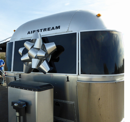
Just a couple of sites down from us there was a 27 foot Airstream with a Christmas bow (made our of metal roof flashing). I told them that they got extra points for being so cool that they had a bow and that made them laugh.
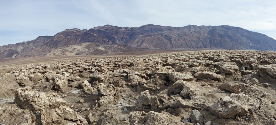
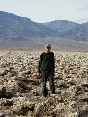
Having set up camp, we set out for our outing for the day. We drove south from Furnace Creek to the Devil’s Golf Course. It’s a short drive down a gravel road off the Badwater Road. When we arrived we had the place our ourselves. Acres and acres of chunky salt formations on the salt flats. It’s called the Devil’s Golf Course because only the Devil would be able to play golf here. Here’s the view looking east across the salt formations to the Funeral Mountains.
And here’s Walter standing out in among the chunks looking west to the Panamint Mountains.
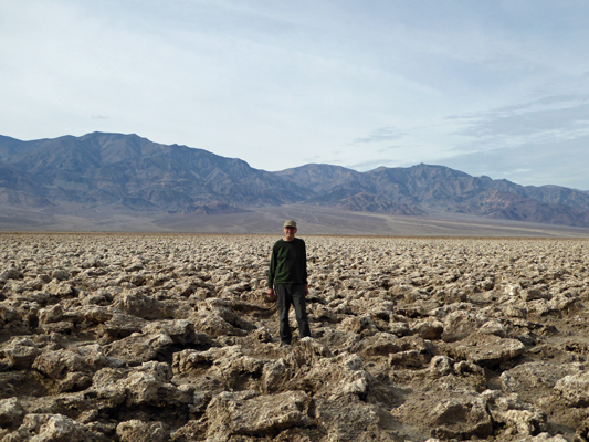
In case you can’t recognize him, here’s a closer shot. Now don’t you want to try to find your golf ball in amongst this stuff? We both wondered how many golf balls had been lost here over the years.
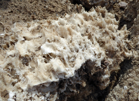
The salt forms all sort of fanciful shapes most with very sharp edges. Note to self do not fall down here.
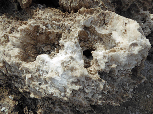
There are rocks with what look like soft edges but it’s all very brittle.
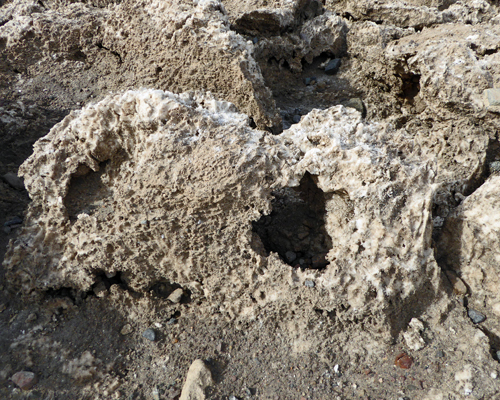
And lots of interesting arches and holes.
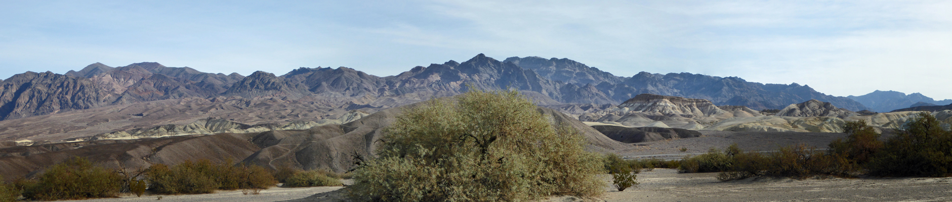
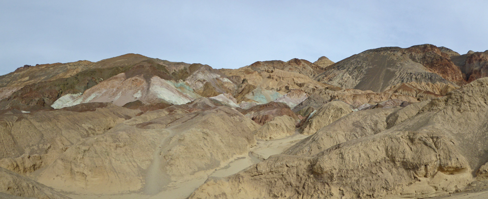
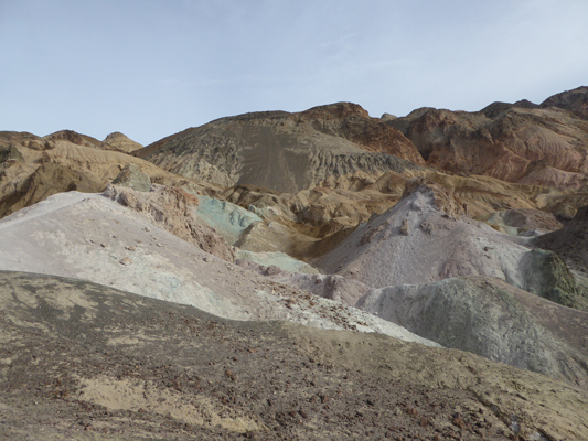
Here’s a panorama shot of the Funeral Range. I love all the wonderful colors. The Artist Drive that takes you up through those colorful rocks was closed to repair damage from the flash floods of October 2015 on Monday which was disappointing.
We took out our camp chairs and sat in the sun listening for the crackle of the expanding salt. All we heard was the ticking of the truck as it cooled off. But we enjoyed ourselves nevertheless.
From here we drove a little further south and then east on another gravel road to the trailhead for the hike to the Natural Arch. This is a mile out and back hike with a couple of hundred feet of gain up a gravel lined canyon as it slowly narrows to a slot canyon.
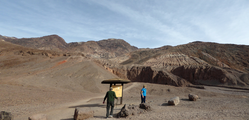
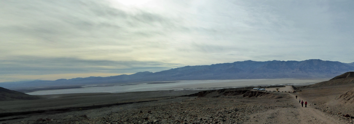
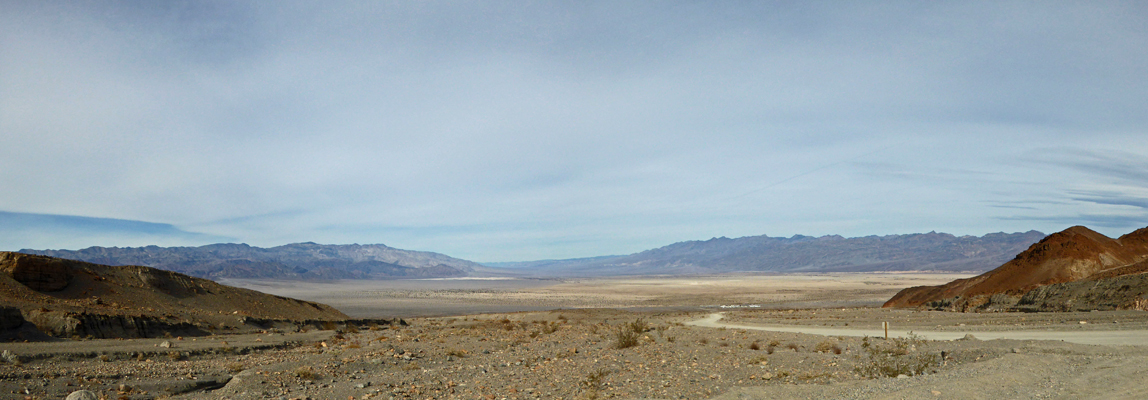
It was a steady climb through gravel so it was some work. I stopped to take a photo of the valley (and the salt flats) looking west. We had some high clouds but the temperature was in the high 60’s and it was very pleasant without our fleece.
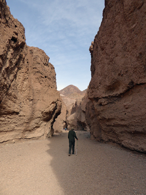
The canyon takes you through a lot of fun geology with various kinds of faults and the marks of old waterfalls. Eventually it starts to narrow down.
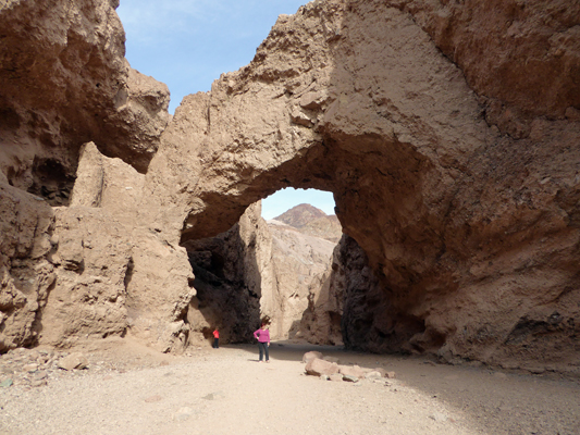
And finally around the bend you come to the Natural Bridge.
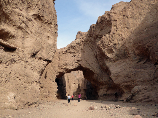
Walter stopped about here, satisfied with the view. But I kept on, wanting a bit of sky under the bridge. In fact, by getting down on my knee I got sky and the mountain peak—very satisfactory.
The trail keeps on for another 1/2 mile. I went on under the bridge to see it from the other side.
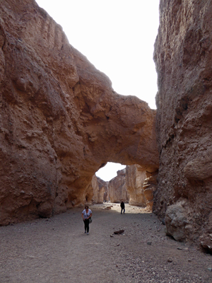
And looked around the corner at a not very exciting slot canyon where I turned back. The hike back was less work but loose gravel is a bit of a challenge on a steep down and my knee talked to me about it.
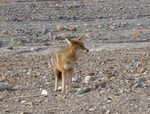
From here we drove north again up Badwater Road and not far from the main Highway we spied a coyote standing right near the road. I rolled down my window and got a nice photo of him. I don’t know what he was watching but he stayed very still for a long time.
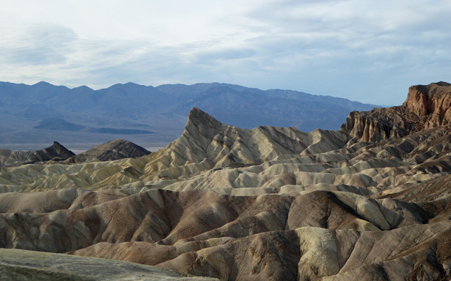
We then took a bit of a detour to go west on the main highway (Hwy 190) to Zabrinski Point, one of my favorite places in Death Valley. We had the viewpoint to ourselves for a while which was a first. This a very popular place and it’s usually crawling with tourists—and hikers setting out on the trails through the Badlands. This is the view northward.
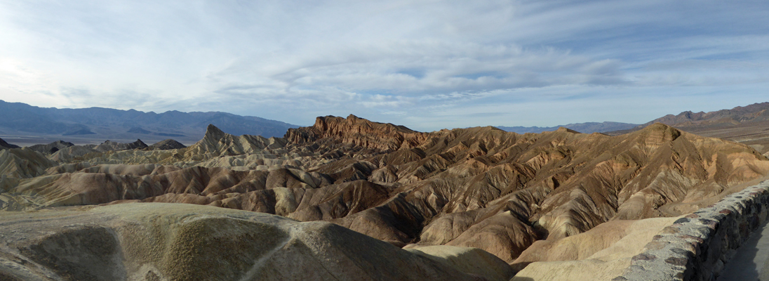
And this is the view southward. The dark black/brown tips sticking up through the yellow are lava that oozed through the floor on an inland sea before the whole area got folded and uplifted and then eroded.
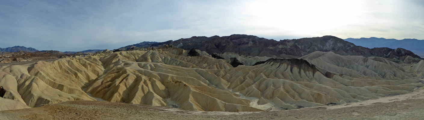
The striations in these formations give you a sense of the angle of the uplift.
It was way past lunchtime so we headed home from here. We had too many clouds for a sunset and I didn’t get to see the moon rise even though we were pointed in the right direction. Ah well, I enjoyed it the night before.
Tuesday morning December 13th, we got up and packed up the trailer AGAIN. This was 4 mornings in a row that we had to move—a very good reminder as to why we have this rule that we stay in the same place for a minimum of 2 days at a time. This time we actually were changing campgrounds. We drove north about 25 miles within Death Valley to Stovepipe Wells where we had a reservation for a full hook up site at the Stovepipe Wells Hotel. We got there a little before noon (their check in time) and a spot was ready for us to move in. When you make reservations on-line with them you don’t get to pick you spot but if you have a favorite it turns out you can call them and they will reserve it for you. This is a basic gravel lot with 14 parking spots in a row but it comes with access to their swimming pool and showers plus a business center with WiFi! Since it’s a private campground within the National Park there is no Senior Discount so we paid $33.30 a night here.
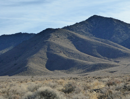
We set up camp, made a lunch and headed west on Hwy 190 up to Emigrant and then south on Emigrant Pass Road. The road twists and turns and at one point we came to these great pink formations.
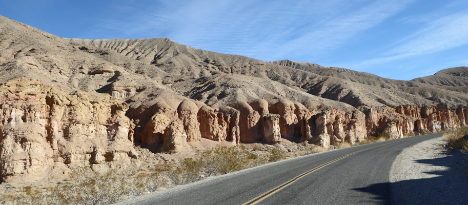
While I was out taking this photo I took a shot of the view to the north too.
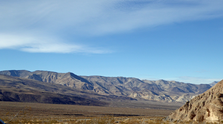
The road goes on and on through the Panamint Mountains which are basically brown with dry grasses. We kept seeing animal droppings on the road that looked too small for horse and we wondered if perhaps someone had driven some sheep through. The droppings continued through the Wild Rose area where there is a tiny tent-ony campground (with two tents in it). Not long before the road turned to gravel we came to this sign.
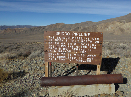
Skidoo was a mining town north of here—yes it’s the source of 23 Skidoo. There’s a gravel road you can take out to it but we decided we didn’t need to bump along on 9 miles of gravel to see the town site that doesn’t have anything left in it—Walter visited it back in the 60’s and wasn’t impressed so we skipped it. I did spy part of the pipeline to the south through—it’s that straight line going up the hill.
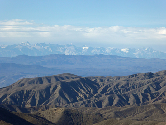
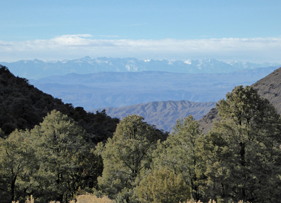
When I turned west to get back into the car I realized that you could see the snow-capped Sierras off in the distance.
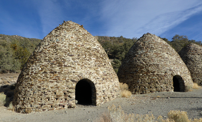
The road continues to climb and turns to gravel and you eventually begin to see junipers and pinyon pines. Nestled in among the pines there are 10 beehive-shaped charcoal kilns built back in 1879 to provide charcoal to the Modock Mine smelter about 30 miles west of here. The kilns only operated for 3 years. But because they weren’t used for long and they are in the middle of nowhere they may be the best preserved examples of charcoal kilns in the west.
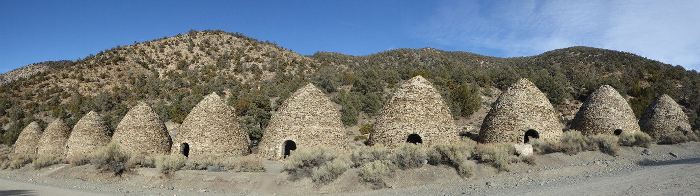
They were stabilized by the CCC in the 1930’s and by a Navajo restoration team in 1971 (who clearly did a great job).
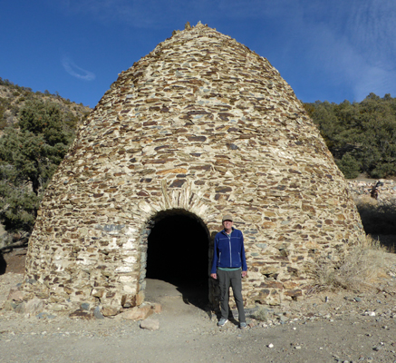
The each kiln stands 25 feet tall and is 30 feet in diameter. They could hold 4 cords of woods each. We both wondered how many of the trees on the hillside might have been cut in the 3 years of operations.
Walter had read about someone who had gone into one of the kilns and played his harmonica and that the local coyotes had sung along. So he tried it too.
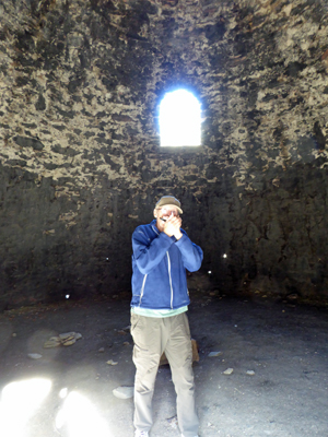
No coyotes sang but we decided the acoustics were good enough for us to sing for a while and that was fun.
The view of the Sierra from up by the Kilns was pretty great and you can see some decent sized pinyons along with it.
This was a great low-key outing. The drive was interesting (if a bit twisty and narrow in places) and the charcoal kilns both educational and fun.
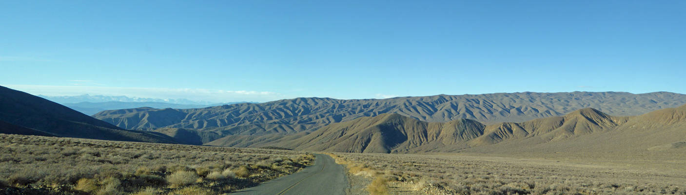
We put the truck into low gear on the way back (you get up to 6800 feet in elevation at the kilns--it was in the low 50’s--and you end up at sea level by the time you get back to Stovepipe Wells). Not long into the drive back we stopped and I took this panorama shot of the view. We both thought that this part of the Panamints looks a lot like brains...
As we approached Wild Rose again we saw a group of 4 wild (feral actually) burros. There’s water here so it made sense they’d be hanging out here.
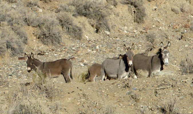
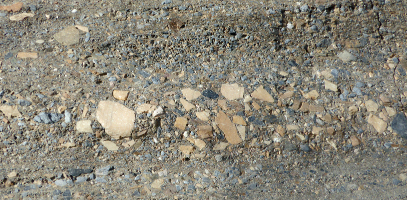
I got out to take their pictures and got a good up-close view of the droppings on the road. It looked like horse poop but smaller in diameter. Mystery solved. It was burro poop! It turns out that they spent lot of money in the 90’s rounding up the burros (they’re hard on the indigenous fauna and flora) but at this point they’re making a comeback.
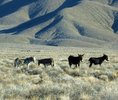
Further along the way (may 20 miles further) we saw 4 more out in the grasslands.
We got back in time to head over to the hotel and have showers and use their Wi-fi to pick up our email. It wasn’t blazing fast but at least now when we finally get a good connection we won’t have 4 or 5 days worth of email to slog through.
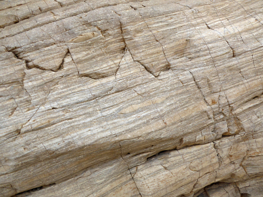
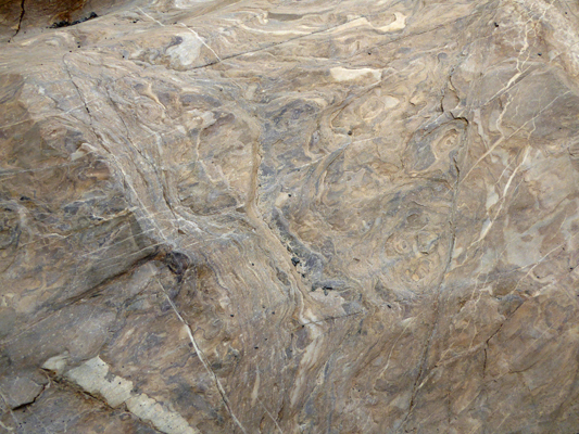
Wednesday December 14th it was sunny once again—don’t you just love the desert? We walked over to the business center and used the computers there to check our email and then drove up the 2 1/2 mile gravel road to the trailhead for Mosaic Canyon. We did this hike back in 2006 and had enjoyed it so we decided we’d try it again. There’s a 1/4 mile walk up the hill before you enter the canyon itself and while it’s a steady up hill grade it wasn’t bad. The canyon itself isn’t very wide and it’s not long before you start to see the conglomerate rock that give the canyon it’s name. It starts out with the mosaic pieces sticking out as round rocks but as you get deeper into the canyon the flash floods over the years have ground the rocks down to flat pieces and polished them while they were at it.
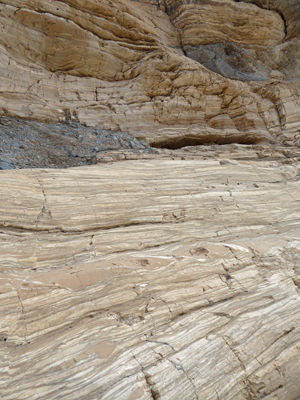
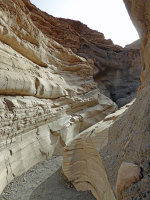
This layer is anywhere for 10 feet to 2 feet high in places. On the opposite wall of the canyon there is layered siltstone.
This goes up for 20 to 30 feet in places and has pockets of the conglomerate scattered in it here and there.
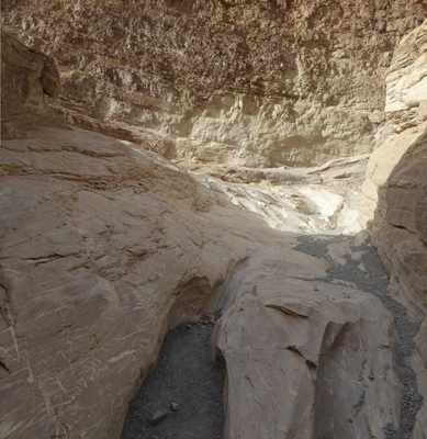
The canyon narrows until it comes to this little turn. Walter went a posed for me to give you a sense of scale.
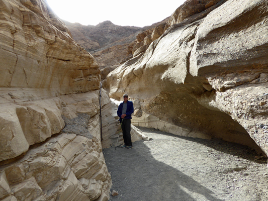
It sure must be a natural place to stand because here he is standing in the exact same spot back in 2006. In 10 years of the flash floods the canyon has changed quite a bit and that marvelous layer of gravel that’s appeared made walking through here a whole lot easier.
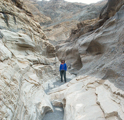
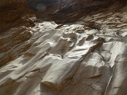
The trail continues on and the siltstone becomes really smooth and polished.
At this point we reached a 4 or 5 foot high barrier of super smooth siltstone.
There were no nice foot holds or even obvious approaches to the thing and we both decided it just didn’t look safe for us. There were a pair of ladies about my age who stood and looked at it and announced that the one lady’s broken wrist and and the other’s newly replaced hip meant they wouldn’t risk it. We had turned around to leave just as some folks came down it (we some difficulty). They said that we really weren’t missing anything since this part of the canyon was the best part anyway. It’s so nice when we wimp out and it turns out we haven’t really missed anything.
I did take a moment to shoot some photos of the top of the formation lit by the sun so it glistened like it was wet.
On the way back through the narrowest part of the slot I took a photo from right in the middle of it.
When we arrived back at the parking lot I took a panorama shot of the valley below.
That little white patch that the road is pointing at is Stovepipe Wells where we started.
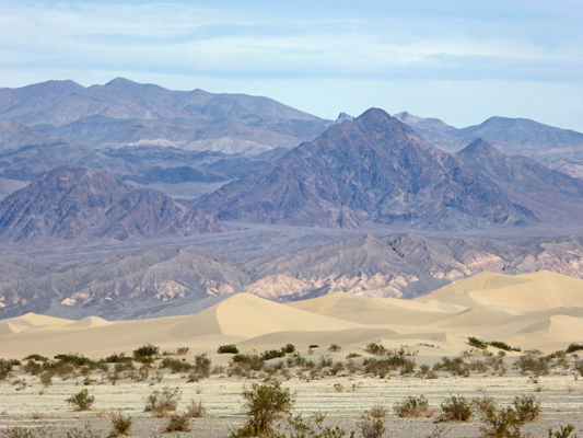
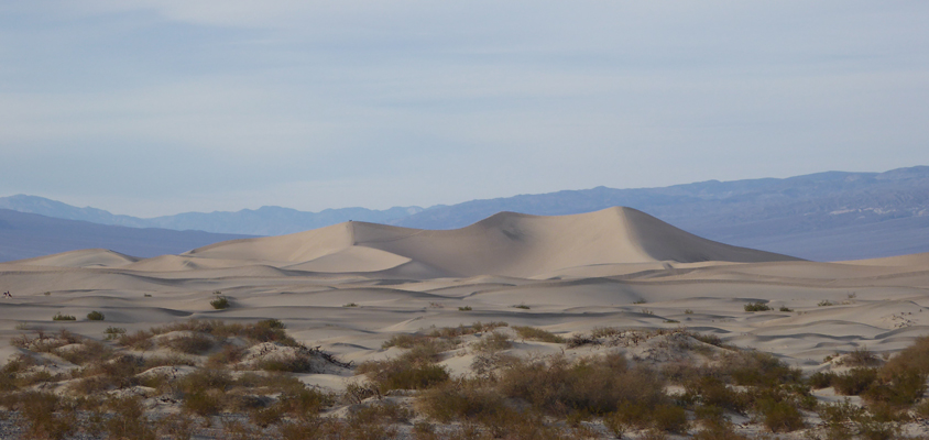
Since this excursion had only taken us about 1/2 hour we decided we head over to Mesquite Flats Sand Dunes so I could take some photos. Right at the dunes the shadows weren’t very good, so we drove back towards Stovepipe Wells and I took photos looking east across the dunes.
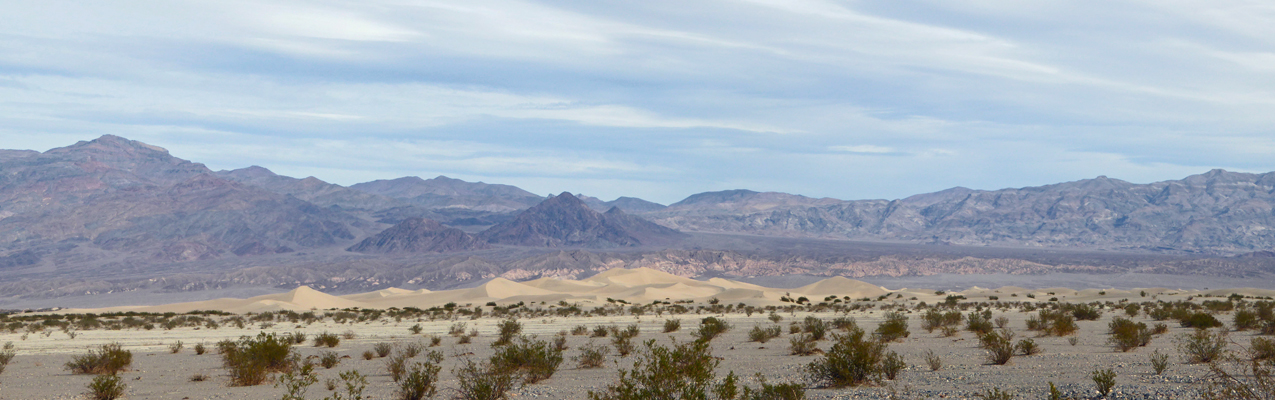
And I tried to capture the dunes with some close ups.
We stopped at the little Stovepipe Wells Visitors Center to ask about the burros we’d seen the day before and in the process we heard that the Artists Drive was open again! Whoo Hoo. The printed info we’d gotten said it was going to be closed from Nov. 14th until late March but reality appears to have been kinder and it was now open. It was over 30 miles away so we decided we’d go home, make a picnic lunch and drive on down.
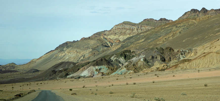
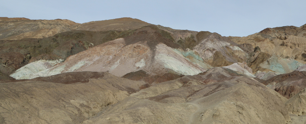
Artists Drive is a paved single lane one-way road that takes you up into the multicolored hills above the alluvial fans of the valley. It winds through colored features and up and down steep dips until you have a view of the area called Artists Palette in the distance.
There’s a little side road that takes you right up to the formations.
There was hardly anyone in the parking lot. In the past when we’ve been here, it’s been a madhouse here. And for the first time I realized that you could hike out towards the colored hills. If you look carefully just left of center you can see a trail going up out of the sandy canyon floor. Walter wasn’t interested but I was pretty excited about the idea. I hemmed and hawed as I took more photos because it was really steep DOWN before you started back up.
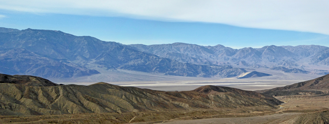
But in the end curiosity drove me on. And I hiked out down and back up and then along the spine of the brown formations—and only slipped one and thank goodness didn’t fall. About half way out I stopped and took a photo of the valley to the west.
In the end I made it all the way up to the colored rocks.
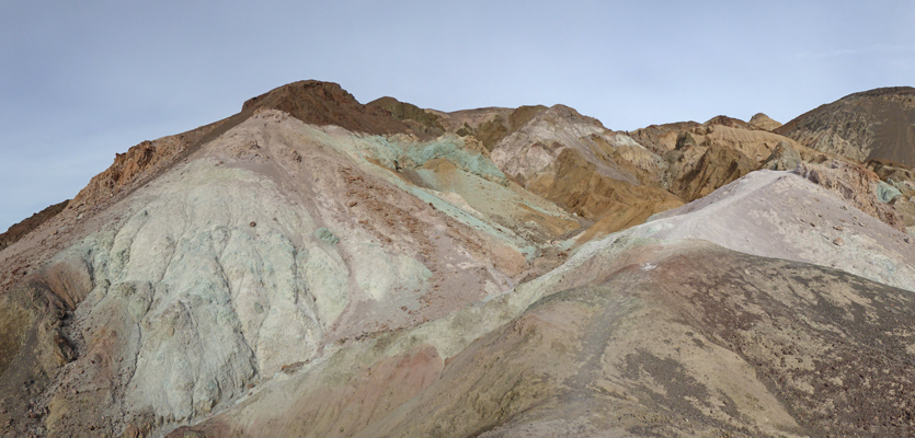
The trail goes on and there were people who disappeared over the ridge but I wasn’t willing to go anywhere on this sandy stuff if I couldn’t see where it led.
It sure was pretty though.
I carefully made my way back DOWN the steep gravel and sand strewn path and struggled my way back UP to the parking lot with my knee talking to me the whole way. And I was greeted by an middle-aged couple who went on and on about how amazingly brave I was to have done such a steep hike. It kind of made me feel like Super Woman. Of course a family with 2 little kids came back up having done the whole loop and that made my feat of daring do not such a big deal but hey I was happy to have been able to do it at all
We drove on back towards Stovepipe Wells and when we passed the Mesquite Flats Sand Dunes, the late afternoon light was creating perfect shadows on the dunes.
It was as if Mother Nature herself had been out with her air brush just for me and my camera.
Thursday morning we had some actual clouds and we heard from one of our neighbors that there were high wind warnings out for gusts up to 65 MPH for Friday night in Death Valley. We packed up and headed east back to Death Valley Junction and then on to Pahrump, NV and the Escapees Pair-A-Dice RV Resort just east of town. We stayed here in March of 2016 and enjoyed our selves. They had space for us so we ended up with a nice big pull through spot (complete with concrete patio. Our hot spot worked here with the booster, and both our phones worked too. Their park-wide wifi wasn’t working but there ws a good hot spot in the activity center which I used while I did the laundry on Thursday afternoon.
Temperatures were in the high 60’s and it only got down to 50 in the early morning hours of Friday morning. The clouds thickened up and we had rain in the night but it stopped by 9 am. As the rain ended the wind kicked up. I don’t know how high the gusts got but my weather station hopped off it’s pedestal and one of the cups broke on the anemometer so for now my very inaccurate wind speed measurements are no more.
Thursday night we planned out our route for the next week (including making reservations for Christmas weekend at Catalina State Park in Tucson as a special way to celebrate the season). Friday we spent doing errands—it’s amazing how much time it can take to make 5 stops—and how hard it is to navigate walking through a parking lot in high winds.
Saturday December 17th, it was clear and beautiful and we could see the snow on the mountains as we ran into town for one more set of errands.
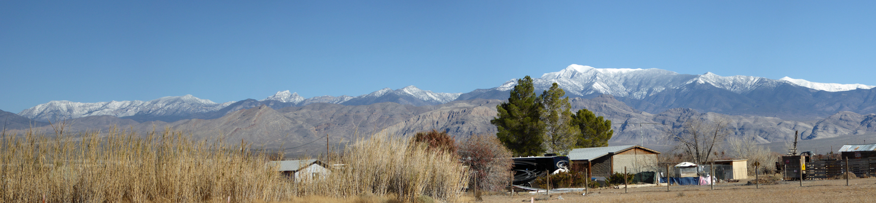
It was only in the high 40’s and the breeze made it seem colder.
We got down to 19 on Sunday morning but it clear and sunny again and slowly warmed up into the 40’s (the 50’s in the sun). We just hung out and home and got caught up on things.