Things warmed up slowly and by 10 am it was in the low 40’s when we packed up and tootled out of Pahrump, Nevada heading south on Hwy 160. We skirted the western edge of Las Vegas and eventually picked up Hwy 95 south through Searchlight and Cal Nev Ari (blink and you’ll miss it) to cross the border into California for about 24 miles where we picked up I-40 and headed east across the Colorado River and into Arizona—a 3 state day! Just east of the border we picked up SR95 south through Lake Havasu City and on a ways to Cattail Cove State Park on the southern end of Lake Havasu.
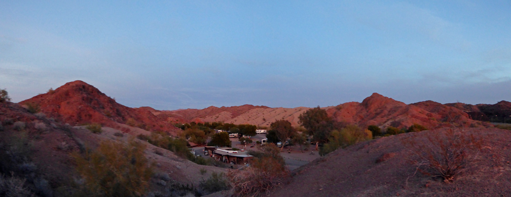
We made a circuit of the campground (it’s not that big really—only 61 sites) and decided we’d take site #1 which gave us a tree to look at out our back windows and a bit of a view of a large red hill to our side.
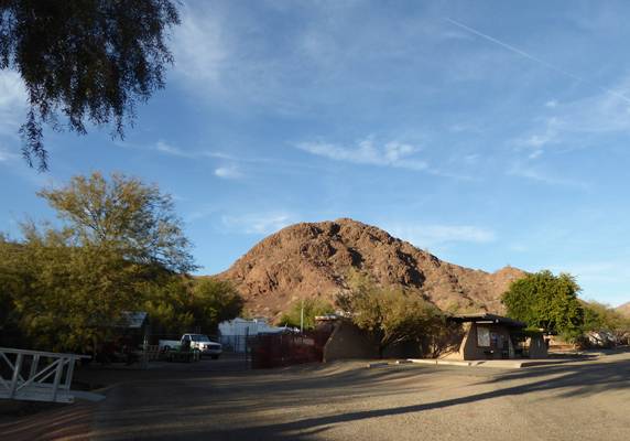
There’s another big red hill on the other side of the campground too, which gives you a sense of the terrain.
It was breezy but in the mid 60’s so we left our side door open while we had lunch. What a treat after the high winds and cold in Pahrump.
Our hot spot worked great here as did Walter’s Verizon phone. The signal was clearly coming from the towers on the hill across the lake in California because Walter’s phone insisted that we were still in Pacific Time even though we were in Arizona which is in Mountain Time. No TV, but hey that’s okay. Walter had pretty decent TV in Pahrump and had watched a lot of football over the weekend.
It was still in the high 50’s when we went to bed and it only got down into the mid 40’s early the next morning—a very welcome change. Early that morning (8 am PST which we were still on in our minds but it was admittedly 9 am in Arizona) a ranger came and knocked on our door. We’d self-registered the day before and used a check and it turns out they don’t take checks. Oops. He was very nice about it and just asked us to stop by the office when we were ready. We were planning on hiking up to the office that morning anyway since they only allow you to self-register for one night at a time and we wanted to stay another night. So no big deal.
While we were getting ready for breakfast we have a large covey of Gambel’s Quail pass through. They’re a lot like California Quail with just some differences in coloring. The males as usual are fancier than the females but they both have nice little top-knots.
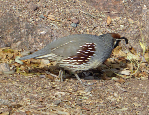
The females don’t have the rust or white markings on their heads.
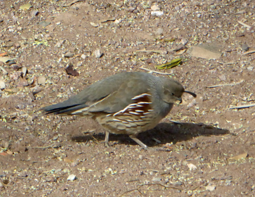
They came through at least twice a day during our stay and we were always happy to see them.
After breakfast we hiked up to the office and registered and paid for our two nights and then took a walk to explore the place. There is a boat launch and a nice little beach down on the lake. I’m sure they truck in that pretty white sand.
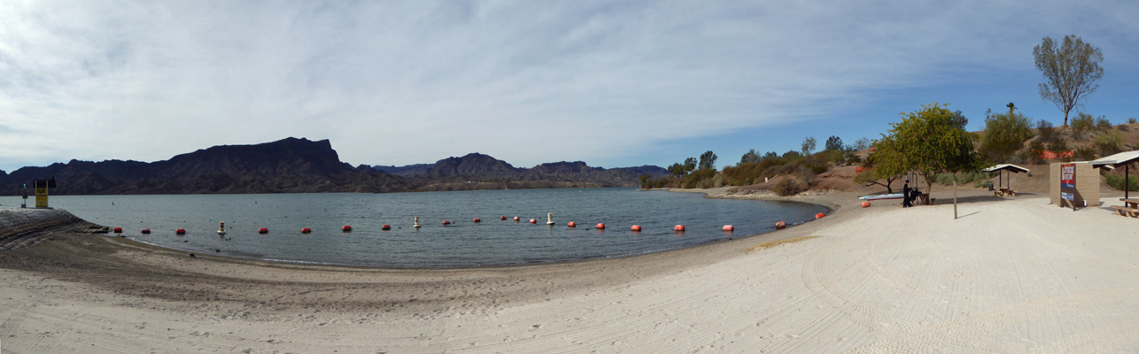
They even have a separate rocky dog beach for canine swimming.
There was a Great Blue Heron sitting on the railing near the boat launch.
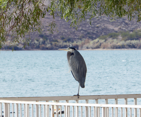
He sat there peacefully for well over 10 minutes before taking off across the lake.
There was one lone jet skier out on the lake. It was breezy and in the high 50’s which seemed to be on the cold side for this. And then we noticed he had a dry suit on!
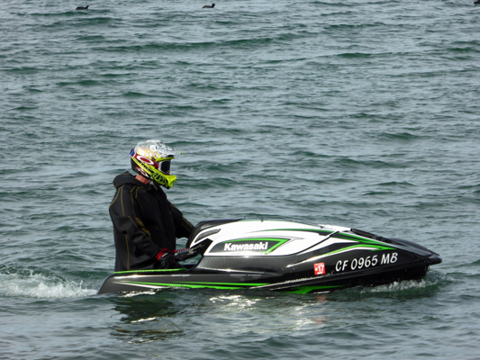
When I asked him if it was cold he said it was just a bit...
We’d gotten a trail map at the office and were standing on the beach trying to figure it out (it was more than a bit sketchy) when a nice Canadian lady walked up and told us where the trailhead was—they’d been through the same thing and someone else had pointed it out to them. There were no signs at all—except for one directing you to the dog beach but sure enough there was a trail over that way—along with a nice picnic table overlooking the lake.
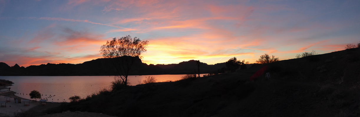
We took the stairs that lead you up the hill with a great view of the lake. That’s California on the other side.
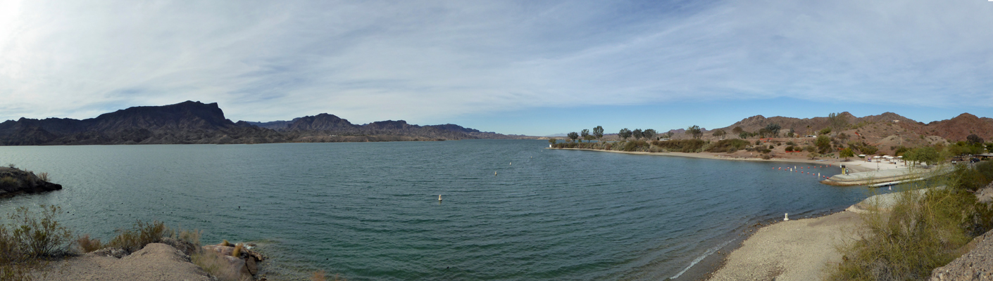
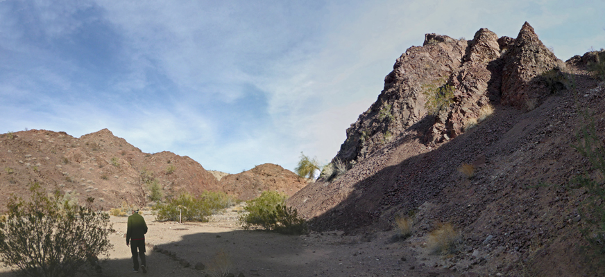
The McKinney Loop Trail follows the lakeshore for a while and then loops back through the rocky hills. The hills are a big change from the palm trees and the lake.
This wasn’t a real long hike but when combined with the trek up to the office and back it was just about right. Walter had a nice nap when we got back which is always a good indicator we’ve done enough.
Right next to our campsite there was a set of stairs leading up the hill. So late in the afternoon, I went up to see where they went. You could tell that in other times this was part of a trail but they had everything leading off the top of the hill closed. But there was a nice bench up on the knoll where you could sit and look at the lake.
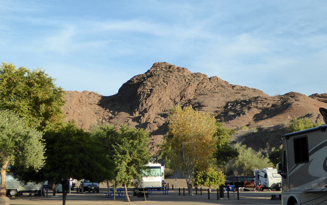
You also got a really good view of the big red hill off to the east.
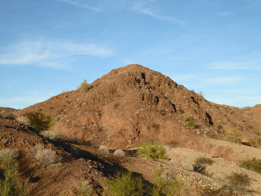
And the hills on the other side of the campground.
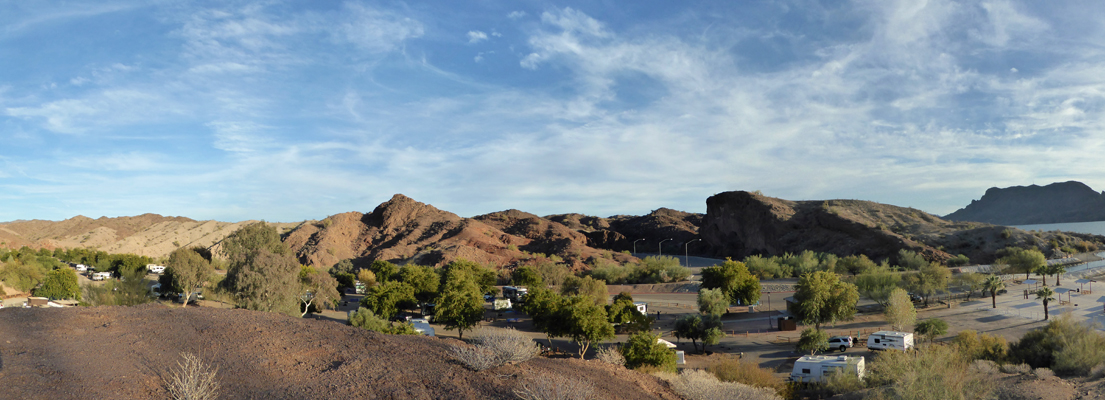
As you can see, the campsites are nicely spaced and the campground was by no means full. Long-term stays (from 4 weeks to 12 weeks) are available here in the winter so there were lots of folks who knew each other. They were even going to have a pot luck on Christmas at the little amphitheater. It had a nice friendly small town feel.
There were two Airstreams parked just up the way from us and when I came back down the hill I saw two women standing next to one of them talking. I went over to see if they were having a mini-jamboree (Airstream gathering) and it turned out that one of them was a camp host. We had a nice visit and that used up the time until sunset.
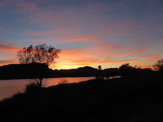
As the sky turned color I raced back up the hill to catch the display from the top of the hill.
It was most definitely worth the climb.
As I turned to head back down I grabbed one more shot of the surrounding hills in the sunset-light.
We had high clouds come in late in the evening so it didn’t cool down as much and we had a low of only 55 the next morning. Boy was that a big change from 18 degrees just 2 days before.
The quail came through again at breakfast time as did a very skittish young jackrabbit. We broke camp and drove south about 25 miles to La Paz County Park just north of Parker, AZ, a place we’d really enjoyed two years ago when we’d followed the Colorado south. That time we’d gotten a nice spot with a view of the water. This time all their regular RV spots were full and all they had were spots in the Group Campground which was just a big gravel lot. Ah well, it was just for two days and it was probably going to rain so what the heck. If they had been full, we would have gone back up north to either Buckskin Mountain or River Island State Parks which looked like they had plenty of spots available. But since we needed to make a quick trip to the market in Parker we decided we’d stay here.
This is another campground with no sewer hook ups (there weren’t any at Cattail Cove either). And since we didn’t get a cable hook up in the Group Campground we only had to pay $24 a night (while Cattail Cove is $30 a night). This place was full because they have really reasonable long term rates. The weekly rate for water, power and cable TV is $155 and the monthly rate is $360 plus your electricity. People come and stay the whole winter here. You can stay three months at Cattail but you have to pay the $30 a night which means it costs $900 a month to stay there. It’s way nicer than La Paz but that’s a big difference in price. Plus La Paz is across the street from a golf course and many of the folks here play golf.
Our hot spot only showed an orange signal but with the booster it turned green and it gave us plenty of speed for the basics—at least most of the time.
We set up camp and had lunch and then motored the little way into Parker to the Safeway to pick up a few groceries. It rained a bit both coming and going so that it smelled like wet dust –it’s the smell I associate with rain having grown up in Southern California.
Late on Wednesday night, it began to rain in earnest. It basically poured for half the night. It stopped before morning but we awoke to giant puddles on all sides of the truck. And thus began ‘one of those days.’
First, Walter’s Chromebook computer seized up and we decided to go to town to use the fast WiFi at the library to download the needed software to take it through the recommended restore process.
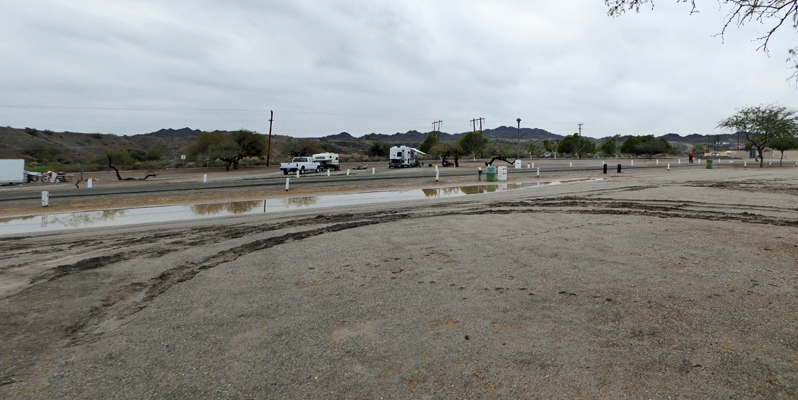
Then when we packed up our computers and I stepped out onto our doormat it sank into the mud—something that we’d never had happen before.
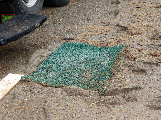
Oh oh. I went back into the trailer and put on my rain shoes (old LL Bean ducks) and waded through the mud (you sank about 2 to 3 inches with each step) out to the truck.
When I drove it around to the back of the trailer I almost got bogged down in the soup—kind of scary really.
I left quite a trail in the mud too.
Then when we got to the library it had just closed early for the holidays. But the WiFi still worked outdoors. So we sat in our camp chairs at a picnic table (the bench was all wet) and downloaded the needed file. And it didn’t work. So we tried it again. And it didn’t work. So I changed memory sticks (their recommendation) and it still didn’t work. Phooey.
But the good news was that while we’d been waiting I’d checked the tracking and discovered that the General Delivery shipment of our mail had come (it wasn’t promised until Friday morning) so we went and picked it up thus avoiding having to deal with parking the truck and trailer at the post office the next morning. We had an 8 foot 2 x 4 in the back of the truck and when we got back we put that down as a little bridge from the solid ground where the truck was now parked through the muck to the trailer. Necessity is the mother of invention they say.
It drizzled off and on the rest of the day but at least it didn’t RAIN any more. We spent some more time doing research on what might be wrong with the computer and decided maybe we should be using a different version of the software.
So after dinner we drove back into town to the library and this time the WiFi wasn’t on. The library normally closes at 7 pm and we were there at 8. Clearly it automatically shuts down after normal working hours. Okie Dokie it was clearly time to give up on that project for the day.
Both us of had a bit of trouble going to sleep that night—worried about dealing with the mud in the morning to get ready to go and to hook the truck up to the trailer and wondering if Walter’s computer had finally bit the dust.
Come Thursday morning December 22nd, the mud was a bit thicker but we both sank nearly ankle deep in places getting ready to go. We got the trailer out okay—thank goodness for 4 wheel drive--and we managed to get the shoes washed off at the dump station so we didn’t track it all over everywhere in the truck and trailer. Another challenge met and dealt with. Whew.
We headed south through Parker and on down SR95 through Quartzsite where we picked up I-10 eastbound to Buckeye where we went south on SR85 to Gila Bend. The only reason for staying in Gila Bend is that it’s about half-way to Tucson (which was beyond our 200 mile driving limit for the day). There’s a KOA here (that used to be an inexpensive RV park) that is in the process of being renovated and serves us well. It’s now $36 a night for a full hook up but for a park not far from an interstate (it’s just off I-8) that’s not bad. Their WiFi actually worked pretty well and our phones worked since there are two huge cell towers within sight of the place.
We set up camp and used their WiFi to download the different version of the restore program that we’d wanted to download the night before. And it still didn’t work. So we called Google and they informed us that the error code we were getting meant that it was a hardware problem. Conclusion: Walter’s computer is toast. It wasn’t very expensive to start with and it’s lasted 2 1/2 years so guess what? Walter gets a new computer for Christmas!
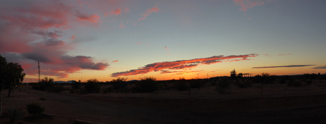
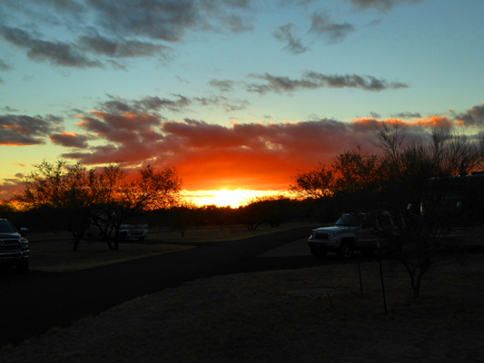
That evening Mother Nature put on a show.
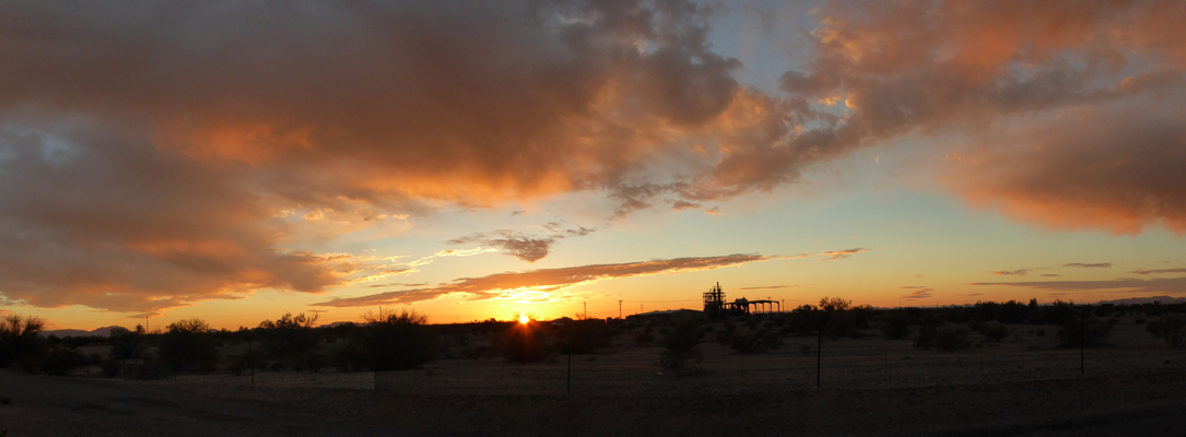
Sunset Gila Bend AZ
Christmas Eve, it was breezy as we broke camp and the clouds were coming in fast. We had a sprinkle or two before we got all hooked up but nothing serious. We headed east on I-8 towards Tucson and had to drive through a couple of really dense dust storms—at least they weren’t long patches but they were pretty intense.
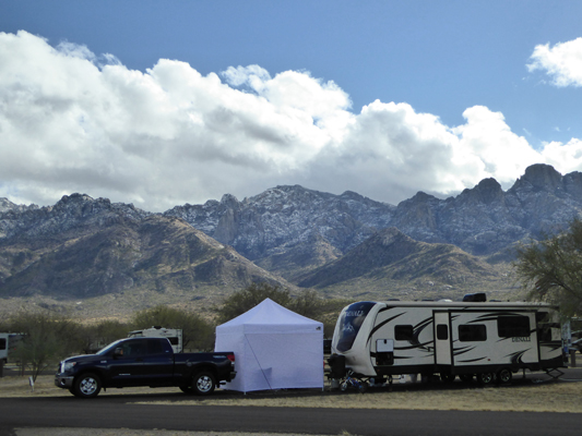
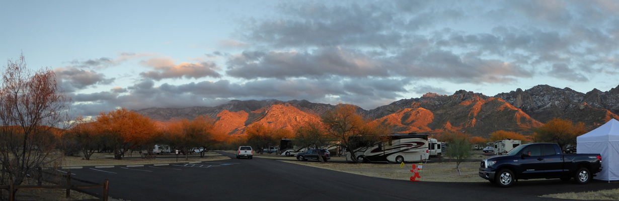
By the time we got to Tucson we’d outrun the clouds but it was pretty windy. We’d made a reservation at Catalina State Park just north of Tucson for the holiday weekend just so we would be someplace really pretty for Christmas. We’d gotten the last spot in the place so we weren’t surprised to see campground full signs when we arrived. There used to be a dry camping overflow lot here but they’ve changed it to a Group Campground and that seems to have put a lot more pressure on the campground. We tried to get reservations mid-January and there wasn’t a day all month with a spot open!
We set up camp and had lunch and then Walter announced he wanted to go over to the Walmart to look at computers. The park is in Oro Valley and there’s a mall that has grown up directly across the highway from the park entrance. There used to be just a Walmart but now they have a Best Buy and Pets Mart and a Dicks and a whole raft of restaurants too. So we drove over and had a look at Chromebooks at the Best Buy and the Walmart. The wind was really blowing hard at this point and the Palo Verde trees in the parking lot planting areas were starting to uproot and fall over! By the time we left the Walmart parking lot, we counted more the 15 of them lying on their sides in the road. None of them seem to have landed on cars which was fortunate. Most of them were good-sized trees—probably 20 feet tall or so and had been planted 8 to 10 years ago. The soil is really sandy and I guess the rain earlier in the week had loosened things up enough so with the big wind they all went over.
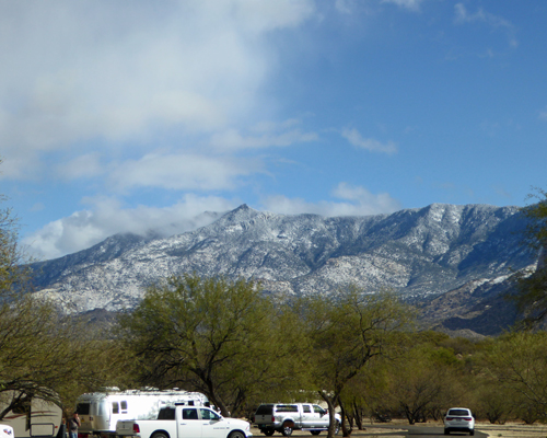
The rain arrived at about 4:30 and it just poured for about 2 hours. And in the first 1/2 hour the temperature dropped 20 degrees from a nice 65 down to a chilly 45. Our windows fogged up in the chill but the wind died down. It got down 38 on Christmas morning and we just lolled around in bed with the heaters running waiting for it to warm up. Walter made blueberry banana pancakes and we enjoyed the view of fresh snow on the mountains as the clouds slowly drifted out.
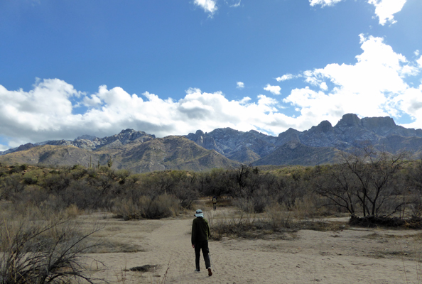
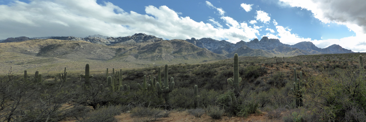
Late morning, I went out and took photos. Here’s the view looking east to the higher reaches of the mountains.
And here’s the view looking south.
Around noon we set out to take a little hike—even though it was only in the high 40’s. We opted to take the Romero Ruins Trail since it’s one we hadn’t taken before.
It leads southward across a wash.
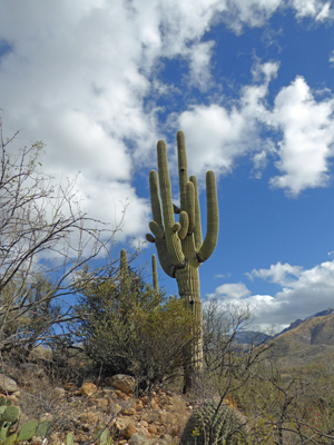
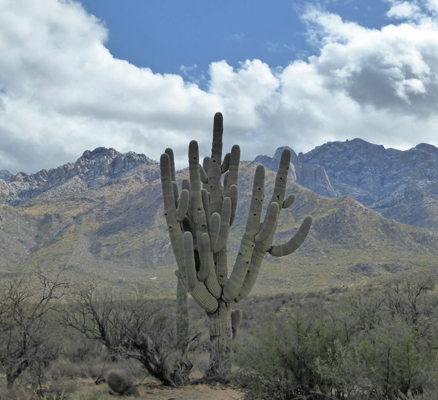
And then there are a series of steps that lead you up onto the nearest ridge. It’s just high enough so that there are saguaros.
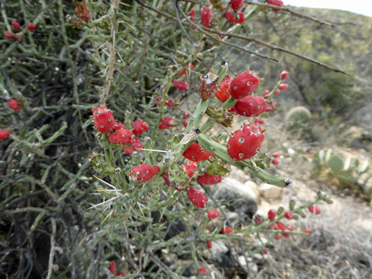
There were also lots of Desert Christmas Cholla loaded with the fruit that gives them their name.
The view southward with the saguaros and the mountains was wonderful.
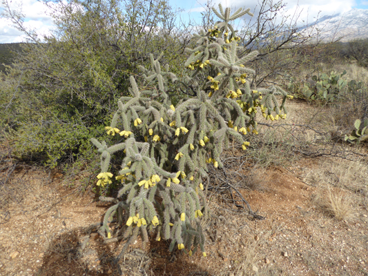
The Cane Cholla were all dressed up for the season too.
There were lots of young saguaros but this old guy definitely has been here a long long time—just look at all the birds nest holes he has.
The Romero Ruins consist of actually 3 archeological sites. The Hohokam Indians lived here for over 1500 years and there was an original village of pit houses here from about 500 AD to 1150 AD. Then there was a walled village here built around 1500 AD. Finally Francisco Romero built a ranch here in about 1850 and abandoned it well before the turn of the century.
There are a few excavated portions of the wall of the Hohokam village (about a foot high though the original wall is estimated to have been about 5 feet tall) and the foundations of several of the Romero buildings.
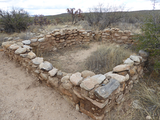
The whole area is considered an archeological site and there are very nice information signs both about the folks who lived here and the process the archeologists have gone through with the site.
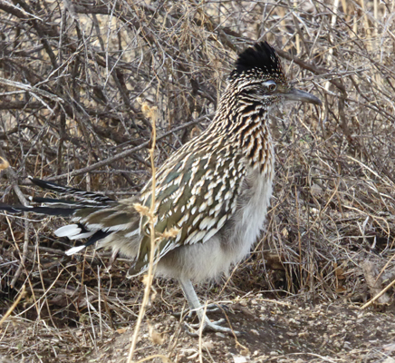
On the way back to the car we spied a Roadrunner! We walked along quietly following him (me snapping photos as we went) and I was rewarded with a nice shot of him at last.
It got up into the low 50’s in the sun and the trailer warmed up nicely so we could turn off the heat. Then the hills lit up first yellow and then orange as the sun began to set.
And Mother Nature wished us all a Happy Christmas with a lovely sunset.
Merry Christmas! Happy Hanukah! Happy Holidays to all.