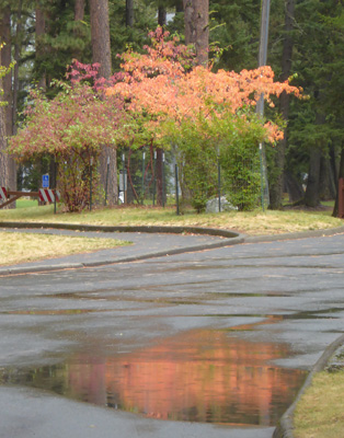
With cold temperatures at night more and more of the trees in the park have begun to show yellow and orange.
Monday September 19th, the construction crew moved over to the B Loop and began preparation to lay forms for the foundation of the bathroom there. It was partly sunny and continued to clear as the day went on. We had under 20 sites to clean and we were done well before 1:30. We had lunch and loaded up the laundry and the computers and headed to town. We had three of packages to pick up at the post office and were successful in picking up two but a third one seemed to have been lost in the shuffle—oh goodie. We got things done in under 2 hours and were back in time to help folks register as the afternoon rush began.
Tuesday September 20th, our day off, we headed into town once again with all the information about the lost package in hand. The post office had no evidence of it which of course made sense since it had been shipped UPS and had UPS tracking info. But the on-line tracking said it had been delivered first to the Enterprise Post Office (who refused it) and then to Joseph. As we were sitting in the truck getting ready to call the company who had shipped it to us, I noticed the UPS truck in the Post Office driveway. Walter headed over and wonders of wonders the driver remembered the mystery package. He said it was at the UPS office in Enterprise but that there was no one there for us to contact. Instead, he promised to deliver it to the State Park office the next day. Now all we had to do was hope he’d remember to do it.
We set out driving west on Hwy 88 towards Enterprise looking for the turn off for Cow Creek Road about half way to Enterprise. We knew we’d missed it when we arrived in Enterprise but we needed propane for the trailer so we stopped at the propane dealer and had our tank filled and they gave us detailed instructions on how to find the turn. It was really easy and well marked coming east on Hwy 88 (but nearly invisible coming the other way). We headed out Cow Creek Road for 5 miles and then took a right on Zumwalt/Buckhorn Road heading towards the Zumwalt Prairie Preserve, a Nature Conservancy preserve.
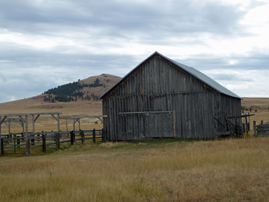
After 14 miles, we turned right onto Duckett Road (which was pretty rough gravel) and headed out to the Duckett Barn Information Center which consists of a kiosk sitting in front of this lovely old barn out in the middle of a bunch grass prairie.
There are low hills around the edges of the prairie where there are small stands of Ponderosa Pines and little fenced off stands of aspens that they are trying to protect from the deer, elk and cattle.
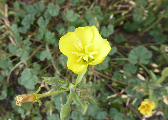
The preserve encompasses 33,000 acres of Pacific Northwest bunchgrass prairie—part of the largest remaining intact tract of this kind of prairie in North America. In the spring this is supposed to be full of all kinds of wonderful wildflowers. But even in autumn we found a few growing near the information kiosk.
There were quite a few of these which I think are Hairy Evening Primrose (Oenothera villosa).
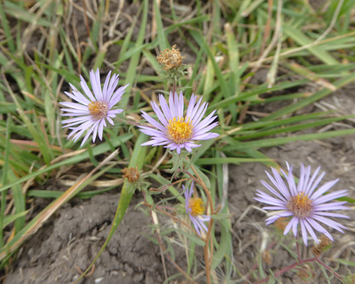
There were a few asters in bloom.
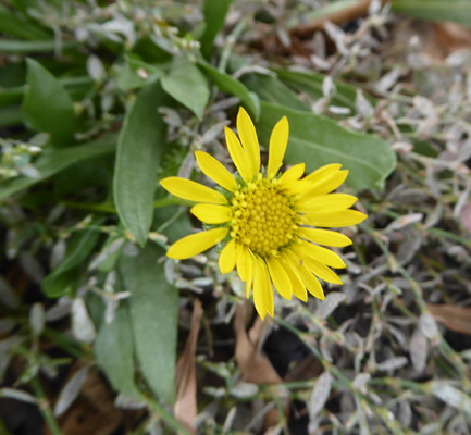
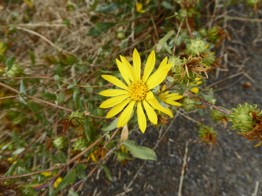
And there were also some yellow daisies that I haven’t been able to identify at all.
Reading about the hikes here we decided that we’d take the Canyon Vista Trail since it actually goes through a wooded draw and opens onto canyon vistas. We headed out Duckett Road which got bumpier as we went. Not long before we hit the turn onto the Old Imnaha Road (which was supposed to be even rougher) we began to see cattle hustling along across the prairie headed toward the road. We came around a bend and saw why—there was a big farm truck parked in the road and where there are farm trucks there are farmers with HAY! Except we couldn’t see anyone at all.
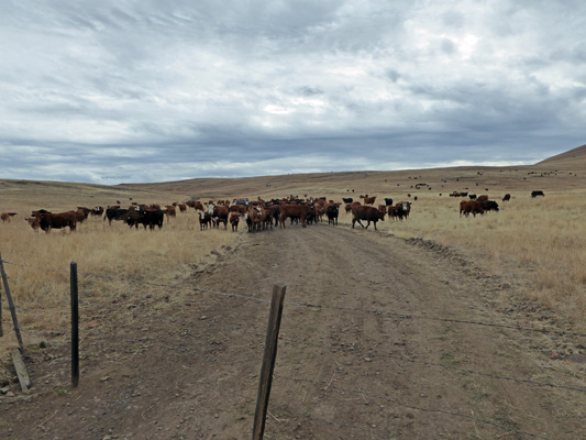
The fence is a gate that you could normally open and then close as you continued to drive on. In this case, driving on didn’t look like a great option—especially since more cows were arriving every minute.
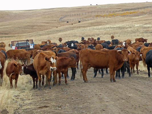
Cows, bad road, more cows. We looked at each other and decided now was a good time to turn around. So we headed back to the Duckett Barn and regrouped. Reading the trail descriptions we opted to head back to the Zumwalt-Buckhorn Road go north to the Horned Lark Trail.
The problem here was that there really is nowhere to park. They tell you to park on the verge (which didn’t exist) and not block the gate (which was the only place to park). So we parked on the only level place we could find (in front of a gate) and had our lunch and looked at the view off to the east.
And to the south.
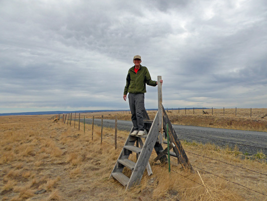
It was only 50 degrees and the wind was blowing. The trail headed off across the prairie and didn’t look all that special—ummm do we even want to bother with this? So we compromised. We decided to take the trail a ways and see what we could see. But first we had to cross the fence using a stile.
We headed across the prairie to the first rise and then continued on to the next.
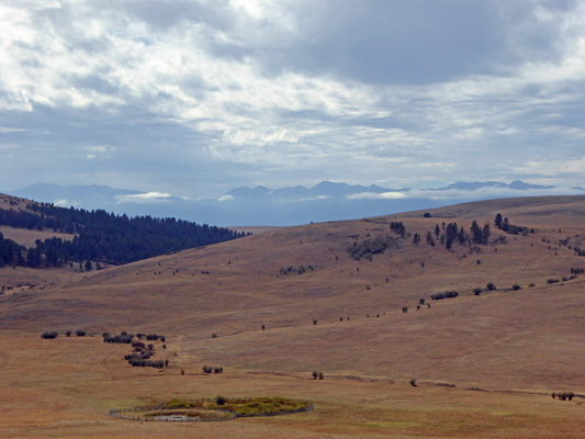
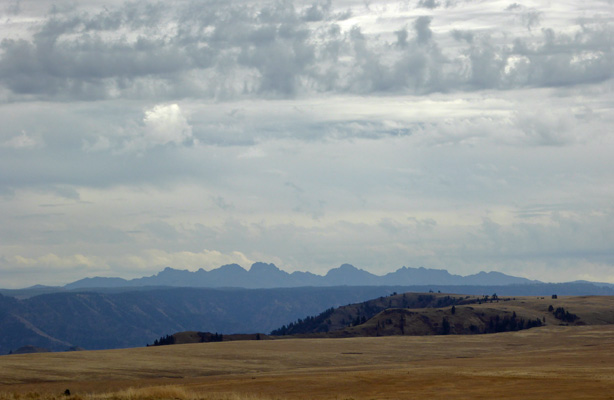
No critters in view—not even any cattle. The fenced area at the bottom of the picture has aspens that they’re protecting. The trail winds down across the valley and then back up again. We decided to give it a pass and headed back to the truck. We had directions to Buckhorn Lookout with great view of the Imnaha River portion of Hells Canyon so that’s where we went.
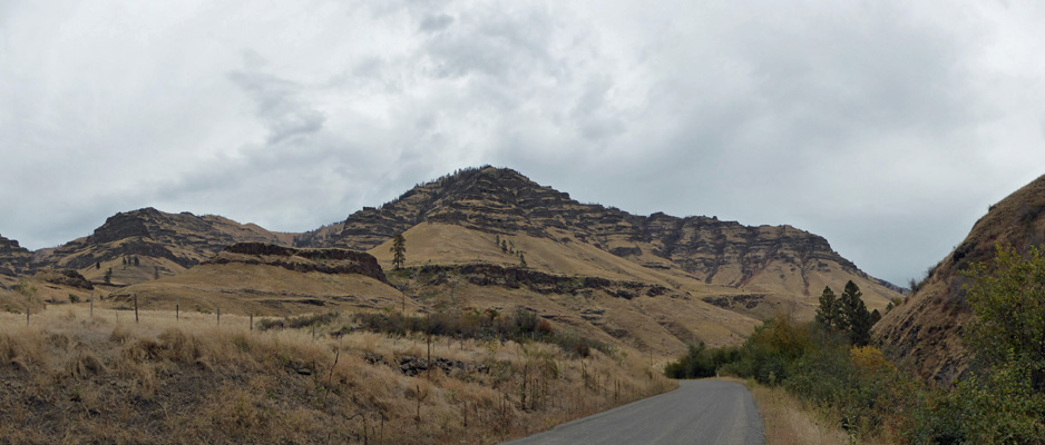
We continued north on Zumwalt-Buckhorn Road until we came to FR 780 where we turned right and continued out to FR 810. Here and there along the way we could see hunters camped in dispersed camping sites. In a short distance on FR 810 (past the Buckhorn Campground where there was one camper that we could see) you come to the Buckhorn Lookout. The Lookout itself was built in the 1940’s. It’s no longer staffed except when there are extreme fire conditions.
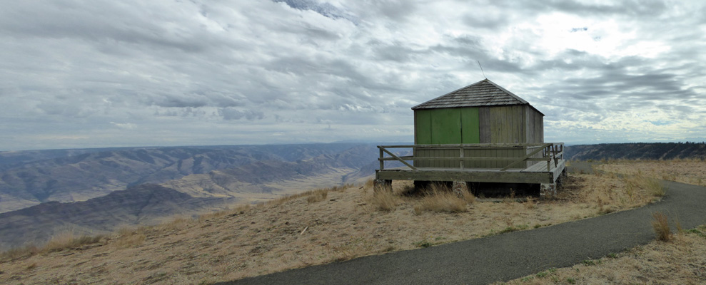
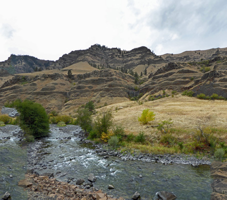
It sits on the lip of Hell’s Canyon. From the front railing you look out to see the Cow Creek, Lightening Creek and Horse Creek Drainages along with the canyon formed by the Imnaha River.
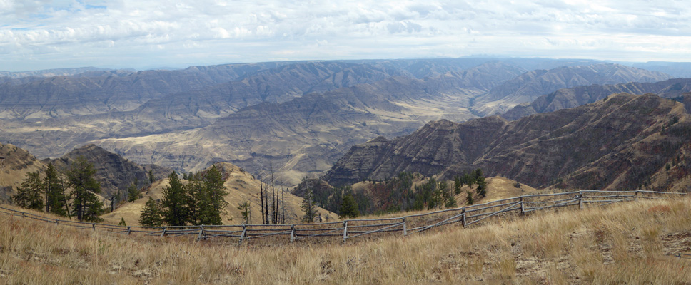
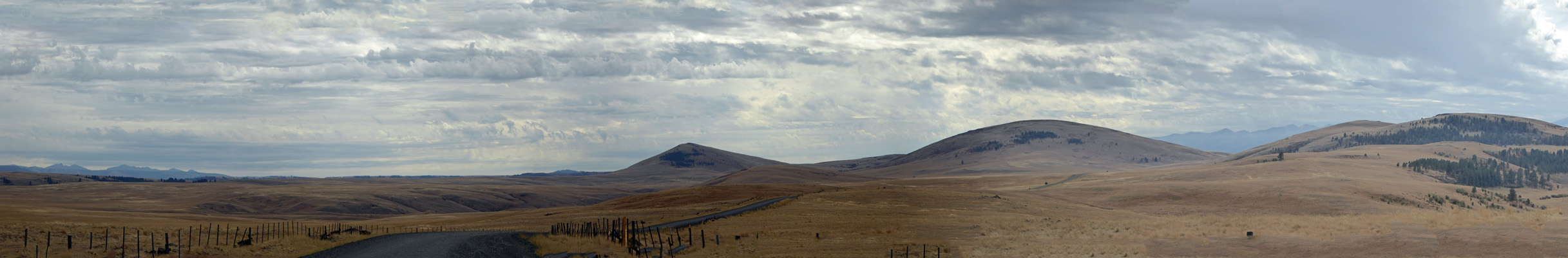
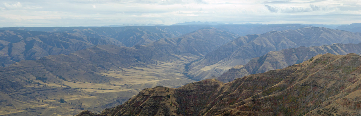
If you walk to the right of here there is a nice viewpoint with a map pointing out the names of the ridges and canyons. The view stretches for miles in all directions. Here’s the view to the southeast.
There were just a few Idaho Gumweed (Grindelia nana) in bloom along the trail here.
We had a few momentary sun breaks while we walked the rim (twice for good measure) and then piled back into the truck. At this point we had a choice between retracing our steps back down and going back down the Zumwalt-Buckhorn Road or continuing on the loop formed by FR 46 that would take us out onto Hwy 3 and then south to Enterprise. The print out we had said that it was only 10 miles further to take 46 so we went that way. However, from the signs along the way it appears it was much farther. No matter, it was an interesting drive—all pretty good gravel—though the last 10 or 15 miles of FR 46 was pretty winding as you came out of the mountains and down to Hwy 3. We saw lots of dispersed hunters camps along the way as we drove through the Ponderosa forest. It’s a long way to pull a trailer on a gravel road but hey, a lot of them seem to do it.
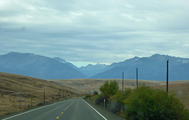
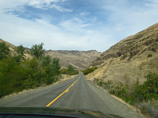
On our way south on Hwy 3, I took this shot of the view looking south towards Enterprise.
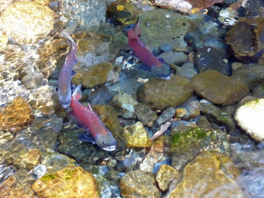
The next morning the weather forecast predicted showers in the afternoon. We intended to take the Wallowa Mountain Loop (another 3 plus hour drive as the one before had been) so I took off to get my exercise by walking around the park. I went out and checked the Kokanee in the river. They were still there but they weren’t big ones like they had been before. Now they were much smaller. I don’t know what the story is—the biggest come first? The smallest lose out? They’re just slower? I don’t know.
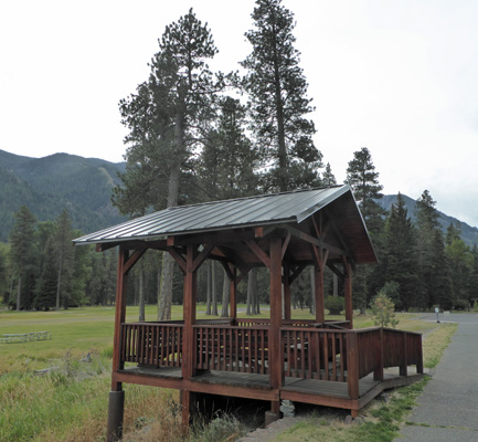
Then I walked through the Day Use Area and stopped to have a look at the new amphitheater they put in for the interpretive programs (both Junior Ranger in the summer afternoons and the evening programs). The old amphitheater was huge—built in the days when they expected big crowds I guess. This one is much more intimate and about the right size for the groups who show up these days.
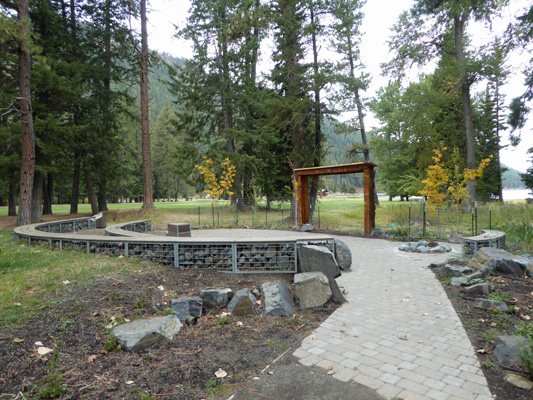
Last week we saw some folks from one of the group campgrounds using it for presentations and it seemed to work real well as a small lecture space.
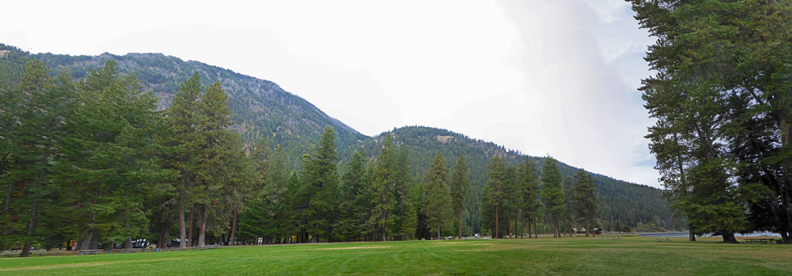
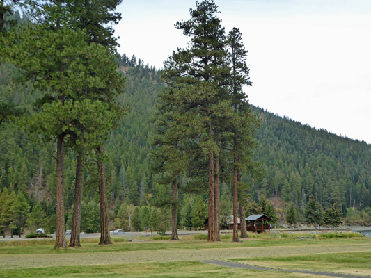
I carried on and got this nice view across the big grassy area towards the mountains to the west. There are lots of nice Ponderosas in this section of the park.
A little further on I got a nice view of the viewing platform down by the Marina.
It’s a nifty little building and very picturesque.
Along about here some folks stopped me to ask about a large number of piles of scat that they’d seen out on the gravel bar by the swimming beach. I went out to have a look and decided it was either coyote poop or perhaps goose poop (though there haven’t been any geese for several months I’m told). They were happy with the suggestion it might be coyote (even if it’s not right) and I continued with my walk.
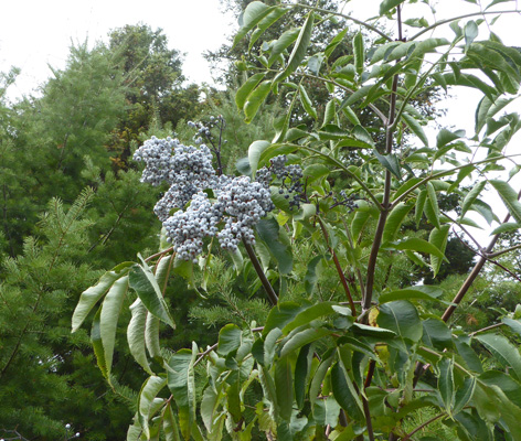
The blue elderberry bushes (Sambucus nigra) were full of fruit along the edge of the Marina parking lot. We saw a lot more of them during our drive that afternoon.
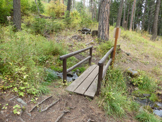
found the end of the park’s Nature Trail on the west end of the parking lot (it’s marked as the pet exercise area) and headed up the hill through the woods. Here and there you can see the campground down below. At the end of the pet area there’s nice little bridge crossing a creek that comes down the hill and along the northwest edge of the A Loop.
The trail ends at the old amphitheater which was cordoned off with caution tape. They’ve taken the bench seats up and pulled about 1/3 of the posts out of the ground (they were of course set in concrete) but they have a long way to go before it’s dismantled. It’s paved in asphalt so they’ve got their work cut out for them.
I followed the path down into the edge of the B Loop and on home. It certainly wasn’t a heavy duty hike but at least I got a bit of exercise. I knew I’d need to grab what I could when I could since our days off next week will be taken up with traveling to Cape Blanco. And I pay with aches and pains if I don’t get out and move enough.
While I was gone, Walter had walked over to the office and let them know (at both the ranger and administrative offices) that we were expecting a package from UPS. They said that the driver didn’t show up until 1 or 2 so we decided not to wait and packed our lunch and set out on an adventure. First stop, the Laundromat to use the Wi-Fi to pick up our email. Then we stopped at the Forest Service Office (in an old elementary school building) to look at maps and information on our proposed drive. Having armed ourselves with a nice print out about the drive we headed towards the little town of Imnaha by turning east on Hwy 350 from downtown Joseph.
The road heads steadily down hill into the canyons.
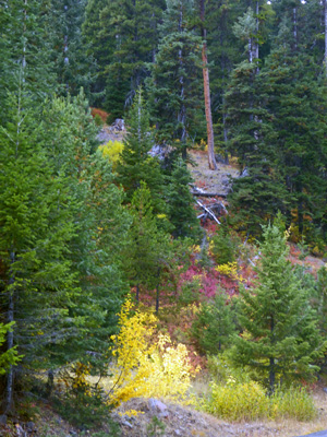
Some of the hillsides were painted with fall color.
The road ends in downtown Imnaha where the Post Office sits at an intersection with choices that will take you north to Dug Bar on the Snake River in the middle of Hells Canyon; east to Hat Point (16% grade on 10 miles of dirt road that takes over an hour to drive) with the best view of Hells Canyon (Buckhorn is second only to Hat Point) or south along the Imnaha River Road.
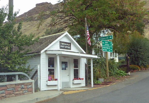
Imnaha has a tavern, a general store and the post office, all very rustic and kind of sweet. The tavern had a faded Bud Light sign celebrating 110 years in business.
Since we weren’t interested in bumping along at 10 miles an hour up a 16% grade and we didn’t need to see the Snake since we’d seen it the spring in Idaho we headed south on the Imnaha River Road to make a loop connecting up with the Wallowa Mountain Loop.
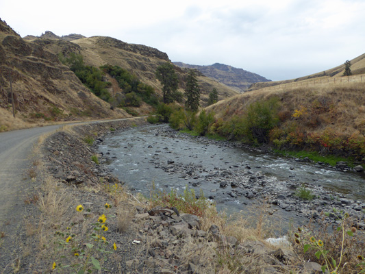
When we had left Joseph it was in the mid 50’s. By the time we got to Imnaha it was 65 but the clouds were closing in. We stopped a little ways out of town along the gravel road to take in the view of the river.
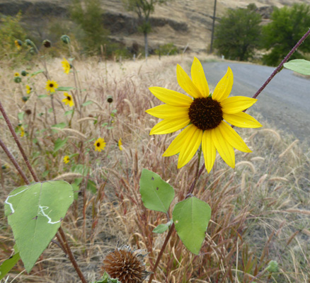
There were sunflowers (Helianthus annus) in bloom along the road’s edge.
Capturing the river and the grandeur of the canyon walls was a real challenge.
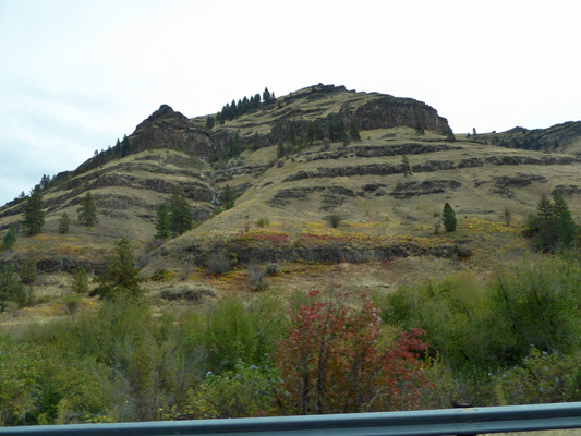
A little further on we stopped to take photos of the canyon walls. I love the way the basalt has worn away so you can see the layer upon layer that was laid down in the huge flows that covered most of northern Oregon and southern Washington millions of years ago. They say that in some places along the Columbia River that the basalt layers are 3,000 feet thick.
Not long after this it began to sprinkle and then we actually had rain for a while. The temperature dropped steadily and we were down to 47 in no time. We stopped for lunch near the southern end of the road in the parking lot for a Fish Weir built as a cooperative effort to improve salmon runs in the Columbia River Basin. They catch salmon here in the weir, spawn them and then take the fertilized eggs to a fish hatchery. 1 1/2 years later they release the smolts into the river so they can head out to sea. They then return to spawn at the location where they were released. The facility was all locked up for the winter and surrounded with a barbed wire-topped fence. But since there had been nary a turn-out along the river where we could stop, we were grateful for the parking lot since we were hungry. There was a sign that the river was closed to tribal fishing as of July 19th because the members of the Nez Perce Tribe had reached the tribal limit for spring Chinook in the river. How much they can catch is based on a Ceremonial and Subsistence Treaty Limit set each year.
We changed drivers and headed south to the intersection of Imnaha River Road and FR 39. From here you can go southeast out to Hells Canyon Overlook (the 3rd best view of Hells Canyon after Hat Point and Buckhorn), or south towards the town of Halfway (and then back around to Baker City) or west up the Wallowa Mountain Loop and back to Joseph. We headed west up the winding road that climbs through the forest.
There was much more traffic on FR 39 so stopping for photos wasn’t as easy as it had been on along the Imnaha River Road. But I did manage to get this photo of fall color in amongst the Ponderosas.
The larches were just starting to turn and were that amazing lime green that shows the first touch of yellow as they begin to turn bright yellow in the weeks to come. The road goes over Salt Creek Summit taking you through many 15 mph hairpin turns. This is a favorite road for motorcycles because of all the twists and turns. We met a few trailers and one very large RV with a tow vehicle but personally, I wouldn’t pull a trailer over it unless I had to.
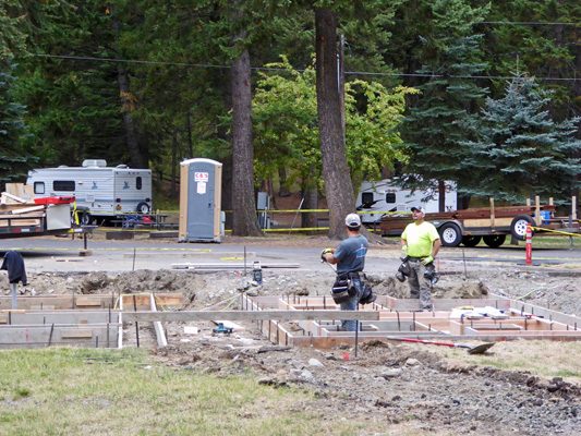
Once the rain stopped the temperature came back up but it was still cloudy. Work had progressed on the B Loop bathroom while we were gone and they were nearly done with the forms for the first concrete pour.
Walter walked over to the office to see if our package had come and had to go on a scavenger hunt to find it. It was in neither of the offices but someone had cleverly gone out and put it in the host mail box out on the road. Thank goodness someone thought to suggest that he go out and look there. So two weeks after we ordered it, we finally received the package. This is only the second time we’ve run into a problem using General Delivery and it was the same one—the shipper sent the order via UPS which doesn’t work. At least this time we got the box. The last time we had to cancel the order and have it reshipped to a physical address.
Thursday morning, September 22nd, we began our final week of work at Wallowa Lake. The temperature was 44 in the morning and it was spitting rain and only 46 when we set out to start cleaning sites. It never rained much but it stayed damp which made it feel much colder. We only had 20 sites to clean so we’d do all that had vacated and then head back indoors to warm up before doing another round. As usual, there were a few folks who waited until nearly 1 pm to leave so it was close to 1:30 when we parked our cart and headed home.
The high point of the morning came when we were making a turn through the E Loop. We’d just finished cleaning a site and turned a corner when 3 horses came trotting into the campground. They turned and headed right at us—oh goodie. Then turned and trotted across the campground—whew. Moments later rangers came driving and running from all directions. The horses headed out by the river and then turned down a gravel road in one of the group campgrounds. They managed to corner them and round them up fairly shortly thereafter. They’d escaped from a horse camp about 1/2 mile up the road and had been seen all the way down by the lake before they turned to make their way across the whole park to the south end. It certainly added a bit of spice to an otherwise pretty no big deal day.
The sun never made it out at all and we hit a high of 51 degrees for the day—definitely a great day to spend the afternoon indoors, take a nap and read a book.
Friday September 23rd, we had broken clouds and a temperature of 43 when we got up. There were only 20 sites total to clean that day and there were 3 sets of hosts on. Still the first host to get the list, divided it in two (his wife doesn’t like to work hard) so we were left with a list of 10 sites to clean. We opted to take those and the other couple headed over to the maintenance staff to see if there was something that needed doing and ended up getting to clean up pot holes (sweeping and blowing) and then marking them with orange paint in preparation for them being filled the next week. We went out for our first round and managed to clean 6 or our 10 sites before 9:30. But since it wasn’t much work we were COLD (it was still only 46) and went back in to warm up while we waited for folks to leave. Next round we got 2 more done and started flattening mole hills and filling in ground squirrel holes. This is of course a losing battle but at least it was something to do. We were all done by noon and decided we’d go to town for internet and lunch.
We had lunch at Embers Brewhouse—which had a nice menu, lots of beer on tap and the food was good. The high for the day was 57 but clouds came back in mid-afternoon.
Saturday September 24th it was clear and 42 when we got up. We bundled up to work—with a whole 20 sites on our list. We were done with the first half by 10 and then went out and cleaned all but the last two by 11:15. We waited until 1 and sure enough neither of these sites had vacated. So we packed it in and turned in our cart for the day.
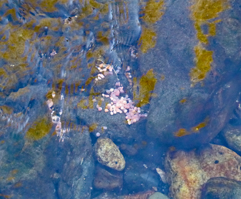
It had warmed up to about 61 by that point so after lunch we took a stroll up the road to the Alpenfest, the big even for the weekend. On the way we stopped to watch the Kokanee again and managed to spy an egg mass out in the river.
And I got another decent shot of the fish themselves coming up river.
There were lots of cars parked out on the road as we approached the fair so it was good that we’d walked. Alpenfest consisted of a small crafts fair in the parking lot of the Wallowa Lake Tramway along with a beer garden—beer provided by Terminal Gravity Brewery of Enterprise, OR. Indoors, there was yodeling, polkas and accordions with an admission price of $15—we stood outside and listened for a little while, grinned and took a pass.
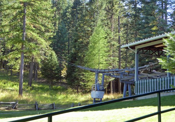
We did walk up and have a look at the tramway while we were at it. The Wallowa Lake Tramway takes you 3700 vertical feet up to the top of Mt. Howard where there’s a deli and about 2 1/2 miles of trails out to viewpoints where you can see the surrounding area. It’s pricey ($31 for adults and $28 for seniors) but lots of folks think it’s well worth it. Neither of us have been particularly drawn to it so there you go.
The tramway consists of gondolas that hold 4 adults. The ride takes 15 minutes traveling over a cable strung across 25 towers.
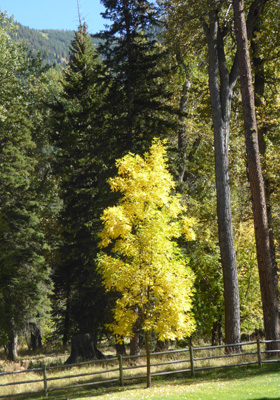
Fall color has come big time to the park—only fair since the Equinox was on Thursday—with the trees turning orange and red
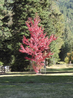
And yellow.
Sunday September 25th it was 39 degrees and clear. Walter had been hacking and coughing and snorting and sniffling all night and clearly had a cold. So we decided he should stay in bed and I’d clean sites. Of course, since it was Sunday and the Alpenfest was on, we had 77 departures total. My share was 39. We both agreed that I should just clean the fire pits and pick up major trash and not worry about patrolling for micro trash. To help ward off his cold, I took an extra 1000 mg of Vitamin C (and old family remedy for scaring off colds) and gargled with Colloidal Silver (a new family remedy which works wonders). I had a hot cup of tea to warm myself up (it was still under 60 in the trailer) and set out.
By 11 am I had 20 sites cleaned and had filled all the buckets I could find with ash—6 five-gallon buckets worth. The rangers had taken our full ash dump to the land fill and now we had nowhere to put our ashes. Mandatory break time! 1/2 an hour later the ash dump returned and I was back in business. By 12:30 I was down to 5 lolligagers who all left right around 1 pm. I was done and back in the trailer by 1:30. So you see, what time you get done isn’t a function of how many sites or how fast you work, it’s a function of when the last folks finally leave.
The temperature briefly hit 75 in the sun in the afternoon but mostly it was around 70—a lovely sunny warm fall day.