The lighthouse is the oldest operating lighthouse on the Oregon Coast—built in 1870.
It was Monday so the tour crew were all members of the Cape Blanco Heritage Society. One fellow waits down in the parking area to direct traffic and tell folks where to check it to get tickets. He sent us up to the new Visitors Center--they used to use a tiny little wooden shack and now have the use of one of the larger old coast guard buildings which gives them lots of room for displays and a big gift shop. Since we are part of the host crew we got our tour for free. Regular folks have to pay $2 per person to go up into the lighthouse.
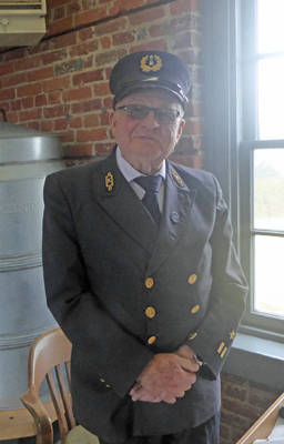
We walked on up to the lighthouse and into the workroom where our tour guide was dressed in full Lighthouse Service uniform.
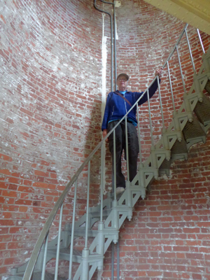
They were having a slow day of it—we were their first visitors at it was noon already! Not to worry there were a whole bunch of folks who showed up while we were there. They sent us right on up the stairs with no waiting. Unlike, Heceta Head Lighthouse where we worked last year, they allow folks to walk the stairs on their own.
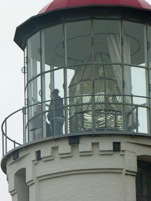
The tour guide meets you in the work room below the light and talks a little bit about history and then you climb a ladder up to be eye to eye with the lens.
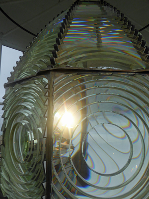
This is their second lens. The first was a 2nd order Fresnel lens while this one is about a 1 1/2—bigger than a 2nd order but definitely not as big as the first order lens at Heceta Head. One of the bulls eyes of this lens was vandalized in the 1990’s and had to be replaced. There are a number of the prisms below the bulls eye that were damaged but not broken through so they remained displaying their cracks.
When the lighthouse first opened it was considered the westernmost lighthouse (and Cape Blanco was the westernmost point) in the US and remained so until Washington became a state in 1889. Then the lighthouses out on the furthest capes there took its place.
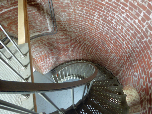
The lighthouse has the same double-walled construction as the Heceta Head Lighthouse but many other features are different since this lighthouse is 28 years older. The bricks were made on site and their first fuel source was lard! It took two keepers to run the light—one to tend the wick and one to adjust the vents to get the flame the right size!
The staircases are different too. And the tower looks like it might not be as big in diameter.
I took a photo of the lens once we were back down just so you could see the whole thing—something that’s difficult when you’re up close in the tower. As you can see, you get to be up to the level with the lens itself, though they don’t let you go out on the catwalk. I’m sure the view is stunning on a clear day. The glass was a little fogged up while we were there so I didn’t bother with photos.
We headed back to the trailer and picked up the laundry and our lunch and on to town. The Laundromat was busier than the week before but there are plenty of machines so it wasn’t a problem. For lunch we headed over to Tseriadun State Recreation Area which is about a mile north of Port Orford Heads State Park. It provides day use access to the dunes and the ocean and to the south end of Garrison Lake (where we had our lunch the week before).
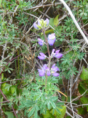
After lunch we headed out towards the dunes to see what we could see. There was lupine in bloom along the trail. We had some in bloom along the road to Hughes House too. I think that this is probably Broadleaf Lupine (Lupinus latifolius) but it sure is unusual to see it in bloom in October.
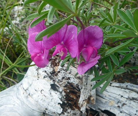
And there was still perennial sweetpeas (Lathrus latifolius) in bloom too—something that used to bloom in my garden in Monroe in June.
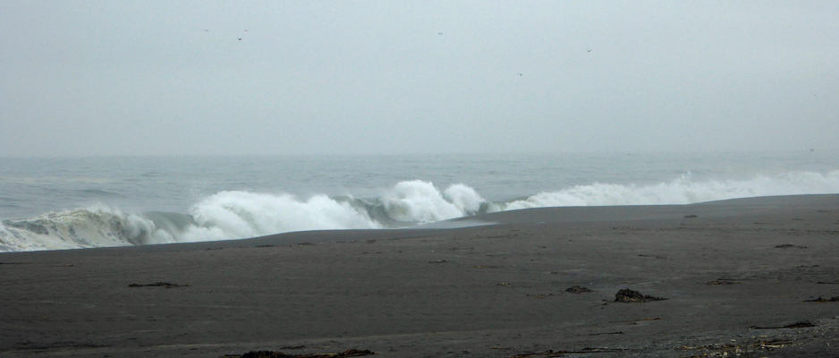
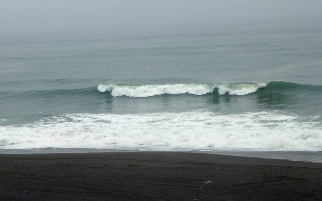
The trail leads out to a low foredune and from the top you can see the ocean. The tide was coming in and waves were lapping at the front of the dune and crashing nicely on the beach.
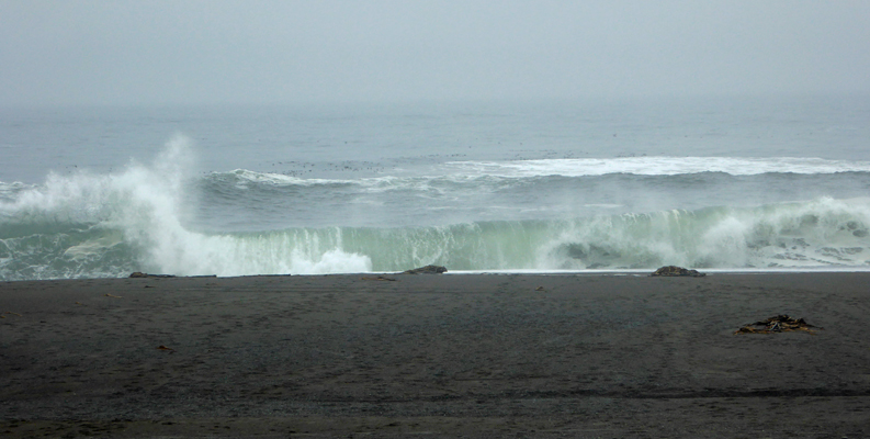
The surf here is really marvelous in the fall.
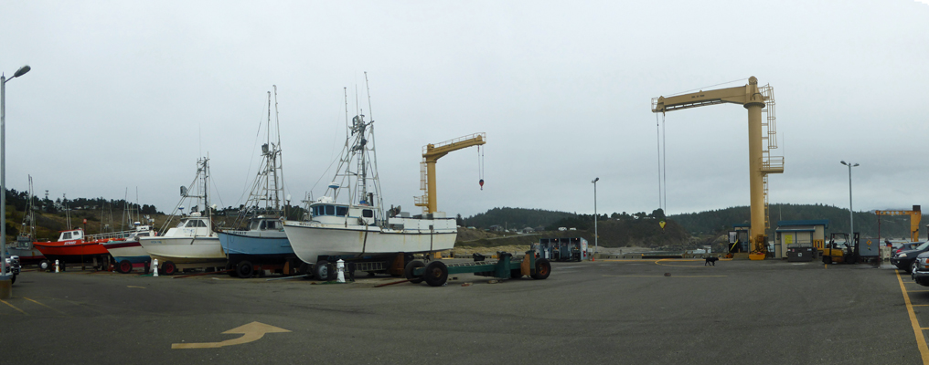
We decided that while we were out and about we might as well drive on over and see the port of Port Orford. It’s one of only 4 ports in the world that hauls all of its boats out of the water every day. That’s the fishing fleet parked on the TOP of the pier.
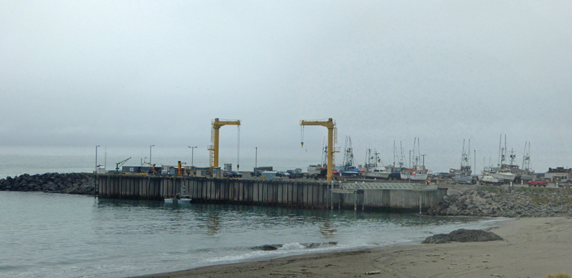
You can drive out onto the pier and watch the proceedings.
There was a fishing boat unloading its catch—by having each big red bucket hauled up on a small wench and the fish dumped into holding tanks.
Here’s the view out across the bay looking southwards.
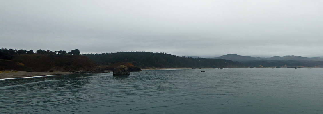
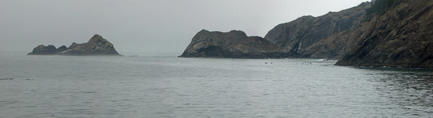
And here’s the view from the north side of the pier looking at the Port Orford Heads.
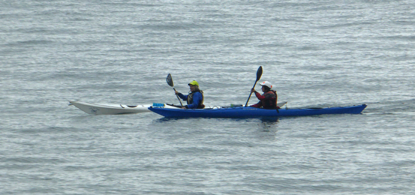
There were four kayakers out along the base of the heads.
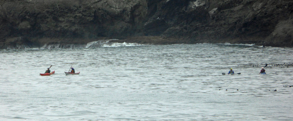
They’re the little dots in the water in the bay to the right of center of this photo.
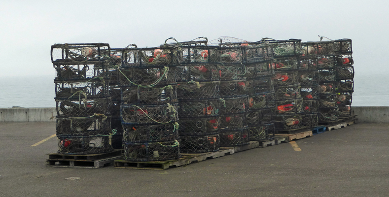
There were pallets of crab pots lined up on the pier—they catch Dungeness Crab here.
Just about this point, the fishing boat was ready to be hauled up. They brought it even with the pier and the fisherman got out and ran over and got his truck with a boat trailer attached and backed it up near the edge of the pier. And the wench first brought it up
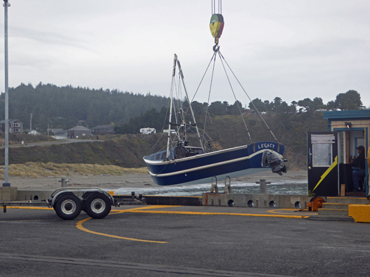
And then swung it over and lowered it onto the trailer.
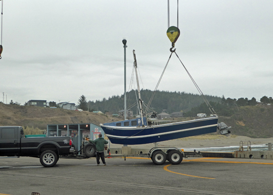
In no time at all, he had it secured to the trailer and he’d driven off and parked near where his fish were being sorted. Amazing.
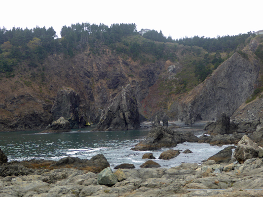
Meanwhile the kayakers were heading back around the pier and at this range you could see that they had dry suits and helmets on—smart when you are going to kayak near the big rocks where there’s surf.
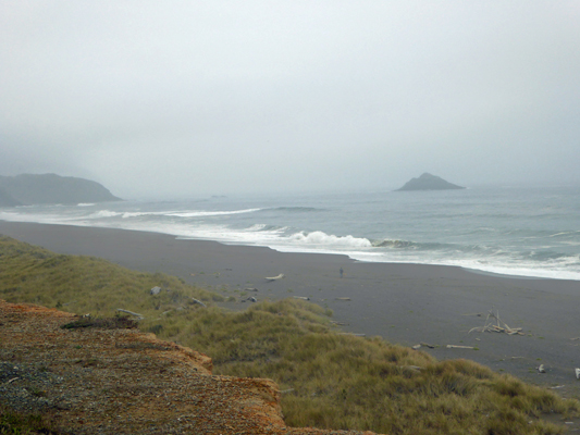
From here we headed over to the library only to discover that it was closed because it was Columbus Day (Happy Indigenous People’s Day). Oh well, we’d try later. So we headed on up to the edge of town and visited Paradise Point—a state beach access point. There were folks sitting in their vehicles watching the surf and I got out to shoot a couple of photos. Over the weekend last weekend we had a local surfer stop by Hughes House asking about access to the beach. And he’d said that the surf wasn’t breaking right anyway. Well, on Monday it looked pretty good to me.
Here’s the view looking southward back toward Port Orford.
All in all it was a successful day and naps were taken in celebration.
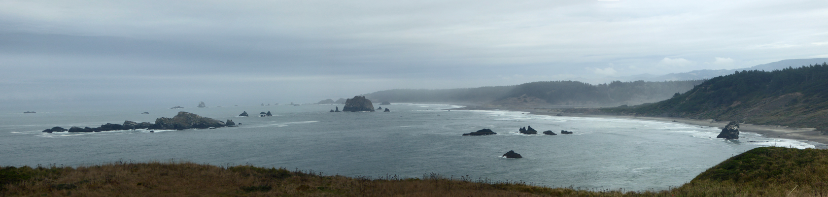
On Tuesday, October 11th, we decided that the weather was good enough for us to risk driving the 60 plus miles north to visit the three state parks just outside of Coos Bay, OR. We drove north on Hwy 101 and then turned west to join up with the Seven Devils Road that leads into the little town of Charleston. Then we turned west yet again and then south to go down the small peninsula there. The sun had been playing hide and seek all the way. One minute it would be foggy and the next the sun would be out.
When we reached Sunset Bay State Park the sun was out and the kids were out playing in the water.
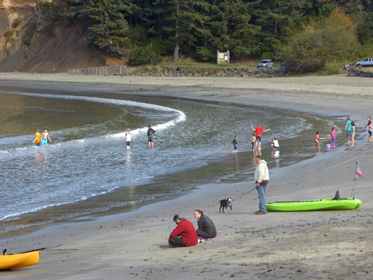
But as you can tell from the adults in the photo is wasn’t all that warm—maybe 60 degrees.
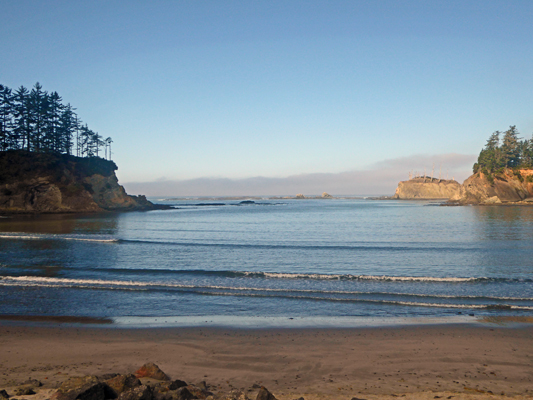
The bay itself is a pretty spot and it is a wonderful place to watch the sunset—we did that here in June 2000 when we camped at the campground at Sunset Bay.
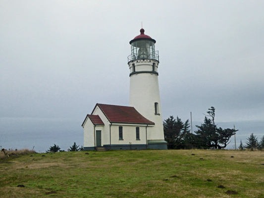
We drove south a ways to an overlook where I could take a photo that included the Cape Arago Lighthouse. It’s not actually on Cape Arago (which is south of here) but it is in the general vicinity of the cape. It overlooks the outer portions of Sunset Bay but you can’t see it from Sunset Bay itself.
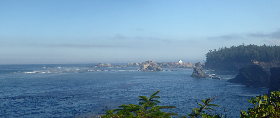
The view southward from this overlook was pretty nifty too.
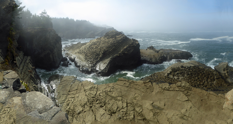
Just south of here you come to Shore Acres State Park, the former grounds of the Simpson Mansion. Simpson was a lumber baron of the early 1900’s. He owned the whole Cape Arago area at one point and built his mansion on the cliff overlooking the Pacific. This is the view from original mansion site.
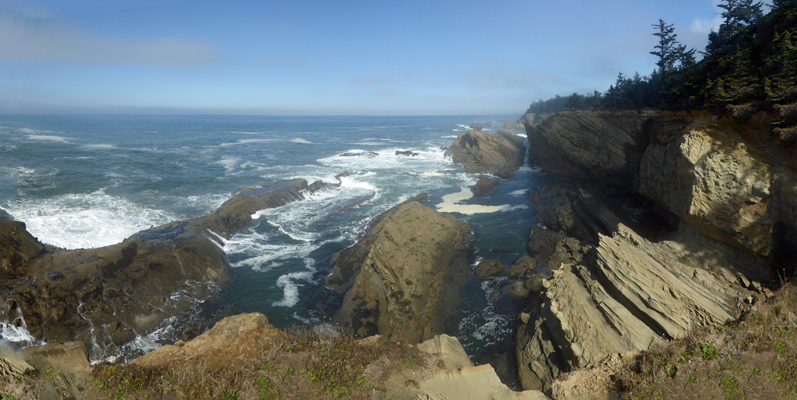
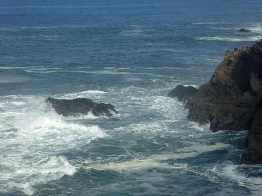
The rocks here are really amazing and the surf is such that it crashes into the rocks coming in
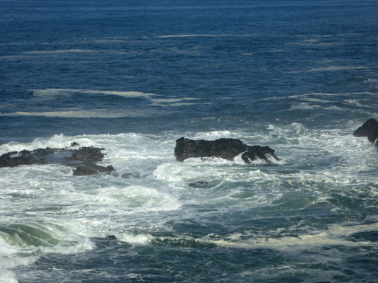
And then rebounds off the cliffs and crashes back into the rocks going back out. It’s wonderful fun to watch.
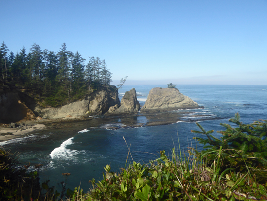
The view just south of the mansion site is pretty cool too.
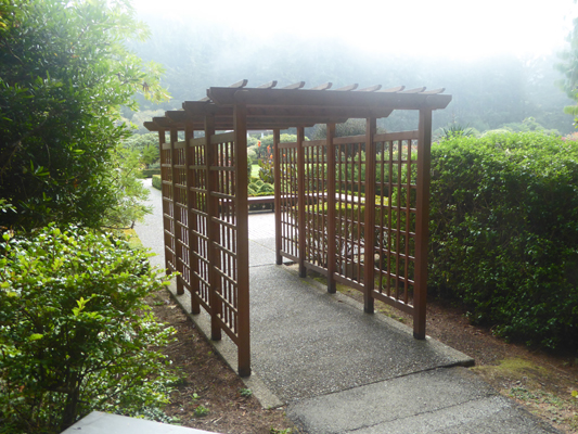
The big draw for most folks here is the botanical garden. Simpson was a gardener at heart and they keep the garden filled with annuals and roses (and tulips in the spring) to provide great summer color. And then they decorate it with lights for the holiday season too. You can enter from a number of directions. We arrived from the ocean side and so came through this nice trellis.
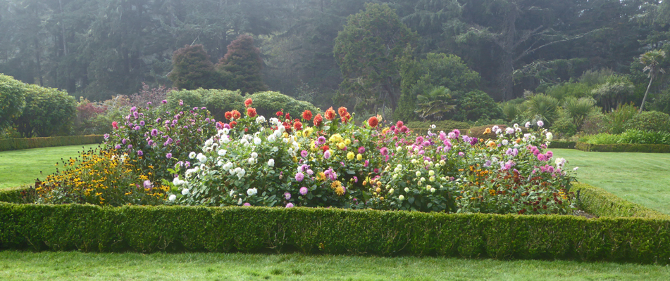
The dahlias were still blooming up a storm. There are at least 4 huge beds like this full of them.
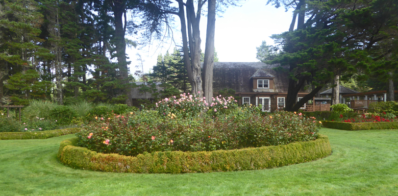
And while the roses were past peak, they were still lovely. One whole end of the garden is filled with them. The building in the background is a gift shop that is huge. We stopped in and talked with the hosts who were working there—they have sales of $500 to $1500 a day, even in October!
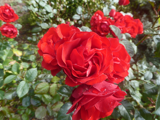
The red roses over on the far right were still producing wonderful blooms.
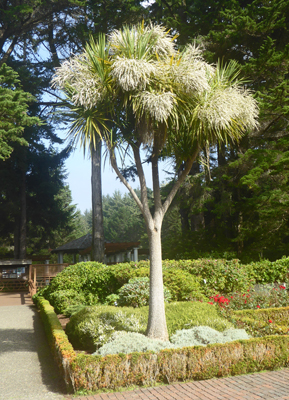
The bones of the garden are really pretty amazing—a collection of shrubs and trees from all over the world. At first I thought this tree was some odd yucca and then I read the sign. It’s a Grass Tree (Cordyline australis) from New Zealand.
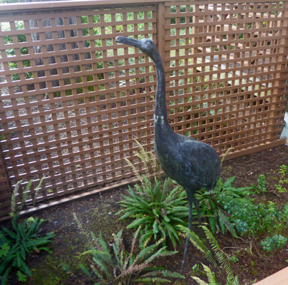
The emphasis of the garden may be the color (to attract most of the tourists) but the collection of interesting plants is pretty impressive too. There is also statuary like this crane in front of the gift shop.
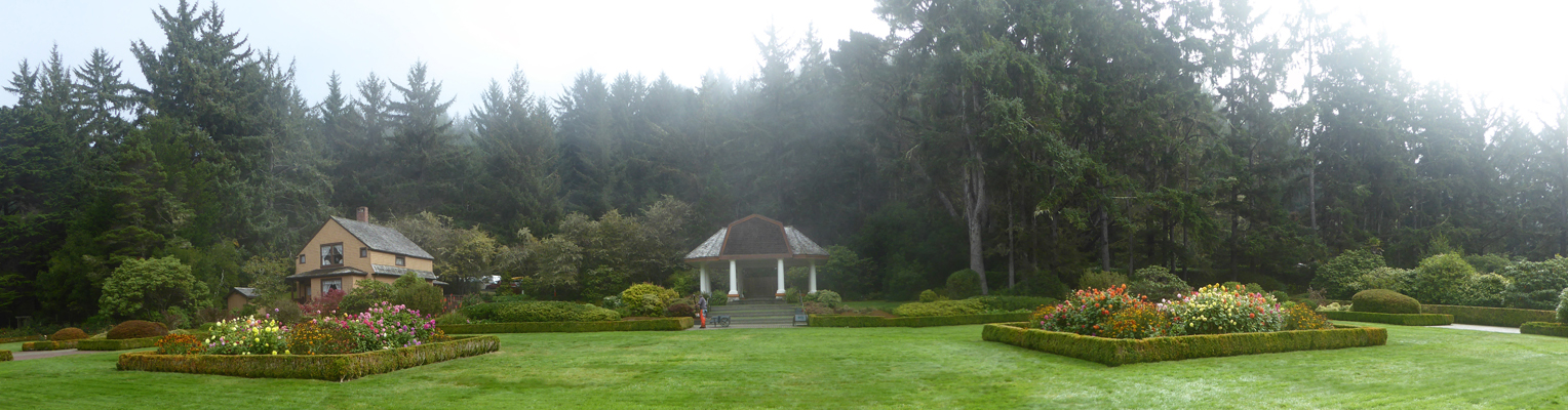
The fog had boiled in while we were in the gift shop and when we came out we had a whole different view of things. Here’s a shot of the east half of the garden including the gardener's cottage where Simpson lived after his first mansion burned down in 1921. He started a second one (after he married a second time) but it was never finished. He sold the property (including the unfinished house) to the state in 1942 and the house was demolished after the war.
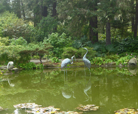
On the south end of the garden there is a lovely Japanese-style pond.
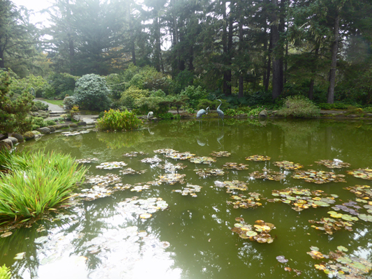
With more cranes
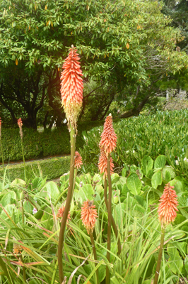
There was a lot of Red Hot Poker (Kniphoria uvaria) in bloom on this end of the garden—we had some in bloom in the hedges near Hughes House too.
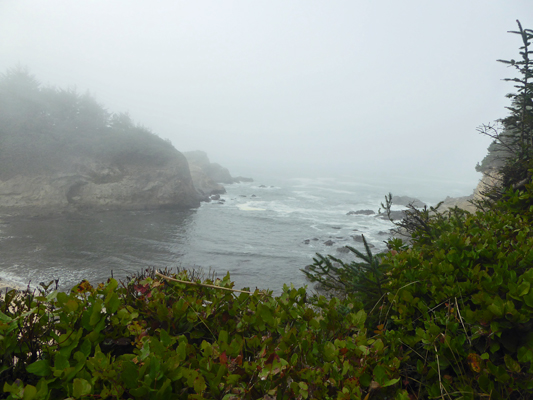
There is a cove on the south end of the property and you can hike down to Simpson Beach. But since the fog was in we decided we didn’t need to and I just took a photo of it from the trail.
Back at the parking lot we spied this cool Dune Buggy.
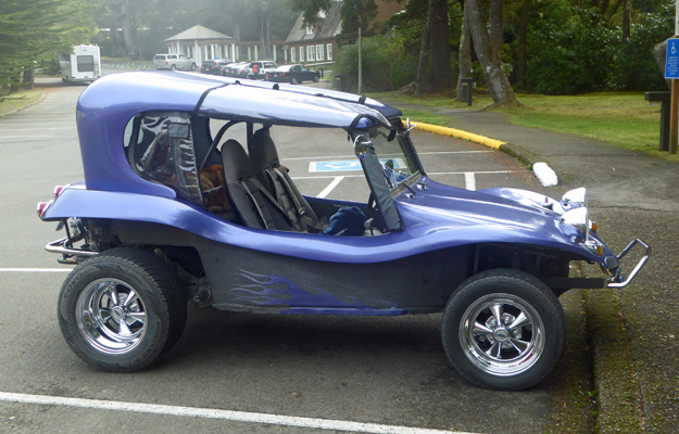
And discovered they had left it with a guard on duty.
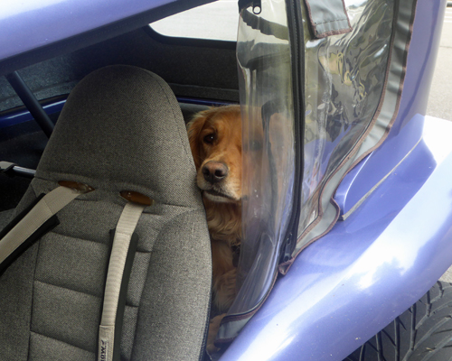
Dogs aren’t allowed on the grounds or paths at Shore Acres... But this guy was very safe waiting for his people in his open air buggy.
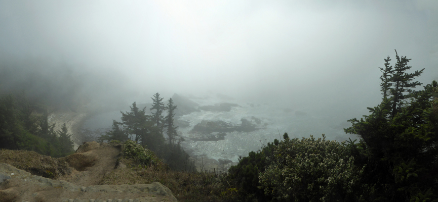
Next stop was Simpson Reef where you’re supposed to be able to see lots of sea lions out on the small islands just off the coast. I got out and you could hear the sea lions barking away. But you couldn’t see a one for the fog.
We went on down to Cape Arago State Park and had our lunch and then took the trail out to the viewpoint on the north end of the cape.
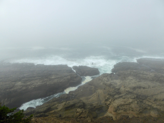
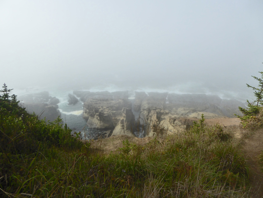
Once again you could hear sea lions barking away but you couldn’t see a one. Back in 2000 we had had a gorgeous sunny day to visit Shore Acres and then the next morning drove out to Cape Arago and it was just like this.
I hiked out to the viewpoint on the southwest side and it was a tiny bit clearer—at least you could sort of see that there is sand down over on the shoreline to the left and islands off shore.
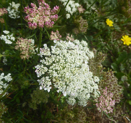
There was Queen Anne’s Lace in bloom along the pathway—again normally an early summer flower. We had it in bloom in August down at Harris Beach.
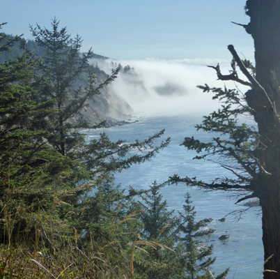
By the time we had driven the road along the south-facing portion of the park, the sun was out! But of course you had to peer through the trees to see the view. And you can see the fog reaching up the cliffs across the little bay.
The weather kept at this all the way back up the cape. Sunset Bay was socked in when we drove by and all the families had gone home. We decided we’d drive inland to Coos Bay and take Hwy 101 all the way home rather than retrace our steps on the winding Seven Devils Road. I’d left the address of the local AAA office in the trailer but we were lucky enough to drive right past it on our way through town so I could pick up some maps to aid in the planning of our big trip next summer to the Canadian Maritimes.
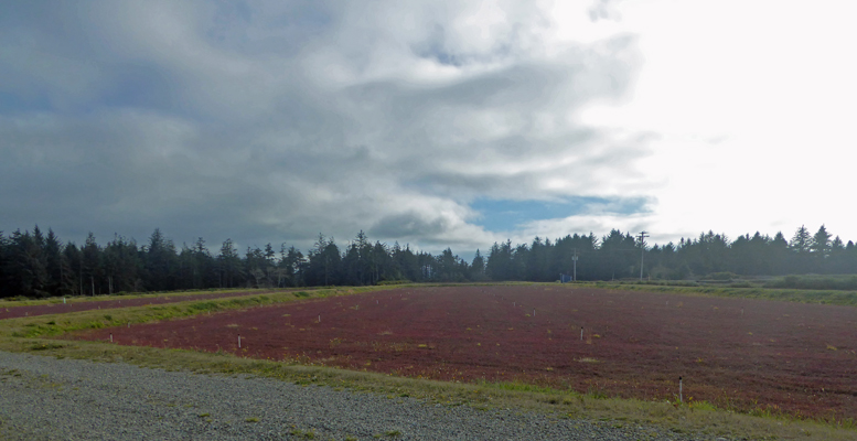
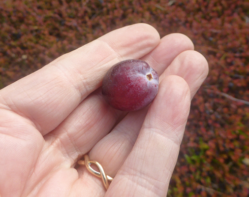
This part of the Oregon Coast is a major cranberry growing area. And it’s harvest time. On our way back we saw a farmer out in a small boat raking up berries in a flooded bog. Of course there was no place to stop to take a photo so I stopped instead to take a photo of one of the bogs along the Cape Blanco Road on the way from Hwy 101 out to the park.
Here’s a close up of the cranberry plants—with berries.
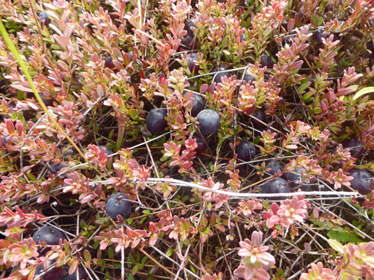
And here’s a nice big cranberry straight out of the bog.
It was late afternoon as we drove in and we saw two sets of deer and I stopped to grab a photo of this small herd.
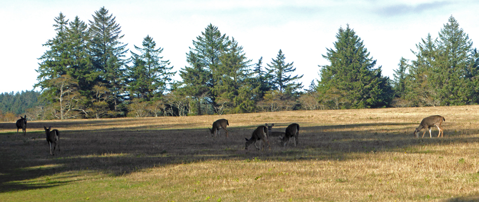
We’ve seen their droppings along the trails in the park but we haven’t seen the deer themselves in the park—these were about a mile outside the park.
While the sun was out here the fog was coming up the river as we arrived home and we were socked in shortly thereafter. That fog can waft around really easily.
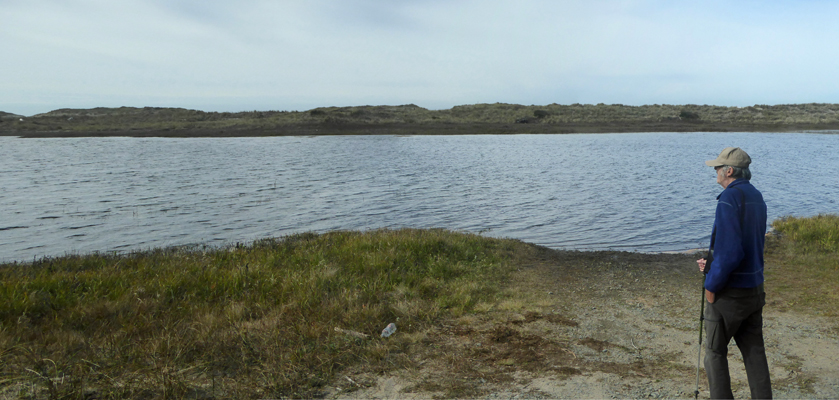
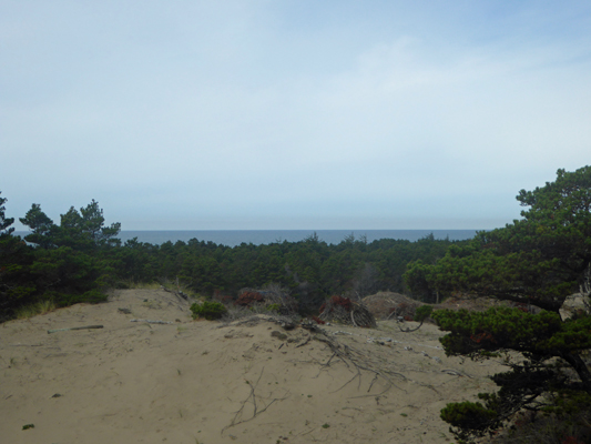
The next morning it was partly sunny and we decided that given that the weather forecast had rain for the next 6 days that we’d better get out and take a hike while we could. We drove north towards Bandon and then about 8 miles south of town turned west on Croft Lake Lane to the New River—a 1200 acre ACEC (Area of Critical Environmental Concern) managed by the BLM (Bureau of Land Management).
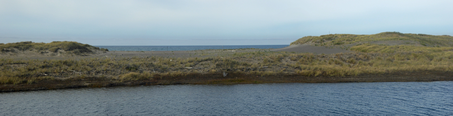
There’s a nice little nature center here and a series of trails that are mostly flat (though there are few dunes to climb). We stopped at the Nature Center and then headed out the New River Road to the boat launch. There you can get a nice view of the New River as it runs parallel to ocean, separated from the Pacific by a series of foredunes.
The river was formed in 1890 when a huge storm bought unusually heavy rain and wind that caused sand to block the outlet of Floras Lake just south of here. Flood waters flowed into a low channel just east of the low dunes that run parallel to the ocean. And New River was born. The river empties into the ocean by breaching the dunes. Where the breach is changes each year—usually increasing the length of the river. Some years the river grows a few feet, some years it grows a quarter of a mile.
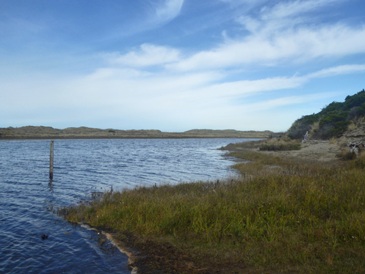
Here’s a view up river.
It was about 60 degrees and the wind along the river was brisk but away from the river it was really pleasant.
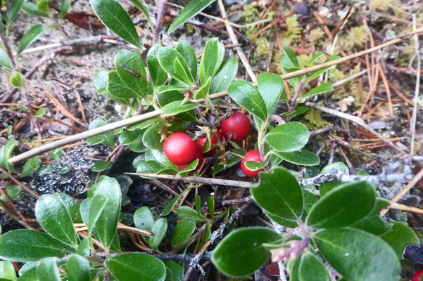
We set out to hike the Ocean View Trail which took us through the woods and a lovely patch of kinnikinnick full of berries.
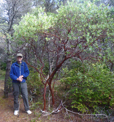
There were big tall Manzanita bushes
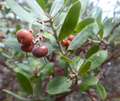
And they had berries too
We took the little spur trail out to the Ocean View point. And sure enough, out across the foredune, there was the ocean.
And we got another nice view up the New River

We kept on going and took the Huckleberry Hill Trail UP the dunes. The rain lately made hiking on the dunes much easier than this summer—nice firm sand—so it wasn’t a arduous hike. And we got yet another view of the ocean from the top of the partially vegetated dunes.
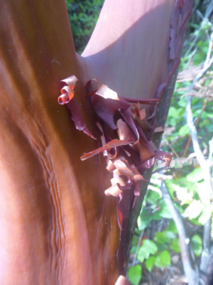
On the way back down the Huckleberry Hill Trail (where there were still lots of huckleberries) there were more Manzanita and some of them had wonderful peeling bark.
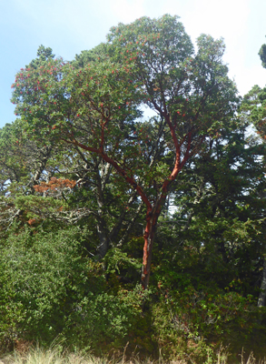
Huckleberry Hill Trail led us to the North Trail which dumped us out at the Nature Center. Walter found a bench to sit on for a while and I wandered off to take a photo of this huge Madrone Tree.
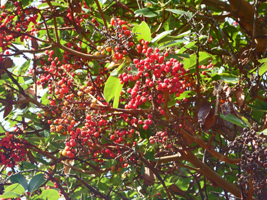
And its fruit.
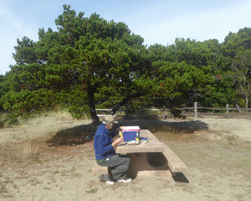
We followed the River Road back to the boat ramp and decided that it was actually warm enough for us to eat outside for a change. We found a picnic table sheltered from the wind in among the shore pines and sat in the sun and ate our lunch.
From here, it was on to the library to use the internet (Windows updates can take a lot of bandwidth as can Norton) and then on to the grocery store. By early evening the clouds had begun to gather and we had steady rain from late evening on.
Thursday, it was back to work for us and it was pouring rain and the wind was blowing like crazy. Normally, we walk the little way up to the Hughes House, but it was so wet, that we climbed into the truck and drove up. Even then, both our raincoats were dripping by the time we got from the trailer to the truck and from the truck to the house. At 10 to 10, the phone ran. The folks up at the lighthouse had decided not to open. The wind was really gusting badly and it was only supposed to get worse so they were going home!
We decided we could just as well sit around in the kitchen as at home so we went ahead and opened up. It poured and blew all day. We had a total of 6 visitors—three sets of two each—whoo hoo. But they were all very appreciative that we were open since they couldn’t visit the lighthouse and we did well both in donations and gift store sales. We were grateful we had the truck when it was time to go home because it was still coming down in bucket-fulls at 3:30.
It rained and blew much of the night but by morning it had pretty much stopped. We even had a couple of minute-long sun breaks. It was another quiet day at Hughes House. No one came until noon and then we had a visit from the park manager. They had decided to close the lighthouse for the weekend because the forecast was so bad. Some forecasts had 130 mph gusts forecast for exposed areas like the end of the cape! They were even offering folks in the campground (including the hosts) refuge over at Humbug Mountain State Park which is a ways inland. He wanted to know if we were willing to keep Hughes House open for the weekend. And we said sure. It’s comfortable to sit in the kitchen and read and then we don’t fog up the windows in the trailer for those hours we’re at the house. The plan was clear. If the power went out, we’d close up for safety’s sake, otherwise we’d stay open.
After he left, we had a big family come through (they bought lots of candy in the gift store and souvenirs too) so our total for the day was 14—better than last Friday when we only had 10. It had been a fairly dry day with just a few showers but as the afternoon moved into evening the showers came closer together and we had thunder and lightening added to it.
Rain continued through the night and by morning the wind was howling and the trailer was rocking with it from time to time. We headed up to Hughes House in the truck and got the place all ready to open. We’d just turned the last switch on and I’d said, “It’s show time” and the power went out. The park manager came up and told us we could stay as long as we liked as long as we locked the door to keep the public out. It was his day off, but there was only one ranger on for both Humbug Mountain and Cape Blanco plus the two Day Use Areas so he was out to see what he could see.
We sat around and watched the lights flicker for a while. The wind was blowing down river so we had the river crashing into the shore like surf. The wind was strong enough so the rain was mostly horizontal. Water was streaming off the roof (there are no downspouts) at the corners and the only sound the house made was the shudder of the front door when the wind hit it. It’s one very sound structure.
It started to get cold in the house so we gave up after 2 hours and turned off all the light switches and went back to the trailer. The wind had died down by that point, so we didn’t rock and roll much as we snuggled in on the bed with a blanket. By mid afternoon the rain had pretty much stopped and the power came back on a little after 4 pm. Long about 5 pm I noticed a patch of blue off the coast and we actually had a bit of sun on the far side of the river. And then low and behold the sky lit up with a bit of color to the west.
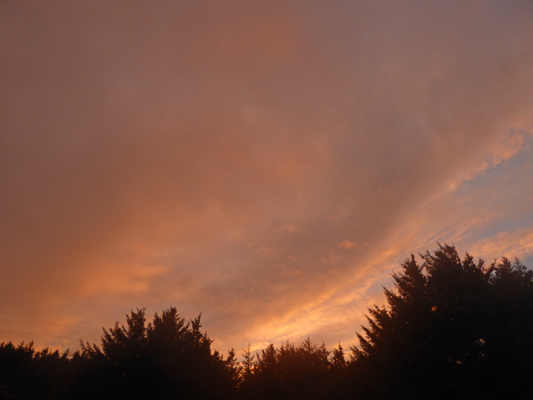
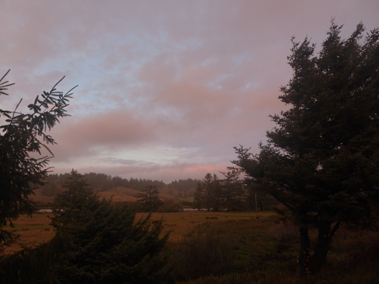
And we had pink across the river to the northeast.
We had squalls come through off and on all evening and then some time in the night it began to rain again in earnest.
Sunday October 16th, it was cloudy and raining when we headed up to Hughes House. It rained off and on most of the day though by afternoon it let up again. It was pretty quiet but we did have 14 visitors by the time the day was done. A number of them were grateful we were open since the lighthouse was still closed. It’d been a wet few days. The rainfall total through Saturday was over 7 inches for the month when the average at that point would normally be 1.6 inches. Blub blub blub.
We have two more weeks to go here. We’ve been enjoying giving tours but it has been awfully quiet some days. We sit in the kitchen in the rockers and read and talk and wait and watch the rain and the wind. Walter gets up now and then and looks out the back pantry window and reports where the sheep are and if there are folks down along the river or not. It’s a quiet life and we certainly will be thoroughly rested up by the time this gig is over.