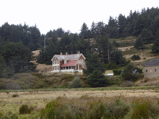
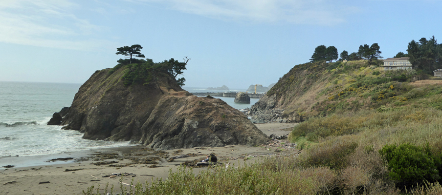
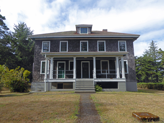
The view of the Hughes House from the river gives you a nice view of the long back porch.
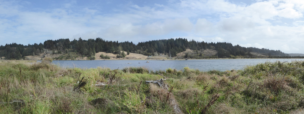
Having seen the sights we went on into town to the Laundromat. It had nice machines that were way less expensive than the laundry in Joseph had been and we were done in about 2 hours—about standard. We’d taken a lunch with us so we went looking for someplace scenic and ended up at the boat launch on Garrison Lake.
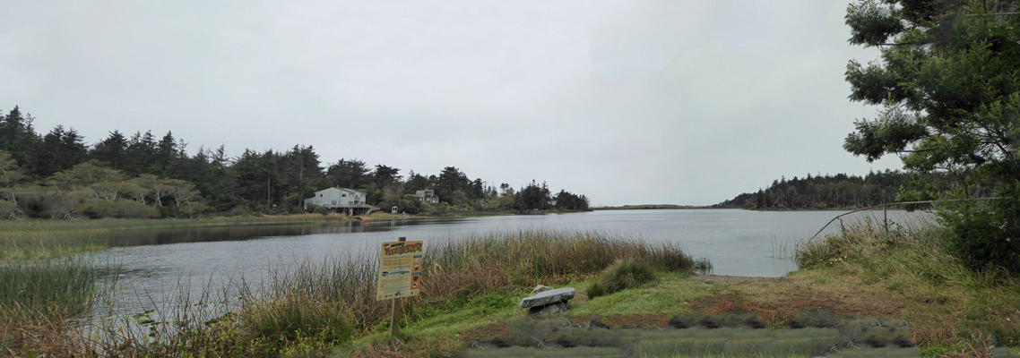
This is a long narrow lake separated from the ocean by a series of low sand dunes. It provides some wonderful waterfront property for folks.
Having fortified ourselves with lunch we then went on over the the Port Orford Library which turns out to be a lovely place that was quiet and peaceful and had a nice fast free WiFi signal. It’s across the street from the grocery store so when we were done at the library we headed on over to have a look. It’s relatively small but it had all the basics in life (and more) and will do nicely for our weekly shopping.
Having wiled away the afternoon we went home and had a nap. I know, life is tough but someone has to do this stuff!
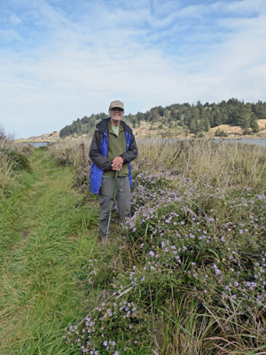
Tuesday morning, Walter set about making pancakes only to discover we were out of eggs. Oops. So I ran into town and got a dozen eggs ($5 for either organic or cage free eggs—the grocery store may have everything you need but it’s not cheap). Round trip it took me under 1/2 an hour (it’s about 7 miles from Hughes House to town) and we had wonderful blueberry-banana pancakes for breakfast. Since we were having sun breaks (even though there was rain in the forecast) we set out to explore the hiking trails at Cape Blanco State Park. We started with the River Trail which starts down at the end of the road below Hughes House. It goes out across the pastureland where we had spied sheep our first day here--but at that point hadn’t seen again.
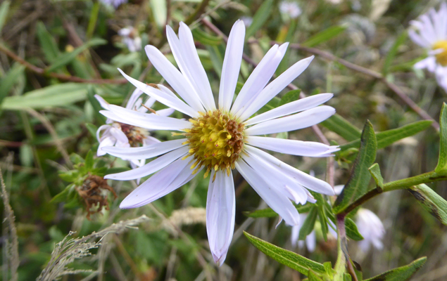
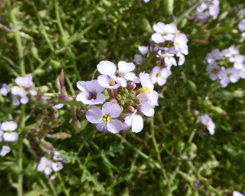
We muddled along wading across little streams and pausing to enjoy the big stands of asters in bloom along the trail.
These were in bloom all over the park, though not in the numbers we found by the river. I think that they are Tea-leaved Asters (Aster ledophyllus).
We blundered along until the trail petered out in a stand of sedge full of puddles. When my shoe filled with water, we declared it done. But that didn’t mean I couldn’t stop and take a picture of the Sixes River.
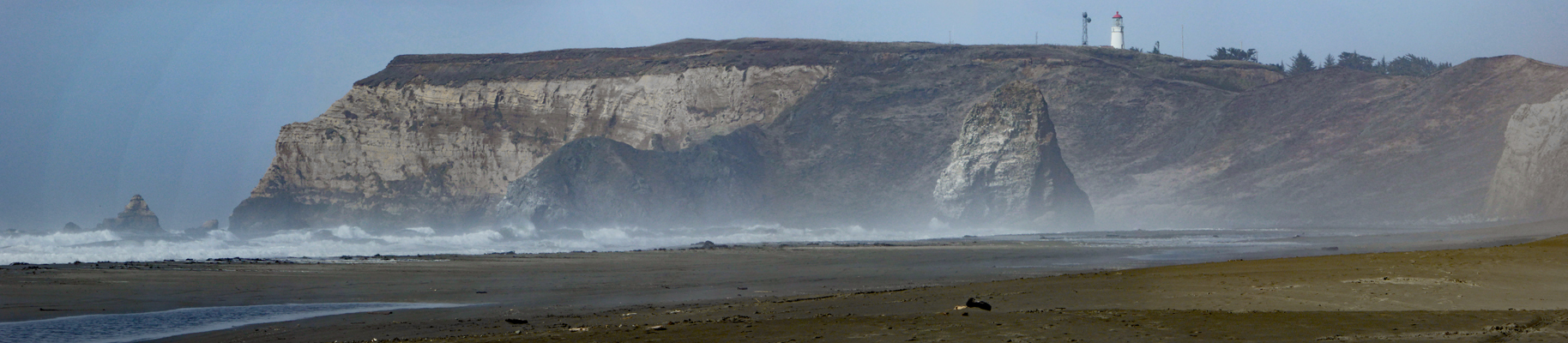
From here we headed back up the hill and I stopped to take a photo of the view from the road just above the Hughes House. I’d hoped you could get out to that lovely beach from the River Trail but without rubber boots you’d never make it. The only way out there is from a trailhead up by the lighthouse—and it’s really really steep.
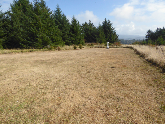
From here we drove a little less than a mile to the Pioneer Cemetery where Mary, Star of the Sea, the small Catholic Church that the Hughes family built, used to stand. The church is no more and the folks interred in the cemetery have all been moved to other cemeteries but the big open space where the church was is still there as are a number of the headstones.
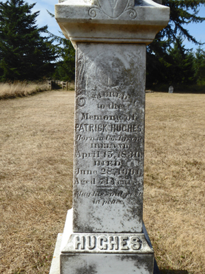
The large monument in the distance marked the grave of Patrick Hughes, the patriarch of the family, who died in 1901.
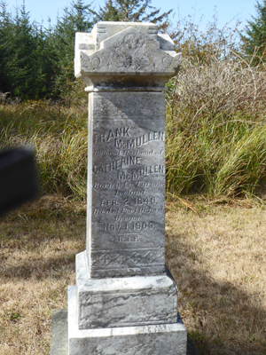
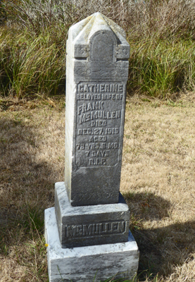
There are also headstones of Frank and Catherine McMullen, who were in-laws to two of the Hughes children—James who married Laura McMullen and Mary who married Frank McMullen, Jr.
Having paid our respects, we moved on to the Cape Blanco Campground. On the south end of the campground there’s a very steep road that takes you down to the beach on the south side of Cape Blanco. It’s a one-lane road so you have to drive really slowly and carefully but there is a decent parking area about 7/8 of the way down. There’s also one spot to park in down at the bottom but we opted to park in the lot instead and hike down to the beach.
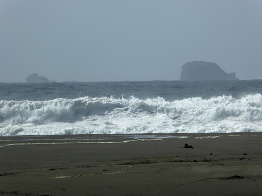
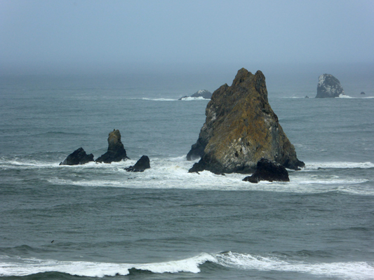
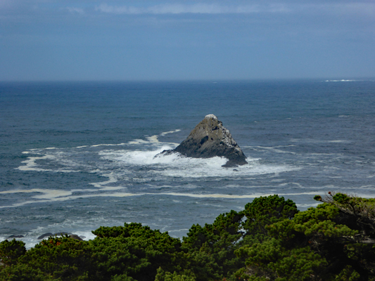
The surf was up but I was most interested in the off-shore islands, one of which looks like a cartoon of a whale.
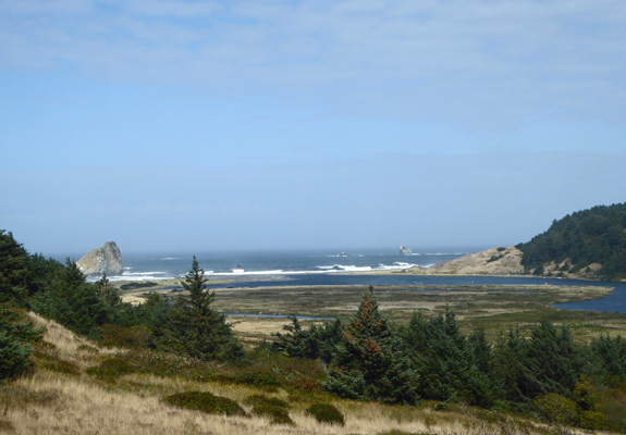
From the beach you get a great view of Cape Blanco—you can understand why the Spanish explorer who named it White Cape did so. And yes, that’s the lighthouse up on the ridge. Cape Blanco is the westernmost point of the continental US and the lighthouse was the westernmost navigation aide for a long long time.
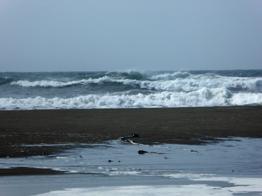
We took a walk down the beach enjoying the fact that the sun was out and the wind wasn’t blowing. When we’d last visited this beach years ago (in June 2000) the wind was howling here.
I took way too many photos of the surf—the tide was starting to come in.
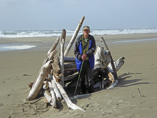
And Walter found a driftwood fort to play in.
There were tons of the little purple flowers in bloom all along the base of the cliffs in big mounds and hummocks. I think that this is European Searocket (Cakile raitima) which is a non-native.
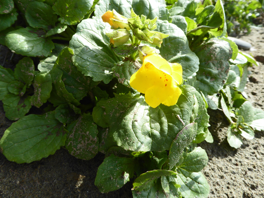
And here and there near the seeps in the sandstone cliffs there were Common Western Monkeyflowers (Mimulus guttatus) still in bloom.
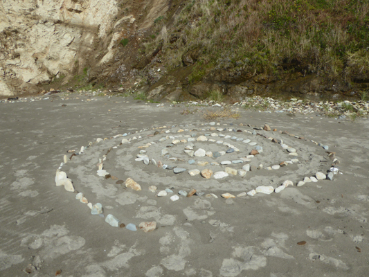
Someone had put a lot of time in to build this lovely spiral maze.
We hiked back UP to the truck and drove up the hill and out of the campground. I’d noticed a sign that said “Pacific View Trail .46 miles” and since Walter thought he’d walked enough, I left him in the truck while I set out to see the view.
The trail went through a tunnel in the dense spruces growing along the ridge.
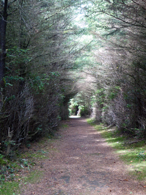
And when it opened up again it turned to an even denser tunnel.
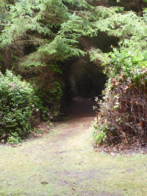
Occasionally, it would open up to an area of bare tree trunks only to become a tunnel again. It joined yet another trail (which heads on down towards to the Hughes House or so the signs say) and finally comes to an end at a viewpoint. Looking southwest you can see back towards Cape Blanco and the lighthouse.
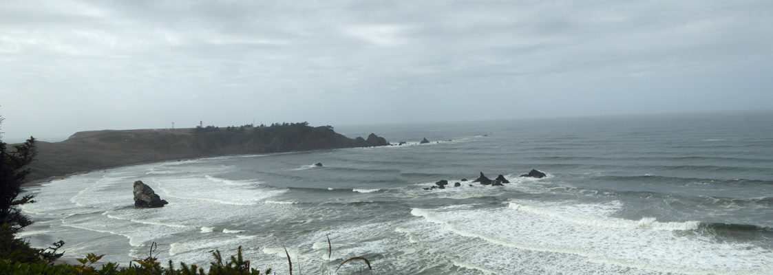
And looking northwest you see the rest of the sweep of the bay.
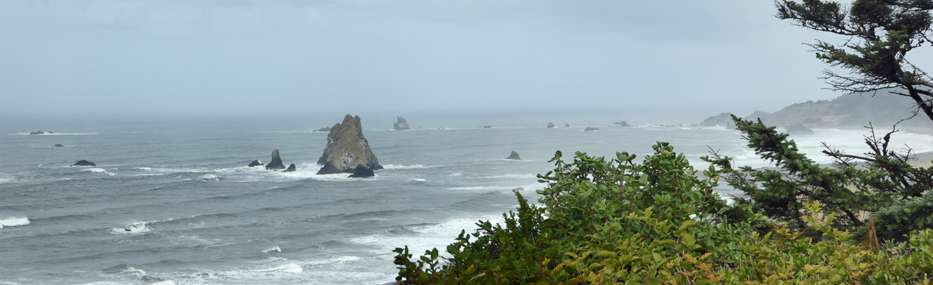
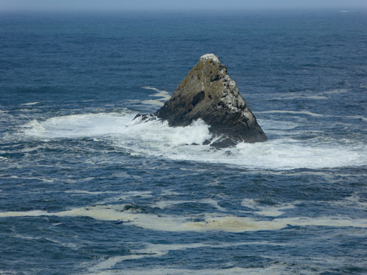
With the surf up I had fun taking photos of the waves crashing against the rocks.
I thought initially this is Castle Rock (but who knows every rock around here seems to have a name). But it turns out to be a side view of Gull Rock which is a really broad looking rock but clearly isn’t very thick.
It rained again later in the afternoon (and much of the night) and we were very grateful we’d had the sunshine we did.
Wednesday morning, October 5th, we once again had sun breaks. We headed into town (with grocery list in hand) to the south end of town and the Visitors Center at Battle Rock
The rock is named after a battle between the native peoples of the area and a group of 9 men armed with rifles and small canon who came to found a town here in 1851. The nine men ran off into the woods but the town was platted and founded here in 1851 and by 1856 they had rounded up all the local native people and shipped them or marched them north to a reservation. (sigh)
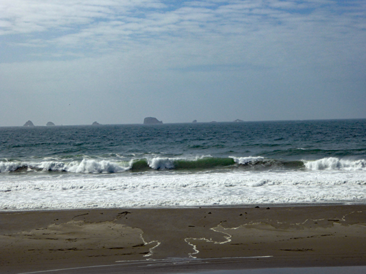
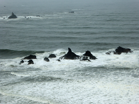
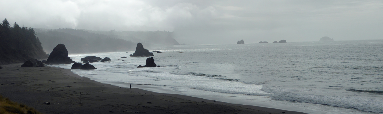
It was a bit foggy to the south which makes for a ghostly photo of the sea stacks off the coast.
We read all the information signs here (they’re really pretty good) and Walter gathered up a bunch of tourist info to plan some future outings. And then we decided we might as well head up to Port Orfords Head State Park and the Coast Guard Lifeboat Station Museum. This park is on the southwest edge of town.
The Coast Guard Station operated here from 1934 until 1970. They had a lifeboat crew here that saved many a crewman whose ship was lost in the storms. After the Coast Guard Station was decommissioned in 1970 the station was used as a research center until it was turned into a state park. The local heritage society managed to procure a lifeboat from the era to preserve here.
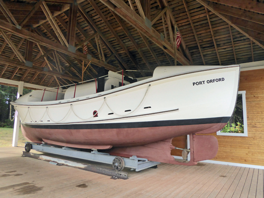
This is a self-bailing boat—the water ran out of the slits just above the water line. This boat had a crew of 8 and could take on 20 rescued crewmen. These boats were incredibly stable so they could be taken out into high seas and not capsize. This ship served for over 35 years along the southern Oregon coast.
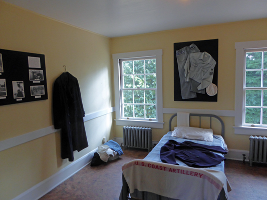
They’ve turned the former Coast Guard Barracks into a museum which opened in 2000.
It has a nicely curated collection of coast guard and local maritime history. They’ve left the barracks rooms intact making for small rooms focused on various topics including what the rooms were like when they were used as barracks.
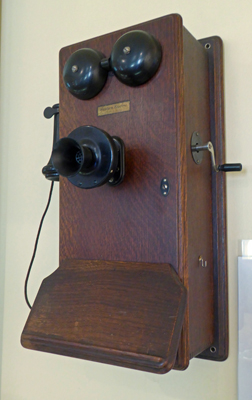
Down in the old mess hall I spied an old crank phone.
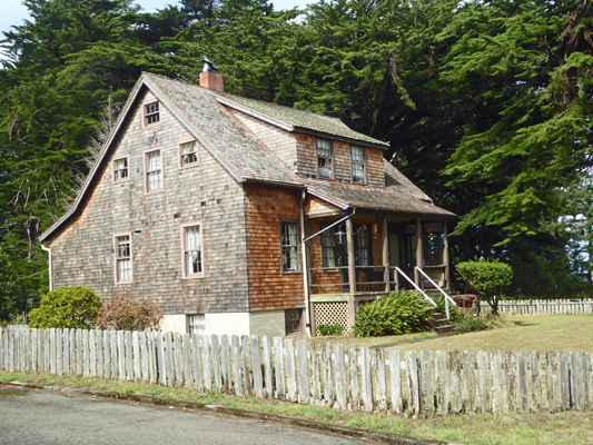
Across from the museum is the old Office-in-Charge’s house, which is now a ranger residence.
Since the sun was still out, we took the Headlands Trail out to the viewpoint. The surf was crashing around the sea stack.
And we sighted one whale (or at least we think we did—suggestion is a wonderful thing). Some ladies we met on our way down had said they’d seen a whale playing down there so I did too—but only once which makes me wonder... At the end of the trail the viewpoint gave you an even closer look at the surf at the sea stack.
Then my camera announced that it’s battery was low and it wouldn’t take any more photos so you’re spared the view to the north!
We got back to the truck in time to head to the grocery store before we got too hungry and were home and had the groceries put away by mid afternoon—when it rained again.
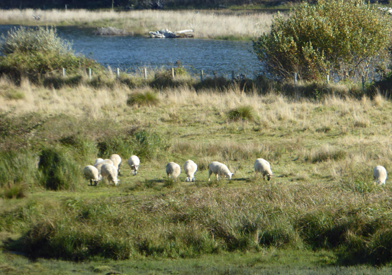
Thursday we were greeted by partially sunny skies and it was back to work for us. But first I had to run back to the trailer and get my camera because the sheep were back! This flock had been in the field next to our rig when we arrived on Friday but we hadn’t seen them since and now they were back. The next day there were 25 of them and they stayed fairly close by for the whole weekend.
Our first hour was quiet but by 11 folks started to appear and we had a fairly steady stream of people until 3:30 when we closed up. Walter made his first sale in the gift shop and we had 41 people come through the house. It had been sunny most of the day but late in the afternoon it began to rain lightly and by evening we had fairly steady rain—October on the coast when it rains even on the sunny days.
It was still wet in the morning Friday but by 10 it had dried off when we headed up to the house for our day of tours. It was slow all day and we only had 19 people come through the house (and a few of those didn’t take tours). But the sun came out in the afternoon and filled the kitchen with late afternoon light. The high point of the day was a family with two little boys. They had just become full-timers and the visit to Hughes House was their history lesson for the day. Shortly after they left, one of the little boys came back in with a long turkey feather in his hand, saying they had found it in the drive and could he have it? His face lit up when we said yes, and I heard him repeating to himself as he walked out “I can have it, I can have it.” And he turned at the door and thanked us yet again. It was really sweet.
Saturday October 8th, we had ground fog hanging over the river and sunshine in the uplands. It wafted around all morning so that sometimes we couldn’t see a thing out the windows of Hughes House and at others we could see across the river. It was a busy day for us with 46 visitors (many of them descending on us at once of course) so we gave a lot of tours and didn’t get to sit down much. The sun was fully out by early afternoon, though you could still see fog down at the beach.
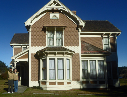
Sunday it was sunny and gorgeous and we set up the tripod and took a photo of ourselves standing in front of the Hughes House—so now you know for sure we’ve been here.
It was a fairly quiet day on Sunday with only 25 visitors. By the time we closed up at a little before 4 pm there was fog coming up the river from the beach and we were pretty much socked in by 6:30. No rain for two days though, which is something!
Take a virtual tour of Hughes House.