After lunch the sun began to peek out so we decided to go ahead and go to the Visitors Center to plan our visit. We watched the movie (they need a new print the colors are all washed out) and checked on the trail conditions (terribly muddy) but since the sun was still out we decided to do the driving tour and stop at all the view points while we could.
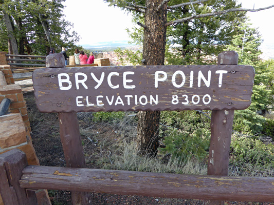
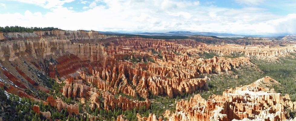
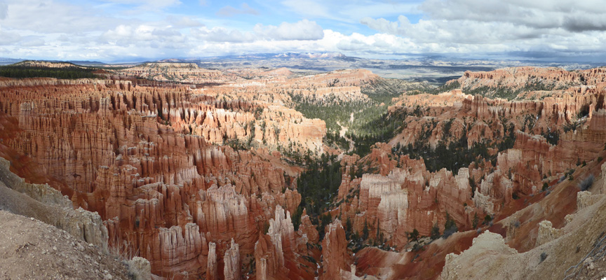
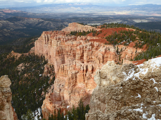
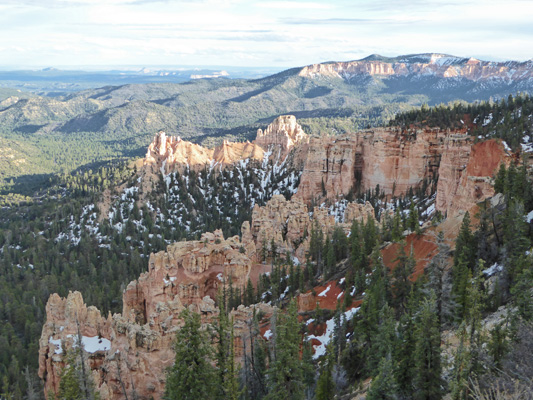
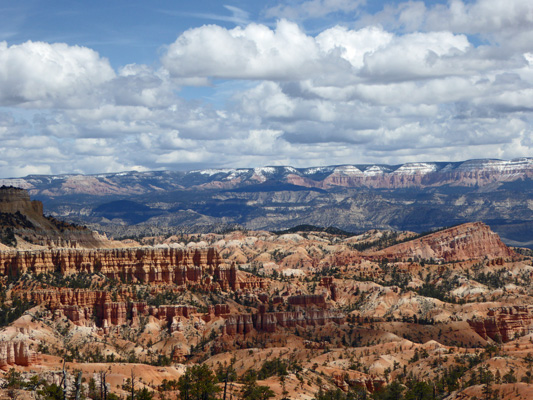
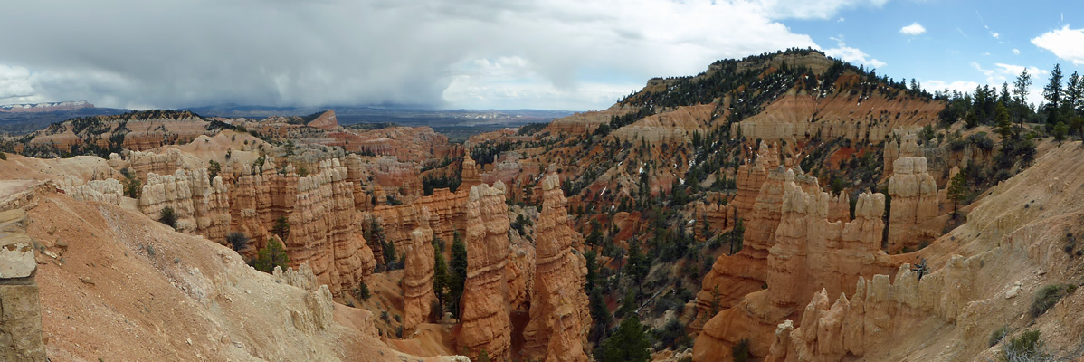
We started at Bryce Point which I think is the most picturesque of the viewpoints in the park. It’s the highest of the viewpoints in the heart of the park (where the campgrounds and the hotel are).
There are views from where those ladies are standing but you get a much wider view if you walk all the way out on the point.
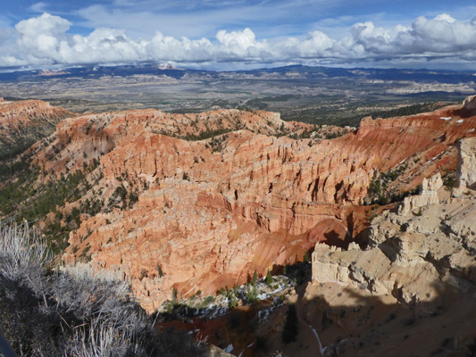
Bryce has huge sweeping views that are a bit of a challenge to capture. But here’s my best shot from the very end of the viewpoint.
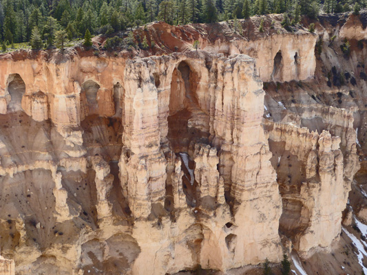
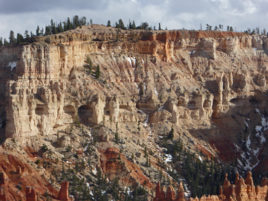
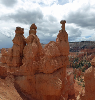
Directly to your left in the photo above there are a series of alcoves that have been eroded out. Even if that big one in front becomes totally separated from the cliff face they won’t call it a true arch since arches are eroded by moving water. These alcoves are called windows because they are eroded by wind and weather rather than moving water.
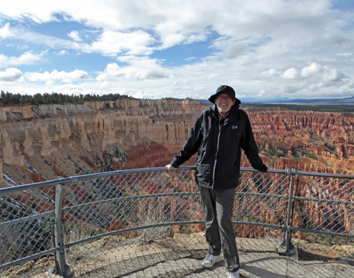
And here’s Walter braving the wind (it was in the low 40’s) at Bryce Point.
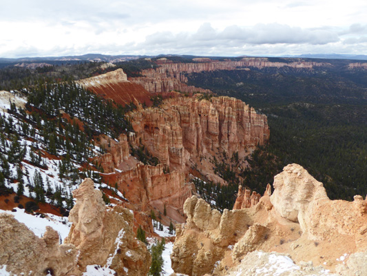
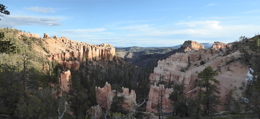
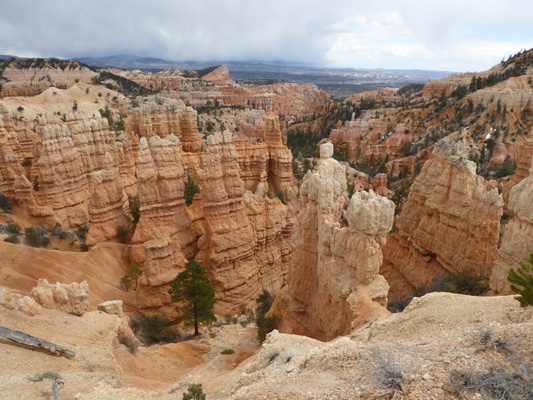
From here we drove back down to Inspiration Point.
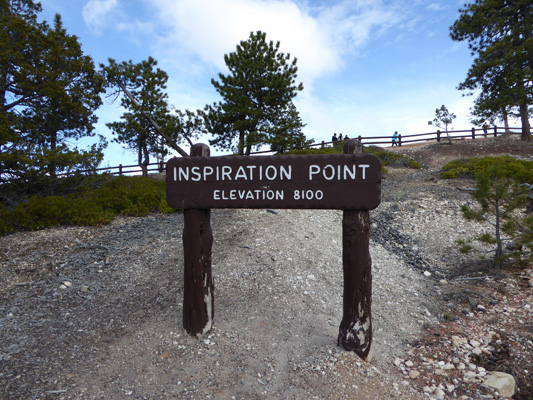
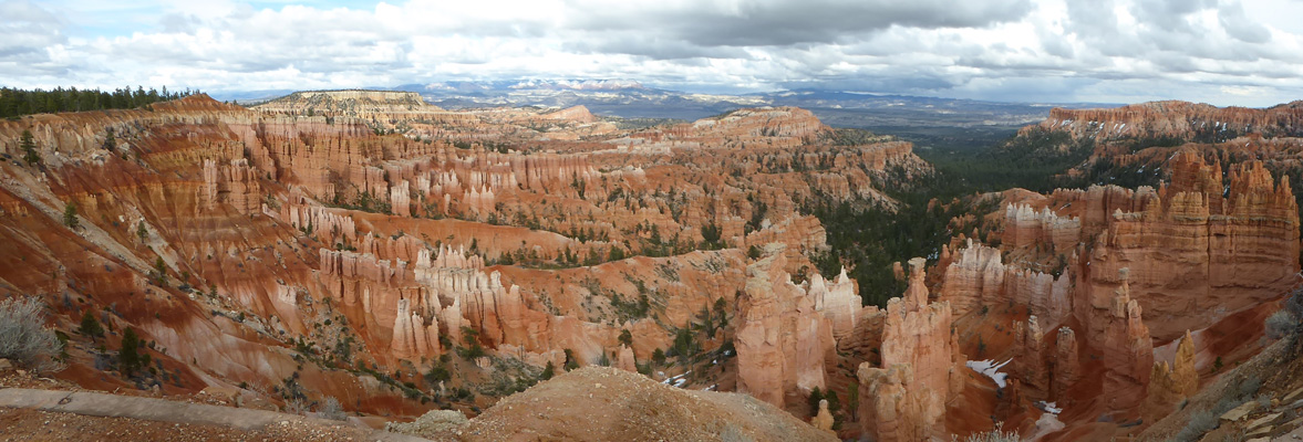
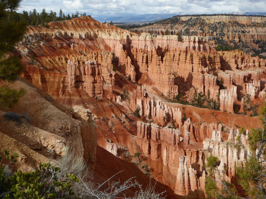
Where the view really is as expected, inspiring. The sun was playing peekaboo with the clouds so the light kept changing with every moment. All the viewpoints in this area give you glimpses of what is known as the Bryce Amphitheater—because Bryce Canyon really isn’t a canyon per se rather a series of amphitheaters eroded into the face of the Pink Cliffs.
From here we drove down into the main ‘village’ area to Sunset Point.
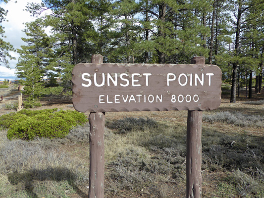
There were lots more people down here since it’s within walking distance of the hotel. Besides that, the Navajo Trail which goes down into the canyon and links up with the Queens Garden Trail to form a loop starts here. We saw lots of folks with really muddy boots and pant legs coming up the trail here.
Have you noticed the snow here and there on the canyon walls in the distance and down at the bottom here on the right? It keeps right on snowing here through April.
There are more alcoves and windows along the canyon rim (and snow).
And I grabbed this shot when the sun came out and lit up the hoodoos. I love the pink/peach colors of Bryce. It makes the delicate formations look even more so.
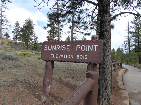
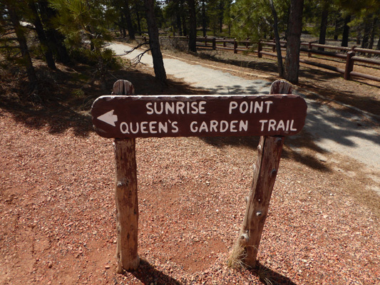
Sunrise Point is up a little bit in elevation and very close to the North Campground. Here you can take the Queens Garden Trail down into the canyon. It’s the easiest of the trails that go down into the canyon with just a 350 feet loss (and of course that’s a gain when you come back up) in less than .8 of a mile.
There are lots of places to view the canyon from here and so lots of different views.
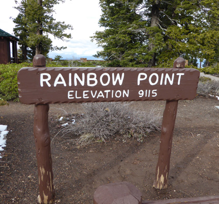
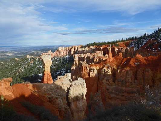
The sunshine was mostly holding so from here we took the 13-mile drive south to Rainbow Point at 9115 feet. It was 38 degrees and breezy here. In other words it was COLD.
But that didn’t keep us from walking all the way out to the point itself. There was more snow here but hey, it’s 1,000 feet higher too.
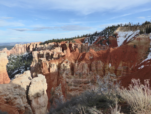
The north facing cliffs were covered with snow.
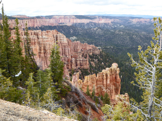
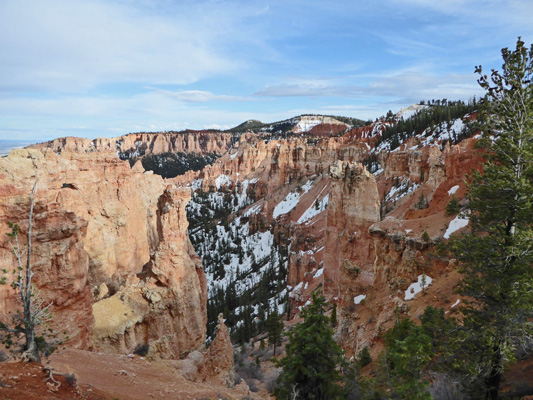
On our way back north we stopped at an un-named overlook where you can see that not all the area is full of hoodoos.
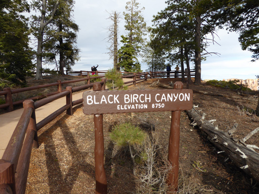
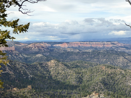
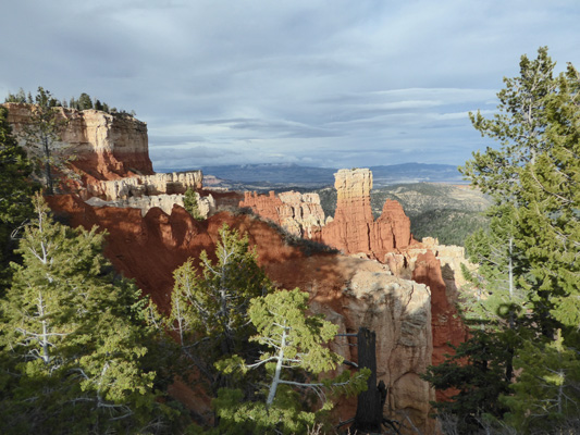
We stopped at Black Birch Canyon.
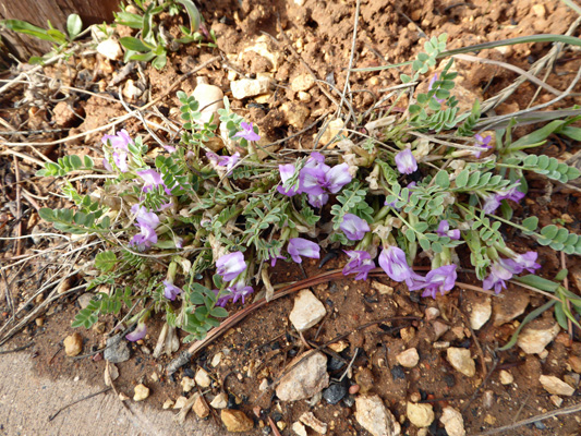
And I spied a little astragalus in bloom. I think it is Zion Milkvetch (Astragalus zionis) but there 24 purple astragalus that grow in Bryce so I just might be wrong.
Southward there were lots of spires and snow.
But northwards it was mostly trees with a view of the cliff walls of the next amphitheater to the north.
In 1992 when we visited Bryce I took a photo of Walter with the sign for Ponderosa Canyon at 8800 feet.
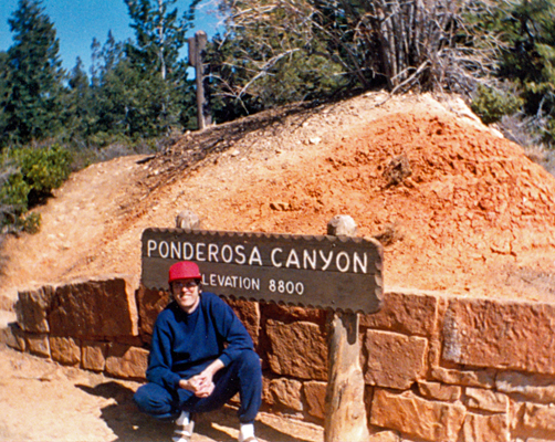
We didn’t find that sign (it must have been down the hill a ways) but we did find Ponderosa Point so I took a picture of him there.
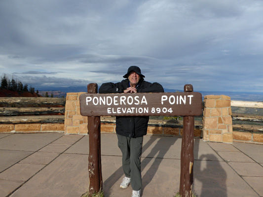
And of course here’s the view from Ponderosa Point.
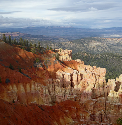
Agua Canyon is just down the road and I got so distracted by the great view I forgot to take a picture of the sign!
It’s an interesting view because you have this big solitary hoodoo and then over to the right you have slumping red cliffs over the top of the usual pink hoodoos.
And to the north there’s a mix of red and pink hoodoos.
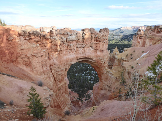
The Natural Bridge is a traditional stop along the road.
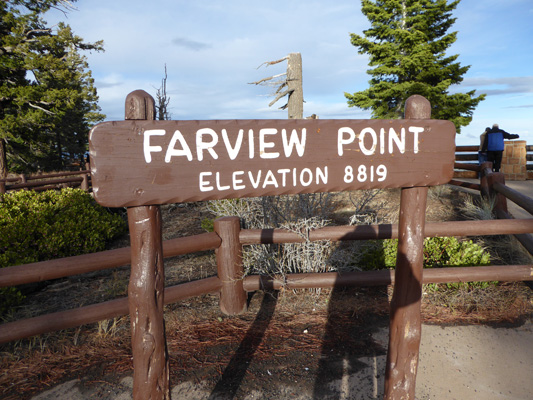
Fairview Point is down the road from the Natural Bridge.
Here you can see the cliff walls to the north very clearly.
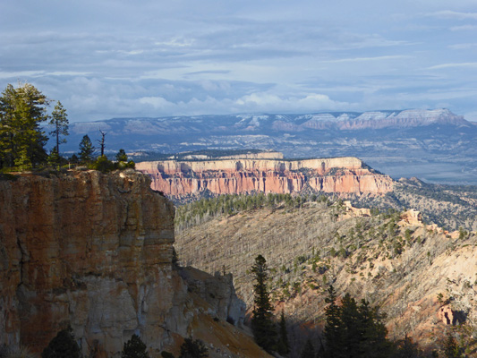
And the same sorts of cliff walls to the south.
By this point it was getting late and the sun had begun to sink in the west. But we still had a bit of light when we made our last stop at Swamp Canyon.
We got back to the trailer in the early evening very satisfied with the results of our day when earlier it had looked like it was going to be a washout.
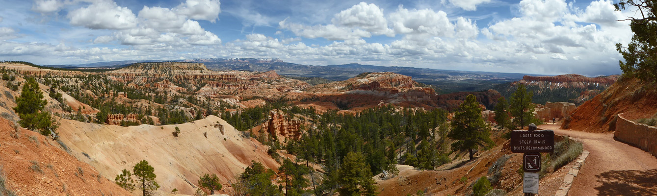
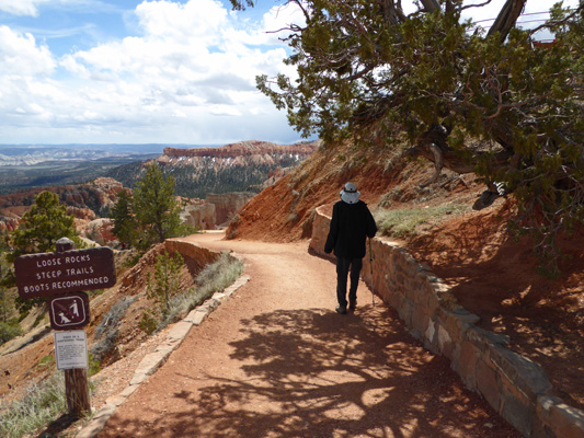
The next morning it was cold but only partly cloudy when we set out to find a parking space at Sunrise Point so we could hike the Queen’s Garden Trail. We drove the loop the first time and found nothing open but on our second try there was a nice big space waiting for us. We got our gear together (including our rain jackets since it was cold and windy) and set out to find the trailhead. I was sure from the map that it was to the north of the parking area but Walter being the pathfinder that he is, found it first try to the south of course.
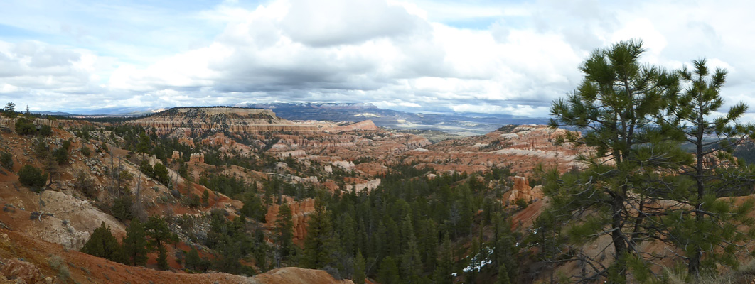
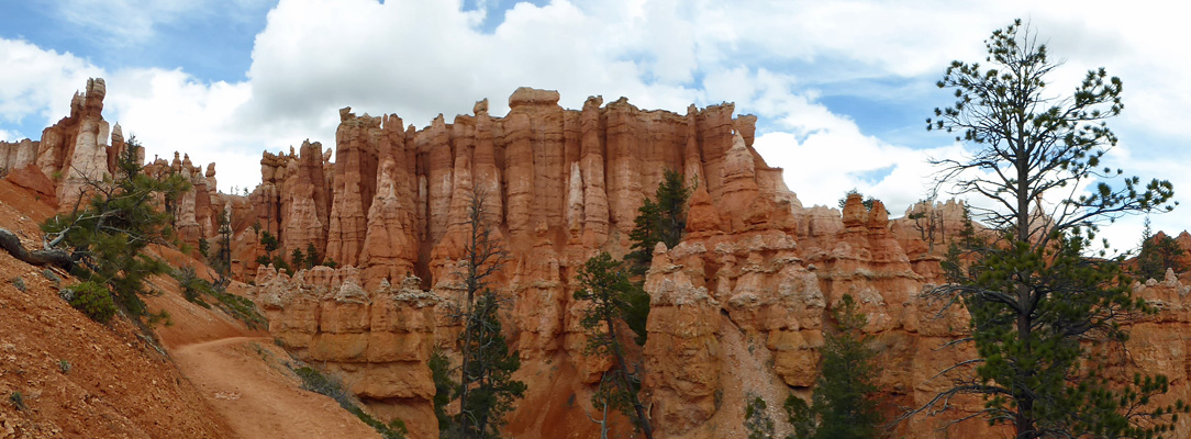
I took a panorama shot in the gorgeous sunshine from the top of the trail. Note the sign on the far right “Loose rocks, steep trails, boots recommended”. In the summer they have problems with folks hiking these trails in sandals and getting hurt because of it. As it was we saw way too many folks in street shoes but at least most of them turned around fairly soon.
The trail starts out fairly gently before it gets really steep.
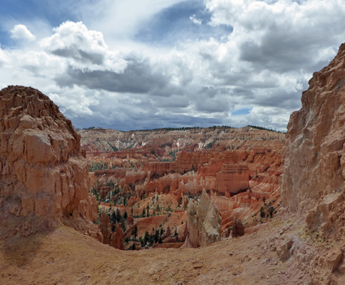
The first window into the canyon makes a nice stop and a lot of folks turned around here.
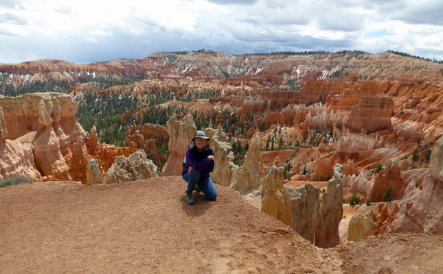
We had a French couple in front of us who posed at every possible photo op to take pictures of each other. She got down on her knee for a photo here and I thought I’d try it too.
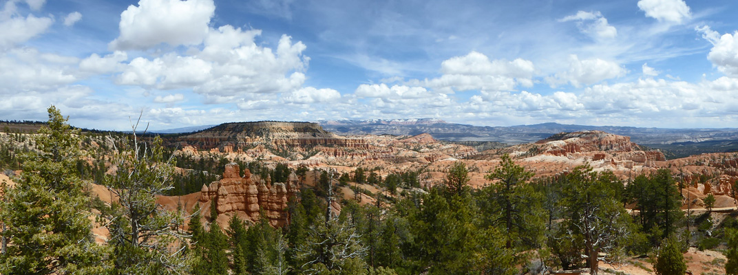
As you descend into the canyon you get lots of opportunities for big panorama shots.
You could see snow on the pink cliffs to the north of the park. They have to be well over 10,000 feet.
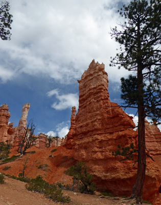
It doesn’t take too long until you are far enough down to be at eye level with the hoodoos.
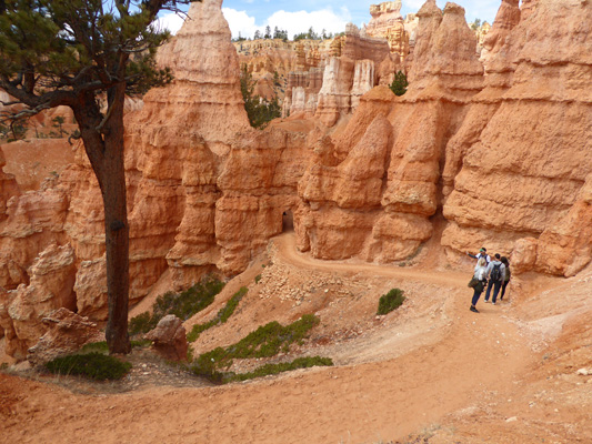
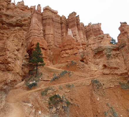
We’d descended about 300 feet when Walter decided he’d gone down far enough. The high altitude (we started up at 8,000 feet) has always been a problem for him and that’s more the case now. So I left him to find a rock to sit on in the sun and headed down the beginning of 3 or 4 sets of switchbacks. The first set of switchbacks leads to a door cut in the canyon wall.
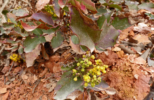
I saw some Rocky Mountain Grape (Mahonia repens) in bloom. It’s clearly a relative of Oregon Grape.
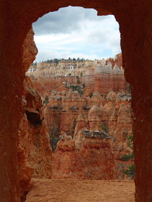
And then I took a shot at the entry to the first door.
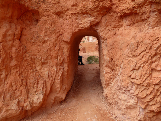
And then another just before I came out of the little tunnel. Fairyland!
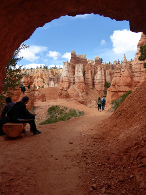
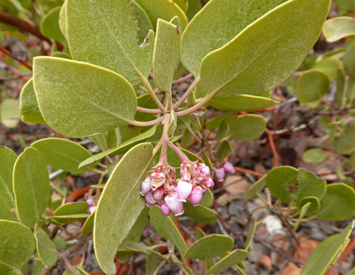
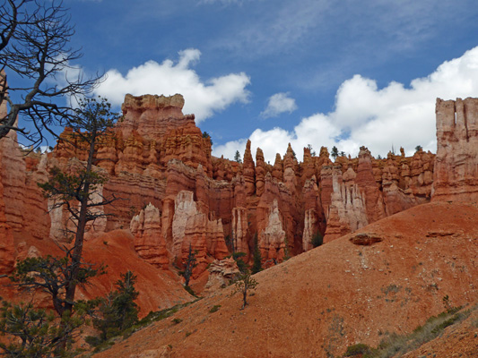
Now you’re down far enough that the hoodoos tower over you and the Greenleaf Manzanita (Arctostaphylos patula) covers the low places along the trail. And it was in bloom.
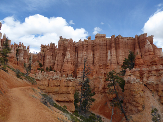
I spent a long time trying to photograph this wall of hoodoos before I realized that if I just walked along the trail a bit more I could turn around and get a great shot.
The next doorway was just around the bend.
And that leads you into the area called the Queen’s Garden.
The name comes from the fact that this rock (when viewed from a particular angle that I didn’t find) looks like Queen Victoria up at the top. There’s a sign to show you what it looks like it but I still couldn’t see it. I suspect you can see if it you go around the other side.
This is the end of the Queen’s Garden Trail. You can continue back a little ways and pick up the Navajo Trail that will take you further through the canyon and then UP to Sunset Point. But since it’s way steeper and I’d left Walter back up the trail I turned around here and headed back.
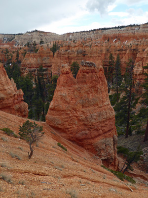
I took this shot so you could see the little layer of caprock that is protecting this hoodoo. Every hoodoo has a little bit of caprock to protect it from erosion. Once that caprock is worn away, the hoodoo melts very quickly.
Everything looks different hiking back up.
Including the switchbacks that hadn’t seemed any big deal going down. The Park Service has done a lot of work over the years to preserve these trails but Mother Nature is working constantly to erode away the whole place. There is a trail called Wall Street with very steep sides that I hiked with my family back in 1966. It’s closed now because it’s just not safe any more.
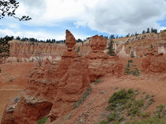
You don’t see many balancing rock hoodoos here.
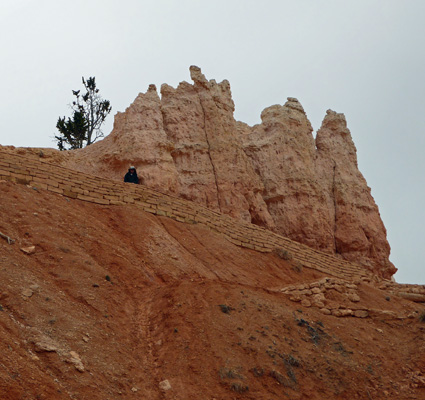
I came through the last doorway and there was Walter up on the ledge watching for me. He had gotten cold waiting in the wind and was WAY ready to head back.
It’s a steep hike from this point on and I had to stop and rest a few times before he was really ready to slow down. At one of those rest points I took one more panorama shot. I do so love this place and was really grateful to get to hike down into it one more time.
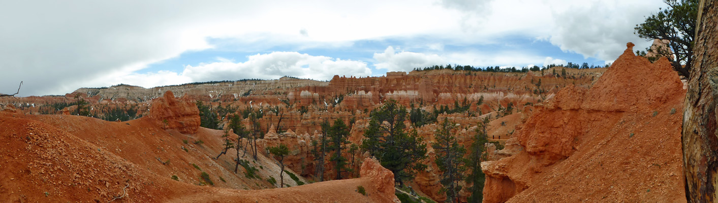
On our way out of the park we stopped at the one viewpoint we’d missed the day before. This is inside the park boundary but you can visit it without passing through the entry gates. And it’s down below 8,000 feet!
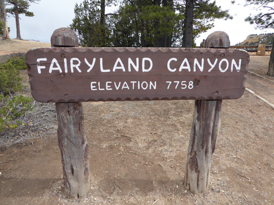
How in the world could I pass up a place called Fairyland? Well, I couldn’t, so I climbed out of the truck one more time to see the view.
There’s a trail here that goes out along a ridge into the canyon before making a loop back and dropping 1716 feet—talk about trudge back up hill!
I walked over to the trailhead and took a view to the south before heading back to the truck. It really does look like Fairyland to me.
All in all we had a very satisfactory visit to Bryce Canyon National Park. If you go, do drive the whole road out to Rainbow Point. There’s a trail out there where you can visit Bristlecone Pines (it was just too darned cold to do it this time). And if you can, do hike down into the magic of the hoodoos—it’s wonderful.
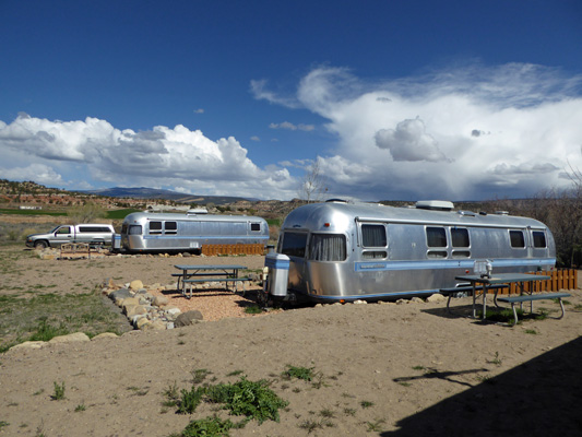
We rested that afternoon and then broke camp the next morning to head out to the town of Escalante in the heart of the Grand Staircase-Escalante National Monument. We stayed at the Shooting Star Resort and RV Park where they have a wonderful collection of old Airstreams that they offer as hotel rooms for the night. Genevieve was right at home surrounded by her older bigger uncles—34 foot Airstream Excellas.