We dumped our tanks (I know you don’t really need to hear this but hey, it’s part of life on the road) and headed northwest to Abilene State Park. The drive from Garner State Park to Inks Lake had taken us through the heart of the Hill Country. The road had steep grades (!) and lots of curves. We saw tons of motorcycles out for rides on the winding roads on Sunday afternoon. But as we drove north from Inks Lake, the countryside began to flatten out. It was as if as you went north someone had smoothed out the hills like you would a wrinkled sheet. They were still there and the road still undulated some, but it just got smoother and smoother the farther north we went.
The trees changed too. The Hill Country is pretty densely treed and many of those trees are pretty tall. As you go north the trees get smaller and there are fewer and fewer of them. By the time we were half way to Abilene we were back to cactus and mesquite trees. Ah well. The other distinctive thing about this drive was the incredible number of dead skunks we saw beside the road. We figure we saw well over 60 of them in the 175 miles we drove that day—and only a deer and rabbit or two otherwise—and so ends the road kill report for the week.
We checked in at Abilene State Park and were assigned a nice spot in the woods—deciduous oaks I think. This is not a real popular park so the fee was only $15 a night (with our Texas Parks Pass paying the daily entry fees). The spot they gave us in the nearly empty campground was only 25 feet deep so we had to disconnect the trailer from the truck but hey, we’re real good at that at this point, so it hardly matters. It’s just when we only plan to stay someplace one night, it’s nice not to have to do it. It turns out there was another loop with longer spots but the busy check-in clerk just asked how big our trailer was and put us in the loop with the 20 and 25 foot spots. There were only a couple of pop-up trailers in the loop with us so it was basically empty.
We settled in for a quiet afternoon with our hot spot and Walter’s Verizon phone both working but of course the Sprint phones showing no signal. With a bit of searching Walter picked up the over-the-air local TV from Abilene and watched the news too.
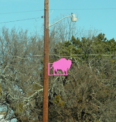
On Wednesday February 17th, we drove north towards Abilene through the little town of Buffalo Gap. They have an historic district and clearly are very proud of their name. They have metal cutouts of buffalo (bison) and the light posts—in every color of the rainbow. I caught a photo of the pink/lavender one as we drove by.
We skirted Abilene and then drove northwest up into the panhandle of Texas, through towns like Hamlin (with a large metal cut out of the pied piper in the town square), Spur (with a giant Spur sculpture in the town square), Dickens, Matador and Turkey (named after the bird). Turkey is the home of Bob Wills and they have a Bob Wills Museum there. But as we drove through, there was no one out on the street either on foot or in a vehicle. Talk about a quiet town.
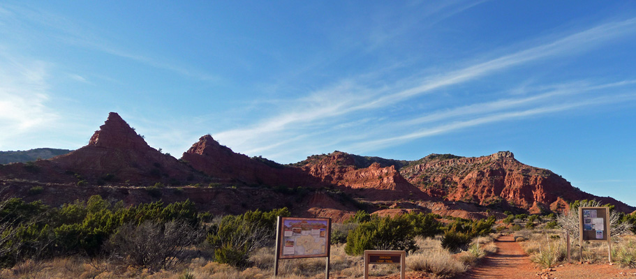
We turned at Quitaque (pronounced Kitty-quay) and found our way to Caprock Canyons State Park, home of the Texas State Bison Herd. We checked in at the very nice new Visitor’s Center and got a spot with water and electric for just $17 a night (with our daily fees paid for by our Texas State Parks Pass). We got the standard “don’t go near the bison” lecture—they’d had a visitor have a bison encounter the day before—and a nice intro to the roads and trails in the park while we were at it.
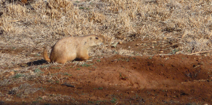
On our way to our campsite we slowed down and looked for prairie dogs in the prairie dog town that’s right next to the campground. Sure enough there were several out and they were kind enough to freeze in place so I could get a photo.
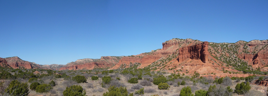
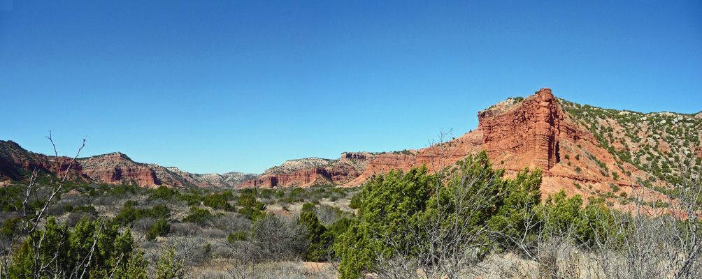
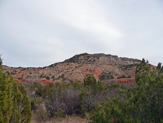
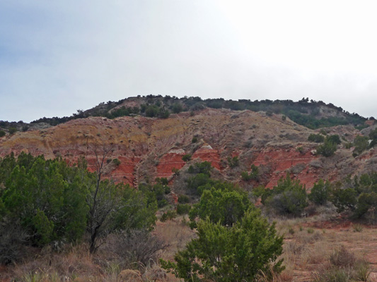
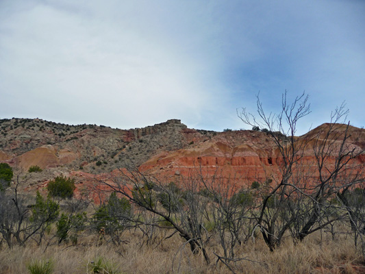
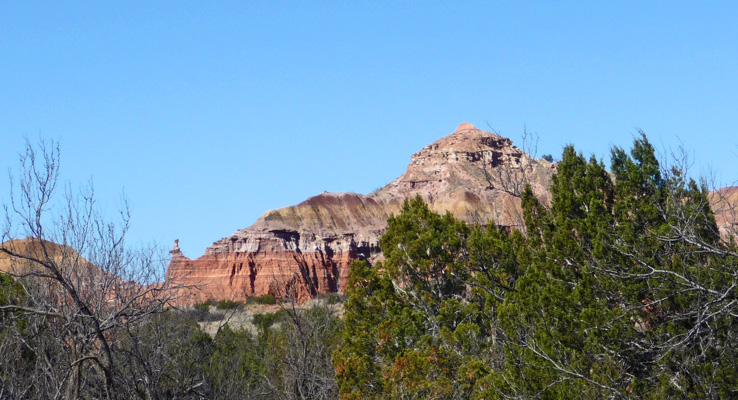
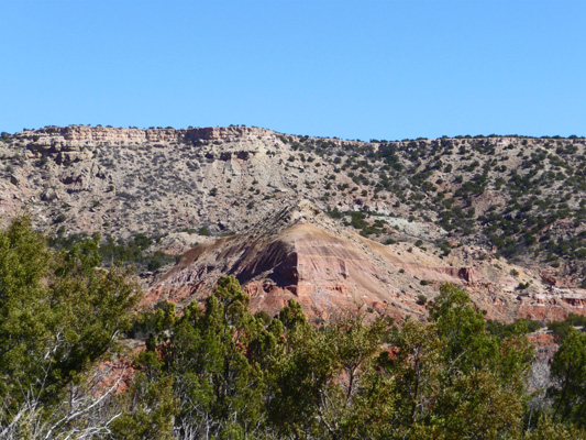
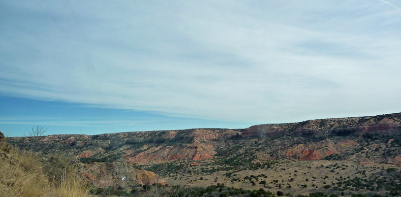
It was late afternoon since we’d driven a little over 200 miles that day but we decided we should go ahead and take the drive out to see the views since the late afternoon light was so nice. We headed out the main road and crested the hill to have the park spread out before us. Red rock, green junipers and blue sky, yum.
The road has several steep grades and they don’t allow trailers longer than 15 feet out past the 16% grade but there are several really nice tent campgrounds out that way in among the red rocks. We stopped at the trailhead for the Canyon Loop Trail. There’s a primitive camping area that you can hike to from here.
And then we followed the road out to the end where there is tent camping right in among the red rocks. I took this shot from a campsite that is right at the trailhead for the Upper Canyon Trail.
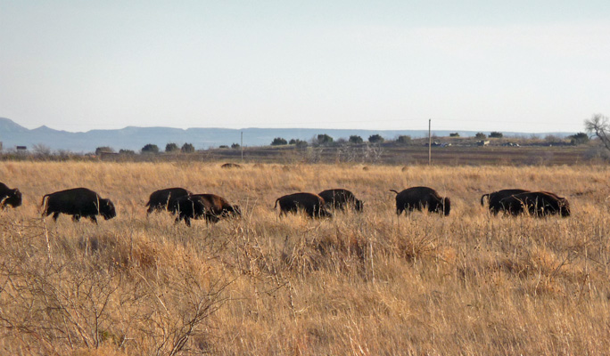
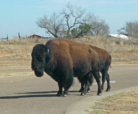
We drove back looking for wildlife and sure enough right after we passed our campground Walter spied a bull Bison (with a female off a ways in front of him).
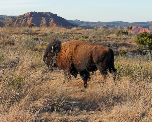
The bison here are true Southern Plains bison and among the last of the remaining members of the huge herds that roamed the southern plains. They were part of a very small herd saved by the Goodnights on their JA Ranch (after they killed off most of the bison in the area to make room for cattle). There were 32 of them when they were moved to Caprocks Canyon State Park in 1997-1998. There are now about 100 of them.
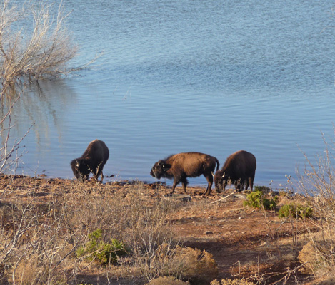
We drove down to Lake Theo looking for more wildlife and only saw a few coots. But as we drove towards the south side of the lake we spied 7 more bison down by the water’s edge.
As we passed the lake we spied a much larger portion of the herd out in the grasslands. It don’t know where they were going but they were making serious time.
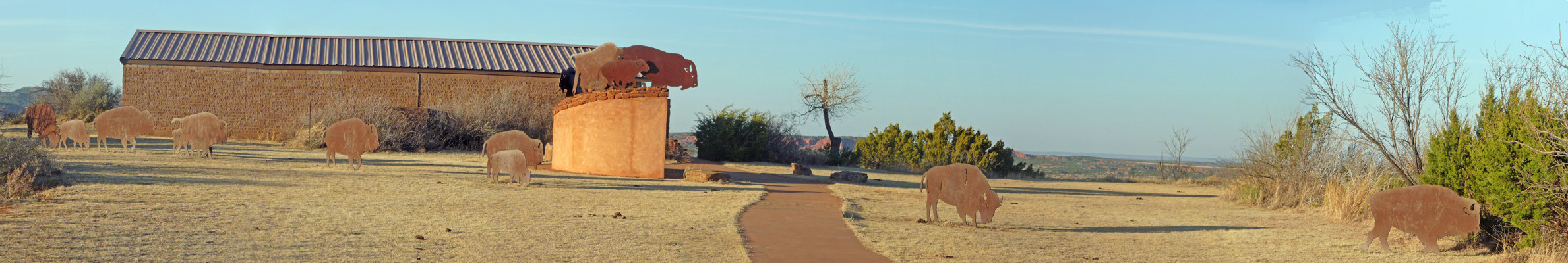
Having taken many more bison photos than anyone needs to see, we drove back towards our campground and stopped to have a look at this sculpture next to one of the smaller visitors centers. It’s in memory of the Folsom Man Site that was found down on the shores of Lake Theo. There archeologists found evidence of bison butchering and processing from the era of Folsom Man, 10,000 to 12,000 years ago. At first we thought it might have been a ‘buffalo jump’ where the animals were forced over the cliff but instead the folks in this area mostly drove bison into box canyons or mud wallows and then killed them.
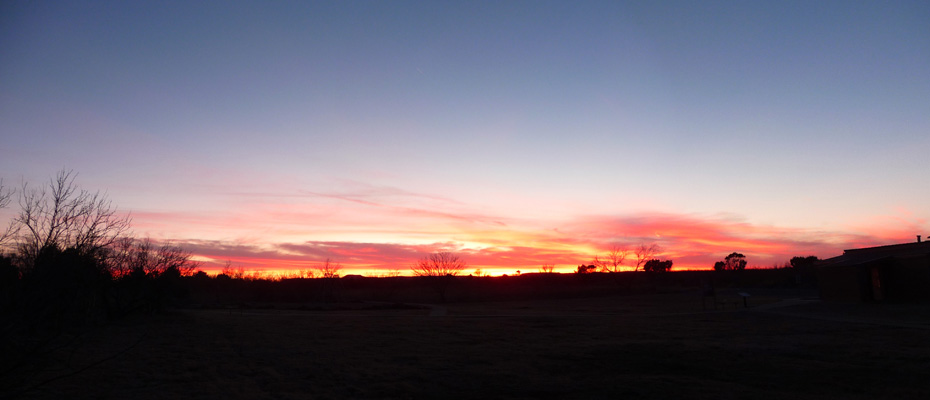
Just as I was starting to work on making dinner, I looked out to see the sky turning all sorts of wonderful colors. I had to find a path through the mesquite thicket in our campsite to get out into the clearing (where the prairie dog town is) to shoot this photo but I made it without a hitch. Mother Nature does such nice work.
It had been a bit windy when we arrived but after sunset the wind really kicked up. We closed all our windows and vents and still the wind howled. And then in the middle of the night it really got going—causing all sorts of racket and making the trailer rock. Needless to say, it was not the best of sleeping nights. In addition, it didn’t cool down that much. It had been 80 when we arrived and it only got down to 56 in the night—pretty warm after several weeks of night time temps in the high thirties..
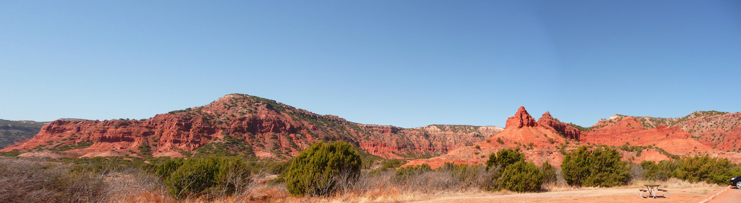
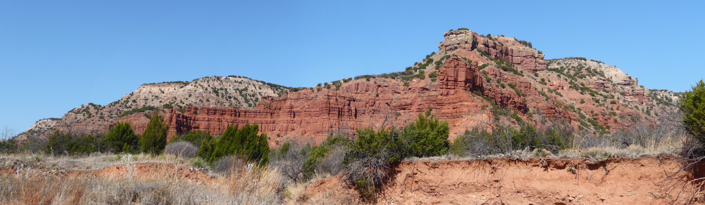
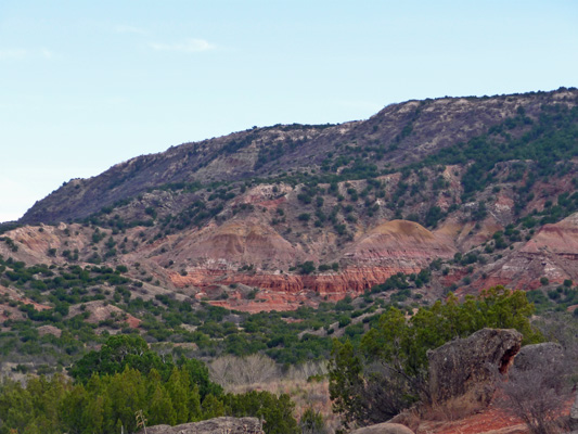
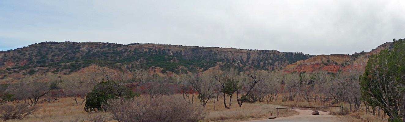
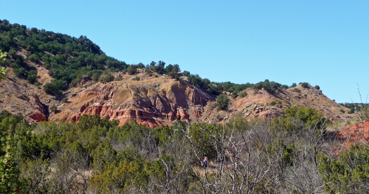
The wind slowly wound down across the day on Thursday but it was still breezy when we set out to take our hike in the late morning. We stopped off once again at the Canyon Loop Trail parking area so I could get a photo of the view in the morning light. I do so love red rocks.
Then we drove on out to the end of the road to take the Upper Canyon Trail.
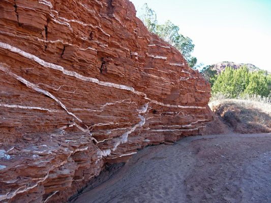
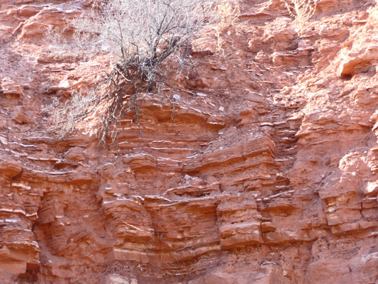
We found the trailhead okay and followed the trail down into a wash. There we found all sorts of nifty striations in the red rock made by layers of gypsum in the rock.
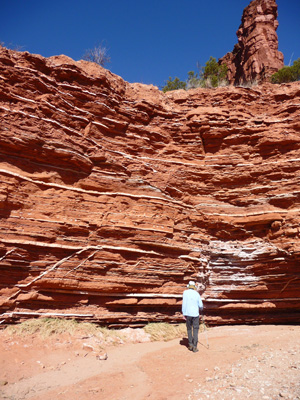
We followed the wash (which was really soft sand) and came to more nifty gypsum layers.
Our intention was to follow the trail out to the South Prong Primitive Camping area but after a while Walter wasn’t convinced that we were actually on the trail. There were no trail markers of any kind along the way—no yellow foot prints or little arrows pointing us along the way or even mile markers. So I got him to agree to go around one more bend so I could take a photo of these nifty hoodoos on the rim of the canyon before we turned back.
Right after this, I found a small path that took us up to a trail marked by the tracks of heavy equipment (like a Cat). We’d seen this same trail back when we’d first seen the gypsum layers and so we took it back. The good news is that this trail gave me an even better view of the hoodoos.

This trail actually had one trail marker that said A2. Since the trail guide said that the Upper Canyon Trail was Trail A we figured we had actually found the trail on the way back. It was still sandy but not anywhere near as hard going as the dry loose sand of the river bottom.
Here’s a view of that lovely ship’s bow formation from the trail on the way back.
By the time we got back it was HOT. The wind was still blowing which helped some but mid 80’s is pretty hot for hiking. As we were getting ready to get back into the truck we heard the distinct sound of sandhill cranes and sure enough, along came a pretty large flock of them flying northward. We saw two more flocks before the day was out so it must be almost spring if the sandhills are heading northward.
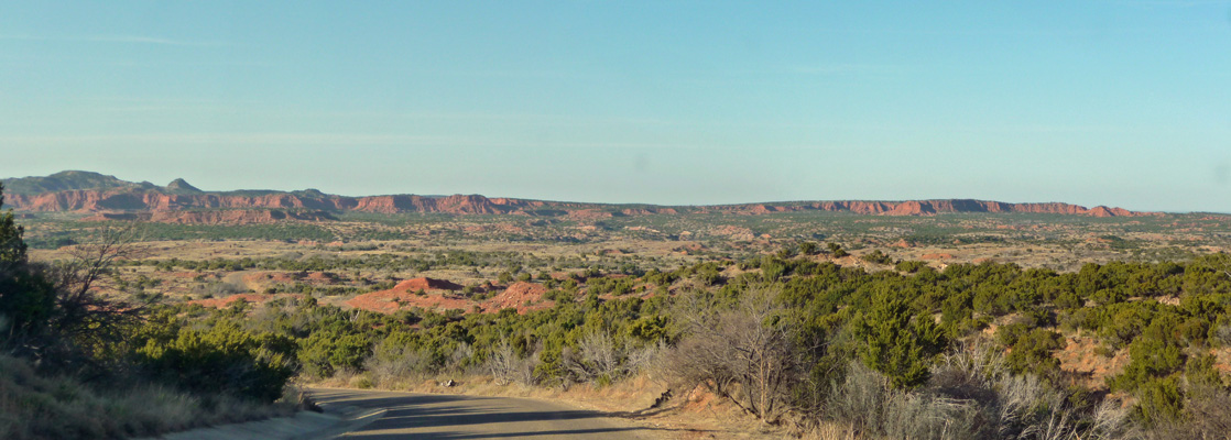
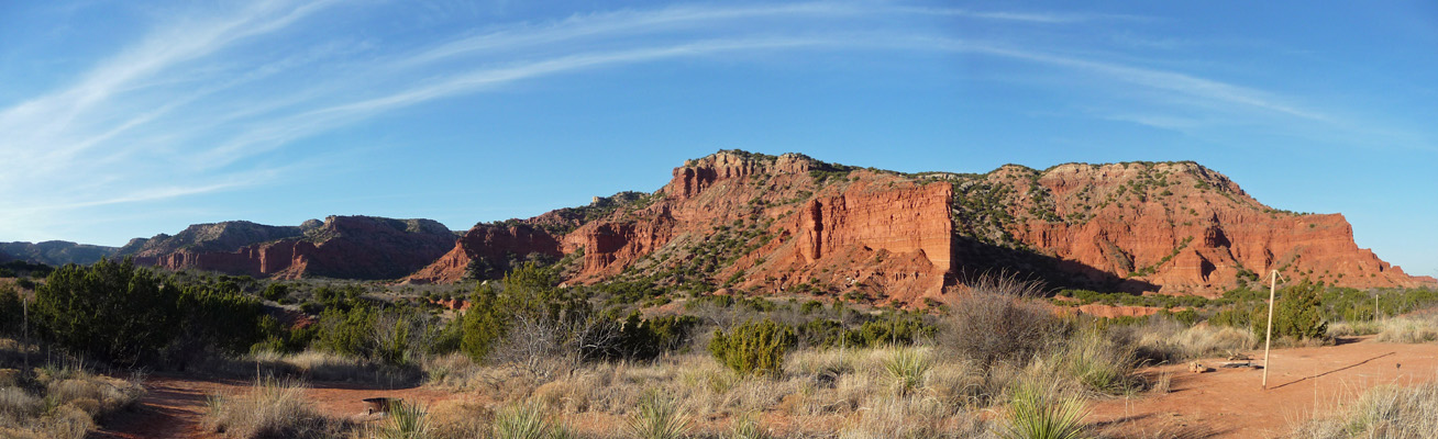
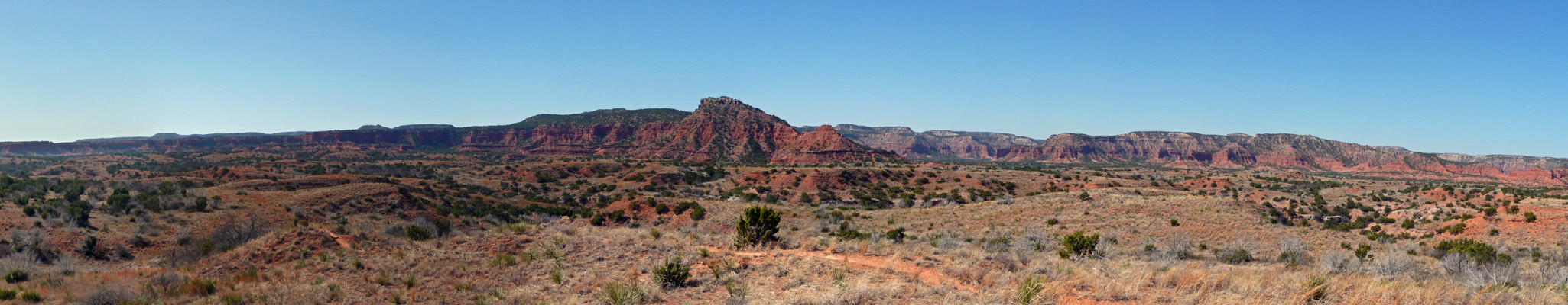
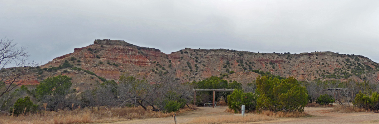
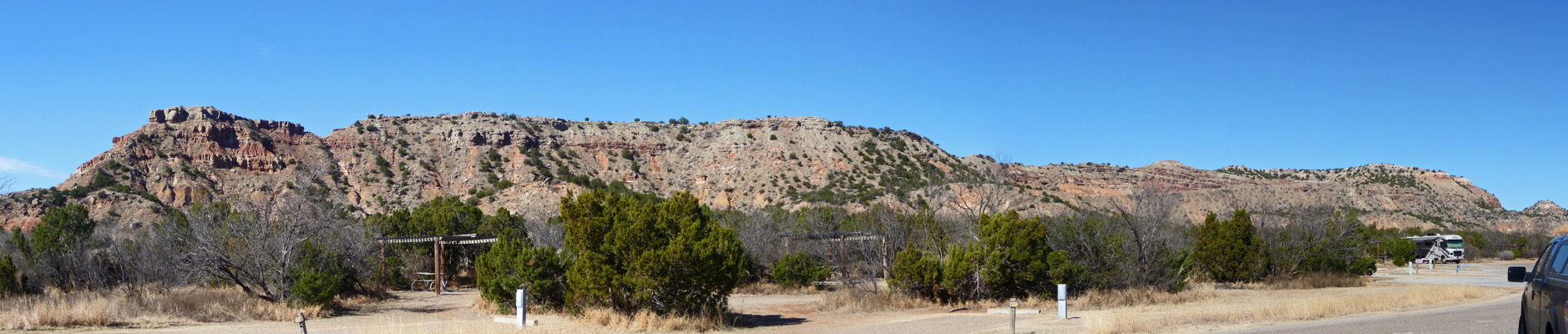
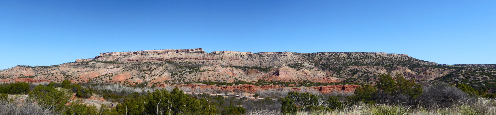
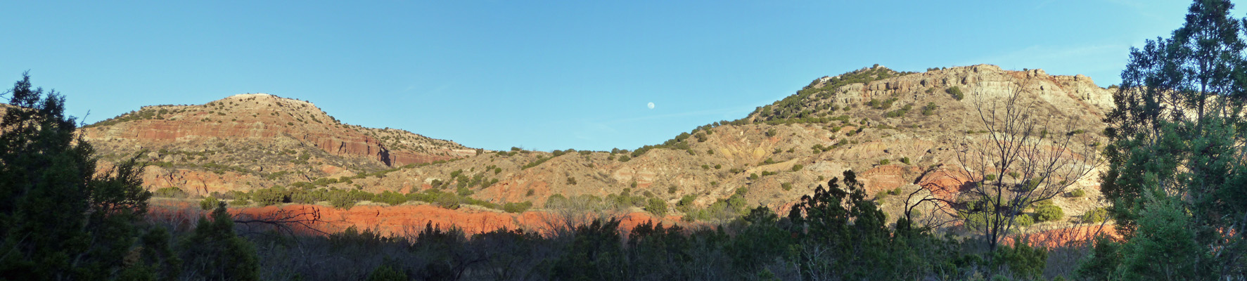
We drove back towards the campground and stopped at one more scenic overlook. This gives you a big wide panoramic view of the Caprock Canyons.
It continued to heat up as the afternoon wore on. It hit 90 outside and 92 inside by 3:30 and we surrendered and turned on the air conditioning. The humidity was in the low teens and there was a fire watch on since heat, low humidity and wind make for very dangerous fire conditions. By late afternoon when the temperatures began to drop the wind had died down to a gentle breeze. By 7:30 it was 82 outside and in and we opened things back up. It never really cooled off—we had a low of 59 the next morning and the wind continued to blow but it was still a better night than the rocking and howling of the night before.
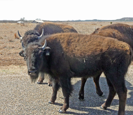
On Friday February 19th, we loaded up and headed out of the park. But just as we got to the visitors center we encountered about 50 bison on the road. Hot diggity, a Bison Jam!
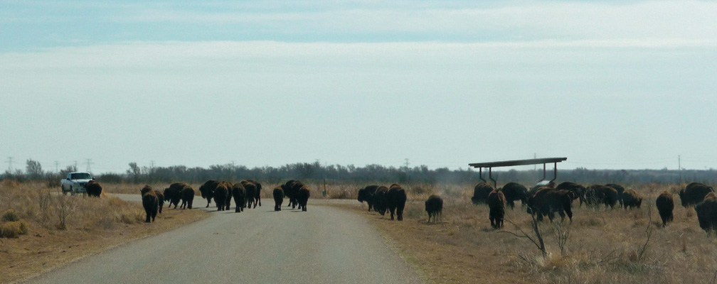
We sat and watched them —while the white truck coming the other way slowly drove through the herd on his side of the road. There cows and bulls and a few youngsters.
We slowly drove through the herd and made it to the other side. But we still weren’t home free. A big bull and a cow coming from the other way decided they needed to stand in the middle of the right turn lane for a while just to be sure we understood that it was their road that they were letting us use.
What a great way to start a drive! A good bison jam is a wonderful thing. Cheerfully we drove northwest to Palo Duro Canyon State Park just south of Amarillo. We had clouds come in which kept the temperature down in the mid 70’s which was a pleasant break from the 90 we’d had the day before.
This is another popular park so the fee for a water and electric spot was $24 a night. There are 3 campgrounds with water and electric hookups. We paid our money at the entry station on the canyon rim and then drove DOWN into the canyon itself where all the campgrounds and most of the other services are. It’s a steep grade but there’s no dip at the bottom like there was at Caprock Canyons so they allow any size trailer and rig to go all the way out into the canyon. We ended up with a nice campsite in the Sagebrush Campground with this view out our back windows.
And this one out our side windows.
The campground was fairly empty—there were only 2 other rigs when we arrived and only a couple more rigs arrived that evening.
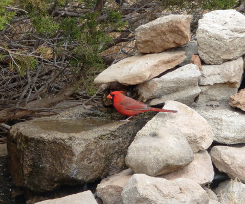
We had lunch and then set out to drive the road and explore the park. First stop was the trading post—complete with lots of tourist trinkets and t-shirts. But more important there is a bird blind behind the store where we spotted a few cardinals. This guy even splashed around in the water and had a little bath.
They have bird feeders hanging here that attract both pine siskins and a sweet little black-crested titmouse.
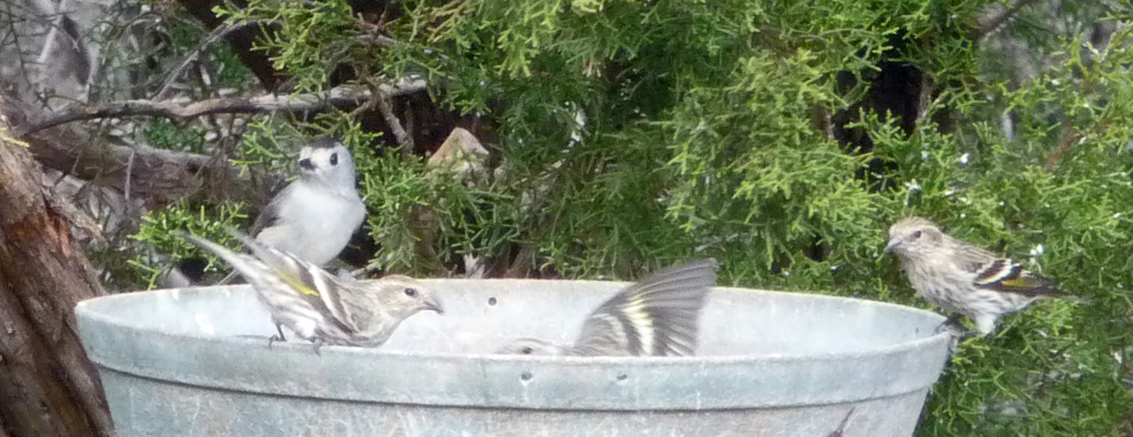
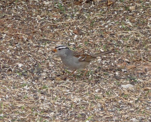
And there were white-crowned sparrows on the ground.
We drove on out the road and caught a nice view of the multiple colors that come from the 250 million of years worth of rock that is exposed in the canyon.
At the end of the road there is an equestrian campground and they have a cool view out along the deeper sections of the canyon. There’s a horse only trail that runs out this way. The canyon is 120 miles long but the park only encompasses the northwest part of it.
We took a turn through the Mesquite Campground (another of the campgrounds with water and electric hookups). They have some close up views of the various colors in the canyon but many of the spots aren’t very level which makes parking a rig there a challenge. We were glad we’d chosen to take the spot they’d assigned us at Sagebrush.
Up the road a little way there’s a great view of cool erosion that’s happening in one of the red rock layers. This is near the Cactus Camp tent campground.
There are 5 bridges across the Red River and two of them were closed for construction so we couldn’t complete the usual loop that the road makes and had to turn around and go back. We made our turn around in the Sunflower Picnic Area and we stopped so I could take this panorama shot of the view across the canyon looking westward.
It was warm again Friday evening but it did eventually cool off in the early morning hours so that we actually had to run the heater in the morning to warm things up before we got up. It was sunny and clear and it warmed up quickly.
I went out and took a panorama shot of our side view while the morning light was good. What a difference sunshine makes in terms of the colors in the canyon.
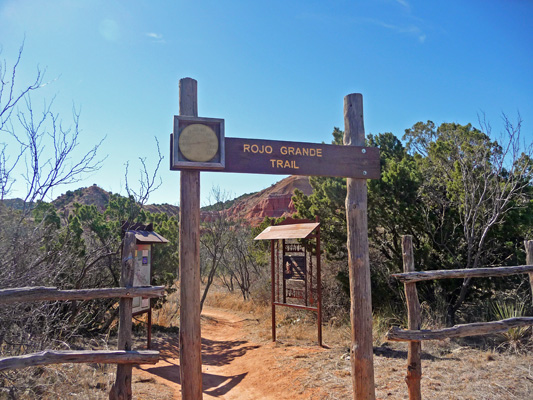
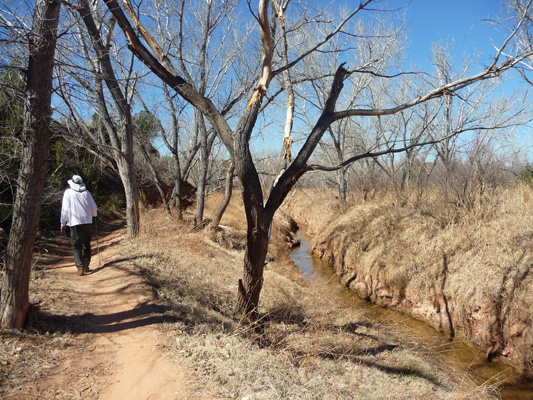
We drove down to the first river crossing area to take the Rojo Grande Trail which threads its way along the canyon floor near the Red River. Parking was at a premium because this is where the Lighthouse Trail, most popular trail in the park, starts too. It’s nearly 6 miles long which was more than we were looking for but clearly from the crowds setting off on it, it’s THE ONE.
The Rojo Grande Trail trailhead is really well marked and the trail was easy to follow.
As we headed out I took this shot looking west. The little tower on the left is the 300 foot tall Lighthouse formation that everyone else was hiking out towards.
About .3 of a mile along Rojo Grande you come to an area called Painted Rocks that has very thin layers of gypsum threaded through the red rock layers. It’s not as spectacular as the ones we saw at Caprock Canyons but it was still cool.
At about .5 mile you actually get to see the Red River—which at this point looks an awful lot like a creek. It’s hard to imagine that a river this size has carved a canyon 800 feet deep but it’s had a million years to do it and the summertime flash floods do most of the work. Palo Duro is the second largest canyon in the US (according to the Texas Parks literature) measuring 120 miles long, 800 feet deep and 20 miles wide at it’s widest.
The trail crosses the road and then goes up a hill that gives you a great view of the canyon walls to the east. This shot shows all the various color phases really well. The bottom of the canyon is deep red rock, followed by mudstone, followed by more red rock and then a white layer called capstone.
There’s a mudstone layer about halfway down that has yellows and maroons in it.
The Rojo Grande is a mixed use trail so you get to share it with mountain bikes. While the signs say that the bikes are supposed to yield to the hikers it never happens that way. Once they’re hauling either up or down a trail, it’s hikers beware. We hopped out of the way of more than one bike on our way out. But on the way back we didn’t meet any at all which was great.
We hit the turn around point at 1.2 miles where the Rojo Grande trail meets the Sunflower trail. You can continue on for another 1.2 miles on the Sunflower and THEN turn around but 2.5 miles is about right for us so we sat for a while on the bench at the turn around point and then headed back.
The light had changed some while we were hiking and I managed to get a decent shot of the colors in the canyon walls on the west side. That Dijon mustard color is part of the mudstone layer.
By the time we finished there were still tons more folks starting out on the Lighthouse Trail and parking was at an even bigger premium. In addition, it was 84 degrees, whew, you’d think it was summer or something. We topped out at 87 later in the afternoon but there was a nice breeze so things didn’t get too bad in the trailer. Besides, we took a nice siesta in the heat of the day. Then when the sun began to sink behind the canyon walls we went out and sat in the shade and enjoyed the cool breeze heading down canyon. In the late afternoon, the view on our east side lit up nicely.
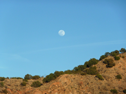
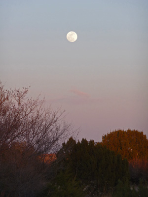
The nearly full moon was rising over the ridge too.
This is a nice park but I actually preferred the colors and the scale of Caprock Canyons better. Of course, it didn’t hurt that we were there mid-week when there were so few folks in the park. The campground at Palo Duro remained mostly empty but the day use levels were really high on both Friday and Saturday. There were lots of college-aged kids out both days both hiking and biking. Western Texas A and M is in Amarillo and Texas Tech (we saw kids with Tech t-shirts on) is just down the road in Lubbock. Good weather and good mountain biking trails does tend to bring the kids out.
On Sunday morning February 21st, we packed up and headed up out of the canyon. I caught one last photo of the canyon from the road as it climbed to the rim.
Then we drove north to Amarillo and turned west towards New Mexico. After nearly 2 1/2 months our time in Texas had drawn to a close. We put in nearly 200 easy miles driving on I-40 and ended up in Santa Rosa New Mexico at the Santa Rosa Campground on old Historic Route 66 (which looks like any 4 lane boulevard anywhere in the US).
We got a spot for 2 nights so we could get caught up on our internet (since there was no signal of any kind in Palo Duro Canyon) and do the laundry. Not only are we finally out of Texas (yahoo) but we’re back in Mountain Time. The nearly full moon rose in the early evening.
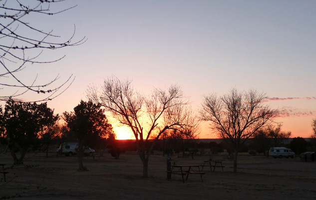
Just as we got a bit of a sunset over to the west.
We’ll spend the next week working our way across New Mexico into central Arizona. If the weather forecast holds, we’ll spend a couple of days exploring the Petrified Forest National Park before we head down to Globe AZ to pick up the mail which we’ve had forwarded there.
Texas was an interesting adventure but we’re both happy to be heading west again.